Allt Fâd

Wood, Forest in Cardiganshire

Wales

Allt Fâd

Ordnance Survey Flush Bracket S8282 This can be found on the wall of a former school building - now a private dwelling.
For more detail see : <span class="nowrap"><a title="http://www.bench-marks.org.uk/bm271" rel="nofollow ugc noopener" href="http://www.bench-marks.org.uk/bm271">Link</a><img style="margin-left:2px;" alt="External link" title="External link - shift click to open in new window" src="https://s1.geograph.org.uk/img/external.png" width="10" height="10"/></span>
Ordnance Survey Flush Bracket S8282 Credit: Peter Wood

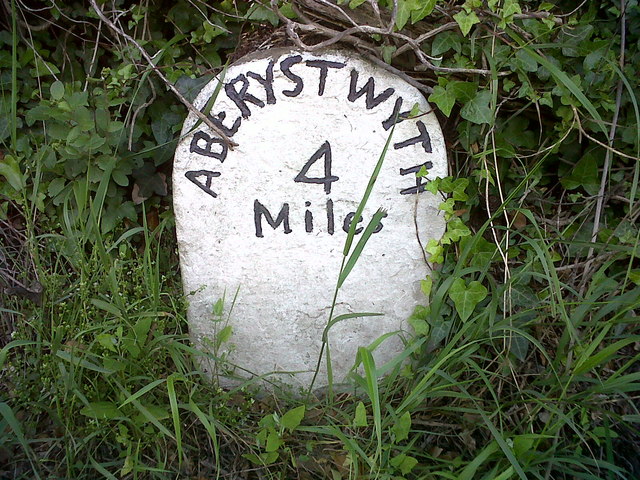
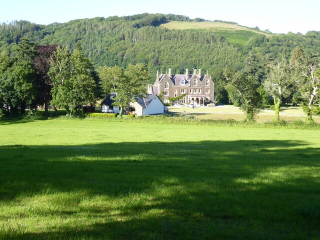
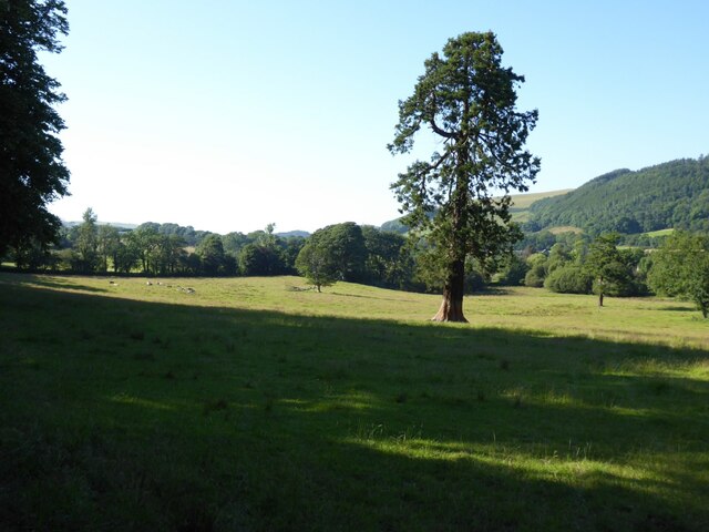
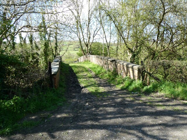
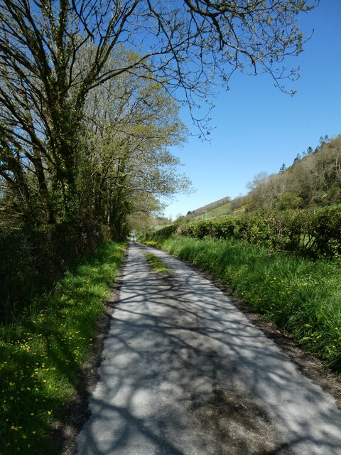
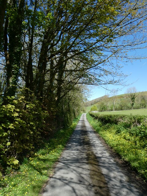
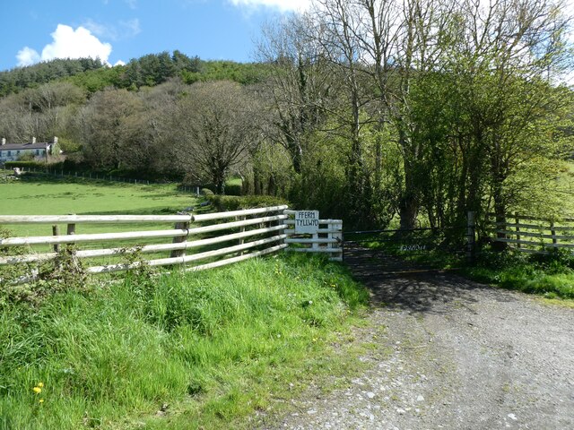
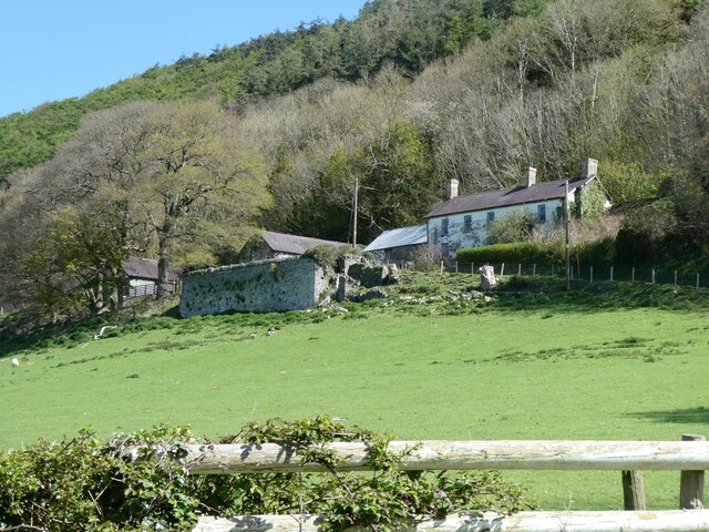
Allt Fâd, located in Cardiganshire, Wales, is a picturesque wood or forest that covers a significant area of land. Nestled in the countryside, it boasts a diverse range of flora and fauna, making it an ideal destination for nature enthusiasts and those seeking tranquility.

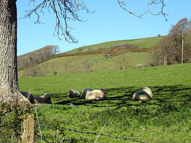
The wood is characterized by its dense canopy of trees, dominated by species such as oak, birch, and beech. These towering trees provide ample shade and shelter for a variety of wildlife, including birds, squirrels, and deer. The forest floor is adorned with a rich carpet of moss, ferns, and wildflowers, creating a vibrant and colorful landscape.

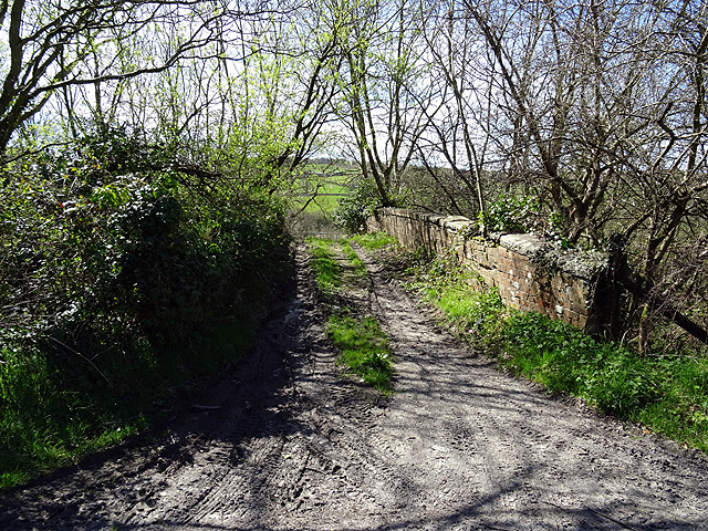
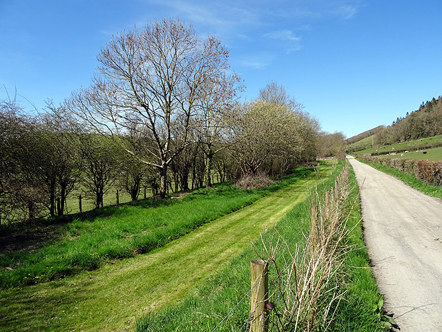
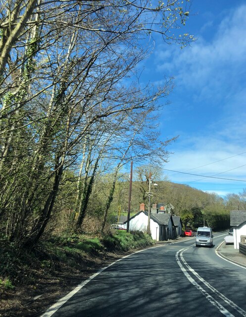
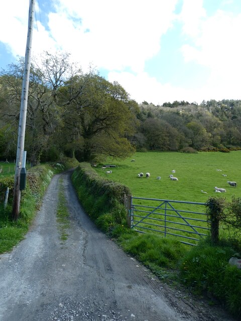
Allt Fâd offers a network of winding trails and footpaths, allowing visitors to explore its natural beauty at their own pace. These well-marked routes cater to both leisurely strolls and more adventurous hikes. Along the way, hikers may encounter hidden streams and stunning viewpoints, offering breathtaking vistas of the surrounding countryside.

Beyond its natural allure, Allt Fâd also holds historical and cultural significance. The wood has been a part of the local landscape for centuries, and remnants of ancient settlements and structures can still be found within its boundaries. These archaeological features add an intriguing layer of history to the forest, enhancing the overall visitor experience.

Overall, Allt Fâd is a captivating woodland retreat that captivates visitors with its lush greenery, diverse wildlife, and serene atmosphere. Whether one seeks solace in nature, wishes to explore its trails, or wants to delve into its past, Allt Fâd offers a memorable experience for all who venture within its borders.

If you have any feedback on the listing, please let us know in the comments section below.
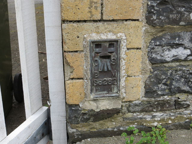
Allt Fâd Images

Images are sourced within 2km of 52.35895/-4.0630149 or Grid Reference SN5975. Thanks to Geograph Open Source API. All images are credited.

Ordnance Survey Flush Bracket S8282 This can be found on the wall of a former school building - now a private dwelling.
For more detail see : <span class="nowrap"><a title="http://www.bench-marks.org.uk/bm271" rel="nofollow ugc noopener" href="http://www.bench-marks.org.uk/bm271">Link</a><img style="margin-left:2px;" alt="External link" title="External link - shift click to open in new window" src="https://s1.geograph.org.uk/img/external.png" width="10" height="10"/></span>
Ordnance Survey Flush Bracket S8282
This can be found on the wall of a former school building - now a private dwelling. For more detail see : LinkExternal link
Old railway overbridge A farm crossing over the trackbed of the long closed Aberystwyth to Carmarthen railway line. The track also forms a right of way but you will need to don your waders to cross Afon Ystwyth a short distance ahead.
Old railway overbridge
A farm crossing over the trackbed of the long closed Aberystwyth to Carmarthen railway line. The track also forms a right of way but you will need to don your waders to cross Afon Ystwyth a short distance ahead.
The Ystwyth Trail The Ystwyth Trail runs along the paved road here as it heads towards Llanfarian. The trackbed of the old Carmarthen to Aberystwyth railway runs to the left of the mown strip seen here.
The Ystwyth Trail
The Ystwyth Trail runs along the paved road here as it heads towards Llanfarian. The trackbed of the old Carmarthen to Aberystwyth railway runs to the left of the mown strip seen here.
Spring is springing A glorious manifestation of Spring in a field at Tyllwd Farm beside the Ystwyth Trail.
Spring is springing
A glorious manifestation of Spring in a field at Tyllwd Farm beside the Ystwyth Trail.
Shade from the sun Sheep shelter from the April sunshine at Tyllwyd Farm.
Shade from the sun
Sheep shelter from the April sunshine at Tyllwyd Farm.
Chancery, Milestone - Aberystwyth 4 The milestone bore an Ordnance Survey benchmark, which was used on the Warrington to Pembroke Docks line of the First Primary Levelling of England & Wales in 1851-1852.  The mark has been erased.  Description: 623. Mark on the 4th milestone from Aberystwyth ; 2.46 ft. above surface.  Page 533 of the abstract: <span class="nowrap"><a title="http://www.trigtools.co.uk/data/1GL/1GLA_533.png" rel="nofollow ugc noopener" href="http://www.trigtools.co.uk/data/1GL/1GLA_533.png">Link</a><img style="margin-left:2px;" alt="External link" title="External link - shift click to open in new window" src="https://s1.geograph.org.uk/img/external.png" width="10" height="10"/></span>  The mark has been erased.
Chancery, Milestone - Aberystwyth 4
The milestone bore an Ordnance Survey benchmark, which was used on the Warrington to Pembroke Docks line of the First Primary Levelling of England & Wales in 1851-1852. The mark has been erased. Description: 623. Mark on the 4th milestone from Aberystwyth ; 2.46 ft. above surface. Page 533 of the abstract: LinkExternal link The mark has been erased.
Ordnance Survey Benchmark - Blaenplwyf Ordnance Survey Benchmark (OSBM) used for levelling height above Ordnance Datum (OD).
It has not been used as a benchmark by the OS for many years.
Ordnance Survey Benchmark - Blaenplwyf
Ordnance Survey Benchmark (OSBM) used for levelling height above Ordnance Datum (OD). It has not been used as a benchmark by the OS for many years.
Ordnance Survey Flush Bracket (S8282) This OS Flush Bracket can be found on the old school. It marks a point 81.768m above mean sea level.
Ordnance Survey Flush Bracket (S8282)
This OS Flush Bracket can be found on the old school. It marks a point 81.768m above mean sea level.
Abermad House Abermad House is a nursing care home in the Ystwyth valley  For more information see: <a href="https://www.geograph.org.uk/photo/4516251">SN6076 : Abermad House</a>
Abermad House
Abermad House is a nursing care home in the Ystwyth valley For more information see: SN6076 : Abermad House
Parkland in the Ystwyth valley Tree in parkland in Ystwyth valley.
Parkland in the Ystwyth valley
Tree in parkland in Ystwyth valley.
A field and bungalows A field and bungalows near Llanfarian.
A field and bungalows
A field and bungalows near Llanfarian.
The A487 road passing through Chancery
Bridge over former railway, near Tynrhelyg This track leads to the river and the site of a ford
Bridge over former railway, near Tynrhelyg
This track leads to the river and the site of a ford
Cycle route (NCN81) near Tynrhelyg towards Llanfarian
Cycle route to Llanfarian (NCN81)
Access gate for Tyllwyd Farm
Former farm buildings at Tyllwyd
Track to Cwm Cati
Track to Cwm Cati
Show me another place!

Allt Fâd is located at Grid Ref: SN5975 (Lat: 52.35895, Lng: -4.0630149)

Unitary Authority: Ceredigion

Police Authority: Dyfed Powys

What 3 Words

///rates.crumbles.mime. Near Llanilar, Ceredigion

Related Wikis

Blaenplwyf

Blaenplwyf (Pontllanio previously) is a village in Ceredigion, to the southwest of Aberystwyth. It is noted for the Blaenplwyf transmitting station, which...

Chancery, Ceredigion

Chancery (Welsh: Rhydgaled) is a hamlet in Llanfarian community, in the district county of Ceredigion, Mid-Wales, south of the administrative centre Aberystwyth...

Ystwyth Trail

The Ystwyth Trail is a 21-mile (34 km) multi-use rail trail linking Aberystwyth, Llanfarian, Ystrad Meurig and Tregaron in Ceredigion, Wales. Cycling and...

Llanfarian

Llanfarian is a village, electoral ward and community in the district county of Ceredigion, Mid-Wales, south of the administrative centre Aberystwyth....

Llanrhystyd Road railway station

Llanrhystyd Road railway station was located on the Carmarthen to Aberystwyth Line, originally called the Manchester and Milford Railway, before being...

Blaenplwyf transmitting station

The Blaenplwyf transmitting station (sometimes written "Blaen Plwyf" or "Blaen-Plwyf") is a broadcasting and telecommunications facility located near the...

Castle Hill, Ceredigion

Castle Hill is an area and country estate in the community of Llanilar, Ceredigion, Wales, which is 70.2 miles (112.9 km) from Cardiff and 175.8 miles...

Llanilar railway station

Llanilar railway station was on the Carmarthen to Aberystwyth Line (originally called the Manchester and Milford Railway before being transferred to the...

Nearby Amenities

Located within 500m of 52.35895,-4.0630149
Bus Stop
Bus: yes
Public Transport: platform
Lat/Long: 52.3623604/-4.0582902
The data included in this document is from www.openstreetmap.org. The data is made available under ODbL.

Have you been to Allt Fâd?

Leave your review of Allt Fâd below (or comments, questions and feedback).