Coed Dinas-ddû

Wood, Forest in Caernarfonshire

Wales

Coed Dinas-ddû

Hiking up Cwm Bychan
Hiking up Cwm Bychan Credit: Bill Harrison

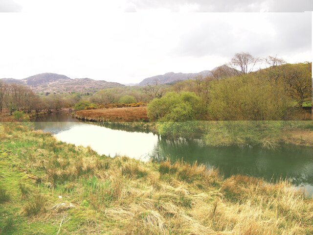
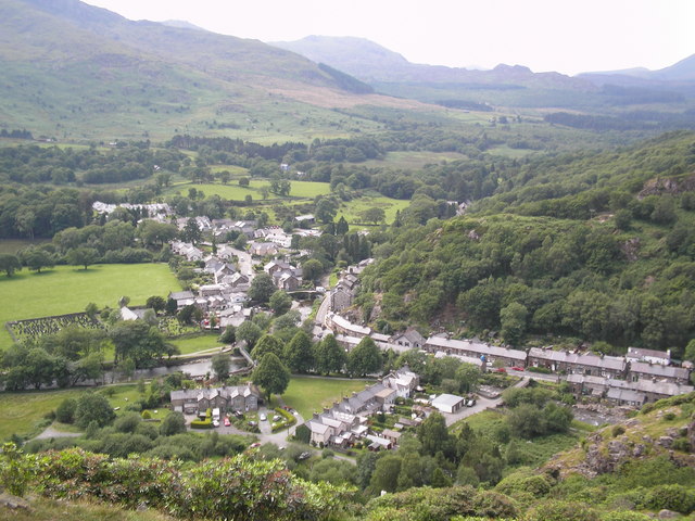
Coed Dinas-ddû, located in Caernarfonshire, Wales, is a picturesque wood or forest known for its natural beauty and rich biodiversity. Spread across an area of approximately 100 acres, it is a popular destination for nature enthusiasts and hikers.

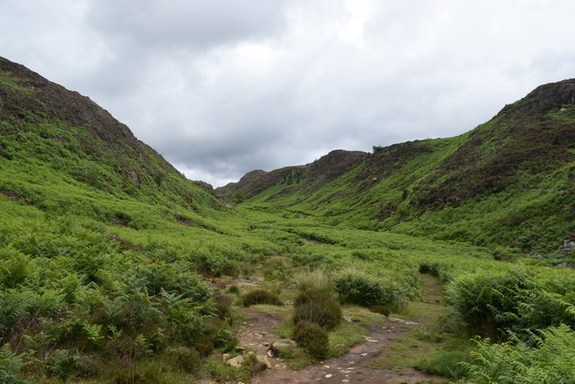
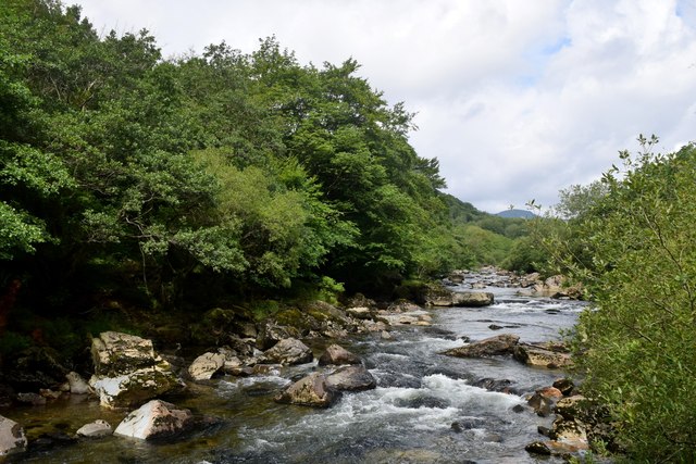
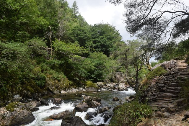
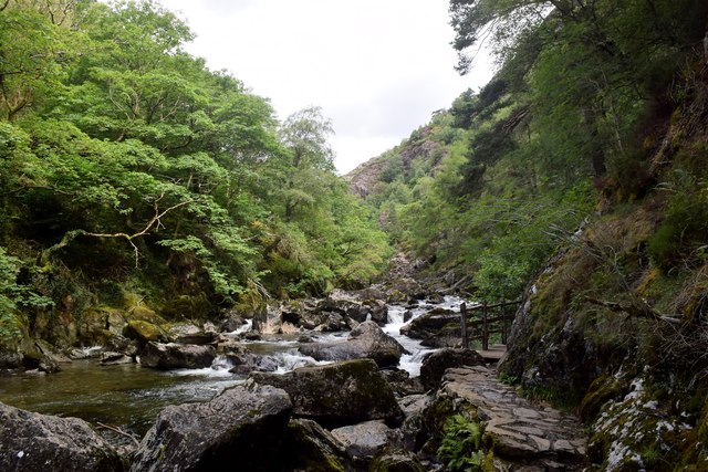
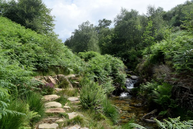
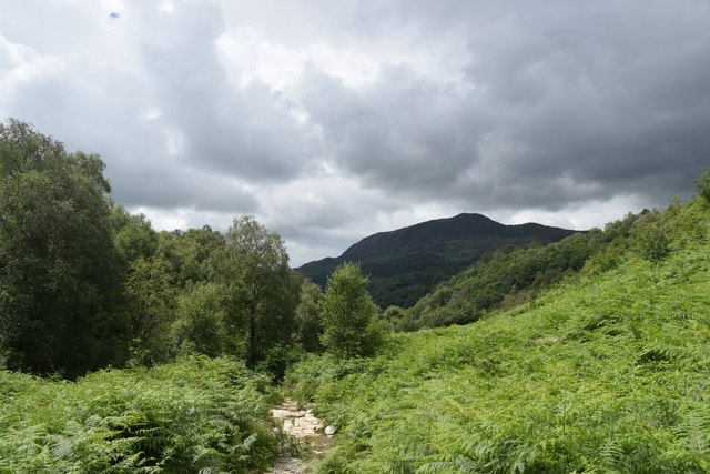
The woodland is characterized by its dense canopy of native trees, including oak, beech, and ash. These towering trees provide a habitat for a wide range of flora and fauna. The forest floor is carpeted with a variety of wildflowers, ferns, and mosses, creating a vibrant and enchanting atmosphere.

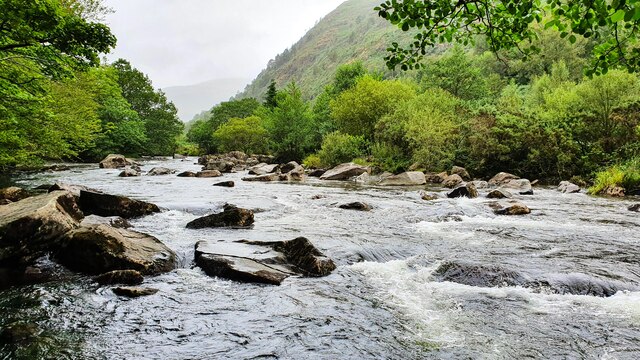
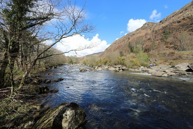
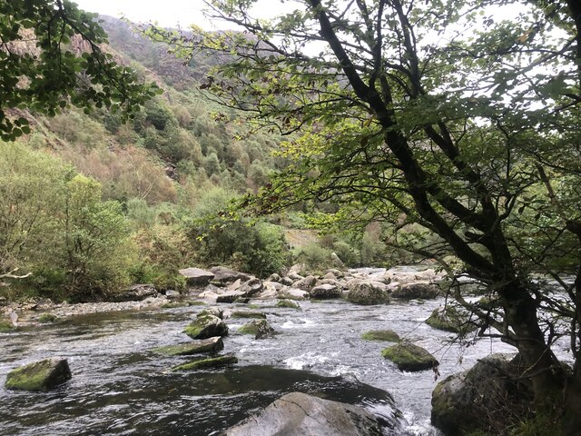
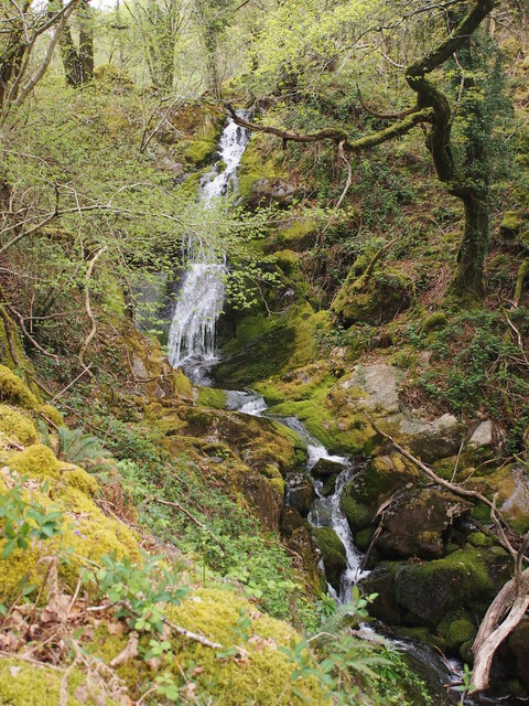
Coed Dinas-ddû is crisscrossed with a network of well-maintained walking trails, allowing visitors to explore the woodland at their own pace. These paths lead to hidden gems such as secluded ponds, trickling streams, and small waterfalls. The tranquil ambiance makes it an ideal location for peaceful walks and meditation.

The forest is home to a diverse array of wildlife. Birdwatchers can spot species such as woodpeckers, owls, and various songbirds. Mammals like badgers, foxes, and squirrels can also be spotted, especially during the quieter hours of the day.

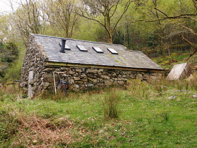
Coed Dinas-ddû has historical significance as well. It is believed to have been part of a medieval hunting ground for Welsh princes. The remains of an ancient fortification can still be seen within the woodland, adding to its charm and intrigue.

Overall, Coed Dinas-ddû is a haven for nature lovers, offering a serene escape from the bustle of everyday life. Its diverse ecosystem and tranquil beauty make it a must-visit destination for anyone seeking solace in the midst of nature.

If you have any feedback on the listing, please let us know in the comments section below.

Coed Dinas-ddû Images

Images are sourced within 2km of 52.98802/-4.0979431 or Grid Reference SH5945. Thanks to Geograph Open Source API. All images are credited.

Hiking up Cwm Bychan
Afon Glaslyn
Afon Glaslyn
The Afon Glaslyn above the gorge From Beddgelert the Afon Glaslyn continues down at a pleasant gradient, but grade three paddlers will have wanted to get off before reaching this section, just before the river becomes engorged and gets significantly harder. Paddling the Aberglaslyn gorge is forbidden in the summer months (and they have already started by early April) though there appears to be no legal basis to this prohibition on what is, by right acknowledged as existing since time immemorial before the Magna Carta, a public navigation (as for all navigable rivers in England and Wales). However, at this level, it is not technically navigable. Paddlers generally adhere to the voluntary agreement not to paddle on any section of the river when it is below a certain level established on prominent markers at the usual points of access for conservation reasons as well as safety and practicality. There are no markers, however, to show when the level is so high that epics are imminent...
The Afon Glaslyn above the gorge
From Beddgelert the Afon Glaslyn continues down at a pleasant gradient, but grade three paddlers will have wanted to get off before reaching this section, just before the river becomes engorged and gets significantly harder. Paddling the Aberglaslyn gorge is forbidden in the summer months (and they have already started by early April) though there appears to be no legal basis to this prohibition on what is, by right acknowledged as existing since time immemorial before the Magna Carta, a public navigation (as for all navigable rivers in England and Wales). However, at this level, it is not technically navigable. Paddlers generally adhere to the voluntary agreement not to paddle on any section of the river when it is below a certain level established on prominent markers at the usual points of access for conservation reasons as well as safety and practicality. There are no markers, however, to show when the level is so high that epics are imminent...
Afon Glaslyn South of Beddgelert
Afon Glaslyn
South of Beddgelert
Afon Glaslyn
Afon Glaslyn
Waterfall Below Plas Oerddwr
Converted Outbuilding in Coed Oerddwr
The Path to Llys From Coed Oerddwr
Old Milestone, A4085, Pont Aberglaslyn Carved in slate at the junction with the A498 on the parapet of the bridge crossing Afon Glaslyn. Penrhyn Deudraeth translates as "two beach peninsula". More milestones on the bridge or near see <a title="https://www.geograph.org.uk/stuff/list.php?title=Old+Milestone&gridref=SH5946" href="https://www.geograph.org.uk/stuff/list.php?title=Old+Milestone&gridref=SH5946">Link</a>

Inscription: Penrhyndeudraeth 6 Miles ☛

Milestone Society National ID: CAE_PYBD06a
Old Milestone, A4085, Pont Aberglaslyn
Carved in slate at the junction with the A498 on the parapet of the bridge crossing Afon Glaslyn. Penrhyn Deudraeth translates as "two beach peninsula". More milestones on the bridge or near see Link Inscription: Penrhyndeudraeth 6 Miles ☛ Milestone Society National ID: CAE_PYBD06a
Bridge House, A498, Pont Aberglaslyn Former Toll House opposite the bridge taking the A4085 to Penrhyndeudraeth (peninsula with two beaches). It would have originally served the Porthdinllaen & Nanthwynant Turnpike Trust.

Milestone Society National ID: GWY.BED02
Bridge House, A498, Pont Aberglaslyn
Former Toll House opposite the bridge taking the A4085 to Penrhyndeudraeth (peninsula with two beaches). It would have originally served the Porthdinllaen & Nanthwynant Turnpike Trust. Milestone Society National ID: GWY.BED02
Double-headed Garratts in the Aberglaslyn Pass Double-headed NGG16 Garratt locomotives No. 130 and No. 87 head south through the Aberglaslyn Pass with a Caernarfon to Porthmadog service during the WHR100 Welsh Highland Railway Centenary event.
Double-headed Garratts in the Aberglaslyn Pass
Double-headed NGG16 Garratt locomotives No. 130 and No. 87 head south through the Aberglaslyn Pass with a Caernarfon to Porthmadog service during the WHR100 Welsh Highland Railway Centenary event.
Bridges near Beddgelert Bridge carrying the 597-mm gauge Welsh Highland Railway and adjacent footbridge over Afon Glaslyn.  In the background, the railway dives under the A498.
Bridges near Beddgelert
Bridge carrying the 597-mm gauge Welsh Highland Railway and adjacent footbridge over Afon Glaslyn. In the background, the railway dives under the A498.
The Aberglaslyn nearing its destination The morning Welsh Highland Railway service from Porthmadog to Beddgelert nears its destination, being hauled by one of the impressive narrow-gauge Bayer-Garratt locomotives.
The Aberglaslyn nearing its destination
The morning Welsh Highland Railway service from Porthmadog to Beddgelert nears its destination, being hauled by one of the impressive narrow-gauge Bayer-Garratt locomotives.
Afon Glaslyn entering the gorge
Path beside Afon Glaslyn The path through the Afon Glaslyn gorge is a spectacular walk but it is wet and slippery and great care must be taken...
Path beside Afon Glaslyn
The path through the Afon Glaslyn gorge is a spectacular walk but it is wet and slippery and great care must be taken...
Afon Glaslyn in the gorge
The path up Cwm Bychan
Storm clouds over Cwm Bychan
Show me another place!

Coed Dinas-ddû is located at Grid Ref: SH5945 (Lat: 52.98802, Lng: -4.0979431)

Unitary Authority: Gwynedd

Police Authority: North Wales

What 3 Words

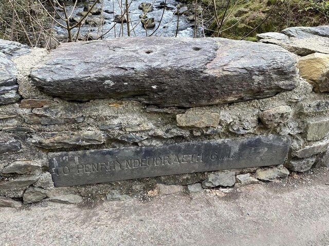
///generals.goodbyes.sweeter. Near Penrhyndeudraeth, Gwynedd

Related Wikis

Aberglaslyn Hall

Aberglaslyn Hall is an outdoor learning centre near Beddgelert, North Wales on the edge of the Snowdonia National Park. The hall was purchased by Leicestershire...

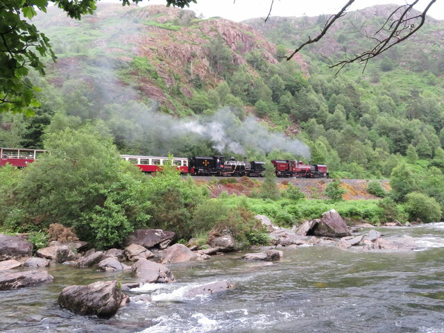
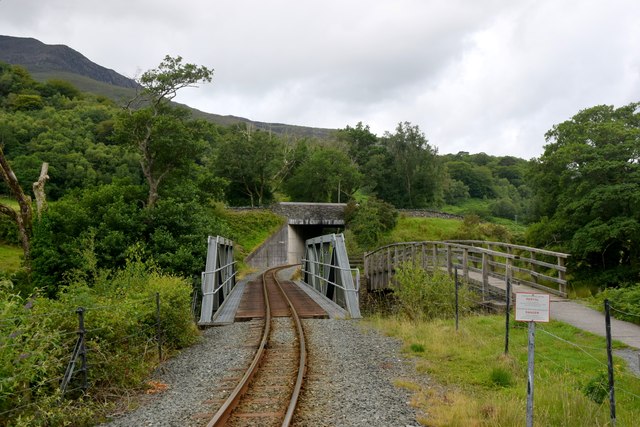
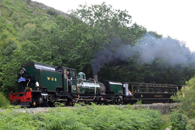
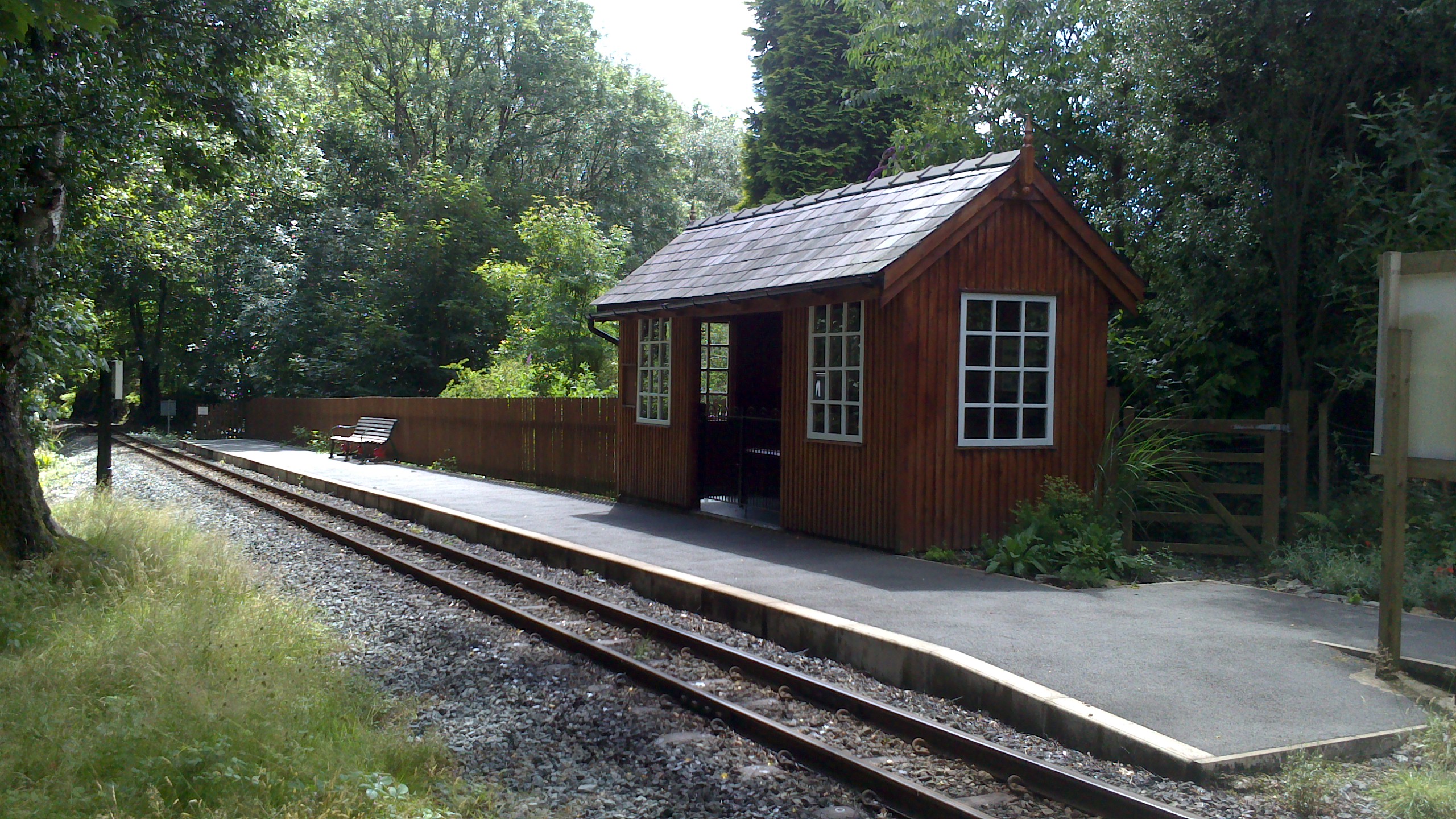
Hafod y Llyn railway station

Hafod y Llyn is a halt in North Wales on the Welsh Highland Railway, located between Beddgelert and Pont Croesor. It had been a halt, with a siding for...

Pont Aberglaslyn

Pont Aberglaslyn is a stone arch bridge over the Afon Glaslyn and the surrounding hamlet, located near Beddgelert and Nantmor in Gwynedd, north-west Wales...

Nantmor railway station

Nantmor is a railway halt in North Wales serving the nearby hamlet of the same name. It is located between the stations of Beddgelert and Pont Croesor...

Aberglaslyn Pass

The Aberglaslyn Pass (Welsh: Bwlch Aberglaslyn) is a narrow gorge of considerable beauty in Snowdonia, Gwynedd, north Wales. The A498 road/A4085 road follows...

Nantmor

Nantmor is a hamlet which lies about 1½ miles to the south of the village of Beddgelert in Gwynedd, Wales. The current spelling of the name Nantmor is...

Beddgelert

Beddgelert (Welsh: [bɛðˈgɛlɛrt] ) is a village and community in the Snowdonia area of Gwynedd, Wales. The population of the community taken at the 2011...

Beddgelert Fault

Beddgelert Fault First reported in a Memoir of the British Geological Survey activity ref. Ramsay 1881. It is a SW-NE trending volcanotectonic fault in...

Nearby Amenities

Located within 500m of 52.98802,-4.0979431
The data included in this document is from www.openstreetmap.org. The data is made available under ODbL.

Have you been to Coed Dinas-ddû?

Leave your review of Coed Dinas-ddû below (or comments, questions and feedback).