Allt Maes-pwll

Wood, Forest in Carmarthenshire

Wales

Allt Maes-pwll

Mechanism in old Barn The satellite maps show the barn as still standing but recent high winds are most likely responsible for blowing it down to reveal this old mechanism...
Mechanism in old Barn Credit: Oliver Strange

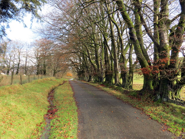
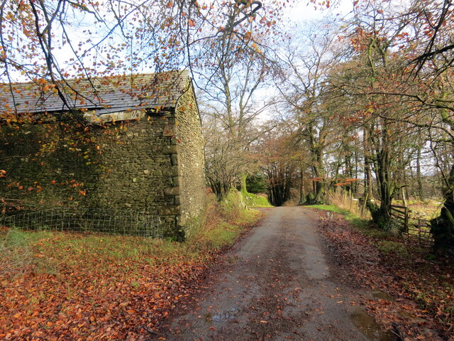
Allt Maes-pwll, located in Carmarthenshire, is a picturesque wood or forest that offers a serene and enchanting experience to visitors. Spread across a vast area, it is renowned for its natural beauty and diverse flora and fauna.

The woodland features a mix of deciduous and coniferous trees, creating a lush green canopy that provides shade and shelter. The towering trees include oak, beech, ash, and pine, among others, forming a dense and vibrant ecosystem.

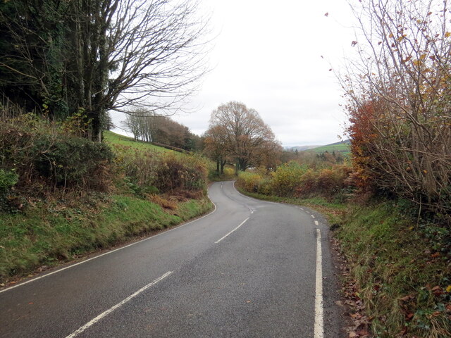
Nature enthusiasts and hikers are drawn to Allt Maes-pwll for its well-maintained trails that wind through the forest. These trails offer varying levels of difficulty, catering to both novice and experienced hikers. Along the way, visitors can enjoy the sights and sounds of nature, from the melodic birdsong to the gentle rustling of leaves.

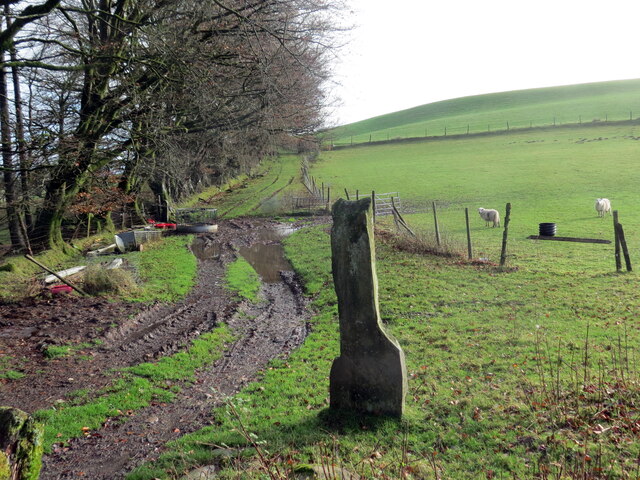
The forest is also home to a diverse range of wildlife, including deer, squirrels, badgers, and a wide array of bird species. Birdwatchers can spot woodpeckers, owls, and a variety of songbirds in their natural habitat.

Allt Maes-pwll is not just a place of natural beauty, but also has historical significance. It is believed to have been used as a hunting ground in the past and may have remnants of ancient structures or artifacts waiting to be discovered.

Overall, Allt Maes-pwll is an idyllic woodland retreat, offering visitors a chance to immerse themselves in nature, explore scenic trails, and encounter a range of wildlife.

If you have any feedback on the listing, please let us know in the comments section below.

Allt Maes-pwll Images

Images are sourced within 2km of 52.046914/-4.0626082 or Grid Reference SN5840. Thanks to Geograph Open Source API. All images are credited.

Mechanism in old Barn The satellite maps show the barn as still standing but recent high winds are most likely responsible for blowing it down to reveal this old mechanism...
Mechanism in old Barn
The satellite maps show the barn as still standing but recent high winds are most likely responsible for blowing it down to reveal this old mechanism...
Cyrraedd Rhydcymerau / Entering Rhydcymerau Y B4337 yn cyrraedd pentre Rhydcymerau.

The B4337 enters the village of Rhydcymerau (trans. ford of confluences).
Cyrraedd Rhydcymerau / Entering Rhydcymerau
Y B4337 yn cyrraedd pentre Rhydcymerau. The B4337 enters the village of Rhydcymerau (trans. ford of confluences).
Pont Rhydcymerau Y B4337 yn croesi Pont Rhydcymerau sy'n rhychwantu Afon Melinddwr.

The B4337 crosses Pont Rhydcymerau (trans. ford of confluences bridge) which spans Afon Melinddwr (trans. watermill river).
Pont Rhydcymerau
Y B4337 yn croesi Pont Rhydcymerau sy'n rhychwantu Afon Melinddwr. The B4337 crosses Pont Rhydcymerau (trans. ford of confluences bridge) which spans Afon Melinddwr (trans. watermill river).
Cyn Ysgol Rhydcymerau / The former Rhydcymerau School Hen Ysgol Gynradd Rhydcymerau a gaewyd ar 31ain Awst 2012. Cyn ddisgybl enwog yn ystod 1891-1898 oedd D.J. Williams (1885-1970), llenor, cenedlaetholwr a heddychwr. 

The former Rhydcymerau Primary School which closed on 31st August 2012. A famous ex pupil who attended the school during 1891-98 was D.J. Williams (1885-1970), writer, Welsh nationalist and pacifist.
Cyn Ysgol Rhydcymerau / The former Rhydcymerau School
Hen Ysgol Gynradd Rhydcymerau a gaewyd ar 31ain Awst 2012. Cyn ddisgybl enwog yn ystod 1891-1898 oedd D.J. Williams (1885-1970), llenor, cenedlaetholwr a heddychwr. The former Rhydcymerau Primary School which closed on 31st August 2012. A famous ex pupil who attended the school during 1891-98 was D.J. Williams (1885-1970), writer, Welsh nationalist and pacifist.
Heol fach ger Pantycrwys / Minor road near Pantyycrwys Rhes o goed ar heol fach ger Ffarm Pantycrwys.

A row of trees on a minor road near Pantycrwys Farm (trans. hollow of ?crosses).
Heol fach ger Pantycrwys / Minor road near Pantyycrwys
Rhes o goed ar heol fach ger Ffarm Pantycrwys. A row of trees on a minor road near Pantycrwys Farm (trans. hollow of ?crosses).
Ffarm Pantycrwys / Pantycrwys Farm Heol fach yn mynd heibio i Ffarm Pantycrwys.

A minor road passes Pantycrwys Farm (trans. hollow of ?crosses).
Ffarm Pantycrwys / Pantycrwys Farm
Heol fach yn mynd heibio i Ffarm Pantycrwys. A minor road passes Pantycrwys Farm (trans. hollow of ?crosses).
Hen heol goll wrth Bantycrwys / An old lost road at Pantycrwys Carreg ddiddorol, hen bostyn gât mae'n debyg, ar hen heol goll wrth ymyl Ffarm Panycrwys.

An interesting stone, probably an old gate post, on a now lost road at Pantycrwys Farm (trans. hollow of ?crosses).
Hen heol goll wrth Bantycrwys / An old lost road at Pantycrwys
Carreg ddiddorol, hen bostyn gât mae'n debyg, ar hen heol goll wrth ymyl Ffarm Panycrwys. An interesting stone, probably an old gate post, on a now lost road at Pantycrwys Farm (trans. hollow of ?crosses).
Heol fynedfa / Access road Heol fynedfa yn mynd i lawr y waered.

A farm access road descending the hill.
Heol fynedfa / Access road
Heol fynedfa yn mynd i lawr y waered. A farm access road descending the hill.
Heol fach wledig / Minor rural road Rhes o goed dymunol ar heol fach wledig.

A fine row of trees on a minor rural road.
Heol fach wledig / Minor rural road
Rhes o goed dymunol ar heol fach wledig. A fine row of trees on a minor rural road.
Hen heol esgeulusedig / A neglected old road Hen heol esgeulusedig ger Nant Rhyd-y-mwyn.

An old negelected road near Nant Rhyd-y-mwyn (trans. ford of the ?mineral stream).
Hen heol esgeulusedig / A neglected old road
Hen heol esgeulusedig ger Nant Rhyd-y-mwyn. An old negelected road near Nant Rhyd-y-mwyn (trans. ford of the ?mineral stream).
Heol esgeulusedig / Negelcted road Heol esgeulusedig ar dir uchel. Yn y pellter ar y gorwel mae mast trosglwyddo Mynydd Pencarreg.

A neglected upland road. In the distance on the horizon is Mynydd Pencarreg transmitter mast
Heol esgeulusedig / Negelcted road
Heol esgeulusedig ar dir uchel. Yn y pellter ar y gorwel mae mast trosglwyddo Mynydd Pencarreg. A neglected upland road. In the distance on the horizon is Mynydd Pencarreg transmitter mast
Heol esgeulusedig / Negelcted road Heol esgeulusedig ar dir uchel.

A negelected upland road.
Heol esgeulusedig / Negelcted road
Heol esgeulusedig ar dir uchel. A negelected upland road.
Heol fynedfa / Access road Heol fynedfa i Benybanc a Maespwll.

Access road to Penybanc (trans. top of the bank) and Maespwll (field of the pit/pool).
Heol fynedfa / Access road
Heol fynedfa i Benybanc a Maespwll. Access road to Penybanc (trans. top of the bank) and Maespwll (field of the pit/pool).
Nant yn gorlifo / A stream in spate Nant y Wenallt yn gorlifo dros bont.

Flooded bridge over Nant y Wenallt (trans. fairwood stream)
Nant yn gorlifo / A stream in spate
Nant y Wenallt yn gorlifo dros bont. Flooded bridge over Nant y Wenallt (trans. fairwood stream)
Heol i Rydcymerau / Road to Rhydcymerau Y B4337 yn mynd i gyfeiriad Rhydcymerau.

The B4337 heads in the direction of Rhydcymerau (trans. ford of the confluences).
Heol i Rydcymerau / Road to Rhydcymerau
Y B4337 yn mynd i gyfeiriad Rhydcymerau. The B4337 heads in the direction of Rhydcymerau (trans. ford of the confluences).
Ordnance Survey Cut Mark This OS cut mark can be found on the NE parapet of Pont Rhydcymerau. It marks a point 196.669m above mean sea level.
Ordnance Survey Cut Mark
This OS cut mark can be found on the NE parapet of Pont Rhydcymerau. It marks a point 196.669m above mean sea level.
Ordnance Survey Cut Mark This OS cut mark can be found on the steps of the building west side of the road. It marks a point 226.643m above mean sea level. <a title="https://www.geograph.org.uk/photo/7395976" href="https://www.geograph.org.uk/photo/7395976">Link</a>
Ordnance Survey Cut Mark
This OS cut mark can be found on the steps of the building west side of the road. It marks a point 226.643m above mean sea level. Link
Corrugated Building There is an Ordnance Survey cut mark on the brick steps. <a title="https://www.geograph.org.uk/photo/7395975" href="https://www.geograph.org.uk/photo/7395975">Link</a>
Corrugated Building
There is an Ordnance Survey cut mark on the brick steps. Link
Show me another place!

Allt Maes-pwll is located at Grid Ref: SN5840 (Lat: 52.046914, Lng: -4.0626082)

Unitary Authority: Carmarthenshire

Police Authority: Dyfed Powys

What 3 Words

///lure.divides.slack. Near Llansawel, Carmarthenshire

Nearby Locations

Allt Maes-pwll

Related Wikis

Cefn Blaenau

Cefn Blaenau is a 23-hectare Site of Special Scientific Interest in a small upland valley in Carmarthen and Dinefwr, Wales. It was designated an SSSI in...

Rhydcymerau

Rhydcymerau is a small village 8.5 kilometres to the south-east of Llanybydder, around the side of Mynydd Llanybydder, in Carmarthenshire, south-west Wales...

Mynydd Pencarreg transmitting station

The Mynydd Pencarreg transmitting station is a broadcasting and telecommunications facility located on high ground about 10 kilometres (6.2 mi) south...

Cae Blaen-dyffryn

Cae Blaen-dyffryn is a Site of Special Scientific Interest (SSSI) in Carmarthenshire, Wales. The SSSI is rectangular in shape, approximately 0.15 miles...

Llansawel transmitting station

The Llansawel television relay station is sited on high ground to the north of the village of Llansawel in Carmarthenshire, South Wales. It was originally...

Parc y Rhos

Parc y Rhos is a small village in Carmarthenshire in mid Wales about 2 miles outside of Lampeter. Once a thriving community with a small shop, two pubs...

Llansawel

Llansawel is a village and community in Carmarthenshire, Wales, about ten miles north of Llandeilo. It covers an area of 4,079 hectares (15.75 sq mi)....

Cwmann

Cwmann is a small village in Carmarthenshire, Wales, in the community of Pencarreg. It is just on the border with Ceredigion and near Lampeter, with Cwmann...

Have you been to Allt Maes-pwll?

Leave your review of Allt Maes-pwll below (or comments, questions and feedback).