Coed Ffridd-lâs

Wood, Forest in Caernarfonshire

Wales

Coed Ffridd-lâs

A good biking surface on Lôn Las Ogwen
A good biking surface on Lôn Las Ogwen Credit: David Medcalf

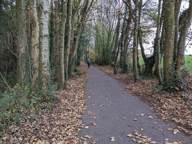
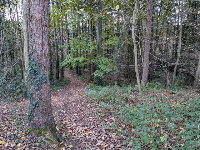
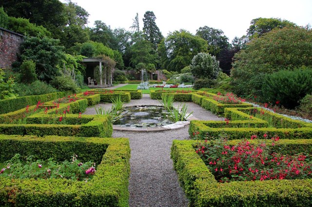
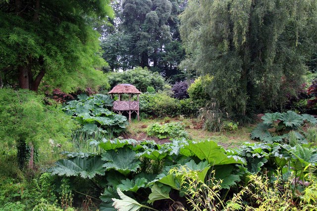
Coed Ffridd-lâs is a picturesque woodland located in Caernarfonshire, Wales. Spanning over a vast area, this enchanting forest offers visitors a tranquil and immersive experience in a natural setting.

The woodland is characterized by its diverse range of tree species, including oak, pine, beech, and birch, which create a rich and varied landscape. The dense foliage provides a haven for a wide array of wildlife, making it a popular destination for nature enthusiasts and birdwatchers alike.

Trails wind through the forest, allowing visitors to explore its hidden corners and discover its hidden gems. The paths are well-maintained, making it accessible for walkers of all abilities. Along the way, hikers can encounter babbling brooks, small waterfalls, and peaceful clearings, providing opportunities for serenity and reflection.

Coed Ffridd-lâs is also home to a number of ancient ruins and historical sites, adding a touch of intrigue to the woodland. These remnants from the past offer glimpses into the area's rich history and cultural heritage.

For those seeking adventure, the forest provides opportunities for outdoor activities such as mountain biking and horseback riding. The dense vegetation and undulating terrain make it an exciting playground for thrill-seekers.

The natural beauty and tranquility of Coed Ffridd-lâs make it a cherished destination for locals and tourists alike. Its diverse ecosystem, rich history, and recreational opportunities make it a must-visit destination for anyone seeking a connection with nature.

If you have any feedback on the listing, please let us know in the comments section below.

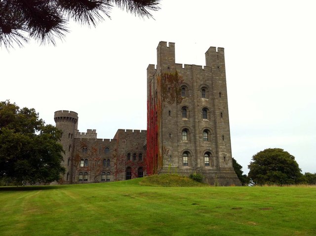
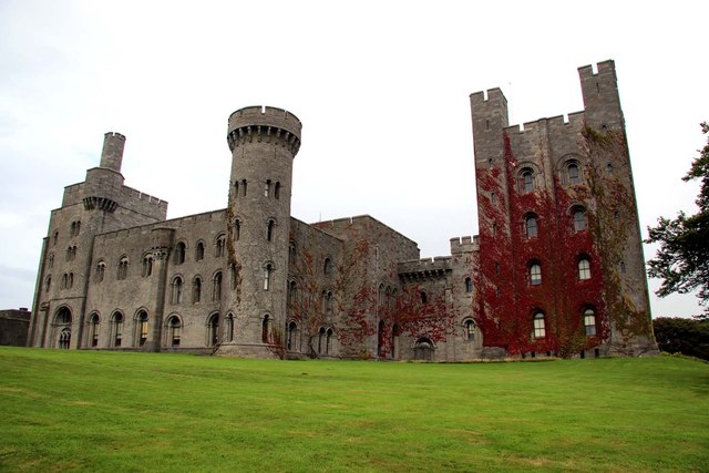
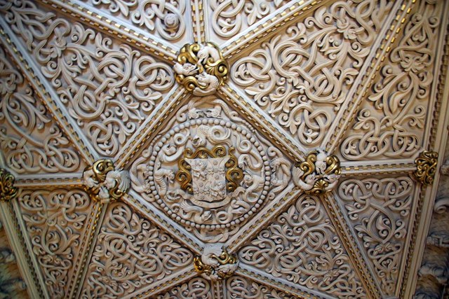
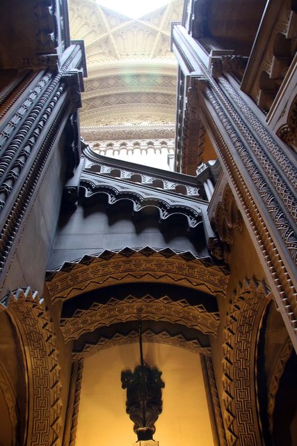
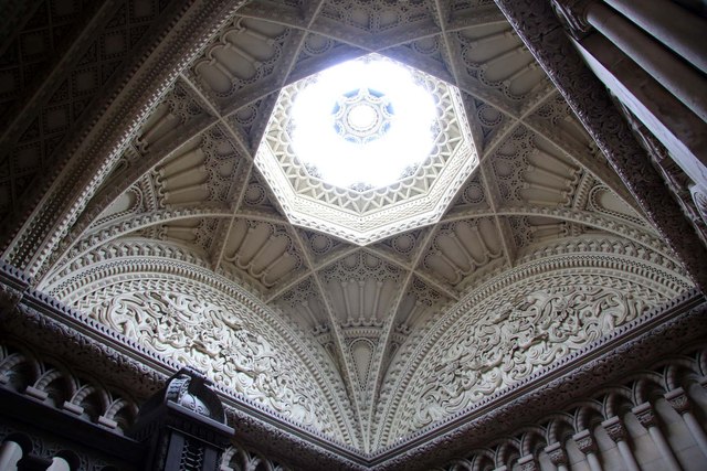
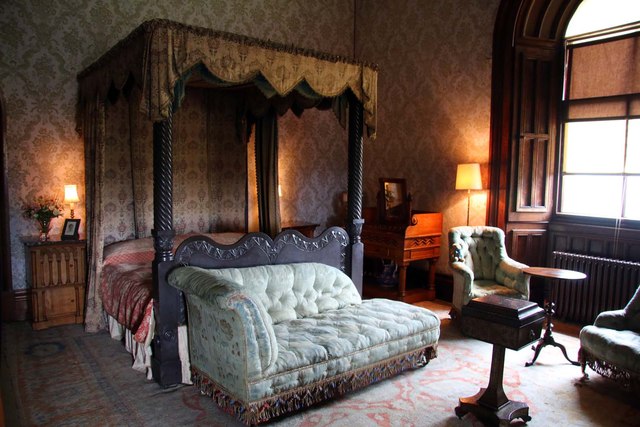
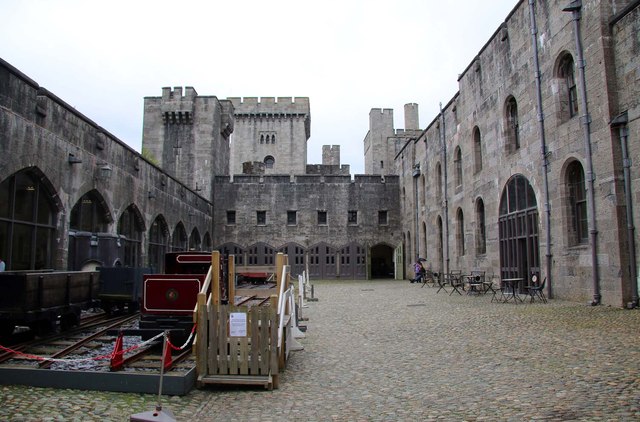
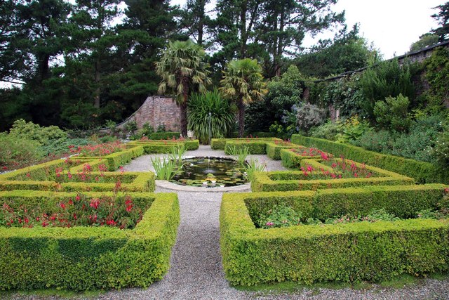
Coed Ffridd-lâs Images

Images are sourced within 2km of 53.219153/-4.1217785 or Grid Reference SH5871. Thanks to Geograph Open Source API. All images are credited.

A good biking surface on Lôn Las Ogwen
The last of the leaves in the woodland Next to Lôn Las Ogwen.
The last of the leaves in the woodland
Next to Lôn Las Ogwen.
A5 approaching A55 junction
A55 North Wales Expressway junction 11
A55, Bangor bypass The A55 is also known as the North Wales expressway. Originally it ran from Chester to Bangor, but was extended in 2001 across Anglesey to Holyhead. It is dual carriageway along its entire length.
Wikipedia: <span class="nowrap"><a title="http://en.wikipedia.org/wiki/A55_road" rel="nofollow ugc noopener" href="http://en.wikipedia.org/wiki/A55_road">Link</a><img style="margin-left:2px;" alt="External link" title="External link - shift click to open in new window" src="https://s1.geograph.org.uk/img/external.png" width="10" height="10"/></span>
A55, Bangor bypass
The A55 is also known as the North Wales expressway. Originally it ran from Chester to Bangor, but was extended in 2001 across Anglesey to Holyhead. It is dual carriageway along its entire length. Wikipedia: LinkExternal link
A5 to Bangor The A5 is a major trunk road that runs 260 miles from London to Holyhead. It follows the course of an old Roman Road (Watling Street).
Wikipedia: <span class="nowrap"><a title="http://en.wikipedia.org/wiki/A5_road_(Great_Britain)" rel="nofollow ugc noopener" href="http://en.wikipedia.org/wiki/A5_road_(Great_Britain)">Link</a><img style="margin-left:2px;" alt="External link" title="External link - shift click to open in new window" src="https://s1.geograph.org.uk/img/external.png" width="10" height="10"/></span>
A5 to Bangor
The A5 is a major trunk road that runs 260 miles from London to Holyhead. It follows the course of an old Roman Road (Watling Street). Wikipedia: LinkExternal link
A5 The A5 is a major trunk road that runs 260 miles from London to Holyhead. It follows the course of an old Roman Road (Watling Street).
Wikipedia: <span class="nowrap"><a title="http://en.wikipedia.org/wiki/A5_road_(Great_Britain)" rel="nofollow ugc noopener" href="http://en.wikipedia.org/wiki/A5_road_(Great_Britain)">Link</a><img style="margin-left:2px;" alt="External link" title="External link - shift click to open in new window" src="https://s1.geograph.org.uk/img/external.png" width="10" height="10"/></span>
A5
The A5 is a major trunk road that runs 260 miles from London to Holyhead. It follows the course of an old Roman Road (Watling Street). Wikipedia: LinkExternal link
Penrhyn Castle Penrhyn Castle is a country house near Bangor, in the form of a Norman castle. The present building was created between about 1822 and 1837 to designs by Thomas Hopper for George Hay Dawkins-Pennant who owned the Penrhyn Estate.
Penrhyn Castle
Penrhyn Castle is a country house near Bangor, in the form of a Norman castle. The present building was created between about 1822 and 1837 to designs by Thomas Hopper for George Hay Dawkins-Pennant who owned the Penrhyn Estate.
The ceiling in the library at Penrhyn Castle The ceiling is decorated with Italian plaster mouldings.
The ceiling in the library at Penrhyn Castle
The ceiling is decorated with Italian plaster mouldings.
The Grand Staircase in Penrhyn Castle A stone staircase built in a Norman style.
The Grand Staircase in Penrhyn Castle
A stone staircase built in a Norman style.
The ceiling above the Grand Staircase in Penrhyn Castle Penrhyn Castle is a country house near Bangor, in the form of a Norman castle. The present building was created between about 1822 and 1837 to designs by Thomas Hopper for George Hay Dawkins-Pennant who owned the Penrhyn Estate.
The ceiling above the Grand Staircase in Penrhyn Castle
Penrhyn Castle is a country house near Bangor, in the form of a Norman castle. The present building was created between about 1822 and 1837 to designs by Thomas Hopper for George Hay Dawkins-Pennant who owned the Penrhyn Estate.
The State Bedroom in Penrhyn Castle Penrhyn Castle is a country house near Bangor, in the form of a Norman castle. The present building was created between about 1822 and 1837 to designs by Thomas Hopper for George Hay Dawkins-Pennant who owned the Penrhyn Estate. 
Queen Victoria is reported to have slept in this bed.
The State Bedroom in Penrhyn Castle
Penrhyn Castle is a country house near Bangor, in the form of a Norman castle. The present building was created between about 1822 and 1837 to designs by Thomas Hopper for George Hay Dawkins-Pennant who owned the Penrhyn Estate. Queen Victoria is reported to have slept in this bed.
The Slate Bedroom in Penrhyn Castle Penrhyn Castle is a country house near Bangor, in the form of a Norman castle. The present building was created between about 1822 and 1837 to designs by Thomas Hopper for George Hay Dawkins-Pennant who owned the Penrhyn Estate. 
Queen Victoria refused to sleep in the 1 ton slate bed, as it reminded her of a tombstone.
The Slate Bedroom in Penrhyn Castle
Penrhyn Castle is a country house near Bangor, in the form of a Norman castle. The present building was created between about 1822 and 1837 to designs by Thomas Hopper for George Hay Dawkins-Pennant who owned the Penrhyn Estate. Queen Victoria refused to sleep in the 1 ton slate bed, as it reminded her of a tombstone.
The Railway Museum in Penrhyn Castle Penrhyn Castle is a country house near Bangor, in the form of a Norman castle. The present building was created between about 1822 and 1837 to designs by Thomas Hopper for George Hay Dawkins-Pennant who owned the Penrhyn Estate.
The Railway Museum in Penrhyn Castle
Penrhyn Castle is a country house near Bangor, in the form of a Norman castle. The present building was created between about 1822 and 1837 to designs by Thomas Hopper for George Hay Dawkins-Pennant who owned the Penrhyn Estate.
The Walled Garden at Penrhyn Castle Penrhyn Castle is a National Trust property.
The Walled Garden at Penrhyn Castle
Penrhyn Castle is a National Trust property.
The Walled Garden at Penrhyn Castle Penrhyn Castle is a National Trust property.
The Walled Garden at Penrhyn Castle
Penrhyn Castle is a National Trust property.
The Bog Garden at Penrhyn Castle Penrhyn Castle is a National Trust property.
The Bog Garden at Penrhyn Castle
Penrhyn Castle is a National Trust property.
Show me another place!

Coed Ffridd-lâs is located at Grid Ref: SH5871 (Lat: 53.219153, Lng: -4.1217785)

Unitary Authority: Gwynedd

Police Authority: North Wales

What 3 Words

///handfuls.safely.frightens. Near Bangor, Gwynedd

Related Wikis

Maesgeirchen

Maesgeirchen is a large housing estate on the edge of the city of Bangor in Gwynedd, north-west Wales, with roughly 4,000 inhabitants. It is the third...

Minffordd Hospital

Minffordd Hospital (Welsh: Ysbyty Minffordd) was a health facility in Bangor, Gwynedd, Wales. It was managed by the Betsi Cadwaladr University Health Board...

Hendre (Bangor electoral ward)

Hendre is one of eight electoral wards in the city of Bangor, Gwynedd, Wales. The ward covers part of the city south of the city centre, including West...

Deiniol (electoral ward)

Deiniol is one of eight electoral wards in the city of Bangor, Gwynedd, Wales, electing councillors to the city and county councils. == Description... ==

Farrar Road Stadium

Farrar Road Stadium was a multi-purpose stadium in Bangor, Wales. The site of the ground is now covered by an Asda supermarket. From 1920, the year it...

Bangor Mountain

Bangor Mountain (Welsh: Mynydd Bangor) is a scarp face of a hill below which the city of Bangor in Gwynedd, Wales, sits.Though not a mountain in the true...

Bangor Cathedral

Bangor Cathedral (Welsh: Eglwys Gadeiriol Bangor) is the cathedral church of Bangor, Gwynedd, Wales. It is dedicated to its founder, Saint Deiniol. The...

Bangor railway station (Wales)

Bangor railway station serves the city of Bangor, Gwynedd; it is operated by Transport for Wales. The station, which is 24+3⁄4 miles (40 km) east of Holyhead...

Nearby Amenities

Located within 500m of 53.219153,-4.1217785
Barrier: kissing_gate
Foot: yes
Lat/Long: 53.2198779/-4.1201238
Barrier: kissing_gate
Foot: yes
Lat/Long: 53.2195383/-4.1182874
Barrier: cycle_barrier
Lat/Long: 53.2187195/-4.115555
Tyddyn-mynyddig
Is In: Wales
Is In Country: United Kingdom
Is In County: Gwynedd
Place: hamlet
Lat/Long: 53.2151225/-4.1219977
Bryniau Bach Cottage
Place: locality
Lat/Long: 53.2208929/-4.1263276
Power: substation
Lat/Long: 53.221783/-4.119943
Bethesda Junction
Historic Railway: junction
Railway: site
Lat/Long: 53.2187562/-4.120566
Direction: 105
Generator Method: photovoltaic
Generator Output Electricity: yes
Generator Solar Modules: 10
Generator Source: solar
Generator Type: solar_photovoltaic_panel
Location: roof
Power: generator
Lat/Long: 53.2201239/-4.1201198
The data included in this document is from www.openstreetmap.org. The data is made available under ODbL.

Have you been to Coed Ffridd-lâs?

Leave your review of Coed Ffridd-lâs below (or comments, questions and feedback).