Allt y Gibach

Wood, Forest in Carmarthenshire

Wales

Allt y Gibach

Bwlch y Rhyd Llwybr cyhoeddus yn dringo lan at Ffarm Bwlch y Rhyd -adfail sy bellach wedi ei hamgylchynu gan blanhigfa goniferaidd.

A public footpath leading up towards the ruined farm of Bwlch y Rhyd (trans. pass of the ford). The farm is today surrounded by a conifer plantation.
Bwlch y Rhyd Credit: Alan Richards

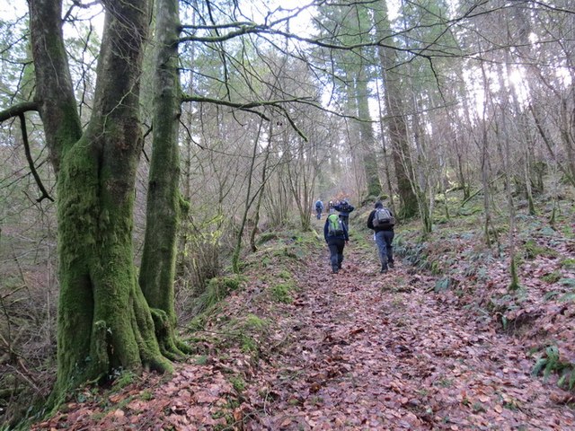
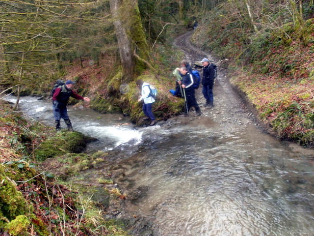
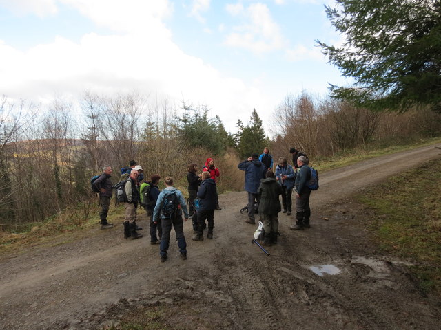
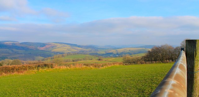
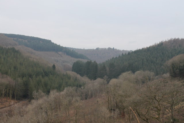
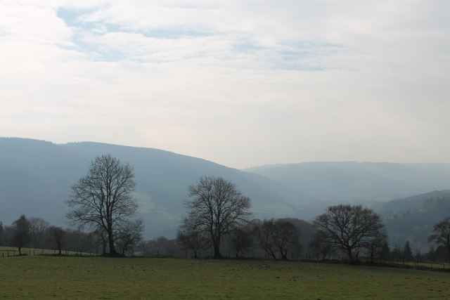
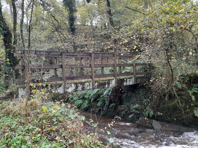
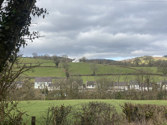
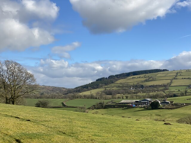
Allt y Gibach is a beautiful woodland located in Carmarthenshire, Wales. Covering an area of approximately 50 hectares, it is a haven for nature lovers and outdoor enthusiasts alike. The woodland is situated on a hillside, offering breathtaking views of the surrounding countryside.

The diverse range of trees found in Allt y Gibach includes oak, beech, birch, and ash, creating a rich and vibrant ecosystem. The forest floor is covered with a variety of flora, including bluebells, primroses, and wild garlic, which create a stunning display of colors during the springtime.

The woodland is home to a wide array of wildlife, making it a popular spot for nature enthusiasts and birdwatchers. Visitors may spot red kites, buzzards, and woodpeckers, among other bird species. Additionally, deer, foxes, and badgers can occasionally be seen roaming through the forest.

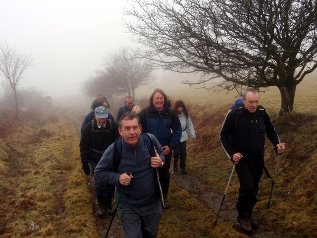
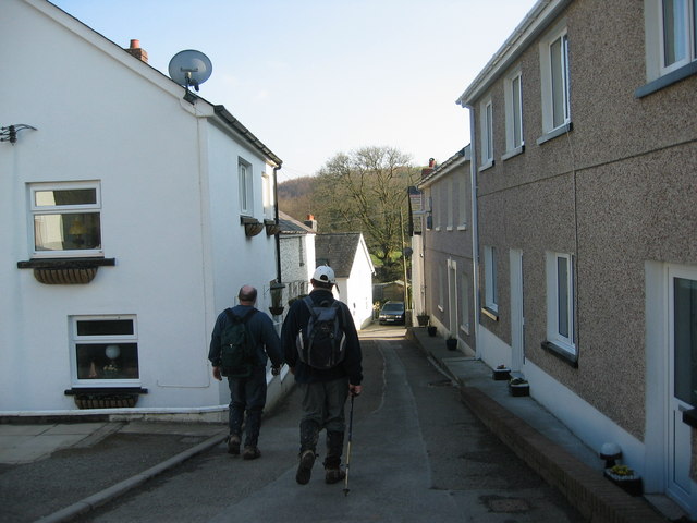
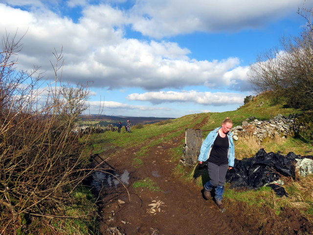
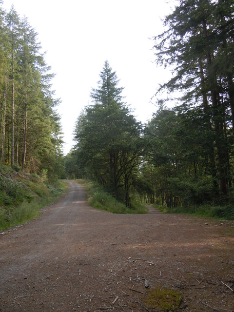
Several walking trails wind their way through Allt y Gibach, allowing visitors to explore the woodland at their own pace. These trails offer a chance to immerse oneself in nature, with the peaceful sound of birdsong and the gentle rustle of leaves underfoot.

Allt y Gibach is a cherished local treasure, providing a tranquil retreat and a valuable habitat for wildlife. Whether it's a leisurely stroll, birdwatching, or simply enjoying the serenity of the natural surroundings, this wood offers something for everyone.

If you have any feedback on the listing, please let us know in the comments section below.

Allt y Gibach Images

Images are sourced within 2km of 51.973878/-4.0836826 or Grid Reference SN5632. Thanks to Geograph Open Source API. All images are credited.

Bwlch y Rhyd Llwybr cyhoeddus yn dringo lan at Ffarm Bwlch y Rhyd -adfail sy bellach wedi ei hamgylchynu gan blanhigfa goniferaidd.

A public footpath leading up towards the ruined farm of Bwlch y Rhyd (trans. pass of the ford). The farm is today surrounded by a conifer plantation.
Bwlch y Rhyd
Llwybr cyhoeddus yn dringo lan at Ffarm Bwlch y Rhyd -adfail sy bellach wedi ei hamgylchynu gan blanhigfa goniferaidd. A public footpath leading up towards the ruined farm of Bwlch y Rhyd (trans. pass of the ford). The farm is today surrounded by a conifer plantation.
Telephone Box and Notice Board, Bro Nant, Nantyffin The telephone box and community notice board as they were in March 2004, when the telephone still took coins. BT wanted to remove it but local protests made them leave it in place. It can only be used by card now, but emergency calls are free. Just as well, as few mobile signals can be received around here.
Telephone Box and Notice Board, Bro Nant, Nantyffin
The telephone box and community notice board as they were in March 2004, when the telephone still took coins. BT wanted to remove it but local protests made them leave it in place. It can only be used by card now, but emergency calls are free. Just as well, as few mobile signals can be received around here.
Rhyd Nant y Ffin Ford Cerddwyr yn croesi Nantyffin. Roedd y rhyd ar y diwrnod yn rhy ddwfn i groesi.

Walkers crossing Nant y Ffin Stream (trans. boundary stream). On the day the water at the ford was too deep to cross.
Rhyd Nant y Ffin Ford
Cerddwyr yn croesi Nantyffin. Roedd y rhyd ar y diwrnod yn rhy ddwfn i groesi. Walkers crossing Nant y Ffin Stream (trans. boundary stream). On the day the water at the ford was too deep to cross.
Heol Rhandir Gini Road Cerddwyr yn dilyn hen heol i gyfeiriad Rhandir Gini (adfail)

Walkers following an old road in the direction of the ruined property known as Rhandir Gini.
Heol Rhandir Gini Road
Cerddwyr yn dilyn hen heol i gyfeiriad Rhandir Gini (adfail) Walkers following an old road in the direction of the ruined property known as Rhandir Gini.
Uwchben / Above Ffinnant Cerddwyr yn cael seibiant ar groesffordd o draciau uwchben Ffarm Ffinnant.

Walkers having a breather at a crossroads of tracks above Ffinnant Farm (trans. boundary stream).
Uwchben / Above Ffinnant
Cerddwyr yn cael seibiant ar groesffordd o draciau uwchben Ffarm Ffinnant. Walkers having a breather at a crossroads of tracks above Ffinnant Farm (trans. boundary stream).
Abergorlech Cerddwyr yn cyrraedd pentre Abergorlech.

Walkers arriving at Abergorelch village.
Abergorlech
Cerddwyr yn cyrraedd pentre Abergorlech. Walkers arriving at Abergorelch village.
Tuag at / Towards Penygarn Cerddwyr yn dilyn llwybr cyhoeddus i'r heol ym Mhenygarn.

Walkers following a footpath towards the road at Penygarn (trans. top of the cairn)
Tuag at / Towards Penygarn
Cerddwyr yn dilyn llwybr cyhoeddus i'r heol ym Mhenygarn. Walkers following a footpath towards the road at Penygarn (trans. top of the cairn)
View East from above Trebwl View towards Llansawel...
View East from above Trebwl
View towards Llansawel...
Nant-Y-Ffin Valley The valley of Nant-Y-Ffin, with Crynarth on the left and Allt Esgair-onen on the right
Nant-Y-Ffin Valley
The valley of Nant-Y-Ffin, with Crynarth on the left and Allt Esgair-onen on the right
View from below Rhandir Gini
Traciau Allt Byrgwm, Fforest Brechfa/Tracks Byrgwm Wood, Brechfa Forest Rhwng/Between Brechfa & Nantyffin
Traciau Allt Byrgwm, Fforest Brechfa/Tracks Byrgwm Wood, Brechfa Forest
Rhwng/Between Brechfa & Nantyffin
Churn Stand
Churn Stand
Foot Bridge
Foot Bridge
Ordnance Survey Cut Mark This OS cut mark can be found on the gatepost NW side of the road. It marks a point 290.278m above mean sea level.
Ordnance Survey Cut Mark
This OS cut mark can be found on the gatepost NW side of the road. It marks a point 290.278m above mean sea level.
Pont Gorlech, Abergorlech
Pont Cothi Bridge over Afon Cothi, Abergorlech.
Pont Cothi
Bridge over Afon Cothi, Abergorlech.
Approaching Abergorlech
Carmarthenshire countryside Beili Bedw farm.
Carmarthenshire countryside
Beili Bedw farm.
Show me another place!

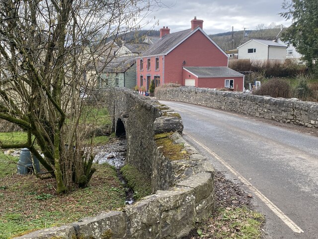
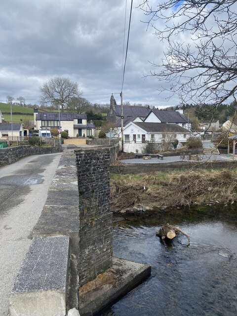
Allt y Gibach is located at Grid Ref: SN5632 (Lat: 51.973878, Lng: -4.0836826)

Unitary Authority: Carmarthenshire

Police Authority: Dyfed Powys

What 3 Words

///cabs.pushed.brothers. Near Llanfynydd, Carmarthenshire

Related Wikis

Abergorlech

Abergorlech is a village 8 miles (13 km) to the north-west of Llandeilo in Carmarthenshire, Wales. It lies on the River Cothi on the B4310 road, between...

Llanfihangel Rhos-y-Corn

Llanfihangel Rhos-y-Corn is a sparsely populated community of Carmarthenshire, Wales. The population of the community taken at the 2011 census was 468...

Gwernogle

Gwernogle is an isolated hamlet in Carmarthenshire, Wales, nestled in the Brechfa Forest. The Ty Cwrdd Welsh Independent Chapel is situated in the hamlet...

Brechfa Forest

The Brechfa Forest is a forest in Carmarthenshire, south Wales. Brechfa Forest is the 'modern' name for part of the ancient Glyn Cothi Forest. From before...

Afon Marlais, Carmarthenshire

The Afon Marlais is a right-bank tributary of the Afon Cothi in Carmarthenshire, West Wales. It rises on the slopes of Mynydd Llanfihangel-rhos-y-corn...

Carmarthen East and Dinefwr (Senedd constituency)

Carmarthen East and Dinefwr (Welsh: Dwyrain Caerfyrddin a Dinefwr) is a constituency of the Senedd. It elects one Member of the Senedd by the first past...

Carmarthen East and Dinefwr (UK Parliament constituency)

Carmarthen East and Dinefwr (Welsh: Dwyrain Caerfyrddin a Dinefwr) is a constituency of the House of Commons of the Parliament of the United Kingdom represented...

Brechfa

Brechfa, situated between Llandeilo and Carmarthen in the county of Carmarthenshire, Wales, is a village that has existed since the 6th century at the...

Have you been to Allt y Gibach?

Leave your review of Allt y Gibach below (or comments, questions and feedback).