Coed Cae-defaid
Wood, Forest in Anglesey
Wales
Coed Cae-defaid
Coed Cae-defaid, located in Anglesey, is a picturesque woodland area known for its natural beauty and rich biodiversity. Covering approximately 100 acres, it is a popular destination for nature enthusiasts, hikers, and those seeking a peaceful retreat in the heart of nature.
The woodland is characterized by a diverse range of tree species, including oak, ash, birch, and beech, which create a vibrant and enchanting atmosphere. The trees provide a haven for various wildlife, such as birds, squirrels, and deer, making it a prime spot for birdwatching and wildlife spotting.
Tranquil walking trails wind their way through the woodland, offering visitors the chance to explore its hidden gems and enjoy the sights and sounds of nature. The paths are well-maintained, making it accessible for all ages and abilities.
Coed Cae-defaid also boasts a small stream that meanders through the forest, adding to the charm and serenity of the area. The stream provides a refreshing backdrop for picnics or simply unwinding and taking in the natural surroundings.
The woodland is a protected area, managed by local conservation organizations, ensuring the preservation of its natural habitats and ecosystems. Educational programs and guided tours are often available, providing visitors with the opportunity to learn more about the flora and fauna that call Coed Cae-defaid their home.
Overall, Coed Cae-defaid offers a tranquil escape from the bustling city life, where visitors can reconnect with nature and enjoy the beauty of Anglesey's woodlands.
If you have any feedback on the listing, please let us know in the comments section below.
Coed Cae-defaid Images
Images are sourced within 2km of 53.257879/-4.1461697 or Grid Reference SH5675. Thanks to Geograph Open Source API. All images are credited.


Coed Cae-defaid is located at Grid Ref: SH5675 (Lat: 53.257879, Lng: -4.1461697)
Unitary Authority: Isle of Anglesey
Police Authority: North Wales
What 3 Words
///cherished.rating.stay. Near Bangor, Gwynedd
Nearby Locations
Related Wikis

Hen Bentref Llandegfan
Hen Bentref Llandegfan is a village in the community of Cwm Cadnant, Anglesey, Wales, which is 128.9 miles (207.5 km) from Cardiff and 207.8 miles (334...
Dindaethwy
Dindaethwy was in medieval times one of two commotes of the cantref of Rhosyr, in the south-east of the Isle of Anglesey. It was between the Menai Strait...
Llansadwrn, Anglesey
Llansadwrn (; Welsh: [ɬanˈsadʊn]; ) is a small village in the community of Cwm Cadnant in south-east Anglesey, in north-west Wales. It lies between Menai...

Cwm Cadnant
Cwm Cadnant is a community and former electoral ward in Anglesey, north Wales. Named after the local river, Afon Cadnant, which flows through it, the community...

Cytir Mawr
Cytir Mawr (also written as Cyttir Mawr) is a local nature reserve in Llandegfan, Anglesey, Wales. == History == In July 2006, the site was designated...
Bryn-minceg
Bryn-minceg is a settlement in Cwm Cadnant, Anglesey, Wales. == References == == See also == List of localities in Wales by population
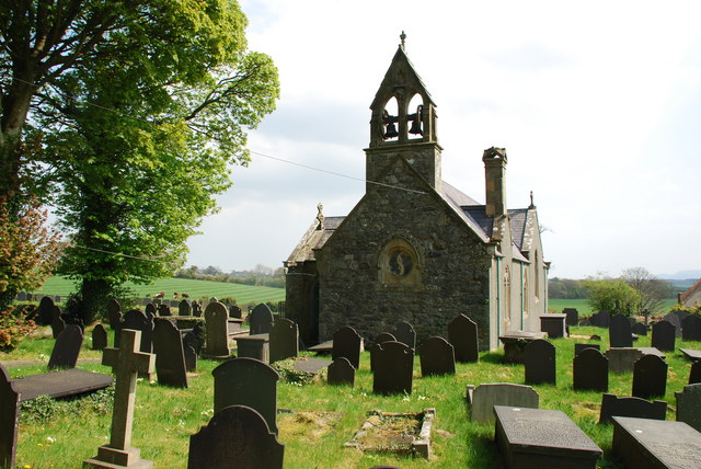
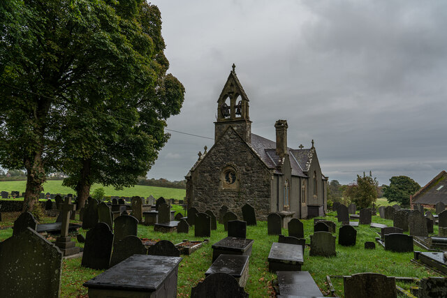
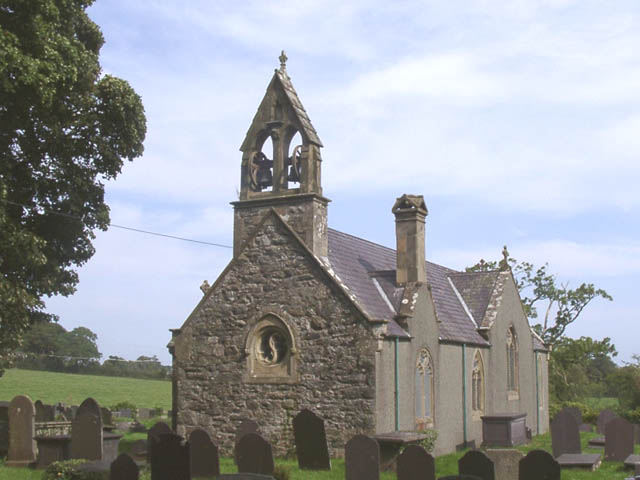
St Sadwrn's Church, Llansadwrn
St Sadwrn's Church, Llansadwrn (; Welsh: [ɬanˈsadʊn]) is a church in the village of Llansadwrn, Anglesey, Wales. It is dedicated to the Welsh saint Sadwrn...
Cremlyn
Cremlyn is an area in the community of Biwmares, Anglesey, Wales, which is 130.4 miles (209.8 km) from Cardiff and 208.5 miles (335.6 km) from London...
Nearby Amenities
Located within 500m of 53.257879,-4.1461697Have you been to Coed Cae-defaid?
Leave your review of Coed Cae-defaid below (or comments, questions and feedback).