Coed Tancarrog

Wood, Forest in Cardiganshire

Wales

Coed Tancarrog

Pencwm Mawr farm North of Llanddeiniol
Pencwm Mawr farm Credit: Eirian Evans

The requested URL returned error: 429 Too Many Requests

If you have any feedback on the listing, please let us know in the comments section below.

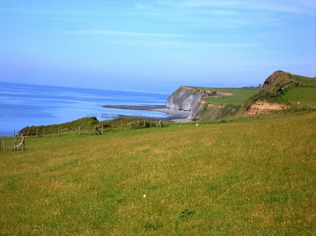
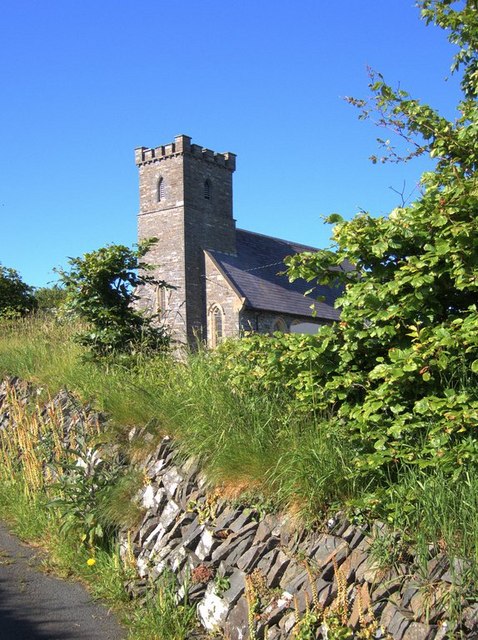
Coed Tancarrog Images

Images are sourced within 2km of 52.331993/-4.103326 or Grid Reference SN5672. Thanks to Geograph Open Source API. All images are credited.

Pencwm Mawr farm North of Llanddeiniol
Pencwm Mawr farm
North of Llanddeiniol
Ceredigion Coastal Footpath
Cairn at Pen Glôg
Cairn at Pen Glôg
A487 near Y Meini
A487 near Y Meini
Milestone - Aberystwyth 6
Milestone - Aberystwyth 7
Ordnance Survey 1GL Bolt This OS Bolt can be found on the west angle of St Deiniol's Church. It marks a point 107.930m above mean sea level.
Ordnance Survey 1GL Bolt
This OS Bolt can be found on the west angle of St Deiniol's Church. It marks a point 107.930m above mean sea level.
Old Milestone by the A487, Y Meini, Llanfarian Parish Aberystwyth tombstone by the A487, in parish of Llanfarian (Ceredigion District),  near Y Meini, in embankment, West side of road.

Inscription reads:-
ABERYSTWYTH
6
Miles
OSBM bench mark recorded on this stone.

Grade II Listed by Cadw.
Reference Number 82508: <span class="nowrap"><a title="https://cadwpublic-api.azurewebsites.net/reports/listedbuilding/FullReport?lang=&id=82508" rel="nofollow ugc noopener" href="https://cadwpublic-api.azurewebsites.net/reports/listedbuilding/FullReport?lang=&id=82508">Link</a><img style="margin-left:2px;" alt="External link" title="External link - shift click to open in new window" src="https://s1.geograph.org.uk/img/external.png" width="10" height="10"/></span>

Surveyed

Milestone Society National ID: CRD_AYCA06
Old Milestone by the A487, Y Meini, Llanfarian Parish
Aberystwyth tombstone by the A487, in parish of Llanfarian (Ceredigion District), near Y Meini, in embankment, West side of road. Inscription reads:- ABERYSTWYTH 6 Miles OSBM bench mark recorded on this stone. Grade II Listed by Cadw. Reference Number 82508: LinkExternal link Surveyed Milestone Society National ID: CRD_AYCA06
Old Milestone by the A487, Llanddeiniol Aberystwyth tombstone by the A487, in parish of Llanrhystyd (Ceredigion District), Llanddeiniol, just North of village turn, in embankment, West side of road.

Inscription reads:-
ABERYSTWYTH
7
MILES

Grade II listed by Cadw.
Reference Number: 17141 <span class="nowrap"><a title="https://cadwpublic-api-staging.azurewebsites.net/reports/listedbuilding/FullReport?lang=&id=17141" rel="nofollow ugc noopener" href="https://cadwpublic-api-staging.azurewebsites.net/reports/listedbuilding/FullReport?lang=&id=17141">Link</a><img style="margin-left:2px;" alt="External link" title="External link - shift click to open in new window" src="https://s1.geograph.org.uk/img/external.png" width="10" height="10"/></span>

Surveyed

Milestone Society National ID: CRD_AYCA07
Old Milestone by the A487, Llanddeiniol
Aberystwyth tombstone by the A487, in parish of Llanrhystyd (Ceredigion District), Llanddeiniol, just North of village turn, in embankment, West side of road. Inscription reads:- ABERYSTWYTH 7 MILES Grade II listed by Cadw. Reference Number: 17141 LinkExternal link Surveyed Milestone Society National ID: CRD_AYCA07
Lane looking towards Brynhir farm Looking south along the lane towards Brynhir farm
Lane looking towards Brynhir farm
Looking south along the lane towards Brynhir farm
Edge of the headland on the Cardigan Bay coast The headland falls off steeply towards the sea.  The highest point of the square is the SE corner at about 110m, near to where the photo was taken from.  There are near vertical cliffs below the grassy edge shown here.
Edge of the headland on the Cardigan Bay coast
The headland falls off steeply towards the sea. The highest point of the square is the SE corner at about 110m, near to where the photo was taken from. There are near vertical cliffs below the grassy edge shown here.
Twr Gwylanod Twr Gwylanod, the "seagull tower", on the Ceredigion coast.  The coastal strip in this area consists of a fairly flat grassy headland above 80m high cliffs.  A few hundred metres inland, there is another grassy slope leading up to the surrounding inland areas at about 160m.  There are sheep on the headland, but all the farm buildings have been abandoned these days.
Twr Gwylanod
Twr Gwylanod, the "seagull tower", on the Ceredigion coast. The coastal strip in this area consists of a fairly flat grassy headland above 80m high cliffs. A few hundred metres inland, there is another grassy slope leading up to the surrounding inland areas at about 160m. There are sheep on the headland, but all the farm buildings have been abandoned these days.
Tree shaped by the wind on the Cardigan Bay coast The prevalent wind direction is southwesterly.  The strong winds force trees on the cliffs to grow parallel to the slope of the ground.
Tree shaped by the wind on the Cardigan Bay coast
The prevalent wind direction is southwesterly. The strong winds force trees on the cliffs to grow parallel to the slope of the ground.
Stream gully in the Ceredigion coast cliffs A stream has found its way down the cliffs near Tynbwlch farm.
Stream gully in the Ceredigion coast cliffs
A stream has found its way down the cliffs near Tynbwlch farm.
Clifftop foxglove Quite a few of these can be found on top of the cliffs near Tynbwlch farm.
Clifftop foxglove
Quite a few of these can be found on top of the cliffs near Tynbwlch farm.
Llanddeiniol church Llanddeiniol is a small village (with church and chapel but sadly no pub) just inland of the Cardigan Bay coast and the A487.  A few minor roads cross the square.  Most of the square is grazing land of the surrounding farms, with a few trees in less accessible areas such as near streams.
Llanddeiniol church
Llanddeiniol is a small village (with church and chapel but sadly no pub) just inland of the Cardigan Bay coast and the A487. A few minor roads cross the square. Most of the square is grazing land of the surrounding farms, with a few trees in less accessible areas such as near streams.
Track and flowering bushes near Carrog farm This is located on an old trackway between two fields of the Carrog estate north of Llanddeiniol.
Track and flowering bushes near Carrog farm
This is located on an old trackway between two fields of the Carrog estate north of Llanddeiniol.
Damp patch amidst farmland Although most of this square is farmland (grazing), there are a few rough damp patches, particularly in E.  The A487 Aberystwyth to Cardigan/Aberteifi crosses the W of the square.
Damp patch amidst farmland
Although most of this square is farmland (grazing), there are a few rough damp patches, particularly in E. The A487 Aberystwyth to Cardigan/Aberteifi crosses the W of the square.
Show me another place!

Coed Tancarrog is located at Grid Ref: SN5672 (Lat: 52.331993, Lng: -4.103326)

Unitary Authority: Ceredigion

Police Authority: Dyfed Powys

What 3 Words

///computers.tomb.screening. Near Llanilar, Ceredigion

Related Wikis

Rhos Blaen Carrog

Rhos Blaen Carrog is a Site of Special Scientific Interest in Ceredigion, west Wales, due to its population of Wavy St. John's Wort (Hypericum undulatum...
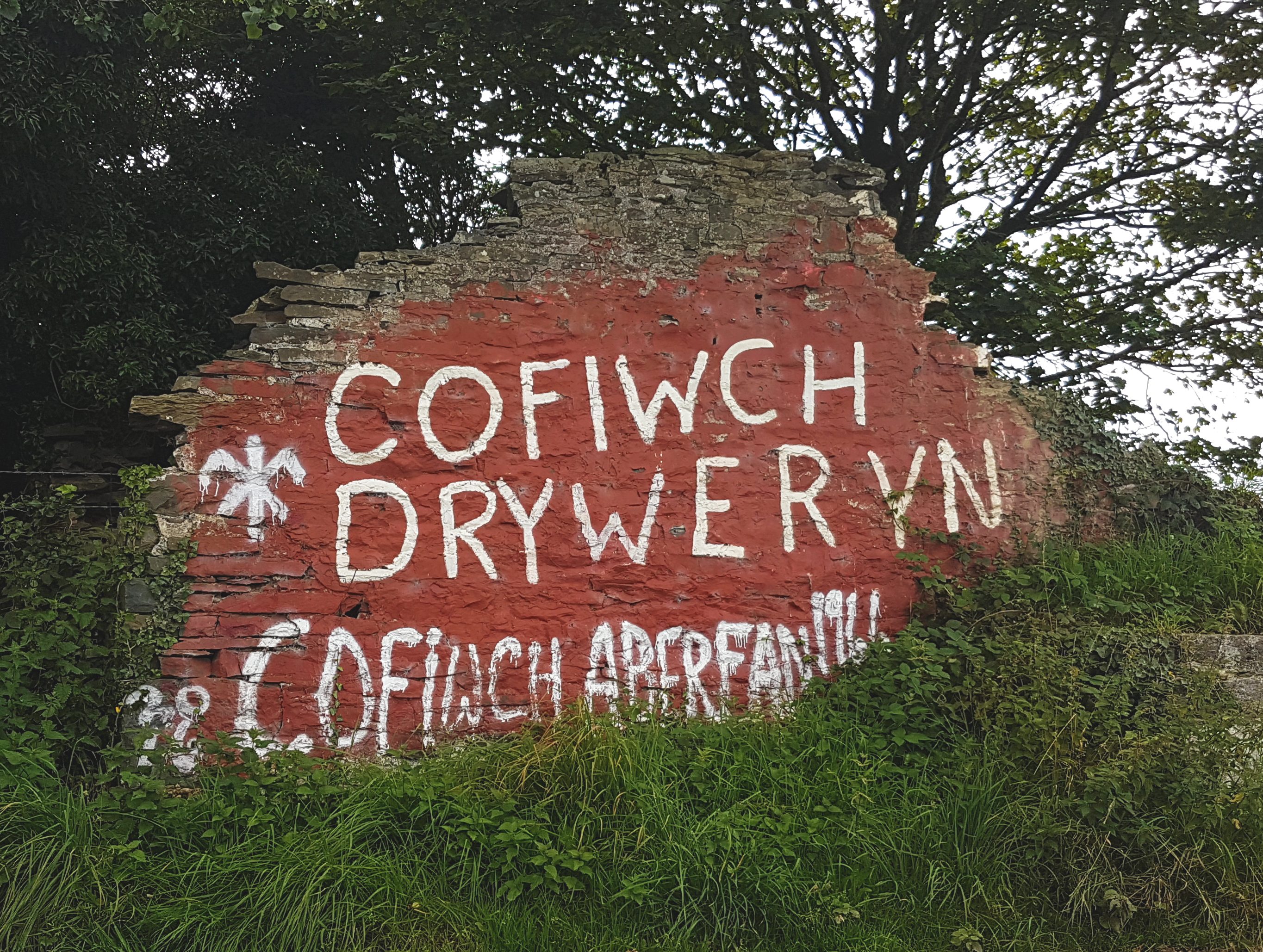
Cofiwch Dryweryn

Cofiwch Dryweryn (Welsh for 'Remember Tryweryn') is a graffitied stone wall near Llanrhystud, Ceredigion, Wales. Author and journalist Meic Stephens originally...

Blaenplwyf transmitting station

The Blaenplwyf transmitting station (sometimes written "Blaen Plwyf" or "Blaen-Plwyf") is a broadcasting and telecommunications facility located near the...

Blaenplwyf

Blaenplwyf (Pontllanio previously) is a village in Ceredigion, to the southwest of Aberystwyth. It is noted for the Blaenplwyf transmitting station, which...

Nearby Amenities

Located within 500m of 52.331993,-4.103326
Place: farm
Lat/Long: 52.3292936/-4.1012683
Place: farm
Lat/Long: 52.3332667/-4.1049376
Building: yes
Lat/Long: 52.3321128/-4.1081991
Access: no
Barrier: stile
Foot: yes
Material: wood
Stile: stepover
Lat/Long: 52.3300197/-4.1055151
Access: no
Barrier: stile
Foot: yes
Material: wood
Stile: stepover
Lat/Long: 52.329175/-4.1048865
The data included in this document is from www.openstreetmap.org. The data is made available under ODbL.

Have you been to Coed Tancarrog?

Leave your review of Coed Tancarrog below (or comments, questions and feedback).