Burnham Market

Settlement in Norfolk King's Lynn and West Norfolk

England

Burnham Market

In All Saints Graveyard This gravestone marks the burial site of Martha and Mary Moxon, daughter and mother. Martha died in 1780, age 20 years, with Mary living until 1793 and 70 years of age. The stone records the two people side by side.
Carved across the top are a shining urn and two cherubs, which might be winged souls indicating the rise of the deceased to Heaven.
In All Saints Graveyard Credit: Mary and Angus Hogg

Burnham Market is a charming village located in the county of Norfolk, England. Situated about three miles inland from the North Norfolk coast, it lies within the Norfolk Coast Area of Outstanding Natural Beauty. With a population of around 1,000 residents, it exudes a quaint and peaceful atmosphere.

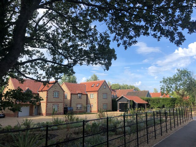
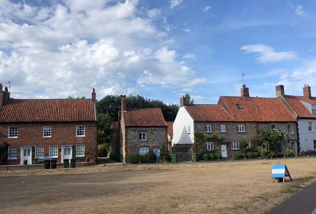
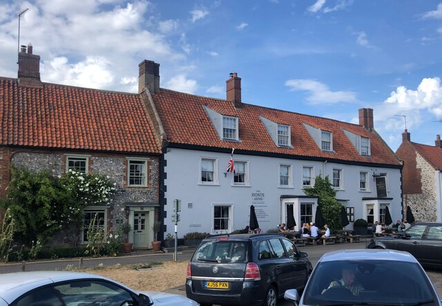
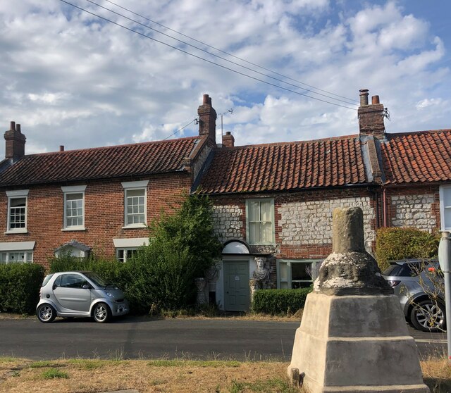
The village is renowned for its picturesque Georgian architecture, featuring attractive red-brick houses, flint cottages, and elegant buildings that house a variety of independent boutique shops, art galleries, and high-end retailers. This has earned it the nickname of "Chelsea-on-Sea" due to its popularity among affluent visitors.

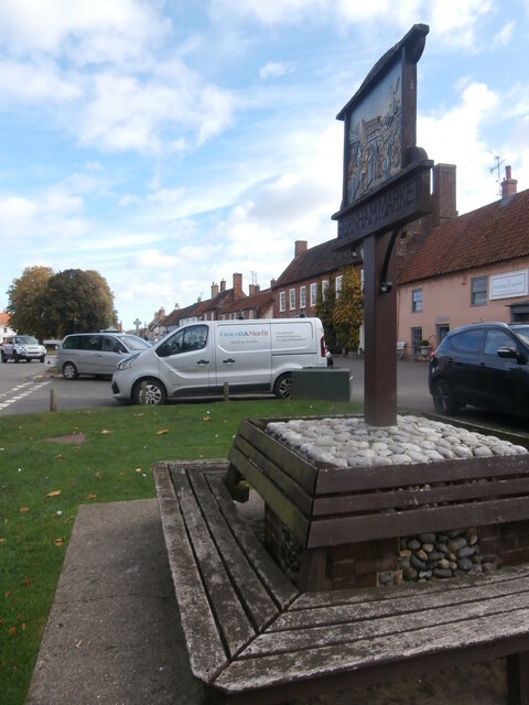
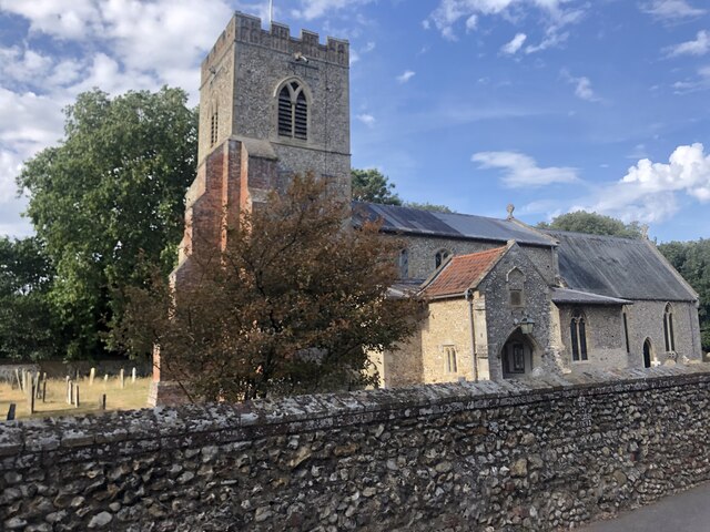
Burnham Market boasts a central green, known as The Green, which acts as the heart of the village and is surrounded by charming pubs, cafes, and restaurants. The village also has a primary school, a parish church, and various amenities to cater to the needs of both residents and visitors.

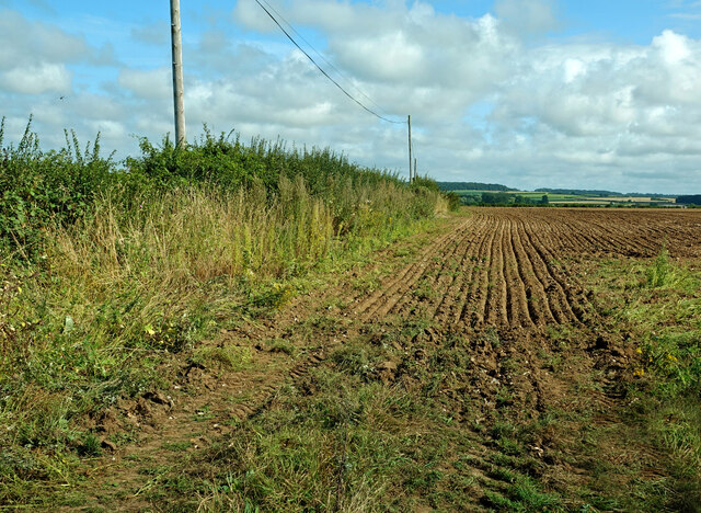
Surrounded by lush countryside, Burnham Market is a haven for nature enthusiasts and offers ample opportunities for outdoor activities. The village is a great starting point for exploring the stunning Norfolk coastline and its beautiful beaches, including the nearby Holkham Beach, which has been voted one of the best beaches in the UK.

Overall, Burnham Market is a quintessential English village that seamlessly combines historic charm with modern elegance. Its idyllic setting, architectural beauty, and proximity to natural wonders make it a popular destination for tourists and a coveted place to live for those seeking a tranquil and picturesque lifestyle.

If you have any feedback on the listing, please let us know in the comments section below.

Burnham Market Images

Images are sourced within 2km of 52.945275/0.725722 or Grid Reference TF8342. Thanks to Geograph Open Source API. All images are credited.

In All Saints Graveyard This gravestone marks the burial site of Martha and Mary Moxon, daughter and mother. Martha died in 1780, age 20 years, with Mary living until 1793 and 70 years of age. The stone records the two people side by side.
Carved across the top are a shining urn and two cherubs, which might be winged souls indicating the rise of the deceased to Heaven.
In All Saints Graveyard
This gravestone marks the burial site of Martha and Mary Moxon, daughter and mother. Martha died in 1780, age 20 years, with Mary living until 1793 and 70 years of age. The stone records the two people side by side. Carved across the top are a shining urn and two cherubs, which might be winged souls indicating the rise of the deceased to Heaven.
All Saints Church, Burnham Sutton cum Ulph During the 18th century the Reverend Nelson, father of Horatio, advised that the parish could no longer maintain its two churches. This resulted in Burnham Sutton church being demolished and the two congregations being amalgamated using the All Saints building.
All Saints Church, Burnham Sutton cum Ulph
During the 18th century the Reverend Nelson, father of Horatio, advised that the parish could no longer maintain its two churches. This resulted in Burnham Sutton church being demolished and the two congregations being amalgamated using the All Saints building.
Beacon Hill Road Viewed at the junction with Creake Road.
Beacon Hill Road
Viewed at the junction with Creake Road.
St Ethelbert’s Church ruins <a href="https://www.geograph.org.uk/photo/2047694">TF8341 : The ruins of St Ethelbert's church in Burnham Sutton</a> gives useful information about this site. The church was dedicated to St Ethelbert, an 8th century king of East Anglia.
St Ethelbert’s Church ruins
TF8341 : The ruins of St Ethelbert's church in Burnham Sutton gives useful information about this site. The church was dedicated to St Ethelbert, an 8th century king of East Anglia.
Fields near Burnham Market Already harvested and re-ploughed for the next crop.
Fields near Burnham Market
Already harvested and re-ploughed for the next crop.
In St Clement’s graveyard A simple coffin-shaped stone marks this grave. The surface was too badly weathered to make out any of the inscription.
In St Clement’s graveyard
A simple coffin-shaped stone marks this grave. The surface was too badly weathered to make out any of the inscription.
St Clement’s gravestone This stone marks the grave of Samuel Brookbank who died in 1776. The carving shows a beautiful winged soul that represents Samuel’s rise to Heaven.
St Clement’s gravestone
This stone marks the grave of Samuel Brookbank who died in 1776. The carving shows a beautiful winged soul that represents Samuel’s rise to Heaven.
In St Clement’s graveyard, Burnham Overy The skulls on this 18th century stone represent man’s mortality while the central cherub, or winged soul, indicates Heavenly life after death.
In St Clement’s graveyard, Burnham Overy
The skulls on this 18th century stone represent man’s mortality while the central cherub, or winged soul, indicates Heavenly life after death.
A carved stone in St Clement’s graveyard A lovely carved headstone marks this 18th century grave. The skull and crossed bones represent death and remind the passer-by that earthly life is limited. The two cherub-like faces may actually be winged souls which represent the rise of the deceased up to Heaven.
A carved stone in St Clement’s graveyard
A lovely carved headstone marks this 18th century grave. The skull and crossed bones represent death and remind the passer-by that earthly life is limited. The two cherub-like faces may actually be winged souls which represent the rise of the deceased up to Heaven.
St Clement’s Church, Burnham Overy Town There has been a church on this site since the 12th century. The Grade 1 listed building has been completely restored.
St Clement’s Church, Burnham Overy Town
There has been a church on this site since the 12th century. The Grade 1 listed building has been completely restored.
Village sign, Burnham Market This village sign has been combined with a four-sided bench, where you can rest after buying books, delicatessen goods and green wellies, all of which can be purchased in the eponymous Market Place. Behind the sign the former Grooms Bakery is now Bombay Sprout <span class="nowrap"><a title="https://bombaysprout.com/" rel="nofollow ugc noopener" href="https://bombaysprout.com/">Link</a><img style="margin-left:2px;" alt="External link" title="External link - shift click to open in new window" src="https://s1.geograph.org.uk/img/external.png" width="10" height="10"/></span> and Aurina <span class="nowrap"><a title="https://burnhammarket.co.uk/aurina/" rel="nofollow ugc noopener" href="https://burnhammarket.co.uk/aurina/">Link</a><img style="margin-left:2px;" alt="External link" title="External link - shift click to open in new window" src="https://s1.geograph.org.uk/img/external.png" width="10" height="10"/></span> , both homewares shops.
Village sign, Burnham Market
This village sign has been combined with a four-sided bench, where you can rest after buying books, delicatessen goods and green wellies, all of which can be purchased in the eponymous Market Place. Behind the sign the former Grooms Bakery is now Bombay Sprout LinkExternal link and Aurina LinkExternal link , both homewares shops.
Burnham Overy windmill, A149, Burnham Overy Staithe Grade II* Listed tower windmill. The mill was built in 1816 by Edmund Savory. Savory worked the mill until his death on 9 February 1827, when it passed to his son John. The mill was six storeys high, with a ground floor diameter of 24 feet and had a stage set around the first floor. It had four double shuttered sails with a span of 81 feet, each had 12 bays of 3 shutters and drove 3 pairs of stones. The mill ceased working between 1912 and 1921 depending on who you believe. Mr. Hugh Hughes architect bought the mill in 1926 and by then all the machinery had been removed. Hughes converted the mill for use as holiday lets and added the single storey extensions. Restoration was carried out by R. Thompson & Son of Alford, Lincs. who added a fixed cap, skeleton sails, stage and fan in 1957. The following year Hughes donated the mill to the National Trust who soon after had to again replace the sails as they had deteriorated badly. Plans by the Trust to restore the mill to working order were opposed by the Norfolk County Council due to the inadequate highway in the locality which did not have the capacity to cope with large numbers of visitors. The mill was renovated internally to meet fire safety regulations and retarred in 1981. The stocks and sails were removed in 1983. Two new 62 feet (18.90 m) long stocks of Jamaican Pitch pine were fitted on 17 July 1985, and four new sails the following day. The new stocks and sails cost £26,500. It is now used for holiday self catering accommodation by the National Trust.
Burnham Overy windmill, A149, Burnham Overy Staithe
Grade II* Listed tower windmill. The mill was built in 1816 by Edmund Savory. Savory worked the mill until his death on 9 February 1827, when it passed to his son John. The mill was six storeys high, with a ground floor diameter of 24 feet and had a stage set around the first floor. It had four double shuttered sails with a span of 81 feet, each had 12 bays of 3 shutters and drove 3 pairs of stones. The mill ceased working between 1912 and 1921 depending on who you believe. Mr. Hugh Hughes architect bought the mill in 1926 and by then all the machinery had been removed. Hughes converted the mill for use as holiday lets and added the single storey extensions. Restoration was carried out by R. Thompson & Son of Alford, Lincs. who added a fixed cap, skeleton sails, stage and fan in 1957. The following year Hughes donated the mill to the National Trust who soon after had to again replace the sails as they had deteriorated badly. Plans by the Trust to restore the mill to working order were opposed by the Norfolk County Council due to the inadequate highway in the locality which did not have the capacity to cope with large numbers of visitors. The mill was renovated internally to meet fire safety regulations and retarred in 1981. The stocks and sails were removed in 1983. Two new 62 feet (18.90 m) long stocks of Jamaican Pitch pine were fitted on 17 July 1985, and four new sails the following day. The new stocks and sails cost £26,500. It is now used for holiday self catering accommodation by the National Trust.
Barn conversion in Burnham Norton
New housing development at Burnham Market
St Mary's Church, Burnham Market Parish church of Burnham Westgate. Largely C14, with a heavy restoration
of 1872 accounting for most exterior details. Flint with stone dressings. Listed Grade 1
St Mary's Church, Burnham Market
Parish church of Burnham Westgate. Largely C14, with a heavy restoration of 1872 accounting for most exterior details. Flint with stone dressings. Listed Grade 1
Houses on The Green, Burnham Market
The Hoste Arms, Burnham Market Grade II listed public house on The Green
The Hoste Arms, Burnham Market
Grade II listed public house on The Green
Wayside Cross, Burnham Overy The remains of the village Cross at the junction of Mill Road and Wells Road. Grade II listed
Wayside Cross, Burnham Overy
The remains of the village Cross at the junction of Mill Road and Wells Road. Grade II listed
Show me another place!

Burnham Market is located at Grid Ref: TF8342 (Lat: 52.945275, Lng: 0.725722)

Administrative County: Norfolk

District: King's Lynn and West Norfolk

Police Authority: Norfolk

What 3 Words

///divisions.acoustics.stressed. Near Wells-next-the-Sea, Norfolk

Nearby Locations

Osier Carr Burnham Market

Related Wikis

Burnham Market

Burnham Market is an English village and civil parish near the north coast of Norfolk. It is one of the Burnhams, a group of three adjacent villages that...

Burnham Westgate Hall

Burnham Westgate Hall is a Georgian country house near Burnham Market, Norfolk, about 2 mi (3.2 km) south of the north Norfolk coast. It was remodelled...

Burnham Market railway station

Burnham Market was a railway station which served the village of Burnham Market in Norfolk, England. Opened by the West Norfolk Junction railway in 1866...

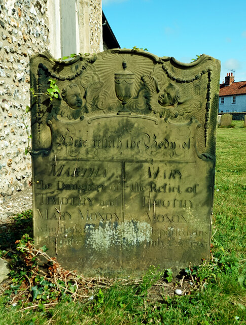
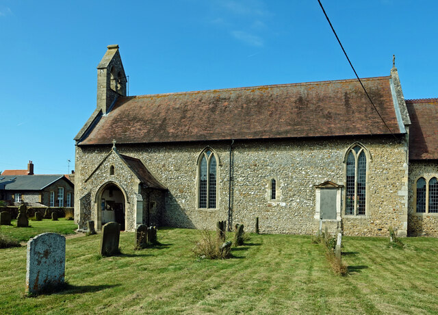
St Margaret's Church, Burnham Norton

St Margaret's Church is a round-tower church in Burnham Norton, Norfolk, England. Likely to have been built in the 11th century, the building retains many...

Burnham Norton Friary

Burnham Norton Friary was a Carmelite (White Friars) friary near Burnham Market in Norfolk, England. It is now a ruin. The friary was founded by Sir William...

Norfolk Burnhams

The Norfolk Burnhams are a group of adjacent villages on the north coast of Norfolk, England. The villages are located near a large natural bay named Brancaster...

Burnham Norton

Burnham Norton is a village and civil parish in the English county of Norfolk, one of the Burnhams, an adjacent group in the northernmost part of Norfolk...

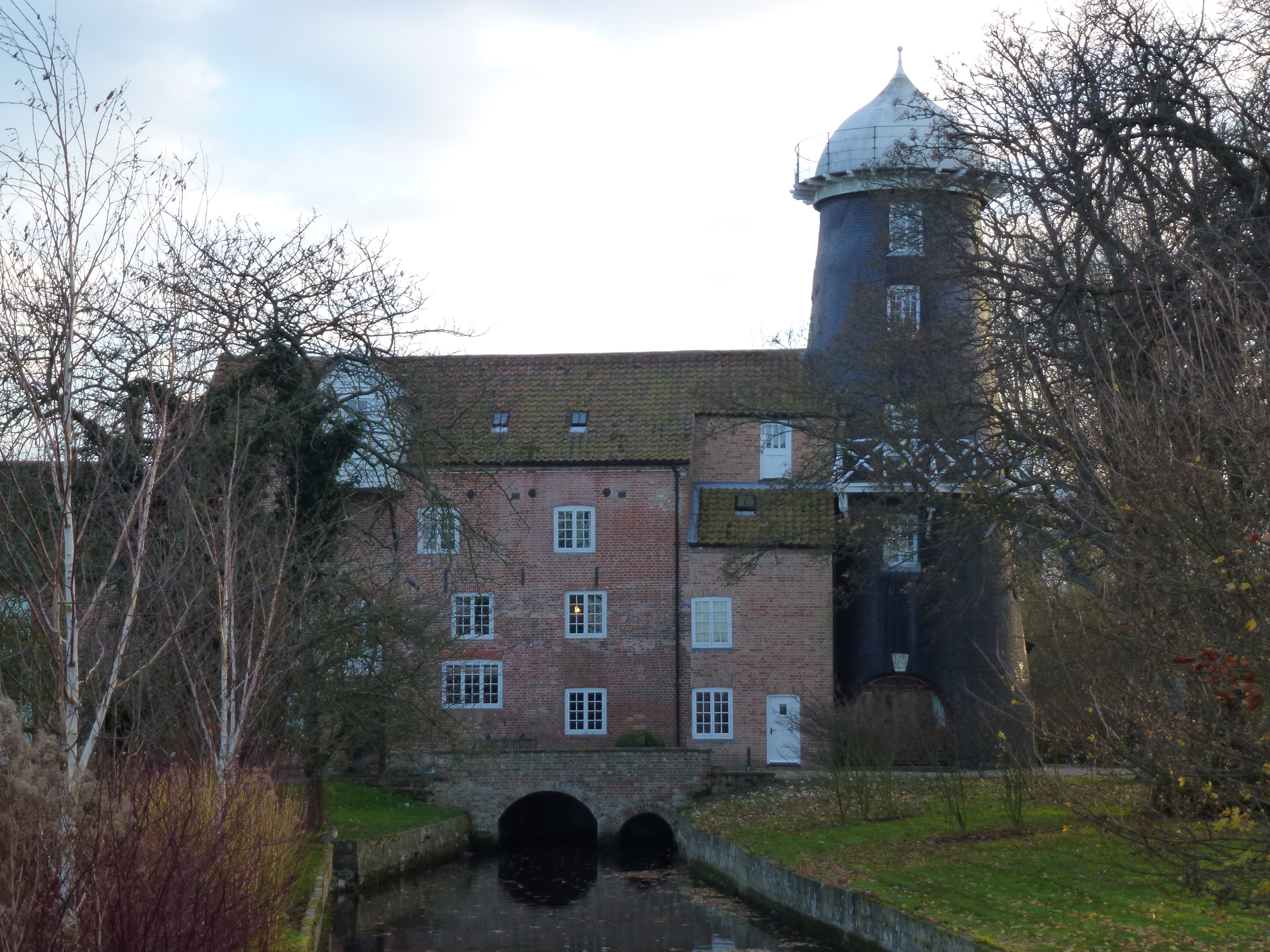
Union Mills, Burnham Overy

Union Mills or Roy's Mills are a Grade II listed combined tower mill and watermill at Burnham Overy, Norfolk, England which has been converted to residential...

Nearby Amenities

Located within 500m of 52.945275,0.725722
Burnham Market
Is In District: King's Lynn and West Norfolk
Place: village
Lat/Long: 52.9461774/0.729629
Pub
The Nelson
Addr City: King's Lynn
Addr Postcode: PE31 8EN
Addr Street: Creake Road
Addr Suburb: Burnham Market
Fhrs Id: 77367
Old Name: The Jockey
Website: https://www.the-nelson.com/
Lat/Long: 52.9459389/0.730827
Village Stores
Shop: convenience
Lat/Long: 52.946685/0.7319717
Pharmacy
Fixme: check location
Healthcare: pharmacy
Lat/Long: 52.9451854/0.7251526
Bus Stop
Bus: yes
Fixme: Does this stop exist?
Public Transport: platform
Lat/Long: 52.9453713/0.7250194
Public Bookcase
Booth: K6
Colour: red
Disused Amenity: telephone
Listed Status: Grade II
Man Made: telephone_box
Public Bookcase Type: phone_box
Lat/Long: 52.9454897/0.724932
Bus Stop
Bellamys Lane, adj
Bus: yes
Naptan AtcoCode: 2900B622
Naptan Bearing: E
Naptan CommonName: Bellamys Lane
Naptan Indicator: adj
Naptan Landmark: opp All Saints Church
Naptan Locality: Burnham Market
Naptan NaptanCode: nfoagpga
Naptan Street: North Street
Naptan Verified: no
Public Transport: platform
Source: naptan_import
Lat/Long: 52.9465539/0.731046
Bus Stop
Burnham Market / The Green / War Memorial
Bench: no
Bin: no
Bus: yes
Naptan AtcoCode: 2900B625
Naptan Bearing: W
Naptan CommonName: green
Naptan Indicator: adj
Naptan Landmark: war memorial
Naptan Locality: Burnham Market
Naptan NaptanCode: nfoagpgj
Naptan Street: The Green
Naptan Verified: no
Note: Street should be 'Market Place' to match addresses
Public Transport: platform
Shelter: yes
Source: naptan_import
Tactile Paving: no
Lat/Long: 52.9454542/0.7257766
Bus Stop
Burnham Market / The Green / War Memorial
Bench: no
Bin: no
Bus: yes
Naptan AtcoCode: 2900B627
Naptan Bearing: E
Naptan CommonName: green
Naptan Indicator: opp
Naptan Locality: Burnham Market
Naptan NaptanCode: nfoagpgp
Naptan Street: The Green
Naptan Verified: no
Note: Street should be 'Market Place' to match addresses
Public Transport: platform
Shelter: no
Source: naptan_import
Tactile Paving: no
Lat/Long: 52.9456402/0.7259601
Bus Stop
All Saints Church, adj
Bus: yes
Naptan AtcoCode: 2900B628
Naptan Bearing: W
Naptan CommonName: All Saints Church
Naptan Indicator: adj
Naptan Landmark: All Saints Church
Naptan Locality: Burnham Market
Naptan NaptanCode: nfoagpgt
Naptan Street: North Street
Naptan Verified: no
Public Transport: platform
Source: naptan_import
Lat/Long: 52.9464767/0.7304041
Entrance: main
Lat/Long: 52.946209/0.7303482
Entrance: main
Lat/Long: 52.9449177/0.7224193
Mini Roundabout
Direction: clockwise
Source: Bing
Lat/Long: 52.9472975/0.7239427
Parking
Fee: no
Parking: surface
Lat/Long: 52.9456173/0.7256125
Parking
Lat/Long: 52.9453969/0.7243057
Parking
Fee: no
Parking: surface
Lat/Long: 52.9455279/0.7249254
Burnham Market
Historic Railway: station
Railway: site
Source: OS 1:25k
Wikidata: Q4999746
Wikipedia: en:Burnham Market railway station
Lat/Long: 52.9435933/0.7302949
Barrier: bollard
Lat/Long: 52.9447454/0.7253043
The Green
Place: locality
Lat/Long: 52.9454418/0.7248173
Burnham Market
Man Made: village_sign
Material: wood
Lat/Long: 52.9453198/0.7250589
Historic: memorial
Lat/Long: 52.9454082/0.7257988
Burnham Westgate
Place: locality
Lat/Long: 52.9451795/0.7198545
Gurney's Fish Shop
Opening Hours: Mo-Sa 09:00-17:00, Su 10:00-13:00
Payment Cash: yes
Phone: +44 1328 738967
Shop: seafood
Website: https://www.gurneysfishshop.co.uk/gurneys-burnham-market.php
Lat/Long: 52.9456849/0.7258678
Defibrillator
Defibrillator Location: On wall outside Gun Hill Clothing, Market Street, Burnham Market, PE31 8HD
Emergency: defibrillator
Indoor: no
Ref: 949
Ref GB The Circuit: D94444ED-7549-40DD-8FF3-AD3C00DC3032
Lat/Long: 52.9454592/0.726645
The Hoste
Addr City: King's Lynn
Addr Housenumber: 14
Addr Postcode: PE31 8HE
Addr Street: Market Place
Addr Village: Burnham Market
Fhrs Id: 43993
Phone: +44 1328 738777
Source Addr: FHRS Open Data
Tourism: hotel
Lat/Long: 52.9455478/0.7240836
Turning Circle
Lat/Long: 52.9447023/0.7263815
Power: pole
Lat/Long: 52.9434196/0.7262716
Power: pole
Lat/Long: 52.943494/0.7282148
Power: pole
Lat/Long: 52.9433267/0.7242961
Gun Hill Outdoors
Shop: outdoor
Lat/Long: 52.9452471/0.726618
Pub
Indoor: yes
Lat/Long: 52.945551/0.7242866
Shop: butcher
Lat/Long: 52.9450424/0.7242296
Uttings of Burnham
Addr City: King's Lynn
Addr Country: GB
Addr Housenumber: 42
Addr Postcode: PE31 8HF
Addr Street: Market Place
Addr Suburb: Burnham Market
Addr Village: Burnham Market
Shop: homeware
Website: https://www.uttingsofburnham.com/
Lat/Long: 52.9457903/0.7265105
Cafe
The Burnhams Tea Room and Cafe
Addr Street: Market Place
Phone: +44 1328730908
Lat/Long: 52.9458188/0.7266474
Humble Pie
Addr City: King's Lynn
Addr Housenumber: 28
Addr Postcode: PE31 8HD
Addr Street: Market Place
Addr Village: Burnham Market
Fhrs Id: 975836
Shop: farm
Source Addr: FHRS Open Data
Lat/Long: 52.9457302/0.7262419
The Tuscan Farm Shop
Addr City: King's Lynn
Addr Housename: The Old Bank
Addr Housenumber: 50
Addr Postcode: PE31 8HF
Addr Street: Market Place
Addr Village: Burnham Market
Fhrs Id: 680723
Opening Hours: Mo-Su 09:00-17:00
Shop: farm
Source Addr: FHRS Open Data
Lat/Long: 52.9457372/0.7269777
Shop: books
Lat/Long: 52.9452155/0.7256917
Entrance: yes
Lat/Long: 52.9450345/0.7223263
Entrance: yes
Lat/Long: 52.9449965/0.7226731
Give Way
Direction: forward
Lat/Long: 52.9452859/0.7239363
Give Way
Direction: forward
Lat/Long: 52.9460293/0.7307022
Entrance: yes
Lat/Long: 52.9463311/0.7306149
Give Way
Direction: forward
Lat/Long: 52.9465733/0.7308336
Give Way
Direction: backward
Lat/Long: 52.9464587/0.7313791
Give Way
Direction: forward
Lat/Long: 52.9459457/0.7304359
Power: pole
Lat/Long: 52.9435856/0.7295609
Power: pole
Lat/Long: 52.9435953/0.7310414
Power: pole
Lat/Long: 52.9436567/0.7325891
Give Way
Direction: forward
Lat/Long: 52.9441513/0.7307906
Give Way
Direction: backward
Lat/Long: 52.9444468/0.7305555
Give Way
Lat/Long: 52.9456322/0.7253171
Give Way
Direction: backward
Lat/Long: 52.9455795/0.7269124
Give Way
Direction: forward
Lat/Long: 52.9457992/0.7267624
Bench
Backrest: yes
Seats: 3
Lat/Long: 52.9454593/0.7248985
Bench
Backrest: yes
Inscription: yes
Seats: 3
Lat/Long: 52.945471/0.7249327
Bench
Backrest: yes
Seats: 3
Lat/Long: 52.9454661/0.7249682
Give Way
Direction: backward
Lat/Long: 52.9455563/0.7260163
Give Way
Direction: backward
Lat/Long: 52.9454342/0.7255744
Give Way
Direction: forward
Lat/Long: 52.9453771/0.7252361
Give Way
Direction: forward
Lat/Long: 52.9453323/0.7248292
Give Way
Direction: forward
Lat/Long: 52.9454881/0.7254672
Give Way
Lat/Long: 52.9455259/0.7244512
Give Way
Direction: forward
Lat/Long: 52.945361/0.7245242
Give Way
Direction: forward
Lat/Long: 52.9452947/0.7244477
Foundry Field
Place: neighbourhood
Lat/Long: 52.9472125/0.7294804
Burnham Market
Traffic Sign: city_limit
Lat/Long: 52.9481232/0.7306418
Burnham Market
Colour: white
Material: metal
Traffic Sign: city_limit
Lat/Long: 52.946271/0.7312318
Restaurant
No. Twenty9
Addr City: King's Lynn
Addr Housenumber: 29
Addr Postcode: PE31 8HF
Addr Street: Market Place
Addr Suburb: Burnham Market
Bar: yes
Cuisine: english;seafood
Opening Hours: Mo-Sa 08:00-23:00, Su 08:00-22:00
Outdoor Seating: yes
Phone: +44 1328 738498
Smoking: outside
Lat/Long: 52.9456908/0.7259771
Restaurant
Socius
Lat/Long: 52.946868/0.727121
Power: pole
Lat/Long: 52.9434256/0.7198057
Power: pole
Lat/Long: 52.9436373/0.7211897
Bicycle Parking
Bicycle Parking: stands
Capacity: 6
Covered: no
Lat/Long: 52.945498/0.7248884
Bicycle Parking
Bicycle Parking: stands
Capacity: 6
Covered: no
Lat/Long: 52.9455109/0.7249755
Bench
Backrest: yes
Lat/Long: 52.9454438/0.7259445
Bench
Lat/Long: 52.9453549/0.7243566
Bench
Lat/Long: 52.9453452/0.7242466
Post Box
Collection Times: Mo-Fr 16:00; Sa 10:00
Operator: Royal Mail
Operator Wikidata: Q638098
Post Box Design: type_a
Post Box Type: pillar
Ref: PE31 172
Royal Cypher: EIIR
Royal Cypher Wikidata: Q33102113
Lat/Long: 52.9454655/0.7267013
Fast Food
The Mermaid Fish and Chips
Addr City: King's Lynn
Addr Country: GB
Addr Housename: Station Garage
Addr Postcode: PE31 8EA
Addr Street: Creake Road
Addr Suburb: Burnham Market
Addr Village: Burnham Market
Building: yes
Cuisine: fish_and_chips
Fhrs Id: 1010266
Source: OS_OpenData_VectorMapLocal
Lat/Long: 52.9434281/0.7305235
Mace
Addr City: King's Lynn
Addr Country: GB
Addr Housename: Station Garage
Addr Postcode: PE31 8EA
Addr Street: Creake Road
Addr Suburb: Burnham Market
Addr Village: Burnham Market
Brand: Mace
Brand Wikidata: Q75240338
Operator: Mace
Shop: convenience
Lat/Long: 52.9433732/0.7305351
Fast Food
Panda Kitchen
Addr City: King's Lynn
Addr Country: GB
Addr Housename: Station Garage
Addr Postcode: PE31 8EA
Addr Street: Creake Road
Addr Suburb: Burnham Market
Addr Village: Burnham Market
Cuisine: chinese
Lat/Long: 52.9433133/0.7305465
Burnham Motors
Addr City: King's Lynn
Addr Postcode: PE31 8EA
Addr Street: Creake Road
Addr Suburb: Burnham Market
Operator: Burnham Motors Garage Limited
Phone: +44 1328 738387
Shop: car_repair
Website: https://www.burnhammotorgarageltd.com/
Lat/Long: 52.943516/0.7298481
Fuel
Gulf
Brand: Gulf
Brand Wikidata: Q5617505
Lat/Long: 52.9434061/0.7308409
Man Made: water_well
Lat/Long: 52.9459349/0.7305431
Man Made: water_well
Lat/Long: 52.9455066/0.7253446
Man Made: trash_screen
Lat/Long: 52.9456322/0.7267433
Give Way
Direction: forward
Lat/Long: 52.9454492/0.7261276
Barrier: bollard
Bollard: removable
Lat/Long: 52.9467808/0.7322768
Barrier: kerb
Kerb: lowered
Lat/Long: 52.9472064/0.732002
Waste Basket
Waste: trash
Lat/Long: 52.9453225/0.7238769
Bench
Backrest: yes
Colour: brown
Inscription: yes
Material: wood
Seats: 2
Lat/Long: 52.9453336/0.7232489
Bench
Backrest: yes
Colour: brown
Inscription: yes
Material: wood
Seats: 4
Lat/Long: 52.9452823/0.7232731
Bench
Backrest: yes
Colour: brown
Inscription: yes
Material: wood
Seats: 3
Lat/Long: 52.9452035/0.7233093
Waste Basket
Waste: trash
Lat/Long: 52.9451595/0.723321
Bench
Backrest: yes
Colour: brown
Inscription: yes
Material: wood
Seats: 4
Lat/Long: 52.9451166/0.7233415
Give Way
Direction: backward
Lat/Long: 52.9450625/0.7235571
Give Way
Lat/Long: 52.9448702/0.7229982
Post Box
Operator: Royal Mail
Operator Wikidata: Q638098
Post Box Mounting: stone_wall
Post Box Type: wall
Ref: PE31 39
Royal Cypher: EIIR
Royal Cypher Wikidata: Q33102113
Lat/Long: 52.9437849/0.7307751
The data included in this document is from www.openstreetmap.org. The data is made available under ODbL.

Have you been to Burnham Market?

Leave your review of Burnham Market below (or comments, questions and feedback).