Burnham Deepdale

Settlement in Norfolk King's Lynn and West Norfolk

England

Burnham Deepdale

Arable field on Deepdale Marsh The rest of this segment of reclaimed land is now grazing marsh.
Arable field on Deepdale Marsh Credit: Hugh Venables

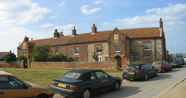
Burnham Deepdale is a small village located on the North Norfolk coast in the county of Norfolk, England. Situated between the popular seaside towns of Hunstanton and Wells-next-the-Sea, Burnham Deepdale is known for its idyllic rural setting, beautiful landscapes, and close proximity to the stunning coastline.

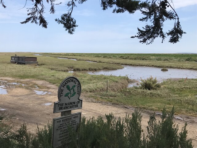
The village is surrounded by rolling countryside, with vast open fields and farmland stretching as far as the eye can see. The area is renowned for its rich agricultural heritage, and visitors can often spot grazing livestock and picturesque windmills dotting the landscape.

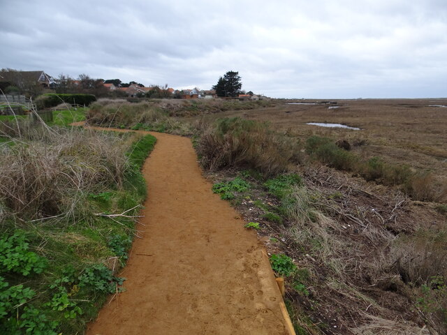
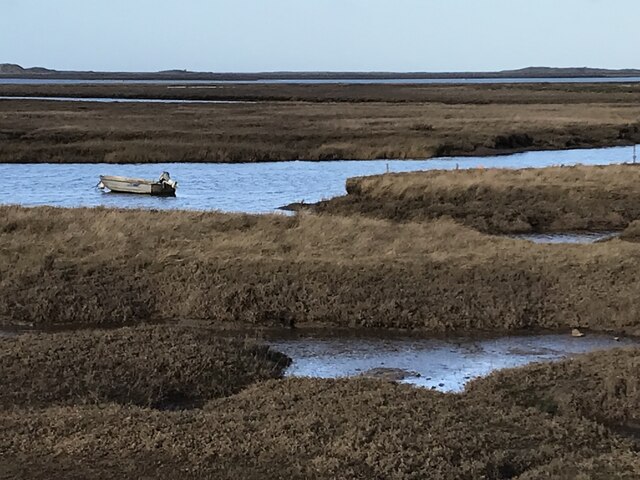
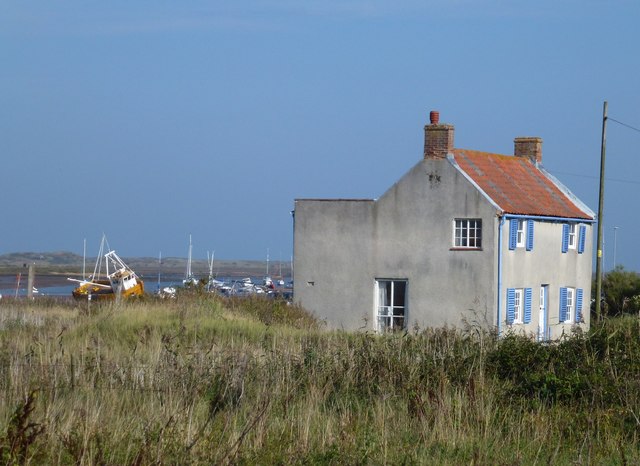
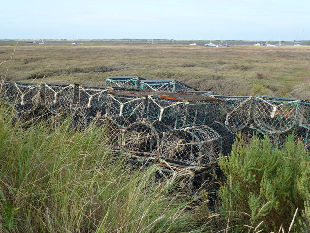
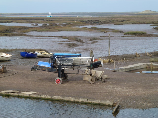
In recent years, Burnham Deepdale has become a popular destination for outdoor enthusiasts and nature lovers. The village acts as a gateway to the Norfolk Coast Area of Outstanding Natural Beauty, offering visitors the opportunity to explore its pristine beaches, salt marshes, and nature reserves. The coastal path that runs through the village provides stunning views of the sea and is a favorite among hikers and cyclists.

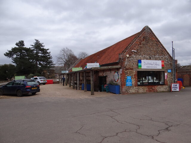
Despite its small size, Burnham Deepdale offers a range of amenities and attractions for visitors. The village is home to a selection of charming local shops, cafes, and pubs, where visitors can sample delicious local produce and enjoy the warm hospitality of the locals. Burnham Deepdale also hosts various events and festivals throughout the year, including the Deepdale Christmas Market and the Deepdale Festival, attracting visitors from near and far.

Overall, Burnham Deepdale is a hidden gem on the Norfolk coast, offering a peaceful retreat for those seeking natural beauty, outdoor activities, and a taste of rural Norfolk life.

If you have any feedback on the listing, please let us know in the comments section below.

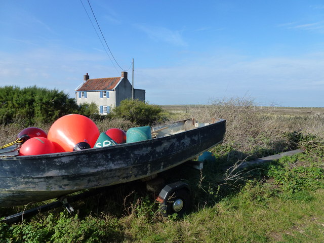
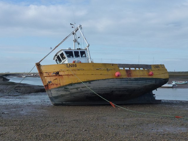
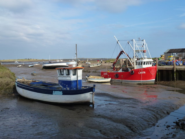
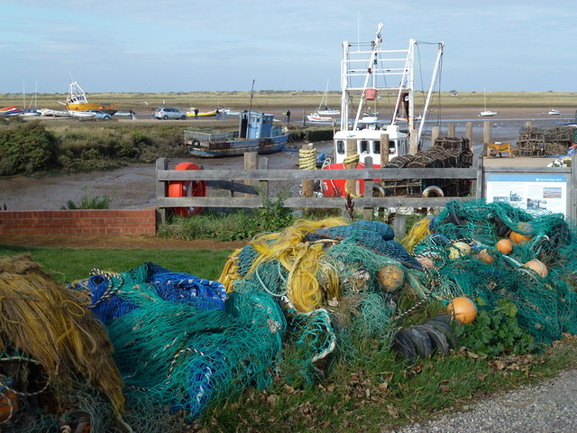
Burnham Deepdale Images

Images are sourced within 2km of 52.965909/0.69074 or Grid Reference TF8044. Thanks to Geograph Open Source API. All images are credited.

Arable field on Deepdale Marsh The rest of this segment of reclaimed land is now grazing marsh.
Arable field on Deepdale Marsh
The rest of this segment of reclaimed land is now grazing marsh.
Deepdale Camping and Rooms Nice place to spend a reasonably priced self-catering weekend with close friends in dormitory accommodation in the roof space, or park your tent/van round the back.  Free parking included and a shop next door!
<span class="nowrap"><a title="https://www.deepdalebackpackers.co.uk" rel="nofollow ugc noopener" href="https://www.deepdalebackpackers.co.uk">Link</a><img style="margin-left:2px;" alt="External link" title="External link - shift click to open in new window" src="https://s1.geograph.org.uk/img/external.png" width="10" height="10"/></span>
Deepdale Camping and Rooms
Nice place to spend a reasonably priced self-catering weekend with close friends in dormitory accommodation in the roof space, or park your tent/van round the back. Free parking included and a shop next door! LinkExternal link
Pleasant path Just about the most perfect surface for a footpath. Clean, well-defined, flat, firm but not too soft nor too hard, no mud, no puddles, no dog poop, no litter!
Pleasant path
Just about the most perfect surface for a footpath. Clean, well-defined, flat, firm but not too soft nor too hard, no mud, no puddles, no dog poop, no litter!
St Mary's Burnham Deepdale Taken from outside Dalegate Market <span class="nowrap"><a title="https://www.dalegatemarket.co.uk/" rel="nofollow ugc noopener" href="https://www.dalegatemarket.co.uk/">Link</a><img style="margin-left:2px;" alt="External link" title="External link - shift click to open in new window" src="https://s1.geograph.org.uk/img/external.png" width="10" height="10"/></span> . The OS symbol for a church with a tower seems inappropriate in these parts, where round-towered churches, as here, are common. The tower at St Mary's is thought to be Norman <span class="nowrap"><a title="http://www.saxonshorebenefice.co.uk/burnhamd.htm" rel="nofollow ugc noopener" href="http://www.saxonshorebenefice.co.uk/burnhamd.htm">Link</a><img style="margin-left:2px;" alt="External link" title="External link - shift click to open in new window" src="https://s1.geograph.org.uk/img/external.png" width="10" height="10"/></span> .
St Mary's Burnham Deepdale
Taken from outside Dalegate Market LinkExternal link . The OS symbol for a church with a tower seems inappropriate in these parts, where round-towered churches, as here, are common. The tower at St Mary's is thought to be Norman LinkExternal link .
The Manor of Brancaster - National Trust
Saltmarsh and creeks, Brancaster Staithe A view from the car park of the White Horse
Saltmarsh and creeks, Brancaster Staithe
A view from the car park of the White Horse
Signpost in the garden of the White Horse, Brancaster Staithe The garden and car park abut the saltmarshes at this popular North Norfolk hostelry.
Signpost in the garden of the White Horse, Brancaster Staithe
The garden and car park abut the saltmarshes at this popular North Norfolk hostelry.
St Mary's church, Burnham Deepdale The church has an eleventh century tower but most of the external detailing of the body of the church dates to the nineteenth century <span class="nowrap"><a title="https://historicengland.org.uk/listing/the-list/list-entry/1237969?section=official-list-entry" rel="nofollow ugc noopener" href="https://historicengland.org.uk/listing/the-list/list-entry/1237969?section=official-list-entry">Link</a><img style="margin-left:2px;" alt="External link" title="External link - shift click to open in new window" src="https://s1.geograph.org.uk/img/external.png" width="10" height="10"/></span>
St Mary's church, Burnham Deepdale
The church has an eleventh century tower but most of the external detailing of the body of the church dates to the nineteenth century LinkExternal link
Brancaster Staithe Quay The quay was renovated in 2007 and is used regularly by fishing vessels.
Brancaster Staithe Quay
The quay was renovated in 2007 and is used regularly by fishing vessels.
House near the marsh at Brancaster Staithe
Buoys in a boat at Brancaster Staithe
High and dry at Brancaster Staithe Fishing boat LN86 waiting for the next tide
High and dry at Brancaster Staithe
Fishing boat LN86 waiting for the next tide
Fishing boats at low tide, Brancaster Staithe Fishing boats and the new steel and concrete quay built in 2007 to replace the timber one.
Fishing boats at low tide, Brancaster Staithe
Fishing boats and the new steel and concrete quay built in 2007 to replace the timber one.
All the colours of the rainbow at Brancaster Staithe Fishing nets and boats near the quay in this tiny fishing harbour
All the colours of the rainbow at Brancaster Staithe
Fishing nets and boats near the quay in this tiny fishing harbour
Crab pots near Brancaster Staithe
Shell fish cleaning reel near Brancaster Staithe
Orange and white or yellow and black A modern RAC van and a listed AA phone box near Brancaster
Orange and white or yellow and black
A modern RAC van and a listed AA phone box near Brancaster
Box 530 Old AA phone box near to Brancaster, Norfolk. For detail views see <a title="https://www.geograph.org.uk/photo/2668267" href="https://www.geograph.org.uk/photo/2668267">Link</a> <a title="https://www.geograph.org.uk/photo/2668272" href="https://www.geograph.org.uk/photo/2668272">Link</a>
Box 530
Old AA phone box near to Brancaster, Norfolk. For detail views see Link Link
Show me another place!

Burnham Deepdale is located at Grid Ref: TF8044 (Lat: 52.965909, Lng: 0.69074)

Administrative County: Norfolk

District: King's Lynn and West Norfolk

Police Authority: Norfolk

What 3 Words

///trapdoor.basin.speech. Near Wells-next-the-Sea, Norfolk

Nearby Locations

Burnham Deepdale

Related Wikis

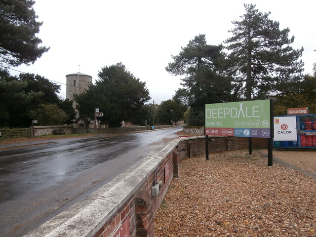
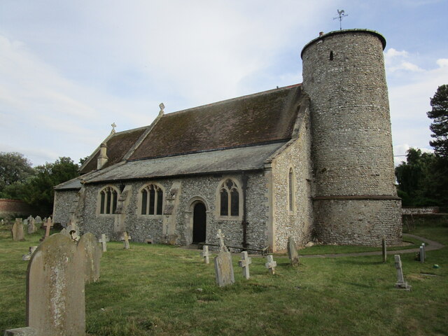
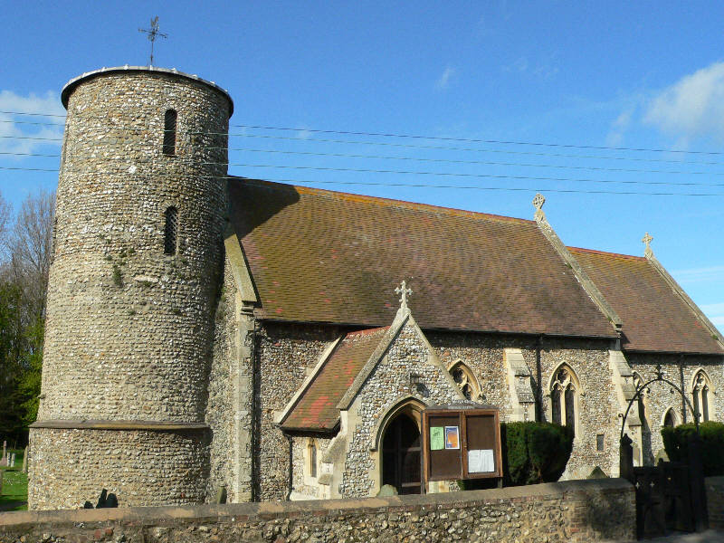
St Mary's Church, Burnham Deepdale

St Mary's Church is a round-tower church in Burnham Deepdale, Norfolk, England. Its round tower and some other parts of the building date from the 11th...
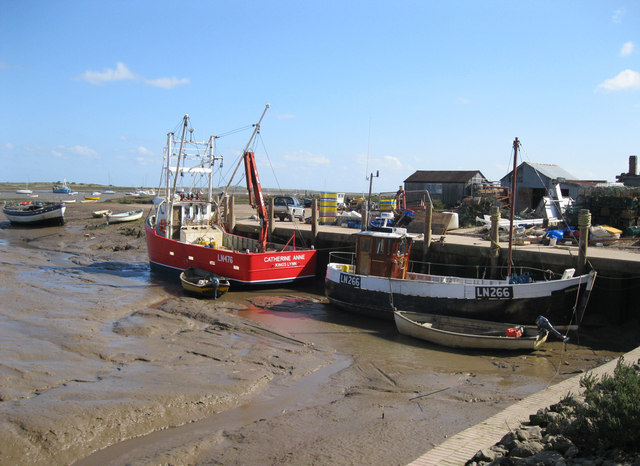
Brancaster Staithe

Brancaster Staithe is a village on the north coast of the English county of Norfolk. Brancaster Staithe merges with Burnham Deepdale, forming one village...

Scolt Head Island

Scolt Head Island is an offshore barrier island between Brancaster and Wells-next-the-Sea in north Norfolk. It is in the parish of Burnham Norton and is...

Burnham Norton

Burnham Norton is a village and civil parish in the English county of Norfolk, one of the Burnhams, an adjacent group in the northernmost part of Norfolk...

Burnham Deepdale

Burnham Deepdale is a village and former civil parish, now in the parish of Brancaster, in the King's Lynn and West Norfolk district, on the north coast...

Branodunum

Branodunum was an ancient Roman fort to the east of the modern English village of Brancaster in Norfolk. Its Roman name derives from the local Celtic language...
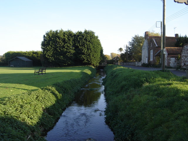
River Burn, Norfolk

The River Burn (also known as "Nelsons River") is a river in the northwest of the County of Norfolk, in the East of England. From its source to its mouth...

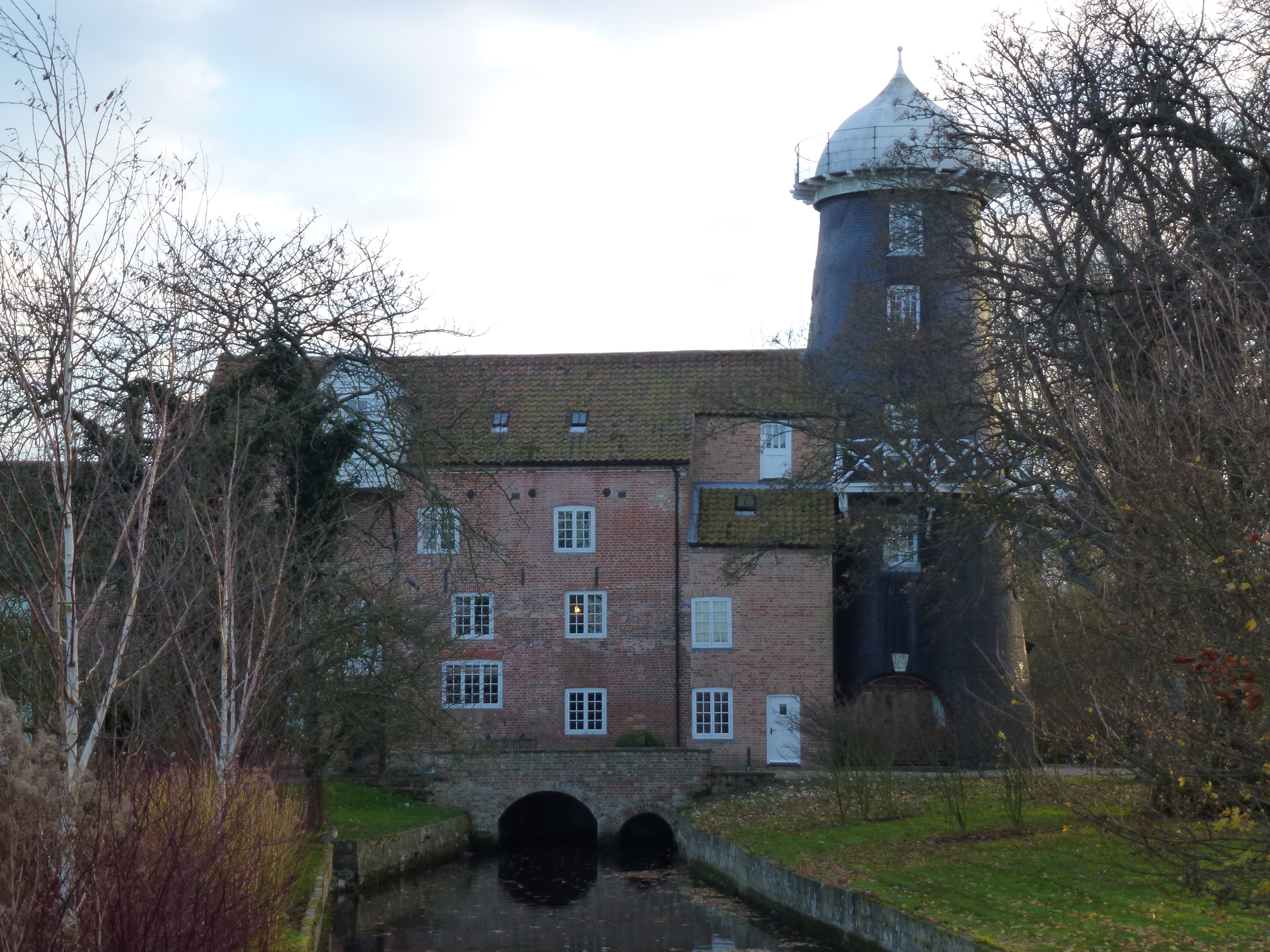
Union Mills, Burnham Overy

Union Mills or Roy's Mills are a Grade II listed combined tower mill and watermill at Burnham Overy, Norfolk, England which has been converted to residential...

Nearby Amenities

Located within 500m of 52.965909,0.69074
Burnham Deepdale
Place: village
Wikidata: Q4999750
Lat/Long: 52.9658165/0.6836152
Bus Stop
church, adj
Naptan AtcoCode: 2900B438
Naptan Bearing: E
Naptan CommonName: church
Naptan Indicator: adj
Naptan Landmark: church
Naptan Locality: Burnham Deepdale
Naptan NaptanCode: nfoagdpw
Naptan ShortCommonName: church
Naptan Street: A149
Naptan Verified: no
Source: naptan_import
Lat/Long: 52.9656703/0.6849495
Deepdale Information
Tourism: information
Lat/Long: 52.9655131/0.6846386
Billetts Barn
Place: farm
Lat/Long: 52.9647823/0.6881798
Deepdale Farm
Place: farm
Lat/Long: 52.9646184/0.685265
Location Transition: yes
Power: pole
Lat/Long: 52.9645387/0.684253
Power: pole
Lat/Long: 52.9643017/0.6851797
Power: pole
Lat/Long: 52.9639179/0.6866515
Power: pole
Lat/Long: 52.9632765/0.6889649
Power: pole
Lat/Long: 52.9632273/0.6893901
Power: pole
Lat/Long: 52.9627793/0.6911322
Power: pole
Lat/Long: 52.9625677/0.6921434
Power: pole
Lat/Long: 52.9621751/0.6935193
Post Box
Collection Times: Mo-Fr 16:00; Sa 10:45
Operator: Royal Mail
Post Box Mounting: pier
Post Box Type: lamp
Ref: PE31 53
Royal Cypher: EIIR
Royal Cypher Wikidata: Q33102113
Lat/Long: 52.965733/0.6838144
Entrance: yes
Lat/Long: 52.9658263/0.6853372
Entrance: main
Lat/Long: 52.965698/0.6853298
Entrance: yes
Lat/Long: 52.9657016/0.685552
Noexit: yes
Lat/Long: 52.9650435/0.683885
Waste Basket
Waste: dog_excrement
Lat/Long: 52.9663057/0.6835623
Crossing
Crossing: unmarked
Tactile Paving: no
Lat/Long: 52.9658622/0.6837767
Noexit: yes
Lat/Long: 52.9650881/0.6838107
Driftwood Glass Studio
Shop: gift
Lat/Long: 52.9655406/0.6842973
Shop: gift
Lat/Long: 52.9650687/0.6837718
Shop: gift
Lat/Long: 52.9650814/0.6837112
Shop: gift
Lat/Long: 52.9650941/0.6836506
Shop: gift
Lat/Long: 52.9651067/0.6835899
Toilets
Lat/Long: 52.9651829/0.6835489
Generator Method: photovoltaic
Generator Output Electricity: yes
Generator Place: roof
Generator Solar Modules: 32
Generator Source: solar
Generator Type: solar_photovoltaic_panel
Power: generator
Lat/Long: 52.9654239/0.6837707
The Hare and the Hen
Addr City: King's Lynn
Addr Country: GB
Addr Postcode: PE31 8FB
Addr Suburb: Brancaster Staithe
Shop: gift
Lat/Long: 52.9653182/0.6835856
Gone Crabbing
Addr City: King's Lynn
Addr Country: GB
Addr Housename: 7
Addr Parentstreet: Main Road
Addr Postcode: PE31 8FB
Addr Street: Dalegate Market
Addr Suburb: Brancaster Staithe
Shop: gift
Lat/Long: 52.9654922/0.6833464
Fatface
Addr City: King's Lynn
Addr Country: GB
Addr Housename: 5-6
Addr Parentstreet: Main Road
Addr Postcode: PE31 8DD
Addr Street: Dalegate Market
Addr Suburb: Brancaster Staithe
Shop: clothes
Lat/Long: 52.9654658/0.6835181
The data included in this document is from www.openstreetmap.org. The data is made available under ODbL.

Have you been to Burnham Deepdale?

Leave your review of Burnham Deepdale below (or comments, questions and feedback).