Allt Pen-lan

Wood, Forest in Cardiganshire

Wales

Allt Pen-lan

Ordnance Survey Rivet This OS rivet can be found on the churn stand east side of the road. It marks a point 75.978m above mean sea level. <a title="https://www.geograph.org.uk/photo/7412377" href="https://www.geograph.org.uk/photo/7412377">Link</a>
Ordnance Survey Rivet Credit: Adrian Dust

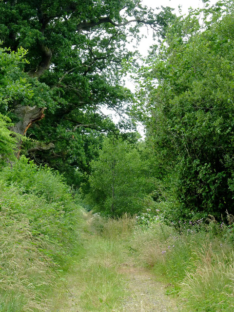
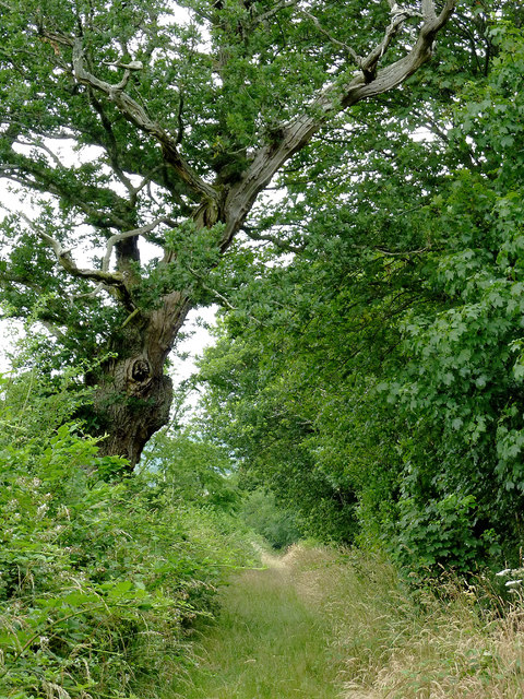
Allt Pen-lan is a vast woodland located in Cardiganshire, Wales. Spread across a sprawling area, it covers approximately 500 acres of land. The woodland is characterized by its abundance of various species of trees, making it a diverse and biodiverse ecosystem.

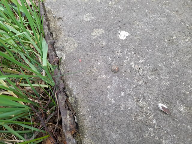
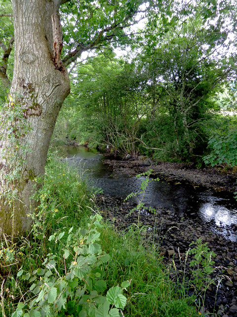
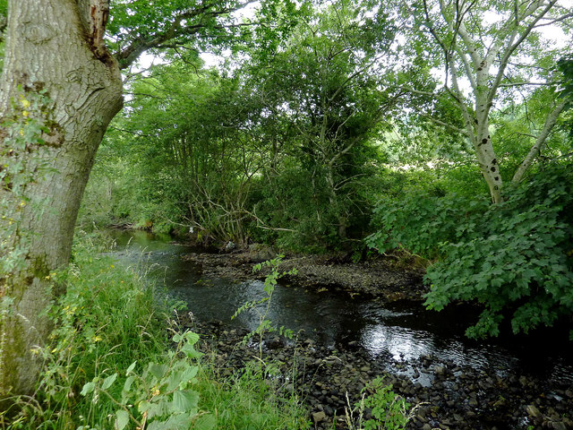
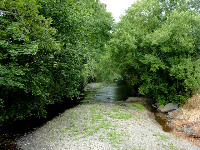
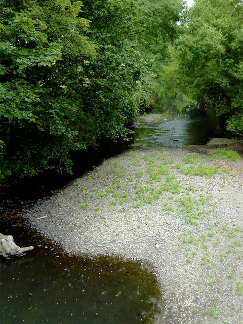
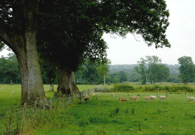
The wood is predominantly comprised of broadleaf trees, including oak, ash, and beech, which provide a dense canopy, creating a shaded and cool environment within the woodland. These trees provide an ideal habitat for a wide range of wildlife, such as birds, insects, and small mammals. The woodland floor is covered in a thick carpet of moss, ferns, and wildflowers, adding to the beauty and richness of the area.

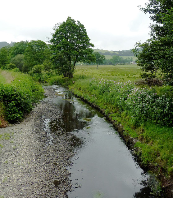
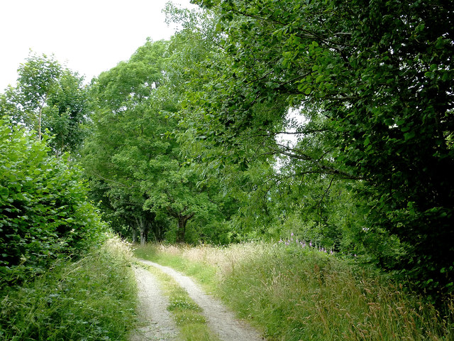
Allt Pen-lan is crisscrossed by numerous footpaths, allowing visitors to explore and enjoy the natural beauty of the woodland. These paths wind through the trees, offering glimpses of picturesque streams and small ponds along the way. The tranquil atmosphere of the woodland makes it a popular destination for nature lovers, hikers, and photographers.

The woodland is also of historical significance, with archaeological remains being discovered within its boundaries. These include ancient settlements and burial sites, providing a glimpse into the rich history of the area.

Allt Pen-lan is managed and protected by local authorities, ensuring the preservation of its natural beauty and wildlife. It serves as an important recreational area, providing a peaceful escape from the hustle and bustle of modern life, and a sanctuary for both humans and wildlife alike.

If you have any feedback on the listing, please let us know in the comments section below.

Allt Pen-lan Images

Images are sourced within 2km of 52.20038/-4.1273523 or Grid Reference SN5457. Thanks to Geograph Open Source API. All images are credited.

Ordnance Survey Rivet This OS rivet can be found on the churn stand east side of the road. It marks a point 75.978m above mean sea level. <a title="https://www.geograph.org.uk/photo/7412377" href="https://www.geograph.org.uk/photo/7412377">Link</a>
Ordnance Survey Rivet
This OS rivet can be found on the churn stand east side of the road. It marks a point 75.978m above mean sea level. Link
Churn Stand There is an Ordnance Survey rivet on the top of the stand. <a title="https://www.geograph.org.uk/photo/7412375" href="https://www.geograph.org.uk/photo/7412375">Link</a>
Churn Stand
There is an Ordnance Survey rivet on the top of the stand. Link
Ordnance Survey Cut Mark This OS cut mark can be found on the north parapet of the bridge. It marks a point 77.971m above mean sea level.
Ordnance Survey Cut Mark
This OS cut mark can be found on the north parapet of the bridge. It marks a point 77.971m above mean sea level.
Milestone - Aberystwyth 16
Footpath near Tal-sarn in Ceredigion The public footpath runs alongside the Afon Aeron between Talsarn and Brynog. The river is off to the right.
Footpath near Tal-sarn in Ceredigion
The public footpath runs alongside the Afon Aeron between Talsarn and Brynog. The river is off to the right.
Footpath near Tal-sarn in Ceredigion The public footpath runs alongside the Afon Aeron between Talsarn and Brynog. The river is off to the right.
Footpath near Tal-sarn in Ceredigion
The public footpath runs alongside the Afon Aeron between Talsarn and Brynog. The river is off to the right.
Afon Aeron west of Tal-sarn in Ceredigion Looking downstream from the adjacent public footpath.
Afon Aeron west of Tal-sarn in Ceredigion
Looking downstream from the adjacent public footpath.
Afon Aeron west of Tal-sarn in Ceredigion Looking downstream from the adjacent public footpath.
Afon Aeron west of Tal-sarn in Ceredigion
Looking downstream from the adjacent public footpath.
Afon Aeron west of Tal-sarn in Ceredigion Looking downstream from the adjacent public footpath.
Afon Aeron west of Tal-sarn in Ceredigion
Looking downstream from the adjacent public footpath.
Afon Aeron west of Tal-sarn in Ceredigion Looking downstream from the adjacent public footpath.
Afon Aeron west of Tal-sarn in Ceredigion
Looking downstream from the adjacent public footpath.
Afon Aeron south of Tal-sarn in Ceredigion This is the Afon Aeron south-east of the bridge near Tal-sarn
Afon Aeron south of Tal-sarn in Ceredigion
This is the Afon Aeron south-east of the bridge near Tal-sarn
The Afon Aeron near Tal-sarn in Ceredigion This shows the Afon Aeron, looking north-west from Pont Tal-sarn.
The Afon Aeron near Tal-sarn in Ceredigion
This shows the Afon Aeron, looking north-west from Pont Tal-sarn.
The Afon Aeron near Tal-sarn in Ceredigion This shows the Afon Aeron, looking north-west from Pont Tal-sarn.
The Afon Aeron near Tal-sarn in Ceredigion
This shows the Afon Aeron, looking north-west from Pont Tal-sarn.
Track and footpath near Tal-sarn in Ceredigion The public footpath runs alongside the Afon Aeron between Talsarn and Brynog. The river is on the right.
Track and footpath near Tal-sarn in Ceredigion
The public footpath runs alongside the Afon Aeron between Talsarn and Brynog. The river is on the right.
Track and footpath near Tal-sarn in Ceredigion The public footpath runs alongside the Afon Aeron between Brynog and Talsarn. The river is off to the left.
Track and footpath near Tal-sarn in Ceredigion
The public footpath runs alongside the Afon Aeron between Brynog and Talsarn. The river is off to the left.
Pasture west of Tal-sarn in Ceredigion Looking south-west towards Felinfach from the riverside path by the Afon Aeron.
Pasture west of Tal-sarn in Ceredigion
Looking south-west towards Felinfach from the riverside path by the Afon Aeron.
Pasture west of Tal-sarn in Ceredigion Looking south-west towards Felinfach from the riverside path by the Afon Aeron.
Pasture west of Tal-sarn in Ceredigion
Looking south-west towards Felinfach from the riverside path by the Afon Aeron.
Riverside footpath to Brynog, Ceredigion The farm track stops here, no longer continuing west into the fields, but the public footpath to Brynog continues alongside the Afon Aeron.
Riverside footpath to Brynog, Ceredigion
The farm track stops here, no longer continuing west into the fields, but the public footpath to Brynog continues alongside the Afon Aeron.
Show me another place!

Allt Pen-lan is located at Grid Ref: SN5457 (Lat: 52.20038, Lng: -4.1273523)

Unitary Authority: Ceredigion

Police Authority: Dyfed Powys

What 3 Words

///trainer.obtain.wriggle. Near Llangybi, Ceredigion

Related Wikis

Talsarn

Talsarn is a hamlet in the community of Nantcwnlle, Ceredigion, Wales. It lies some 16 miles (26 km) south of Aberystwyth, 64 miles (103 km) north-west...

Trychrug

for the hill in Carmarthenshire with a similar name see TrichrugTrychrug is a mountain in Ceredigion, Wales, which rises to 343 metres (1,125 ft) high...

Abermeurig

Abermeurig (also spelt Aber-meurig) is a small village in the county of Ceredigion, Wales.

Ystrad Aeron

Ystrad Aeron is a small village west of Felinfach on the A482 between Lampeter and Aberaeron, Ceredigion, Wales. It is part of the constituent community...

Felin Fach railway station

Felin Fach or Ystrad was a small railway station in the rural location between Ystrad Aeron and Felinfach, the intermediate station on the Aberayron branch...
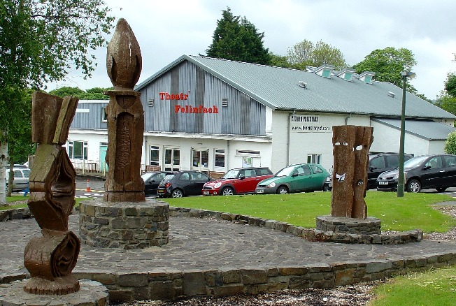
Theatr Felinfach

Theatr Felinfach is a small regional theatre located outside the village of Ystrad Aeron in Dyffryn Aeron, about 7 miles from the university town of Lampeter...

Nantcwnlle

Nantcwnlle is a community in Ceredigion, Wales, including the villages of Talsarn and Llwyn-y-groes. Daniel Rowland (1713–1790), was born in Nantcwnlle...

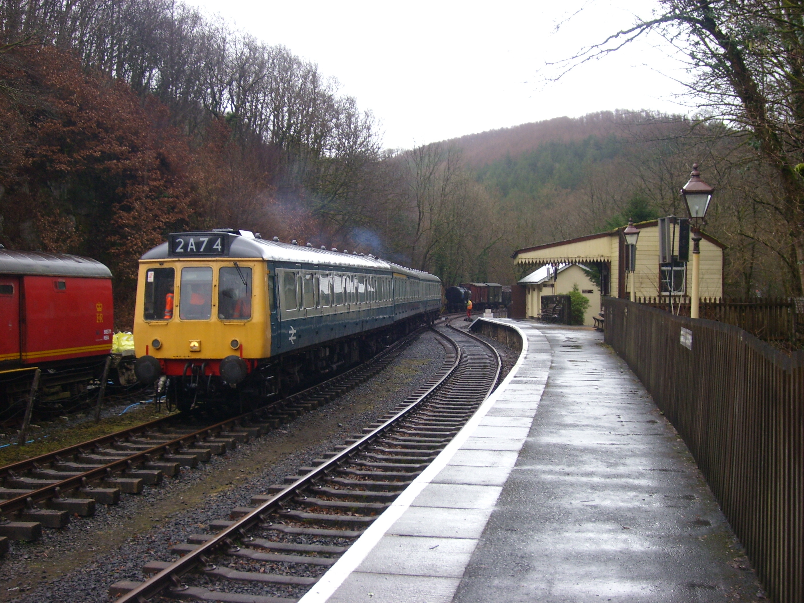
Talsarn Halt railway station

Talsarn Halt was a small railway station in a very rural location on the Aberayron branch of the Carmarthen to Aberystwyth Line in the Welsh county of...

Nearby Amenities

Located within 500m of 52.20038,-4.1273523
Direction: 145
Generator Method: photovoltaic
Generator Output Electricity: yes
Generator Solar Modules: 15
Generator Source: solar
Generator Type: solar_photovoltaic_panel
Location: roof
Power: generator
Lat/Long: 52.2039091/-4.12625
The data included in this document is from www.openstreetmap.org. The data is made available under ODbL.

Have you been to Allt Pen-lan?

Leave your review of Allt Pen-lan below (or comments, questions and feedback).