Perth-y-gwenyn Plantation

Wood, Forest in Cardiganshire

Wales

Perth-y-gwenyn Plantation

Farm driveway south of Llanrhystud in Ceredigion From the B4337, this is the way into the Fantasy Farm Park. <span class="nowrap"><a title="http://www.fantasyfarmpark.co.uk/" rel="nofollow ugc noopener" href="http://www.fantasyfarmpark.co.uk/">Link</a><img style="margin-left:2px;" alt="External link" title="External link - shift click to open in new window" src="https://s1.geograph.org.uk/img/external.png" width="10" height="10"/></span>
Farm driveway south of Llanrhystud in Ceredigion Credit: Roger D Kidd

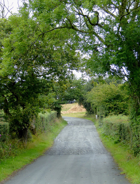
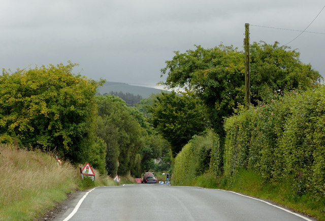
Perth-y-gwenyn Plantation is a picturesque woodland located in Cardiganshire, Wales. Covering an area of approximately 100 acres, this enchanting forest is nestled in the heart of the countryside, offering a peaceful retreat for nature enthusiasts and outdoor adventurers.

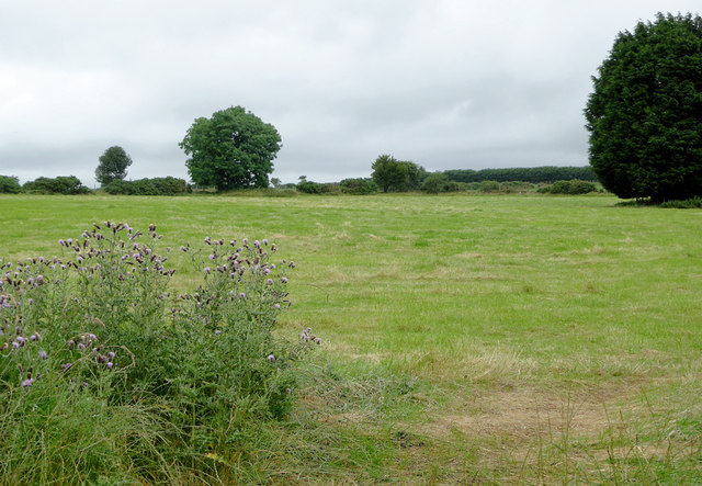
The plantation is predominantly composed of native broadleaf trees, including oak, beech, and ash, which create a vibrant and diverse ecosystem. These trees not only provide a stunning visual display throughout the seasons, but also serve as a habitat for a wide range of flora and fauna.

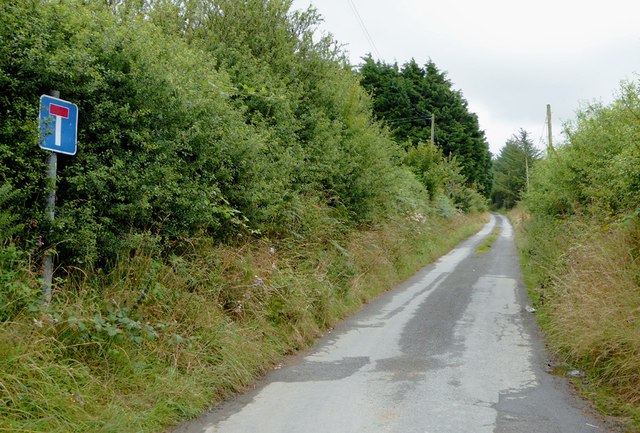
Walking through the woodland, visitors can explore a network of well-maintained trails that meander through the trees, offering glimpses of meadows, streams, and wildlife along the way. The peaceful atmosphere and the gentle sound of birdsong make it an ideal spot for nature lovers seeking tranquility.

Perth-y-gwenyn Plantation also holds historical significance, as it was once used as a timber resource by the local community. Today, remnants of old saw pits and charcoal platforms can still be found, serving as a reminder of the area's past.

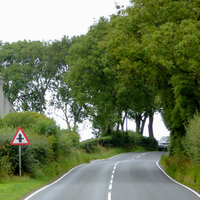
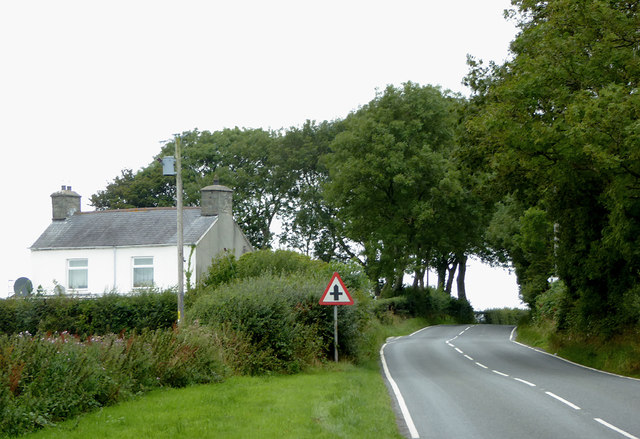
The plantation is easily accessible by foot or bike, with a small car park available for visitors. It is a popular destination for hikers, joggers, and families looking to enjoy a day out in nature.

Overall, Perth-y-gwenyn Plantation is a captivating woodland with its diverse range of trees, wildlife, and historical charm. Whether seeking solace in nature or embarking on an outdoor adventure, this enchanting forest offers a memorable experience for all who visit.

If you have any feedback on the listing, please let us know in the comments section below.

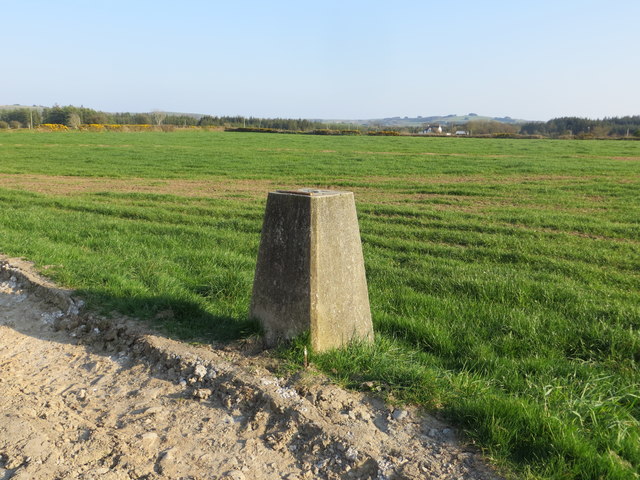
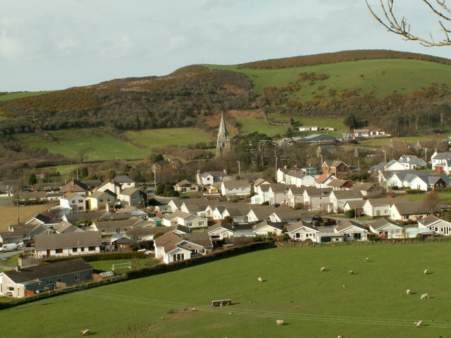
Perth-y-gwenyn Plantation Images

Images are sourced within 2km of 52.282989/-4.1342993 or Grid Reference SN5467. Thanks to Geograph Open Source API. All images are credited.

Farm driveway south of Llanrhystud in Ceredigion From the B4337, this is the way into the Fantasy Farm Park. <span class="nowrap"><a title="http://www.fantasyfarmpark.co.uk/" rel="nofollow ugc noopener" href="http://www.fantasyfarmpark.co.uk/">Link</a><img style="margin-left:2px;" alt="External link" title="External link - shift click to open in new window" src="https://s1.geograph.org.uk/img/external.png" width="10" height="10"/></span>
Farm driveway south of Llanrhystud in Ceredigion
From the B4337, this is the way into the Fantasy Farm Park. LinkExternal link
The B4337 to Llanrhystud in Ceredigion This is about a mile west of Rhydroser. The B4337 leads from Temple Bar (near Lampeter) to Llanrhystud.
The B4337 to Llanrhystud in Ceredigion
This is about a mile west of Rhydroser. The B4337 leads from Temple Bar (near Lampeter) to Llanrhystud.
The B4337 to Llanrhystud in Ceredigion This is about a mile west of Rhydroser. The B4337 leads from Temple Bar (near Lampeter) to Llanrhystud. Hafod Newydd farm house is on the left.
The B4337 to Llanrhystud in Ceredigion
This is about a mile west of Rhydroser. The B4337 leads from Temple Bar (near Lampeter) to Llanrhystud. Hafod Newydd farm house is on the left.
The B4337 north of Nebo, Ceredigion The B4337 leads from Temple Bar (near Lampeter) to Llanrhystud.
The B4337 north of Nebo, Ceredigion
The B4337 leads from Temple Bar (near Lampeter) to Llanrhystud.
The B4337 approaching Nebo, Ceredigion The B4337 leads between Llanwrystud and Temple Bar (near Lampeter).
The B4337 approaching Nebo, Ceredigion
The B4337 leads between Llanwrystud and Temple Bar (near Lampeter).
Narrow lane near Nebo in Ceredigion The lane eventually becomes a byway then forestry road or bridleway.
Narrow lane near Nebo in Ceredigion
The lane eventually becomes a byway then forestry road or bridleway.
Pasture north of Nebo, Ceredigion Seen from the B4337 Temple Bar to Llanrhystrud road.
Pasture north of Nebo, Ceredigion
Seen from the B4337 Temple Bar to Llanrhystrud road.
Dewi Sant Church at Nebo in Ceredigion Built in 1913. <span class="nowrap"><a title="http://www.llanon.org.uk/jimweb/dewisant.HTM" rel="nofollow ugc noopener" href="http://www.llanon.org.uk/jimweb/dewisant.HTM">Link</a><img style="margin-left:2px;" alt="External link" title="External link - shift click to open in new window" src="https://s1.geograph.org.uk/img/external.png" width="10" height="10"/></span>
Dewi Sant Church at Nebo in Ceredigion
Built in 1913. LinkExternal link
Hedge side Triangulation Pillar near Penfor-fach Looking north-eastward.
Hedge side Triangulation Pillar near Penfor-fach
Looking north-eastward.
Field view from the track at the Triangulation Pillar near Hafodwnog Ucha Looking south-eastward.
Field view from the track at the Triangulation Pillar near Hafodwnog Ucha
Looking south-eastward.
The Tin Church of St David near Nebo Viewed from the south.
The Tin Church of St David near Nebo
Viewed from the south.
Milestone - Aberystwyth 12
Old Milestone by the B4337, Ty-Newydd, Llanrhystud Parish Aberystwyth tombstone by the B4337, in parish of Llanrhystud (Ceredigion District), Ty-Newydd, West side of road, by electricity pole.

Inscription reads:- : ABERYSTWYTH / 10 / LAMPETER / 14 :

Surveyed

Milestone Society National ID: CRD_AYLP10
Old Milestone by the B4337, Ty-Newydd, Llanrhystud Parish
Aberystwyth tombstone by the B4337, in parish of Llanrhystud (Ceredigion District), Ty-Newydd, West side of road, by electricity pole. Inscription reads:- : ABERYSTWYTH / 10 / LAMPETER / 14 : Surveyed Milestone Society National ID: CRD_AYLP10
Old Milestone by the B4337, Llansantffraid parish Aberystwyth tombstone by the B4337, in parish of Llansantffraid (Ceredigion District), South of Hafod Peris.

Inscription reads:-
ABERYSTWYTH
11
LAMPETER
13

To be surveyed

Milestone Society National ID: CRD_AYLP11
Old Milestone by the B4337, Llansantffraid parish
Aberystwyth tombstone by the B4337, in parish of Llansantffraid (Ceredigion District), South of Hafod Peris. Inscription reads:- ABERYSTWYTH 11 LAMPETER 13 To be surveyed Milestone Society National ID: CRD_AYLP11
Old Milestone by the B4337, Nebo, Llansantffraid Aberystwyth tombstone by the B4337, in parish of Llansantffraid (Ceredigion District), Nebo, 100m South of Pont Nebo.

Inscription reads:-
ABERYSTWYTH
12
LAMPETER
12 
 
Grade II listed by Cadw.
Reference Number: 17917 <span class="nowrap"><a title="https://cadwpublic-api.azurewebsites.net/reports/listedbuilding/FullReport?lang=&id=17917" rel="nofollow ugc noopener" href="https://cadwpublic-api.azurewebsites.net/reports/listedbuilding/FullReport?lang=&id=17917">Link</a><img style="margin-left:2px;" alt="External link" title="External link - shift click to open in new window" src="https://s1.geograph.org.uk/img/external.png" width="10" height="10"/></span>

Surveyed

Milestone Society National ID: CRD_AYLP12
Old Milestone by the B4337, Nebo, Llansantffraid
Aberystwyth tombstone by the B4337, in parish of Llansantffraid (Ceredigion District), Nebo, 100m South of Pont Nebo. Inscription reads:- ABERYSTWYTH 12 LAMPETER 12 Grade II listed by Cadw. Reference Number: 17917 LinkExternal link Surveyed Milestone Society National ID: CRD_AYLP12
Pen y Castell Farm near Llanrhystyd
Castell Mawr & Castell Bach from the A487
Farmland near Llanon Seen from the lane at Ty Nant, the field drops down towards Cwm Peris.
Farmland near Llanon
Seen from the lane at Ty Nant, the field drops down towards Cwm Peris.
Show me another place!

Perth-y-gwenyn Plantation is located at Grid Ref: SN5467 (Lat: 52.282989, Lng: -4.1342993)

Unitary Authority: Ceredigion

Police Authority: Dyfed Powys

What 3 Words

///words.wriggle.meanders. Near Llanon, Ceredigion

Related Wikis

Tŷ-Newydd, Ceredigion

Tŷ-Newydd is a small village in the community of Llanrhystud, Ceredigion, Wales, which is 69.5 miles (111.8 km) from Cardiff and 179.1 miles (288.2 km...

Rhyd-Rosser

Rhydroser is a hamlet in the community of Llanrhystud, Ceredigion, Wales, which is 68.5 miles (110.3 km) from Cardiff and 178 miles (286.5 km) from London...

Trawsnant

Trawsnant is a hamlet in the community of Llanrhystud, Ceredigion, Wales, which is 67.8 miles (109.1 km) from Cardiff and 177.5 miles (285.7 km) from...

Gaer Penrhôs

Gaer Penrhôs, in Ceredigion, Wales, was a ringwork castle at the summit of a steep hill near the village of Llanrhystud; now all that remains are the outlines...

Llanrhystud

Llanrhystud is a seaside village and electoral division on the A487 road in the county of Ceredigion, in Wales, 9 miles (14 km) south of Aberystwyth, and...
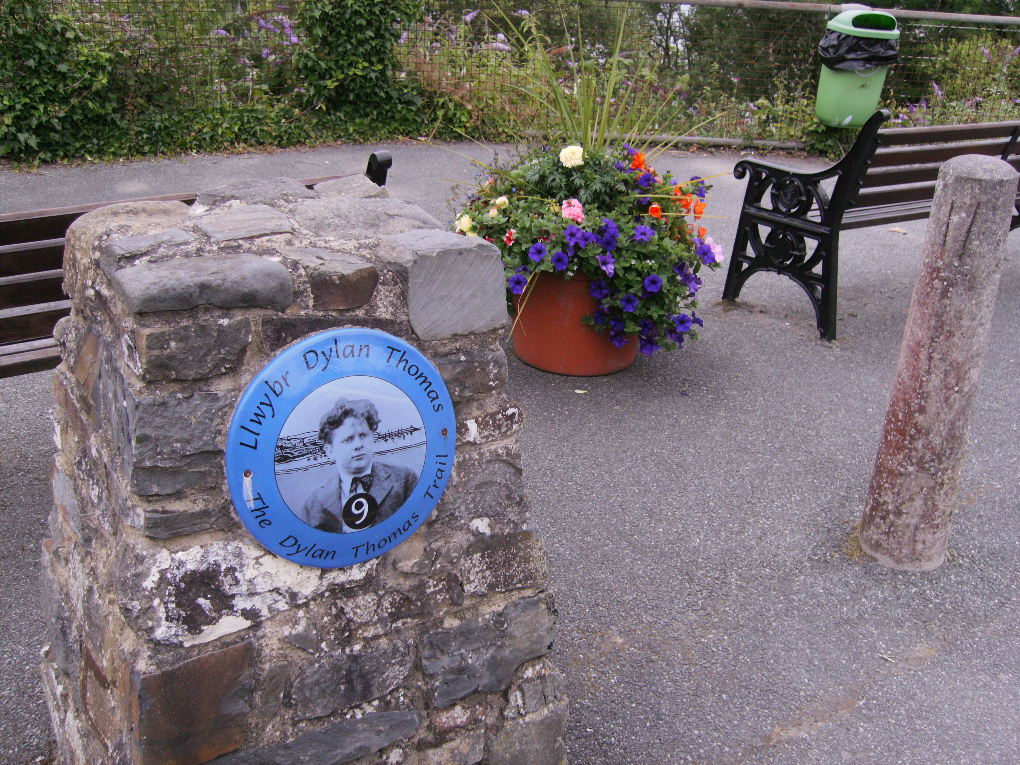
Dylan Thomas Trail

The Dylan Thomas Trail (Welsh: Llwybr Dylan Thomas) runs through places associated with the poet Dylan Thomas in Ceredigion, west Wales. It was officially...

Llanon

Llanon (also spelled Llan-non) is a village in Ceredigion, Wales. It adjoins the village of Llansantffraed on the coast of Cardigan Bay, 5 mi (8.0 km)...

Afon Wyre

Afon Wyre (Welsh pronunciation: [ˈʊɨ̯rɛ] ), (English: River Wyre), is a small river in the county of Ceredigion, Wales; also called Afon Wyre Fawr ("Great...

Nearby Amenities

Located within 500m of 52.282989,-4.1342993
Power: tower
Lat/Long: 52.2788878/-4.1365508
Power: tower
Lat/Long: 52.2851266/-4.1293464
Power: tower
Lat/Long: 52.283768/-4.1308216
Power: tower
Lat/Long: 52.2801744/-4.1350273
Power: tower
Lat/Long: 52.2814182/-4.1335789
Power: tower
Lat/Long: 52.2844013/-4.1301404
Direction: WSW
Generator Method: photovoltaic
Generator Output Electricity: yes
Generator Solar Modules: 7
Generator Source: solar
Generator Type: solar_photovoltaic_panel
Location: roof
Power: generator
Lat/Long: 52.27933/-4.1312309
Direction: ENE
Generator Method: photovoltaic
Generator Output Electricity: yes
Generator Solar Modules: 7
Generator Source: solar
Generator Type: solar_photovoltaic_panel
Location: roof
Power: generator
Lat/Long: 52.2793406/-4.1311819
The data included in this document is from www.openstreetmap.org. The data is made available under ODbL.

Have you been to Perth-y-gwenyn Plantation?

Leave your review of Perth-y-gwenyn Plantation below (or comments, questions and feedback).