Coed Main

Wood, Forest in Anglesey

Wales

Coed Main

Low tide at Red Wharf Bay This is the south western end of the bay.
Low tide at Red Wharf Bay Credit: Mat Fascione

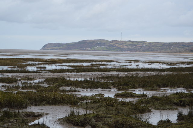
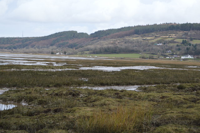
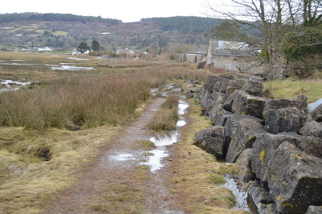
Coed Main, located in Anglesey, North Wales, is a picturesque woodland area known for its natural beauty and diverse ecosystem. Covering roughly 150 hectares, this enchanting forest is situated in close proximity to the village of Llanddona and offers a tranquil escape for nature lovers.

The woodland is predominantly made up of native tree species, including oak, birch, rowan, and holly, creating a rich and varied habitat for wildlife. Coed Main is home to a wide range of bird species, such as woodpeckers, buzzards, and owls, making it a popular destination for birdwatchers.

A network of well-maintained footpaths and trails meander through the woods, providing visitors with the opportunity to explore and immerse themselves in nature. The paths lead through dense foliage, over babbling brooks, and past serene ponds, offering a truly immersive experience.

Coed Main also boasts a number of picnic areas, allowing visitors to relax and enjoy the peaceful surroundings. In addition, there are designated spaces for camping and barbecues, making it an ideal spot for family outings and outdoor activities.

The forest is managed and maintained by local authorities, ensuring the preservation of its natural beauty for future generations. Educational events and guided walks are regularly organized, providing an opportunity for visitors to learn about the flora and fauna that call Coed Main home.

Overall, Coed Main in Anglesey is a haven for nature enthusiasts, offering stunning scenery, diverse wildlife, and a range of recreational opportunities.

If you have any feedback on the listing, please let us know in the comments section below.
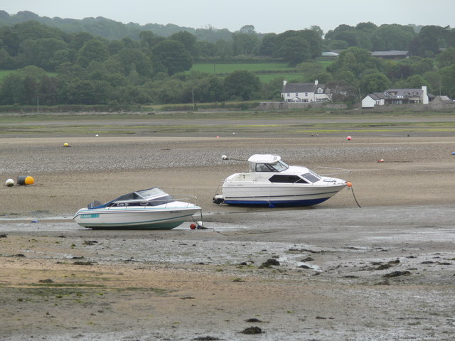
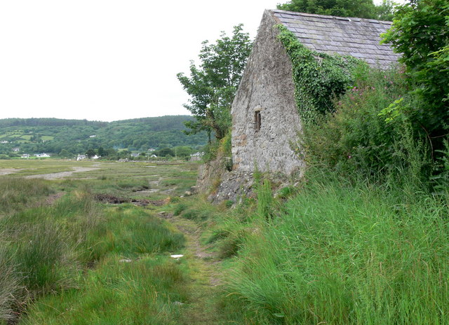
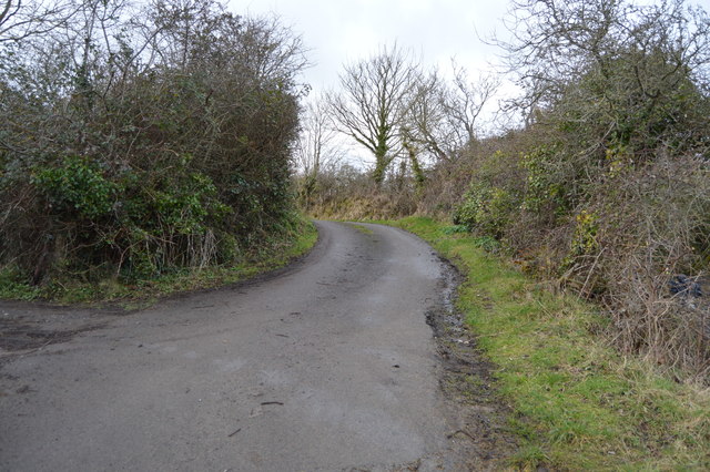
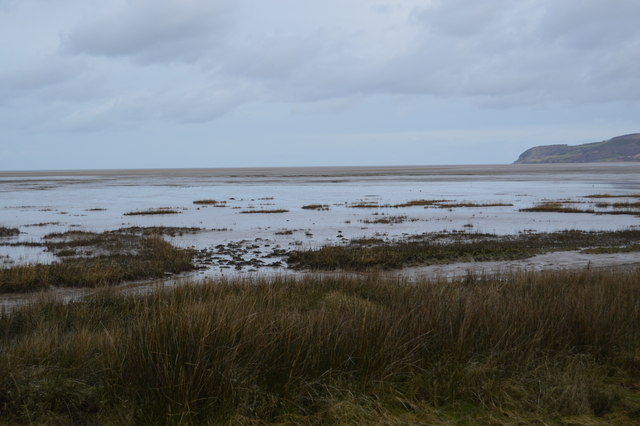
Coed Main Images

Images are sourced within 2km of 53.281016/-4.2098687 or Grid Reference SH5278. Thanks to Geograph Open Source API. All images are credited.

Low tide at Red Wharf Bay This is the south western end of the bay.
Low tide at Red Wharf Bay
This is the south western end of the bay.
Low tide at Red Wharf Bay Looking towards Talgwyn and Yr-lard on the south west shore of Red Wharf Bay.
Low tide at Red Wharf Bay
Looking towards Talgwyn and Yr-lard on the south west shore of Red Wharf Bay.
The muddy southwest edge of Red Wharf Bay
Old barn at Red Wharf Bay
Tide out, Red Wharf Way Traeth Coch (Welsh for Red Beach) is a wide sandy bay and an area of outstanding natural beauty on the east coast of the island of Anglesey in Wales. The bay is also known in English as Red Wharf Bay and lies between the villages of Pentraeth and Benllech. It is also close to Castell Mawr Rock, thought to be the site of an Iron Age fort.
Red Wharf Bay beach itself has an immense expanse of sand, at low tide almost 10 sq miles of sand is uncovered. The sand and the sea life disappears beneath the waves twice a day, and reappears just a few hours later.
Tide out, Red Wharf Way
Traeth Coch (Welsh for Red Beach) is a wide sandy bay and an area of outstanding natural beauty on the east coast of the island of Anglesey in Wales. The bay is also known in English as Red Wharf Bay and lies between the villages of Pentraeth and Benllech. It is also close to Castell Mawr Rock, thought to be the site of an Iron Age fort. Red Wharf Bay beach itself has an immense expanse of sand, at low tide almost 10 sq miles of sand is uncovered. The sand and the sea life disappears beneath the waves twice a day, and reappears just a few hours later.
Talgwyn Isaf Traeth Coch (Welsh for Red Beach) is a wide sandy bay and an area of outstanding natural beauty on the east coast of the island of Anglesey in Wales. The bay is also known in English as Red Wharf Bay and lies between the villages of Pentraeth and Benllech. It is also close to Castell Mawr Rock, thought to be the site of an Iron Age fort.
Red Wharf Bay beach itself has an immense expanse of sand, at low tide almost 10 sq miles of sand is uncovered. The sand and the sea life disappears beneath the waves twice a day, and reappears just a few hours later.
Talgwyn Isaf
Traeth Coch (Welsh for Red Beach) is a wide sandy bay and an area of outstanding natural beauty on the east coast of the island of Anglesey in Wales. The bay is also known in English as Red Wharf Bay and lies between the villages of Pentraeth and Benllech. It is also close to Castell Mawr Rock, thought to be the site of an Iron Age fort. Red Wharf Bay beach itself has an immense expanse of sand, at low tide almost 10 sq miles of sand is uncovered. The sand and the sea life disappears beneath the waves twice a day, and reappears just a few hours later.
Footbridge, Anglesey Coast Path, Red Wharf Bay Traeth Coch (Welsh for Red Beach) is a wide sandy bay and an area of outstanding natural beauty on the east coast of the island of Anglesey in Wales. The bay is also known in English as Red Wharf Bay and lies between the villages of Pentraeth and Benllech. It is also close to Castell Mawr Rock, thought to be the site of an Iron Age fort.
Red Wharf Bay beach itself has an immense expanse of sand, at low tide almost 10 sq miles of sand is uncovered. The sand and the sea life disappears beneath the waves twice a day, and reappears just a few hours later.
Footbridge, Anglesey Coast Path, Red Wharf Bay
Traeth Coch (Welsh for Red Beach) is a wide sandy bay and an area of outstanding natural beauty on the east coast of the island of Anglesey in Wales. The bay is also known in English as Red Wharf Bay and lies between the villages of Pentraeth and Benllech. It is also close to Castell Mawr Rock, thought to be the site of an Iron Age fort. Red Wharf Bay beach itself has an immense expanse of sand, at low tide almost 10 sq miles of sand is uncovered. The sand and the sea life disappears beneath the waves twice a day, and reappears just a few hours later.
Out building, Talgwyn Isaf
Narrow lane from Red Wharf Bay
Talgwyn Isaf
Talgwyn Isaf
Marshes, Red Wharf Bay Traeth Coch (Welsh for Red Beach) is a wide sandy bay and an area of outstanding natural beauty on the east coast of the island of Anglesey in Wales. The bay is also known in English as Red Wharf Bay and lies between the villages of Pentraeth and Benllech. It is also close to Castell Mawr Rock, thought to be the site of an Iron Age fort.
Red Wharf Bay beach itself has an immense expanse of sand, at low tide almost 10 sq miles of sand is uncovered. The sand and the sea life disappears beneath the waves twice a day, and reappears just a few hours later.
Marshes, Red Wharf Bay
Traeth Coch (Welsh for Red Beach) is a wide sandy bay and an area of outstanding natural beauty on the east coast of the island of Anglesey in Wales. The bay is also known in English as Red Wharf Bay and lies between the villages of Pentraeth and Benllech. It is also close to Castell Mawr Rock, thought to be the site of an Iron Age fort. Red Wharf Bay beach itself has an immense expanse of sand, at low tide almost 10 sq miles of sand is uncovered. The sand and the sea life disappears beneath the waves twice a day, and reappears just a few hours later.
On the shores of Red Wharf Bay
Anglesey Coast path below a small cliff, Red Wharf Bay Traeth Coch (Welsh for Red Beach) is a wide sandy bay and an area of outstanding natural beauty on the east coast of the island of Anglesey in Wales. The bay is also known in English as Red Wharf Bay and lies between the villages of Pentraeth and Benllech. It is also close to Castell Mawr Rock, thought to be the site of an Iron Age fort.
Red Wharf Bay beach itself has an immense expanse of sand, at low tide almost 10 sq miles of sand is uncovered. The sand and the sea life disappears beneath the waves twice a day, and reappears just a few hours later.
Anglesey Coast path below a small cliff, Red Wharf Bay
Traeth Coch (Welsh for Red Beach) is a wide sandy bay and an area of outstanding natural beauty on the east coast of the island of Anglesey in Wales. The bay is also known in English as Red Wharf Bay and lies between the villages of Pentraeth and Benllech. It is also close to Castell Mawr Rock, thought to be the site of an Iron Age fort. Red Wharf Bay beach itself has an immense expanse of sand, at low tide almost 10 sq miles of sand is uncovered. The sand and the sea life disappears beneath the waves twice a day, and reappears just a few hours later.
Salt marsh, Red Wharf Bay Traeth Coch (Welsh for Red Beach) is a wide sandy bay and an area of outstanding natural beauty on the east coast of the island of Anglesey in Wales. The bay is also known in English as Red Wharf Bay and lies between the villages of Pentraeth and Benllech. It is also close to Castell Mawr Rock, thought to be the site of an Iron Age fort.
Red Wharf Bay beach itself has an immense expanse of sand, at low tide almost 10 sq miles of sand is uncovered. The sand and the sea life disappears beneath the waves twice a day, and reappears just a few hours later.
Salt marsh, Red Wharf Bay
Traeth Coch (Welsh for Red Beach) is a wide sandy bay and an area of outstanding natural beauty on the east coast of the island of Anglesey in Wales. The bay is also known in English as Red Wharf Bay and lies between the villages of Pentraeth and Benllech. It is also close to Castell Mawr Rock, thought to be the site of an Iron Age fort. Red Wharf Bay beach itself has an immense expanse of sand, at low tide almost 10 sq miles of sand is uncovered. The sand and the sea life disappears beneath the waves twice a day, and reappears just a few hours later.
Anglesey Coast Path, Red Wharf Bay The Anglesey Coastal Path (formally the Isle of Anglesey Coastal Path) is a 200-kilometre (124 mi) long-distance footpath around the island of Anglesey in North Wales. The route is part of the Wales Coast Path. The path logo is a flying tern. <a href="https://www.geograph.org.uk/photo/4380990">SH5186 : Anglesey Coastal Path Logo</a>
Wikipedia: <span class="nowrap"><a title="http://en.wikipedia.org/wiki/Anglesey_Coastal_Path" rel="nofollow ugc noopener" href="http://en.wikipedia.org/wiki/Anglesey_Coastal_Path">Link</a><img style="margin-left:2px;" alt="External link" title="External link - shift click to open in new window" src="https://s1.geograph.org.uk/img/external.png" width="10" height="10"/></span>
Anglesey Coast Path, Red Wharf Bay
The Anglesey Coastal Path (formally the Isle of Anglesey Coastal Path) is a 200-kilometre (124 mi) long-distance footpath around the island of Anglesey in North Wales. The route is part of the Wales Coast Path. The path logo is a flying tern. SH5186 : Anglesey Coastal Path Logo Wikipedia: LinkExternal link
Show me another place!

Coed Main is located at Grid Ref: SH5278 (Lat: 53.281016, Lng: -4.2098687)

Unitary Authority: Isle of Anglesey

Police Authority: North Wales

What 3 Words

///stated.diets.dove. Near Benllech, Isle of Anglesey

Related Wikis

Plas Gwyn

Plas Gwyn is an area in the community of Pentraeth, Anglesey, Wales, which is 131.8 miles (212 km) from Cardiff and 211.2 miles (339.8 km) from London...

Panton Arms Hotel, Pentraeth

The Panton Arms Hotel, in Pentraeth, Anglesey, is a Grade II listed building situated in the centre of the village. It is named after the Panton family...

St Mary's Church, Pentraeth

St Mary's Church, Pentraeth is a small medieval parish church in the village of Pentraeth, in Anglesey, north Wales. The date of construction is unknown...

Pentraeth

Pentraeth (; Welsh: ['pɛntraiθ]) is a village and community on the island of Anglesey (Ynys Môn), North Wales, at grid reference SH523786. The Royal Mail...

Pentraeth railway station

Pentraeth railway station was situated on the Red Wharf Bay branch line between Holland Arms railway station and Benllech, the third station after the...

Rhos Cefn Hir

Rhos Cefn Hir (or Rhoscefnhir) is a village in the community of Pentraeth, Anglesey, Wales, which is 130.8 miles (210.5 km) from Cardiff and 210.8 miles...

Pen-y-garnedd

Pen-y-garnedd is a village in the community of Pentraeth, Anglesey, Wales, which is 130.6 miles (210.2 km) from Cardiff and 210.1 miles (338.2 km) from...

Llanddyfnan

Llanddyfnan is a village and community in Anglesey, Wales, located 3.5 miles (5.6 km) north east of Llangefni, 6.6 miles (10.6 km) north west of Menai...

Nearby Amenities

Located within 500m of 53.281016,-4.2098687
Pentraeth
Is In: Ynys Mon, Cymru, UK
Name Cy: Pentraeth
Name En: Pentraeth
Place: village
Wikidata: Q2278993
Lat/Long: 53.2816608/-4.2145365
Crossing
Crossing: traffic_signals
Crossing Ref: puffin
Kerb: flush
Tactile Paving: yes
Lat/Long: 53.2822001/-4.2160582
Bus Stop
Bay: yes
Bus: yes
Naptan AtcoCode: 5410ANX17090
Naptan NaptanCode: ynydgpj
Public Transport: platform
Shelter: yes
Lat/Long: 53.2825453/-4.2163266
Bus Stop
Bus: yes
Naptan AtcoCode: 5410AWP26248
Naptan NaptanCode: ynydgpt
Public Transport: platform
Lat/Long: 53.2824593/-4.2165761
Bus Stop
Bus: yes
Public Transport: platform
Shelter: no
Lat/Long: 53.2822203/-4.2154077
Fuel
Texaco
Brand: Texaco
Brand Wikidata: Q775060
Brand Wikipedia: en:Texaco
Website: https://locations.valero.com/en-gb/LocationDetails/Index/BANGOR-ROAD/0000886905
Lat/Long: 53.2813565/-4.2154918
Barrier: stile
Material: stone
Stile: stepover
Lat/Long: 53.2822638/-4.2037688
Barrier: stile
Material: wood
Stile: ladder
Lat/Long: 53.282361/-4.2037423
Parking
Pentraeth Community Centre
Lat/Long: 53.2825419/-4.2127756
Power: pole
Lat/Long: 53.2834992/-4.2065995
Power: pole
Lat/Long: 53.2840347/-4.2095339
Power: pole
Lat/Long: 53.2837835/-4.2082185
Power: pole
Lat/Long: 53.2835734/-4.2046297
Power: pole
Lat/Long: 53.2843426/-4.2112237
Power: pole
Lat/Long: 53.2836467/-4.2074766
Power: pole
Lat/Long: 53.2841951/-4.2138791
Power: pole
Lat/Long: 53.2841181/-4.2151236
Power: pole
Lat/Long: 53.2842737/-4.2124709
Restaurant
Cuisine: chinese
Lat/Long: 53.2824531/-4.216016
Power: pole
Lat/Long: 53.2836427/-4.2158283
Power: pole
Lat/Long: 53.2840285/-4.2146396
Power: pole
Lat/Long: 53.284081/-4.213717
Power: pole
Lat/Long: 53.2841962/-4.2119395
Power: pole
Lat/Long: 53.2842528/-4.2111791
Power: pole
Lat/Long: 53.2839538/-4.2096449
Power: pole
Lat/Long: 53.2836649/-4.2083033
Power: pole
Lat/Long: 53.2835073/-4.207499
Power: pole
Lat/Long: 53.2841679/-4.2111778
Power: pole
Lat/Long: 53.2839202/-4.213369
Power: pole
Lat/Long: 53.2833621/-4.2066585
Power: pole
Lat/Long: 53.2834038/-4.2057359
Power: pole
Lat/Long: 53.2834984/-4.2045315
Power: pole
Lat/Long: 53.2833698/-4.2036567
Power: pole
Lat/Long: 53.2837878/-4.2145426
Heritage Footpaths
Hiking: yes
Information: map
Tourism: information
Lat/Long: 53.2830125/-4.2164339
War Memorial
Historic: memorial
Lat/Long: 53.2823788/-4.2126811
The data included in this document is from www.openstreetmap.org. The data is made available under ODbL.

Have you been to Coed Main?

Leave your review of Coed Main below (or comments, questions and feedback).