Allt Pen-cwnc

Wood, Forest in Cardiganshire

Wales

Allt Pen-cwnc

Tafarn y Vale/Vale of Aeron Public house on the A482 at Ystrad Aeron, a local pub which has been bought by the community
Tafarn y Vale/Vale of Aeron Credit: Eirian Evans

Allt Pen-cwnc is a picturesque woodland area located in the county of Cardiganshire, Wales. Covering a vast area of approximately 500 acres, this tranquil forest is a haven for nature lovers and outdoor enthusiasts.

The woodland is predominantly composed of a mixture of broadleaf and coniferous trees, creating a diverse and beautiful landscape. Ancient oaks, beech, and birch trees are interspersed with towering pines and spruces, providing a rich habitat for a wide variety of wildlife.

Walking through Allt Pen-cwnc, visitors can immerse themselves in the serenity of nature. The forest boasts a network of well-maintained trails, allowing hikers and nature enthusiasts to explore the area at their own pace. These trails offer stunning views of the surrounding countryside, with glimpses of rolling hills and distant mountains.

The forest is home to a wealth of wildlife, including deer, badgers, and a variety of bird species. Birdwatchers can spot woodpeckers, owls, and even the elusive red kite soaring above the treetops. The forest floor is also teeming with life, with wildflowers, ferns, and mosses creating a tapestry of color and texture.

Allt Pen-cwnc is a popular destination for outdoor activities such as birdwatching, hiking, and photography. The peaceful atmosphere and natural beauty make it an ideal location for those seeking a break from the hustle and bustle of everyday life.

In conclusion, Allt Pen-cwnc is a stunning woodland area in Cardiganshire, Wales, offering visitors a chance to connect with nature and enjoy the tranquility of a diverse and thriving ecosystem.

If you have any feedback on the listing, please let us know in the comments section below.

Allt Pen-cwnc Images

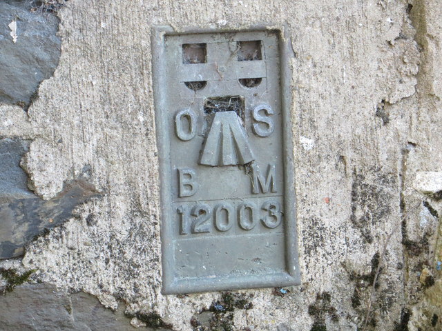
Images are sourced within 2km of 52.179122/-4.1674394 or Grid Reference SN5155. Thanks to Geograph Open Source API. All images are credited.

Tafarn y Vale/Vale of Aeron Public house on the A482 at Ystrad Aeron, a local pub which has been bought by the community
Tafarn y Vale/Vale of Aeron
Public house on the A482 at Ystrad Aeron, a local pub which has been bought by the community
Neuadd Goffa Felinfach Memorial Hall Based in the Centre of Lampeter Village, the hall was built in 1927 and refurbished in 2008.
Neuadd Goffa Felinfach Memorial Hall
Based in the Centre of Lampeter Village, the hall was built in 1927 and refurbished in 2008.
Playground at Felinfach junior school
Old Milestone by the A482, Felinfach, Llanfihangel Ystrad parish Aberayron tombstone by the A482, in parish of Llanfihangel Ystrad (Ceredigion District), Felinfach, in village centre, West side of road, North of bus shelter, and opposite the B4342 junction.

Inscription reads:-
ABERAYRON
7
MILES
LAMPETER
6

Grade II listed by Cadw.
Reference Number: 17445 <span class="nowrap"><a title="https://cadwpublic-api.azurewebsites.net/reports/listedbuilding/FullReport?lang=&id=17445" rel="nofollow ugc noopener" href="https://cadwpublic-api.azurewebsites.net/reports/listedbuilding/FullReport?lang=&id=17445">Link</a><img style="margin-left:2px;" alt="External link" title="External link - shift click to open in new window" src="https://s1.geograph.org.uk/img/external.png" width="10" height="10"/></span>

Surveyed

Milestone Society National ID: CRD_AALP07
Old Milestone by the A482, Felinfach, Llanfihangel Ystrad parish
Aberayron tombstone by the A482, in parish of Llanfihangel Ystrad (Ceredigion District), Felinfach, in village centre, West side of road, North of bus shelter, and opposite the B4342 junction. Inscription reads:- ABERAYRON 7 MILES LAMPETER 6 Grade II listed by Cadw. Reference Number: 17445 LinkExternal link Surveyed Milestone Society National ID: CRD_AALP07
Ordnance Survey Flush Bracket 12003 This can be found on the wall of the chapel at Ty'n-y-gwndwn.
For more detail see : <span class="nowrap"><a title="http://www.bench-marks.org.uk/bm22712" rel="nofollow ugc noopener" href="http://www.bench-marks.org.uk/bm22712">Link</a><img style="margin-left:2px;" alt="External link" title="External link - shift click to open in new window" src="https://s1.geograph.org.uk/img/external.png" width="10" height="10"/></span>
Ordnance Survey Flush Bracket 12003
This can be found on the wall of the chapel at Ty'n-y-gwndwn. For more detail see : LinkExternal link
Ordnance Survey Flush Bracket 12004 This can be found on the wall of Felinfach Theatre at Ystrad Aeron College.
For more detail see : <span class="nowrap"><a title="http://www.bench-marks.org.uk/bm22713" rel="nofollow ugc noopener" href="http://www.bench-marks.org.uk/bm22713">Link</a><img style="margin-left:2px;" alt="External link" title="External link - shift click to open in new window" src="https://s1.geograph.org.uk/img/external.png" width="10" height="10"/></span>
Ordnance Survey Flush Bracket 12004
This can be found on the wall of Felinfach Theatre at Ystrad Aeron College. For more detail see : LinkExternal link
Afon Aeron valley west of Ystrad Aeron, 1994 View eastward about a mile from Ystrad on the B4342 road from Dihewyd, to the Cambrian Mountains in the distance.
Afon Aeron valley west of Ystrad Aeron, 1994
View eastward about a mile from Ystrad on the B4342 road from Dihewyd, to the Cambrian Mountains in the distance.
Milestone - Aberayron 7
Milestone - Aberayron 6 There is an OS cut mark on the front. It marks a point 80.8390m above mean sea level.
Milestone - Aberayron 6
There is an OS cut mark on the front. It marks a point 80.8390m above mean sea level.
The Aeron Valley near Ystrad Aeron This landscape is seen (using telephoto assistance) from the byway between Tal-sarn and Brynog.
The Aeron Valley near Ystrad Aeron
This landscape is seen (using telephoto assistance) from the byway between Tal-sarn and Brynog.
Across the Aeron Valley in Ceredigion Seen from the byway between Tal-sarn and Gwynog, looking across land near Cilbwn farm - and across the Aeron Valley near Ystrad Aeron.
Across the Aeron Valley in Ceredigion
Seen from the byway between Tal-sarn and Gwynog, looking across land near Cilbwn farm - and across the Aeron Valley near Ystrad Aeron.
The Aeron Valley near Felinfach in Ceredigion This is a telephoto assisted image showing the flat valley of the Afon Aeron near Felinfach and Ystrad Aeron. The view is seen from the byway north of Cilbwn farm.
The Aeron Valley near Felinfach in Ceredigion
This is a telephoto assisted image showing the flat valley of the Afon Aeron near Felinfach and Ystrad Aeron. The view is seen from the byway north of Cilbwn farm.
Entrance to lane to Bwlch-y-person and Pencaelyfri
Ystrad Aeron, at the junction of the B4342 with the A482
Old Milestone by the A482, Ystrad Aeron, Llanfihangel Ystrad Parish Aberayron tombstone by the A482, in parish of Llanfihangel Ystrad (Ceredigion District), Ystrad Aeron, at entrance to Felin Fach Theatre.

Inscription reads:-
ABERAYRON
6
Miles
Lampeter
(7)

Grade II listed by Cadw. Reference Number: 17432
<span class="nowrap"><a title="https://cadwpublic-api.azurewebsites.net/reports/listedbuilding/FullReport?lang=&id=17432" rel="nofollow ugc noopener" href="https://cadwpublic-api.azurewebsites.net/reports/listedbuilding/FullReport?lang=&id=17432">Link</a><img style="margin-left:2px;" alt="External link" title="External link - shift click to open in new window" src="https://s1.geograph.org.uk/img/external.png" width="10" height="10"/></span>

Surveyed

Milestone Society National ID: CRD_AALP06
Old Milestone by the A482, Ystrad Aeron, Llanfihangel Ystrad Parish
Aberayron tombstone by the A482, in parish of Llanfihangel Ystrad (Ceredigion District), Ystrad Aeron, at entrance to Felin Fach Theatre. Inscription reads:- ABERAYRON 6 Miles Lampeter (7) Grade II listed by Cadw. Reference Number: 17432 LinkExternal link Surveyed Milestone Society National ID: CRD_AALP06
Old Milestone by the A482, Felinfach, Llanfihangel Ystrad parish Aberayron tombstone by the A482, in parish of Llanfihangel Ystrad (Ceredigion District), Felinfach, in village centre, West side of road, North of bus shelter, and opposite the B4342 junction.

Inscription reads:-
ABERAYRON
7
MILES
LAMPETER
6

Grade II listed by Cadw.
Reference Number: 17445 <span class="nowrap"><a title="https://cadwpublic-api.azurewebsites.net/reports/listedbuilding/FullReport?lang=&id=17445" rel="nofollow ugc noopener" href="https://cadwpublic-api.azurewebsites.net/reports/listedbuilding/FullReport?lang=&id=17445">Link</a><img style="margin-left:2px;" alt="External link" title="External link - shift click to open in new window" src="https://s1.geograph.org.uk/img/external.png" width="10" height="10"/></span>

Surveyed

Milestone Society National ID: CRD_AALP07
Old Milestone by the A482, Felinfach, Llanfihangel Ystrad parish
Aberayron tombstone by the A482, in parish of Llanfihangel Ystrad (Ceredigion District), Felinfach, in village centre, West side of road, North of bus shelter, and opposite the B4342 junction. Inscription reads:- ABERAYRON 7 MILES LAMPETER 6 Grade II listed by Cadw. Reference Number: 17445 LinkExternal link Surveyed Milestone Society National ID: CRD_AALP07
Pomprenni / Footbridges Cerddwyr yn croesi pomprenni ar lan Afon Aeron.

Walkers crossing footbridges above the Aeron River.
Pomprenni / Footbridges
Cerddwyr yn croesi pomprenni ar lan Afon Aeron. Walkers crossing footbridges above the Aeron River.
Greenfield Greenfield, Felinfach
Greenfield
Greenfield, Felinfach
Show me another place!

Allt Pen-cwnc is located at Grid Ref: SN5155 (Lat: 52.179122, Lng: -4.1674394)

Unitary Authority: Ceredigion

Police Authority: Dyfed Powys

What 3 Words

///plays.prongs.motored. Near Llangybi, Ceredigion

Nearby Locations

Allt Pen-cwnc

Related Wikis

Llanfihangel Ystrad

Llanfihangel Ystrad (English "Vale of St Michael") is a constituent community in Ceredigion, Wales. It is named after the principal place of worship, St...

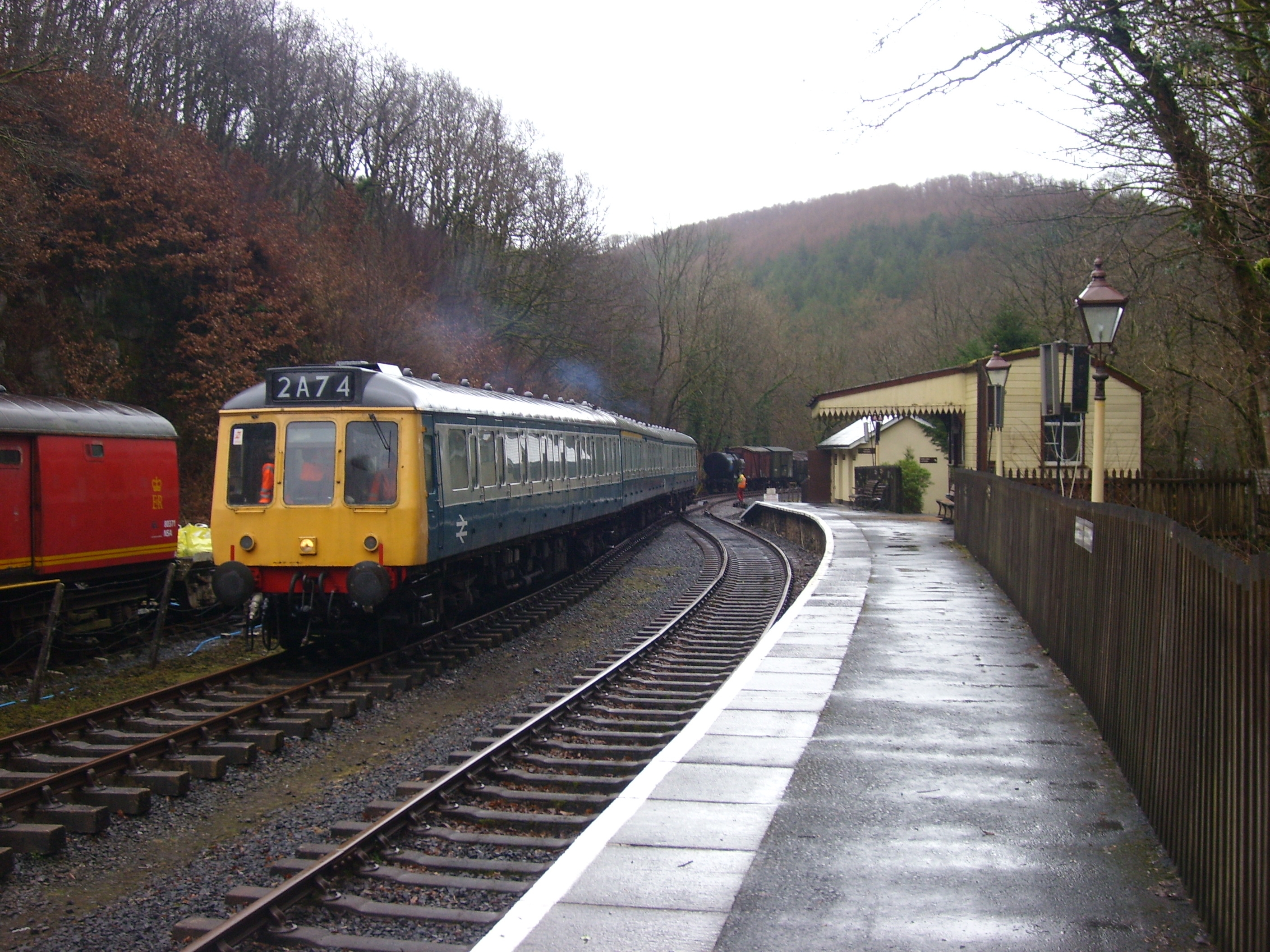
Felin Fach railway station

Felin Fach or Ystrad was a small railway station in the rural location between Ystrad Aeron and Felinfach, the intermediate station on the Aberayron branch...

Ystrad Aeron

Ystrad Aeron is a small village west of Felinfach on the A482 between Lampeter and Aberaeron, Ceredigion, Wales. It is part of the constituent community...

Green Grove, Ceredigion

Green Grove is a small village in the community of Llanfihangel Ystrad, Ceredigion, Wales, which is 64.9 miles (104.4 km) from Cardiff and 179.1 miles...
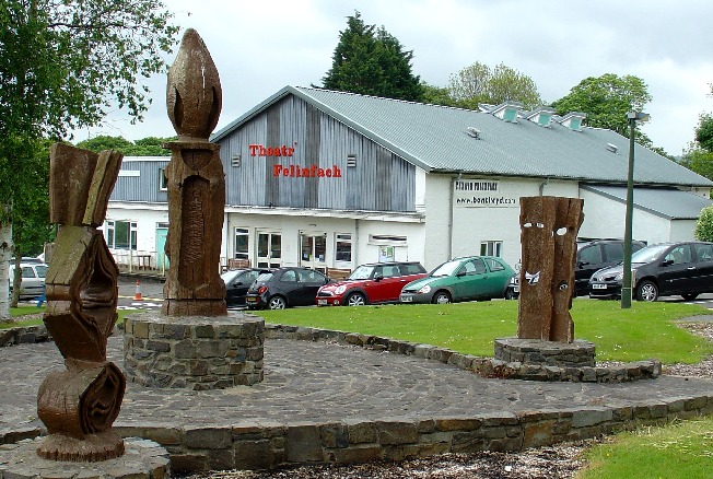
Theatr Felinfach

Theatr Felinfach is a small regional theatre located outside the village of Ystrad Aeron in Dyffryn Aeron, about 7 miles from the university town of Lampeter...

Talsarn Halt railway station

Talsarn Halt was a small railway station in a very rural location on the Aberayron branch of the Carmarthen to Aberystwyth Line in the Welsh county of...

Ffynnon-oer

Ffynnon-oer is a hamlet in the community of Llanfihangel Ystrad, Ceredigion, Wales, which is 62.6 miles (100.8 km) from Cardiff and 177.4 miles (285.6...

Talsarn

Talsarn is a hamlet in the community of Nantcwnlle, Ceredigion, Wales. It lies some 16 miles (26 km) south of Aberystwyth, 64 miles (103 km) north-west...

Nearby Amenities

Located within 500m of 52.179122,-4.1674394
Place: farm
Lat/Long: 52.1748879/-4.1687752
Power: pole
Lat/Long: 52.1769516/-4.172557
Power: pole
Lat/Long: 52.1769253/-4.170894
Power: pole
Lat/Long: 52.1769023/-4.1692257
Power: pole
Lat/Long: 52.1768645/-4.1674742
Power: pole
Lat/Long: 52.1768414/-4.1658327
Power: pole
Lat/Long: 52.1824951/-4.1633825
Power: pole
Lat/Long: 52.1816604/-4.1628259
Power: pole
Lat/Long: 52.1803801/-4.1619529
Power: pole
Lat/Long: 52.1793094/-4.1612501
Power: pole
Lat/Long: 52.1784648/-4.1606829
Power: pole
Lat/Long: 52.1768135/-4.163982
Power: pole
Lat/Long: 52.1767937/-4.1629601
Power: pole
Lat/Long: 52.1767757/-4.1618121
Power: pole
Lat/Long: 52.1750239/-4.1703898
Power: pole
Lat/Long: 52.1752213/-4.168936
Power: pole
Lat/Long: 52.1753266/-4.1679436
Power: pole
Lat/Long: 52.1754368/-4.1669646
Power: pole
Lat/Long: 52.1756243/-4.1653097
Power: pole
Lat/Long: 52.1757295/-4.1642582
Power: pole
Lat/Long: 52.1758661/-4.1632095
The data included in this document is from www.openstreetmap.org. The data is made available under ODbL.

Have you been to Allt Pen-cwnc?

Leave your review of Allt Pen-cwnc below (or comments, questions and feedback).