Bryn Covert

Wood, Forest in Caernarfonshire

Wales

Bryn Covert

Tir Plas Porthamel / Land at Plas Porthamel
Tir Plas Porthamel / Land at Plas Porthamel Credit: Ceri Thomas

Bryn Covert is a picturesque woodland area located in Caernarfonshire, a historic county in North Wales. Nestled amidst the captivating Snowdonia National Park, this enchanting forest offers a haven of tranquility and natural beauty.

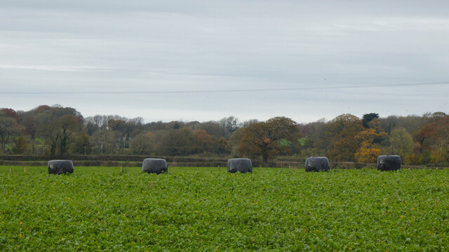
Covering an expansive area, Bryn Covert is characterized by its dense canopy of deciduous and coniferous trees, creating a lush green landscape that changes with the seasons. The forest is home to a diverse range of flora and fauna, including oak, beech, and birch trees, as well as an array of wildflowers and mosses. The vibrant colors of autumn bring a captivating spectacle to the area, while the fresh green foliage of spring revitalizes the forest.

The woodland is crisscrossed by a network of walking trails, allowing visitors to explore its hidden treasures. These paths meander through the forest, leading to charming clearings, babbling brooks, and stunning viewpoints that offer panoramic vistas of the surrounding countryside. Nature enthusiasts and hikers can revel in the peaceful ambiance, immersing themselves in the sights and sounds of this captivating woodland.

Bryn Covert is also home to a diverse range of wildlife, including red squirrels, badgers, and a variety of bird species. Birdwatchers can spot woodpeckers, owls, and even the elusive red kite soaring above the treetops. The forest is a sanctuary for wildlife, providing a vital habitat for many species.

Whether seeking solitude, adventure, or simply a connection with nature, Bryn Covert is a destination that promises a truly immersive experience in the heart of Caernarfonshire's stunning landscape.

If you have any feedback on the listing, please let us know in the comments section below.

Bryn Covert Images

Images are sourced within 2km of 53.1678/-4.2351946 or Grid Reference SH5065. Thanks to Geograph Open Source API. All images are credited.
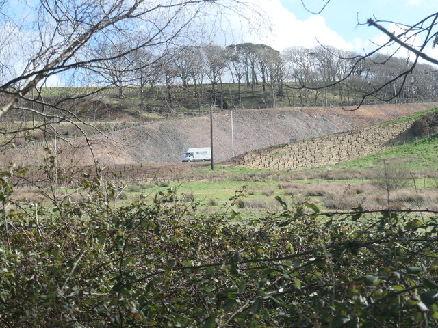
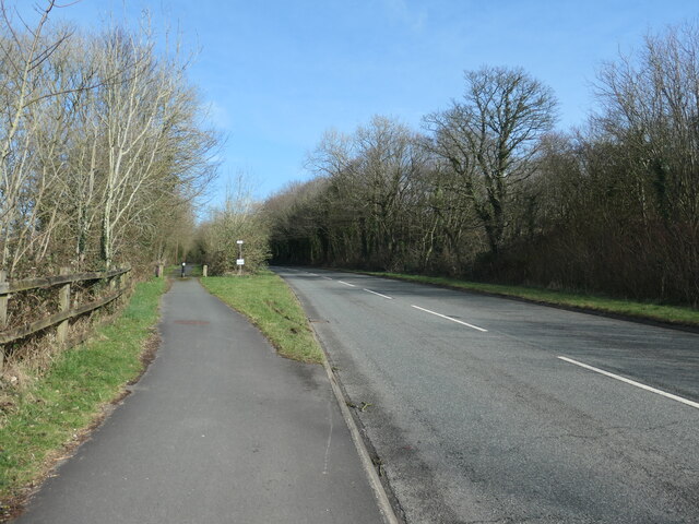
Tir Plas Porthamel / Land at Plas Porthamel
Truck on the Y Felinheli Bypass (A487) DAF XF (CX18 MON) on the A487 near Y Felinheli.
Truck on the Y Felinheli Bypass (A487)
DAF XF (CX18 MON) on the A487 near Y Felinheli.
Bridge over the Y Felinheli Bypass near Carreg Goch
A487 at Plas Menai Roundabout Roadworks at the Plas Menai Roundabout as the diversion to the A487 (the new Caernarfon to Bontnewydd bypass <span class="nowrap"><a title="https://gov.wales/a487-caernarfon-bontnewydd-bypass" rel="nofollow ugc noopener" href="https://gov.wales/a487-caernarfon-bontnewydd-bypass">Link</a><img style="margin-left:2px;" alt="External link" title="External link - shift click to open in new window" src="https://s1.geograph.org.uk/img/external.png" width="10" height="10"/></span> ) is nearing completion (it would be opened later in the week).
A487 at Plas Menai Roundabout
Roadworks at the Plas Menai Roundabout as the diversion to the A487 (the new Caernarfon to Bontnewydd bypass LinkExternal link ) is nearing completion (it would be opened later in the week).
Open-sided barn, Parciau Farm Above some holiday cottages and the road to Caernarfon.
Open-sided barn, Parciau Farm
Above some holiday cottages and the road to Caernarfon.
This way to Griffiths Crossing and Caernarfon Lon Las Menai, heading south-west. Built on the track bed of the former railway between Bangor and Caernarfon.
This way to Griffiths Crossing and Caernarfon
Lon Las Menai, heading south-west. Built on the track bed of the former railway between Bangor and Caernarfon.
Unknown structures in a stream bed At the downstream end of a culvert under the former Bangor - Caernarfon railway.
Unknown structures in a stream bed
At the downstream end of a culvert under the former Bangor - Caernarfon railway.
Gash in the hillside, below Bryn Covert The northern end of the new Caernarfon and Bontnewydd by-pass.
Gash in the hillside, below Bryn Covert
The northern end of the new Caernarfon and Bontnewydd by-pass.
A487, old and new In the foreground, the old A487 from Y Felinheli to Caernarfon [now the A4871]. Cutting through the hillside, the new A487 from Y Felinheli, bypassing both Caernarfon and Bontnewydd.
A487, old and new
In the foreground, the old A487 from Y Felinheli to Caernarfon [now the A4871]. Cutting through the hillside, the new A487 from Y Felinheli, bypassing both Caernarfon and Bontnewydd.
Lon Las Menai, near Llanfair Hall Farm The end of a short stretch along the pavement of Ffordd Caernarfon / Caernarfon Road.
Lon Las Menai, near Llanfair Hall Farm
The end of a short stretch along the pavement of Ffordd Caernarfon / Caernarfon Road.
The southern edge of Llanfair Wood Descending to the shore of the Menai Straits.
The southern edge of Llanfair Wood
Descending to the shore of the Menai Straits.
Trees along a field boundary, near Plas Llanfair Seen from Lon Las Menai.
Trees along a field boundary, near Plas Llanfair
Seen from Lon Las Menai.
Lon Las Menai, nearing Y Felinheli A recreational route built on the trackbed of the former Caernarfon - Bangor railway.
Lon Las Menai, nearing Y Felinheli
A recreational route built on the trackbed of the former Caernarfon - Bangor railway.
Crossing Cottage, Y Felinheli Now you just have to cross Glan y Mor / Beach Road to reach this house. But the name refers to the former level crossing here on the Bangor - Caernarfon railway line.
Crossing Cottage, Y Felinheli
Now you just have to cross Glan y Mor / Beach Road to reach this house. But the name refers to the former level crossing here on the Bangor - Caernarfon railway line.
Route of the railway between Bangor and Caernarfon Now an access track for houses on Ffordd Caernarfon / Caernarfon Road. Not part of Lon Las Menai.
Route of the railway between Bangor and Caernarfon
Now an access track for houses on Ffordd Caernarfon / Caernarfon Road. Not part of Lon Las Menai.
Path to the sea shore, Y Felinheli Fenced, gated and waymarked, but not mapped as a public footpath.
Path to the sea shore, Y Felinheli
Fenced, gated and waymarked, but not mapped as a public footpath.
Public footpath heading south-east towards Bethel On the south side of Caernarfon Road, near Llanfair Hall Farm.
Public footpath heading south-east towards Bethel
On the south side of Caernarfon Road, near Llanfair Hall Farm.
An entrance to Llanfair Hall Farm On the north side of Caernarfon Road.
An entrance to Llanfair Hall Farm
On the north side of Caernarfon Road.
Show me another place!

Bryn Covert is located at Grid Ref: SH5065 (Lat: 53.1678, Lng: -4.2351946)

Unitary Authority: Gwynedd

Police Authority: North Wales

What 3 Words

///options.depending.destroyer. Near Y Felinheli, Gwynedd

Nearby Locations

Dingle Covert Bryn Covert

Related Wikis

Griffith's Crossing railway station

Griffith's Crossing railway station was a former railway station located on the Bangor and Carnarvon Railway about a mile and a half south west of Port...

Llanfair-is-gaer

Llanfair-is-gaer was an ecclesiastical parish in Caernarfon, Gwynedd: the parish church was St Mary's. == References ==

Menai Strait

The Menai Strait (Welsh: Afon Menai, lit. 'River Menai') is a strait which separates the island of Anglesey from Gwynedd, on the mainland of Wales. It...

Old Church of St Nidan, Llanidan

The Old Church of St Nidan, Llanidan is a medieval church in the community of Llanidan, in Anglesey, North Wales, close to the Menai Strait. The first...

Related Videos

Cwtch@Hafod Making Happy Holiday Memories August 2021

3 gorgeous glamping getaways. 2 shepherd's huts. 1 cabin.Each one with hot tubs. 1 small personal reliable business owner.

North wales camping

Making memories rhyd y galen caravan and camping park.

Nearby Amenities

Located within 500m of 53.1678,-4.2351946
Power: pole
Lat/Long: 53.1656993/-4.2304441
Power: pole
Lat/Long: 53.1656559/-4.2291781
Power: pole
Lat/Long: 53.1658649/-4.231407
Barrier: stile
Lat/Long: 53.1704312/-4.2317693
Barrier: stile
Source: visual
Lat/Long: 53.1705469/-4.2318927
Power: pole
Lat/Long: 53.1655292/-4.2310631
Power: pole
Lat/Long: 53.1651341/-4.2313199
Power: pole
Lat/Long: 53.1647249/-4.2314348
Power: pole
Lat/Long: 53.1644554/-4.2312489
Power: pole
Lat/Long: 53.1641312/-4.2309515
Barrier: bollard
Bicycle: yes
Foot: yes
Lat/Long: 53.170027/-4.2340469
Barrier: bollard
Bicycle: yes
Foot: yes
Lat/Long: 53.1700527/-4.2339505
Griffiths' Crossing
Name Cy: Croesfan Griffiths
Place: hamlet
Lat/Long: 53.1669719/-4.2418182
Bryn
Building: yes
Lat/Long: 53.1670706/-4.2307292
Parciau
Building: yes
Lat/Long: 53.1653726/-4.2414258
Griffith's Crossing
Historic Railway: station
Railway: site
Wikidata: Q23073533
Wikipedia: en:Griffith's Crossing railway station
Lat/Long: 53.167524/-4.2389826
Griffith's Crossing
Historic Railway: level_crossing
Lat/Long: 53.1676818/-4.2386032
The data included in this document is from www.openstreetmap.org. The data is made available under ODbL.

Have you been to Bryn Covert?

Leave your review of Bryn Covert below (or comments, questions and feedback).