Allt Treloyw

Wood, Forest in Cardiganshire

Wales

Allt Treloyw

Llanerchaeron House and Garden: Field of buttercups seen from the lake
Llanerchaeron House and Garden: Field of buttercups seen from the lake Credit: Michael Garlick

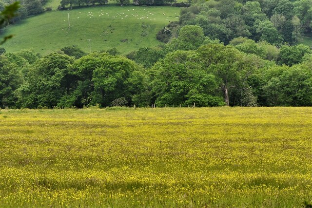
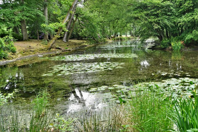
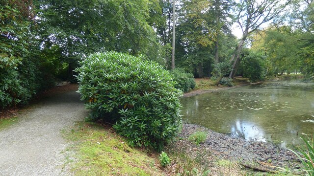
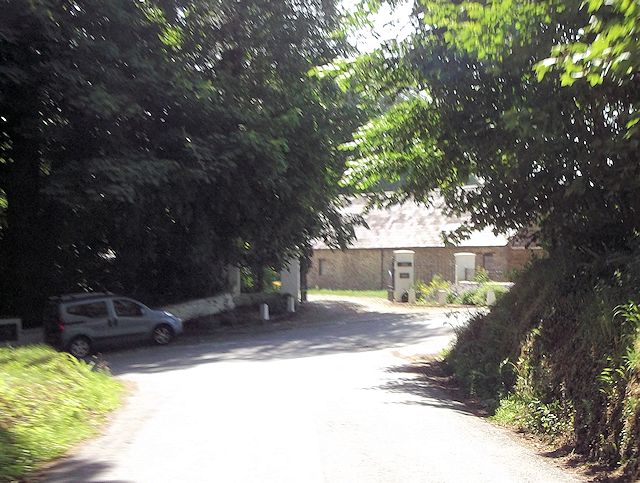
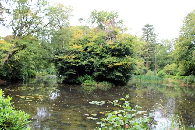
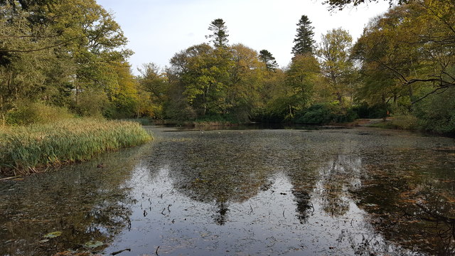
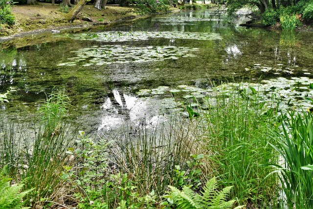
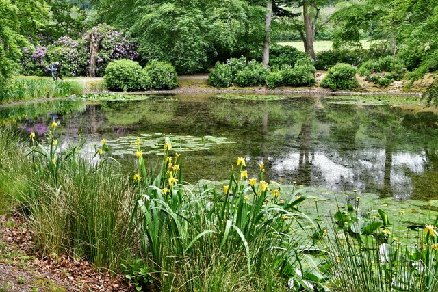
Allt Treloyw is a picturesque woodland area located in the county of Cardiganshire, Wales. Spanning approximately 200 acres, it is a haven for nature enthusiasts and outdoor lovers alike. The name "Allt Treloyw" translates to "Wood of the Bleeding Slope," a reference to the steep hillsides that characterize the landscape.

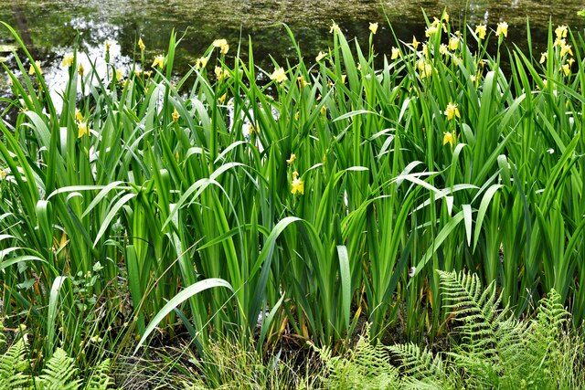
The woodland is primarily composed of native tree species, including oak, ash, and beech, which create a dense canopy overhead. The forest floor is adorned with vibrant carpets of bluebells, wood sorrel, and wild garlic, providing a striking contrast to the towering trees above.

Walking trails wind their way through the woods, offering visitors the opportunity to explore the diverse wildlife and natural beauty of the area. Birdwatchers will delight in spotting species such as red kites, buzzards, and woodpeckers, while lucky observers might even catch a glimpse of elusive mammals like badgers and foxes.

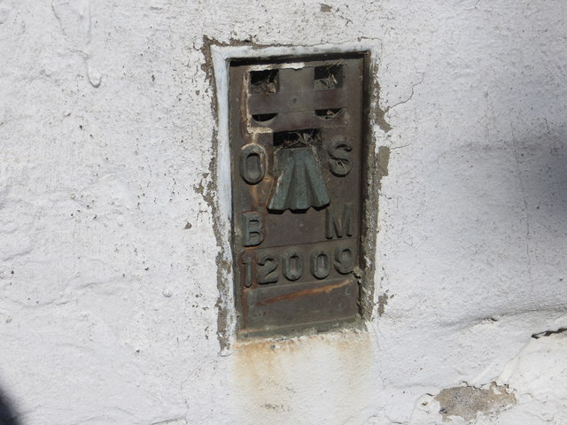
Allt Treloyw is also home to a variety of historical and archaeological sites. Ancient burial mounds and stone circles can be found hidden amongst the trees, providing a glimpse into the area's rich history.

Visitors to Allt Treloyw can enjoy a peaceful escape from the hustle and bustle of everyday life. Whether it's a leisurely stroll through the woodland, a picnic amidst the tranquil surroundings, or simply soaking in the natural beauty, Allt Treloyw offers a truly rejuvenating experience for all who venture into its depths.

If you have any feedback on the listing, please let us know in the comments section below.

Allt Treloyw Images

Images are sourced within 2km of 52.21775/-4.195716 or Grid Reference SN5059. Thanks to Geograph Open Source API. All images are credited.

Llanerchaeron House and Garden: Field of buttercups seen from the lake
Llanerchaeron House and Garden: View from the eastern end of the lake
Path and pond at Llanerchaeron
Bungalows at Ciliau Aeron
Approaching junction at Ty Glyn
The end of the lake, National Trust, Llanerchaeron
Threshing Barn and Hayrick Stands at Llanerchaeron
Ordnance Survey Flush Bracket 12009 This can be found on the wall of a building at Parc-neuadd.
For more detail see : <span class="nowrap"><a title="http://www.bench-marks.org.uk/bm22716" rel="nofollow ugc noopener" href="http://www.bench-marks.org.uk/bm22716">Link</a><img style="margin-left:2px;" alt="External link" title="External link - shift click to open in new window" src="https://s1.geograph.org.uk/img/external.png" width="10" height="10"/></span>
Ordnance Survey Flush Bracket 12009
This can be found on the wall of a building at Parc-neuadd. For more detail see : LinkExternal link
The Lake at Llanerchaeron (2) Not sure if this actually forms part of the farm or the estate.
Since the estate was left to The National Trust in 1989, the farm has been managed by Llanerchaeron staff and not tenanted out, making it the only in-hand National Trust farm in Wales.
The Lake at Llanerchaeron (2)
Not sure if this actually forms part of the farm or the estate. Since the estate was left to The National Trust in 1989, the farm has been managed by Llanerchaeron staff and not tenanted out, making it the only in-hand National Trust farm in Wales.
Lake at Llanerchaeron House An elegant Georgian villa, set in the wooded Aeron valley. Remarkably unaltered for over 200 years, this self-sufficient estate includes a farm, walled gardens and lake
Lake at Llanerchaeron House
An elegant Georgian villa, set in the wooded Aeron valley. Remarkably unaltered for over 200 years, this self-sufficient estate includes a farm, walled gardens and lake
Old Milestone by the A482, Ciliau Aeron parish Aberayron tombstone by the A482, in parish of Ciliau Aeron (Ceredigion District), Ciliau Aeron, 200m Northwest of crossroads against wall, South side of road.
Inscription reads:-
ABERAYRON
4
MILES
LAMPETER
9

Surveyed

Milestone Society National ID: CRD_AALP04
Old Milestone by the A482, Ciliau Aeron parish
Aberayron tombstone by the A482, in parish of Ciliau Aeron (Ceredigion District), Ciliau Aeron, 200m Northwest of crossroads against wall, South side of road. Inscription reads:- ABERAYRON 4 MILES LAMPETER 9 Surveyed Milestone Society National ID: CRD_AALP04
Old Milestone by the A482, Allt Llanerchaeron Aberayron tombstone by the A482, in parish of Henfynyw (Ceredigion District), Allt Llanerchaeron.

Inscription reads:-
Aberaeron
3
Lampeter
10

Surveyed

Milestone Society National ID: CRD_AALP03
Old Milestone by the A482, Allt Llanerchaeron
Aberayron tombstone by the A482, in parish of Henfynyw (Ceredigion District), Allt Llanerchaeron. Inscription reads:- Aberaeron 3 Lampeter 10 Surveyed Milestone Society National ID: CRD_AALP03
Ordnance Survey Flush Bracket (12009) This OS Flush Bracket can be found on the barn at Parc Neuadd NW side of the road. It marks a point 73.771m above mean sea level.
Ordnance Survey Flush Bracket (12009)
This OS Flush Bracket can be found on the barn at Parc Neuadd NW side of the road. It marks a point 73.771m above mean sea level.
Llanerchaeron House and Garden: The eastern end of the lake
Llanerchaeron House and Garden: Yellow iris 'Iris pseudacorus'
Llanerchaeron House and Garden: The lake
Beside the lake at Llanerchaeron The path around the lake at Llanerchaeron.
Beside the lake at Llanerchaeron
The path around the lake at Llanerchaeron.
New Bungalow, Cilcennin
Show me another place!

Allt Treloyw is located at Grid Ref: SN5059 (Lat: 52.21775, Lng: -4.195716)

Unitary Authority: Ceredigion

Police Authority: Dyfed Powys

What 3 Words

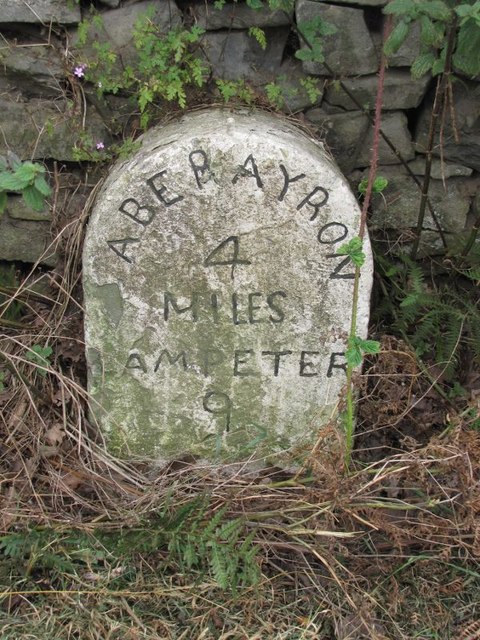
///winded.scorpions.assist. Near Aberaeron, Ceredigion

Related Wikis

Tŷ Glyn

Tŷ Glyn or Tyglyn is a small village in the community of Ciliau Aeron, Ceredigion, Wales, which is 67.1 miles (107.9 km) from Cardiff and 180.5 miles...

Ciliau-Aeron Halt railway station

Ciliau-Aeron Halt was a small railway station on the Aberayron branch of the Carmarthen to Aberystwyth Line in the Welsh county of Ceredigion serving the...

Newbridge, Ceredigion

Newbridge is a small village in the community of Ciliau Aeron, Ceredigion, Wales. Newbridge is on the A482 road between Aberaeron and Lampeter. It is represented...

Ciliau Aeron

Ciliau Aeron (English: where the valley of the river Aeron narrows) is a community and small village 4 miles from Aberaeron in Ceredigion, Wales on the...

Nearby Amenities

Located within 500m of 52.21775,-4.195716
Source: npe
Lat/Long: 52.2158083/-4.199795
Source: npe
Lat/Long: 52.2152355/-4.1972005
Source: npe
Lat/Long: 52.2134922/-4.1940335
Tŷ Glyn
Place: hamlet
Wikidata: Q16248541
Wikipedia: en:Tŷ Glyn
Lat/Long: 52.217106/-4.1988427
Direction: SE
Generator Method: photovoltaic
Generator Output Electricity: yes
Generator Solar Modules: 16
Generator Source: solar
Generator Type: solar_photovoltaic_panel
Location: roof
Power: generator
Lat/Long: 52.217217/-4.1903454
Give Way
Direction: forward
Lat/Long: 52.2168482/-4.1978891
The data included in this document is from www.openstreetmap.org. The data is made available under ODbL.

Have you been to Allt Treloyw?

Leave your review of Allt Treloyw below (or comments, questions and feedback).