Allt Rhyddallt-bâch

Wood, Forest in Caernarfonshire

Wales

Allt Rhyddallt-bâch

Cambr croes / Cross cambre Note the angle of the traffic cones compared with the upright telephone pole.
Cambr croes / Cross cambre Credit: Ceri Thomas

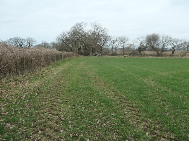
Allt Rhyddallt-bâch is a small wood located in the county of Caernarfonshire, Wales. It covers an area of approximately 20 hectares and is situated on the eastern slope of the Nantlle Valley, near the village of Rhyd Ddu.

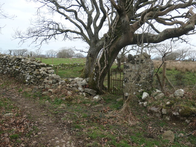
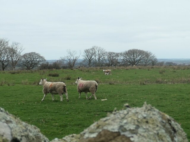
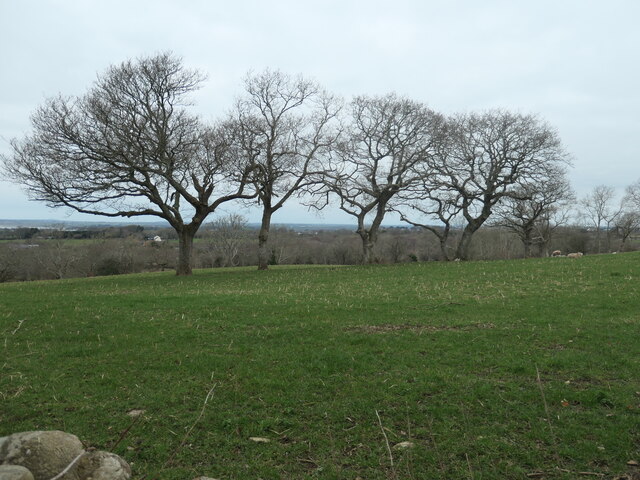
The wood predominantly consists of native broadleaf trees, such as oak, ash, and birch, which provide a diverse habitat for various flora and fauna. The dense canopy of the trees creates a shaded and tranquil environment, making it an ideal spot for nature enthusiasts and walkers.

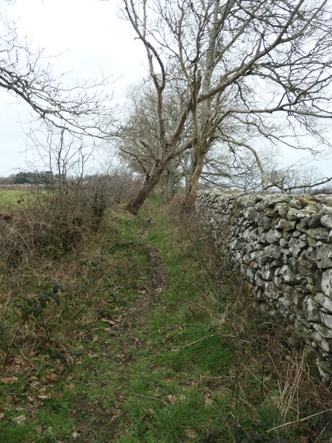
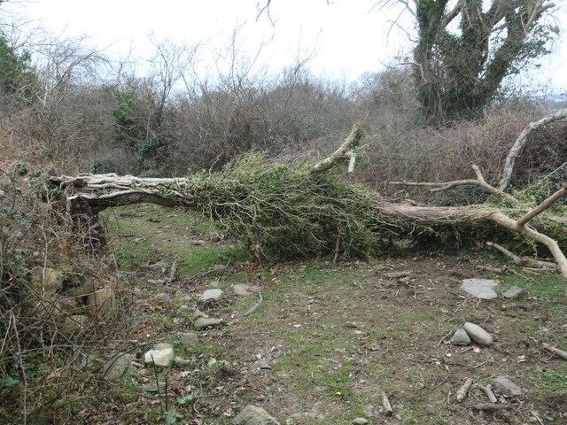
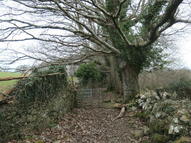
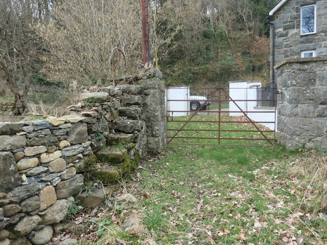
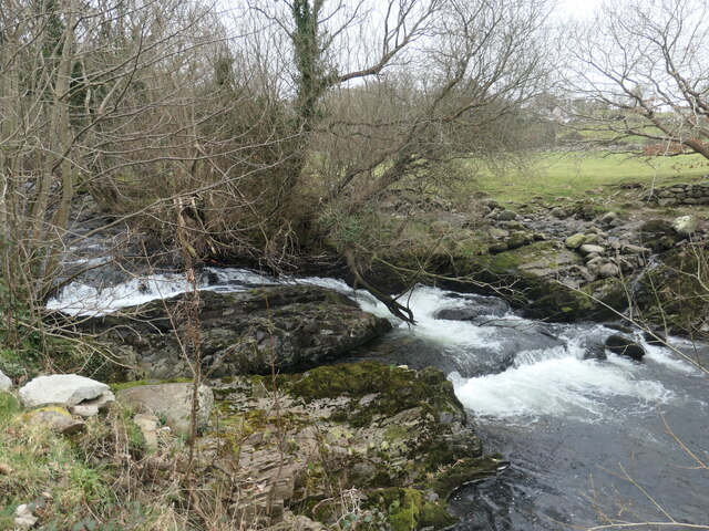
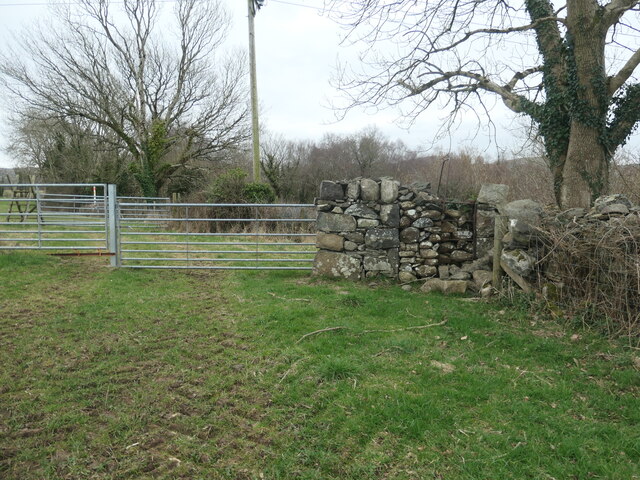
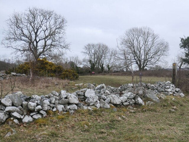
The woodland is crisscrossed by a network of footpaths, allowing visitors to explore its beauty and enjoy the peaceful surroundings. These paths provide access to different parts of the wood, including a small river that flows through it, adding to the overall charm of the area.

Allt Rhyddallt-bâch is home to a wide range of wildlife, including various bird species, mammals, and insects. The wood provides a haven for woodland birds, such as woodpeckers, nuthatches, and tawny owls, while the river supports a variety of aquatic life, including otters and fish.

The wood is also managed sustainably, with selective tree felling and replanting taking place to maintain the health and diversity of the woodland. This management ensures that the wood remains a vibrant and thriving ecosystem for future generations to enjoy.

Overall, Allt Rhyddallt-bâch is a picturesque and biodiverse wood, offering a peaceful retreat for nature lovers and a valuable habitat for a wide range of species.

If you have any feedback on the listing, please let us know in the comments section below.

Allt Rhyddallt-bâch Images

Images are sourced within 2km of 53.127482/-4.2638483 or Grid Reference SH4861. Thanks to Geograph Open Source API. All images are credited.

Cambr croes / Cross cambre Note the angle of the traffic cones compared with the upright telephone pole.
Cambr croes / Cross cambre
Note the angle of the traffic cones compared with the upright telephone pole.
Public bridleway to Bontnewydd A field edge footpath.
Public bridleway to Bontnewydd
A field edge footpath.
Giât fach mewn wal carreg sych This small gate off a bridleway leads to no path or building, just a field.
Giât fach mewn wal carreg sych
This small gate off a bridleway leads to no path or building, just a field.
Llwybr march, edrych i'r gorllewin / Bridleway, looking west Walled and hedged and becoming increasing overgrown.
Llwybr march, edrych i'r gorllewin / Bridleway, looking west
Walled and hedged and becoming increasing overgrown.
Defaid, rhai ag ŵyn / Sheep, some with lambs On the north side of the bridleway, near Bodwyn.
Defaid, rhai ag ŵyn / Sheep, some with lambs
On the north side of the bridleway, near Bodwyn.
Coeden wedi cwympo ar y llwybr / fallen tree on the path Been down for some time, looking at the wear from people climbing over it.
Coeden wedi cwympo ar y llwybr / fallen tree on the path
Been down for some time, looking at the wear from people climbing over it.
Giât ar y llwybr / Gate on the path A kissing gate on a public bridleway.
Giât ar y llwybr / Gate on the path
A kissing gate on a public bridleway.
Camfa a giât ger y porthdy / Stile and gate near the lodge On a public bridleway. The steps are narrow but very secure, as is the handrail at the top.
Camfa a giât ger y porthdy / Stile and gate near the lodge
On a public bridleway. The steps are narrow but very secure, as is the handrail at the top.
Rhaeadr ar yr afon Gwyrfai / Waterfall on Afon Gwyrfai The OS map surveyed in 1888 shows a wool factory upstream of here and a water-powered corn mill downstream. The farm here is called Dol Pandy - 'pandy' being Welsh for fulling mill.
Rhaeadr ar yr afon Gwyrfai / Waterfall on Afon Gwyrfai
The OS map surveyed in 1888 shows a wool factory upstream of here and a water-powered corn mill downstream. The farm here is called Dol Pandy - 'pandy' being Welsh for fulling mill.
Coed ar derfyn cae blaenorol / Trees on a former field boundary The large-scale OS maps surveyed in 1888 and 1898 show a track to Ty'n y Coed following the line of the trees. It is not shown on the map revised in 1913.
Coed ar derfyn cae blaenorol / Trees on a former field boundary
The large-scale OS maps surveyed in 1888 and 1898 show a track to Ty'n y Coed following the line of the trees. It is not shown on the map revised in 1913.
Hen gamfa fetel dros wal / Old metal stile over a wall On the public bridleway south of Bodwyn.
Hen gamfa fetel dros wal / Old metal stile over a wall
On the public bridleway south of Bodwyn.
Pont droed ar y llwybr  march / Footbridge on the bridleway The footbridge [which the OS maps] is the small slab of slate at the foot of the ladder stile.
Pont droed ar y llwybr march / Footbridge on the bridleway
The footbridge [which the OS maps] is the small slab of slate at the foot of the ladder stile.
Llwybr march ger Hendai / Bridleway near Hendai The gorse and large tree are in a ruined enclosure. On the older large-scale OS maps this was Hendai - a small building with a square enclosure. Hendai can be translated as old house, or rural house. The enclosure and the bridleway are now part of a paddock.
Llwybr march ger Hendai / Bridleway near Hendai
The gorse and large tree are in a ruined enclosure. On the older large-scale OS maps this was Hendai - a small building with a square enclosure. Hendai can be translated as old house, or rural house. The enclosure and the bridleway are now part of a paddock.
Old Milestone by A4871, South of Bontnewydd The Milestone is located roadside on the West of the road.  Parish of Bontnewydd (Gwynedd District), erected  in the 19th Century.  

Inscription reads:-   
CARNARVON / 2½M / PWLLHELI / 18 M 

Milestone Society National ID: CAE_CVPW02
Old Milestone by A4871, South of Bontnewydd
The Milestone is located roadside on the West of the road.  Parish of Bontnewydd (Gwynedd District), erected in the 19th Century.   Inscription reads:- CARNARVON / 2½M / PWLLHELI / 18 M Milestone Society National ID: CAE_CVPW02
Crossing the Gwyrfai on the Welsh Highland Railway
Grade II listed former Capel Siloam, Bontnewydd The original Siloam Methodist Chapel was built in 1840 and first rebuilt in 1877.
This building is the 1896 rebuild. Its style is an unusual combination of Baroque and Classical. 
Grade II listed in July 1997, it is now a private residence.
Grade II listed former Capel Siloam, Bontnewydd
The original Siloam Methodist Chapel was built in 1840 and first rebuilt in 1877. This building is the 1896 rebuild. Its style is an unusual combination of Baroque and Classical. Grade II listed in July 1997, it is now a private residence.
The Golden Cod, Bontnewydd Fish & chip shop located on Dol Beuno, on the edge of the A487.
The Golden Cod, Bontnewydd
Fish & chip shop located on Dol Beuno, on the edge of the A487.
Southern boundary of Bontnewydd The A487 reaches the southern boundary of Bontnewydd, a village about 3km (2 miles) south of Caernarfon. As a non Welsh speaker I was puzzled as to why the name of the village is Bontnewydd (new bridge) when several villages in South Wales are named Pontnewydd (new bridge). The explanation is that the original name was Y Bontnewydd (the new bridge), the Y causing the P to mutate to B. The Y was later dropped from the name, but the mutation remained.
Southern boundary of Bontnewydd
The A487 reaches the southern boundary of Bontnewydd, a village about 3km (2 miles) south of Caernarfon. As a non Welsh speaker I was puzzled as to why the name of the village is Bontnewydd (new bridge) when several villages in South Wales are named Pontnewydd (new bridge). The explanation is that the original name was Y Bontnewydd (the new bridge), the Y causing the P to mutate to B. The Y was later dropped from the name, but the mutation remained.
Show me another place!

Allt Rhyddallt-bâch is located at Grid Ref: SH4861 (Lat: 53.127482, Lng: -4.2638483)

Unitary Authority: Gwynedd

Police Authority: North Wales

What 3 Words

///stem.fake.reds. Near Caernarfon, Gwynedd

Nearby Locations

Allt Rhyddallt-bâch

Related Wikis

Ysbyty Eryri

Ysbyty Eryri (Welsh for 'Snowdonia Hospital') is a health facility in Lôn Parc, Caernarfon, Gwynedd, Wales. It is managed by the Betsi Cadwaladr University...

Caernarfon RFC

Caernarfon Rugby Football Club (Welsh: Clwb Rygbi Caernarfon) is a rugby union team from the town of Caernarfon, Gwynedd, North Wales. They currently play...

Caernarvon (Morfa) railway station

Caernarvon (Morfa) was the temporary western terminus of the Carnarvon and Llanberis Railway, located on the southern fringe of Caernarfon, Gwynedd, Wales...

Carnarvon (Pant) railway station

Carnarvon (Pant) was the temporary northern terminus of the Carnarvonshire Railway, located on the southern fringe of Caernarfon, Gwynedd, Wales.The line...

Nearby Amenities

Located within 500m of 53.127482,-4.2638483
Barrier: kissing_gate
Lat/Long: 53.1287231/-4.2641892
Power: pole
Lat/Long: 53.1251794/-4.2589258
Power: pole
Lat/Long: 53.1255656/-4.2581506
Power: pole
Lat/Long: 53.1258779/-4.2574962
Power: pole
Lat/Long: 53.1245468/-4.2599101
Power: pole
Lat/Long: 53.1242024/-4.2604493
Power: pole
Lat/Long: 53.1236197/-4.2613424
Waste Basket
Lat/Long: 53.1305166/-4.2682824
Waste Basket
Lat/Long: 53.1301645/-4.267235
Bench
Backrest: yes
Lat/Long: 53.1302756/-4.2675447
Bench
Lat/Long: 53.1300889/-4.2671464
Leisure: playground
Lat/Long: 53.1293671/-4.2658831
Bench
Lat/Long: 53.1291893/-4.2657758
Caernarvon (Morfa)
Historic Railway: station
Railway: site
Wikidata: Q27825941
Wikipedia: en:Caernarvon (Morfa) railway station
Lat/Long: 53.1303656/-4.2684536
Direction: WSW
Generator Method: photovoltaic
Generator Output Electricity: yes
Generator Solar Modules: 10
Generator Source: solar
Generator Type: solar_photovoltaic_panel
Location: roof
Power: generator
Lat/Long: 53.13167/-4.2630695
Bus Stop
Bus: yes
Naptan AtcoCode: 5400AWD70202
Naptan NaptanCode: gwndgdm
Public Transport: platform
Lat/Long: 53.1273179/-4.2678906
Barrier: yes
Lat/Long: 53.1304783/-4.2686706
The data included in this document is from www.openstreetmap.org. The data is made available under ODbL.

Have you been to Allt Rhyddallt-bâch?

Leave your review of Allt Rhyddallt-bâch below (or comments, questions and feedback).