Burlorne Tregoos

Settlement in Cornwall

England

Burlorne Tregoos

Camel Trail beside the river in Gaff Wood The National Cycle Network is a network of cycle routes. It was created by the charity Sustrans <span class="nowrap"><a title="http://www.sustrans.org.uk/what-we-do/national-cycle-network" rel="nofollow ugc noopener" href="http://www.sustrans.org.uk/what-we-do/national-cycle-network">Link</a><img style="margin-left:2px;" alt="External link" title="External link - shift click to open in new window" src="https://s1.geograph.org.uk/img/external.png" width="10" height="10"/></span>  (Sustainable Transport), aided by a National Lottery grant.

Many routes aim to minimise contact with motor traffic, though 70% of them are on roads. In some cases the NCN uses pedestrian routes, disused railways, minor roads, canal towpaths, or traffic-calmed routes in towns and cities.
Camel Trail beside the river in Gaff Wood Credit: David Smith

Burlorne Tregoos is a small village located in the county of Cornwall, England. Situated in the rural landscape of the North Cornwall District, it is nestled amidst the picturesque countryside and rolling hills that characterize the region. The village is surrounded by lush green fields and offers stunning views of the nearby Atlantic Ocean.

With a population of around 300 residents, Burlorne Tregoos exudes a charming and tranquil atmosphere, making it an ideal destination for those seeking a peaceful retreat. The village is characterized by its traditional architecture, featuring a mix of charming cottages and historic buildings that showcase the area's rich heritage.

Although small in size, Burlorne Tregoos offers a range of amenities to its residents and visitors. The village is home to a local pub, providing a cozy spot for locals to gather and visitors to enjoy a taste of the region's hospitality. Additionally, there are a few small shops catering to basic needs.

Nature enthusiasts will find plenty to explore in and around Burlorne Tregoos. The village serves as a gateway to the stunning North Cornwall coast, famous for its rugged cliffs, sandy beaches, and dramatic seascapes. It is also within close proximity to the Cornwall Area of Outstanding Natural Beauty, offering opportunities for hiking, cycling, and wildlife spotting.

Overall, Burlorne Tregoos offers a serene and idyllic setting, making it a haven for those seeking tranquility amidst the beautiful Cornish countryside.

If you have any feedback on the listing, please let us know in the comments section below.

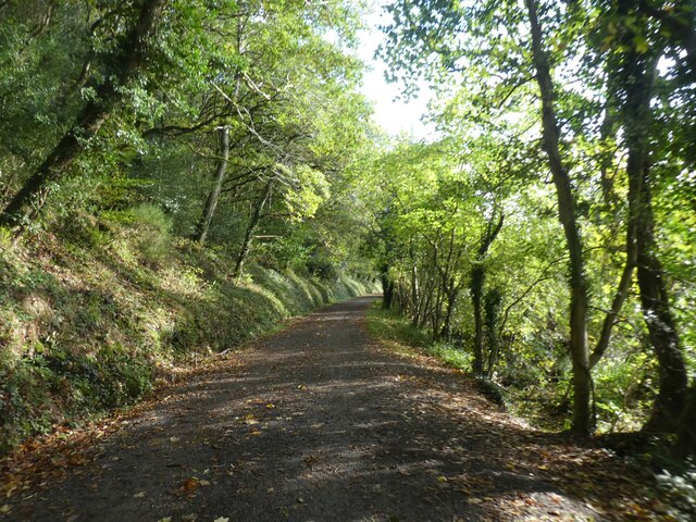
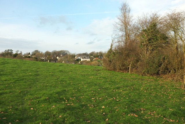
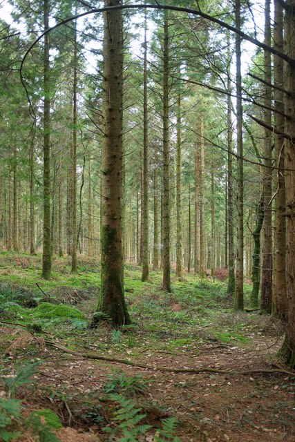
Burlorne Tregoos Images

Images are sourced within 2km of 50.486935/-4.8066502 or Grid Reference SX0169. Thanks to Geograph Open Source API. All images are credited.

Camel Trail beside the river in Gaff Wood The National Cycle Network is a network of cycle routes. It was created by the charity Sustrans <span class="nowrap"><a title="http://www.sustrans.org.uk/what-we-do/national-cycle-network" rel="nofollow ugc noopener" href="http://www.sustrans.org.uk/what-we-do/national-cycle-network">Link</a><img style="margin-left:2px;" alt="External link" title="External link - shift click to open in new window" src="https://s1.geograph.org.uk/img/external.png" width="10" height="10"/></span>  (Sustainable Transport), aided by a National Lottery grant.

Many routes aim to minimise contact with motor traffic, though 70% of them are on roads. In some cases the NCN uses pedestrian routes, disused railways, minor roads, canal towpaths, or traffic-calmed routes in towns and cities.
Camel Trail beside the river in Gaff Wood
The National Cycle Network is a network of cycle routes. It was created by the charity Sustrans LinkExternal link (Sustainable Transport), aided by a National Lottery grant. Many routes aim to minimise contact with motor traffic, though 70% of them are on roads. In some cases the NCN uses pedestrian routes, disused railways, minor roads, canal towpaths, or traffic-calmed routes in towns and cities.
Camel Trail north of Bishop's Wood The National Cycle Network is a network of cycle routes. It was created by the charity Sustrans <span class="nowrap"><a title="http://www.sustrans.org.uk/what-we-do/national-cycle-network" rel="nofollow ugc noopener" href="http://www.sustrans.org.uk/what-we-do/national-cycle-network">Link</a><img style="margin-left:2px;" alt="External link" title="External link - shift click to open in new window" src="https://s1.geograph.org.uk/img/external.png" width="10" height="10"/></span>  (Sustainable Transport), aided by a National Lottery grant.

Many routes aim to minimise contact with motor traffic, though 70% of them are on roads. In some cases the NCN uses pedestrian routes, disused railways, minor roads, canal towpaths, or traffic-calmed routes in towns and cities.
Camel Trail north of Bishop's Wood
The National Cycle Network is a network of cycle routes. It was created by the charity Sustrans LinkExternal link (Sustainable Transport), aided by a National Lottery grant. Many routes aim to minimise contact with motor traffic, though 70% of them are on roads. In some cases the NCN uses pedestrian routes, disused railways, minor roads, canal towpaths, or traffic-calmed routes in towns and cities.
Camel Trail in Gaff Wood The National Cycle Network is a network of cycle routes. It was created by the charity Sustrans <span class="nowrap"><a title="http://www.sustrans.org.uk/what-we-do/national-cycle-network" rel="nofollow ugc noopener" href="http://www.sustrans.org.uk/what-we-do/national-cycle-network">Link</a><img style="margin-left:2px;" alt="External link" title="External link - shift click to open in new window" src="https://s1.geograph.org.uk/img/external.png" width="10" height="10"/></span>  (Sustainable Transport), aided by a National Lottery grant.

Many routes aim to minimise contact with motor traffic, though 70% of them are on roads. In some cases the NCN uses pedestrian routes, disused railways, minor roads, canal towpaths, or traffic-calmed routes in towns and cities.
Camel Trail in Gaff Wood
The National Cycle Network is a network of cycle routes. It was created by the charity Sustrans LinkExternal link (Sustainable Transport), aided by a National Lottery grant. Many routes aim to minimise contact with motor traffic, though 70% of them are on roads. In some cases the NCN uses pedestrian routes, disused railways, minor roads, canal towpaths, or traffic-calmed routes in towns and cities.
River Camel
River Camel
Track, Hustyn Wood A track through the upper, southwestern, part of the access wood. <a href="https://www.geograph.org.uk/photo/5431783">SW9968 : End of the track, Hustyn Wood</a> looks in the other direction from here.
Track, Hustyn Wood
A track through the upper, southwestern, part of the access wood. SW9968 : End of the track, Hustyn Wood looks in the other direction from here.
Field, Burlawn A steep grass field crossed by footpath 534 1/1 as it descends into a deep valley.
Field, Burlawn
A steep grass field crossed by footpath 534 1/1 as it descends into a deep valley.
Approaching Burlawn Looking up the field that <a href="https://www.geograph.org.uk/photo/5431038">SW9969 : Field, Burlawn</a> looks down, with footpath 534 1/1 heading for a concealed gate into the houses.
Approaching Burlawn
Looking up the field that SW9969 : Field, Burlawn looks down, with footpath 534 1/1 heading for a concealed gate into the houses.
Path to Hustyn Mill Footpath 534 1/1 runs across this grass field whose eastern edge loops in and out above steep woodland. The path is about to plunge down through woodland into that valley ahead.
Path to Hustyn Mill
Footpath 534 1/1 runs across this grass field whose eastern edge loops in and out above steep woodland. The path is about to plunge down through woodland into that valley ahead.
Towards Burlawn Looking in the opposite direction from where <a href="https://www.geograph.org.uk/photo/5431123">SW9969 : Path to Hustyn Mill</a> was taken, along the course of footpath 534 1/1.
Towards Burlawn
Looking in the opposite direction from where SW9969 : Path to Hustyn Mill was taken, along the course of footpath 534 1/1.
Towards Burlawn A similar image to <a href="https://www.geograph.org.uk/photo/5431279">SW9969 : Towards Burlawn</a>, but taken further south. Why all these photos of one field <a title="https://www.geograph.org.uk/search.php?i=72696356" href="https://www.geograph.org.uk/search.php?i=72696356">Link</a> ? Well, the sun had nearly come out.
Towards Burlawn
A similar image to SW9969 : Towards Burlawn, but taken further south. Why all these photos of one field Link ? Well, the sun had nearly come out.
Gate between fields, Burlawn From the same spot as <a href="https://www.geograph.org.uk/photo/5431460">SW9969 : Towards Burlawn</a>, looking right. Across the valley is Hustyn Wood.
Gate between fields, Burlawn
From the same spot as SW9969 : Towards Burlawn, looking right. Across the valley is Hustyn Wood.
Field above Mill Pool Wood Taken from footpath 534 1/1 just before it leaves the field to plunge down through the wood, behind the camera.
Field above Mill Pool Wood
Taken from footpath 534 1/1 just before it leaves the field to plunge down through the wood, behind the camera.
Path to Hustyn Mill Footpath 534 1/1 drops steeply through Mill Pool Wood. I went flying here, tripping over a small tree stump at about the spot shown. No harm done except to composure.
Path to Hustyn Mill
Footpath 534 1/1 drops steeply through Mill Pool Wood. I went flying here, tripping over a small tree stump at about the spot shown. No harm done except to composure.
Coniferous woodland, Hustyn Wood On the upper slopes of the access woodland, and from the same spot as <a href="https://www.geograph.org.uk/photo/5431775">SW9968 : Track, Hustyn Wood</a>.
Coniferous woodland, Hustyn Wood
On the upper slopes of the access woodland, and from the same spot as SW9968 : Track, Hustyn Wood.
Track, Hustyn Wood Further along the track shown in <a href="https://www.geograph.org.uk/photo/5431633">SX0068 : Track, Hustyn Wood</a>, and from where <a href="https://www.geograph.org.uk/photo/5431644">SW9968 : Coniferous woodland, Hustyn Wood</a> looks left.
Track, Hustyn Wood
Further along the track shown in SX0068 : Track, Hustyn Wood, and from where SW9968 : Coniferous woodland, Hustyn Wood looks left.
End of the track, Hustyn Wood The track shown in <a href="https://www.geograph.org.uk/photo/5431775">SW9968 : Track, Hustyn Wood</a> seems to peter out here, high on the wooded hillside. <a href="https://www.geograph.org.uk/photo/5262751">SW9968 : Track, Hustyn Wood</a> looks behind the camera.
End of the track, Hustyn Wood
The track shown in SW9968 : Track, Hustyn Wood seems to peter out here, high on the wooded hillside. SW9968 : Track, Hustyn Wood looks behind the camera.
Camel Trail in Cottonwoods The National Cycle Network is a network of cycle routes. It was created by the charity Sustrans <span class="nowrap"><a title="http://www.sustrans.org.uk/what-we-do/national-cycle-network" rel="nofollow ugc noopener" href="http://www.sustrans.org.uk/what-we-do/national-cycle-network">Link</a><img style="margin-left:2px;" alt="External link" title="External link - shift click to open in new window" src="https://s1.geograph.org.uk/img/external.png" width="10" height="10"/></span>  (Sustainable Transport), aided by a National Lottery grant.

Many routes aim to minimise contact with motor traffic, though 70% of them are on roads. In some cases the NCN uses pedestrian routes, disused railways, minor roads, canal towpaths, or traffic-calmed routes in towns and cities.
Camel Trail in Cottonwoods
The National Cycle Network is a network of cycle routes. It was created by the charity Sustrans LinkExternal link (Sustainable Transport), aided by a National Lottery grant. Many routes aim to minimise contact with motor traffic, though 70% of them are on roads. In some cases the NCN uses pedestrian routes, disused railways, minor roads, canal towpaths, or traffic-calmed routes in towns and cities.
Camel Trail south-west of Denby The National Cycle Network is a network of cycle routes. It was created by the charity Sustrans <span class="nowrap"><a title="http://www.sustrans.org.uk/what-we-do/national-cycle-network" rel="nofollow ugc noopener" href="http://www.sustrans.org.uk/what-we-do/national-cycle-network">Link</a><img style="margin-left:2px;" alt="External link" title="External link - shift click to open in new window" src="https://s1.geograph.org.uk/img/external.png" width="10" height="10"/></span>  (Sustainable Transport), aided by a National Lottery grant.

Many routes aim to minimise contact with motor traffic, though 70% of them are on roads. In some cases the NCN uses pedestrian routes, disused railways, minor roads, canal towpaths, or traffic-calmed routes in towns and cities.
Camel Trail south-west of Denby
The National Cycle Network is a network of cycle routes. It was created by the charity Sustrans LinkExternal link (Sustainable Transport), aided by a National Lottery grant. Many routes aim to minimise contact with motor traffic, though 70% of them are on roads. In some cases the NCN uses pedestrian routes, disused railways, minor roads, canal towpaths, or traffic-calmed routes in towns and cities.
Show me another place!

Burlorne Tregoos is located at Grid Ref: SX0169 (Lat: 50.486935, Lng: -4.8066502)

Unitary Authority: Cornwall

Police Authority: Devon and Cornwall

What 3 Words

///party.palace.lakeside. Near Wadebridge, Cornwall

Related Wikis

Burlorne Tregoose

Burlorne Tregoose (Cornish: Boslowen Tregoos, meaning woodland farm of the happy dwelling) is a hamlet in the parish of St Breock, Cornwall, England, UK...

Brocton, Cornwall

Brocton is a hamlet in the parish of St Breock, Cornwall, England, UK. == References ==

Polbrock

Polbrock (Cornish: Polbrogh, meaning badger's pool) is a small hamlet in north Cornwall, England, United Kingdom. It is situated two miles southeast of...

Burlorne Pillow

Burlorne Pillow (Cornish: Boslowenpolbrogh, meaning "badger's pool at Burlorne") is a hamlet in the civil parish of Egloshayle, north Cornwall, England...

Nearby Amenities

Located within 500m of 50.486935,-4.8066502
Post Box
Operator: Royal Mail
Operator Wikidata: Q638098
Post Box Type: lamp
Ref: PL30 127
Royal Cypher: EIIR
Royal Cypher Wikidata: Q33102113
Lat/Long: 50.4844641/-4.8039275
The data included in this document is from www.openstreetmap.org. The data is made available under ODbL.

Have you been to Burlorne Tregoos?

Leave your review of Burlorne Tregoos below (or comments, questions and feedback).