Cae Gors Bach

Wood, Forest in Caernarfonshire

Wales

Cae Gors Bach

Mynydd Cennin Parking to WNW near forest track. Just one tricky wall to get over before locating trig.
Name: Mynydd Cennin
Hill number: 5145
Height: 262m / 860ft
Area: 30A: Anglesey and the Lleyn Peninsula
Class: Hu
Grid ref: SH 45845 44968
Summit feature: trig point
Drop: 105m
Col: 157m  SH447452
Mynydd Cennin Credit: Rude Health

Cae Gors Bach, located in Caernarfonshire, Wales, is a picturesque woodland area that spans across a sprawling 200 acres. Nestled in the heart of Snowdonia National Park, this enchanting forest is a haven for nature enthusiasts and offers a tranquil escape from the hustle and bustle of everyday life.

The woodland is predominantly made up of native Welsh trees, including oak, ash, and birch, which form a dense canopy overhead. The forest floor is covered in a rich carpet of mosses, lichens, and ferns, creating a vibrant and diverse ecosystem. The area is also home to an array of wildlife, such as red squirrels, badgers, and various species of birds.

Cae Gors Bach is crisscrossed by a network of well-maintained footpaths, allowing visitors to explore the woodland at their own pace. The paths wind their way through towering trees, past babbling brooks, and alongside peaceful ponds, offering breathtaking views at every turn. There are also several picnic areas scattered throughout the forest, providing the perfect spot for visitors to relax and immerse themselves in the natural surroundings.

The forest is a popular destination for outdoor activities, including hiking, cycling, and birdwatching. It also serves as an educational resource, with guided nature walks and workshops available for schools and community groups. Additionally, Cae Gors Bach hosts annual events and festivals, celebrating the beauty of the natural world and promoting conservation efforts.

Overall, Cae Gors Bach is a captivating woodland retreat, offering visitors the chance to reconnect with nature and experience the tranquility of the Welsh countryside.

If you have any feedback on the listing, please let us know in the comments section below.

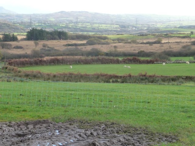
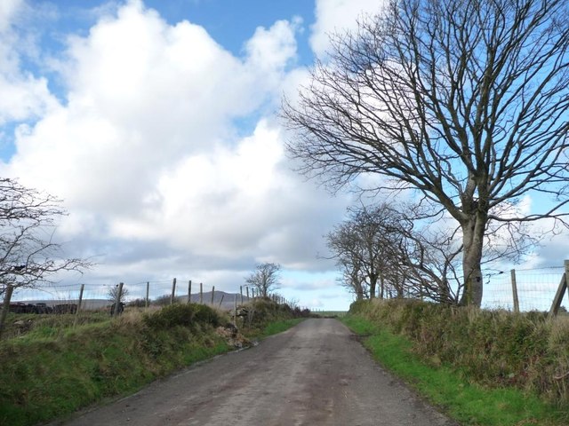
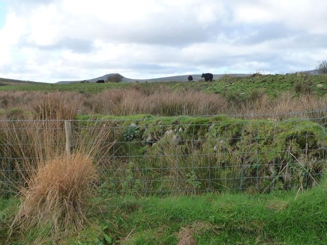
Cae Gors Bach Images

Images are sourced within 2km of 52.982332/-4.30915 or Grid Reference SH4545. Thanks to Geograph Open Source API. All images are credited.

Mynydd Cennin Parking to WNW near forest track. Just one tricky wall to get over before locating trig.
Name: Mynydd Cennin
Hill number: 5145
Height: 262m / 860ft
Area: 30A: Anglesey and the Lleyn Peninsula
Class: Hu
Grid ref: SH 45845 44968
Summit feature: trig point
Drop: 105m
Col: 157m  SH447452
Mynydd Cennin
Parking to WNW near forest track. Just one tricky wall to get over before locating trig. Name: Mynydd Cennin Hill number: 5145 Height: 262m / 860ft Area: 30A: Anglesey and the Lleyn Peninsula Class: Hu Grid ref: SH 45845 44968 Summit feature: trig point Drop: 105m Col: 157m SH447452
The road to Llwyngwnadl Looking north-east at the entrance to Ty'n y Gors.
The road to Llwyngwnadl
Looking north-east at the entrance to Ty'n y Gors.
Tyn y Gors - Ar Werth [Marsh House - For Sale] The spelling used locally is different from that mapped by the OS.
Tyn y Gors - Ar Werth [Marsh House - For Sale]
The spelling used locally is different from that mapped by the OS.
Farmland east of Tyn y Gors On the west side of the road to Llwyngwnadl.
Farmland east of Tyn y Gors
On the west side of the road to Llwyngwnadl.
Stacks of bales near Terfynau On the east side of the minor road from Bwlch-Derwin.
Stacks of bales near Terfynau
On the east side of the minor road from Bwlch-Derwin.
Sheep pasture south of Terfynau The valley bottom is unimproved, but the slopes support sheep.
Sheep pasture south of Terfynau
The valley bottom is unimproved, but the slopes support sheep.
The track to Terfynau Running east from the minor road from Bwlch-Derwin.
The track to Terfynau
Running east from the minor road from Bwlch-Derwin.
Y Foel [The bare mountain] With a spot-heighted summit of 218 metres above sea level, it is the highest ground in this kilometre square.
Y Foel [The bare mountain]
With a spot-heighted summit of 218 metres above sea level, it is the highest ground in this kilometre square.
Trees along the road to Bwlch-Derwin Looking northwards.
Trees along the road to Bwlch-Derwin
Looking northwards.
Low wall in cattle pasture, west of Terfynau Overgrown, redundant and only shown on smaller scale maps.
Low wall in cattle pasture, west of Terfynau
Overgrown, redundant and only shown on smaller scale maps.
Farmland east of Ty'r Dewin Looking south-east from the minor road.
Farmland east of Ty'r Dewin
Looking south-east from the minor road.
Scrubby woodland on the valley floor East of Ty'r Dewin, along a tributary of Afon Dwyfach.
Scrubby woodland on the valley floor
East of Ty'r Dewin, along a tributary of Afon Dwyfach.
Farm track running east from Ty'r Dewin Dropping down to the scrubby valley floor.
Farm track running east from Ty'r Dewin
Dropping down to the scrubby valley floor.
Sheep pasture between Ty'r Dewin and Terfynau On the east side of the minor road.
Sheep pasture between Ty'r Dewin and Terfynau
On the east side of the minor road.
The road to Bwlch-Derwin, heading north towards Y Foel Seen from a 162 metre spot height.
The road to Bwlch-Derwin, heading north towards Y Foel
Seen from a 162 metre spot height.
The entrance to Ty'r Dewin On the west side of a minor road at the 162 metre spot height.
The entrance to Ty'r Dewin
On the west side of a minor road at the 162 metre spot height.
Fenced farmland south of Pen Sarn Looking north-east from the road to Llecheiddior.
Fenced farmland south of Pen Sarn
Looking north-east from the road to Llecheiddior.
Southern entrance to Pen Sarn The fence just inside the gate is made from pallets.
Southern entrance to Pen Sarn
The fence just inside the gate is made from pallets.
Show me another place!

Cae Gors Bach is located at Grid Ref: SH4545 (Lat: 52.982332, Lng: -4.30915)

Unitary Authority: Gwynedd

Police Authority: North Wales

What 3 Words

///parsnips.drags.bandage. Near Penygroes, Gwynedd

Nearby Locations

Cae Gors Bach

Related Wikis

Caernarfon (Assembly constituency)

Caernarfon was a constituency of the National Assembly for Wales from 1999 to 2007. It was one of nine constituencies in the North Wales electoral region...

Caernarfon (UK Parliament constituency)

Caernarfon was a parliamentary constituency centred on the town of Caernarfon in Wales. It elected one Member of Parliament (MP) by the first past the...

Battle of Bryn Derwin

The Battle of Bryn Derwin was fought in Eifionydd, Gwynedd on June 1255, between Llywelyn ap Gruffudd and his brothers, Dafydd ap Gruffudd and Owain Goch...

Pen Llystyn

Pen Llystyn, sometimes referred to as Pen Llys Tyn, was a Roman fort located to the north of Bryncir, between Porthmadog and Caernarfon in Gwynedd, north...

Have you been to Cae Gors Bach?

Leave your review of Cae Gors Bach below (or comments, questions and feedback).