Allt Cwmcerwyni

Wood, Forest in Carmarthenshire

Wales

Allt Cwmcerwyni

Track to Pantydriw
Track to Pantydriw Credit: Alan Hughes

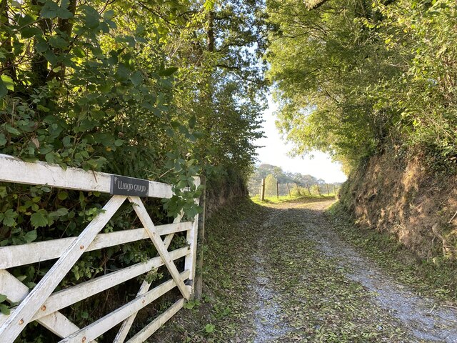
Allt Cwmcerwyni is a picturesque woodland located in Carmarthenshire, Wales. Spread over an area of approximately 100 hectares, it is known for its diverse flora and fauna, making it a popular destination for nature enthusiasts and hikers alike.

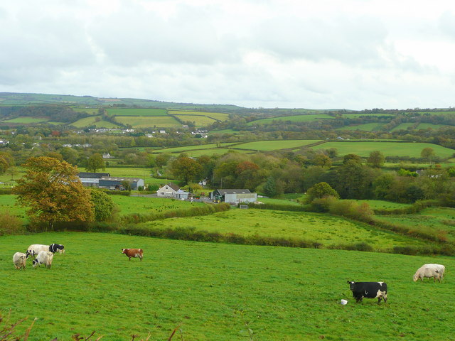
The woodland is situated on the slopes of the Cwmcerwyni Valley, offering breathtaking views of the surrounding hills and valleys. It is predominantly composed of deciduous trees, including oak, beech, and birch, which create a vibrant and colorful environment throughout the year. The forest floor is rich with mosses, ferns, and wildflowers, adding to the natural beauty of the area.

Allt Cwmcerwyni is home to a variety of wildlife species, making it an important habitat for conservation. Visitors may come across red squirrels, badgers, and numerous species of birds, including woodpeckers and owls. The peaceful atmosphere of the woodland provides a perfect opportunity for birdwatching and wildlife photography.

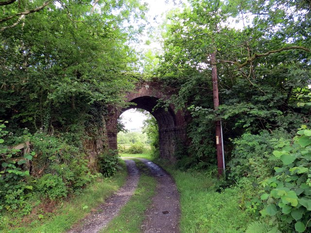
There are several well-maintained walking trails that traverse the woodland, allowing visitors to explore its beauty at their own pace. These trails offer a range of difficulty levels, catering to both casual walkers and experienced hikers. Along the way, there are benches and picnic spots where visitors can take a break and enjoy the serene surroundings.

Allt Cwmcerwyni is managed by the local authorities, who ensure the preservation of its natural integrity. They organize educational programs and guided walks to raise awareness about the importance of conservation and sustainable practices.

Overall, Allt Cwmcerwyni is a hidden gem in Carmarthenshire, offering a peaceful and picturesque retreat for those seeking a connection with nature.

If you have any feedback on the listing, please let us know in the comments section below.

Allt Cwmcerwyni Images

Images are sourced within 2km of 51.932115/-4.3028268 or Grid Reference SN4128. Thanks to Geograph Open Source API. All images are credited.

Track to Pantydriw
Track to Pantydriw
Gated entrance to Llwyn Gwyn
Glasfryn Cerddwyr yn dilyn heol fach i gyfeiriad anhedd-dy o'r enw Glasfryn.

Walkers following a minor road in the direction of a property known as Glasfryn (trans. greenhill).
Glasfryn
Cerddwyr yn dilyn heol fach i gyfeiriad anhedd-dy o'r enw Glasfryn. Walkers following a minor road in the direction of a property known as Glasfryn (trans. greenhill).
Llwybr Pantydriw Path Llwybr cyhoeddus a thrac yn mynd o dan bont a arferai gludo Rheilffordd Caerfyrddin i Aberystwyth. Caewyd y lein gan yr anenwog y Ddr Beeching yn 1965. Mae 'na obeithion y bydd hi'n cael ei hailagor. 

A public footpath and a track approaching a bridge which formerly carried the Carmarthen to Aberystwyth Railway line. Closed in 1965 by the infamous Dr Beeching there are hopes that the line will reopen.
Llwybr Pantydriw Path
Llwybr cyhoeddus a thrac yn mynd o dan bont a arferai gludo Rheilffordd Caerfyrddin i Aberystwyth. Caewyd y lein gan yr anenwog y Ddr Beeching yn 1965. Mae 'na obeithion y bydd hi'n cael ei hailagor. A public footpath and a track approaching a bridge which formerly carried the Carmarthen to Aberystwyth Railway line. Closed in 1965 by the infamous Dr Beeching there are hopes that the line will reopen.
Llwybr Pantydriw Path Sticil ar lwybr cyhoeddus ger Ffarm Pantydriw.

A stile on a public footpath near Pantydriw Farm (trans. druids'? hollow)
Llwybr Pantydriw Path
Sticil ar lwybr cyhoeddus ger Ffarm Pantydriw. A stile on a public footpath near Pantydriw Farm (trans. druids'? hollow)
Hen bont reilffordd / Disused railway bridge Hen bont reilffordd yn rhychwantu Afon Gwili. Dyma hen lein Caerfyrddin i Aberystwyth a gaewyd dan bwyell anenwog Beeching yn 1965 - twpdra o'r radd flaenaf. Mae'r trac yn eiddo i Reilffordd Gwili a'r gobaith yw ehangu'r line mor bell â Llanpumsaint yn y dyfodol.

A disused railway bridge spanning Afon Gwili. This is the former Carmarthen-Aberystwyth line which closed in 1965 by the infamous Beeching axe - an act of utter stupidity! The track belongs to the Gwili Railway and it hopes to extend the line as far as Llanpumsaint in the future.
Hen bont reilffordd / Disused railway bridge
Hen bont reilffordd yn rhychwantu Afon Gwili. Dyma hen lein Caerfyrddin i Aberystwyth a gaewyd dan bwyell anenwog Beeching yn 1965 - twpdra o'r radd flaenaf. Mae'r trac yn eiddo i Reilffordd Gwili a'r gobaith yw ehangu'r line mor bell â Llanpumsaint yn y dyfodol. A disused railway bridge spanning Afon Gwili. This is the former Carmarthen-Aberystwyth line which closed in 1965 by the infamous Beeching axe - an act of utter stupidity! The track belongs to the Gwili Railway and it hopes to extend the line as far as Llanpumsaint in the future.
Pastoral scene Looking south over the rich grazing of Carmarthenshire near Llanpumsaint.
Pastoral scene
Looking south over the rich grazing of Carmarthenshire near Llanpumsaint.
Homemade sign near Pencilgan Farm
Fields Taken from SN 420 268.
Fields
Taken from SN 420 268.
Ffos-y-maen Looking up the lane to Ffos-y-maen.
Ffos-y-maen
Looking up the lane to Ffos-y-maen.
Junction Looking south to the junction at SN 416 288.
Junction
Looking south to the junction at SN 416 288.
Railway Bridge Disused railway bridge.
Railway Bridge
Disused railway bridge.
Chapel A chapel in Llanpumpsaint SN 415 294.
Chapel
A chapel in Llanpumpsaint SN 415 294.
Gwili View
Gwili View
Gwili View The Gwili River Valley at Pontarsais
Gwili View
The Gwili River Valley at Pontarsais
Uwch Gwili Bwthyn gyda gardd drawiadol o'i flaen.
A modern cottage with an impressive garden in front of it.
Uwch Gwili
Bwthyn gyda gardd drawiadol o'i flaen. A modern cottage with an impressive garden in front of it.
View over the Gwili valley Looking south-east from Henfryn across the heart of Carmarthenshire.
View over the Gwili valley
Looking south-east from Henfryn across the heart of Carmarthenshire.
Field on Allt Glan-Gwili Looking northwest from the top of the hill near the road, towards Llanpumpsaint.
Field on Allt Glan-Gwili
Looking northwest from the top of the hill near the road, towards Llanpumpsaint.
Show me another place!

Allt Cwmcerwyni is located at Grid Ref: SN4128 (Lat: 51.932115, Lng: -4.3028268)

Unitary Authority: Carmarthenshire

Police Authority: Dyfed Powys

What 3 Words

///elaborate.barrel.retrial. Near Pencader, Carmarthenshire

Nearby Locations

Allt Cwmcerwyni

Related Wikis

Llanpumsaint

Llanpumsaint (; Welsh "Llan" church + "pum" five + "saint" saint(s)) is a village and community in Carmarthenshire, Wales. In the 2001 UK Census, Llanpumsaint...

Rhosydd Llanpumsaint

Rhosydd Llanpumsaint is a Site of Special Scientific Interest (SSSI) in Carmarthenshire, Wales. == SSSI == Rhosydd Llanpumsaint SSSI is located approximately...

Llanpumpsaint railway station

Llanpumpsaint was a railway station near the village of Llanpumpsaint, West Wales, serving the hamlet and the rural locale. == History == The Teifi Valley...

Pontarsais

Pontarsais is a village in Carmarthenshire, Wales, 5 miles (8 km) north of Carmarthen and 57 miles (92 km) miles northwest of Cardiff (Caerdydd). The nearest...

Nearby Amenities

Located within 500m of 51.932115,-4.3028268
Direction: 145
Generator Method: photovoltaic
Generator Output Electricity: yes
Generator Solar Modules: 4
Generator Source: solar
Generator Type: solar_photovoltaic_panel
Location: roof
Power: generator
Lat/Long: 51.9365214/-4.3030498
Direction: 145
Generator Method: photovoltaic
Generator Output Electricity: yes
Generator Solar Modules: 4
Generator Source: solar
Generator Type: solar_photovoltaic_panel
Location: roof
Power: generator
Lat/Long: 51.9365032/-4.3030921
Direction: 145
Generator Method: photovoltaic
Generator Output Electricity: yes
Generator Solar Modules: 4
Generator Source: solar
Generator Type: solar_photovoltaic_panel
Location: roof
Power: generator
Lat/Long: 51.9364792/-4.303139
Direction: 80
Generator Method: photovoltaic
Generator Output Electricity: yes
Generator Solar Modules: 7
Generator Source: solar
Generator Type: solar_photovoltaic_panel
Location: roof
Power: generator
Lat/Long: 51.9363957/-4.305042
The data included in this document is from www.openstreetmap.org. The data is made available under ODbL.

Have you been to Allt Cwmcerwyni?

Leave your review of Allt Cwmcerwyni below (or comments, questions and feedback).