Allt Penllwyniorwg

Wood, Forest in Carmarthenshire

Wales

Allt Penllwyniorwg

Danycoed Halt The view of the Halt on the Gwili Preserved Railway.
Danycoed Halt Credit: Gordon Griffiths

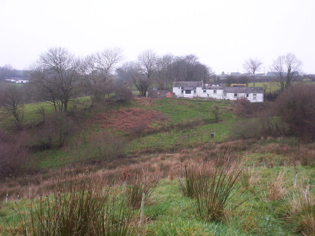
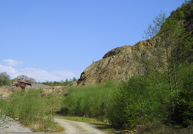
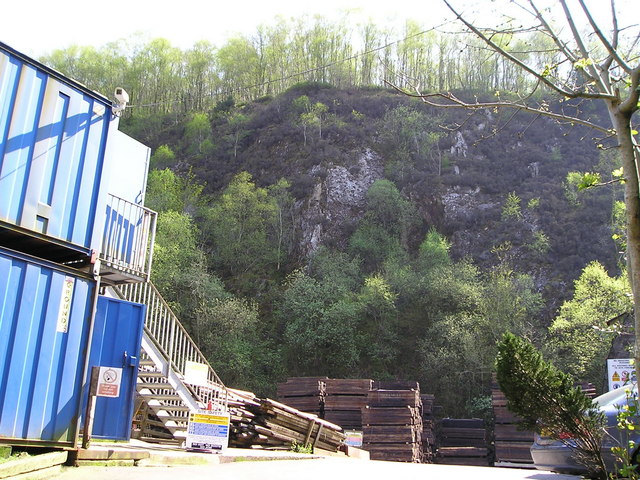
Allt Penllwyniorwg is a picturesque wood located in the county of Carmarthenshire, Wales. Spanning an area of approximately 200 acres, it is a charming forest that offers a peaceful retreat for nature enthusiasts and hikers alike.

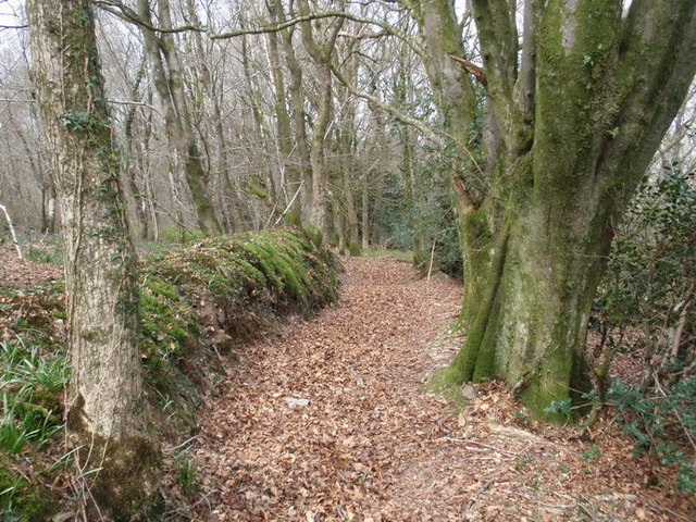
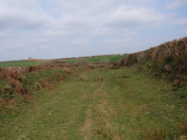
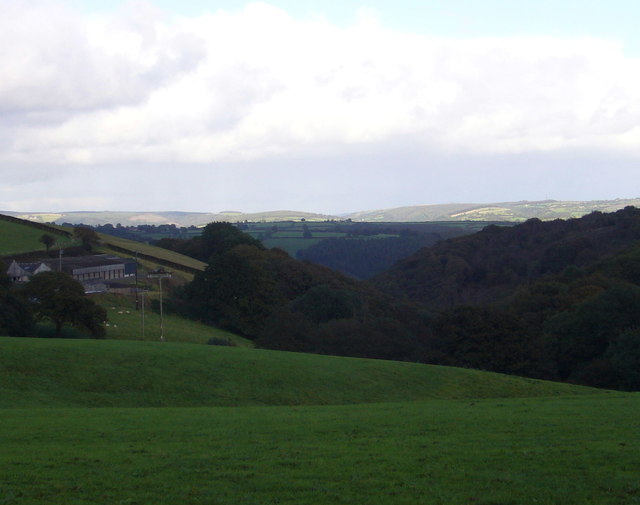
The wood is situated on a steep hillside, providing visitors with breathtaking views of the surrounding countryside. It is predominantly composed of native broadleaf trees, including oak, beech, and ash, which create a diverse and vibrant ecosystem. The forest floor is covered in a lush carpet of ferns, bluebells, and wildflowers, adding to its natural beauty.

The wood is home to a variety of wildlife, including red squirrels, badgers, and a wide range of bird species. Birdwatchers can spot woodpeckers, nuthatches, and various songbirds while exploring the forest trails.

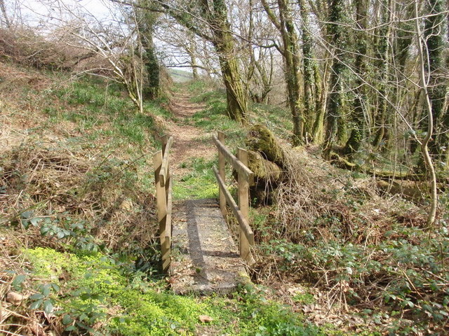
There are several well-marked paths that wind their way through the wood, catering to different levels of fitness and ability. These paths provide visitors with the opportunity to explore the forest at their own pace, immersing themselves in the tranquility of nature. Along the way, there are seating areas and picnic spots where one can take a break and enjoy the peaceful surroundings.

Allt Penllwyniorwg is a popular destination for families, walkers, and nature lovers, offering a chance to reconnect with the natural world and escape the hustle and bustle of everyday life. Whether it's a leisurely stroll or a more challenging hike, this wood has something to offer everyone who appreciates the beauty and serenity of a well-preserved forest.

If you have any feedback on the listing, please let us know in the comments section below.

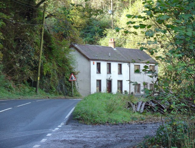
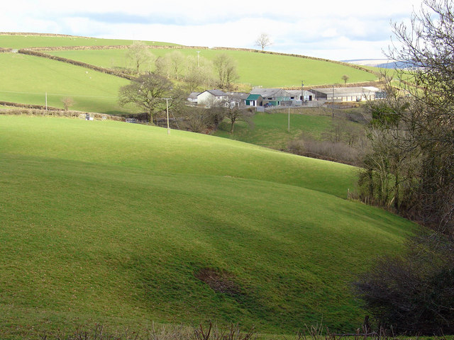
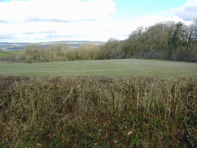
Allt Penllwyniorwg Images

Images are sourced within 2km of 51.909345/-4.3380102 or Grid Reference SN3926. Thanks to Geograph Open Source API. All images are credited.

Danycoed Halt The view of the Halt on the Gwili Preserved Railway.
Danycoed Halt
The view of the Halt on the Gwili Preserved Railway.
Hen heol Cwmdwyfran old road Cerddwyr yn dilyn hen heol heb darmac o Ffarm Foel Isaf hyd at bentref Cwmdwyfran

Walkers following an unsurfaced road from Foel Isaf Farm (trans. lower farm of the bare hill) to the village of Cwmdwyfran (trans. valley of the two crow streams)
Hen heol Cwmdwyfran old road
Cerddwyr yn dilyn hen heol heb darmac o Ffarm Foel Isaf hyd at bentref Cwmdwyfran Walkers following an unsurfaced road from Foel Isaf Farm (trans. lower farm of the bare hill) to the village of Cwmdwyfran (trans. valley of the two crow streams)
Cwm Tawel Woods, Cwmdwyfran Llwybr cyhoeddus yng Nghoed Cwm Tawel. A'r llwybr o Glwb Golff Caerfyrddin i lawr yr allt at yr A484 gerllaw cyn dafarn y Rock & Fountain 

Public footpath in Cwm Tawel Woods. The path commences from Carmarthen Golf Club and descends through the woods towards the A484 and the former Rock and Fountain Public House
Cwm Tawel Woods, Cwmdwyfran
Llwybr cyhoeddus yng Nghoed Cwm Tawel. A'r llwybr o Glwb Golff Caerfyrddin i lawr yr allt at yr A484 gerllaw cyn dafarn y Rock & Fountain Public footpath in Cwm Tawel Woods. The path commences from Carmarthen Golf Club and descends through the woods towards the A484 and the former Rock and Fountain Public House
Llwybr ceffyl Ty'r Eglwys / Ty'r Eglwys bridleway Llwybr ceffyl dymunol gerllaw Ffarm Ty'r Eglwys, Llannewydd.

A fine bridleway near Ty'r Eglwys Farm (trans. Church House), Newchurch.
Llwybr ceffyl Ty'r Eglwys / Ty'r Eglwys bridleway
Llwybr ceffyl dymunol gerllaw Ffarm Ty'r Eglwys, Llannewydd. A fine bridleway near Ty'r Eglwys Farm (trans. Church House), Newchurch.
Cwm Tawel Llwybr cyhoeddus ym mhen uchaf Cwm Tawel nid nepell o Lannewydd

Public footpath at the higher end of Cwm Tawel (trans. quiet valley) near Newchurch.
Cwm Tawel
Llwybr cyhoeddus ym mhen uchaf Cwm Tawel nid nepell o Lannewydd Public footpath at the higher end of Cwm Tawel (trans. quiet valley) near Newchurch.
Blaen-ffrwd, Eglwysnewydd Blaen-ffrwd farm is on the left. See also <a href="https://www.geograph.org.uk/photo/1185512">SN3725 : Blaen-ffrwd, Eglwysnewydd</a> viewed from about the same point.
Blaen-ffrwd, Eglwysnewydd
Blaen-ffrwd farm is on the left. See also SN3725 : Blaen-ffrwd, Eglwysnewydd viewed from about the same point.
Conwil station remains, 1992 View southward, towards Carmarthen: ex-Great Western Carmarthen - Aberystwyth line, closed 22/2/65. (See also <a href="https://www.geograph.org.uk/photo/2040575">SN3826 : Conwil Station, from train</a>).
Conwil station remains, 1992
View southward, towards Carmarthen: ex-Great Western Carmarthen - Aberystwyth line, closed 22/2/65. (See also SN3826 : Conwil Station, from train).
Misty along the A484 heading for Cynwyl Elfed A misty view of the A484 heading for Cynwyl Elfed viewed from the entrance to the garage and fuel filling station.
Misty along the A484 heading for Cynwyl Elfed
A misty view of the A484 heading for Cynwyl Elfed viewed from the entrance to the garage and fuel filling station.
Triangulation Pillar (S2339) Newchurch Secondary Triangulation Pillar carries Flush Bracket S2339 which marks a point 238.223m above mean sea level.
Triangulation Pillar (S2339)
Newchurch Secondary Triangulation Pillar carries Flush Bracket S2339 which marks a point 238.223m above mean sea level.
Llwybr Ty'r Eglwys / Ty'r Eglwys path Llwybr ceffyl yn agosau at Ffarm Ty'r Eglwys.

Bridleway approaching Ty'r Eglwys Farm (trans. church house).
Llwybr Ty'r Eglwys / Ty'r Eglwys path
Llwybr ceffyl yn agosau at Ffarm Ty'r Eglwys. Bridleway approaching Ty'r Eglwys Farm (trans. church house).
Ger / Near Rhydymarchog Cerddwyr ar heol fach ger Rhyd y Marchog.

Walkers on a minor road near Rhyd y Marchog (trans. Knightsford).
Ger / Near Rhydymarchog
Cerddwyr ar heol fach ger Rhyd y Marchog. Walkers on a minor road near Rhyd y Marchog (trans. Knightsford).
Ffoslyn Isaf Traditional farmhouse - barn conversion 30+ years ago - now a smallholding for the Roscoe family
Ffoslyn Isaf
Traditional farmhouse - barn conversion 30+ years ago - now a smallholding for the Roscoe family
Quarry Scene A vast quantity of stone has been removed from the hillside in this quarry over many years. Young trees have sprung up on the rubble and rock waste below the cliff face.
Quarry Scene
A vast quantity of stone has been removed from the hillside in this quarry over many years. Young trees have sprung up on the rubble and rock waste below the cliff face.
Quarry with New Uses It is some years since stone was taken from this quarry and the rock face is covered in trees and undergrowth. The quarry is now used for the storage of such things as railway sleepers and telegraph poles.
Quarry with New Uses
It is some years since stone was taken from this quarry and the rock face is covered in trees and undergrowth. The quarry is now used for the storage of such things as railway sleepers and telegraph poles.
12th century "new church" at Llannewydd/Newchurch (From a display board opposite the church.) "As early as the 12th century AD, Newchurch was known as Eglwys Newydd. This suggests that the present parish church was a Norman foundation replacing an earlier Celtic church, quite possibly that of Llanfihangel Crosfeint which was demolished in 1847. The parish of Newchurch was held and valued by Carmarthen Priory in the Middle Ages. At one time the Prior lived at Carmarthen Castle, and, as a result, the area inside the castle walls was made a part of Newchurch parish."The church is dedicated to Sant Mihangel/Saint Michael.
12th century "new church" at Llannewydd/Newchurch
(From a display board opposite the church.) "As early as the 12th century AD, Newchurch was known as Eglwys Newydd. This suggests that the present parish church was a Norman foundation replacing an earlier Celtic church, quite possibly that of Llanfihangel Crosfeint which was demolished in 1847. The parish of Newchurch was held and valued by Carmarthen Priory in the Middle Ages. At one time the Prior lived at Carmarthen Castle, and, as a result, the area inside the castle walls was made a part of Newchurch parish."The church is dedicated to Sant Mihangel/Saint Michael.
Dol-goi, Newchurch
Dol-goi, Newchurch
Blaen-ffrwd, Eglwysnewydd
Field near Ty-rhos, Eglwysnewydd
Show me another place!

Allt Penllwyniorwg is located at Grid Ref: SN3926 (Lat: 51.909345, Lng: -4.3380102)

Unitary Authority: Carmarthenshire

Police Authority: Dyfed Powys

What 3 Words

///wound.poker.tonight. Near Abernant, Carmarthenshire

Nearby Locations

Allt Penllwyniorwg

Related Wikis

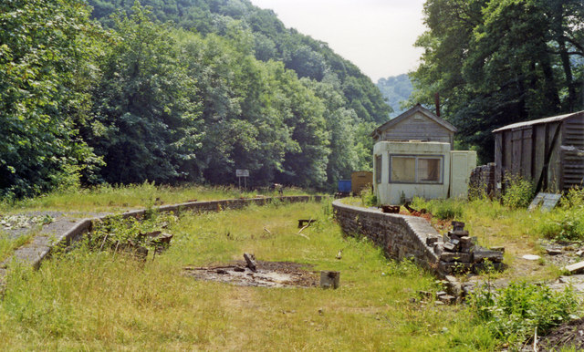
Danycoed Halt railway station

Danycoed Halt, which is Welsh for below the trees, was built by the Gwili Railway in the late 1990s and opened in 2001. It is the current northern terminus...

Conwil railway station

Conwil was a railway station near the village of Cynwyl Elfed in Carmarthenshire, Wales, serving the hamlet and the rural locale. It was once a thriving...

Elvet Hundred

Elvet was a hundred, a geographic division, in the northwest of the traditional county of Carmarthenshire, Wales. Boundaries Extent of the Elvet Hundreds...

Llannewydd

Llannewydd or Newchurch is a parish in Carmarthenshire, Wales. It is 3 miles (5 km) north of Carmarthen on the banks of the Gwili. The church was rebuilt...

Nearby Amenities

Located within 500m of 51.909345,-4.3380102
Railway: buffer_stop
Lat/Long: 51.9073946/-4.3320355
Railway: switch
Lat/Long: 51.9072957/-4.3316728
Ford: yes
Lat/Long: 51.9078175/-4.3429525
The data included in this document is from www.openstreetmap.org. The data is made available under ODbL.

Have you been to Allt Penllwyniorwg?

Leave your review of Allt Penllwyniorwg below (or comments, questions and feedback).