Allt Blaen-eigiau

Wood, Forest in Carmarthenshire

Wales

Allt Blaen-eigiau

Footpath near Cynwyl Elfed
Footpath near Cynwyl Elfed Credit: Alistair Hare

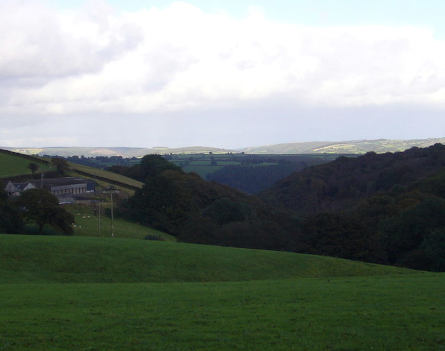
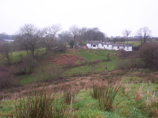
Allt Blaen-eigiau is a wood located in the county of Carmarthenshire, Wales. Situated near the village of Myddfai, this forested area covers approximately 1,000 acres. The woodland is part of the Brecon Beacons National Park, known for its stunning natural landscapes and rich biodiversity.

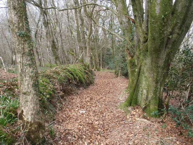
Allt Blaen-eigiau is characterized by its diverse range of tree species, including oak, beech, birch, and pine. These trees create a dense canopy, providing shelter and habitat for a variety of wildlife species. The wood is home to numerous bird species such as woodpeckers, owls, and jays, making it a haven for birdwatchers and nature enthusiasts.

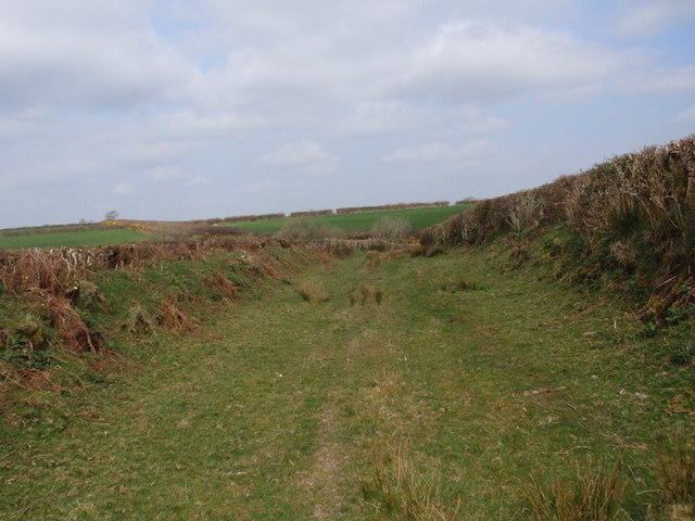
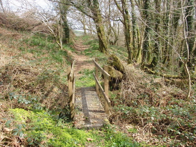
The forest is crisscrossed by several walking trails, allowing visitors to explore its natural beauty. The trails offer panoramic views of the surrounding countryside, with glimpses of rolling hills and picturesque valleys. The wood is a popular destination for hikers, providing opportunities for both leisurely strolls and more challenging hikes.

Allt Blaen-eigiau is also known for its historical significance. The area has remnants of ancient settlements, including Bronze Age cairns and field systems. These archaeological features provide valuable insights into the region's past and attract history enthusiasts.

The wood is well-maintained and managed by local authorities, ensuring the preservation of its natural and cultural heritage. Allt Blaen-eigiau offers a tranquil and serene environment, making it an ideal destination for those seeking a peaceful retreat in nature.

If you have any feedback on the listing, please let us know in the comments section below.

Allt Blaen-eigiau Images

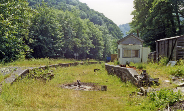
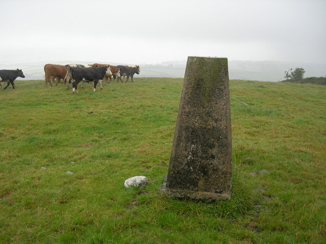
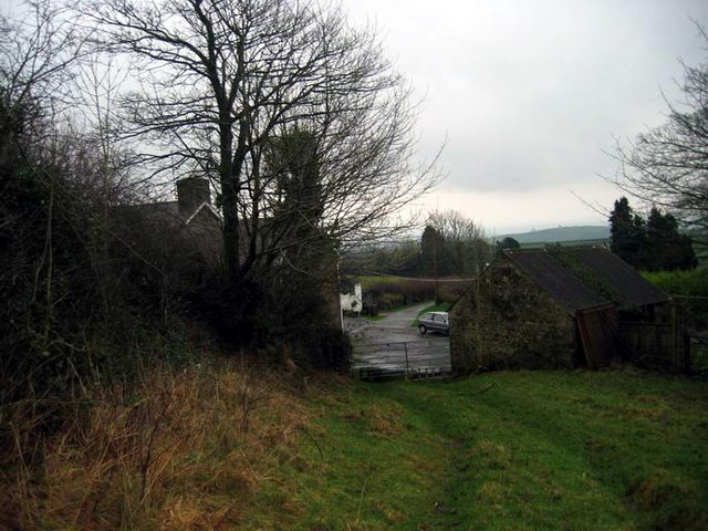
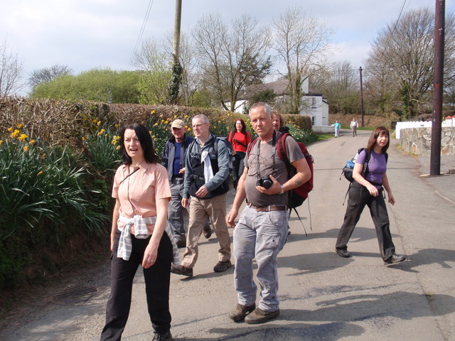
Images are sourced within 2km of 51.90735/-4.3492179 or Grid Reference SN3825. Thanks to Geograph Open Source API. All images are credited.

Footpath near Cynwyl Elfed
Danycoed Halt The view of the Halt on the Gwili Preserved Railway.
Danycoed Halt
The view of the Halt on the Gwili Preserved Railway.
Hen heol Cwmdwyfran old road Cerddwyr yn dilyn hen heol heb darmac o Ffarm Foel Isaf hyd at bentref Cwmdwyfran

Walkers following an unsurfaced road from Foel Isaf Farm (trans. lower farm of the bare hill) to the village of Cwmdwyfran (trans. valley of the two crow streams)
Hen heol Cwmdwyfran old road
Cerddwyr yn dilyn hen heol heb darmac o Ffarm Foel Isaf hyd at bentref Cwmdwyfran Walkers following an unsurfaced road from Foel Isaf Farm (trans. lower farm of the bare hill) to the village of Cwmdwyfran (trans. valley of the two crow streams)
Cwm Tawel Woods, Cwmdwyfran Llwybr cyhoeddus yng Nghoed Cwm Tawel. A'r llwybr o Glwb Golff Caerfyrddin i lawr yr allt at yr A484 gerllaw cyn dafarn y Rock & Fountain 

Public footpath in Cwm Tawel Woods. The path commences from Carmarthen Golf Club and descends through the woods towards the A484 and the former Rock and Fountain Public House
Cwm Tawel Woods, Cwmdwyfran
Llwybr cyhoeddus yng Nghoed Cwm Tawel. A'r llwybr o Glwb Golff Caerfyrddin i lawr yr allt at yr A484 gerllaw cyn dafarn y Rock & Fountain Public footpath in Cwm Tawel Woods. The path commences from Carmarthen Golf Club and descends through the woods towards the A484 and the former Rock and Fountain Public House
Llwybr ceffyl Ty'r Eglwys / Ty'r Eglwys bridleway Llwybr ceffyl dymunol gerllaw Ffarm Ty'r Eglwys, Llannewydd.

A fine bridleway near Ty'r Eglwys Farm (trans. Church House), Newchurch.
Llwybr ceffyl Ty'r Eglwys / Ty'r Eglwys bridleway
Llwybr ceffyl dymunol gerllaw Ffarm Ty'r Eglwys, Llannewydd. A fine bridleway near Ty'r Eglwys Farm (trans. Church House), Newchurch.
Cwm Tawel Llwybr cyhoeddus ym mhen uchaf Cwm Tawel nid nepell o Lannewydd

Public footpath at the higher end of Cwm Tawel (trans. quiet valley) near Newchurch.
Cwm Tawel
Llwybr cyhoeddus ym mhen uchaf Cwm Tawel nid nepell o Lannewydd Public footpath at the higher end of Cwm Tawel (trans. quiet valley) near Newchurch.
Blaen-ffrwd, Eglwysnewydd Blaen-ffrwd farm is on the left. See also <a href="https://www.geograph.org.uk/photo/1185512">SN3725 : Blaen-ffrwd, Eglwysnewydd</a> viewed from about the same point.
Blaen-ffrwd, Eglwysnewydd
Blaen-ffrwd farm is on the left. See also SN3725 : Blaen-ffrwd, Eglwysnewydd viewed from about the same point.
Conwil station remains, 1992 View southward, towards Carmarthen: ex-Great Western Carmarthen - Aberystwyth line, closed 22/2/65. (See also <a href="https://www.geograph.org.uk/photo/2040575">SN3826 : Conwil Station, from train</a>).
Conwil station remains, 1992
View southward, towards Carmarthen: ex-Great Western Carmarthen - Aberystwyth line, closed 22/2/65. (See also SN3826 : Conwil Station, from train).
Misty along the A484 heading for Cynwyl Elfed A misty view of the A484 heading for Cynwyl Elfed viewed from the entrance to the garage and fuel filling station.
Misty along the A484 heading for Cynwyl Elfed
A misty view of the A484 heading for Cynwyl Elfed viewed from the entrance to the garage and fuel filling station.
Triangulation Pillar (S2339) Newchurch Secondary Triangulation Pillar carries Flush Bracket S2339 which marks a point 238.223m above mean sea level.
Triangulation Pillar (S2339)
Newchurch Secondary Triangulation Pillar carries Flush Bracket S2339 which marks a point 238.223m above mean sea level.
Llwybr Ty'r Eglwys / Ty'r Eglwys path Llwybr ceffyl yn agosau at Ffarm Ty'r Eglwys.

Bridleway approaching Ty'r Eglwys Farm (trans. church house).
Llwybr Ty'r Eglwys / Ty'r Eglwys path
Llwybr ceffyl yn agosau at Ffarm Ty'r Eglwys. Bridleway approaching Ty'r Eglwys Farm (trans. church house).
Ger / Near Rhydymarchog Cerddwyr ar heol fach ger Rhyd y Marchog.

Walkers on a minor road near Rhyd y Marchog (trans. Knightsford).
Ger / Near Rhydymarchog
Cerddwyr ar heol fach ger Rhyd y Marchog. Walkers on a minor road near Rhyd y Marchog (trans. Knightsford).
Llwybr y Beili  ./ Beili footpath Gât fochyn ar lwybr cyhoeddus uwchlaw pentre Cynwyl Elfed

A kissing gate on a public footpath above the village of Cynwyl Elfed (trans. Cynwyl's church in Elfed).
Llwybr y Beili ./ Beili footpath
Gât fochyn ar lwybr cyhoeddus uwchlaw pentre Cynwyl Elfed A kissing gate on a public footpath above the village of Cynwyl Elfed (trans. Cynwyl's church in Elfed).
Llwybr Beili  / Beili path Gât fochyn ar lwybr cyhoeddus ger Ffarm y Beili.

A kissing gate on a public footpath near Beili Farm (trans. bailey)
Llwybr Beili / Beili path
Gât fochyn ar lwybr cyhoeddus ger Ffarm y Beili. A kissing gate on a public footpath near Beili Farm (trans. bailey)
St. Cynwyl, Cynwyl Elfed
Ffoslyn Isaf Traditional farmhouse - barn conversion 30+ years ago - now a smallholding for the Roscoe family
Ffoslyn Isaf
Traditional farmhouse - barn conversion 30+ years ago - now a smallholding for the Roscoe family
Wooded Hillside Hanging wood and gorse and scrubby bank.
Wooded Hillside
Hanging wood and gorse and scrubby bank.
Chapel at Bwlchnewydd
Show me another place!

Allt Blaen-eigiau is located at Grid Ref: SN3825 (Lat: 51.90735, Lng: -4.3492179)

Unitary Authority: Carmarthenshire

Police Authority: Dyfed Powys

What 3 Words

///neckline.sharpens.rankings. Near Abernant, Carmarthenshire

Nearby Locations

Allt Blaen-eigiau

Related Wikis

Conwil railway station

Conwil was a railway station near the village of Cynwyl Elfed in Carmarthenshire, Wales, serving the hamlet and the rural locale. It was once a thriving...

Danycoed Halt railway station

Danycoed Halt, which is Welsh for below the trees, was built by the Gwili Railway in the late 1990s and opened in 2001. It is the current northern terminus...

Llannewydd

Llannewydd or Newchurch is a parish in Carmarthenshire, Wales. It is 3 miles (5 km) north of Carmarthen on the banks of the Gwili. The church was rebuilt...

Newchurch and Merthyr

Newchurch and Merthyr is a community located in Carmarthenshire, Wales including the villages of Newchurch (Welsh: Eglwysnewydd) and Merthyr. The community...

Nearby Amenities

Located within 500m of 51.90735,-4.3492179
Ford: yes
Lat/Long: 51.9078175/-4.3429525
The data included in this document is from www.openstreetmap.org. The data is made available under ODbL.

Have you been to Allt Blaen-eigiau?

Leave your review of Allt Blaen-eigiau below (or comments, questions and feedback).