Coed Elernion

Wood, Forest in Caernarfonshire

Wales

Coed Elernion

Information board on Tre'r Ceiri with chair frame After a climb through hill fog / low cloud this should raise at least a smile. The stone looks like a cushion and I bet it is fairly comfortable for those that may avail themselves of its temporary comfort. The boards need updating I think.
Information board on Tre'r Ceiri with chair frame Credit: Jeremy Bolwell

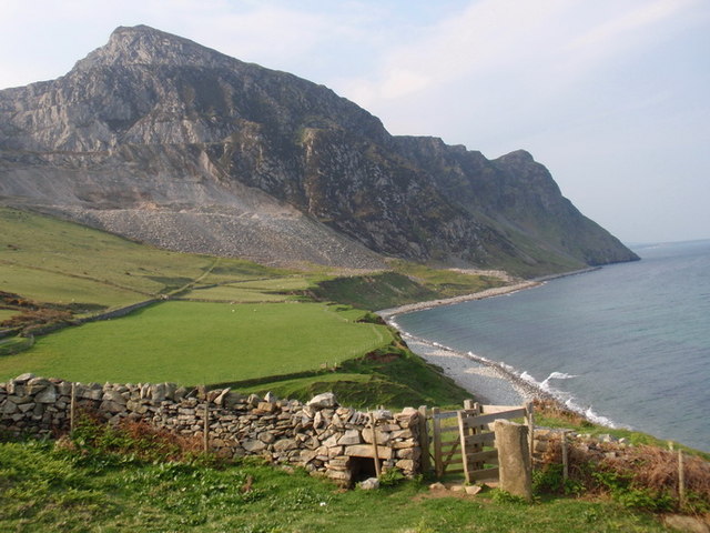
Coed Elernion is a picturesque woodland located in the county of Caernarfonshire, Wales. Situated near the town of Caernarfon, this enchanting forest covers an area of approximately 500 acres and is known for its diverse flora and fauna.

The woodland is characterized by its dense canopy of towering trees, predominantly comprised of oak, birch, and beech. These ancient trees create a serene and tranquil atmosphere, making it a popular destination for nature enthusiasts and hikers seeking solace in the midst of nature.

Coed Elernion is home to a wide range of wildlife, including various bird species, such as the chaffinch, red kite, and woodpecker. Nature lovers can also spot elusive mammals like badgers, foxes, and even the occasional deer roaming freely through the forest.

The woodland is crisscrossed by a network of well-maintained walking trails, allowing visitors to explore its beauty at their own pace. These trails lead to hidden gems within the forest, including a cascading waterfall and a serene lake, providing a perfect backdrop for photography and relaxation.

Coed Elernion is not only a haven for nature enthusiasts but also serves as an important ecological site. The forest plays a crucial role in maintaining local biodiversity, acting as a habitat for numerous plant and animal species. Conservation efforts are in place to protect and preserve the woodland, ensuring its longevity for future generations to enjoy.

In conclusion, Coed Elernion in Caernarfonshire is a captivating woodland that offers a tranquil escape into nature. With its diverse flora, abundant wildlife, and scenic trails, it provides an idyllic setting for outdoor exploration and appreciation of the natural world.

If you have any feedback on the listing, please let us know in the comments section below.

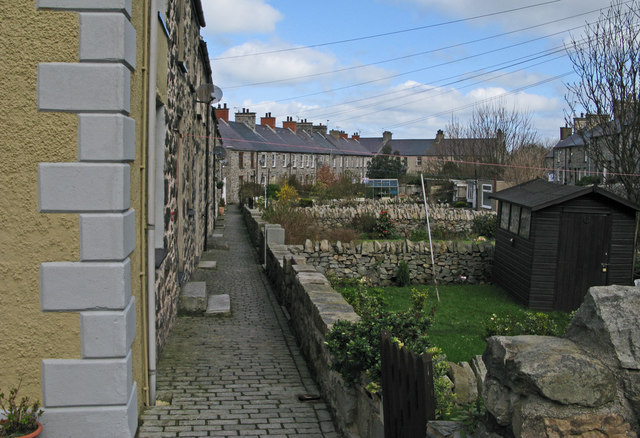
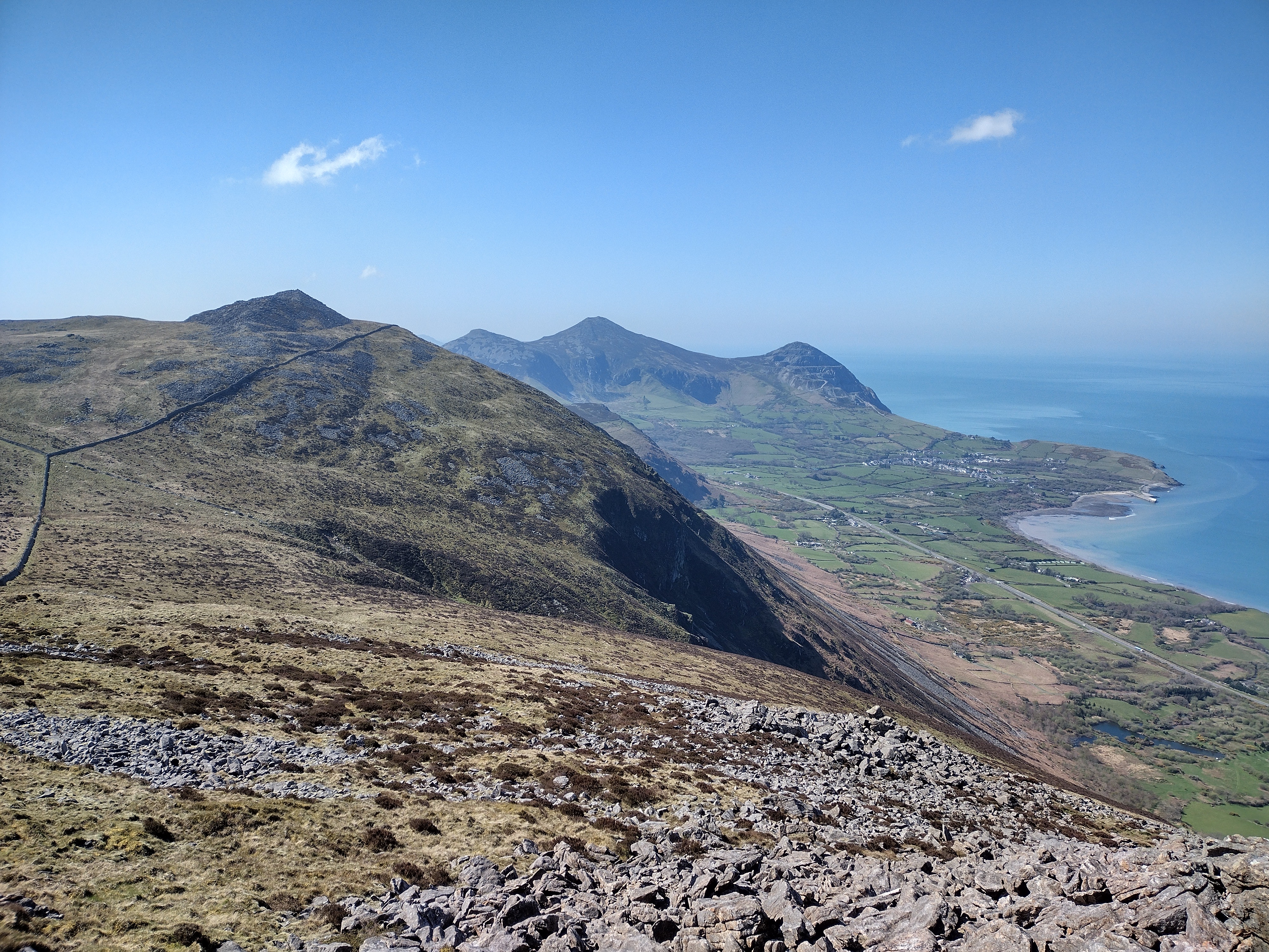
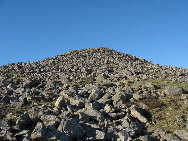
Coed Elernion Images

Images are sourced within 2km of 52.98622/-4.4161246 or Grid Reference SH3745. Thanks to Geograph Open Source API. All images are credited.

Information board on Tre'r Ceiri with chair frame After a climb through hill fog / low cloud this should raise at least a smile. The stone looks like a cushion and I bet it is fairly comfortable for those that may avail themselves of its temporary comfort. The boards need updating I think.
Information board on Tre'r Ceiri with chair frame
After a climb through hill fog / low cloud this should raise at least a smile. The stone looks like a cushion and I bet it is fairly comfortable for those that may avail themselves of its temporary comfort. The boards need updating I think.
Trig pillar on Yr Eifl Taken from within the small but effective shelter cairn next to the trig point. Someone has adapted it for their own purposes. Could this catch on? (I trust that A is still 4 H and vice versa).
Trig pillar on Yr Eifl
Taken from within the small but effective shelter cairn next to the trig point. Someone has adapted it for their own purposes. Could this catch on? (I trust that A is still 4 H and vice versa).
Graig For Llidiart gerdded ar Lwybr Arfordir Llyn. Enw'r graig yn y pellter yw Graig For (neu Mynydd y Gwaith). Mae rhan sylweddol o'r mynydd wedi cael ei ddifetha gan chwarel gwenithfaen. Mae'r cerrig yn adnabyddus am wneud feini cwrlo yn enwedig ar gyfer Gemau Olympaidd y Gaeaf.

A pedestrian gate on the Llyn Coastal Path. The name of the crag in the distance is Graig For (also known as Mynydd y Gwaith). A substantial part of the rock has been quarried away. Granite from the quarry is well known as having been used in the manufacture of curling stones, some of which have been used in the Winter Olympic Games.
Graig For
Llidiart gerdded ar Lwybr Arfordir Llyn. Enw'r graig yn y pellter yw Graig For (neu Mynydd y Gwaith). Mae rhan sylweddol o'r mynydd wedi cael ei ddifetha gan chwarel gwenithfaen. Mae'r cerrig yn adnabyddus am wneud feini cwrlo yn enwedig ar gyfer Gemau Olympaidd y Gaeaf. A pedestrian gate on the Llyn Coastal Path. The name of the crag in the distance is Graig For (also known as Mynydd y Gwaith). A substantial part of the rock has been quarried away. Granite from the quarry is well known as having been used in the manufacture of curling stones, some of which have been used in the Winter Olympic Games.
Bwthyn West End Cottage Bwthyn a elwir West End ger Trefor. Y graig yn y cefndir yw Garn For. 

West End Cottage Cottage near Trefor. The rock in the distance is called Garn For.
Bwthyn West End Cottage
Bwthyn a elwir West End ger Trefor. Y graig yn y cefndir yw Garn For. West End Cottage Cottage near Trefor. The rock in the distance is called Garn For.
Tre'r Ceiri from the west Taken from the col between Tre'r Ceiri's hill and Yr Eifl. The extensive ramparts are clearly visible.
Tre'r Ceiri from the west
Taken from the col between Tre'r Ceiri's hill and Yr Eifl. The extensive ramparts are clearly visible.
Yr Eifl from Tre' Ceiri From inside the main wall.
Yr Eifl from Tre' Ceiri
From inside the main wall.
View towards Gyrn Ddu from Tre'r Ceiri A sensational view from the north end of the fort, looking down to the pass which carries the A499 way below. On the other side is the distinctive hill of Moel Pen-llechog, with the pointed summit of Gyrn Ddu in the distance. All surrounded by the patchwork quilt of fields of the local farms.
View towards Gyrn Ddu from Tre'r Ceiri
A sensational view from the north end of the fort, looking down to the pass which carries the A499 way below. On the other side is the distinctive hill of Moel Pen-llechog, with the pointed summit of Gyrn Ddu in the distance. All surrounded by the patchwork quilt of fields of the local farms.
Trefor beach and jetty On a cold but sunny day the lifeguard on duty had no customers to watch over. The sheltered beach can become quite crowded at weekends in the summer. Several small boats are moored on the beach. A slipway provides access to the water from the road. The stone jetty has a disused wooden pier at its end.
Trefor beach and jetty
On a cold but sunny day the lifeguard on duty had no customers to watch over. The sheltered beach can become quite crowded at weekends in the summer. Several small boats are moored on the beach. A slipway provides access to the water from the road. The stone jetty has a disused wooden pier at its end.
Trefor Pier and Gyrn Goch Trefor Pier juts out at right-angles from the stone jetty. It is no longer used. In the distance Gyrn Goch (492m) towers above the bay.
Trefor Pier and Gyrn Goch
Trefor Pier juts out at right-angles from the stone jetty. It is no longer used. In the distance Gyrn Goch (492m) towers above the bay.
Terraced housing in Trefor Trefor is a village of the north side of the Lleyn Peninsula.
Terraced housing in Trefor
Trefor is a village of the north side of the Lleyn Peninsula.
Ruins at Eifl Granite Quarry The Eifl Granite Quarry lies high above the village of Trefor on the north side of the Lleyn Peninsula. The massive ruin of stone and concrete seen here is part of the rock crusher.
Ruins at Eifl Granite Quarry
The Eifl Granite Quarry lies high above the village of Trefor on the north side of the Lleyn Peninsula. The massive ruin of stone and concrete seen here is part of the rock crusher.
Heather cover of summit area of Yr Eifl A view from the summit of Yr Eifl on the Lleyn Peninsula with the mountains of Snowdonia seen distantly beyond the nearer Gynn Ddu.
Heather cover of summit area of Yr Eifl
A view from the summit of Yr Eifl on the Lleyn Peninsula with the mountains of Snowdonia seen distantly beyond the nearer Gynn Ddu.
Tre’r Ceiri - Iron Age hill fort Tre’r Ceiri is or occupies a hill top  where a massive rampart surrounds the remains of dwellings, some of which are seen in this image. The local high point of Yr Eifl is the heather and boulder clad hill beyond.
Tre’r Ceiri - Iron Age hill fort
Tre’r Ceiri is or occupies a hill top where a massive rampart surrounds the remains of dwellings, some of which are seen in this image. The local high point of Yr Eifl is the heather and boulder clad hill beyond.
Dry stone wall with fields beside B4417 The wall and fields are beside the B4417 heading towards Llanaelhaearn which is the village right of centre in the image; Gyrn Ddu is the distant, central hill.
Dry stone wall with fields beside B4417
The wall and fields are beside the B4417 heading towards Llanaelhaearn which is the village right of centre in the image; Gyrn Ddu is the distant, central hill.
Rough grazing and walling near Penllechog The decaying walls of this part of the Lleyn Peninsula are made from large rounded boulders - there's an ample supply locally as may be seen on the distant slopes of Moel-Pen-llechog and Gyrn Ddu.
Rough grazing and walling near Penllechog
The decaying walls of this part of the Lleyn Peninsula are made from large rounded boulders - there's an ample supply locally as may be seen on the distant slopes of Moel-Pen-llechog and Gyrn Ddu.
Rough grazing on slopes of Gyrn Ddu Unenclosed rough grassland with heather covers the south-western slope of Gyrn Ddu. Moel-Pen-llechog is the dome in the middle distance with the steep ground of 'The Rivals' beyond.
Rough grazing on slopes of Gyrn Ddu
Unenclosed rough grassland with heather covers the south-western slope of Gyrn Ddu. Moel-Pen-llechog is the dome in the middle distance with the steep ground of 'The Rivals' beyond.
Cefn-buarddau Cefn-buarddau is a deserted house to the north of Moel-Pen-llechog.
Cefn-buarddau
Cefn-buarddau is a deserted house to the north of Moel-Pen-llechog.
Beach north-east of Trefor A public footpath reaches the beach of Caernarfon Bay at this point. The hills seen distantly are Gyrn Goch and Gyrn Ddu. The 'earth' above the beach on which the walkers are standing appears to be glacial drift.
Beach north-east of Trefor
A public footpath reaches the beach of Caernarfon Bay at this point. The hills seen distantly are Gyrn Goch and Gyrn Ddu. The 'earth' above the beach on which the walkers are standing appears to be glacial drift.
Show me another place!

Coed Elernion is located at Grid Ref: SH3745 (Lat: 52.98622, Lng: -4.4161246)

Unitary Authority: Gwynedd

Police Authority: North Wales

What 3 Words

///spreads.notifying.began. Near Nefyn, Gwynedd

Nearby Locations

Coed Elernion

Related Wikis

Trefor Quarry railway

The Trefor Quarry railway was an industrial, 1 ft 11+1⁄2 in (597 mm) narrow-gauge railway connecting the Trefor granite quarry with the pier at Llanaelhaearn...

Trefor, Gwynedd

Trefor is a village on the northern coast of the Llŷn Peninsula, in Gwynedd, Wales. It had a population of 1,067 at the 2021 Census. Trefor is in the Community...

Llanaelhaearn

Llanaelhaearn is a village and community on the Llŷn Peninsula in the county of Gwynedd, Wales. The community includes the larger village of Trefor and...

Tre'r Ceiri

Tre'r Ceiri ([treːr ˈkɛiri] ) is a hillfort dating back to the Iron Age. The name means 'town of the giants', from cewri, plural of cawr, 'giant'. The...
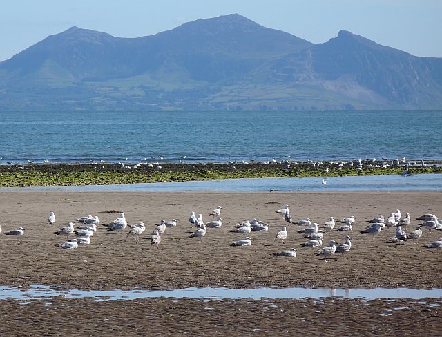
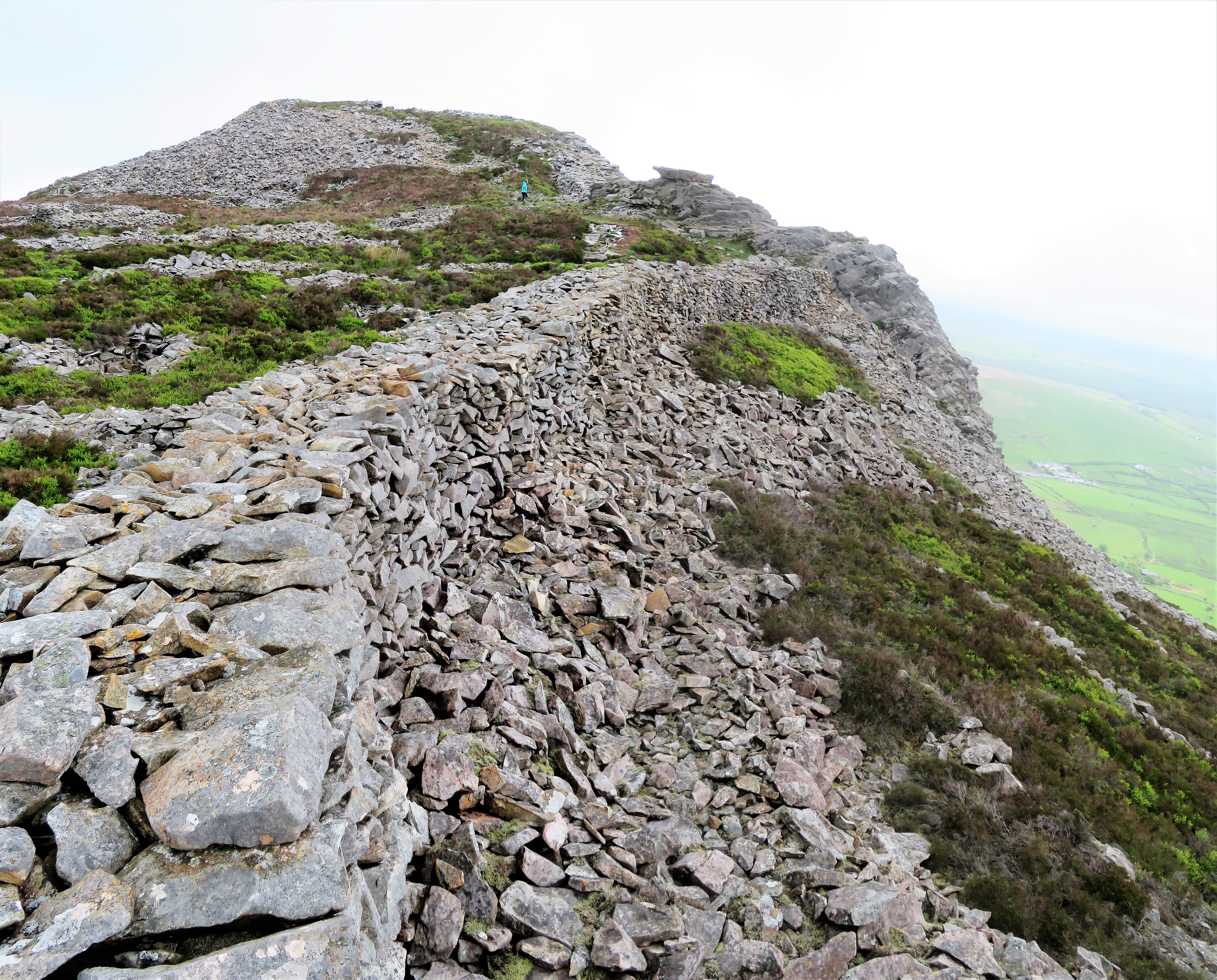
Yr Eifl

Yr Eifl, sometimes called the Rivals in English, is a group of hills on the north coast of the Llŷn Peninsula in Gwynedd, Wales. On a clear day, the views...

A499 road

The A499 road is the major road of the Llŷn peninsula in North Wales. Its northern terminus is a roundabout with the A487 trunk road between Llanwnda and...

Gyrn Ddu

Gyrn Ddu is a hill near the northeastern corner of the Llŷn Peninsula in the community of Llanaelhaearn in the county of Gwynedd in North Wales. It forms...

Carnguwch

Carnguwch is a former civil parish in the Welsh county of Gwynedd. It was abolished in 1934, and incorporated into Pistyll. The parish included 1,179...

Nearby Amenities

Located within 500m of 52.98622,-4.4161246
Power: pole
Lat/Long: 52.9867789/-4.4089788
Power: pole
Lat/Long: 52.985496/-4.4091096
The data included in this document is from www.openstreetmap.org. The data is made available under ODbL.

Have you been to Coed Elernion?

Leave your review of Coed Elernion below (or comments, questions and feedback).