Allt y Dinas

Wood, Forest in Carmarthenshire

Wales

Allt y Dinas

Nant Bran River, Cwmhiraeth Pontroed yn rhychwantu Nant Bran yng Nghwmhiraeth. Mae'r heol sy'n rhydio'r afon yn arwain lan y tyle at Ffarm Pant yr Efail, man geni Griffith Jones, Llanddowror. Y bwthyn adfeiliedig yn y pellter yw Maes y Coed ('Banc yr On' gynt)

A footbridge spanning the Bran River in Cwmhiraeth. The road which fords the stream leads up to Pant yr Efail Farm, the birthplace of Griffith Jones, Llanddowror. The dilapidated cottage in the distance is called Maes y Coed (formerly 'Banc yr On')
Nant Bran River, Cwmhiraeth Credit: Alan Richards

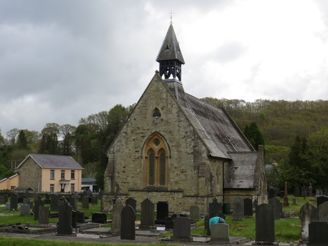
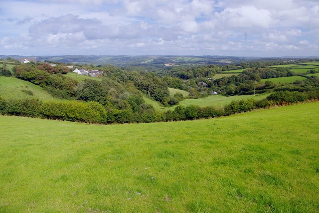
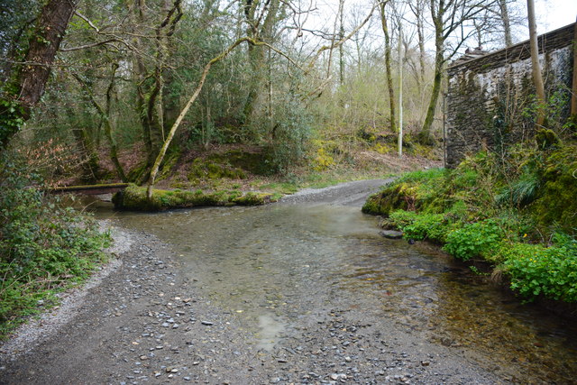
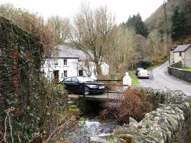
Allt y Dinas is a picturesque woodland located in Carmarthenshire, Wales. Spread across a vast area, this forest is an idyllic retreat for nature lovers and outdoor enthusiasts. The woodland is situated on the eastern slopes of the Brecon Beacons National Park, offering stunning views of the surrounding landscape.

The forest is home to a diverse range of tree species, including oak, beech, and ash. The dense canopy provides a habitat for a variety of wildlife, making it a popular spot for birdwatching and nature photography. Visitors may spot native species such as red kites, buzzards, and woodpeckers.

There are several walking trails that wind their way through the forest, allowing visitors to explore its natural beauty. These trails vary in difficulty, catering to both casual walkers and more experienced hikers. Along the way, visitors can admire the tranquil streams and cascading waterfalls that add to the charm of Allt y Dinas.

The woodland also has a rich historical background. The remains of an Iron Age hillfort can be found within the forest, providing a glimpse into the area's ancient past. Additionally, there are several archaeological sites nearby, including burial mounds and standing stones.

Allt y Dinas is a true gem in the Welsh countryside, offering a peaceful escape from the bustle of everyday life. Whether you're seeking a leisurely stroll, a birdwatching adventure, or a glimpse into history, this Carmarthenshire woodland has something for everyone.

If you have any feedback on the listing, please let us know in the comments section below.
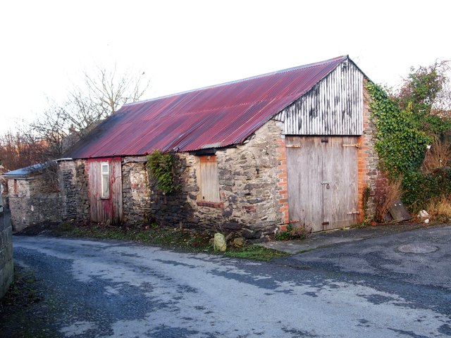
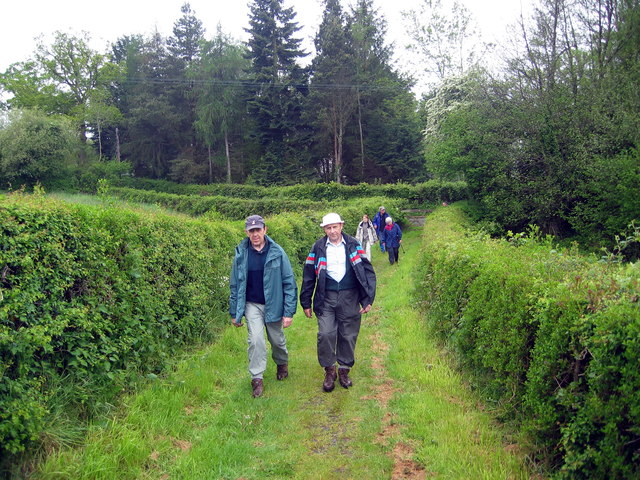
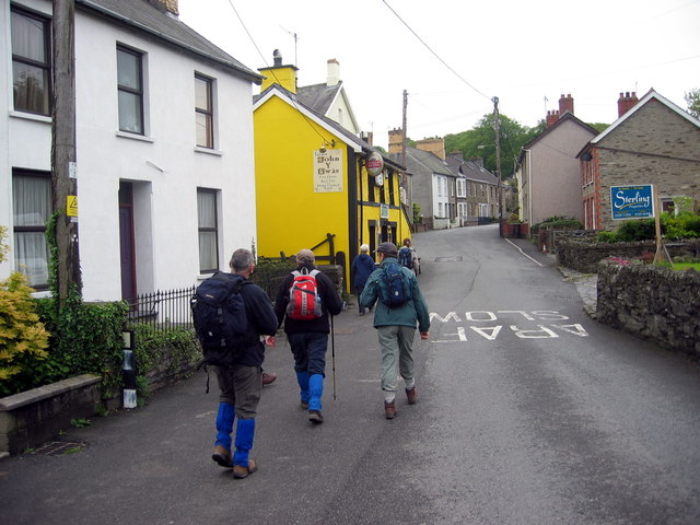
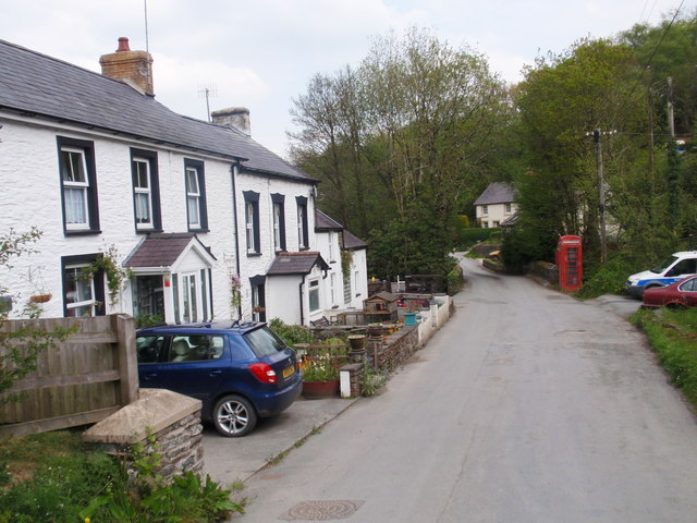
Allt y Dinas Images

Images are sourced within 2km of 52.022218/-4.4129573 or Grid Reference SN3438. Thanks to Geograph Open Source API. All images are credited.

Nant Bran River, Cwmhiraeth Pontroed yn rhychwantu Nant Bran yng Nghwmhiraeth. Mae'r heol sy'n rhydio'r afon yn arwain lan y tyle at Ffarm Pant yr Efail, man geni Griffith Jones, Llanddowror. Y bwthyn adfeiliedig yn y pellter yw Maes y Coed ('Banc yr On' gynt)

A footbridge spanning the Bran River in Cwmhiraeth. The road which fords the stream leads up to Pant yr Efail Farm, the birthplace of Griffith Jones, Llanddowror. The dilapidated cottage in the distance is called Maes y Coed (formerly 'Banc yr On')
Nant Bran River, Cwmhiraeth
Pontroed yn rhychwantu Nant Bran yng Nghwmhiraeth. Mae'r heol sy'n rhydio'r afon yn arwain lan y tyle at Ffarm Pant yr Efail, man geni Griffith Jones, Llanddowror. Y bwthyn adfeiliedig yn y pellter yw Maes y Coed ('Banc yr On' gynt) A footbridge spanning the Bran River in Cwmhiraeth. The road which fords the stream leads up to Pant yr Efail Farm, the birthplace of Griffith Jones, Llanddowror. The dilapidated cottage in the distance is called Maes y Coed (formerly 'Banc yr On')
St Barnabas Church at Felindre
Ordnance Survey Cut Mark This can be found on a buttress at St Barnabas Church.
For more detail see : <span class="nowrap"><a title="http://www.bench-marks.org.uk/bm48806" rel="nofollow ugc noopener" href="http://www.bench-marks.org.uk/bm48806">Link</a><img style="margin-left:2px;" alt="External link" title="External link - shift click to open in new window" src="https://s1.geograph.org.uk/img/external.png" width="10" height="10"/></span>
Ordnance Survey Cut Mark
This can be found on a buttress at St Barnabas Church. For more detail see : LinkExternal link
B4333 heading for Newcastle Emlyn Heading downhill along the B4333 for Newcastle Emlyn.
B4333 heading for Newcastle Emlyn
Heading downhill along the B4333 for Newcastle Emlyn.
National Wool Museum, Dre-fach Felindre Part of the National Museum of Wales.
National Wool Museum, Dre-fach Felindre
Part of the National Museum of Wales.
Road bridge across the Teifi, Henllan
View towards Cwmhiraeth
Old Mill Store, Drefach Felindre
Llwybr Drefach Felindre / Drefach Felindre Path Llwybr cyhoeddus yn mynd i gyfeiriad yr amgueddfa wlan.

A public footpath heading in the direction of the woollen museum.
Llwybr Drefach Felindre / Drefach Felindre Path
Llwybr cyhoeddus yn mynd i gyfeiriad yr amgueddfa wlan. A public footpath heading in the direction of the woollen museum.
Tafarn John y Gwas / John y Gwas Public House Cerddwyr yn agosau at Dafarn John y Gwas, New Shop Inn gynt. Enwyd y tafarn ar ol y cynghorydd John Evans, gwr a fu'n amlwg iawn yng nghylchoedd crefyddol, diwylliannol a chymdeithasol y gymuned. 

Walkers approaching Tafarn John y Gwas (trans. John the servant's tavern), formerly known as the New Shop Inn. The present pub is named after John Evans, a former councillor, who made a valuable contribution to the cultural, religious and social life in the district.
Tafarn John y Gwas / John y Gwas Public House
Cerddwyr yn agosau at Dafarn John y Gwas, New Shop Inn gynt. Enwyd y tafarn ar ol y cynghorydd John Evans, gwr a fu'n amlwg iawn yng nghylchoedd crefyddol, diwylliannol a chymdeithasol y gymuned. Walkers approaching Tafarn John y Gwas (trans. John the servant's tavern), formerly known as the New Shop Inn. The present pub is named after John Evans, a former councillor, who made a valuable contribution to the cultural, religious and social life in the district.
Llwybr yn Nrefelin / A footpath at Drefelin Cerddwyr yn dilyn llwybr cyhoeddus yn Nrefelin.

Walkers following a public footpath at Drefelin (trans. homestead of the mill).
Llwybr yn Nrefelin / A footpath at Drefelin
Cerddwyr yn dilyn llwybr cyhoeddus yn Nrefelin. Walkers following a public footpath at Drefelin (trans. homestead of the mill).
Llwybr Penlangribin / Penlangribin Path Cerddwyr yn dringo stepiau gerllaw anhedd-dy o'r enw Penlangribin.

Walkers ascending steps near a property known as Penlangripin (trans. hilltop of the little ridge).
Llwybr Penlangribin / Penlangribin Path
Cerddwyr yn dringo stepiau gerllaw anhedd-dy o'r enw Penlangribin. Walkers ascending steps near a property known as Penlangripin (trans. hilltop of the little ridge).
Cwmhiraeth Tai ym mhentre Cwmhiraeth.

Houses in the village of Cwmhireth (trans. valley of longing?)
Cwmhiraeth
Tai ym mhentre Cwmhiraeth. Houses in the village of Cwmhireth (trans. valley of longing?)
Nant Brân Ford This is the first of two fords on Nant Brân near Cwmhiraeth. The building in the image was at an early stage of renovation.
Nant Brân Ford
This is the first of two fords on Nant Brân near Cwmhiraeth. The building in the image was at an early stage of renovation.
Nant Brân Ford This is the second of the two Nant Brân fords. The bridleway to the ford leading down from Troed-y-rhiw has been allowed to become completely overgrown and the ford has also run into disrepair.
Nant Brân Ford
This is the second of the two Nant Brân fords. The bridleway to the ford leading down from Troed-y-rhiw has been allowed to become completely overgrown and the ford has also run into disrepair.
Car park, National Wool Museum The museum is to the right on the other side of a river.
Car park, National Wool Museum
The museum is to the right on the other side of a river.
Path to National Wool Museum The path comes from the car park <a href="https://www.geograph.org.uk/photo/6281917">SN3539 : Car park, National Wool Museum</a> and here runs alongside the former tailrace from the waterwheel before going to the entrance to the museum (out of shot to left). The brick building is part of the woollen mill.
Path to National Wool Museum
The path comes from the car park SN3539 : Car park, National Wool Museum and here runs alongside the former tailrace from the waterwheel before going to the entrance to the museum (out of shot to left). The brick building is part of the woollen mill.
National Wool Museum, Drefach The main building is on the left. The building on the right is a commercial weaving shed. Both were formerly part of Cambrian Mill, the largest mill in the area - 'the Huddersfield of Wales'.
National Wool Museum, Drefach
The main building is on the left. The building on the right is a commercial weaving shed. Both were formerly part of Cambrian Mill, the largest mill in the area - 'the Huddersfield of Wales'.
Show me another place!

Allt y Dinas is located at Grid Ref: SN3438 (Lat: 52.022218, Lng: -4.4129573)

Unitary Authority: Carmarthenshire

Police Authority: Dyfed Powys

What 3 Words

///evaporate.tables.developer. Near Newcastle Emlyn, Ceredigion

Related Wikis

Dre-fach Felindre

Dre-fach Felindre is a village in Carmarthenshire, West Wales. It is located four miles south-east of Newcastle Emlyn. It lies at the confluence of three...

Cwmhiraeth

Cwmhiraeth is a hamlet in Carmarthenshire, Wales, contained in the Dre-fach Felindre district. While the name has no exact meaning in English, it can be...

National Wool Museum

The National Wool Museum, located in Drefach Felindre, Llandysul, Carmarthenshire, is part of Amgueddfa Cymru – Museum Wales. == Background == Historically...

Teifi Valley Railway

The Teifi Valley Railway (Welsh: Rheilffordd Dyffryn Teifi) is a 2 ft (610 mm) narrow gauge railway occupying a section of the former standard gauge Great...

Capel Eidalwyr

Capel Eidalwyr is a Roman Catholic chapel located on the site of a prisoner-of-war camp at Henllan, Ceredigion, Wales. The chapel was established in a...

Emlyn

Emlyn was one of the seven cantrefi of Dyfed, an ancient district of Wales, which became part of Deheubarth in around 950. It consisted of the northern...

Cwmpengraig

Cwmpengraig is a rural hamlet in Carmarthenshire, Wales, located in the Teifi Valley approximately 1.5 miles (2.4 km) from the village of Dre-fach Felindre...

Llangeler

Llangeler () is a hamlet and community located in north Carmarthenshire, Wales. The name is believed to refer to St. Gelert. Llangeler parish covers a...

Nearby Amenities

Located within 500m of 52.022218,-4.4129573
Bus Stop
Waungilwen
Shelter: yes
Lat/Long: 52.0262913/-4.4124039
Place: farm
Lat/Long: 52.0225664/-4.4192983
Give Way
Direction: forward
Lat/Long: 52.0183783/-4.4116909
Give Way
Direction: backward
Lat/Long: 52.0263489/-4.4127324
Power: pole
Lat/Long: 52.0179058/-4.4128346
Direction: 195
Generator Method: photovoltaic
Generator Output Electricity: yes
Generator Solar Modules: 14
Generator Source: solar
Generator Type: solar_photovoltaic_panel
Location: roof
Power: generator
Lat/Long: 52.0262306/-4.4115542
Direction: 195
Generator Method: photovoltaic
Generator Output Electricity: yes
Generator Solar Modules: 14
Generator Source: solar
Generator Type: solar_photovoltaic_panel
Location: roof
Power: generator
Lat/Long: 52.0261293/-4.4110869
Direction: SE
Generator Method: photovoltaic
Generator Output Electricity: yes
Generator Solar Modules: 5
Generator Source: solar
Generator Type: solar_photovoltaic_panel
Location: roof
Power: generator
Lat/Long: 52.0255576/-4.4094014
Direction: SW
Generator Method: photovoltaic
Generator Output Electricity: yes
Generator Solar Modules: 6
Generator Source: solar
Generator Type: solar_photovoltaic_panel
Location: roof
Power: generator
Lat/Long: 52.0254997/-4.4094698
Direction: 215
Generator Method: photovoltaic
Generator Output Electricity: yes
Generator Solar Modules: 12
Generator Source: solar
Generator Type: solar_photovoltaic_panel
Location: roof
Power: generator
Lat/Long: 52.0239947/-4.4067621
Direction: SW
Generator Method: photovoltaic
Generator Output Electricity: yes
Generator Solar Modules: 14
Generator Source: solar
Generator Type: solar_photovoltaic_panel
Location: roof
Power: generator
Lat/Long: 52.0239245/-4.4066408
Telephone
Defibrillator
Booth: K6
Covered: booth
Defibrillator Location: inside old red phone box in Waungilwen
Emergency: defibrillator
Man Made: telephone_box
Lat/Long: 52.026384/-4.4129552
The data included in this document is from www.openstreetmap.org. The data is made available under ODbL.

Have you been to Allt y Dinas?

Leave your review of Allt y Dinas below (or comments, questions and feedback).