Coed Bodfel

Wood, Forest in Caernarfonshire

Wales

Coed Bodfel

Sports ground at Efailnewydd Pwllheli Cricket Club home ground.
Sports ground at Efailnewydd Credit: Eirian Evans

Coed Bodfel is a picturesque woodland located in the county of Caernarfonshire, Wales. Nestled amidst the stunning landscape of Snowdonia National Park, it covers an area of approximately 50 hectares. The woodland is known for its diverse range of flora and fauna, making it a popular destination for nature enthusiasts and hikers alike.

The forest is predominantly composed of native trees, including oak, beech, and birch, creating a vibrant and rich canopy. These trees provide a haven for various bird species, such as woodpeckers, owls, and thrushes, which can be heard and spotted throughout the woodland.

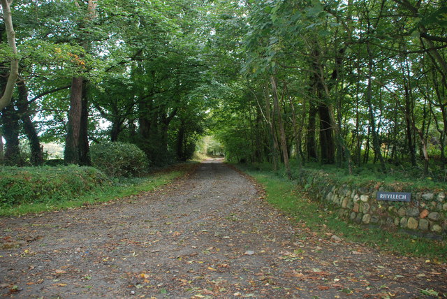
Coed Bodfel boasts a network of well-maintained trails and footpaths, allowing visitors to explore the area at their own pace. The paths wind through the forest, offering glimpses of the surrounding meadows and breathtaking views of the nearby mountains. It is a tranquil environment, perfect for those seeking solitude or a peaceful retreat from the hustle and bustle of everyday life.

The woodland is also home to a diverse range of wildlife. Red squirrels can be spotted scurrying among the branches, while deer and foxes roam the forest floor. In springtime, the forest floor comes alive with a carpet of bluebells and other wildflowers, creating a truly magical atmosphere.

Coed Bodfel is managed by local conservation organizations, who strive to preserve its natural beauty and protect the delicate ecosystem within. As such, visitors are encouraged to respect and appreciate the woodland, ensuring its preservation for future generations to enjoy.

If you have any feedback on the listing, please let us know in the comments section below.

Coed Bodfel Images

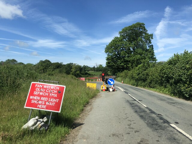
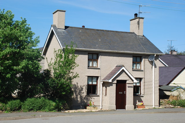
Images are sourced within 2km of 52.908586/-4.4626049 or Grid Reference SH3437. Thanks to Geograph Open Source API. All images are credited.

Sports ground at Efailnewydd Pwllheli Cricket Club home ground.
Sports ground at Efailnewydd
Pwllheli Cricket Club home ground.
Road bridge repairs on the A497 This is the main road from Nefyn to Pwllheli, but in January 2019 the bridge over the River Rhyd-Hir became unsafe due to one of the arch pillars collapsing into the river below after being struck by a vehicle. A temporary bailey bridge is being used while discussions continue on how to repair the bridge and possibly provide another wider bridge nearby
Road bridge repairs on the A497
This is the main road from Nefyn to Pwllheli, but in January 2019 the bridge over the River Rhyd-Hir became unsafe due to one of the arch pillars collapsing into the river below after being struck by a vehicle. A temporary bailey bridge is being used while discussions continue on how to repair the bridge and possibly provide another wider bridge nearby
Afon Rhyd-Hir at Pont Bodfel Rough pasture land by the river
Afon Rhyd-Hir at Pont Bodfel
Rough pasture land by the river
Eglwys Y Groes Sanctaidd, Llannor
Benchmark by the B4415 at Llwyn Beuno, Efailnewydd Ordnance Survey benchmark on the B4415 roadside wall in front of Llwyn Beuno, west of Efailnewydd. Levelled at 14.161m above Newlyn Datum, verified 1974. N.B. The Ordnance Survey recorded grid reference is incorrect by 100 metres further east, although the description is correct (apart from the spelling mistake). For a wider view see <a href="https://www.geograph.org.uk/photo/7506411">SH3435 : The B4419 by Llwyn Beuno, Efailnewydd</a> 

<span class="nowrap"><a title="https://www.bench-marks.org.uk/bm194255" rel="nofollow ugc noopener" href="https://www.bench-marks.org.uk/bm194255">Link</a><img style="margin-left:2px;" alt="External link" title="External link - shift click to open in new window" src="https://s1.geograph.org.uk/img/external.png" width="10" height="10"/></span>
Benchmark by the B4415 at Llwyn Beuno, Efailnewydd
Ordnance Survey benchmark on the B4415 roadside wall in front of Llwyn Beuno, west of Efailnewydd. Levelled at 14.161m above Newlyn Datum, verified 1974. N.B. The Ordnance Survey recorded grid reference is incorrect by 100 metres further east, although the description is correct (apart from the spelling mistake). For a wider view see SH3435 : The B4419 by Llwyn Beuno, Efailnewydd LinkExternal link
The B4419 by Llwyn Beuno, Efailnewydd There is an Ordnance Survey benchmark on the large stone in the roadside wall just this side of the entrance <a href="https://www.geograph.org.uk/photo/7506407">SH3435 : Benchmark by the B4415 at Llwyn Beuno, Efailnewydd</a>
The B4419 by Llwyn Beuno, Efailnewydd
There is an Ordnance Survey benchmark on the large stone in the roadside wall just this side of the entrance SH3435 : Benchmark by the B4415 at Llwyn Beuno, Efailnewydd
Eglwys Buan Sant Boduan Deconsecrated church at Boduan. See Alan Fryer's contribution <a href="https://www.geograph.org.uk/photo/618261">SH3237 : Eglwys Buan Sant Boduan</a> for more information.
Eglwys Buan Sant Boduan
Deconsecrated church at Boduan. See Alan Fryer's contribution SH3237 : Eglwys Buan Sant Boduan for more information.
A497 near Boduan A straight section of the road as it crosses the Llyn Peninsula.
A497 near Boduan
A straight section of the road as it crosses the Llyn Peninsula.
Eglwys Buan Sant Since earlier pictures were taken the churchyard has become overgrown with brambles.
Eglwys Buan Sant
Since earlier pictures were taken the churchyard has become overgrown with brambles.
Entrance to Efailnewydd
Entrance to Bryn Bodvel
Field near to Llannerch A rather sparsely grassed piece of pasture.
Field near to Llannerch
A rather sparsely grassed piece of pasture.
Eglwys Buan Sant, Boduan I am obliged to Alan Fryer for the following:-
The present building was first erected by the Wynne family of Plas Boduan in 1765 and after falling into disrepair rebuilt between 1890 and 1894. After falling into disrepair again in the 20th century it was deconsecrated in 1991 and reopened in 2004 as the Buan centre. It is now closed.
Eglwys Buan Sant, Boduan
I am obliged to Alan Fryer for the following:- The present building was first erected by the Wynne family of Plas Boduan in 1765 and after falling into disrepair rebuilt between 1890 and 1894. After falling into disrepair again in the 20th century it was deconsecrated in 1991 and reopened in 2004 as the Buan centre. It is now closed.
Llannor Church The Church of the Holy Cross is of medieval origin but was rebuilt in 1885 by Henry Kennedy with later alterations in 1905 by Harold Hughes. The lower part of the tower is believed to be of late 15th or early 16th century origin.
Llannor Church
The Church of the Holy Cross is of medieval origin but was rebuilt in 1885 by Henry Kennedy with later alterations in 1905 by Harold Hughes. The lower part of the tower is believed to be of late 15th or early 16th century origin.
Cottages in Llannor These cottages face the church; the nearest is called Tan y Fynwent (beneath the cemetery), which seems appropriate.
Cottages in Llannor
These cottages face the church; the nearest is called Tan y Fynwent (beneath the cemetery), which seems appropriate.
Rhyllech The drive to Rhyllech from the Penrhos to Efailnewydd road
Rhyllech
The drive to Rhyllech from the Penrhos to Efailnewydd road
Tir amaethyddol ger Rhyllech - Farmland near Rhyllech
Show me another place!

Coed Bodfel is located at Grid Ref: SH3437 (Lat: 52.908586, Lng: -4.4626049)

Unitary Authority: Gwynedd

Police Authority: North Wales

What 3 Words

///discussed.acoustics.upsetting. Near Pwllheli, Gwynedd

Nearby Locations

Coed Bodfel

Related Wikis

Dwyfor

Dwyfor was one of the five local government districts of Gwynedd, Wales from 1974 to 1996, covering the Llŷn peninsula. Its council was based in Pwllheli...

Pont Bodefail

Pont Bodfel is a bridge between the villages of Boduan and Efailnewydd in Wales. The bridge carries the A497 road over the Afon Rhyd-hir. It is a single...
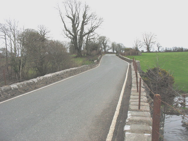
Pont Bodfel

Pont Bodfel is a bridge between the villages of Boduan and Efailnewydd in Wales. The bridge formerly carried the A497 road over the Afon Rhyd-hir. It has...

Llannor

Llannor (Welsh pronunciation: [ˈɬanɔr]) is a village, parish and community located on the Llŷn Peninsula (Welsh: Penrhyn Llŷn) in the Welsh county of Gwynedd...

Nearby Amenities

Located within 500m of 52.908586,-4.4626049
Power: pole
Lat/Long: 52.90578/-4.4681847
Power: pole
Lat/Long: 52.9064173/-4.4687828
Power: pole
Lat/Long: 52.9070547/-4.4693622
The data included in this document is from www.openstreetmap.org. The data is made available under ODbL.

Have you been to Coed Bodfel?

Leave your review of Coed Bodfel below (or comments, questions and feedback).