Burghfield

Settlement in Berkshire

England

Burghfield

Roundabout and houses, Sheffield Bottom The roundabout is a fairly recent replacement for a three-way junction with a fairly large grass triangle. The houses were aligned with one side of the triangle, and a fragment remains for access.
Roundabout and houses, Sheffield Bottom Credit: Robin Webster

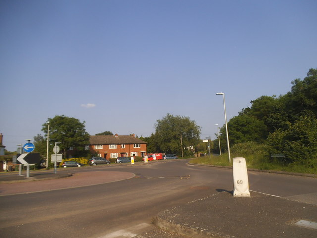
Burghfield is a village and civil parish located in the county of Berkshire, in southern England. Situated about 7 miles southwest of Reading, it is nestled in the picturesque Kennet Valley. The village is divided into three main areas: Burghfield Common, Burghfield Village, and Burghfield Bridge.

Burghfield Common is the largest part of the village and has a thriving community with a range of amenities. It offers a variety of shops, including a supermarket, post office, and several local businesses. There are also recreational facilities, such as sports clubs, a leisure center, and a golf course.

Burghfield Village, on the other hand, has a more rural feel with a historic church, a primary school, and a few local shops and pubs. The surrounding countryside is dotted with fields and meadows, providing a peaceful and idyllic setting.

Burghfield Bridge, located on the outskirts of the village, is a small hamlet that straddles the River Kennet. It is known for its picturesque canal and lock, which are popular with boaters and walkers.

Overall, Burghfield offers a pleasant mix of rural charm and modern amenities. It boasts a close-knit community and provides easy access to nearby towns and cities, making it an attractive place to live for both families and commuters.

If you have any feedback on the listing, please let us know in the comments section below.

Burghfield Images

Images are sourced within 2km of 51.411046/-1.049498 or Grid Reference SU6668. Thanks to Geograph Open Source API. All images are credited.

Roundabout and houses, Sheffield Bottom The roundabout is a fairly recent replacement for a three-way junction with a fairly large grass triangle. The houses were aligned with one side of the triangle, and a fragment remains for access.
Roundabout and houses, Sheffield Bottom
The roundabout is a fairly recent replacement for a three-way junction with a fairly large grass triangle. The houses were aligned with one side of the triangle, and a fragment remains for access.
Maple leaves in Burghfield Common, Berkshire Autumn colour and a sliver of sunshine.
Maple leaves in Burghfield Common, Berkshire
Autumn colour and a sliver of sunshine.
Reading Services exit, M4 The M4 is 190 miles long and runs from London to South Wales. Major centres close to the motorway include Reading, Swindon, Bristol, Newport, Cardiff and Swansea. The motorway was constructed between 1961 and 1996. The M4 originally crossed the first Severn Road Bridge. It has now been diverted to use the Second Severn Crossing and the motorway over the older bridge has been renumbered as M48.
Wikipedia: <span class="nowrap"><a title="http://en.wikipedia.org/wiki/M4_motorway" rel="nofollow ugc noopener" href="http://en.wikipedia.org/wiki/M4_motorway">Link</a><img style="margin-left:2px;" alt="External link" title="External link - shift click to open in new window" src="https://s1.geograph.org.uk/img/external.png" width="10" height="10"/></span>
Reading Services exit, M4
The M4 is 190 miles long and runs from London to South Wales. Major centres close to the motorway include Reading, Swindon, Bristol, Newport, Cardiff and Swansea. The motorway was constructed between 1961 and 1996. The M4 originally crossed the first Severn Road Bridge. It has now been diverted to use the Second Severn Crossing and the motorway over the older bridge has been renumbered as M48. Wikipedia: LinkExternal link
Modern house, Burghfield Common, Berkshire
Farmland, Burghfield, Berkshire
Bottom Lane at the junction of Jaques Lane
Roundabout on Jaques Lane, Sherfield Bottom
Bennett's Hill at the junction of Deans Copse Road
The entrance to Hadley Skip Hire, Sheffield Bottom
The entrance to Hadley Waste Disposal, Trash Green
Field by Deans Copse Road, Burghfield
Boldrewood, Burghfield Common A residential street in this very suburban village.
Boldrewood, Burghfield Common
A residential street in this very suburban village.
Pump on the lawn An old pump over a well or borehole in front of The Hollies, a former large house now converted to a care home.
Pump on the lawn
An old pump over a well or borehole in front of The Hollies, a former large house now converted to a care home.
Gate to Highwoods One of several large properties in this square which are set back from the road and approached by a driveway.
Gate to Highwoods
One of several large properties in this square which are set back from the road and approached by a driveway.
Hanningtons Way A short residential no through road on the edge of Burghfield Common.
Hanningtons Way
A short residential no through road on the edge of Burghfield Common.
Hosehill Lake One of many old gravel pits around here, now a nature reserve.
Hosehill Lake
One of many old gravel pits around here, now a nature reserve.
Looking towards Amners Farm, Burghfield
Amners Farm Road, Burghfield
Show me another place!

Burghfield is located at Grid Ref: SU6668 (Lat: 51.411046, Lng: -1.049498)

Unitary Authority: West Berkshire

Police Authority: Thames Valley

What 3 Words

///quick.jokes.potato. Near Calcot, Berkshire

Nearby Locations

Burghfield

Related Wikis

Burghfield

Burghfield is a village and large civil parish in West Berkshire, England, with a boundary with Reading. Burghfield can trace its history back to before...

Arlington Square, Bracknell

Arlington Square Business Park is a business park in Bracknell, England, owned and operated by Goodman Group. The park houses a number of well-known companies...

Great Auclum National Speed Hill Climb

Great Auclum National Speed Hill Climb was a motorcar course close to Burghfield Common in the English county of Berkshire. It was based in the grounds...

Hosehill Lake

Hosehill Lake is a 23.6-hectare (58-acre) Local Nature Reserve west of Reading in Berkshire. It is owned by West Berkshire Council and managed by the...

Nearby Amenities

Located within 500m of 51.411046,-1.049498
Burghfield
Is In: Berkshire, England, UK
Place: village
Lat/Long: 51.4123926/-1.0457081
Turning Circle
Lat/Long: 51.408579/-1.0532996
Turning Circle
Lat/Long: 51.40943/-1.0554633
Bus Stop
Elm Drive (adj)
Bus: yes
Departures Board: timetable
Naptan AtcoCode: 030052100002
Naptan NaptanCode: brkgmwd
Network: Lime 2
Operator: Reading Buses
Public Transport: platform
Route Ref: 2
Shelter: no
Lat/Long: 51.4077956/-1.0536299
Bus Stop
Clayhill Road Turn (adj)
Bench: no
Bus: yes
Departures Board: timetable
Naptan AtcoCode: 030055750002
Naptan NaptanCode: brkdmjw
Network: Lime 2
Operator: Reading Buses
Public Transport: platform
Route Ref: 2;2A
Shelter: no
Source: survey
Lat/Long: 51.4112138/-1.0487656
Leisure: playground
Lat/Long: 51.4114483/-1.0446108
Barrier: cycle_barrier
Lat/Long: 51.4117721/-1.047947
Barrier: cycle_barrier
Lat/Long: 51.4125715/-1.0472074
Waste Basket
Lat/Long: 51.411435/-1.0433401
Bus Stop
Clayhill Road Turn (opp)
Bench: no
Bus: yes
Departures Board: timetable
Naptan AtcoCode: 030055750001
Naptan NaptanCode: brkdmjt
Network: Lime 2
Operator: Reading Buses
Public Transport: platform
Route Ref: 2;2A
Shelter: no
Source: survey
Lat/Long: 51.4112979/-1.048715
Power: pole
Lat/Long: 51.4128/-1.0519651
Power: pole
Lat/Long: 51.4119117/-1.0532579
Power: pole
Lat/Long: 51.4114734/-1.0551649
Power: pole
Lat/Long: 51.411179/-1.0565785
Power: pole
Lat/Long: 51.4121225/-1.0543844
Power: pole
Lat/Long: 51.4138423/-1.0486928
Power: pole
Lat/Long: 51.4144813/-1.0459784
Power: pole
Lat/Long: 51.4144646/-1.0483924
Power: pole
Lat/Long: 51.4148694/-1.0480329
Power: pole
Lat/Long: 51.4151956/-1.0479042
Give Way
Direction: backward
Lat/Long: 51.4110536/-1.0494542
Stop
Direction: backward
Stop: minor
Lat/Long: 51.4116046/-1.04505
Give Way
Direction: forward
Lat/Long: 51.4116696/-1.045114
Give Way
Lat/Long: 51.4103928/-1.0439499
The data included in this document is from www.openstreetmap.org. The data is made available under ODbL.

Have you been to Burghfield?

Leave your review of Burghfield below (or comments, questions and feedback).