Coed Mynydd-Meilian
Wood, Forest in Caernarfonshire
Wales
Coed Mynydd-Meilian

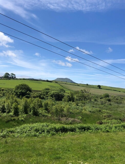
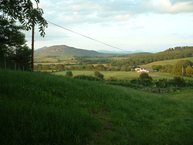
Coed Mynydd-Meilian, located in Caernarfonshire, Wales, is a picturesque woodland area known for its natural beauty and rich biodiversity. Covering an approximate area of [insert size], the forest is nestled within the Snowdonia National Park, offering visitors a tranquil escape into nature.
The woodland is predominantly made up of native tree species, including oak, beech, and birch, which create a dense and verdant canopy. The forest floor is adorned with a variety of ferns, mosses, and wildflowers, adding to the area's enchanting atmosphere.
Coed Mynydd-Meilian is home to a diverse range of wildlife, making it a haven for nature enthusiasts and wildlife photographers. Visitors may spot native mammals such as red squirrels, badgers, and foxes, as well as a multitude of bird species including woodpeckers, owls, and various songbirds.
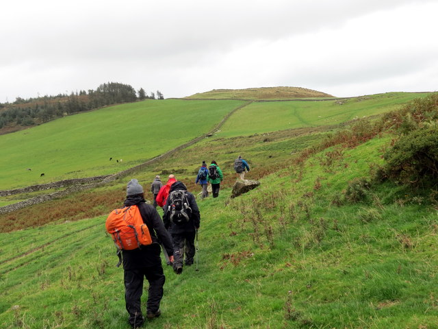
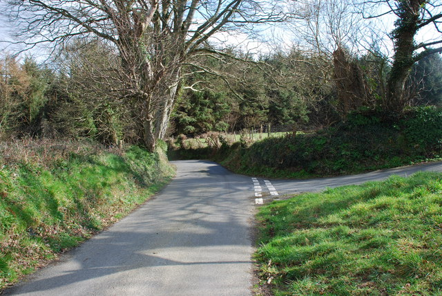
The forest offers a network of well-marked walking trails, allowing visitors to explore its beauty at their own pace. These trails cater to all levels of fitness, offering options for both leisurely strolls and more challenging hikes. Along the paths, there are several viewpoints and picnic areas where visitors can pause and admire the breathtaking vistas of the surrounding landscape.
In addition to its natural beauty, Coed Mynydd-Meilian is also of historical significance. The forest is home to ancient ruins, including remnants of old settlements and burial grounds, providing insight into the area's past.
Overall, Coed Mynydd-Meilian is a captivating woodland area that offers visitors a chance to immerse themselves in the tranquility of nature, explore its diverse wildlife, and delve into its rich history.
If you have any feedback on the listing, please let us know in the comments section below.
Coed Mynydd-Meilian Images
Images are sourced within 2km of 52.904447/-4.536638 or Grid Reference SH2937. Thanks to Geograph Open Source API. All images are credited.


Coed Mynydd-Meilian is located at Grid Ref: SH2937 (Lat: 52.904447, Lng: -4.536638)
Unitary Authority: Gwynedd
Police Authority: North Wales
What 3 Words
///cornering.waxes.judge. Near Nefyn, Gwynedd
Nearby Locations
Related Wikis

Cors Geirch National Nature Reserve
Cors Geirch National Nature Reserve is an extensive wetland site on the Llŷn Peninsula, in the central part of the valley that runs between Nefyn and Pwllheli...

Llandudwen
Llandudwen is a former civil parish in the Welsh county of Gwynedd. It was abolished in 1934, and divided between Buan and Tudweiliog. == References ==

Ceidio
Ceidio is a former civil parish in the Welsh county of Gwynedd. It was abolished in 1934, and incorporated into Buan. == References ==
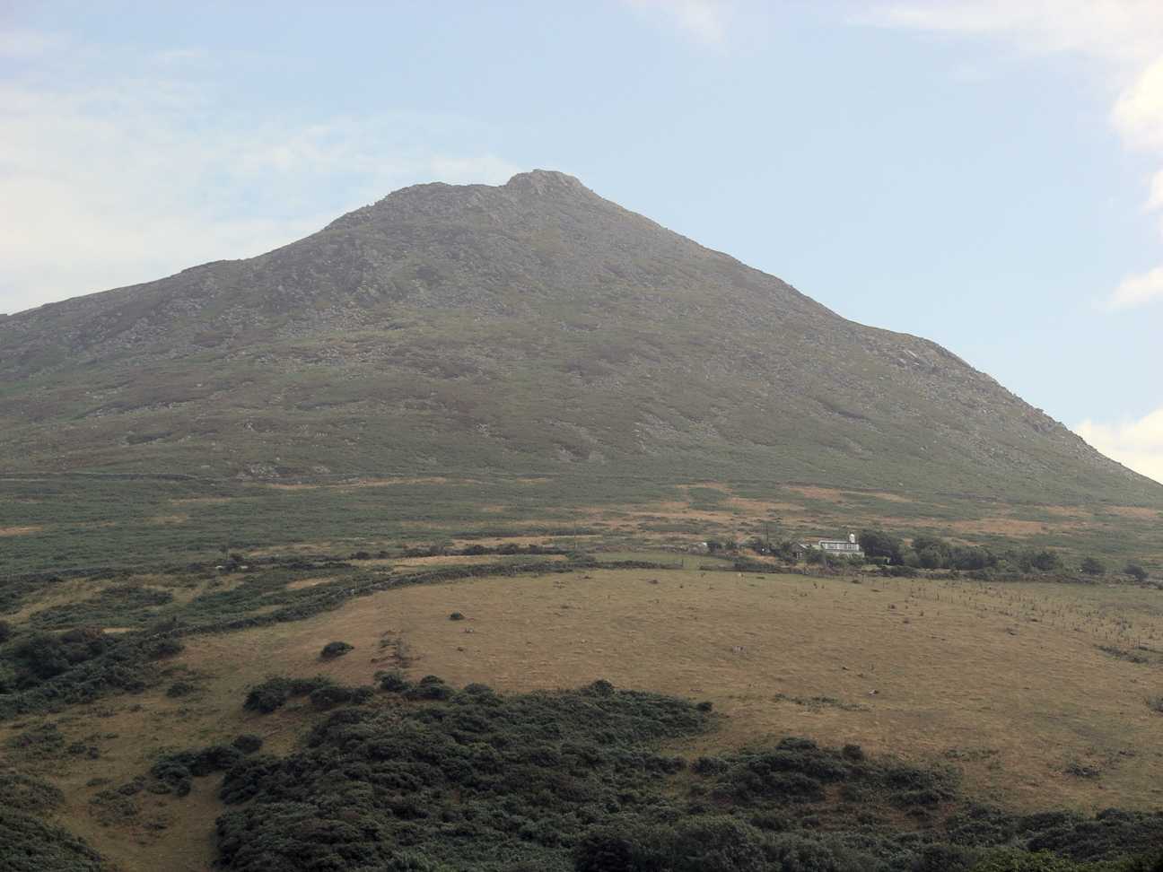
Carn Fadryn
Carn Fadryn, sometimes Carn Fadrun or Garn Fadryn, is a five-hectare Iron Age hillfort and is the name of the mountain on which the fort is situated. It...

Garn Boduan
Garn Boduan is an Iron Age hillfort and hill near Nefyn, on the Llŷn Peninsula in Wales. In a survey in the 1950s the traces of over 170 round houses were...

Llanfihangel Bachellaeth
Llanfihangel Bachellaeth is a former civil parish in the Welsh county of Gwynedd. It was abolished in 1934, and incorporated into Buan. == References ==

Boduan
Boduan is a village in Gwynedd, Wales, about 4 miles from Pwllheli. It is in the historic county of Caernarfonshire. It was due to host the National Eisteddfod...
Buan, Gwynedd
Buan is a community in the Welsh county of Gwynedd, located on the Llŷn Peninsula. It includes the villages of Boduan and Rhydyclafdy, and has a population...
Nearby Amenities
Located within 500m of 52.904447,-4.536638Have you been to Coed Mynydd-Meilian?
Leave your review of Coed Mynydd-Meilian below (or comments, questions and feedback).