Coed Cae-maen-hîr

Wood, Forest in Caernarfonshire

Wales

Coed Cae-maen-hîr

On Carn Fadryn - view towards Yr Eifl
On Carn Fadryn - view towards Yr Eifl Credit: Colin Park

Coed Cae-maen-hîr, located in Caernarfonshire, is a picturesque woodland area known for its natural beauty and diverse ecosystem. Covering an expansive area, this forest is a popular destination for locals and tourists alike, offering a tranquil escape from the bustling city life.

The woodland is characterized by its dense canopy of trees, predominantly consisting of oak, beech, and birch trees, which provide shelter and habitat for a wide variety of flora and fauna. The forest floor is adorned with a rich carpet of ferns, mosses, and wildflowers, creating a vibrant and enchanting environment.

Visitors to Coed Cae-maen-hîr can explore its numerous walking trails, which meander through the forest and offer breathtaking views of the surrounding countryside. The diverse range of bird species, including woodpeckers, owls, and thrushes, make it an ideal spot for birdwatching enthusiasts. Additionally, the forest is home to various mammals, such as badgers, foxes, and deer, making it a haven for wildlife enthusiasts.

The management of Coed Cae-maen-hîr is focused on preserving the natural habitat and ensuring the long-term sustainability of the forest. Efforts are made to maintain the delicate balance between human activity and the preservation of the ecosystem.

Overall, Coed Cae-maen-hîr is a captivating woodland area that offers visitors a chance to immerse themselves in the beauty of nature. Whether it's for a leisurely stroll, birdwatching, or simply enjoying the peaceful ambiance, this forest is a must-visit destination for nature enthusiasts and those seeking a serene escape.

If you have any feedback on the listing, please let us know in the comments section below.

Coed Cae-maen-hîr Images

Images are sourced within 2km of 52.897452/-4.5483624 or Grid Reference SH2836. Thanks to Geograph Open Source API. All images are credited.
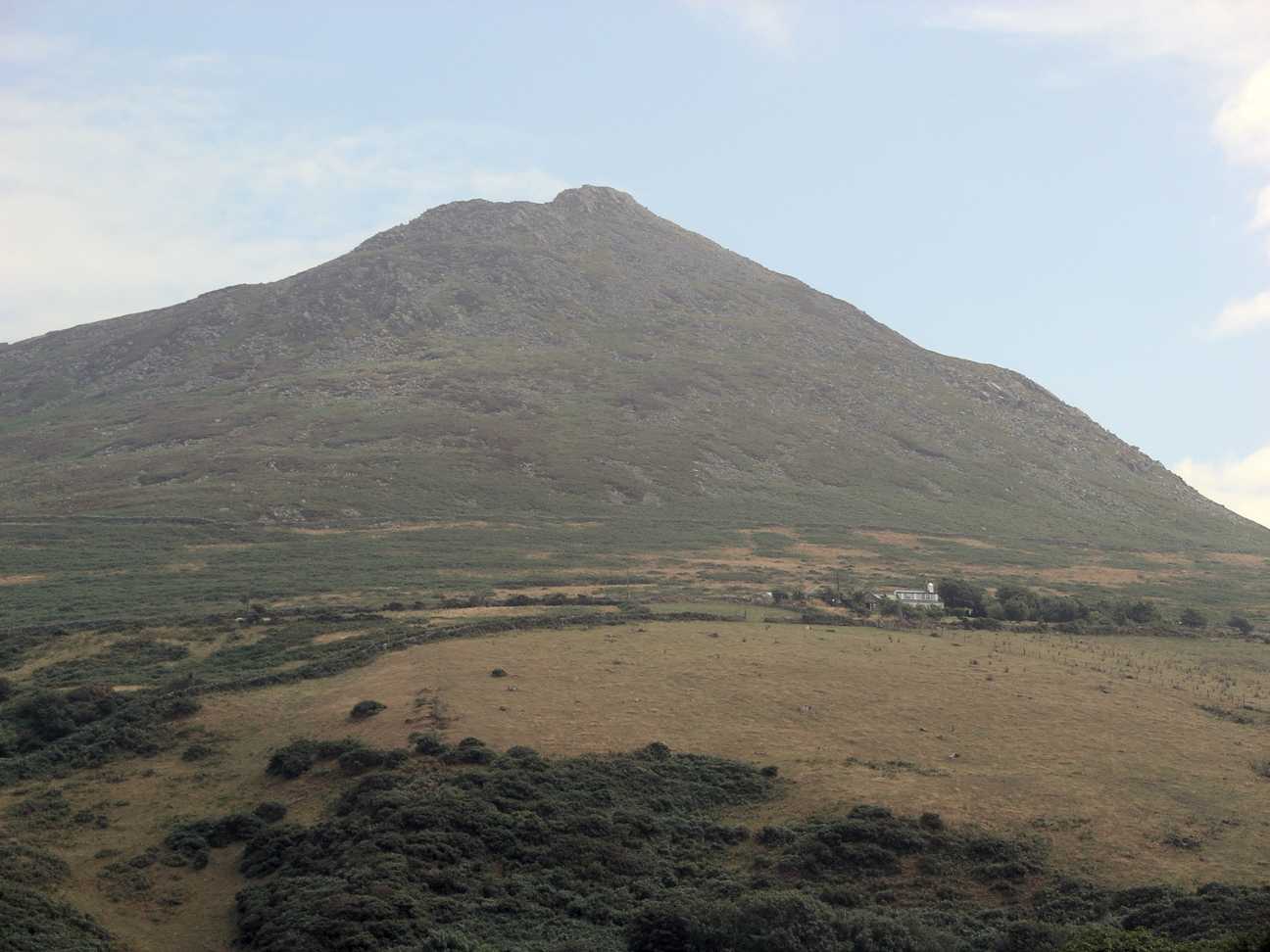
On Carn Fadryn - view towards Yr Eifl
North Wales WWII defences: RAF Nefyn - Chain Home Radar Station - Fourth Bunker (11) -
Chain Home Station: DoB ID: e11356

The fourth bunker is over the road in the farmyard to the south of the main site and was the second of two Type 'C' Receiver Blocks. It's evident that this bunker's concrete exterior was given a waterproof membrane at some stage to prevent damp penetration presumably. I've seen this done before on HAA gun emplacements.  

<a href="https://www.geograph.org.uk/photo/5493275">SH2637 : North Wales WWII defences: RAF Nefyn - Chain Home Radar Station - Fifth Bunker (12)</a>
North Wales WWII defences: RAF Nefyn - Chain Home Radar Station - Fourth Bunker (11)
- Chain Home Station: DoB ID: e11356 The fourth bunker is over the road in the farmyard to the south of the main site and was the second of two Type 'C' Receiver Blocks. It's evident that this bunker's concrete exterior was given a waterproof membrane at some stage to prevent damp penetration presumably. I've seen this done before on HAA gun emplacements. SH2637 : North Wales WWII defences: RAF Nefyn - Chain Home Radar Station - Fifth Bunker (12)
Llwybr Garnfadryn / Path to Garnfadryn Llwybr yn arwain i lawr y waered at bentre Carnfadryn a enwyd ar ol bryn gerllaw. 

A path descending towards Carnfadryn village [trans. Madrun's cairn], named after a nearby hill.
Llwybr Garnfadryn / Path to Garnfadryn
Llwybr yn arwain i lawr y waered at bentre Carnfadryn a enwyd ar ol bryn gerllaw. A path descending towards Carnfadryn village [trans. Madrun's cairn], named after a nearby hill.
Bryngaer Carn Fadrun / Caer Fadrun Hillfort Cerddwr o fewn Bryngaer Carn Fadrun, amddiffynfa sy'n dyddio o'r Oes Haearn.

Walkers within Carn Fadrun hillfort (trans. Madrun's cairn), an Iron Age fortification.
Bryngaer Carn Fadrun / Caer Fadrun Hillfort
Cerddwr o fewn Bryngaer Carn Fadrun, amddiffynfa sy'n dyddio o'r Oes Haearn. Walkers within Carn Fadrun hillfort (trans. Madrun's cairn), an Iron Age fortification.
Sticil / Stile Cerddwr yn dringo sticil ger Ffarm Caeau Gwynion.

Walkers climbing a stile near Caeau Gwynion (trans. white / fair fields)
Sticil / Stile
Cerddwr yn dringo sticil ger Ffarm Caeau Gwynion. Walkers climbing a stile near Caeau Gwynion (trans. white / fair fields)
Tuag at Foel Caerau / Towards Moel Caerau Cerddwyr yn mynd I gyfeiriad Moel Caearau, y bryn yn y pellter.

Walkers heading towards Moel Caearau (trans. bare hilltop of the forts), the hill in the distance.
Tuag at Foel Caerau / Towards Moel Caerau
Cerddwyr yn mynd I gyfeiriad Moel Caearau, y bryn yn y pellter. Walkers heading towards Moel Caearau (trans. bare hilltop of the forts), the hill in the distance.
Llwybr Caerau Uchaf / Upper Caerau Path Cerddwyr yn dilyn llwybr cyhoeddus tuag at Ffarm Caerau Uchaf.

Walkers following a public footpath towards Caerau Uchaf Farm (trans. upper forts).
Llwybr Caerau Uchaf / Upper Caerau Path
Cerddwyr yn dilyn llwybr cyhoeddus tuag at Ffarm Caerau Uchaf. Walkers following a public footpath towards Caerau Uchaf Farm (trans. upper forts).
Tuag at Garn Bach / Towards Garn Bach Cerddwyr yn dilyn llwybr cyhoeddus tuag at Garn Bach, y bryncyn yn y pellter.

Walkers following a public footpath towards Garn Fach (trans. little rock), the hillock in the distance.
Tuag at Garn Bach / Towards Garn Bach
Cerddwyr yn dilyn llwybr cyhoeddus tuag at Garn Bach, y bryncyn yn y pellter. Walkers following a public footpath towards Garn Fach (trans. little rock), the hillock in the distance.
Copa Garn Bach / Summit of Garn Bach Cerddwyr ar gopa Gran Bach.

Walkers on the summit of Garn Bach (trans. little cairn).
Copa Garn Bach / Summit of Garn Bach
Cerddwyr ar gopa Gran Bach. Walkers on the summit of Garn Bach (trans. little cairn).
Dringo Garn Bach / Ascending Garn Bach Cerddwr yn dringo lan Garn Bach.

A walker ascending Garn Bach (trans. little cairn).
Dringo Garn Bach / Ascending Garn Bach
Cerddwr yn dringo lan Garn Bach. A walker ascending Garn Bach (trans. little cairn).
View of Carn Fadryn The peak of Carn Fadryn <a href="https://www.geograph.org.uk/gridref/SH3233">SH3233</a> seen from above Porth y Cychod. Two caravan sites and the village of Tudweiliog in the middle distance.
View of Carn Fadryn
The peak of Carn Fadryn SH3233 seen from above Porth y Cychod. Two caravan sites and the village of Tudweiliog in the middle distance.
Carn Fadryn Trig Point Since Barry Hunter was here in 2007 (see <a href="https://www.geograph.org.uk/photo/462230">SH2735 : Carn Fadryn Trig Point</a>) the pillar has lost its bright yellow look, and someone has fallen in love with Ava.
Carn Fadryn Trig Point
Since Barry Hunter was here in 2007 (see SH2735 : Carn Fadryn Trig Point) the pillar has lost its bright yellow look, and someone has fallen in love with Ava.
From Garn Bach - a view of Carn Fadryn
Carn Fadrun Fort Stone hut circles and fortifications in the area of the hill fort.
Carn Fadrun Fort
Stone hut circles and fortifications in the area of the hill fort.
Carn Fadryn The lane rising in the image leaves the small village of Garnfadryn heading towards the hill, Carn Fadryn which is a Marilyn - a hill having a prominence of at least 150m.
Carn Fadryn
The lane rising in the image leaves the small village of Garnfadryn heading towards the hill, Carn Fadryn which is a Marilyn - a hill having a prominence of at least 150m.
Garn Bach Garn Bach and Carn Fadryn are two hills of the Lleyn Peninsula rising above the small settlement of Garnfadryn. Here, Garn Bach is seen from the south-eastern slope of Carn Fadryn.
Garn Bach
Garn Bach and Carn Fadryn are two hills of the Lleyn Peninsula rising above the small settlement of Garnfadryn. Here, Garn Bach is seen from the south-eastern slope of Carn Fadryn.
Path rising to summit of Carn Fadryn Carn Fadryn is a hill of the Lleyn Peninsula; the path is approaching the trig point at the summit from the north.
Path rising to summit of Carn Fadryn
Carn Fadryn is a hill of the Lleyn Peninsula; the path is approaching the trig point at the summit from the north.
Heather on east side of Carn Fadryn Carn Fadryn is generally steep all round but here on the upper, east side of the hill there's almost flat ground. In the distance are the hills of the northern part of the Lleyn Peninsula.
Heather on east side of Carn Fadryn
Carn Fadryn is generally steep all round but here on the upper, east side of the hill there's almost flat ground. In the distance are the hills of the northern part of the Lleyn Peninsula.
Show me another place!

Coed Cae-maen-hîr is located at Grid Ref: SH2836 (Lat: 52.897452, Lng: -4.5483624)

Unitary Authority: Gwynedd

Police Authority: North Wales

What 3 Words

///suspended.airbag.reclining. Near Nefyn, Gwynedd

Nearby Locations

Coed Cae-maen-hîr

Related Wikis

Cors Geirch National Nature Reserve

Cors Geirch National Nature Reserve is an extensive wetland site on the Llŷn Peninsula, in the central part of the valley that runs between Nefyn and Pwllheli...

Llandudwen

Llandudwen is a former civil parish in the Welsh county of Gwynedd. It was abolished in 1934, and divided between Buan and Tudweiliog. == References ==

Carn Fadryn

Carn Fadryn, sometimes Carn Fadrun or Garn Fadryn, is a five-hectare Iron Age hillfort and is the name of the mountain on which the fort is situated. It...

Ceidio

Ceidio is a former civil parish in the Welsh county of Gwynedd. It was abolished in 1934, and incorporated into Buan. == References ==

Have you been to Coed Cae-maen-hîr?

Leave your review of Coed Cae-maen-hîr below (or comments, questions and feedback).