Burgh Muir

Settlement in Midlothian

Scotland

Burgh Muir

Swans at Linlithgow Loch
Swans at Linlithgow Loch Credit: Mat Fascione

Burgh Muir is a historic area located in Midlothian, Scotland. Situated on the outskirts of Edinburgh, it holds significant historical and cultural importance. The name "Burgh Muir" translates to "Town Moor" in English, indicating its past as a common land used for grazing livestock and communal activities.

In the past, Burgh Muir served as a meeting point for armies, including the Scottish troops assembling for the Battle of Flodden in 1513. It was also utilized as a training ground for soldiers during the Jacobite uprisings. This rich history is reflected in the presence of several ancient monuments and burial sites scattered throughout the area.

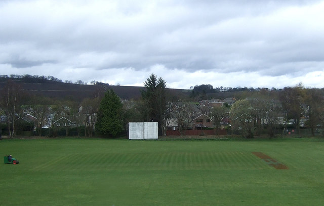
Today, Burgh Muir is a popular destination for outdoor activities and recreational pursuits. It boasts vast expanses of open green spaces, making it an ideal location for walking, jogging, and picnicking. The area is also home to a number of sports facilities, including football pitches and tennis courts, providing opportunities for both leisure and competitive sports.

Furthermore, Burgh Muir is surrounded by a diverse range of flora and fauna, making it an attractive spot for nature lovers. The presence of woodlands and ponds contribute to the area's natural beauty and provide habitats for various species of plants and animals.

Overall, Burgh Muir is a historically significant and visually appealing area, offering a blend of historical charm and outdoor recreational options for residents and visitors alike.

If you have any feedback on the listing, please let us know in the comments section below.

Burgh Muir Images

Images are sourced within 2km of 55.975744/-3.5879704 or Grid Reference NT0177. Thanks to Geograph Open Source API. All images are credited.

Swans at Linlithgow Loch
Linlithgow Loch Seen from the walls of Linlithgow Palace.
Linlithgow Loch
Seen from the walls of Linlithgow Palace.
The Church of St Ninian's Craigmailen, Linlithgow Church of Scotland.
The Church of St Ninian's Craigmailen, Linlithgow
Church of Scotland.
The West Port Hotel, Linlithgow
The Black Bitch Public House, Linlithgow Although this seems to be a less than endearing name for a pub, all 
 who are born in Linlithgow are apparently known locally as 'black bitches'.
The Black Bitch Public House, Linlithgow
Although this seems to be a less than endearing name for a pub, all who are born in Linlithgow are apparently known locally as 'black bitches'.
Holemill Bridge No 46 Crossing the Union Canal in Linlithgow.
Holemill Bridge No 46
Crossing the Union Canal in Linlithgow.
Linlithgow Academy viewed from the Union Canal
Preston Road Bridge No 45 Crossing the Union Canal in Linlithgow.
Preston Road Bridge No 45
Crossing the Union Canal in Linlithgow.
A706 West Port in Linlithgow
Swans at Linlithgow Loch
Houses on Ashley Hall Gardens, Linlithgow
Linlithgow Loch Looking across the loch from its western end towards Linlithgow Palace.
Linlithgow Loch
Looking across the loch from its western end towards Linlithgow Palace.
Houses on Mains Road, Linlithgow
Railway bridge over Mains Road, Linlithgow
The Black Bitch of Linlithgow Public house on West Port.
The Black Bitch of Linlithgow
Public house on West Port.
Sign for the Black Bitch of Linlithgow
The West Port Hotel, Linlithgow On West Port (A803).
The West Port Hotel, Linlithgow
On West Port (A803).
Terraced housing on Mains Road, Linlithgow
Show me another place!

Burgh Muir is located at Grid Ref: NT0177 (Lat: 55.975744, Lng: -3.5879704)

Unitary Authority: West Lothian

Police Authority: The Lothians and Scottish Borders

What 3 Words

///domestic.scrapping.backers. Near Linlithgow, West Lothian

Nearby Locations

Pilgrims' Hill Burgh Muir

Related Wikis

St Michael's Hospital, Linlithgow

St Michael's Hospital, Linlithgow was a community hospital in Linlithgow, Scotland, operated by NHS Lothian. == History == The hospital had its origins...

St Magdalene distillery

St. Magdalene distillery was a producer of single malt Scotch whisky that operated between 1798 and 1983. == History == St. Magdalene was established at...

Boghall Cricket Club Ground

Boghall Cricket Club Ground is a cricket ground in Linlithgow, Scotland. The first recorded match held on the ground came in 1969 when West Lothian played...

Linlithgow railway station

Linlithgow railway station is a railway station serving the town of Linlithgow in West Lothian, Scotland. It is located on the Glasgow to Edinburgh via...

Nearby Amenities

Located within 500m of 55.975744,-3.5879704
Linlithgow
Naptan AtcoCode: 9100LNLTHGW
Network: National Rail
Network Website: https://www.nationalrail.co.uk/stations/lin/
Network Wikidata: Q26334
Operator: ScotRail
Operator Website: https://www.scotrail.co.uk/plan-your-journey/stations-and-facilities/lin
Operator Wikidata: Q18356161
Public Transport: station
Railway: station
Ref Crs: LIN
Source: NPE
Train: yes
Wheelchair: yes
Wikidata: Q3244484
Wikipedia: en:Linlithgow railway station
Lat/Long: 55.9764096/-3.5957662
Post Box
Collection Times: Mo-Fr 09:00; Sa 07:00
Operator: Royal Mail
Operator Wikidata: Q638098
Post Box Type: wall
Ref: EH49 4D
Royal Cypher: GR
Royal Cypher Wikidata: Q33102273
Lat/Long: 55.9781758/-3.593932
Traffic Signals
Lat/Long: 55.9767132/-3.5944485
Traffic Signals
Lat/Long: 55.9766012/-3.5936993
Traffic Signals
Lat/Long: 55.9761294/-3.5849451
Traffic Signals
Lat/Long: 55.9758377/-3.5845822
Barrier: bollard
Motor Vehicle: no
Lat/Long: 55.9778553/-3.5910752
Fast Food
Greggs
Addr City: Linlithgow
Addr Postcode: EH49 7HU
Addr Street: Blackness Road
Brand: Greggs
Brand Wikidata: Q3403981
Brand Wikipedia: en:Greggs
Contact Website: https://www.greggs.co.uk/shop-finder?shop-code=1729
Cuisine: sandwich;bakery
Fhrs Id: 588213
Opening Hours: Mo-Fr 07:00-17:00, Sa 07:30-17:00, Su 08:30-17:00
Takeaway: yes
Lat/Long: 55.977507/-3.5947983
Atm
Brand: Bank of Scotland
Brand Wikidata: Q627381
Operator: Bank of Scotland
Operator Wikidata: Q627381
Lat/Long: 55.9775116/-3.594921
Crossing
Note: path crosses carpark service road here
Lat/Long: 55.9775485/-3.5940694
Traffic Signals
Lat/Long: 55.9779287/-3.586415
Entrance: main
Lat/Long: 55.9763572/-3.5946963
Entrance: yes
Lat/Long: 55.977717/-3.5948228
Crossing
Crossing: marked
Crossing Markings: zebra
Crossing Ref: zebra
Lat/Long: 55.9772344/-3.5940977
Crossing
Crossing: uncontrolled
Lat/Long: 55.9772502/-3.5942965
Barrier: bollard
Bicycle: yes
Foot: yes
Lat/Long: 55.9770149/-3.5929278
Ladbrokes
Brand: Ladbrokes
Brand Wikidata: Q1799875
Brand Wikipedia: en:Ladbrokes Coral
Opening Hours: Su-Fr 09:00-22:00, Sa 08:30-22:00
Operator: Ladbrokes
Shop: bookmaker
Lat/Long: 55.9773013/-3.5946136
Alan Steel Asset Management
Addr City: Linlithgow
Addr Housename: Nobel House
Addr Postcode: EH49 7HU
Building: commercial
Lat/Long: 55.9777017/-3.5947981
Railway: signal
Railway Signal Direction: backward
Railway Signal Shunting: GB-NR:shunting
Railway Signal Shunting Form: light
Ref: EL959
Lat/Long: 55.9771564/-3.5908714
Traffic Signals
Lat/Long: 55.9776039/-3.5856771
March Stone
Historic: boundary_stone
Lat/Long: 55.9767232/-3.5832135
Bicycle Parking
Bicycle Parking: stands
Capacity: 8
Covered: no
Lat/Long: 55.9771646/-3.5951125
Barrier: bollard
Lat/Long: 55.9773054/-3.5929457
Barrier: bollard
Source: survey
Lat/Long: 55.9767305/-3.5932426
Cafe
White Dove Coffee
Cuisine: coffee_shop
Opening Hours: Mo-Sa 08:00-17:00; Su 09:00-17:00
Outdoor Seating: yes
Lat/Long: 55.9771221/-3.5949242
Restaurant
Delhi's Winter
Addr City: Linlithgow
Addr Postcode: EH49 7HU
Addr Street: Blackness Road
Cuisine: indian
Fhrs Id: 588193
Lat/Long: 55.977207/-3.5947055
Defibrillator
Emergency: defibrillator
Indoor: yes
Ref GB The Circuit: 0D06D4E3-FF1D-435E-BF4C-AE1E00D168D8
Lat/Long: 55.9772687/-3.5954276
Post Box
Collection Times: Mo-Fr 17:00; Sa 11:00
Drive Through: no
Note: inside Tesco store
Operator: Royal Mail
Operator Wikidata: Q638098
Post Box Type: pillar
Ref: EH49 29
Royal Cypher: scottish_crown
Lat/Long: 55.9772781/-3.5953671
Entrance: main
Lat/Long: 55.977298/-3.595123
Atm
Brand: RBS
Brand Wikidata: Q160126
Official Name: Royal Bank of Scotland
Opening Hours: 24/7
Operator: RBS
Operator Wikidata: Q160126
Wheelchair: yes
Lat/Long: 55.977364/-3.5951595
Specsavers
Addr Housename: Unit D1
Brand: Specsavers
Brand Wikidata: Q2000610
Brand Wikipedia: en:Specsavers
Contact Website: https://www.specsavers.co.uk/stores/linlithgow
Phone: +44 1506 534 484
Shop: optician
Lat/Long: 55.9772535/-3.5946599
Linlithgow
Public Transport: stop_position
Railway: stop
Train: yes
Lat/Long: 55.9765171/-3.595068
Debra Charity Shop
Brand: Debra
Brand Wikidata: Q104535435
Opening Hours: Mo-Sa 09:00-17:30, Su 11:00-17:00
Operator: Debra
Second Hand: yes
Shop: charity
Lat/Long: 55.9771447/-3.594809
Fastek Electronics
Office: company
Lat/Long: 55.9757165/-3.5839475
Information: map
Map Size: town
Tourism: information
Lat/Long: 55.9773954/-3.5952939
Barrier: bollard
Material: metal
Lat/Long: 55.9774261/-3.5953574
Barrier: bollard
Material: metal
Lat/Long: 55.9774649/-3.5952866
Barrier: bollard
Material: metal
Lat/Long: 55.9774558/-3.5953045
Barrier: bollard
Material: metal
Lat/Long: 55.9774457/-3.5953235
Barrier: bollard
Material: metal
Lat/Long: 55.9774358/-3.5953385
Parking Space
Capacity: 4
Disabled: designated
Lat/Long: 55.9774158/-3.594188
Material: wood
Power: pole
Lat/Long: 55.9746567/-3.5904291
Material: wood
Power: pole
Lat/Long: 55.9744226/-3.5893938
Material: wood
Power: pole
Lat/Long: 55.9741779/-3.5883424
Material: wood
Power: pole
Lat/Long: 55.9739003/-3.5873178
Material: wood
Power: pole
Lat/Long: 55.9733659/-3.5850245
Material: wood
Power: pole
Lat/Long: 55.9730598/-3.5838175
Material: wood
Power: pole
Lat/Long: 55.973423/-3.5812694
Entrance: yes
Lat/Long: 55.9763635/-3.595479
Entrance: yes
Lat/Long: 55.9765441/-3.5958046
Entrance: yes
Lat/Long: 55.9764539/-3.5958829
Bus Stop
Provost Road
Bus: yes
Public Transport: platform
Lat/Long: 55.9784116/-3.594303
Crossing
Crossing: marked
Tactile Paving: yes
Lat/Long: 55.9767104/-3.5941784
Elevator
Level: 2
Wheelchair: yes
Lat/Long: 55.9763181/-3.5957965
Elevator
Lat/Long: 55.9764971/-3.595733
Barrier: bollard
Lat/Long: 55.9762999/-3.5957625
Barrier: bollard
Lat/Long: 55.9763036/-3.5957325
Barrier: bollard
Lat/Long: 55.9763083/-3.5957026
Traffic Calming: table
Lat/Long: 55.9774225/-3.5918562
Traffic Calming: table
Lat/Long: 55.9773674/-3.5926741
Entrance: yes
Lat/Long: 55.9776272/-3.5913527
Charging Station
Capacity: 2
Lat/Long: 55.9778871/-3.5867407
Bench
Lat/Long: 55.9774322/-3.594967
Bench
Lat/Long: 55.977472/-3.5951022
Bench
Lat/Long: 55.9774516/-3.5951435
Bench
Lat/Long: 55.9774367/-3.5950317
Bench
Lat/Long: 55.9774145/-3.5950803
Power: pole
Lat/Long: 55.9727889/-3.5825986
Power: pole
Lat/Long: 55.9729465/-3.5821541
Power: pole
Lat/Long: 55.974913/-3.5914719
Power: pole
Lat/Long: 55.9750344/-3.5924652
Power: pole
Lat/Long: 55.9751512/-3.5933772
Power: pole
Lat/Long: 55.9752808/-3.5945124
Power: pole
Lat/Long: 55.9754478/-3.5959022
Power: pole
Lat/Long: 55.9751045/-3.5914197
Charging Station
Access: yes
Operator: ChargePlace Scotland
Operator Wikidata: Q105359316
Source: https://chargeplacescotland.org/news/
Lat/Long: 55.9764539/-3.5947692
Bus Stop
Back Station Road
Bus: yes
Departures Board: no
Public Transport: platform
Shelter: yes
Lat/Long: 55.9767576/-3.5951499
Bus Stop
Edinburgh Road
Bus: yes
Departures Board: timetable
Public Transport: platform
Shelter: yes
Lat/Long: 55.9767981/-3.58866
Bus Stop
Edinburgh Road
Bus: yes
Departures Board: no
Public Transport: platform
Shelter: no
Lat/Long: 55.9767346/-3.5882679
Bus Stop
St Michael's Hospital
Bus: yes
Departures Board: no
Public Transport: platform
Shelter: no
Lat/Long: 55.9755239/-3.583824
Bus Stop
St Michael's Hospital
Bus: yes
Departures Board: no
Public Transport: platform
Shelter: no
Lat/Long: 55.9755116/-3.5834377
Railway: signal
Railway Signal Direction: forward
Railway Signal Main: GB-NR:main
Railway Signal Main Form: light
Ref: EL622
Lat/Long: 55.9780164/-3.5839864
Railway: signal
Railway Signal Direction: forward
Railway Signal Main: GB-NR:main
Railway Signal Main Form: light
Ref: EL618
Lat/Long: 55.9780302/-3.5841186
Railway: signal
Railway Signal Direction: backward
Railway Signal Shunting: GB-NR:shunting
Railway Signal Shunting Form: light
Ref: EL951
Lat/Long: 55.977136/-3.5908574
Railway: signal
Railway Signal Direction: backward
Railway Signal Shunting: GB-NR:shunting
Railway Signal Shunting Form: light
Ref: EL954
Lat/Long: 55.9767193/-3.5934834
The data included in this document is from www.openstreetmap.org. The data is made available under ODbL.

Have you been to Burgh Muir?

Leave your review of Burgh Muir below (or comments, questions and feedback).