Allt Llawddog
Wood, Forest in Cardiganshire
Wales
Allt Llawddog
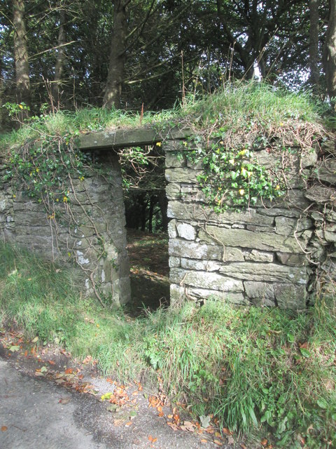
![Pen Lan Bagged high point in field and reservoir with Alex and Smudge.
Name: Pen Lan
Hill number: 15425
Height:183m / 600ft
Parent (Ma/M): 2221 Rhos Ymryson
Section:31C: South-West Wales
County/UA: Cardiganshire [Ceredigion] (CoU)
Class: Tump (100-199m)
Grid ref:SN252471 (est)
Drop: 36m
Col:147m SN245459](https://s2.geograph.org.uk/geophotos/04/66/70/4667006_8a055dbc.jpg)
Allt Llawddog is a picturesque wood located in Cardiganshire, Wales. Covering an area of approximately 50 acres, it is a captivating destination for nature enthusiasts and hikers alike. The wood is situated near the village of Capel Bangor, nestled within the rolling hills and lush valleys of the region.
The woodland itself is predominantly composed of a variety of deciduous trees, including oak, beech, and birch. These towering trees create a dense canopy, providing shade and shelter to an array of flora and fauna. The forest floor is adorned with vibrant wildflowers, ferns, and mosses, creating a rich tapestry of colors and textures.
Traversing through Allt Llawddog, visitors will find a network of well-marked trails and footpaths, allowing them to explore the wood's beauty at their own pace. The paths wind through the trees, offering glimpses of babbling brooks and small cascades that add to the enchanting atmosphere.
The wood is also home to a diverse range of wildlife. Birdwatchers can spot various species of woodland birds, such as woodpeckers, owls, and warblers, while lucky visitors may catch sight of elusive mammals like badgers and foxes. The tranquil ambiance of Allt Llawddog makes it an ideal habitat for these creatures.
For those seeking solace in nature or a peaceful retreat from the bustling city life, Allt Llawddog offers a serene haven. Its natural beauty and tranquility make it a cherished destination for locals and tourists alike, providing a respite from the demands of modern life.
If you have any feedback on the listing, please let us know in the comments section below.
Allt Llawddog Images
Images are sourced within 2km of 52.088733/-4.5246463 or Grid Reference SN2746. Thanks to Geograph Open Source API. All images are credited.


Allt Llawddog is located at Grid Ref: SN2746 (Lat: 52.088733, Lng: -4.5246463)
Unitary Authority: Ceredigion
Police Authority: Dyfed Powys
What 3 Words
///hairstyle.unearthly.fortnight. Near Aberporth, Ceredigion
Nearby Locations
Related Wikis

Neuadd Trefawr
Neuadd Trefawr (sometimes misspelt Noyadd Trefawr) is a small village in the community of Beulah, Ceredigion, Wales, which is 71.9 miles (115.8 km) from...
Ponthirwaun
Ponthirwaun is a hamlet in the community of Beulah, Ceredigion, Wales, which is 71.3 miles (114.8 km) from Cardiff and 192.5 miles (309.7 km) from London...
Beulah, Ceredigion
Beulah (Welsh: Bwla) is a small village, wider community and electoral ward located halfway between the market town of Newcastle Emlyn and the seaside...
Tŷ-llwyd
Tŷ-llwyd is an old mansion and estate in the community of Beulah, Ceredigion, Wales, which is 71.4 miles (114.8 km) from Cardiff and 191.4 miles (308...
Blaen-pant
Blaen-pant is a small village in the community of Beulah, Ceredigion, Wales, which is 71.5 miles (115 km) from Cardiff and 192.8 miles (310.3 km) from...
Glaneirw
Glaneirw is an old mansion in the community of Aberporth, Ceredigion, Wales, which is 72 miles (115.8 km) from Cardiff and 192 miles (309 km) from London...
Capel Tygwydd
Capel Tygwydd is a hamlet in the community of Beulah, Ceredigion, Wales, which is 70.3 miles (113.1 km) from Cardiff and 191.7 miles (308.5 km) from London...
Llain-wen
Llain-wen is a hamlet in the community of Penbryn, Ceredigion, Wales, which is 71.9 miles (115.7 km) from Cardiff and 191.9 miles (308.8 km) from London...
Nearby Amenities
Located within 500m of 52.088733,-4.5246463Have you been to Allt Llawddog?
Leave your review of Allt Llawddog below (or comments, questions and feedback).