Burgedin

Settlement in Montgomeryshire

Wales

Burgedin

Old Milestone by the B4392, near Burgedin Locks Pool Gable stone by the B4392, in parish of Llandrinio (Powys District), Northwest of Burgedin Locks, on grass verge.

Inscription reads:-
POOL 6
OSWESTRY 9

Grade II listed by Cadw.
Reference Number: 15423 <span class="nowrap"><a title="https://cadwpublic-api.azurewebsites.net/reports/listedbuilding/FullReport?lang=&id=15423" rel="nofollow ugc noopener" href="https://cadwpublic-api.azurewebsites.net/reports/listedbuilding/FullReport?lang=&id=15423">Link</a><img style="margin-left:2px;" alt="External link" title="External link - shift click to open in new window" src="https://s1.geograph.org.uk/img/external.png" width="10" height="10"/></span>

Surveyed

Milestone Society National ID: MOT_WPOWa06
Old Milestone by the B4392, near Burgedin Locks Credit: Milestone Society

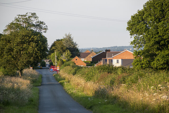
Burgedin is a small village located in the historic county of Montgomeryshire, Wales. Situated in the picturesque countryside, it is nestled in the heart of the Severn Valley, offering stunning views of the surrounding hills and meadows. The village is conveniently positioned along the A483 road, connecting it to nearby towns such as Newtown and Welshpool.

With a population of around 300 residents, Burgedin is known for its close-knit community and friendly atmosphere. The village is characterized by its traditional Welsh architecture, including charming stone cottages and a quaint parish church. The surrounding landscape provides ample opportunities for outdoor activities, attracting nature enthusiasts and hikers.

Burgedin is home to a few local amenities, including a village hall that serves as a hub for community events and gatherings. The nearest primary school is located in the neighboring village of Aberhafesp, while secondary education facilities are available in the nearby towns.

The village has a rich history, dating back centuries. It was once a thriving agricultural community, with farming being a significant part of the local economy. Today, however, Burgedin has transitioned into a primarily residential area, with many residents commuting to nearby towns for work.

Overall, Burgedin offers a peaceful and idyllic countryside lifestyle, making it an attractive place for those seeking a tranquil retreat while still having easy access to essential amenities and nearby towns.

If you have any feedback on the listing, please let us know in the comments section below.
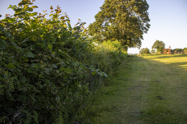
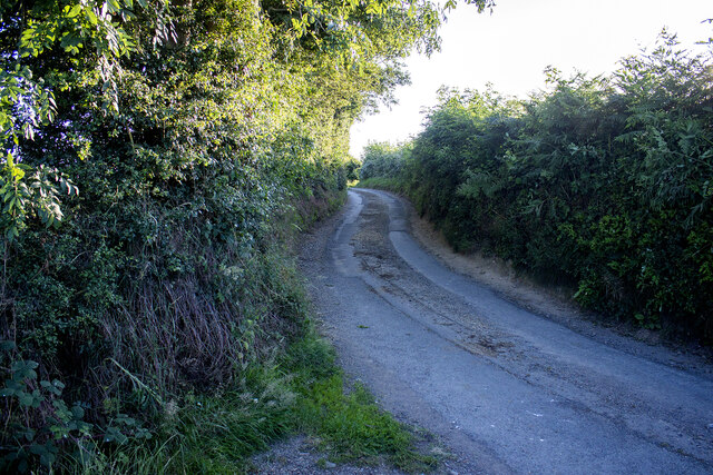
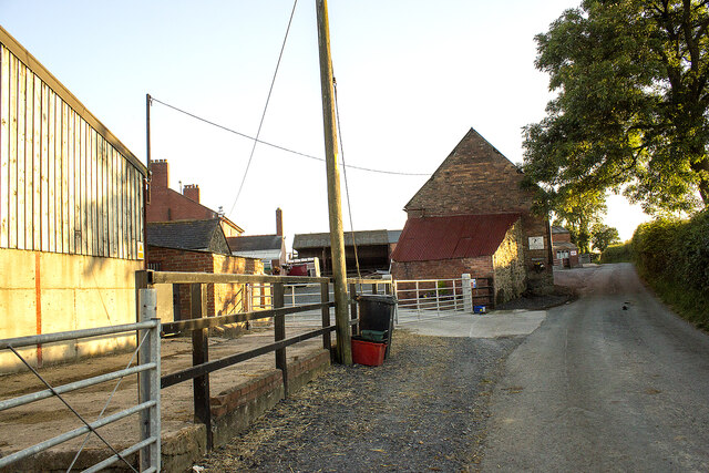
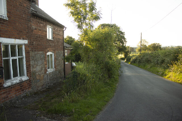
Burgedin Images

Images are sourced within 2km of 52.723305/-3.12674 or Grid Reference SJ2414. Thanks to Geograph Open Source API. All images are credited.

Old Milestone by the B4392, near Burgedin Locks Pool Gable stone by the B4392, in parish of Llandrinio (Powys District), Northwest of Burgedin Locks, on grass verge.

Inscription reads:-
POOL 6
OSWESTRY 9

Grade II listed by Cadw.
Reference Number: 15423 <span class="nowrap"><a title="https://cadwpublic-api.azurewebsites.net/reports/listedbuilding/FullReport?lang=&id=15423" rel="nofollow ugc noopener" href="https://cadwpublic-api.azurewebsites.net/reports/listedbuilding/FullReport?lang=&id=15423">Link</a><img style="margin-left:2px;" alt="External link" title="External link - shift click to open in new window" src="https://s1.geograph.org.uk/img/external.png" width="10" height="10"/></span>

Surveyed

Milestone Society National ID: MOT_WPOWa06
Old Milestone by the B4392, near Burgedin Locks
Pool Gable stone by the B4392, in parish of Llandrinio (Powys District), Northwest of Burgedin Locks, on grass verge. Inscription reads:- POOL 6 OSWESTRY 9 Grade II listed by Cadw. Reference Number: 15423 LinkExternal link Surveyed Milestone Society National ID: MOT_WPOWa06
Old Milestone by the B4392, near Varchoel Bridge, Guilsfield parish Pool Gable by the B4392, in parish of Guilsfield (Powys District), Burgedin, Southwest of Varchoel Bridge, in bank, North side of road.

Inscription reads:-
Pool. 5.
OSWeSTRY.10½  

Grade II listed by Cadw.
Reference Number: 15794 <span class="nowrap"><a title="https://cadwpublic-api.azurewebsites.net/reports/listedbuilding/FullReport?lang=&id=15794" rel="nofollow ugc noopener" href="https://cadwpublic-api.azurewebsites.net/reports/listedbuilding/FullReport?lang=&id=15794">Link</a><img style="margin-left:2px;" alt="External link" title="External link - shift click to open in new window" src="https://s1.geograph.org.uk/img/external.png" width="10" height="10"/></span>

Surveyed

Milestone Society National ID: MOT_WPOWa05
Old Milestone by the B4392, near Varchoel Bridge, Guilsfield parish
Pool Gable by the B4392, in parish of Guilsfield (Powys District), Burgedin, Southwest of Varchoel Bridge, in bank, North side of road. Inscription reads:- Pool. 5. OSWeSTRY.10½ Grade II listed by Cadw. Reference Number: 15794 LinkExternal link Surveyed Milestone Society National ID: MOT_WPOWa05
Hedgerow and field Hedgerow and field near Little Rhos Farm
Hedgerow and field
Hedgerow and field near Little Rhos Farm
Road to Little Rhos Farm Road with hedgerows
Road to Little Rhos Farm
Road with hedgerows
Burgedin farm Vernacular and modern farm buildings at Burgedin farm
Burgedin farm
Vernacular and modern farm buildings at Burgedin farm
Corner House Road at Corner House
Corner House
Road at Corner House
Arddlin village Road from Burgedin to Arddlin
Arddlin village
Road from Burgedin to Arddlin
Upper House Farm Modern farm building at Upper House Farm
Upper House Farm
Modern farm building at Upper House Farm
Burgedin Cottages To to Burgedin Cottages
Burgedin Cottages
To to Burgedin Cottages
Hedgerows and fields Hedgerows and fields near Bridge Farm
Hedgerows and fields
Hedgerows and fields near Bridge Farm
The Montgomery Canal, Wern. The disused Montgomery Canal crossed by the lane from Pool Quay, at Wern.

<span class="nowrap"><a title="http://www.canaljunction.com/canal/montgomery.htm" rel="nofollow ugc noopener" href="http://www.canaljunction.com/canal/montgomery.htm">Link</a><img style="margin-left:2px;" alt="External link" title="External link - shift click to open in new window" src="https://s1.geograph.org.uk/img/external.png" width="10" height="10"/></span>
The Montgomery Canal, Wern.
The disused Montgomery Canal crossed by the lane from Pool Quay, at Wern. LinkExternal link
Bridge 106 Montgomery Canal Next to Wern Clay workings
Bridge 106 Montgomery Canal
Next to Wern Clay workings
Wern Claypits Nature Reserve entrance
Artefacts from the old Wern Claypits By bridge 106 over canal
Artefacts from the old Wern Claypits
By bridge 106 over canal
Montgomery Canal - Bridge 104
Montgomery Canal near Arddleen/Arddlin
Tanhouse Bridge
Tanhouse Bridge
B4392 south at Arddleen from phone box
Show me another place!

Burgedin is located at Grid Ref: SJ2414 (Lat: 52.723305, Lng: -3.12674)

Unitary Authority: Powys

Police Authority: Dyfed Powys

What 3 Words

///petal.bucks.mega. Near Guilsfield, Powys

Nearby Locations

Burgedin Deep Cutting

Related Wikis

Burgedin

Burgedin is a village in Powys, Wales. The Montgomery Canal passes through the village. == External links == Photos of Burgedin and surrounding area on...

Holy Trinity Church, Penrhos

Holy Trinity Church is a church in the valley of Penrhos, Powys, Wales. The present church was built in 1845 to a design by Sydney Smirke, as a replacement...

Arddleen

Arddleen (Welsh: Arddlîn) or Arddlin is a village in Powys, central Wales. It lies about 5 miles north of Welshpool, in the community of Llandrinio. It...

Pool Quay railway station

Pool Quay railway station was a station in Pool Quay, Powys, Wales. The station was opened on 1 May 1860 and closed on 18 January 1965. == References ==

Nearby Amenities

Located within 500m of 52.723305,-3.12674
Place: farm
Lat/Long: 52.7255314/-3.1327286
Barrier: cattle_grid
Lat/Long: 52.7252657/-3.1303636
Direction: 215
Generator Method: photovoltaic
Generator Output Electricity: yes
Generator Solar Modules: 7
Generator Source: solar
Generator Type: solar_photovoltaic_panel
Location: roof
Power: generator
Lat/Long: 52.7262182/-3.12428
Direction: 215
Generator Method: photovoltaic
Generator Output Electricity: yes
Generator Solar Modules: 25
Generator Source: solar
Generator Type: solar_photovoltaic_panel
Location: roof
Power: generator
Lat/Long: 52.7262458/-3.1242424
Direction: SE
Generator Method: photovoltaic
Generator Output Electricity: yes
Generator Solar Modules: 18
Generator Source: solar
Generator Type: solar_photovoltaic_panel
Location: roof
Power: generator
Lat/Long: 52.7253085/-3.1325264
The data included in this document is from www.openstreetmap.org. The data is made available under ODbL.

Have you been to Burgedin?

Leave your review of Burgedin below (or comments, questions and feedback).