Allt Pen-gaer
Wood, Forest in Pembrokeshire
Wales
Allt Pen-gaer

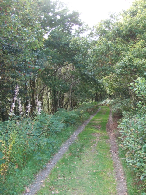
Allt Pen-gaer, located in Pembrokeshire, Wales, is a picturesque woodland area known for its natural beauty and rich biodiversity. Covering an extensive area, this woodland is a popular destination for nature enthusiasts, hikers, and birdwatchers.
The forest is characterized by its diverse range of indigenous tree species, such as oak, birch, and ash. These trees create a dense canopy, providing shelter and a suitable habitat for various wildlife species. Allt Pen-gaer is home to an array of fauna, including red squirrels, badgers, and numerous bird species, such as woodpeckers and buzzards. Additionally, the forest floor is adorned with an abundance of wildflowers and ferns, adding to the enchanting atmosphere.
Visitors to Allt Pen-gaer can explore the woodland through a network of well-maintained trails, allowing them to fully immerse themselves in nature. The trails cater to different levels of fitness and offer breathtaking views of the surrounding countryside. Some paths lead to the nearby ridge, providing panoramic vistas over the Pembrokeshire Coast National Park.
In addition to its natural beauty, Allt Pen-gaer holds historical significance. The forest is located near the remains of an Iron Age hillfort, offering visitors a glimpse into the region's ancient past. The hillfort, known as Pen-gaer, is an archaeological marvel, with its earthen banks and ditches still visible today.
Overall, Allt Pen-gaer in Pembrokeshire is a true haven for nature lovers, offering a tranquil retreat amidst its lush woodland and captivating wildlife.
If you have any feedback on the listing, please let us know in the comments section below.
Allt Pen-gaer Images
Images are sourced within 2km of 52.03947/-4.6813284 or Grid Reference SN1641. Thanks to Geograph Open Source API. All images are credited.


Allt Pen-gaer is located at Grid Ref: SN1641 (Lat: 52.03947, Lng: -4.6813284)
Unitary Authority: Pembrokeshire
Police Authority: Dyfed Powys
What 3 Words
///absorbing.oath.vipers. Near Cardigan, Ceredigion
Nearby Locations
Related Wikis

Llantood
Llantood (formerly Llantyd, Llantwyd or Llan-Illtyd) is a hamlet and parish in Cilgerran community, north Pembrokeshire, Wales. == Location == Llantood...

Bridell
Bridell (Welsh: Y Bridell) is a small settlement and parish in north Pembrokeshire, Wales. The parish includes the village of Pen-y-bryn. Together with...
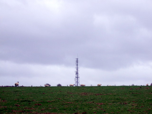
Cardigan transmitting station
The Cardigan transmitting station is a broadcasting and telecommunications facility located at Penwaun in Pembrokeshire, Wales, about 3 km to the south...

Rhoshill, Pembrokeshire
Rhoshill (also known as Rhos-hill) is a hamlet on the A478 road, in the community and parish of Cilgerran, in Pembrokeshire, South-west Wales. The hamlet...
Eglwyswrw
Eglwyswrw [ɛɡlʊɨˈsuːrʊ] is a village, community and parish in the former Cantref of Cemais, Pembrokeshire, Wales. The village lies between Newport and...

Cilgerran
Cilgerran (previously Kilgerran or Cil-Garon) is both a village, a parish, and also a community, situated on the south bank of the River Teifi in Pembrokeshire...

Cilgerran Castle
Cilgerran Castle (Welsh: Castell Cilgerran) is a 13th-century ruined castle located in Cilgerran, Pembrokeshire, Wales, near Cardigan. The first castle...
Pengelli National Nature Reserve
Pengelli National Nature Reserve is part of the largest block of ancient oak woodland in West Wales. It has survived for hundreds of years, despite being...
Nearby Amenities
Located within 500m of 52.03947,-4.6813284Have you been to Allt Pen-gaer?
Leave your review of Allt Pen-gaer below (or comments, questions and feedback).