Fir Hill Wood

Wood, Forest in Pembrokeshire

Wales

Fir Hill Wood

Castle Lake Camp Detritus left behind at Castle Lake Camp, a promontory fort overlooking the Eastern Cleddau.
Castle Lake Camp Credit: Deborah Tilley

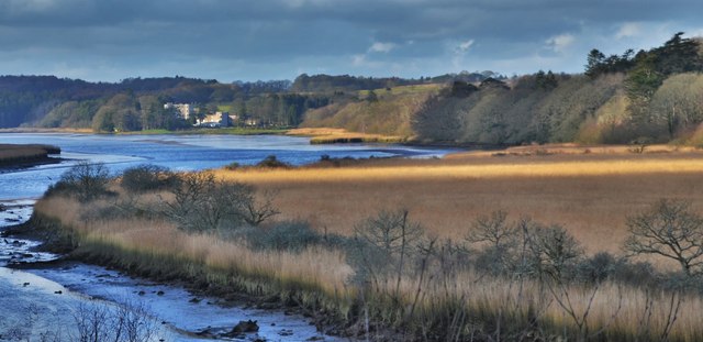
Fir Hill Wood is a picturesque forest located in the county of Pembrokeshire, Wales. Spanning over several acres, this woodland area is known for its breathtaking natural beauty and diverse flora and fauna.

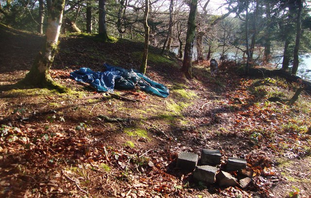
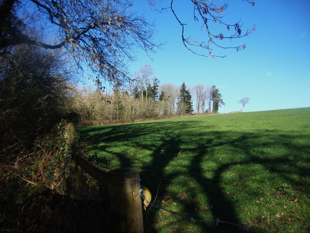
The forest is predominantly composed of fir trees, which provide a lush green canopy throughout the year. The tall, straight trunks of these evergreen trees create a magical atmosphere, particularly during the winter months when they are dusted with a layer of snow. The forest floor is carpeted with a rich assortment of wildflowers, ferns, and mosses, adding to the enchanting ambiance.

Fir Hill Wood is a haven for wildlife enthusiasts, as it is home to a variety of animal species. Visitors can spot an array of birds, including woodpeckers, owls, and songbirds, flitting among the branches. Squirrels and rabbits can be seen darting around the forest floor, while deer occasionally make an appearance, adding to the sense of tranquility and natural harmony.

Trails wind through Fir Hill Wood, providing ample opportunities for hiking and exploring. These paths lead visitors through the heart of the forest, allowing them to immerse themselves in the sights, sounds, and scents of nature. Along the way, there are designated picnic areas and benches, offering a chance to rest and take in the stunning surroundings.

Fir Hill Wood is a true gem of Pembrokeshire, offering a serene escape from the hustle and bustle of everyday life. Whether it's a leisurely stroll, a picnic with loved ones, or birdwatching, this woodland is a must-visit destination for nature enthusiasts and those seeking tranquility amid the beauty of the natural world.

If you have any feedback on the listing, please let us know in the comments section below.

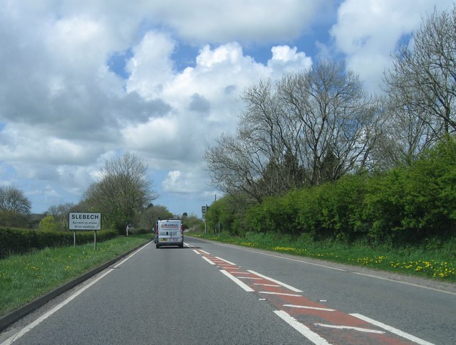
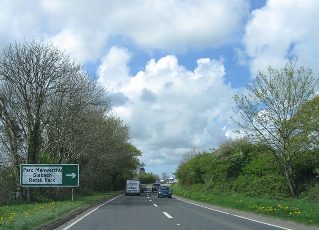
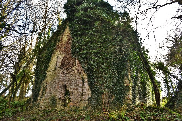
Fir Hill Wood Images

Images are sourced within 2km of 51.796185/-4.8646441 or Grid Reference SN0214. Thanks to Geograph Open Source API. All images are credited.

Castle Lake Camp Detritus left behind at Castle Lake Camp, a promontory fort overlooking the Eastern Cleddau.
Castle Lake Camp
Detritus left behind at Castle Lake Camp, a promontory fort overlooking the Eastern Cleddau.
Pasture north of Crafty Wood On the Picton estate
Pasture north of Crafty Wood
On the Picton estate
A40 heading for Arnolds Hill Heading for the top of Arnolds Hill from Slebech on the A40 before descending  towards Haverfordwest.
A40 heading for Arnolds Hill
Heading for the top of Arnolds Hill from Slebech on the A40 before descending towards Haverfordwest.
Picton Castle - South Elevation The castle was built around 1300 by Sir John Wogan, Justice of Ireland. His descendants, the Philipps family still live here (see Baron Milford). The layout is unusual because there is no internal courtyard. Protection was provided by seven projecting circular towers. The gate and portcullis led directly into the basement under the great hall. Baron Philipps had the west tower demolished in the early 19th century and replaced it with the four-storey rectangular castellated block on this corner.
Castle - <span class="nowrap"><a title="http://en.wikipedia.org/wiki/Picton_Castle" rel="nofollow ugc noopener" href="http://en.wikipedia.org/wiki/Picton_Castle">Link</a><img style="margin-left:2px;" alt="External link" title="External link - shift click to open in new window" src="https://s1.geograph.org.uk/img/external.png" width="10" height="10"/></span>
Baron Milford - <span class="nowrap"><a title="http://en.wikipedia.org/wiki/Baron_Milford" rel="nofollow ugc noopener" href="http://en.wikipedia.org/wiki/Baron_Milford">Link</a><img style="margin-left:2px;" alt="External link" title="External link - shift click to open in new window" src="https://s1.geograph.org.uk/img/external.png" width="10" height="10"/></span>
Picton Castle - South Elevation
The castle was built around 1300 by Sir John Wogan, Justice of Ireland. His descendants, the Philipps family still live here (see Baron Milford). The layout is unusual because there is no internal courtyard. Protection was provided by seven projecting circular towers. The gate and portcullis led directly into the basement under the great hall. Baron Philipps had the west tower demolished in the early 19th century and replaced it with the four-storey rectangular castellated block on this corner. Castle - LinkExternal link Baron Milford - LinkExternal link
Picton Castle - North Elevation The origins of the castle are unclear, but it probably started when Henry I in 1108 attempted to exercise control over west Wales and may have built a castle nearby (see <a href="https://www.geograph.org.uk/photo/1232817">SN0113 : Picton Motte Dungledi</a> ). By the end of the 13th century the castle was owned by Wogan, baron of Wiston, who built the present castle. The estate passed via marriage to the Dwnn family and eventually to Sir Thomas Philipps of Cilsant, esquire to Henry VII, in the late 15th century. In 1611, James I raised money for the Irish campaigns by selling baronetcies and Sir John Philipps bought one for £1,095! In 1776 Sir Richard Philipps was created Lord Milford. Throughout the 17th and 18th centuries the Philipps family was the most powertful in Pembrokshire, owning vast estates and becoming the local lord lieutenants and MPs. The castle is now owned by the Picton Castle Trust.
Picton Castle - North Elevation
The origins of the castle are unclear, but it probably started when Henry I in 1108 attempted to exercise control over west Wales and may have built a castle nearby (see SN0113 : Picton Motte Dungledi ). By the end of the 13th century the castle was owned by Wogan, baron of Wiston, who built the present castle. The estate passed via marriage to the Dwnn family and eventually to Sir Thomas Philipps of Cilsant, esquire to Henry VII, in the late 15th century. In 1611, James I raised money for the Irish campaigns by selling baronetcies and Sir John Philipps bought one for £1,095! In 1776 Sir Richard Philipps was created Lord Milford. Throughout the 17th and 18th centuries the Philipps family was the most powertful in Pembrokshire, owning vast estates and becoming the local lord lieutenants and MPs. The castle is now owned by the Picton Castle Trust.
Picton Castle - Courtyard The courtyard is to the north of the castle and houses the main entrance, shop and tea rooms for visitors.
Picton Castle - Courtyard
The courtyard is to the north of the castle and houses the main entrance, shop and tea rooms for visitors.
Picton Castle
Picton Castle
Picton Castle
Picton Castle
Slebech Church This church is now deserted and derelict. Surrounded by security fencing to prevent access. The graveyard is reachable though.
Slebech Church
This church is now deserted and derelict. Surrounded by security fencing to prevent access. The graveyard is reachable though.
Ordnance Survey Flush Bracket G3234 This can be found on the wall of a house at Slebech.
For more detail see : <span class="nowrap"><a title="http://www.bench-marks.org.uk/log?bm_key=11150" rel="nofollow ugc noopener" href="http://www.bench-marks.org.uk/log?bm_key=11150">Link</a><img style="margin-left:2px;" alt="External link" title="External link - shift click to open in new window" src="https://s1.geograph.org.uk/img/external.png" width="10" height="10"/></span>
Ordnance Survey Flush Bracket G3234
This can be found on the wall of a house at Slebech. For more detail see : LinkExternal link
A40 westbound
A40 westbound
Entrance to Slebech, A40 westbound
A40 westbound
A40 westbound
A40 westbound
A40 westbound
Ordnance Survey Flush Bracket (G3234) This OS Flush Bracket can be found on Thorn Bush House to the north of the road. It marks a point 69.032m above mean sea level.
Ordnance Survey Flush Bracket (G3234)
This OS Flush Bracket can be found on Thorn Bush House to the north of the road. It marks a point 69.032m above mean sea level.
Ordnance Survey Rivet This OS rivet can be found on a north facing buttress of St John the Baptist Church. It marks a point 70.997m above mean sea level.
Ordnance Survey Rivet
This OS rivet can be found on a north facing buttress of St John the Baptist Church. It marks a point 70.997m above mean sea level.
Downriver at Minwear Woods Slebech Park is situated across the river beyond the reed beds
Downriver at Minwear Woods
Slebech Park is situated across the river beyond the reed beds
Sisters' House at Minwear The Sisters' House is a collection of ruined buildings on the south bank of the Eastern Cleddau, Pembrokeshire, opposite the site of the commandery of the Hospital of St John of Jerusalem at Slebech. The Sisters' House formed part of the manor of Minwear, which was given to the order of the Hospital at Slebech in the mid-twelfth century. It is first mentioned in a document of 1546, when it was named as part of the Slebech estates sold after the dissolution of the monasteries in England and Wales. Scholars have differed in their interpretation of the buildings at the Sisters' House, variously describing the main building as a barn or as a pilgrim hospice
Sisters' House at Minwear
The Sisters' House is a collection of ruined buildings on the south bank of the Eastern Cleddau, Pembrokeshire, opposite the site of the commandery of the Hospital of St John of Jerusalem at Slebech. The Sisters' House formed part of the manor of Minwear, which was given to the order of the Hospital at Slebech in the mid-twelfth century. It is first mentioned in a document of 1546, when it was named as part of the Slebech estates sold after the dissolution of the monasteries in England and Wales. Scholars have differed in their interpretation of the buildings at the Sisters' House, variously describing the main building as a barn or as a pilgrim hospice
Show me another place!

Fir Hill Wood is located at Grid Ref: SN0214 (Lat: 51.796185, Lng: -4.8646441)

Unitary Authority: Pembrokeshire

Police Authority: Dyfed Powys

What 3 Words

///masterpiece.respects.garden. Near Wiston, Pembrokeshire

Nearby Locations

Fir Hill Wood

Related Wikis

Uzmaston, Boulston and Slebech

Uzmaston, Boulston and Slebech is a community in Pembrokeshire, Wales, which includes the villages of Uzmaston, Boulston and Slebech, and the Haverfordwest...

Slebech

Slebech was a community (prior to 1974, a civil parish) in Pembrokeshire, Wales, which is now part of the combined community of Uzmaston and Boulston and...

Minwear Wood

Minwear Wood is a Site of Special Scientific Interest (or SSSI) in Pembrokeshire, South Wales. It has been designated as a Site of Special Scientific Interest...
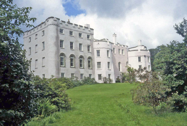
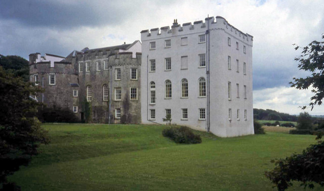
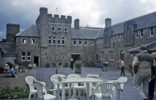
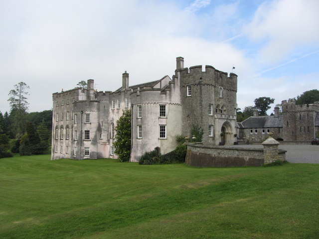
Picton Castle

Picton Castle (Welsh: Castell Pictwn) is a medieval castle near Haverfordwest in the community of Uzmaston, Boulston and Slebech, Pembrokeshire, Wales...

Minwear

Minwear is a former parish and village in the community of Martletwy, in the county of Pembrokeshire, Wales, on the Eastern Cleddau river, 4+1⁄2 miles...

Martletwy (electoral ward)

Martletwy is the name of an electoral ward in Pembrokeshire, Wales. It is bordered to the west by the River Cleddau and includes three communities within...

Big House, Landshipping

The Big House, also known as Landshipping House, is a historic house on the banks of the River Cleddau in Landshipping, Pembrokeshire, Wales. The house...

Wiston, Pembrokeshire

Wiston (Welsh: Cas-Wis) is a village, parish and community in Pembrokeshire, Wales, in the United Kingdom. It was once a marcher borough. George Owen,...

Nearby Amenities

Located within 500m of 51.796185,-4.8646441
Direction: 190
Generator Method: photovoltaic
Generator Output Electricity: yes
Generator Solar Modules: 17
Generator Source: solar
Generator Type: solar_photovoltaic_panel
Location: roof
Power: generator
Lat/Long: 51.7981483/-4.8688927
The data included in this document is from www.openstreetmap.org. The data is made available under ODbL.

Have you been to Fir Hill Wood?

Leave your review of Fir Hill Wood below (or comments, questions and feedback).