Bunker's Hill

Settlement in Cambridgeshire Fenland

England

Bunker's Hill

Mixed flower cover-crop south of Tholomas Drove A mixture of sunflowers and other flowers.
Mixed flower cover-crop south of Tholomas Drove Credit: Richard Humphrey

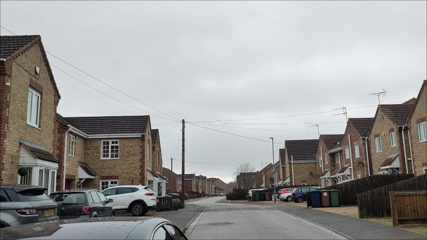
Bunker's Hill is a small village located in the county of Cambridgeshire, England. Situated approximately 5 miles northeast of the city of Ely, it is nestled amidst the picturesque Fenland landscape. The village is home to a close-knit community and offers a peaceful and idyllic setting for its residents.

The origins of Bunker's Hill can be traced back several centuries, with evidence of human habitation in the area dating back to the Roman period. The village takes its name from a prominent hill that overlooks the surrounding countryside, providing stunning panoramic views of the Cambridgeshire Fens.

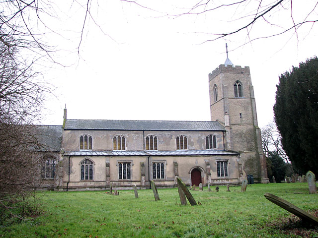
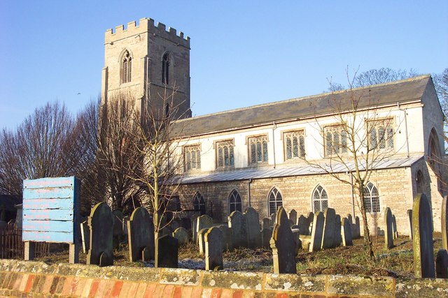
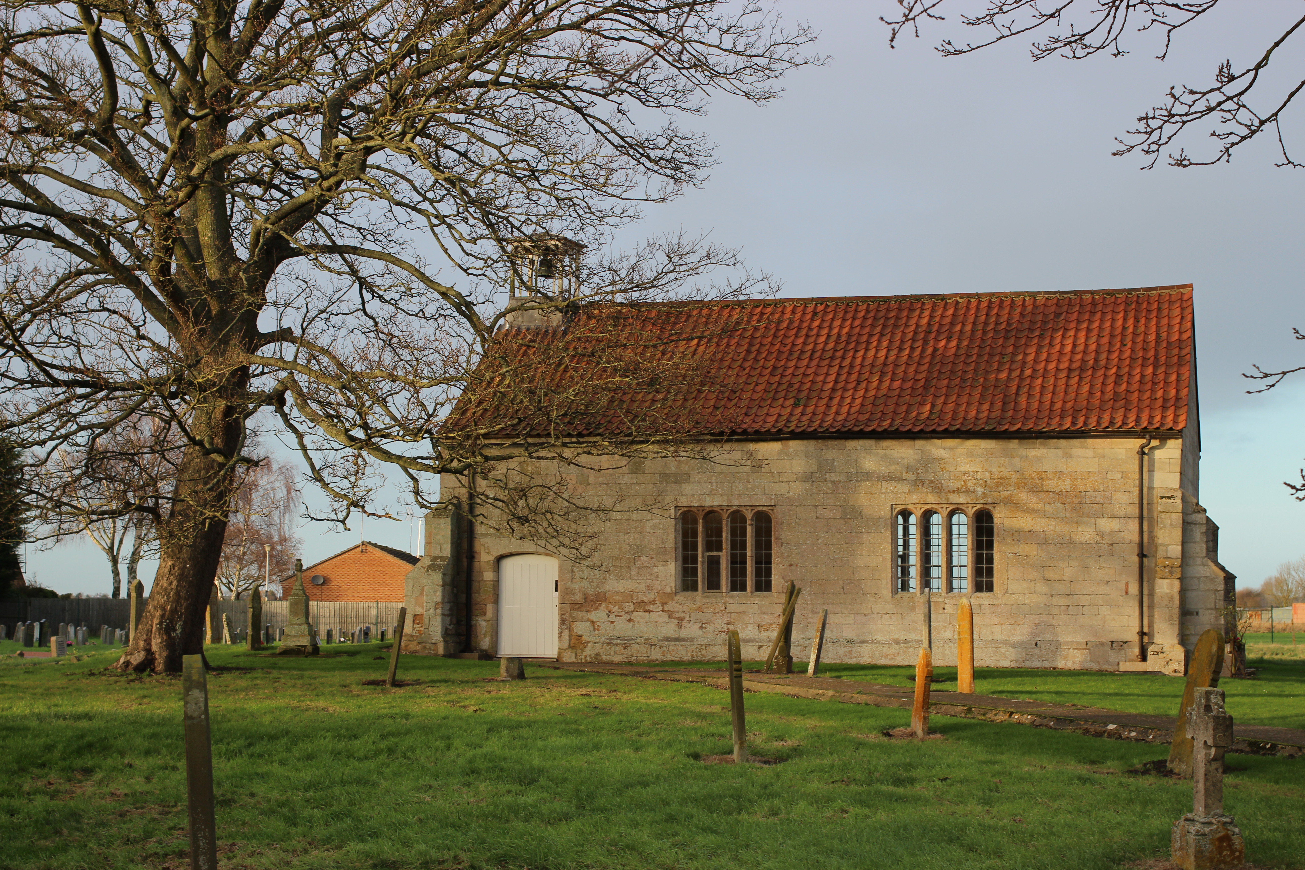
The village itself is characterized by its charming and traditional architecture, with a mix of historic cottages and more modern houses. Bunker's Hill is also home to a small but well-preserved medieval church, which stands as a testament to the village's rich history.

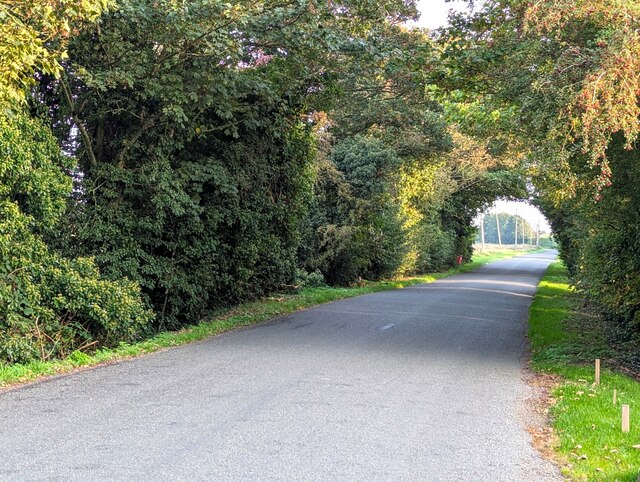
Although Bunker's Hill is primarily a residential area, it benefits from its proximity to nearby towns and cities. Residents have convenient access to amenities and services in Ely, including shops, schools, and healthcare facilities. The village is also well-connected to the wider region through a network of local roads and public transportation.

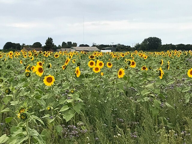
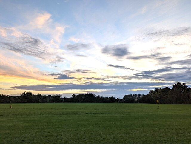
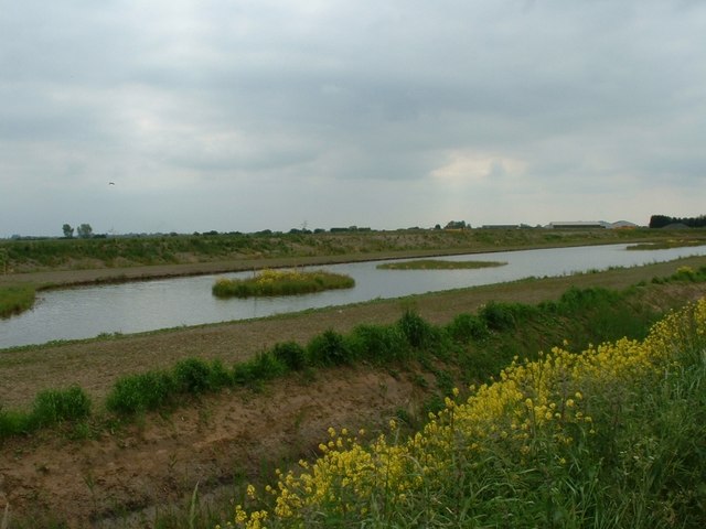
The surrounding countryside offers ample opportunities for outdoor activities, with numerous walking and cycling routes traversing the beautiful Fenland landscape. Bunker's Hill provides a tranquil and serene environment for those seeking a peaceful rural retreat, while still being within easy reach of urban amenities.

If you have any feedback on the listing, please let us know in the comments section below.

Bunker's Hill Images

Images are sourced within 2km of 52.643745/0.079453711 or Grid Reference TF4007. Thanks to Geograph Open Source API. All images are credited.

Mixed flower cover-crop south of Tholomas Drove A mixture of sunflowers and other flowers.
Mixed flower cover-crop south of Tholomas Drove
A mixture of sunflowers and other flowers.
Sunflowers in a mixed flower cover-crop Alongside the main road between Wisbech St Mary and Guyhirn
Sunflowers in a mixed flower cover-crop
Alongside the main road between Wisbech St Mary and Guyhirn
Pond Life - Wisbech St Mary During 2022 the pond was cleaned out, fenced and a new information board erected by the Parish Council
Pond Life - Wisbech St Mary
During 2022 the pond was cleaned out, fenced and a new information board erected by the Parish Council
Development land and new housing in Wisbech St Mary Planning permission has recently been granted for houses to be built on this grass area. In the distance is a large new housing estate nearing completion called Beckett Hamlet
Development land and new housing in Wisbech St Mary
Planning permission has recently been granted for houses to be built on this grass area. In the distance is a large new housing estate nearing completion called Beckett Hamlet
Frozen parkland at Inham Hall, Wisbech St Mary
Frosted trees next to Northside Drain Next to Rummers Lane, Wisbech St Mary
Frosted trees next to Northside Drain
Next to Rummers Lane, Wisbech St Mary
A winter's day on Rummers Lane, Wisbech St Mary Rummers Lane on the left and Northside Drain on the right
A winter's day on Rummers Lane, Wisbech St Mary
Rummers Lane on the left and Northside Drain on the right
Sugar beet heap off Rummers Lane, Wisbech St Mary
Frosty dike off Rummers Lane, Wisbech St Mary
Drain off Rummers Lane Also see <a title="https://www.geograph.org.uk/photo/6163315" href="https://www.geograph.org.uk/photo/6163315">Link</a>
Drain off Rummers Lane
Also see Link
Houses under construction in Wisbech St Mary For a view in March 2020 see <a title="https://www.geograph.org.uk/photo/6426645" href="https://www.geograph.org.uk/photo/6426645">Link</a>
Houses under construction in Wisbech St Mary
For a view in March 2020 see Link
Rainbow over Sandbank, Wisbech St Mary The view from my bedroom as a child. 
There was a pot of gold at the end of this rainbow as the farmland between the barns and the end of the rainbow is now occupied by housing, see <span class="nowrap"><a title="https://www.google.com/maps/@52.6496589,0.0819716,3a,90y,197.04h,72.97t/data=!3m7!1e1!3m5!1sbVGnFaSPjGAQTmj4py7niw!2e0!5s20190301T000000!7i13312!8i6656?authuser=0&entry=ttu" rel="nofollow ugc noopener" href="https://www.google.com/maps/@52.6496589,0.0819716,3a,90y,197.04h,72.97t/data=!3m7!1e1!3m5!1sbVGnFaSPjGAQTmj4py7niw!2e0!5s20190301T000000!7i13312!8i6656?authuser=0&entry=ttu">Link</a><img style="margin-left:2px;" alt="External link" title="External link - shift click to open in new window" src="https://s1.geograph.org.uk/img/external.png" width="10" height="10"/></span>
Rainbow over Sandbank, Wisbech St Mary
The view from my bedroom as a child. There was a pot of gold at the end of this rainbow as the farmland between the barns and the end of the rainbow is now occupied by housing, see LinkExternal link
Sunset over a meadow in Wisbech St Mary
Horses at Sandbank Farm, Wisbech St Mary
Bevis Lane in Wisbech St Mary
The Chequers, Tholomas Drove The pub is a tied-house belonging to the independent brewer Elgoods of Wisbech.
The Chequers, Tholomas Drove
The pub is a tied-house belonging to the independent brewer Elgoods of Wisbech.
A view towards Church End, Parson Drove An early summer pastoral scene, looking across the fenland fields towards Church End and Woad Mills Farm.
A view towards Church End, Parson Drove
An early summer pastoral scene, looking across the fenland fields towards Church End and Woad Mills Farm.
New Fishery, Murrow Yet another landowner has decided there's more money to be made by digging a new fishery than growing English apples.
New Fishery, Murrow
Yet another landowner has decided there's more money to be made by digging a new fishery than growing English apples.
Show me another place!

Bunker's Hill is located at Grid Ref: TF4007 (Lat: 52.643745, Lng: 0.079453711)

Division: Isle of Ely

Administrative County: Cambridgeshire

District: Fenland

Police Authority: Cambridgeshire

What 3 Words

///differ.bravery.escapes. Near Wisbech, Cambridgeshire

Nearby Locations

Bunker's Hill Richey Field

Related Wikis

Tholomas Drove

Tholomas Drove is a hamlet in Wisbech St Mary civil parish, part of the Fenland district in the Isle of Ely, Cambridgeshire, England. The population is...

Wisbech St Mary F.C.

Wisbech St Mary Football Club is a football club based in Wisbech St Mary, Cambridgeshire in England. The club are currently members of the Cambridgeshire...

Wisbech St Mary railway station

Wisbech St Mary railway station was a station on the Midland and Great Northern Joint Railway line between Wisbech and Peterborough. Located in Wisbech...

Wisbech St Mary

Wisbech St Mary is a village in the Fenland District of Cambridgeshire, England. It is 2 miles (3 km) west of the town of Wisbech. It lies between two...

St John the Baptist's Church, Parson Drove

St John the Baptist's Church is a redundant Anglican church in the village of Parson Drove, Cambridgeshire, England. It is recorded in the National Heritage...

Guyhirn

Guyhirn (sometimes spelled Guyhirne) is a village near the town of Wisbech in Cambridgeshire, England. It is on the northern bank of the River Nene, at...

Guyhirn Chapel of Ease

Guyhirn Chapel of Ease, also known as Guyhirn Old Church, is a small rectangular chapel in Guyhirn, Cambridgeshire noted for being built during the Puritan...

Murrow, Cambridgeshire

Murrow is a village in the civil parish of Wisbech St Mary, in Cambridgeshire, England.The village is on Murrow Bank, the B1187 road, 5 miles (8 km) west...

Nearby Amenities

Located within 500m of 52.643745,0.079453711
Bus Stop
Willock Lane
Naptan AtcoCode: 0500FWISM006
Naptan Bearing: NE
Naptan CommonName: Willock Lane
Naptan Indicator: opp
Naptan Landmark: Willock Lane
Naptan NaptanCode: cmbdmjmg
Naptan ShortCommonName: Willock Lane
Naptan Street: High Road
Naptan Verified: no
Source: naptan_import
Lat/Long: 52.643393/0.0791572
Bus Stop
Willock Lane
Naptan AtcoCode: 0500FWISM014
Naptan Bearing: SW
Naptan CommonName: Willock Lane
Naptan Indicator: near
Naptan Landmark: Willock Lane
Naptan NaptanCode: cmbdmjpj
Naptan ShortCommonName: Willock Lane
Naptan Street: High Road
Naptan Verified: no
Source: naptan_import
Lat/Long: 52.6428643/0.0790582
Cables: 3
Power: pole
Lat/Long: 52.6424676/0.0814906
Power: pole
Lat/Long: 52.641068/0.0772073
Power: pole
Lat/Long: 52.6401582/0.082734
Power: pole
Lat/Long: 52.6406668/0.0759936
Power: pole
Lat/Long: 52.6418492/0.0795701
Power: pole
Lat/Long: 52.6414716/0.0784061
Power: pole
Lat/Long: 52.6415229/0.0813741
Power: pole
Lat/Long: 52.6422382/0.0806083
Power: pole
Lat/Long: 52.640812/0.0820248
Power: pole
Lat/Long: 52.6443664/0.0822785
Power: pole
Lat/Long: 52.6471049/0.0830429
Power: pole
Lat/Long: 52.6467267/0.0832583
Power: pole
Lat/Long: 52.6451157/0.0825852
Power: pole
Lat/Long: 52.6458993/0.0829191
Power: pole
Lat/Long: 52.6433198/0.0818355
Bunkers Hill
Place: hamlet
Source: survey
Lat/Long: 52.6433889/0.0788569
The data included in this document is from www.openstreetmap.org. The data is made available under ODbL.

Have you been to Bunker's Hill?

Leave your review of Bunker's Hill below (or comments, questions and feedback).