Carnedd Llewelyn

Hill, Mountain in Caernarfonshire

Wales

Carnedd Llewelyn

Rock Outcrops Above Melynllyn
Rock Outcrops Above Melynllyn Credit: Chris Andrews

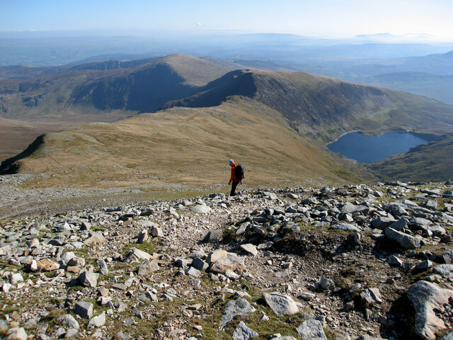
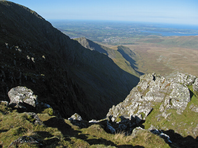
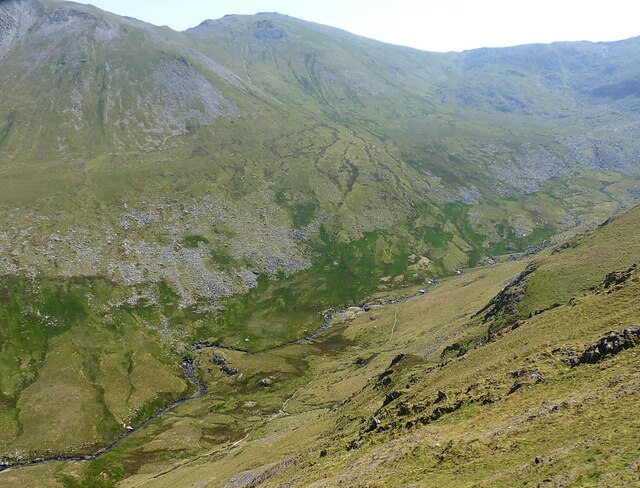
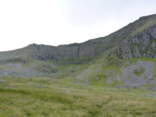
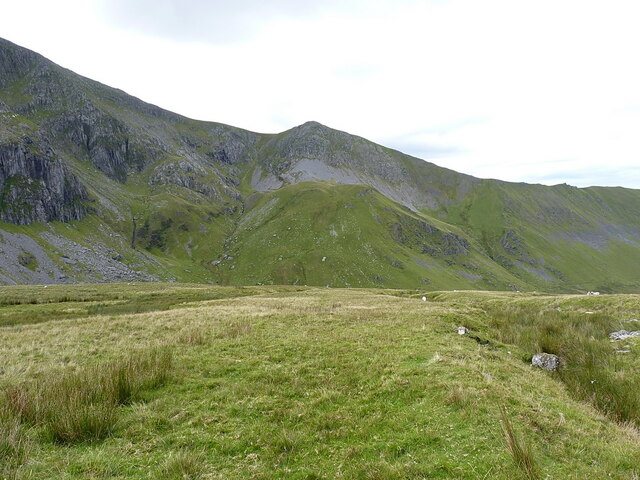
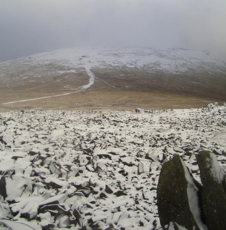
Carnedd Llewelyn is a prominent mountain located in the county of Caernarfonshire, Wales. It is part of the Carneddau range, which is known for its rugged beauty and challenging hiking opportunities. At an elevation of 1,064 meters (3,491 feet), Carnedd Llewelyn is the second highest peak in Wales, making it a popular destination for mountaineers and nature enthusiasts.

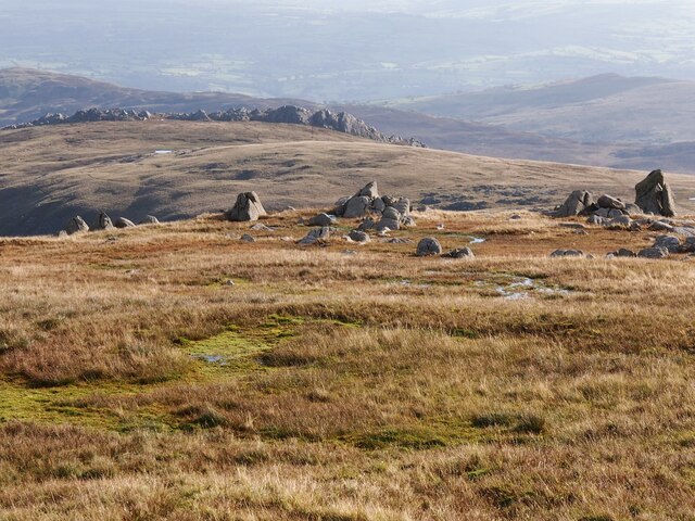
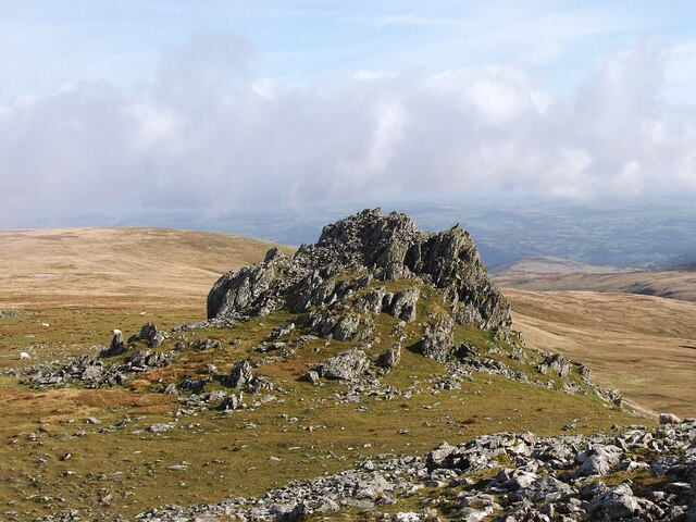
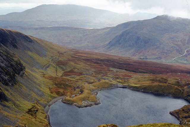
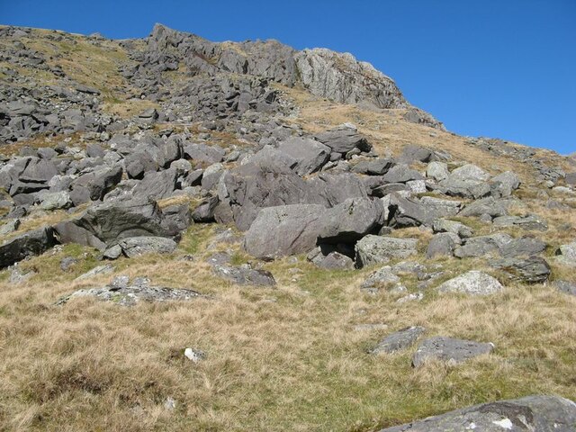
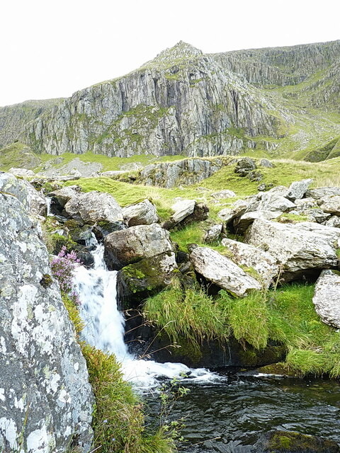
The mountain is characterized by its steep slopes and rocky terrain, offering breathtaking panoramic views of the surrounding landscape. Its summit is marked by a cairn, which provides a sense of accomplishment for those who reach the top. The ascent to Carnedd Llewelyn can be challenging, with several different routes available to choose from, each varying in difficulty and length.

The mountain is also home to a diverse range of flora and fauna, including heather, mosses, and lichens, as well as various bird species such as red grouse and peregrine falcons. The area is designated as a Site of Special Scientific Interest (SSSI) due to its ecological importance.

Carnedd Llewelyn is often part of the popular hiking route known as the Welsh 3000s, which involves conquering all 15 peaks in Wales over 3,000 feet in a single day. It is also a common starting point for exploring the wider Carneddau range, with other notable peaks such as Carnedd Dafydd and Pen yr Ole Wen nearby.

Overall, Carnedd Llewelyn offers an exciting and challenging outdoor experience, showcasing the natural beauty of the Welsh mountains and providing a thrilling adventure for outdoor enthusiasts.

If you have any feedback on the listing, please let us know in the comments section below.

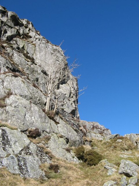
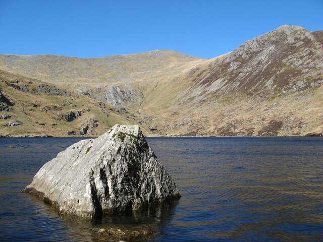
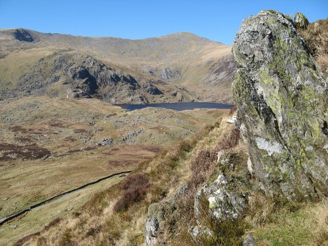
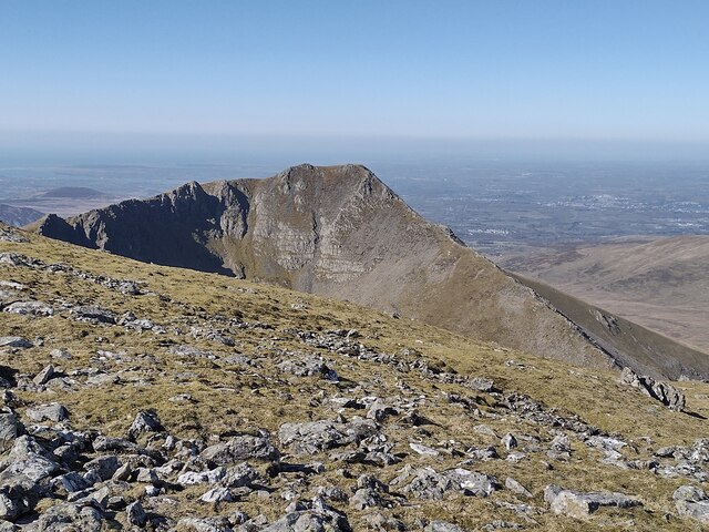
Carnedd Llewelyn Images

Images are sourced within 2km of 53.15949/-3.9712109 or Grid Reference SH6864. Thanks to Geograph Open Source API. All images are credited.

Rock Outcrops Above Melynllyn
Rock Outcrop, Carnedd Llewelyn
Ffynnon Llugwy Reservoir Looking south from Bwlch Eryl Farchog. Gallt yr Ogof (right) and Moel Siabod (left) are in the distance.
Ffynnon Llugwy Reservoir
Looking south from Bwlch Eryl Farchog. Gallt yr Ogof (right) and Moel Siabod (left) are in the distance.
Change of rock-type Rockfalls from the southern margin of Craig y Llyn are mostly of a dark grey sandstone (Llewelyn Volcanic Group) but there are also pale blocks of rhyolite. Looking up the slope shows a contact between grey sandstone and pale grey rhyolite, actually welded ash-flows of the Capel Curig Volcanic Formation. The silica-rich volcanic rock weathers to a very pale grey colour and is distinctive in outcrops. Both rock types are of Ordovician, Caradoc age.
Change of rock-type
Rockfalls from the southern margin of Craig y Llyn are mostly of a dark grey sandstone (Llewelyn Volcanic Group) but there are also pale blocks of rhyolite. Looking up the slope shows a contact between grey sandstone and pale grey rhyolite, actually welded ash-flows of the Capel Curig Volcanic Formation. The silica-rich volcanic rock weathers to a very pale grey colour and is distinctive in outcrops. Both rock types are of Ordovician, Caradoc age.
Craig y Llyn A cliff face developed in hard, volcanic rocks belonging to the Capel Curig Volcanic Formation (Ordovician, Caradoc). A rowan tree is growing on a rather inhospitable cliff face, but probably only survived because sheep could not reach it. The Capel Curig Volcanic Formation represents the accumulation of rhyolitic tuffs which were erupted from volcanoes spread between Tryfan and the northern coast beyond Conwy. It is chilling to consider the violence of eruptions which would hurl red-hot clouds of ash as far as 25km before they coalesced and hardened, often under water.
Craig y Llyn
A cliff face developed in hard, volcanic rocks belonging to the Capel Curig Volcanic Formation (Ordovician, Caradoc). A rowan tree is growing on a rather inhospitable cliff face, but probably only survived because sheep could not reach it. The Capel Curig Volcanic Formation represents the accumulation of rhyolitic tuffs which were erupted from volcanoes spread between Tryfan and the northern coast beyond Conwy. It is chilling to consider the violence of eruptions which would hurl red-hot clouds of ash as far as 25km before they coalesced and hardened, often under water.
Island boulder A single, glacial boulder forming an island in the water of Ffynnon Lugwy. From this angle it can be seen that Cwm Llugwy forms a second, shallow cirque above the primary cirque which holds the lake.
Island boulder
A single, glacial boulder forming an island in the water of Ffynnon Lugwy. From this angle it can be seen that Cwm Llugwy forms a second, shallow cirque above the primary cirque which holds the lake.
Craig y Llyn The fabulous, rocky headwall of the lower cirque (or cwm). The development of these features relates to climate deterioration for a few centuries during the Loch Lomond cold stage (Younger Dryas) when the absence of glaciers at lower levels had halted systematic erosion and only isolated patches of ice were active.
Craig y Llyn
The fabulous, rocky headwall of the lower cirque (or cwm). The development of these features relates to climate deterioration for a few centuries during the Loch Lomond cold stage (Younger Dryas) when the absence of glaciers at lower levels had halted systematic erosion and only isolated patches of ice were active.
Craig y Llyn 2 The fabulous, rocky headwall of the lower cirque (or cwm). The development of these features relates to climate deterioration for a few centuries during the Loch Lomond cold stage (Younger Dryas) when the absence of glaciers at lower levels had halted systematic erosion and only isolated patches of ice were active.
I could not decide between portrait and landscape format here, so submitted both.
Craig y Llyn 2
The fabulous, rocky headwall of the lower cirque (or cwm). The development of these features relates to climate deterioration for a few centuries during the Loch Lomond cold stage (Younger Dryas) when the absence of glaciers at lower levels had halted systematic erosion and only isolated patches of ice were active. I could not decide between portrait and landscape format here, so submitted both.
Slate outcrop with Cwm Tryfan Outcrop of slate on the edge of Y Braich. In the background if Ffynnon Llugwy and Cwm Llugwy. The disposition of the two cirques and the extensive field of moraines can be appreciated.
Slate outcrop with Cwm Tryfan
Outcrop of slate on the edge of Y Braich. In the background if Ffynnon Llugwy and Cwm Llugwy. The disposition of the two cirques and the extensive field of moraines can be appreciated.
Ffynnon Llugwy from Cranedd Llywelyn
Descending from Carnedd Llewelyn This path traverses the top of Craig yr Ysfa, from there you can pass Ffynnon Llugwy reservoir to reach  the A5 road.
Descending from Carnedd Llewelyn
This path traverses the top of Craig yr Ysfa, from there you can pass Ffynnon Llugwy reservoir to reach the A5 road.
Looking down on Cwmglas Mawr
The head of Cwm Pen-llafar, seen from the Mynydd Du ridge The steep Black Ladders (Ysgolion Duon) cliffs lie just out of sight on the right, sporting a series of fine winter climbs.
The head of Cwm Pen-llafar, seen from the Mynydd Du ridge
The steep Black Ladders (Ysgolion Duon) cliffs lie just out of sight on the right, sporting a series of fine winter climbs.
Small waterfall in Cwm Glas-bach On one of the streams that cascades down from the upper cliffs and crags above; the triangular blunt end of the Crib Lem ridge is the most prominent feature in the background.
Small waterfall in Cwm Glas-bach
On one of the streams that cascades down from the upper cliffs and crags above; the triangular blunt end of the Crib Lem ridge is the most prominent feature in the background.
Ysgolion Duon - The Black Ladders cliffs Tucked away high at the head of Cwm Pen-llafar, in fact forming the headwall of their own Cwmglas Mawr - this is probably the finest winter climbing venue in North Wales. The crags are 300-400ft high, and top out at around 3100ft altitude along most of the main cliff. They hold a good coating of snow and ice, during a decent winter at any rate, and sport roughly 50 hard climbs from Winter IV up to Winter VIII, most of which are two- or three-starred. I have walked across the top of them on several occasions, in conditions varying from bright summer sun to mid-winter, one such being <a href="https://www.geograph.org.uk/photo/1671475">SH6763 : Winter conditions at the top of The Black Ladders - Cefn Ysgolion Duon</a>.
Ysgolion Duon - The Black Ladders cliffs
Tucked away high at the head of Cwm Pen-llafar, in fact forming the headwall of their own Cwmglas Mawr - this is probably the finest winter climbing venue in North Wales. The crags are 300-400ft high, and top out at around 3100ft altitude along most of the main cliff. They hold a good coating of snow and ice, during a decent winter at any rate, and sport roughly 50 hard climbs from Winter IV up to Winter VIII, most of which are two- or three-starred. I have walked across the top of them on several occasions, in conditions varying from bright summer sun to mid-winter, one such being SH6763 : Winter conditions at the top of The Black Ladders - Cefn Ysgolion Duon.
Boulders and grassland low on the slopes of Carnedd Llewelyn
Downhill on the slopes of Carnedd Llewelyn Looking downhill, roughly along one branch of the Nant Ddu stream which lies in the gullies to my left or my right, towards Cwmglas Bach on the other side of the main Cwm Pen-llafar valley.
Downhill on the slopes of Carnedd Llewelyn
Looking downhill, roughly along one branch of the Nant Ddu stream which lies in the gullies to my left or my right, towards Cwmglas Bach on the other side of the main Cwm Pen-llafar valley.
Show me another place!

Carnedd Llewelyn is located at Grid Ref: SH6864 (Lat: 53.15949, Lng: -3.9712109)

Unitary Authority: Conwy/ Gwynedd

Police Authority: North Wales

What 3 Words

///fail.into.zinc. Near Bethesda, Gwynedd

Nearby Locations

Carnedd Llewelyn

Related Wikis

Carnedd Llewelyn

Carnedd Llewelyn, also spelled Carnedd Llywelyn, is a mountain massif in the Carneddau range in Snowdonia, north-west Wales. It is the highest point of...

Llyn Llyffant

Llyn Llyffant is the highest lake in Wales, located at grid reference SH 687 645. Its name translates into English as "frog lake". It lies at an elevation...

Yr Elen

Yr Elen is a mountain in the Carneddau range in Snowdonia, Wales. It is the ninth highest mountain in Snowdonia. The average annual temperature of the...

Foel Grach

Foel Grach is a mountain in the Carneddau range. It is the eighth-highest summit in Snowdonia as well as Wales, and is included in the Welsh 3000s. It...

Nearby Amenities

Located within 500m of 53.15949,-3.9712109
Man Made: cairn
Lat/Long: 53.1599465/-3.9701814
Carnedd Llewelyn
Ele: 1064
Name Cy: Carnedd Llywelyn
Natural: peak
Wikidata: Q462704
Wikipedia: en:Carnedd Llewelyn
Lat/Long: 53.1601041/-3.9703023
Man Made: cairn
Name Cy: Carnedd Llywelyn
Lat/Long: 53.1601705/-3.9703498
Man Made: cairn
Lat/Long: 53.161282/-3.9703206
The data included in this document is from www.openstreetmap.org. The data is made available under ODbL.

Have you been to Carnedd Llewelyn?

Leave your review of Carnedd Llewelyn below (or comments, questions and feedback).