Carnedd Dafydd

Hill, Mountain in Caernarfonshire

Wales

Carnedd Dafydd

Emerging onto flat ground A few minutes after <a href="https://www.geograph.org.uk/photo/1671327">SH6562 : Down the headwall of Cwm Ffynnon Lloer, winter conditions</a>, and just about at the top of the steep frozen snowslope that covered the scree on the hillside. The steep craggy buttresses of Craig Lloer are visible behind the climber, with a tiny patch of open water in Llyn Lloer in the depths of the cwm below.
Emerging onto flat ground Credit: Richard Law

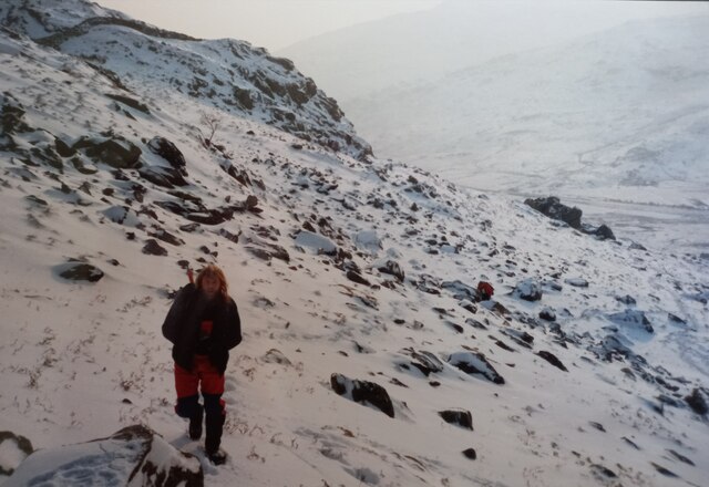
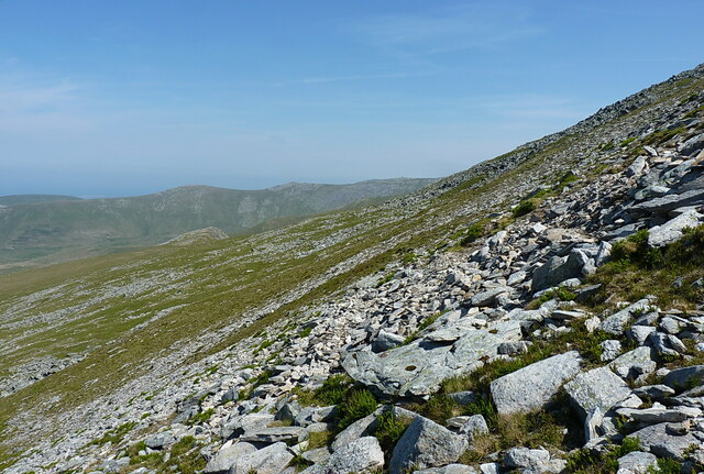
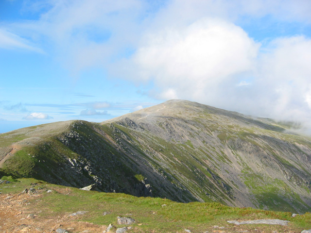
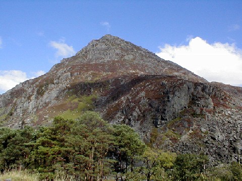
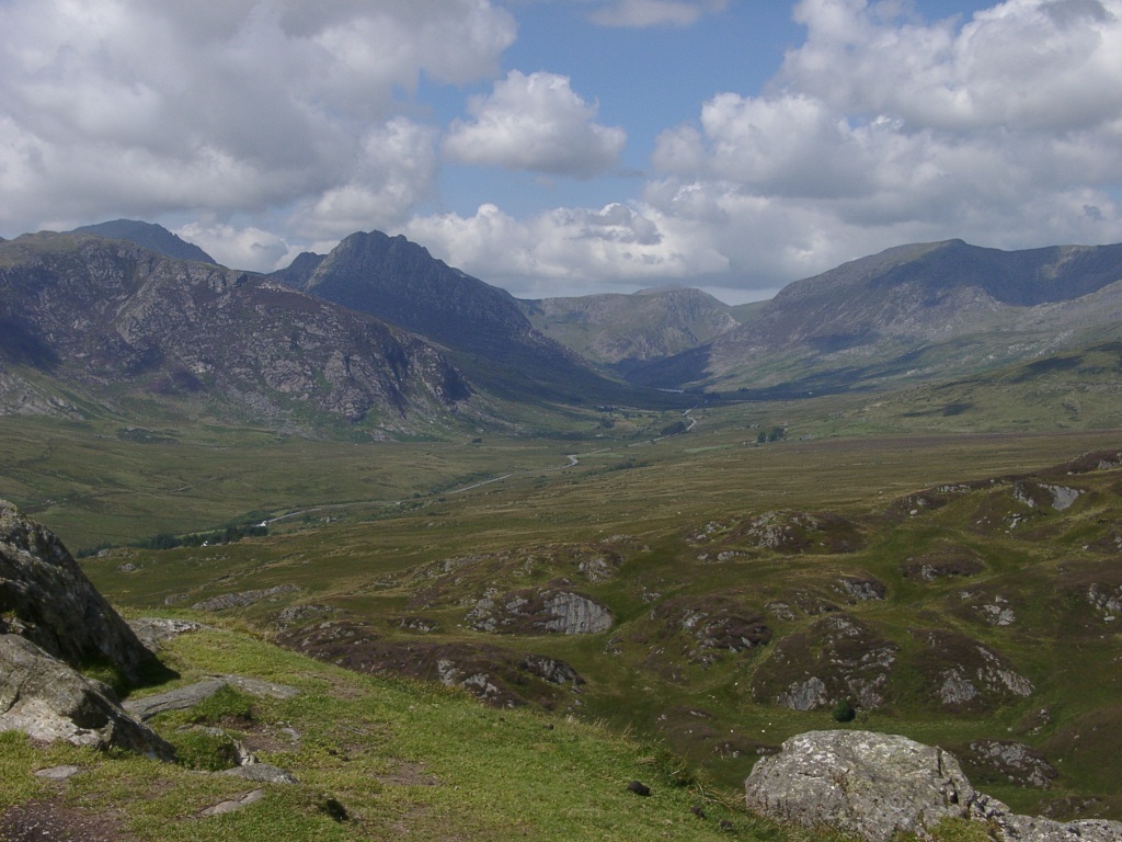
Carnedd Dafydd is a prominent mountain located in the county of Caernarfonshire, Wales. It is part of the Carneddau range and stands at an impressive height of 1,044 meters (3,425 feet). The mountain is named after Dafydd ap Llywelyn, a medieval Welsh prince, and is often considered one of the most challenging and rewarding peaks in Snowdonia National Park.

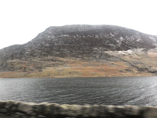
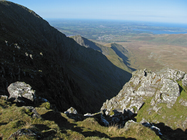
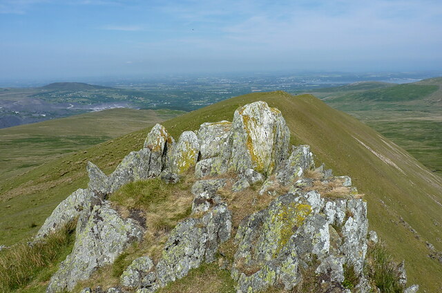
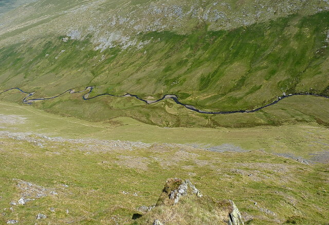
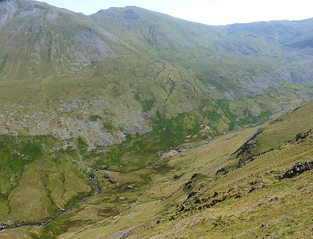
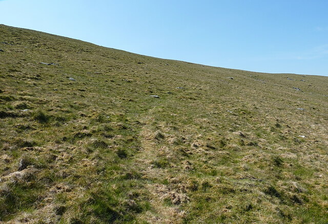
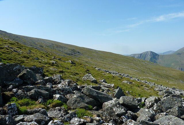
Carnedd Dafydd offers breathtaking views of the surrounding landscapes, including the nearby peaks such as Carnedd Llewelyn and Pen yr Ole Wen. Its steep slopes are covered in grass and heather, creating a picturesque and rugged scenery. The mountain attracts many hikers and mountaineers who are looking for a challenging adventure.

The ascent to Carnedd Dafydd can be challenging, particularly along the eastern face, where the rocky terrain requires careful navigation. However, the effort is rewarded with stunning panoramic views from the summit. On clear days, it is possible to see as far as the Isle of Man and the Irish Sea.

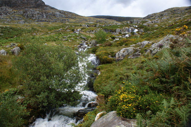
Carnedd Dafydd is also home to a variety of wildlife, including mountain goats, red grouse, and peregrine falcons. The mountain is protected within the boundaries of Snowdonia National Park, ensuring the preservation of its natural beauty and diverse ecosystems.

For those seeking an unforgettable outdoor experience, Carnedd Dafydd offers a challenging yet rewarding climb, stunning vistas, and a chance to immerse oneself in the pristine wilderness of Snowdonia National Park.

If you have any feedback on the listing, please let us know in the comments section below.

Carnedd Dafydd Images

Images are sourced within 2km of 53.147288/-4.0020549 or Grid Reference SH6663. Thanks to Geograph Open Source API. All images are credited.

Emerging onto flat ground A few minutes after <a href="https://www.geograph.org.uk/photo/1671327">SH6562 : Down the headwall of Cwm Ffynnon Lloer, winter conditions</a>, and just about at the top of the steep frozen snowslope that covered the scree on the hillside. The steep craggy buttresses of Craig Lloer are visible behind the climber, with a tiny patch of open water in Llyn Lloer in the depths of the cwm below.
Emerging onto flat ground
A few minutes after SH6562 : Down the headwall of Cwm Ffynnon Lloer, winter conditions, and just about at the top of the steep frozen snowslope that covered the scree on the hillside. The steep craggy buttresses of Craig Lloer are visible behind the climber, with a tiny patch of open water in Llyn Lloer in the depths of the cwm below.
On the hillside above Glan Dena On the first part of the climb up from the A5 at the eastern end of Llyn Ogwen, heading for a fine winter day out around the hills of the southern Carneddau. The route on this occasion took the Wrekin Mountaineering Club members directly up the steep headwall of Cwm Ffynnon Lloer, a line of ascent that wouldn't normally be at all wise due to masses of loose scree high up, but with a covering of frozen snow on the ground it was perfectly viable <a href="https://www.geograph.org.uk/photo/1671327">SH6562 : Down the headwall of Cwm Ffynnon Lloer, winter conditions</a>
On the hillside above Glan Dena
On the first part of the climb up from the A5 at the eastern end of Llyn Ogwen, heading for a fine winter day out around the hills of the southern Carneddau. The route on this occasion took the Wrekin Mountaineering Club members directly up the steep headwall of Cwm Ffynnon Lloer, a line of ascent that wouldn't normally be at all wise due to masses of loose scree high up, but with a covering of frozen snow on the ground it was perfectly viable SH6562 : Down the headwall of Cwm Ffynnon Lloer, winter conditions
Pen yr Ole Wen from across Llyn Ogwen Pen yr Ole Wen is the seventh highest mountain in Snowdonia and is the same height as England's highest, Scafell Pike. It is the most southerly of the Carneddau range.
Pen yr Ole Wen from across Llyn Ogwen
Pen yr Ole Wen is the seventh highest mountain in Snowdonia and is the same height as England's highest, Scafell Pike. It is the most southerly of the Carneddau range.
Eastern flank of Pen yr Ole Wen Pen yr Ole Wen is the seventh highest mountain in Snowdonia and is the same height as England's highest, Scafell Pike. It is the most southerly of the Carneddau range. Seen from across Llyn Ogwen.
Eastern flank of Pen yr Ole Wen
Pen yr Ole Wen is the seventh highest mountain in Snowdonia and is the same height as England's highest, Scafell Pike. It is the most southerly of the Carneddau range. Seen from across Llyn Ogwen.
Looking down on Cwmglas Mawr
Downhill view on Mynydd Du Looking down the 'ridge' of the pleasant stroll up Mynydd Du, with Bethesda town just on the edge of the moors, and the coastal plain stretching towards Bangor in the haze beyond.
Downhill view on Mynydd Du
Looking down the 'ridge' of the pleasant stroll up Mynydd Du, with Bethesda town just on the edge of the moors, and the coastal plain stretching towards Bangor in the haze beyond.
Rocks and the steep NE face of Mynydd Du The steep slope beyond drops down into Cwm Pen-llafar on the right, about 600ft below
Rocks and the steep NE face of Mynydd Du
The steep slope beyond drops down into Cwm Pen-llafar on the right, about 600ft below
Rocky outcrop on the ridge of Mynydd Du This is a slightly different view of the same set of rocks shown in <a href="https://www.geograph.org.uk/photo/5159020">SH6564 : Rocky outcrops on the Mynydd Du ridge</a>
Rocky outcrop on the ridge of Mynydd Du
This is a slightly different view of the same set of rocks shown in SH6564 : Rocky outcrops on the Mynydd Du ridge
Steeply down into Cwm Pen-llafar A drop of about 600ft very steeply down into the cwm below. I'd not recommend it as a descent or ascent, unless you were training for something.
Steeply down into Cwm Pen-llafar
A drop of about 600ft very steeply down into the cwm below. I'd not recommend it as a descent or ascent, unless you were training for something.
The head of Cwm Pen-llafar, seen from the Mynydd Du ridge The steep Black Ladders (Ysgolion Duon) cliffs lie just out of sight on the right, sporting a series of fine winter climbs.
The head of Cwm Pen-llafar, seen from the Mynydd Du ridge
The steep Black Ladders (Ysgolion Duon) cliffs lie just out of sight on the right, sporting a series of fine winter climbs.
Down the ridge of Mynydd Du A view downhill towards Bethesda town, just visible over the hillslope.
Down the ridge of Mynydd Du
A view downhill towards Bethesda town, just visible over the hillslope.
Incipient path forming on the slopes of Foelcraig A walkers' path, narrow and unobtrusive at present. There were clear bootmarks in a patch of scree a little further up from here, but it'll probably never be a popular ascent route for the Carneddau, as it's much longer than the obvious route(s) from Ogwen.
Incipient path forming on the slopes of Foelcraig
A walkers' path, narrow and unobtrusive at present. There were clear bootmarks in a patch of scree a little further up from here, but it'll probably never be a popular ascent route for the Carneddau, as it's much longer than the obvious route(s) from Ogwen.
Boulder scree and outcrops on the slopes of Foel Meirch
Across the hillside of Foel Meirch Looking across the hills towards Y Garn on the far side of Ogwen
Across the hillside of Foel Meirch
Looking across the hills towards Y Garn on the far side of Ogwen
Boulder scree high on Foel Meirch
Boulder scree on the hillside below the summit of Carnedd Dafydd Surprisingly easy ground to traverse, certainly on a hot & dry day at any rate.
Boulder scree on the hillside below the summit of Carnedd Dafydd
Surprisingly easy ground to traverse, certainly on a hot & dry day at any rate.
Carnedd Fach cairn from the south side Probably not the best view of it, but the alternative image, taken from uphill, would have involved much more into the bright sun on this occasion. We do have such a view, at <a href="https://www.geograph.org.uk/photo/425670">SH6562 : Carnedd Fach</a>  taken in 2007.
 The large cairn, roughly 25m in diameter, is thought to date to the Bronze Age between 2300BC and 800BC, and to be a prominent burial place. Disturbed in more recent times by the excavation of walkers' shelters and such like, but still primarily intact. Gwynedd Archeological Trust report, dated 1987, at <span class="nowrap"><a title="https://archwilio.org.uk/arch/query/page.php?watprn=GAT754&dbname=gat&tbname=core" rel="nofollow ugc noopener" href="https://archwilio.org.uk/arch/query/page.php?watprn=GAT754&dbname=gat&tbname=core">Link</a><img style="margin-left:2px;" alt="External link" title="External link - shift click to open in new window" src="https://s1.geograph.org.uk/img/external.png" width="10" height="10"/></span>
Carnedd Fach cairn from the south side
Probably not the best view of it, but the alternative image, taken from uphill, would have involved much more into the bright sun on this occasion. We do have such a view, at SH6562 : Carnedd Fach taken in 2007. The large cairn, roughly 25m in diameter, is thought to date to the Bronze Age between 2300BC and 800BC, and to be a prominent burial place. Disturbed in more recent times by the excavation of walkers' shelters and such like, but still primarily intact. Gwynedd Archeological Trust report, dated 1987, at LinkExternal link
To Elidir Fawr from Bwlch yr Ole Wen Looking near enough west over the hills on the other side of the Nant Francon valley (primarily Foel Goch and Carnedd y Filiast) to Elidir Fawr beyond.
To Elidir Fawr from Bwlch yr Ole Wen
Looking near enough west over the hills on the other side of the Nant Francon valley (primarily Foel Goch and Carnedd y Filiast) to Elidir Fawr beyond.
Show me another place!

Carnedd Dafydd is located at Grid Ref: SH6663 (Lat: 53.147288, Lng: -4.0020549)

Unitary Authority: Conwy/ Gwynedd

Police Authority: North Wales

What 3 Words

///replenish.theory.managers. Near Bethesda, Gwynedd

Related Wikis

Foel Meirch

Foel Meirch is a top of Carnedd Dafydd in the Carneddau range in Snowdonia, North Wales. It offers commanding views of Carnedd Llewelyn and Yr Elen, and...

Carnedd Dafydd

Carnedd Dafydd is a mountain peak in the Carneddau range in Snowdonia, Wales, and is the third highest peak in Wales, or the fourth if Crib y Ddysgl on...

Welsh 1000 m Peaks Race

The Welsh 1000m Peaks Race takes place on the first Saturday in June each year. The 32 km route is also known as the Snowdonia Summits Marathon as competitors...

Ffynnon Lloer

Ffynnon Lloer (Welsh : Source of [the] Moon) is a lake in the Carneddau range of mountains in Snowdonia, North Wales. It lies below the peaks of Pen yr...

Pen yr Ole Wen

Pen yr Ole Wen is the seventh highest mountain in Snowdonia and in Wales. It is the most southerly of the Carneddau range. The mountain lies to the north...

Afon Lloer

Afon Lloer is a small river in Snowdonia in north-west Wales. It is the outflow from Ffynnon Lloer, a lake in the Carneddau mountains, and it flows into...

Yr Elen

Yr Elen is a mountain in the Carneddau range in Snowdonia, Wales. It is the ninth highest mountain in Snowdonia. The average annual temperature of the...

Dyffryn Ogwen

Dyffryn Ogwen, or Ogwen Valley, is a valley mostly located in the Welsh county of Gwynedd. The upper section of the valley, east of Llyn Ogwen, lies in...

Nearby Amenities

Located within 500m of 53.147288,-4.0020549
Carnedd Dafydd
Ele: 1044
Man Made: cairn
Natural: peak
Wikidata: Q2939744
Wikipedia: en:Carnedd Dafydd
Lat/Long: 53.1477282/-4.0008363
Man Made: cairn
Lat/Long: 53.1476803/-3.9998039
Man Made: cairn
Lat/Long: 53.1477065/-4.0008235
Man Made: cairn
Source: survey
Lat/Long: 53.1466708/-4.0028483
Man Made: cairn
Lat/Long: 53.1455/-4.0049
Man Made: cairn
Lat/Long: 53.1455591/-4.0047695
Man Made: cairn
Lat/Long: 53.148/-3.99774
Man Made: cairn
Lat/Long: 53.148/-3.99863
Man Made: cairn
Lat/Long: 53.148028/-3.9988043
Carnedd Dafydd
Demolished Man Made: survey_point
Description: OS trig pillar
Ele: 1045.464
Material: concrete
Note: There is a block with metal work remains of the original pillar
Ref: 11252
Source: Ordnance Survey and Trigpointing.uk
Survey Point: pillar
Tpuk Ref: TP1986
Lat/Long: 53.147713/-4.000819
The data included in this document is from www.openstreetmap.org. The data is made available under ODbL.

Have you been to Carnedd Dafydd?

Leave your review of Carnedd Dafydd below (or comments, questions and feedback).