Castell Ogwr

Heritage Site in Glamorgan

Wales

Castell Ogwr

Ogmore Estuary This is near where the Ogmore (Ogwr) joins the sea and is an area of saltmarsh. On the left side lie part of the windswept dunes of Candlestone.
Ogmore Estuary Credit: Richard Knights

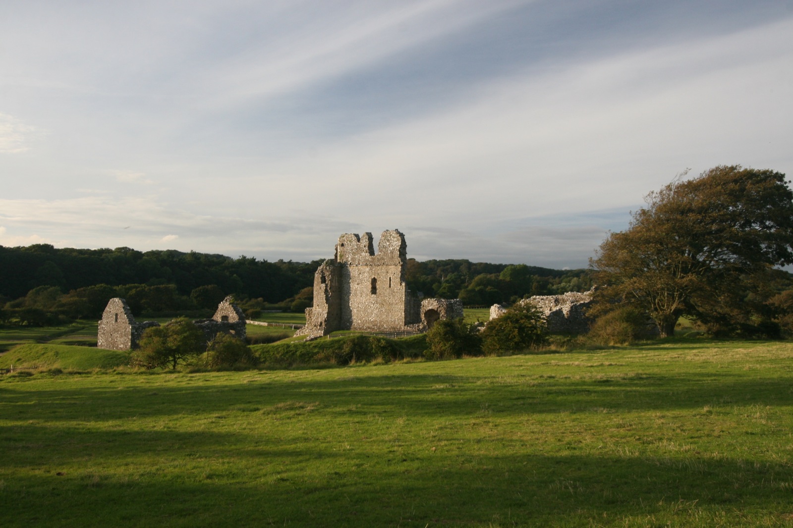
Castell Ogwr, also known as Ogmore Castle, is a historic heritage site located in Glamorgan, Wales. This medieval castle stands in the picturesque Ogmore Valley, near the confluence of the Ogmore and Ewenny rivers.

Believed to have been built in the early 12th century by William de Londres, the castle was originally a timber structure. However, it was later rebuilt in stone during the 14th century by the powerful de Clare family. The castle's strategic position, guarding a crossing point on the river, made it an important defensive stronghold during the medieval period.

The castle consists of a rectangular-shaped fortified enclosure, surrounded by a curtain wall with round towers at each corner. The entrance to the castle is through a grand gatehouse, which features a drawbridge and portcullis. Inside the castle, the remains of a great hall, tower, and other domestic buildings can be seen, showcasing the architectural features of the time.

Throughout its history, Castell Ogwr witnessed several conflicts and sieges. It changed hands multiple times between the Welsh and English forces during the turbulent medieval period. Today, the castle stands as a ruin, with parts of the walls and towers still intact. Visitors can explore the site and envision its former grandeur, enjoying breathtaking views of the surrounding countryside.

Castell Ogwr is a popular destination for history enthusiasts, offering a glimpse into the rich heritage of Glamorgan. With its charming location and fascinating history, it continues to captivate visitors from near and far.

If you have any feedback on the listing, please let us know in the comments section below.

Castell Ogwr Images

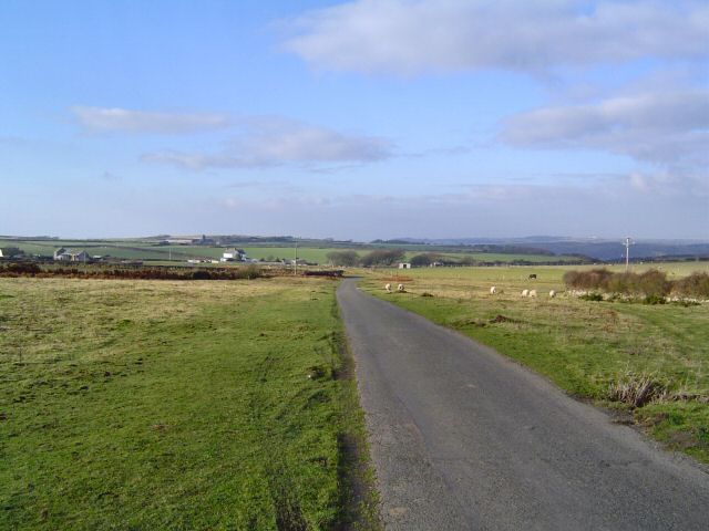
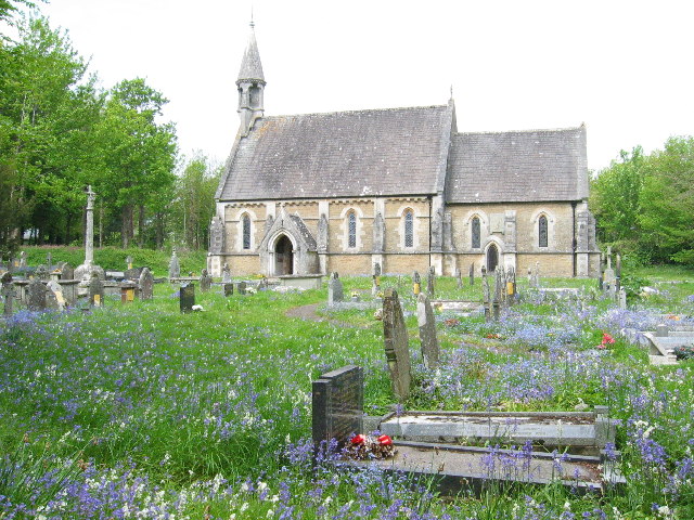
Images are sourced within 2km of 51.4805/-3.6115 or Grid Reference SS8876. Thanks to Geograph Open Source API. All images are credited.

Ogmore Estuary This is near where the Ogmore (Ogwr) joins the sea and is an area of saltmarsh. On the left side lie part of the windswept dunes of Candlestone.
Ogmore Estuary
This is near where the Ogmore (Ogwr) joins the sea and is an area of saltmarsh. On the left side lie part of the windswept dunes of Candlestone.
Merthyrmawr Warren This is part of an extensive area of wind blown sand dunes. Over the years most of it has largely stabilised with plant growth.
Merthyrmawr Warren
This is part of an extensive area of wind blown sand dunes. Over the years most of it has largely stabilised with plant growth.
Ogmore Castle The first earth and timber fortification built in 1116 was quicky replaced by the stone castle
Ogmore Castle
The first earth and timber fortification built in 1116 was quicky replaced by the stone castle
Candleston Castle - Glamorgan The ruins of this castle that is now on the edge of the Merthyrmawr sand warren.
Candleston Castle - Glamorgan
The ruins of this castle that is now on the edge of the Merthyrmawr sand warren.
Merthyr Mawr Church
Merthyr Mawr Church
Bridge over the Ogmore River Ogmore castle in the background
Bridge over the Ogmore River
Ogmore castle in the background
Stepping Stones on River Ogmore, Ogmore Castle, Ogmore, near Bridgend, Wales
Mouth of River Ogmore, Ogmore-by-Sea, Wales
Heol y Mynydd A limestone plateau that supports a great variety of farming.
Heol y Mynydd
A limestone plateau that supports a great variety of farming.
Near St Brides - Glamorgan This photo is taken from the top of a limestone ridge looking down into the valley called "Pant St Brides" that carries the main road that heads off to Bridgend. The slope in the foreground is known as "The Slip".
Near St Brides - Glamorgan
This photo is taken from the top of a limestone ridge looking down into the valley called "Pant St Brides" that carries the main road that heads off to Bridgend. The slope in the foreground is known as "The Slip".
Ogmore Castle initially constructed soon after 1100 by William de Londres as part of the Norman invasion of Wales.
Ogmore Castle
initially constructed soon after 1100 by William de Londres as part of the Norman invasion of Wales.
Merthyr Mawr sand dunes These large sand dunes in South Wales contain the highest dunes in the UK
Merthyr Mawr sand dunes
These large sand dunes in South Wales contain the highest dunes in the UK
Cattle Grid at the start of the Pant St Brides Road
Pant St Brides - ??? Farm
B4265 - Pant St Brides The "back road" to Bridgend is rather twisty - hence the many warnings
B4265 - Pant St Brides
The "back road" to Bridgend is rather twisty - hence the many warnings
Entrance to Lithalun Quarry - Ewenny
Ogmore castle by sunset
Merthyr Mawr House
Merthyr Mawr House
Show me another place!

Castell Ogwr is located at Grid Ref: SS8876 (Lat: 51.4805, Lng: -3.6115)

Unitary Authority: The Vale of Glamorgan

Police Authority: South Wales

Also known as: Ogmore Castle

What 3 Words

///before.relay.fully. Near Merthyr Mawr, Bridgend

Related Wikis

Ogmore Castle

Ogmore Castle (Welsh: Castell Ogwr) is a Grade I listed castle ruin located near the village of Ogmore-by-Sea, south of the town of Bridgend in Glamorgan...

Ogmore, Vale of Glamorgan

Ogmore (Welsh: Ogwr) is a village in the Vale of Glamorgan, Wales on the River Ogmore. It grew around the now ruined Ogmore Castle, built by the Normans...

Southerndown Golf Club

Southerndown Golf Club is a downland/links golf club in the Vale of Glamorgan, in south-east Wales, near the coast and Ogmore-by-Sea and Southerndown,...

Ewenny River

The Ewenny River (Welsh: Afon Ewenni) is a river in South Wales. For most of its 10 miles (16 km) length, it forms the border between the Vale of Glamorgan...

Merthyr Mawr

Merthyr Mawr is a village and community in Bridgend, Wales. The village is about 2+1⁄2 miles from the centre of Bridgend town. The population of the community...

Candleston Castle

Candleston Castle (historically sometimes Candlestone Castle) is a 14th-century fortified manor house, in ruins since the 19th century. It is 0.75 miles...

Portobello House

Portobello House (also known formerly as Portobello Hotel) is a building on the bank of the River Ogmore, about half a mile up from the sea, near the estuary...
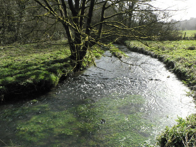
Afon Alun

The Afon Alun is a river in the Vale of Glamorgan, south Wales. It is a tributary of the Ewenny River, which it joins to the south of Bridgend. == Course... ==

Nearby Amenities

Located within 500m of 51.4805,-3.6115
Ogmore Village
Name Cy: Ogwr
Place: village
Wikidata: Q3398441
Lat/Long: 51.4791735/-3.6106677
Barrier: cattle_grid
Bicycle: yes
Foot: yes
Motorcar: yes
Motorcycle: yes
Lat/Long: 51.4812356/-3.6059044
Pub
The Pelican in her Piety
Addr City: Ogmore By Sea
Addr Postcode: CF32 0QP
Fhrs Id: 1058841
Name En: The Pelican Inn
Phone: +44 1656 880 049
Website: http://www.pelicanpub.co.uk
Wikidata: Q80858157
Lat/Long: 51.478811/-3.6114906
Barrier: stile
Lat/Long: 51.4839566/-3.609124
Ford: yes
Lat/Long: 51.4807658/-3.6122071
Ford: yes
Lat/Long: 51.4843389/-3.6096693
Ford: yes
Lat/Long: 51.4805687/-3.612483
Bench
Lat/Long: 51.478675/-3.6123173
Bus Stop
Lat/Long: 51.4786922/-3.6122895
The data included in this document is from www.openstreetmap.org. The data is made available under ODbL.

Have you been to Castell Ogwr?

Leave your review of Castell Ogwr below (or comments, questions and feedback).