Bulls Cross

Settlement in Middlesex

England

Bulls Cross

Oldpark Ride Bridleway Cheshunt 73 towards Theobalds Manor.
Oldpark Ride Credit: Robin Webster

Bulls Cross is a small suburban area located in the London Borough of Enfield, Middlesex, England. Situated in the northeast part of London, Bulls Cross is surrounded by the neighboring areas of Enfield Chase, Crews Hill, and Forty Hill. It is approximately 13 miles away from the city center, making it a desirable residential area for those looking for a quieter place to live within easy reach of the capital.

The area of Bulls Cross mainly consists of residential properties, ranging from detached houses to terraced homes. It offers a mix of properties to suit different preferences and budgets, attracting a diverse community of residents. The area is well-connected to other parts of London, with good transport links including bus services and nearby train stations such as Turkey Street and Enfield Chase.

Bulls Cross benefits from its proximity to several green spaces, including the nearby Hilly Fields Park and Whitewebbs Park, providing residents with opportunities for outdoor activities and leisurely walks. There are also a number of amenities in the area, including local shops, supermarkets, and primary schools, making it a convenient place to live for families.

While Bulls Cross is primarily a residential area, it is within easy reach of nearby towns and commercial centers, offering access to a wider range of amenities and services. The surrounding areas provide a variety of shopping centers, leisure facilities, and entertainment options.

Overall, Bulls Cross in Middlesex offers a peaceful and suburban lifestyle, with good transport links and convenient access to nearby amenities, making it an attractive location for residents seeking a balance between urban convenience and a tranquil environment.

If you have any feedback on the listing, please let us know in the comments section below.
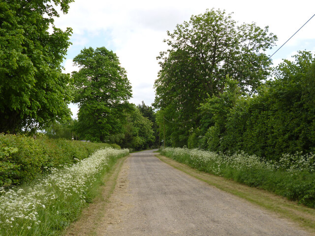
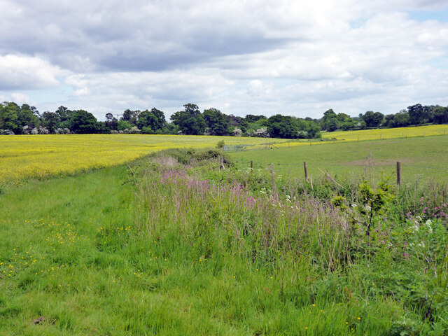
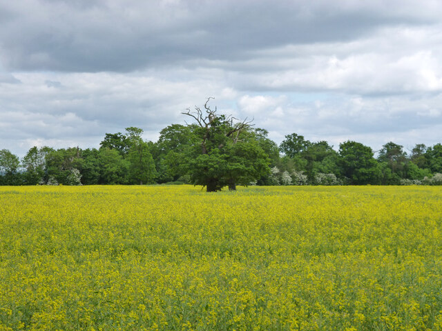
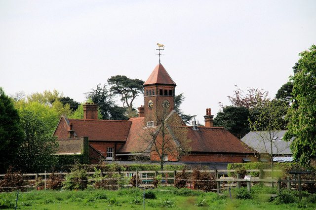
Bulls Cross Images

Images are sourced within 2km of 51.676357/-0.058314 or Grid Reference TQ3499. Thanks to Geograph Open Source API. All images are credited.

Oldpark Ride Bridleway Cheshunt 73 towards Theobalds Manor.
Oldpark Ride
Bridleway Cheshunt 73 towards Theobalds Manor.
Drain near Theobalds Manor Heading down to join Theobalds Brook.
Drain near Theobalds Manor
Heading down to join Theobalds Brook.
Trees in a rape field Remains of a hedgerow.
Trees in a rape field
Remains of a hedgerow.
M25 junction At the Great Cambridge Road roundabout.
M25 junction
At the Great Cambridge Road roundabout.
M25, London Orbital Motorway Officially named the London Orbital and frequently derided as nothing more than a very big car park, the M25 is a 117-mile orbital motorway that encircles London; one of the world's biggest ring roads (Europe's second longest orbital road after the Berliner Ring, which is 122 miles). It is not, however, a continuous loop of motorway as the Dartford Crossing section (comprising the Dartford Tunnels and the Queen Elizabeth II Bridge) over the Thames and its approach roads are designated as the A282. 

Constructed between 1975 and 1986, the M25 is reputedly the most expensive motorway Britain ever built, costing a total of £909m or roughly £7.5m per mile, but at the time of its planning, the demand for the road was considerably underestimated so that when it was finally completed in 1986, it was already out of date. Demand outstripped capacity within a few years and ever since then it's been very heavily congested. 

The M25 is one of the UK’s busiest motorways, carrying up to 200,000 vehicles and 10,000 HGVs per day (AADT - Annual Average Daily Traffic flow) on the section near to Heathrow Airport. Since its opening in the 1980s, the southern, western and eastern sections have been widened to largely dual four lane (D4M) standard, but much of the motorway retains its dual three lane road (D3M) cross-section as originally built. 

The M25 was home to England's first Variable Speed Limits on motorways between the A3 and M4 in the early 1990s.

<span class="nowrap"><a title="http://www.cbrd.co.uk/motorway/m25/" rel="nofollow ugc noopener" href="http://www.cbrd.co.uk/motorway/m25/">Link</a><img style="margin-left:2px;" alt="External link" title="External link - shift click to open in new window" src="https://s1.geograph.org.uk/img/external.png" width="10" height="10"/></span>  cbrd
<span class="nowrap"><a title="http://www.sabre-roads.org.uk/wiki/index.php?title=M25" rel="nofollow ugc noopener" href="http://www.sabre-roads.org.uk/wiki/index.php?title=M25">Link</a><img style="margin-left:2px;" alt="External link" title="External link - shift click to open in new window" src="https://s1.geograph.org.uk/img/external.png" width="10" height="10"/></span>  SABRE
M25, London Orbital Motorway
Officially named the London Orbital and frequently derided as nothing more than a very big car park, the M25 is a 117-mile orbital motorway that encircles London; one of the world's biggest ring roads (Europe's second longest orbital road after the Berliner Ring, which is 122 miles). It is not, however, a continuous loop of motorway as the Dartford Crossing section (comprising the Dartford Tunnels and the Queen Elizabeth II Bridge) over the Thames and its approach roads are designated as the A282. Constructed between 1975 and 1986, the M25 is reputedly the most expensive motorway Britain ever built, costing a total of £909m or roughly £7.5m per mile, but at the time of its planning, the demand for the road was considerably underestimated so that when it was finally completed in 1986, it was already out of date. Demand outstripped capacity within a few years and ever since then it's been very heavily congested. The M25 is one of the UK’s busiest motorways, carrying up to 200,000 vehicles and 10,000 HGVs per day (AADT - Annual Average Daily Traffic flow) on the section near to Heathrow Airport. Since its opening in the 1980s, the southern, western and eastern sections have been widened to largely dual four lane (D4M) standard, but much of the motorway retains its dual three lane road (D3M) cross-section as originally built. The M25 was home to England's first Variable Speed Limits on motorways between the A3 and M4 in the early 1990s. LinkExternal link cbrd LinkExternal link SABRE
M25 at Waltham Cross Interchange (Junction 25) Officially named the London Orbital and frequently derided as nothing more than a very big car park, the M25 is a 117-mile orbital motorway that encircles London; one of the world's biggest ring roads (Europe's second longest orbital road after the Berliner Ring, which is 122 miles). It is not, however, a continuous loop of motorway as the Dartford Crossing section (comprising the Dartford Tunnels and the Queen Elizabeth II Bridge) over the Thames and its approach roads are designated as the A282. 

Constructed between 1975 and 1986, the M25 is reputedly the most expensive motorway Britain ever built, costing a total of £909m or roughly £7.5m per mile, but at the time of its planning, the demand for the road was considerably underestimated so that when it was finally completed in 1986, it was already out of date. Demand outstripped capacity within a few years and ever since then it's been very heavily congested. 

The M25 is one of the UK’s busiest motorways, carrying up to 200,000 vehicles and 10,000 HGVs per day (AADT - Annual Average Daily Traffic flow) on the section near to Heathrow Airport. Since its opening in the 1980s, the southern, western and eastern sections have been widened to largely dual four lane (D4M) standard, but much of the motorway retains its dual three lane road (D3M) cross-section as originally built. 

The M25 was home to England's first Variable Speed Limits on motorways between the A3 and M4 in the early 1990s.

<span class="nowrap"><a title="http://www.cbrd.co.uk/motorway/m25/" rel="nofollow ugc noopener" href="http://www.cbrd.co.uk/motorway/m25/">Link</a><img style="margin-left:2px;" alt="External link" title="External link - shift click to open in new window" src="https://s1.geograph.org.uk/img/external.png" width="10" height="10"/></span>  cbrd
<span class="nowrap"><a title="http://www.sabre-roads.org.uk/wiki/index.php?title=M25" rel="nofollow ugc noopener" href="http://www.sabre-roads.org.uk/wiki/index.php?title=M25">Link</a><img style="margin-left:2px;" alt="External link" title="External link - shift click to open in new window" src="https://s1.geograph.org.uk/img/external.png" width="10" height="10"/></span>  SABRE
M25 at Waltham Cross Interchange (Junction 25)
Officially named the London Orbital and frequently derided as nothing more than a very big car park, the M25 is a 117-mile orbital motorway that encircles London; one of the world's biggest ring roads (Europe's second longest orbital road after the Berliner Ring, which is 122 miles). It is not, however, a continuous loop of motorway as the Dartford Crossing section (comprising the Dartford Tunnels and the Queen Elizabeth II Bridge) over the Thames and its approach roads are designated as the A282. Constructed between 1975 and 1986, the M25 is reputedly the most expensive motorway Britain ever built, costing a total of £909m or roughly £7.5m per mile, but at the time of its planning, the demand for the road was considerably underestimated so that when it was finally completed in 1986, it was already out of date. Demand outstripped capacity within a few years and ever since then it's been very heavily congested. The M25 is one of the UK’s busiest motorways, carrying up to 200,000 vehicles and 10,000 HGVs per day (AADT - Annual Average Daily Traffic flow) on the section near to Heathrow Airport. Since its opening in the 1980s, the southern, western and eastern sections have been widened to largely dual four lane (D4M) standard, but much of the motorway retains its dual three lane road (D3M) cross-section as originally built. The M25 was home to England's first Variable Speed Limits on motorways between the A3 and M4 in the early 1990s. LinkExternal link cbrd LinkExternal link SABRE
Clockwise M25 approaching Holmesdale Tunnel The Holmesdale Tunnel carries the M25 London Orbital Motorway between the Hertfordshire town of Waltham Cross and the northern fringe of Enfield. Construction of the tunnel began in 1981 with this section of the M25 opening to traffic in January 1984, creating a continuous motorway between the A1(M) and the Dartford Crossing. It was widened in 2007 to provide three traffic lanes.
Clockwise M25 approaching Holmesdale Tunnel
The Holmesdale Tunnel carries the M25 London Orbital Motorway between the Hertfordshire town of Waltham Cross and the northern fringe of Enfield. Construction of the tunnel began in 1981 with this section of the M25 opening to traffic in January 1984, creating a continuous motorway between the A1(M) and the Dartford Crossing. It was widened in 2007 to provide three traffic lanes.
Clockwise M25, The Holmesdale Tunnel The Holmesdale Tunnel carries the M25 London Orbital Motorway between the Hertfordshire town of Waltham Cross and the northern fringe of Enfield. Construction of the tunnel began in 1981 with this section of the M25 opening to traffic in January 1984, creating continuous motorway between the A1(M) and the Dartford Crossing. It was widened in 2007 to provide three traffic lanes.

The tunnel is of cut-and-cover construction, comprising three reinforced concrete walls with a reinforced concrete roof slab spanning the three walls. The tunnel was fitted with mechanical ventilation systems. Raised walkways and emergency doors into the adjoining tunnel were provided for emergency purposes (<span class="nowrap"><a title="https://www.sabre-roads.org.uk/wiki/index.php?title=Holmesdale_Tunnel" rel="nofollow ugc noopener" href="https://www.sabre-roads.org.uk/wiki/index.php?title=Holmesdale_Tunnel">Link</a><img style="margin-left:2px;" alt="External link" title="External link - shift click to open in new window" src="https://s1.geograph.org.uk/img/external.png" width="10" height="10"/></span> SABRE).
Clockwise M25, The Holmesdale Tunnel
The Holmesdale Tunnel carries the M25 London Orbital Motorway between the Hertfordshire town of Waltham Cross and the northern fringe of Enfield. Construction of the tunnel began in 1981 with this section of the M25 opening to traffic in January 1984, creating continuous motorway between the A1(M) and the Dartford Crossing. It was widened in 2007 to provide three traffic lanes. The tunnel is of cut-and-cover construction, comprising three reinforced concrete walls with a reinforced concrete roof slab spanning the three walls. The tunnel was fitted with mechanical ventilation systems. Raised walkways and emergency doors into the adjoining tunnel were provided for emergency purposes (LinkExternal link SABRE).
Wild Flowers, Forty Hall, Enfield Part of Natural England's rewilding project.
Wild Flowers, Forty Hall, Enfield
Part of Natural England's rewilding project.
Lake, Forty Hall, Enfield Fishing area by lake.
Lake, Forty Hall, Enfield
Fishing area by lake.
Lake, Forty Hall, Enfield Fishing area by lake.
Lake, Forty Hall, Enfield
Fishing area by lake.
Lake, Forty Hall, Enfield Fishing area by lake.
Lake, Forty Hall, Enfield
Fishing area by lake.
Lake, Forty Hall, Enfield Ornamental lake by Forty Hall.
Lake, Forty Hall, Enfield
Ornamental lake by Forty Hall.
Lake, Forty Hall, Enfield Ornamental lake by Forty Hall.
Lake, Forty Hall, Enfield
Ornamental lake by Forty Hall.
Lake, Forty Hall, Enfield Ornamental lake by Forty Hall with Canada Geese.
Lake, Forty Hall, Enfield
Ornamental lake by Forty Hall with Canada Geese.
Rewilding Forty Hall, Enfield Part of the Natural England rewilding project.
Rewilding Forty Hall, Enfield
Part of the Natural England rewilding project.
Rewilding Forty Hall, Enfield Part of the Natural England rewilding project.
Rewilding Forty Hall, Enfield
Part of the Natural England rewilding project.
Rewilding Forty Hall, Enfield Part of the Natural England rewilding project.
Rewilding Forty Hall, Enfield
Part of the Natural England rewilding project.
Show me another place!

Bulls Cross is located at Grid Ref: TQ3499 (Lat: 51.676357, Lng: -0.058314)

Unitary Authority: Enfield

Police Authority: Metropolitan

What 3 Words

///remain.occurs.radio. Near Waltham Cross, Hertfordshire

Related Wikis

Bulls Cross

Bulls Cross is a road and hamlet in Enfield, England, on the outskirts of north London, forming part of the Metropolitan Green Belt. Although it now lies...

Capel Manor College

Capel Manor College is a special environmental college located in Enfield, London. The College has five campuses across the capital, Crystal Palace Park...

Silcoates School

Silcoates School is a co-educational independent school in the village of Wrenthorpe near Wakefield, England. The school was founded in 1820 as the Northern...

St Ignatius College, Enfield

St Ignatius College is a Catholic voluntary aided secondary school for boys aged 11–18 in Enfield, London, England, founded by the Society of Jesus in...

Elsyng Palace

Elsyng Palace (variously also Elsynge, Elsing, Elsings) was a Tudor palace on the site of what are now the grounds of Forty Hall in Enfield, north London...

Bullsmoor

Bullsmoor is an area of Enfield, on the outskirts of north London. == Geography == Freezywater is to the south, Bulls Cross is to the west and Enfield...

Turkey Street railway station

Turkey Street is a London Overground station on the Southbury Loop section of the Lea Valley lines, located in the Bullsmoor area to the north of Enfield...

Enfield Crematorium

Enfield Crematorium is a cemetery located on the Great Cambridge Road, Enfield, London. It was opened in 1938 and consists of 50 acres (20 ha) of land...

Nearby Amenities

Located within 500m of 51.676357,-0.058314
Ele: 30.41
Lat/Long: 51.6746006/-0.0560368
Ele: 30.42
Time: 2006-05-13T13:39:55Z
Lat/Long: 51.6745563/-0.0559487
Ele: 29.94
Time: 2006-05-13T13:40:11Z
Lat/Long: 51.6737686/-0.0544211
Ref GB Tflcid: RWG276195
Traffic Calming: cushion
Lat/Long: 51.6746331/-0.0550702
Ref GB Tflcid: RWG144456
Traffic Calming: cushion
Lat/Long: 51.6761163/-0.0540241
Ref GB Tflcid: RWG144455
Traffic Calming: cushion
Lat/Long: 51.6769652/-0.0537782
Pub
The Pied Bull
Addr Postcode: EN2 9HE
Wikidata: Q26350046
Lat/Long: 51.6781721/-0.0593586
Created By: YahooApplet 1.0
Lat/Long: 51.672068/-0.0570174
Created By: YahooApplet 1.0
Lat/Long: 51.6723741/-0.0555369
Created By: YahooApplet 1.0
Lat/Long: 51.6726536/-0.0546356
Created By: YahooApplet 1.0
Lat/Long: 51.6739539/-0.0568565
Created By: YahooApplet 1.0
Lat/Long: 51.6721902/-0.0564146
Mini Roundabout
Lat/Long: 51.6784032/-0.0589732
Crossing
Crossing: marked
Crossing Ref: zebra
Lat/Long: 51.6789338/-0.0555198
Bus Stop
Manor Court
Local Ref: P
Naptan AtcoCode: 490009549N
Naptan Bearing: N
Naptan CommonName: Manor Court
Naptan Indicator: Stop P
Naptan Street: GREAT CAMBRIDGE ROAD
Naptan Verified: no
Public Transport: platform
Shelter: yes
Lat/Long: 51.6771994/-0.0522352
Bus Stop
Manor Court
Local Ref: N
Naptan AtcoCode: 490009549S
Naptan Bearing: S
Naptan CommonName: Manor Court
Naptan Indicator: Stop N
Naptan Street: GREAT CAMBRIDGE ROAD
Naptan Verified: no
Public Transport: platform
Lat/Long: 51.6778719/-0.0516125
Bus Stop
Turkey Street Station
Bus: yes
Local Ref: B
Naptan AtcoCode: 490013843N
Naptan Bearing: N
Naptan CommonName: St Ignatius CollegeTurkey St
Naptan Indicator: B
Naptan Street: GREAT CAMBRIDGE ROAD
Naptan Verified: no
Public Transport: platform
Shelter: yes
Lat/Long: 51.6738745/-0.0533751
Bus Stop
Turkey Street Station
Bus: yes
Local Ref: C
Naptan AtcoCode: 490013843S
Naptan Bearing: S
Naptan CommonName: St Ignatius CollegeTurkey St
Naptan Indicator: C
Naptan Street: GREAT CAMBRIDGE ROAD
Naptan Verified: no
Public Transport: platform
Lat/Long: 51.6735435/-0.0531106
Crossing
Bicycle: yes
Crossing: unmarked
Lat/Long: 51.6732023/-0.0531815
Give Way
Direction: backward
Lat/Long: 51.675423/-0.0524842
Street Lamp
Lamp Model: OrangeTek AriaLED 160
Lamp Type: LED
Light Count: 1
Source: Personal memory
Lat/Long: 51.6737255/-0.0530216
Source: Local knowledge.
Traffic Sign: low_emission_zone
Lat/Long: 51.6793029/-0.0534166
Bulls Cross
Place: neighbourhood
Wikidata: Q4997038
Lat/Long: 51.6784103/-0.0590736
Post Box
Lat/Long: 51.6739109/-0.0542842
Waste Basket
Waste: dog
Lat/Long: 51.6735748/-0.0539288
Waste Basket
Lat/Long: 51.6736015/-0.0539851
Addr Housenumber: 1-6
Addr Street: Manor Court
Source: gps+mapnoter
Lat/Long: 51.6780397/-0.0522682
Addr Housenumber: 91-96
Addr Street: Manor Court
Source: gps+mapnoter
Lat/Long: 51.6768688/-0.0526169
Addr Housenumber: 604
Source: gps+mapnoter
Lat/Long: 51.6754194/-0.0521762
Note: there is currently not a building here
Lat/Long: 51.6732069/-0.0597425
Fixme: gate?
Lat/Long: 51.6796905/-0.0585153
Fixme: gate?
Lat/Long: 51.6798253/-0.0589063
Fixme: greenhouses?
Lat/Long: 51.675692/-0.0579684
Addr Housenumber: 4
Addr Street: Maiden Cottages
Source: gps+mapnoter
Lat/Long: 51.6733469/-0.0598186
Addr Housename: Maiden Cottages
Addr Housenumber: 7
Addr Street: Bull's Cross
Source: gps+mapnoter
Lat/Long: 51.6729958/-0.0598233
Addr Housenumber: 89
Addr Street: Capel Road
Source: gps+mapnoter
Lat/Long: 51.6747009/-0.055216
Barrier: block
Lat/Long: 51.6745759/-0.0559859
Addr Housenumber: 78
Addr Street: Capel Road
Source: gps+mapnoter
Lat/Long: 51.674556/-0.0549256
Addr Housenumber: 184
Addr Street: Turkey Street
Source: gps+mapnoter
Lat/Long: 51.6744248/-0.0561118
Addr Housenumber: 135
Addr Street: Turkey Street
Source: gps+mapnoter
Lat/Long: 51.6743466/-0.055165
Addr Housenumber: 143
Addr Postcode: EN1 4NN
Addr Street: Turkey Street
Source: gps+mapnoter
Lat/Long: 51.6745992/-0.055682
Addr Housenumber: 137
Addr Postcode: EN1 4NN
Addr Street: Turkey Street
Source: gps+mapnoter
Lat/Long: 51.6744925/-0.0554807
Addr Housename: West Lodge
Addr Housenumber: 167
Addr Postcode: EN1 4RJ
Addr Street: Turkey Street
Source: gps+mapnoter
Lat/Long: 51.6746892/-0.0594753
Addr Housenumber: 6
Addr Street: Bull's Cross
Source: gps+mapnoter
Lat/Long: 51.6783167/-0.0592493
Post Box
Ref: EN2 111D
Source: gps+mapnoter
Lat/Long: 51.6784763/-0.0586546
Addr Housenumber: 14
Addr Street: Bull's Cross
Source: gps+mapnoter
Lat/Long: 51.6787758/-0.059199
Addr Housename: East Lodge
Source: gps+mapnoter
Lat/Long: 51.6746708/-0.0592279
Addr Housename: Winterton
Source: gps+mapnoter
Lat/Long: 51.674714/-0.0589382
Addr Housenumber: 3
Source: gps+mapnoter
Lat/Long: 51.6775284/-0.0594378
Myddelton Farm
Addr Housenumber: 4
Addr Postcode: EN2 9HE
Source: gps+mapnoter
Lat/Long: 51.6778444/-0.0594056
Addr Housenumber: 13
Addr Street: Bull's Cross
Source: gps+mapnoter
Lat/Long: 51.6785961/-0.0591903
Addr Housenumber: 1
Source: gps+mapnoter
Lat/Long: 51.6771341/-0.0595068
Old Ignatians Loyola Ground
Source: gps+mapnoter
Lat/Long: 51.6747905/-0.0560976
Addr Housenumber: 212
Addr Postcode: EN1 4SQ
Source: gps+mapnoter
Lat/Long: 51.6791067/-0.0538185
Addr Housenumber: 5
Addr Street: Bull's Cross
Source: gps+mapnoter
Lat/Long: 51.6781588/-0.0593051
Addr Housename: Maiden Cottages
Addr Housenumber: 1
Addr Street: Bull's Cross
Source: gps+mapnoter
Lat/Long: 51.6735465/-0.0598347
Addr Housename: Garnault
Lat/Long: 51.6738855/-0.0595413
Barrier: bollard
Lat/Long: 51.6795824/-0.0608095
Barrier: lift_gate
Lat/Long: 51.6796009/-0.0606223
Street Lamp
Lamp Model: OrangeTek AriaLED 160
Lamp Type: LED
Light Count: 1
Source: Personal memory
Lat/Long: 51.6759267/-0.0526384
Street Lamp
Lamp Model: OrangeTek AriaLED 160
Lamp Type: LED
Light Count: 1
Source: Personal memory
Lat/Long: 51.6758885/-0.0523192
Street Lamp
Lamp Model: OrangeTek AriaLED 160
Lamp Type: LED
Light Count: 1
Source: Personal memory
Lat/Long: 51.6755109/-0.0527939
Street Lamp
Lamp Model: OrangeTek AriaLED 160
Lamp Type: LED
Light Count: 1
Source: Personal memory
Lat/Long: 51.6754809/-0.0524506
Street Lamp
Lamp Model: OrangeTek AriaLED 160
Lamp Type: LED
Light Count: 1
Source: Personal memory
Lat/Long: 51.6751283/-0.0529173
Street Lamp
Lamp Model: OrangeTek AriaLED 160
Lamp Type: LED
Light Count: 1
Source: Personal memory
Lat/Long: 51.6750884/-0.0525793
Street Lamp
Lamp Model: OrangeTek AriaLED 160
Lamp Type: LED
Light Count: 1
Source: Personal memory
Lat/Long: 51.6748323/-0.0530273
Street Lamp
Lamp Model: OrangeTek AriaLED 160
Lamp Type: LED
Light Count: 1
Source: Personal memory
Lat/Long: 51.6747923/-0.052684
Street Lamp
Lamp Model: OrangeTek AriaLED 160
Lamp Type: LED
Light Count: 1
Source: Personal memory
Lat/Long: 51.6745429/-0.0531587
Street Lamp
Lamp Model: OrangeTek AriaLED 160
Lamp Type: LED
Light Count: 1
Source: Personal memory
Lat/Long: 51.6745013/-0.0527886
Street Lamp
Lamp Model: OrangeTek AriaLED 160
Lamp Type: LED
Light Count: 1
Source: Personal memory
Lat/Long: 51.6741769/-0.0529066
Street Lamp
Lamp Model: OrangeTek AriaLED 160
Lamp Type: LED
Light Count: 1
Source: Personal memory
Lat/Long: 51.6742202/-0.0532848
Street Lamp
Lamp Model: OrangeTek AriaLED 160
Lamp Type: LED
Light Count: 1
Source: Personal memory
Lat/Long: 51.6738043/-0.0534162
Street Lamp
Lamp Model: OrangeTek AriaLED 160
Lamp Type: LED
Light Count: 1
Source: Personal memory
Lat/Long: 51.6733206/-0.0531726
Street Lamp
Lamp Model: OrangeTek AriaLED 160
Lamp Type: LED
Light Count: 1
Source: Personal memory
Lat/Long: 51.6733718/-0.053536
Street Lamp
Lamp Model: OrangeTek AriaLED 160
Lamp Type: LED
Light Count: 1
Source: Personal memory
Lat/Long: 51.6729282/-0.053684
Street Lamp
Lamp Model: OrangeTek AriaLED 160
Lamp Type: LED
Light Count: 1
Source: Personal memory
Lat/Long: 51.6762401/-0.052203
Street Lamp
Lamp Model: OrangeTek AriaLED 160
Lamp Type: LED
Light Count: 1
Source: Personal memory
Lat/Long: 51.676283/-0.0525279
Street Lamp
Lamp Model: OrangeTek AriaLED 160
Lamp Type: LED
Light Count: 1
Source: Personal memory
Lat/Long: 51.6765906/-0.0520604
Street Lamp
Lamp Model: OrangeTek AriaLED 160
Lamp Type: LED
Light Count: 1
Source: Personal memory
Lat/Long: 51.6766309/-0.0524039
Bus: yes
Public Transport: stop_position
Lat/Long: 51.6777455/-0.0517296
Manor Court
Public Transport: stop_position
Lat/Long: 51.6772063/-0.0521093
Street Lamp
Lamp Model: OrangeTek AriaLED 160
Lamp Type: LED
Light Count: 1
Source: Personal memory
Lat/Long: 51.6770562/-0.0518864
Street Lamp
Lamp Model: OrangeTek AriaLED 160
Lamp Type: LED
Light Count: 1
Source: Personal memory
Lat/Long: 51.677099/-0.0522438
Street Lamp
Lamp Model: OrangeTek AriaLED 160
Lamp Type: LED
Light Count: 1
Source: Personal memory
Lat/Long: 51.6773646/-0.0517784
Street Lamp
Lamp Model: OrangeTek AriaLED 160
Lamp Type: LED
Light Count: 1
Source: Personal memory
Lat/Long: 51.6774096/-0.0521607
Street Lamp
Lamp Model: OrangeTek AriaLED 160
Lamp Type: LED
Light Count: 1
Source: Personal memory
Lat/Long: 51.6777745/-0.0520138
Street Lamp
Lamp Model: OrangeTek AriaLED 160
Lamp Type: LED
Light Count: 1
Source: Personal memory
Lat/Long: 51.6777366/-0.0516422
Street Lamp
Lamp Model: OrangeTek AriaLED 160
Lamp Type: LED
Light Count: 1
Source: Personal memory
Lat/Long: 51.6782007/-0.0518439
Barrier: cycle_barrier
Lat/Long: 51.6737832/-0.0530293
Crossing
Crossing: unmarked
Lat/Long: 51.6784103/-0.0587435
Crossing
Crossing: unmarked
Lat/Long: 51.6799499/-0.0607213
Traffic Calming: cushion
Lat/Long: 51.6751903/-0.0544978
Traffic Calming: cushion
Lat/Long: 51.6784299/-0.0579953
Traffic Calming: cushion
Lat/Long: 51.6738011/-0.0599408
Traffic Calming: cushion
Lat/Long: 51.6732905/-0.0599919
Traffic Calming: cushion
Lat/Long: 51.6721572/-0.0598231
Traffic Calming: cushion
Lat/Long: 51.6727412/-0.0598754
Traffic Calming: cushion
Lat/Long: 51.6779179/-0.0534937
Traffic Calming: cushion
Lat/Long: 51.6786182/-0.0532749
Traffic Calming: cushion
Lat/Long: 51.6774493/-0.052272
Traffic Calming: hump
Lat/Long: 51.6784922/-0.0567126
Crossing
Crossing: uncontrolled
Crossing Island: yes
Lat/Long: 51.6791625/-0.0547251
Barrier: kissing_gate
Lat/Long: 51.6791625/-0.0540626
Traffic Calming: hump
Lat/Long: 51.6744372/-0.0598528
Historic: milestone
Lat/Long: 51.6807686/-0.0579937
Entrance: exit
Lat/Long: 51.6808031/-0.0578522
Entrance: main
Lat/Long: 51.6808054/-0.0577959
Addr Housename: 76 Capel Road
Lat/Long: 51.6746199/-0.0548456
Barrier: block
Lat/Long: 51.6746278/-0.0560929
Barrier: kissing_gate
Lat/Long: 51.6793508/-0.0539689
Proposed Barrier: bollard
Lat/Long: 51.6745457/-0.0559269
Proposed Barrier: bollard
Lat/Long: 51.679179/-0.0538415
Crossing
Crossing: marked
Crossing Island: no
Lat/Long: 51.6731921/-0.0531605
Tactile Paving: yes
Lat/Long: 51.6732152/-0.0531528
The data included in this document is from www.openstreetmap.org. The data is made available under ODbL.

Have you been to Bulls Cross?

Leave your review of Bulls Cross below (or comments, questions and feedback).