Tŷ Mawr Standing Stone

Heritage Site in Anglesey

Wales

Tŷ Mawr Standing Stone

Millennium Cross, Trearddur Bay This Millennium Celtic Cross, made from Anglesey limestone from Moelfre Quarry, is situated just behind the promenade on Towyn y Capel beach. A plaque at the base of the cross reads:
“Croes Mileniwm Santes Ffraid
Codwyd 22 Mehefin 2000”
(Saint Ffraid’s Millennium Cross erected 22 June 2000)

The words "St Bride, Pray for Us" are inscribed in four languages, English, Latin, Irish and Welsh; one on each side of the plinth.

The name Santes Ffraid is the Welsh version of Saint Bride (or "Brigid") <span class="nowrap"><a title="https://en.wikipedia.org/wiki/Brigid_of_Kildare" rel="nofollow ugc noopener" href="https://en.wikipedia.org/wiki/Brigid_of_Kildare">Link</a><img style="margin-left:2px;" alt="External link" title="External link - shift click to open in new window" src="https://s1.geograph.org.uk/img/external.png" width="10" height="10"/></span> . According to legend, she was carried over the Irish Sea, and arrived at Trearddur Bay beach, on a square of green turf. Halfway up the 8 foot-high cross is a carving representing a hand carrying a flame. This symbolises the light from Kildare, Ireland.
Millennium Cross, Trearddur Bay Credit: David Dixon

Tŷ Mawr Standing Stone is a prominent heritage site located on the Isle of Anglesey in Wales. This historical monument is situated in a beautiful rural setting, near the village of Llanddaniel Fab.

The standing stone is a single, tall monolith made of local limestone. It stands at an impressive height of approximately 4.8 meters (16 feet) and is estimated to weigh around 16 tons. The stone is believed to date back to the late Neolithic or early Bronze Age, making it over 4,000 years old.

Tŷ Mawr Standing Stone is known for its unique shape and imposing presence. It has a slightly tapering form, with a broader base narrowing towards the top. The stone is freestanding and has not undergone any significant changes or modifications over the centuries, preserving its original appearance.

The purpose of Tŷ Mawr Standing Stone remains a subject of speculation. Some theories suggest that it may have served as a marker for a burial site or as a boundary stone. Others propose that it had a ceremonial or religious significance, possibly being a focal point for rituals or gatherings.

Despite its age, Tŷ Mawr Standing Stone has managed to withstand the test of time and remains intact. It attracts visitors from all over who come to admire its ancient beauty and ponder over its mysterious origins. The site is accessible to the public, offering a glimpse into the rich history and heritage of Anglesey.

If you have any feedback on the listing, please let us know in the comments section below.

Tŷ Mawr Standing Stone Images

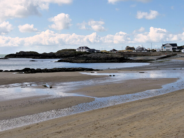
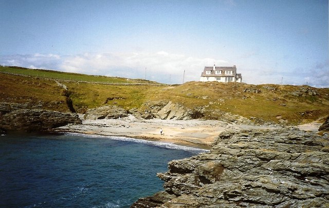
Images are sourced within 2km of 53.2967/-4.6214 or Grid Reference SH2580. Thanks to Geograph Open Source API. All images are credited.

Millennium Cross, Trearddur Bay This Millennium Celtic Cross, made from Anglesey limestone from Moelfre Quarry, is situated just behind the promenade on Towyn y Capel beach. A plaque at the base of the cross reads:
“Croes Mileniwm Santes Ffraid
Codwyd 22 Mehefin 2000”
(Saint Ffraid’s Millennium Cross erected 22 June 2000)

The words "St Bride, Pray for Us" are inscribed in four languages, English, Latin, Irish and Welsh; one on each side of the plinth.

The name Santes Ffraid is the Welsh version of Saint Bride (or "Brigid") <span class="nowrap"><a title="https://en.wikipedia.org/wiki/Brigid_of_Kildare" rel="nofollow ugc noopener" href="https://en.wikipedia.org/wiki/Brigid_of_Kildare">Link</a><img style="margin-left:2px;" alt="External link" title="External link - shift click to open in new window" src="https://s1.geograph.org.uk/img/external.png" width="10" height="10"/></span> . According to legend, she was carried over the Irish Sea, and arrived at Trearddur Bay beach, on a square of green turf. Halfway up the 8 foot-high cross is a carving representing a hand carrying a flame. This symbolises the light from Kildare, Ireland.
Millennium Cross, Trearddur Bay
This Millennium Celtic Cross, made from Anglesey limestone from Moelfre Quarry, is situated just behind the promenade on Towyn y Capel beach. A plaque at the base of the cross reads: “Croes Mileniwm Santes Ffraid Codwyd 22 Mehefin 2000” (Saint Ffraid’s Millennium Cross erected 22 June 2000) The words "St Bride, Pray for Us" are inscribed in four languages, English, Latin, Irish and Welsh; one on each side of the plinth. The name Santes Ffraid is the Welsh version of Saint Bride (or "Brigid") LinkExternal link . According to legend, she was carried over the Irish Sea, and arrived at Trearddur Bay beach, on a square of green turf. Halfway up the 8 foot-high cross is a carving representing a hand carrying a flame. This symbolises the light from Kildare, Ireland.
Towyn y Capel Beach, Trearddur Bay
Trearddur Bay IRB Station RNLI station at Trearddur Bay.
Trearddur Bay IRB Station
RNLI station at Trearddur Bay.
Porth y Corwgl
Porth y Corwgl
Trearddur Bay
Trearddur Bay
Post Office, Treaddur
Lon Isallt by the Waterfront Inn Trearddur
Craig-y-Mor house on its rock from Main road
Craig-y-Mor above Porth-y-Afon
Porth-yr-Afon from Lon Isallt
Lon Isallt looking west from Craig y Mor entrance
Footpath to Craig-y-Mor from Lon Isallt
Porth-y-Post from Lon Isallt
Roadworks on Lon Isallt above Porth-y-Pwll
Lon Isallt above Porth-y-Post Footpath sign can be seen
Lon Isallt above Porth-y-Post
Footpath sign can be seen
Lon Isallt west from Porth-y-Post
White House on the road to Porth-y-post
Porth-y-post On a wet grey Summer's day.
Porth-y-post
On a wet grey Summer's day.
Show me another place!

Tŷ Mawr Standing Stone is located at Grid Ref: SH2580 (Lat: 53.2967, Lng: -4.6214)

Unitary Authority: Isle of Anglesey

Police Authority: North Wales

What 3 Words

///bracelet.shares.marketing. Near Holyhead, Isle of Anglesey

Related Wikis

Trefignath

Trefignath is a Neolithic burial chamber near Trearddur, south of Holyhead on Holy Island, off Anglesey in Wales. In its most complete form it included...

Kingsland, Anglesey

Kingsland is an area in the community of Holyhead, Anglesey, Wales. It is also a community electoral ward for the town, electing two councillors to Holyhead...

Holyhead Hotspur F.C.

Holyhead Hotspur Football Club (Welsh: Clwb Pêl-droed Hotspur Caergybi) is a football club based in Holyhead, Anglesey. They currently play in the Ardal...

Ysbyty Penrhos Stanley

Ysbyty Penrhos Stanley (English: Penrhos Stanley Hospital) is a health facility in Holyhead, Anglesey, Wales. It is managed by the Betsi Cadwaladr University...

Nearby Amenities

Located within 500m of 53.2967,-4.6214
Barrier: bollard
Lat/Long: 53.2992861/-4.6257474
Crossing
Crossing: unmarked
Crossing Island: no
Crossing Markings: no
Tactile Paving: yes
Lat/Long: 53.2997989/-4.6229879
Crossing
Crossing: unmarked
Crossing Island: no
Crossing Markings: no
Tactile Paving: yes
Lat/Long: 53.2975645/-4.6257718
Mini Roundabout
Direction: clockwise
Lat/Long: 53.2997627/-4.6195773
Motorway Junction
Tŷ Mawr
Ref: 2
Lat/Long: 53.2972517/-4.618448
Crossing
Lat/Long: 53.2993225/-4.6194357
Crossing
Lat/Long: 53.2994235/-4.6192801
Peacocks
Brand: Peacocks
Brand Wikidata: Q7157762
Brand Wikipedia: en:Peacocks (clothing)
Contact Website: https://www.peacocks.co.uk/store-finder/index/storeDetail/id/288/
Shop: clothes
Lat/Long: 53.3002097/-4.6176595
Poundland
Brand: Poundland
Brand Wikidata: Q1434528
Brand Wikipedia: en:Poundland
Shop: variety_store
Lat/Long: 53.2999147/-4.6180136
Crossing
Crossing: unmarked
Crossing Island: no
Crossing Markings: no
Tactile Paving: yes
Lat/Long: 53.2991576/-4.6234155
New Look
Brand: New Look
Brand Wikidata: Q12063852
Brand Wikipedia: en:New Look (company)
Shop: clothes
Lat/Long: 53.3000317/-4.6178205
Shop: charity
Lat/Long: 53.3003118/-4.61748
Power: pole
Lat/Long: 53.2959082/-4.6150794
Power: pole
Lat/Long: 53.2962737/-4.6160692
Power: pole
Lat/Long: 53.2966761/-4.6169677
Crossing
Crossing: unmarked
Crossing Island: no
Crossing Markings: no
Tactile Paving: yes
Lat/Long: 53.2976502/-4.6275258
Power: pole
Lat/Long: 53.2943206/-4.6252133
Power: pole
Lat/Long: 53.2947599/-4.6263747
Man Made: mast
Lat/Long: 53.2958816/-4.6177381
Power: pole
Lat/Long: 53.2938765/-4.6240921
Power: pole
Lat/Long: 53.2958372/-4.628271
Crossing
Lat/Long: 53.2994041/-4.6201273
Crossing
Lat/Long: 53.2992133/-4.6195915
Crossing
Lat/Long: 53.2989383/-4.6192782
Crossing
Button Operated: yes
Crossing: traffic_signals
Crossing Island: no
Crossing Markings: dots
Tactile Paving: yes
Lat/Long: 53.3007938/-4.6194189
Power: pole
Lat/Long: 53.2952856/-4.627684
Tŷ Mawr Standing Stone
Archaeological Site: megalith
Historic: archaeological_site
Historic Civilization: prehistoric
Ref GB Cadw: AN012
Wikidata: Q110224375
Lat/Long: 53.2967529/-4.6214217
Street Lamp
Lamp Model: GEC Z8600
Lamp Type: high_pressure_sodium
Light Power: 150
Source: Mapillary (2020-03-23)
Lat/Long: 53.3004706/-4.6244993
Street Lamp
Lamp Model: GEC Z8600
Lamp Type: high_pressure_sodium
Light Power: 150
Source: Mapillary (2020-03-23)
Lat/Long: 53.3002189/-4.6241684
Street Lamp
Lamp Model: GEC Z8600
Lamp Type: high_pressure_sodium
Light Power: 150
Source: Mapillary (2020-03-23)
Lat/Long: 53.2999947/-4.6238676
Street Lamp
Lamp Model: GEC Z8600
Lamp Type: high_pressure_sodium
Light Power: 150
Source: Mapillary (2020-03-23)
Lat/Long: 53.2997546/-4.6235367
Street Lamp
Lamp Model: GEC Z8600
Lamp Type: high_pressure_sodium
Light Power: 150
Source: Mapillary (2020-03-23)
Lat/Long: 53.2995251/-4.6232022
Street Lamp
Lamp Model: GEC Z8600
Lamp Type: high_pressure_sodium
Light Power: 150
Source: Mapillary (2020-03-23)
Lat/Long: 53.2993136/-4.622866
Street Lamp
Lamp Model: GEC Z8600
Lamp Type: high_pressure_sodium
Light Power: 150
Source: Mapillary (2020-03-23)
Lat/Long: 53.2990753/-4.6224887
Street Lamp
Lamp Model: GEC Z8600
Lamp Type: high_pressure_sodium
Light Power: 150
Source: Mapillary (2020-03-23)
Lat/Long: 53.2988736/-4.6221267
Street Lamp
Lamp Model: GEC Z8600
Lamp Type: high_pressure_sodium
Light Power: 150
Source: Mapillary (2020-03-23)
Lat/Long: 53.2986784/-4.6217739
Street Lamp
Lamp Model: GEC Z8600
Lamp Type: high_pressure_sodium
Light Power: 150
Source: Mapillary (2020-03-23)
Lat/Long: 53.2984869/-4.6214088
Street Lamp
Lamp Model: GEC Z8600
Lamp Type: high_pressure_sodium
Light Power: 150
Source: Mapillary (2020-03-23)
Lat/Long: 53.2983267/-4.6210683
Street Lamp
Lamp Model: GEC Z8600
Lamp Type: high_pressure_sodium
Light Power: 150
Source: Mapillary (2020-03-23)
Lat/Long: 53.2981675/-4.6207094
Street Lamp
Lamp Model: GEC Z8600
Lamp Type: high_pressure_sodium
Light Power: 150
Source: Mapillary (2020-03-23)
Lat/Long: 53.2979962/-4.6203212
Street Lamp
Lamp Model: GEC Z8600
Lamp Type: high_pressure_sodium
Light Power: 150
Source: Mapillary (2020-03-23)
Lat/Long: 53.2978369/-4.6199299
Street Lamp
Lamp Model: GEC Z8600
Lamp Type: high_pressure_sodium
Light Power: 150
Source: Mapillary (2020-03-23)
Lat/Long: 53.2976781/-4.6195098
Street Lamp
Lamp Model: GEC Z8600
Lamp Type: high_pressure_sodium
Light Power: 150
Source: Mapillary (2020-03-23)
Lat/Long: 53.2975204/-4.6190778
Street Lamp
Lamp Model: GEC Z8600
Lamp Type: high_pressure_sodium
Light Power: 150
Source: Mapillary (2020-03-23)
Lat/Long: 53.2973815/-4.6186587
Street Lamp
Lamp Model: GEC Z8600
Lamp Type: high_pressure_sodium
Light Power: 150
Source: Mapillary (2020-03-23)
Lat/Long: 53.2972357/-4.6181905
Street Lamp
Lamp Model: GEC Z8600
Lamp Type: high_pressure_sodium
Light Power: 150
Source: Mapillary (2020-03-23)
Lat/Long: 53.2970878/-4.6177107
Street Lamp
Lamp Model: GEC Z8600
Lamp Type: high_pressure_sodium
Light Power: 150
Source: Mapillary (2020-03-23)
Lat/Long: 53.2969489/-4.6172297
Street Lamp
Lamp Model: GEC Z8600
Lamp Type: high_pressure_sodium
Light Power: 150
Source: Mapillary (2020-03-23)
Lat/Long: 53.2968135/-4.616765
Street Lamp
Lamp Model: GEC Z8600
Lamp Type: high_pressure_sodium
Light Power: 150
Source: Mapillary (2020-03-23)
Lat/Long: 53.29669/-4.6163354
Street Lamp
Lamp Model: GEC Z8600
Lamp Type: high_pressure_sodium
Light Power: 150
Source: Mapillary (2020-03-23)
Lat/Long: 53.29657/-4.6159069
Street Lamp
Lamp Model: GEC Z8600
Lamp Type: high_pressure_sodium
Light Power: 150
Source: Mapillary (2020-03-23)
Lat/Long: 53.2964451/-4.6154761
Street Lamp
Lamp Model: GEC Z8600
Lamp Type: high_pressure_sodium
Light Power: 150
Source: Mapillary (2020-03-23)
Lat/Long: 53.296316/-4.6150324
Street Lamp
Lamp Model: GEC Z8600
Lamp Type: high_pressure_sodium
Light Power: 150
Source: Mapillary (2020-03-23)
Lat/Long: 53.2961918/-4.614604
Barrier: bollard
Lat/Long: 53.2956125/-4.6184701
Barrier: bollard
Lat/Long: 53.2954735/-4.6182794
Barrier: bollard
Lat/Long: 53.2941539/-4.6159462
Barrier: bollard
Lat/Long: 53.2940582/-4.6158209
Barrier: lift_gate
Lat/Long: 53.2956863/-4.6217118
Barrier: lift_gate
Lat/Long: 53.2948047/-4.619745
Direction: 255
Generator Method: photovoltaic
Generator Output Electricity: yes
Generator Solar Modules: 4
Generator Source: solar
Generator Type: solar_photovoltaic_panel
Location: roof
Power: generator
Lat/Long: 53.2962221/-4.6265631
Direction: SSE
Generator Method: photovoltaic
Generator Output Electricity: yes
Generator Solar Modules: 3
Generator Source: solar
Generator Type: solar_photovoltaic_panel
Location: roof
Power: generator
Lat/Long: 53.2961836/-4.6266027
Direction: SSE
Generator Method: photovoltaic
Generator Output Electricity: yes
Generator Solar Modules: 12
Generator Source: solar
Generator Type: solar_photovoltaic_panel
Location: roof
Power: generator
Lat/Long: 53.2962393/-4.6266335
Direction: 255
Generator Method: photovoltaic
Generator Output Electricity: yes
Generator Solar Modules: 11
Generator Source: solar
Generator Type: solar_photovoltaic_panel
Location: roof
Power: generator
Lat/Long: 53.2961543/-4.6265289
Bus Stop
Bus: yes
Public Transport: platform
Lat/Long: 53.298576/-4.6282297
Bus Stop
Bus: yes
Public Transport: platform
Lat/Long: 53.298244/-4.6279504
Crossing
Lat/Long: 53.2953562/-4.6192679
Crossing
Crossing: unmarked
Crossing Island: no
Crossing Markings: no
Tactile Paving: yes
Lat/Long: 53.2974641/-4.6248413
Crossing
Crossing Ref: zebra
Lat/Long: 53.2961465/-4.6223097
Crossing
Lat/Long: 53.2964168/-4.6220145
Fuel
Lat/Long: 53.2950698/-4.621831
Crossing
Crossing Ref: zebra
Lat/Long: 53.2976681/-4.6227821
Crossing
Crossing: unmarked
Crossing Island: no
Crossing Markings: no
Tactile Paving: yes
Lat/Long: 53.2979193/-4.6248399
Barrier: kissing_gate
Material: metal
Lat/Long: 53.2985098/-4.6240814
Give Way
Direction: forward
Lat/Long: 53.2996176/-4.6225785
Crossing
Crossing: unmarked
Crossing Island: no
Crossing Markings: no
Tactile Paving: yes
Lat/Long: 53.2996081/-4.6221267
Give Way
Direction: forward
Lat/Long: 53.2995621/-4.6221456
Give Way
Direction: forward
Lat/Long: 53.298767/-4.6232377
Crossing
Crossing: unmarked
Crossing Island: no
Crossing Markings: no
Tactile Paving: yes
Lat/Long: 53.2979612/-4.6255485
Crossing
Crossing: unmarked
Crossing Island: no
Crossing Markings: no
Tactile Paving: yes
Lat/Long: 53.2979457/-4.6255807
Crossing
Crossing: unmarked
Crossing Island: no
Crossing Markings: no
Tactile Paving: yes
Lat/Long: 53.297202/-4.6243348
Crossing
Crossing: unmarked
Crossing Island: no
Crossing Markings: no
Tactile Paving: yes
Lat/Long: 53.2985985/-4.6234276
Crossing
Crossing: unmarked
Crossing Island: no
Crossing Markings: no
Tactile Paving: yes
Lat/Long: 53.2971354/-4.627343
Crossing
Crossing: unmarked
Crossing Island: no
Crossing Markings: no
Tactile Paving: yes
Lat/Long: 53.296967/-4.6267727
Crossing
Crossing: unmarked
Crossing Island: no
Crossing Markings: no
Tactile Paving: yes
Lat/Long: 53.2974505/-4.6265047
Traffic Signals
Traffic Signals: pedestrian_crossing
Traffic Signals Direction: backward
Lat/Long: 53.3007765/-4.6194793
Traffic Signals
Traffic Signals: pedestrian_crossing
Traffic Signals Direction: forward
Lat/Long: 53.3008109/-4.6193577
Crossing
Crossing: unmarked
Crossing Island: no
Crossing Markings: no
Tactile Paving: yes
Lat/Long: 53.3004596/-4.62072
Crossing
Crossing: unmarked
Crossing Island: no
Crossing Markings: no
Tactile Paving: yes
Lat/Long: 53.299651/-4.6222067
Crossing
Crossing: unmarked
Crossing Island: no
Crossing Markings: no
Tactile Paving: yes
Lat/Long: 53.3001888/-4.6203297
Crossing
Crossing: unmarked
Crossing Island: no
Crossing Markings: no
Tactile Paving: yes
Lat/Long: 53.3002417/-4.6202413
Crossing
Lat/Long: 53.3001606/-4.6183413
Crossing
Lat/Long: 53.3003505/-4.6186898
Give Way
Direction: forward
Lat/Long: 53.2987191/-4.6227973
The data included in this document is from www.openstreetmap.org. The data is made available under ODbL.

Have you been to Tŷ Mawr Standing Stone?

Leave your review of Tŷ Mawr Standing Stone below (or comments, questions and feedback).