Bullbrook

Settlement in Berkshire

England

Bullbrook

Entering Hayley Green On the B3034.
Entering Hayley Green Credit: JThomas

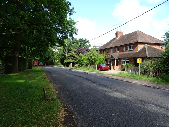
Bullbrook is a small suburban area situated in Berkshire, England. It is located approximately 2 miles east of the town center of Bracknell. With its peaceful and residential atmosphere, Bullbrook offers a tranquil escape from the hustle and bustle of nearby urban areas.

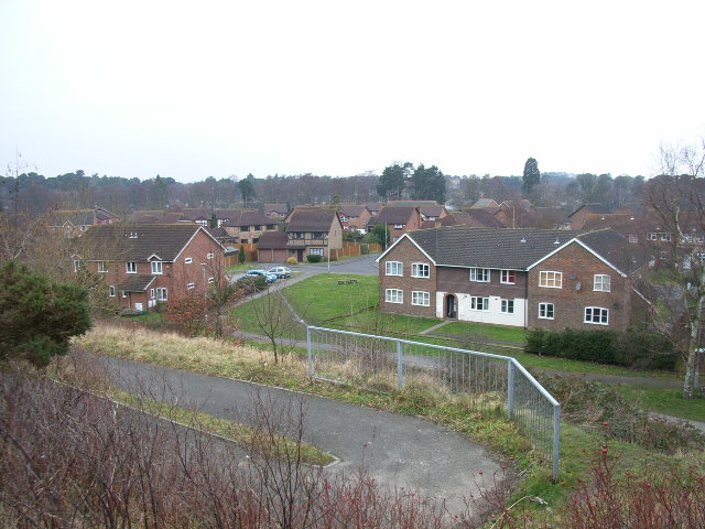
The area primarily consists of housing estates, providing a mix of detached and semi-detached houses, as well as some apartment buildings. The properties are well-maintained, and the streets are lined with trees and green spaces, creating a pleasant environment for residents.

Bullbrook benefits from its close proximity to various amenities and facilities. The Peel Center, a large retail park, is just a short drive away, offering a wide range of shops, restaurants, and leisure activities. Additionally, the town center of Bracknell provides further shopping options, including a modern shopping mall and a bustling pedestrian high street.

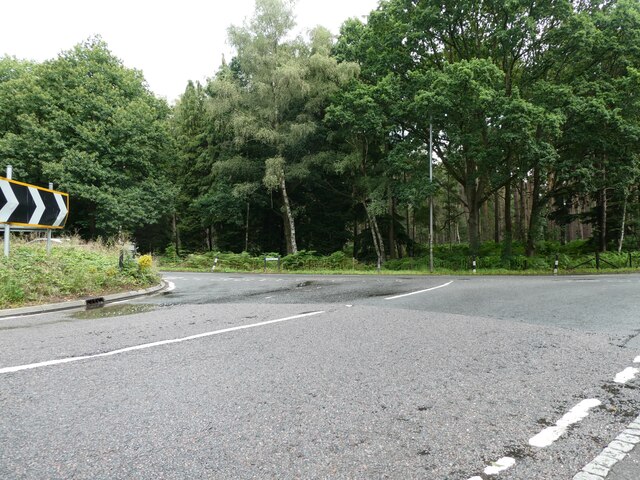
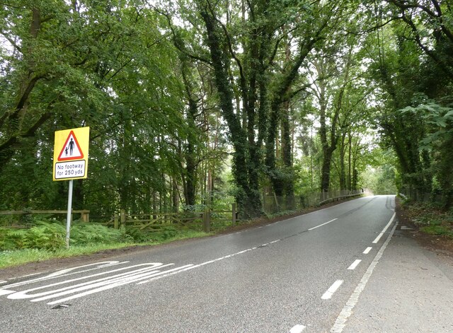
The area is well-connected in terms of transport links. The nearby A329(M) provides easy access to the M4 motorway, connecting Bullbrook to London and the wider Berkshire area. Bracknell train station offers regular services to London Waterloo, making it an attractive location for commuters.

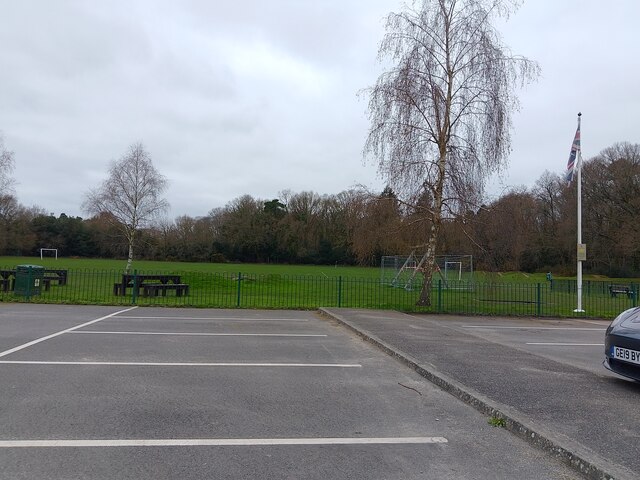
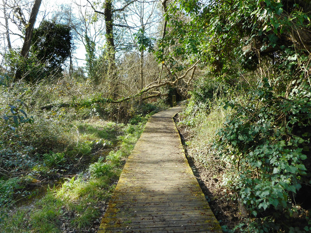
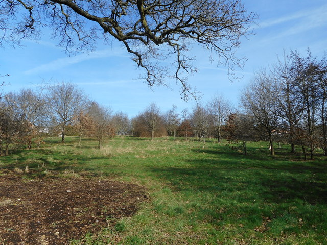
Nature enthusiasts will appreciate the nearby South Hill Park, a large country park with picturesque lakes, woodland areas, and walking trails. This green space provides opportunities for recreational activities such as jogging, cycling, and picnicking.

In summary, Bullbrook is a peaceful suburban area in Berkshire, offering a range of housing options, convenient amenities, and good transport links. Its proximity to Bracknell town center and natural attractions make it an attractive place to live for individuals and families alike.

If you have any feedback on the listing, please let us know in the comments section below.

Bullbrook Images

Images are sourced within 2km of 51.414654/-0.725768 or Grid Reference SU8869. Thanks to Geograph Open Source API. All images are credited.

Entering Hayley Green On the B3034.
Entering Hayley Green
On the B3034.
House on Forest Road, Hayley Green
Cottages on Forest Road
Forest Road (B3034), Hayley Green
Strawberry Hill, Warfield
Lakeside and Wick Hill Wood Lakeside is the name of this street, and there is a pond off to the left behind the houses, but you can't see it.
Wick Hill Wood is a small square of woodland that has been left standing for people to enjoy.
Lakeside and Wick Hill Wood
Lakeside is the name of this street, and there is a pond off to the left behind the houses, but you can't see it. Wick Hill Wood is a small square of woodland that has been left standing for people to enjoy.
Bracknell : Tesco A Tesco store on the outskirts of Bracknell.
Bracknell : Tesco
A Tesco store on the outskirts of Bracknell.
Ascot Jubilee Recreation Ground A park with playing fields and a playground between North Ascot and Chavey Down. The car park is very large for the size of the park.
Ascot Jubilee Recreation Ground
A park with playing fields and a playground between North Ascot and Chavey Down. The car park is very large for the size of the park.
Old Milestone by the A329 at the B3017 junction Opposite The Royal Foresters
Old Milestone by the A329 at the B3017 junction
Opposite The Royal Foresters
Old Milestone by the A329 at the B3017 junction Opposite The Royal Foresters
Old Milestone by the A329 at the B3017 junction
Opposite The Royal Foresters
Navigating northwards up the Basher (33) Looking from the B3017 onto the A322
Roads named the King's Ride depict places where in the past a royal monarch alone was allowed to hunt. Most recent events include July 3rd 2023, the Israeli military deploys ground forces and armed drones into the Jenin camp, killing 13 and injuring more than 100; July 14th, Hollywood scriptwriters begin a major strike; 23rd, tens of thousands of tourists flee Rhodes, Greece, amid wildfires during the extreme heatwave; and 26th, President Mohamed Bazoum of Niger is toppled in a coup
Navigating northwards up the Basher (33)
Looking from the B3017 onto the A322 Roads named the King's Ride depict places where in the past a royal monarch alone was allowed to hunt. Most recent events include July 3rd 2023, the Israeli military deploys ground forces and armed drones into the Jenin camp, killing 13 and injuring more than 100; July 14th, Hollywood scriptwriters begin a major strike; 23rd, tens of thousands of tourists flee Rhodes, Greece, amid wildfires during the extreme heatwave; and 26th, President Mohamed Bazoum of Niger is toppled in a coup
Navigating northwards up the Basher (34) Looking towards a railway bridge on the 3017
Navigating northwards up the Basher (34)
Looking towards a railway bridge on the 3017
Navigating northwards up the Basher (35) Ascot Priory, founded by Lydia Sellon <span class="nowrap"><a title="https://en.wikipedia.org/wiki/Lydia_Sellon" rel="nofollow ugc noopener" href="https://en.wikipedia.org/wiki/Lydia_Sellon">Link</a><img style="margin-left:2px;" alt="External link" title="External link - shift click to open in new window" src="https://s1.geograph.org.uk/img/external.png" width="10" height="10"/></span> Sadly Sellon died in 1876. Departing this month were: 1st July 2023, Bob Kerslake, head of the civil service   from 2012 to 2014; 16th, Jane Birkin, one half of that controversial song, later an actress; 21st, Ann Clywd, Wales' first female MP, and veteran crooner, Tony Bennett; 24th, BBC journalist George Alagiah and Trevor Francis, England’s first £ million footballer; 26th, Irish singer/ songwriter  Sinéad O'Connor; and 28th, The Eagles original bassist Randy Meisner.
Navigating northwards up the Basher (35)
Ascot Priory, founded by Lydia Sellon LinkExternal link Sadly Sellon died in 1876. Departing this month were: 1st July 2023, Bob Kerslake, head of the civil service from 2012 to 2014; 16th, Jane Birkin, one half of that controversial song, later an actress; 21st, Ann Clywd, Wales' first female MP, and veteran crooner, Tony Bennett; 24th, BBC journalist George Alagiah and Trevor Francis, England’s first £ million footballer; 26th, Irish singer/ songwriter Sinéad O'Connor; and 28th, The Eagles original bassist Randy Meisner.
Braybrooke recreation area, Bracknell The children's play area in the recreation area off Braybrooke Road.
Braybrooke recreation area, Bracknell
The children's play area in the recreation area off Braybrooke Road.
Houses on Chavey Down Road
Bracknell Road at the junction of Forest Road
Boardwalk over the swampy bit Just off Harvest Ride there is a small area of damp woodland, a remnant of what was here before the whole place was built over. There is a footpath through the middle of it.
Boardwalk over the swampy bit
Just off Harvest Ride there is a small area of damp woodland, a remnant of what was here before the whole place was built over. There is a footpath through the middle of it.
A bit of a park A patch of informal open space amongst all the houses. I guess it's called something, but there wasn't a name by the way I came in and there isn't one on the map.
A bit of a park
A patch of informal open space amongst all the houses. I guess it's called something, but there wasn't a name by the way I came in and there isn't one on the map.
Show me another place!

Bullbrook is located at Grid Ref: SU8869 (Lat: 51.414654, Lng: -0.725768)

Unitary Authority: Bracknell Forest

Police Authority: Thames Valley

What 3 Words

///reader.hired.sobs. Near Bracknell, Berkshire

Related Wikis

Bullbrook

Bullbrook is a suburb of Bracknell , in the English county of Berkshire, formerly part of the parish of Winkfield. It is named after the Bull Brook which...

Martins Heron

Martins Heron is a suburb of Bracknell 25 miles (40 km) west of London in Berkshire, England. Martins Heron and the neighbouring suburb The Warren are...

Martins Heron railway station

Martins Heron railway station serves Martins Heron, a suburb on the eastern edge of Bracknell, Berkshire, England. It is 31 miles 9 chains (50.1 km) down...

Jennett's Park

Jennett's Park is a suburb of Bracknell in the English county of Berkshire. It is a recent development with the first residents moving there in 2007. It...

The Warren, Bracknell Forest

The Warren is a suburban area in Berkshire, England, and a conurbation of Bracknell, adjacent to the large expanses of Swinley Forest, part of the Crown...

Heathfield School, Ascot

Heathfield School is a girls' independent boarding and day school in Ascot, Berkshire, England. In 2006, the school absorbed St Mary's School, Wantage...

Chavey Down

Chavey Down is a hamlet partly in Ascot, Berkshire, England, and part of the civil parish of Winkfield. The settlement lies near to the A329 road, and...

RAF Staff College, Bracknell

The RAF Staff College at Bracknell was a Royal Air Force staff college active for most of the second half of the 20th century. Its role was the training...

Nearby Amenities

Located within 500m of 51.414654,-0.725768
Barrier: bollard
Lat/Long: 51.4154511/-0.7193366
Traffic Signals
Traffic Signals: pedestrian_crossing
Traffic Signals Direction: backward
Lat/Long: 51.412698/-0.7223758
Crossing
Bicycle: yes
Crossing: traffic_signals
Crossing Ref: toucan
Kerb: lowered
Lat/Long: 51.4127662/-0.719758
Barrier: bollard
Lat/Long: 51.4126763/-0.7207048
Crossing
Bicycle: yes
Crossing: unmarked
Kerb: lowered
Lat/Long: 51.414074/-0.7310141
Crossing
Bicycle: yes
Crossing: unmarked
Crossing Island: no
Kerb: lowered
Lat/Long: 51.4165071/-0.7288422
Turning Circle
Lat/Long: 51.412177/-0.72525
Leisure: playground
Lat/Long: 51.4105592/-0.7242442
Turning Circle
Lat/Long: 51.4121352/-0.7218462
Crossing
Bicycle: yes
Crossing: unmarked
Kerb: lowered
Sloped Curb: yes
Lat/Long: 51.4186851/-0.7254855
Crossing
Crossing: unmarked
Kerb: lowered
Lat/Long: 51.4147432/-0.7306518
Parking
Lily Hill Park
Lat/Long: 51.4167981/-0.7250152
Bench
Lat/Long: 51.4145104/-0.7244932
Barrier: kissing_gate
Lat/Long: 51.4127705/-0.7261201
Crossing
Crossing: uncontrolled
Crossing Island: yes
Kerb: lowered
Lat/Long: 51.4143443/-0.7305572
Crossing
Crossing: unmarked
Kerb: lowered
Lat/Long: 51.4157231/-0.7290637
FC
Ele: 80.543
Lat/Long: 51.413253/-0.7239738
FG ORCHARD
Ele: 80.741
Lat/Long: 51.4134642/-0.7243341
FC
Ele: 81.391
Lat/Long: 51.4136199/-0.7240994
FC
Ele: 82.899
Lat/Long: 51.4134088/-0.7237391
Barrier: bollard
Lat/Long: 51.4119961/-0.7301505
Crossing
Bicycle: yes
Crossing: unmarked
Crossing Island: no
Kerb: lowered
Lat/Long: 51.4145494/-0.7303333
Crossing
Bicycle: yes
Crossing: unmarked
Kerb: lowered
Lat/Long: 51.4133783/-0.7191112
Crossing
Bicycle: yes
Crossing: unmarked
Crossing Island: no
Kerb: lowered
Lat/Long: 51.4156428/-0.7291727
Crossing
Bicycle: yes
Crossing: uncontrolled
Crossing Island: yes
Kerb: lowered
Lat/Long: 51.4133724/-0.7311668
Barrier: cycle_barrier
Lat/Long: 51.4137826/-0.7317101
Barrier: cycle_barrier
Lat/Long: 51.4139615/-0.7321113
Bullbrook
Place: neighbourhood
Wikidata: Q4996704
Lat/Long: 51.4149503/-0.7275857
Crossing
Bicycle: yes
Button Operated: yes
Crossing: traffic_signals
Crossing Island: no
Crossing Ref: toucan
Kerb: lowered
Tactile Paving: yes
Lat/Long: 51.4127012/-0.7224492
Traffic Signals
Traffic Signals: pedestrian_crossing
Traffic Signals Direction: forward
Lat/Long: 51.4127029/-0.7225007
Crossing
Crossing: unmarked
Kerb: lowered
Lat/Long: 51.4128856/-0.7297563
Crossing
Bicycle: yes
Crossing: unmarked
Crossing Island: no
Kerb: no
Source: Bing;Streetside
Tactile Paving: no
Lat/Long: 51.4132363/-0.7313031
Crossing
Bicycle: yes
Crossing: uncontrolled
Crossing Island: yes
Kerb: lowered
Lat/Long: 51.413289/-0.7312924
Barrier: kerb
Kerb: lowered
Tactile Paving: yes
Lat/Long: 51.414485/-0.7304395
Barrier: kerb
Kerb: lowered
Tactile Paving: yes
Lat/Long: 51.4146118/-0.7302305
Barrier: cycle_barrier
Lat/Long: 51.4137668/-0.7323365
Crossing
Crossing: unmarked
Kerb: lowered
Sloped Curb: yes
Lat/Long: 51.4116152/-0.7300606
Barrier: bollard
Lat/Long: 51.4129164/-0.7301394
Waste Basket
Lat/Long: 51.4111598/-0.7266265
Barrier: kissing_gate
Lat/Long: 51.411235/-0.7267056
Barrier: bollard
Lat/Long: 51.4182919/-0.726165
Barrier: kerb
Kerb: lowered
Tactile Paving: yes
Lat/Long: 51.4155666/-0.7292168
Barrier: kerb
Kerb: lowered
Tactile Paving: yes
Lat/Long: 51.415705/-0.7291367
Crossing
Crossing: unmarked
Kerb: lowered
Sloped Curb: yes
Lat/Long: 51.4165255/-0.7295487
Crossing
Crossing: unmarked
Kerb: lowered
Sloped Curb: yes
Lat/Long: 51.4176061/-0.7260382
Crossing
Crossing: unmarked
Kerb: lowered
Sloped Curb: yes
Source: survey
Lat/Long: 51.4171497/-0.7247183
Barrier: bollard
Lat/Long: 51.4167252/-0.7255943
Forester's Hill
Natural: peak
Source: OS OpenData StreetView
Lat/Long: 51.4140433/-0.7224891
Scott's Hill
Natural: peak
Source: OS OpenData StreetView
Lat/Long: 51.4124042/-0.7268665
Bench
Source: survey
Lat/Long: 51.4127392/-0.7216403
Post Box
Post Box Type: wall
Lat/Long: 51.4127505/-0.7255381
Telephone
Booth: KX100
Covered: booth
Fixme: is this still in use? Bing Streetside and Mapillary shows it covered in graffiti
Lat/Long: 51.4127643/-0.7255401
Post Box
Addr City: Bracknell
Addr Housenumber: 110
Addr Street: Bullbrook Drive
Collection Times: Mo-Fr 09:00; Sa 07:00
Drive Through: no
Operator: Royal Mail
Post Box Type: wall
Ref: RG12 116D
Royal Cypher: EIIR
Royal Cypher Wikidata: Q33102113
Lat/Long: 51.419041/-0.7269387
Leisure: playground
Lat/Long: 51.4190308/-0.725166
Crossing
Crossing Island: yes
Kerb: lowered
Sloped Curb: yes
Lat/Long: 51.4160494/-0.7210633
Crossing
Lat/Long: 51.4169991/-0.7315119
Barrier: bollard
Lat/Long: 51.4184767/-0.7260788
Barrier: cycle_barrier
Lat/Long: 51.4132495/-0.7317768
Barrier: bollard
Lat/Long: 51.4127542/-0.7226029
Barrier: bollard
Lat/Long: 51.4128627/-0.7257948
Barrier: bollard
Lat/Long: 51.4129261/-0.727966
Barrier: bollard
Lat/Long: 51.4127701/-0.7231158
Crossing
Bicycle: yes
Crossing: unmarked
Kerb: no
Tactile Paving: no
Lat/Long: 51.4129313/-0.7281448
Barrier: bollard
Lat/Long: 51.4127329/-0.7220536
Bus Stop
Allsmoor Lane
Bus: yes
Public Transport: platform
Source: Bing
Lat/Long: 51.4127121/-0.7217731
Martins Heron Crossroads
Old Name: Martins Heron Roundabout
Place: locality
Lat/Long: 51.4125631/-0.7197396
Crossing
Bicycle: yes
Crossing: traffic_signals
Crossing Ref: toucan
Kerb: lowered
Lat/Long: 51.4127112/-0.7196408
Crossing
Bicycle: dismount
Crossing: traffic_signals
Crossing Ref: pelican
Kerb: lowered
Lat/Long: 51.4126137/-0.7200622
Crossing
Bicycle: dismount
Crossing: traffic_signals
Crossing Ref: pelican
Kerb: lowered
Lat/Long: 51.412533/-0.720014
Traffic Signals
Source: survey
Traffic Signals: junction
Traffic Signals Direction: forward
Lat/Long: 51.4124306/-0.7197371
Traffic Signals
Source: survey
Traffic Signals: junction
Traffic Signals Direction: forward
Lat/Long: 51.412616/-0.7201214
Traffic Signals
Source: guess
Traffic Signals: junction
Traffic Signals Direction: forward
Lat/Long: 51.412752/-0.7196317
Barrier: kerb
Kerb: lowered
Tactile Paving: yes
Lat/Long: 51.4133523/-0.7312321
Barrier: bollard
Lat/Long: 51.4130947/-0.7303642
Crossing
Crossing: uncontrolled
Crossing Island: yes
Kerb: lowered
Source: seen from shared use path
Lat/Long: 51.4129247/-0.7295543
Barrier: bollard
Lat/Long: 51.4129443/-0.7285782
Building: house
Source: Bing
Lat/Long: 51.4129625/-0.7257254
Bus Stop
Bus: yes
Naptan AtcoCode: 0380H221G146
Naptan NaptanCode: bknawpg
Public Transport: platform
Shelter: yes
Lat/Long: 51.4144311/-0.7327859
Direction: 175
Generator Method: photovoltaic
Generator Output Electricity: yes
Generator Solar Modules: 10
Generator Source: solar
Generator Type: solar_photovoltaic_panel
Location: roof
Power: generator
Lat/Long: 51.4147179/-0.7312626
Direction: 175
Generator Method: photovoltaic
Generator Output Electricity: yes
Generator Solar Modules: 8
Generator Source: solar
Generator Type: solar_photovoltaic_panel
Location: roof
Power: generator
Lat/Long: 51.4155631/-0.7299719
Direction: 170
Generator Method: photovoltaic
Generator Output Electricity: yes
Generator Solar Modules: 13
Generator Source: solar
Generator Type: solar_photovoltaic_panel
Location: roof
Power: generator
Lat/Long: 51.4161955/-0.7313455
Direction: 170
Generator Method: photovoltaic
Generator Output Electricity: yes
Generator Solar Modules: 14
Generator Source: solar
Generator Type: solar_photovoltaic_panel
Location: roof
Power: generator
Lat/Long: 51.4162311/-0.7305893
Direction: 165
Generator Method: photovoltaic
Generator Output Electricity: yes
Generator Solar Modules: 12
Generator Source: solar
Generator Type: solar_photovoltaic_panel
Location: roof
Power: generator
Lat/Long: 51.4162858/-0.7299785
Direction: 165
Generator Method: photovoltaic
Generator Output Electricity: yes
Generator Solar Modules: 11
Generator Source: solar
Generator Type: solar_photovoltaic_panel
Location: roof
Power: generator
Lat/Long: 51.4163303/-0.7297868
Direction: 175
Generator Method: photovoltaic
Generator Output Electricity: yes
Generator Solar Modules: 14
Generator Source: solar
Generator Type: solar_photovoltaic_panel
Location: roof
Power: generator
Lat/Long: 51.4168473/-0.7316849
Direction: 175
Generator Method: photovoltaic
Generator Output Electricity: yes
Generator Solar Modules: 12
Generator Source: solar
Generator Type: solar_photovoltaic_panel
Location: roof
Power: generator
Lat/Long: 51.4171244/-0.7315818
Direction: 175
Fixme: survey for panel count
Generator Method: photovoltaic
Generator Output Electricity: yes
Generator Solar Modules: 16
Generator Source: solar
Generator Type: solar_photovoltaic_panel
Location: roof
Power: generator
Lat/Long: 51.4174295/-0.7302489
Direction: 260
Fixme: survey for panel count
Generator Method: photovoltaic
Generator Output Electricity: yes
Generator Solar Modules: 21
Generator Source: solar
Generator Type: solar_photovoltaic_panel
Location: roof
Power: generator
Lat/Long: 51.4173037/-0.7299013
Direction: 200
Generator Method: photovoltaic
Generator Output Electricity: yes
Generator Solar Modules: 16
Generator Source: solar
Generator Type: solar_photovoltaic_panel
Location: roof
Power: generator
Lat/Long: 51.4173383/-0.7248366
Bus Stop
Bus: yes
Public Transport: platform
Lat/Long: 51.4182161/-0.7245512
Direction: 225
Generator Method: photovoltaic
Generator Output Electricity: yes
Generator Solar Modules: 16
Generator Source: solar
Generator Type: solar_photovoltaic_panel
Location: roof
Power: generator
Lat/Long: 51.4183714/-0.7246233
Direction: 210
Fixme: survey: the one odd panel - thermal?
Generator Method: photovoltaic
Generator Output Electricity: yes
Generator Solar Modules: 17
Generator Source: solar
Generator Type: solar_photovoltaic_panel
Location: roof
Power: generator
Lat/Long: 51.4179225/-0.7216496
Direction: 210
Generator Method: photovoltaic
Generator Output Electricity: yes
Generator Solar Modules: 16
Generator Source: solar
Generator Type: solar_photovoltaic_panel
Location: roof
Power: generator
Lat/Long: 51.4156925/-0.7216175
Direction: 210
Generator Method: photovoltaic
Generator Output Electricity: yes
Generator Solar Modules: 16
Generator Source: solar
Generator Type: solar_photovoltaic_panel
Location: roof
Power: generator
Lat/Long: 51.4155032/-0.7221096
Direction: 90
Generator Method: photovoltaic
Generator Output Electricity: yes
Generator Solar Modules: 16
Generator Source: solar
Generator Type: solar_photovoltaic_panel
Location: roof
Power: generator
Lat/Long: 51.414275/-0.7209256
Direction: 140
Generator Method: photovoltaic
Generator Output Electricity: yes
Generator Solar Modules: 16
Generator Source: solar
Generator Type: solar_photovoltaic_panel
Location: roof
Power: generator
Lat/Long: 51.4143457/-0.719328
Direction: 140
Generator Method: photovoltaic
Generator Output Electricity: yes
Generator Solar Modules: 17
Generator Source: solar
Generator Type: solar_photovoltaic_panel
Location: roof
Power: generator
Lat/Long: 51.4144725/-0.719511
Direction: 220
Generator Method: photovoltaic
Generator Output Electricity: 3920W
Generator Solar Modules: 16
Generator Source: solar
Generator Type: solar_photovoltaic_panel
Location: roof
Power: generator
Lat/Long: 51.4141303/-0.7187347
Direction: 205
Generator Method: photovoltaic
Generator Output Electricity: yes
Generator Solar Modules: 11
Generator Source: solar
Generator Type: solar_photovoltaic_panel
Location: roof
Power: generator
Lat/Long: 51.4118303/-0.7224788
Direction: 115
Generator Method: photovoltaic
Generator Output Electricity: yes
Generator Solar Modules: 4
Generator Source: solar
Generator Type: solar_photovoltaic_panel
Location: roof
Power: generator
Lat/Long: 51.411832/-0.7224129
Direction: 115
Generator Method: photovoltaic
Generator Output Electricity: yes
Generator Solar Modules: 10
Generator Source: solar
Generator Type: solar_photovoltaic_panel
Location: roof
Power: generator
Lat/Long: 51.41237/-0.7240282
Direction: 115
Generator Method: photovoltaic
Generator Output Electricity: yes
Generator Solar Modules: 11
Generator Source: solar
Generator Type: solar_photovoltaic_panel
Location: roof
Power: generator
Lat/Long: 51.4122567/-0.7241125
Direction: 180
Generator Method: photovoltaic
Generator Output Electricity: yes
Generator Solar Modules: 15
Generator Source: solar
Generator Type: solar_photovoltaic_panel
Location: roof
Power: generator
Lat/Long: 51.4108888/-0.7268456
Direction: 205
Generator Method: photovoltaic
Generator Output Electricity: yes
Generator Solar Modules: 14
Generator Source: solar
Generator Type: solar_photovoltaic_panel
Location: roof
Power: generator
Lat/Long: 51.4110572/-0.7294571
Direction: 165
Generator Method: photovoltaic
Generator Output Electricity: yes
Generator Solar Modules: 20
Generator Source: solar
Generator Type: solar_photovoltaic_panel
Location: roof
Power: generator
Lat/Long: 51.4117646/-0.7310094
Direction: 175
Generator Method: photovoltaic
Generator Output Electricity: yes
Generator Solar Modules: 14
Generator Source: solar
Generator Type: solar_photovoltaic_panel
Location: roof
Power: generator
Lat/Long: 51.4115161/-0.7280417
Direction: 175
Generator Method: photovoltaic
Generator Output Electricity: yes
Generator Solar Modules: 14
Generator Source: solar
Generator Type: solar_photovoltaic_panel
Location: roof
Power: generator
Lat/Long: 51.4112649/-0.7281415
Direction: 175
Generator Method: photovoltaic
Generator Output Electricity: yes
Generator Solar Modules: 7
Generator Source: solar
Generator Type: solar_photovoltaic_panel
Location: roof
Power: generator
Lat/Long: 51.4117656/-0.7272397
Direction: 265
Generator Method: photovoltaic
Generator Output Electricity: yes
Generator Solar Modules: 4
Generator Source: solar
Generator Type: solar_photovoltaic_panel
Location: roof
Power: generator
Lat/Long: 51.4117288/-0.7272362
Direction: 200
Generator Method: photovoltaic
Generator Output Electricity: yes
Generator Solar Modules: 6
Generator Source: solar
Generator Type: solar_photovoltaic_panel
Location: roof
Power: generator
Lat/Long: 51.4129741/-0.7313028
Barrier: kerb
Kerb: lowered
Tactile Paving: yes
Lat/Long: 51.4125836/-0.7200649
Barrier: kerb
Kerb: lowered
Tactile Paving: yes
Lat/Long: 51.4125583/-0.7200109
Barrier: kerb
Kerb: lowered
Tactile Paving: yes
Lat/Long: 51.4143214/-0.7305159
Barrier: kerb
Kerb: lowered
Tactile Paving: yes
Lat/Long: 51.4143705/-0.7306045
Barrier: kerb
Kerb: lowered
Tactile Paving: yes
Lat/Long: 51.4140461/-0.7309736
Barrier: kerb
Kerb: lowered
Tactile Paving: yes
Lat/Long: 51.4140879/-0.7310344
Barrier: kerb
Kerb: lowered
Tactile Paving: yes
Lat/Long: 51.4140444/-0.7309476
Barrier: kerb
Kerb: lowered
Tactile Paving: no
Lat/Long: 51.4139433/-0.7309015
Barrier: kerb
Kerb: lowered
Tactile Paving: no
Lat/Long: 51.414189/-0.7305036
Barrier: kerb
Kerb: lowered
Tactile Paving: yes
Lat/Long: 51.4133239/-0.7312853
Barrier: kerb
Kerb: lowered
Tactile Paving: yes
Lat/Long: 51.4133839/-0.7311294
Barrier: bollard
Lat/Long: 51.4133683/-0.7310981
Barrier: kerb
Kerb: lowered
Tactile Paving: yes
Lat/Long: 51.4128795/-0.7296666
Barrier: kerb
Kerb: lowered
Tactile Paving: yes
Lat/Long: 51.412889/-0.7298065
Barrier: kerb
Kerb: lowered
Tactile Paving: yes
Lat/Long: 51.4128977/-0.7295538
Barrier: kerb
Kerb: lowered
Tactile Paving: yes
Lat/Long: 51.4129549/-0.7295549
Barrier: kerb
Kerb: lowered
Tactile Paving: yes
Lat/Long: 51.4129314/-0.7295544
Barrier: kerb
Kerb: lowered
Tactile Paving: yes
Lat/Long: 51.4129158/-0.7295541
Barrier: kerb
Kerb: lowered
Tactile Paving: yes
Lat/Long: 51.4143367/-0.7305435
Barrier: kerb
Kerb: lowered
Tactile Paving: yes
Lat/Long: 51.4143515/-0.7305701
Give Way
Lat/Long: 51.4145403/-0.7303176
Barrier: kerb
Kerb: lowered
Tactile Paving: yes
Lat/Long: 51.415702/-0.7289938
Barrier: kerb
Kerb: lowered
Tactile Paving: yes
Lat/Long: 51.4157343/-0.7291006
Barrier: kerb
Kerb: lowered
Tactile Paving: yes
Lat/Long: 51.4147298/-0.7306763
Barrier: kerb
Kerb: lowered
Tactile Paving: yes
Lat/Long: 51.414753/-0.7306339
Give Way
Lat/Long: 51.4156393/-0.7291547
Turning Circle
Source: Bing
Lat/Long: 51.4161062/-0.7292759
Barrier: kerb
Kerb: lowered
Tactile Paving: yes
Lat/Long: 51.4165229/-0.7288322
Barrier: kerb
Kerb: lowered
Tactile Paving: yes
Lat/Long: 51.4164807/-0.728859
Crossing
Bicycle: yes
Crossing: unmarked
Crossing Island: no
Kerb: no
Source: Bing;Streetside
Tactile Paving: no
Lat/Long: 51.413204/-0.7311149
Barrier: kerb
Kerb: lowered
Tactile Paving: yes
Lat/Long: 51.4132542/-0.7312995
Crossing
Bicycle: yes
Crossing: unmarked
Crossing Island: no
Kerb: no
Source: Bing;Streetside
Tactile Paving: no
Lat/Long: 51.4131371/-0.7309274
Crossing
Bicycle: yes
Crossing: unmarked
Crossing Island: no
Kerb: no
Source: Bing;Streetside
Tactile Paving: no
Lat/Long: 51.4130712/-0.7307394
Crossing
Bicycle: yes
Crossing: unmarked
Crossing Island: no
Kerb: no
Source: Bing;Streetside
Tactile Paving: no
Lat/Long: 51.4130083/-0.7304974
Crossing
Bicycle: yes
Crossing: unmarked
Crossing Island: no
Kerb: no
Source: Bing;Streetside
Tactile Paving: no
Lat/Long: 51.4129536/-0.7302427
Barrier: bollard
Lat/Long: 51.4128787/-0.7263696
Bus Stop
Bench: no
Bus: yes
Naptan AtcoCode: 0380H635H978
Naptan NaptanCode: bkndaja
Public Transport: platform
Shelter: no
Lat/Long: 51.4128693/-0.7269133
Bus Stop
Bench: no
Bus: yes
Naptan AtcoCode: 0380H620H967
Naptan NaptanCode: bkndagw
Public Transport: platform
Shelter: no
Lat/Long: 51.4128132/-0.7271361
Barrier: kerb
Kerb: lowered
Tactile Paving: yes
Lat/Long: 51.412733/-0.7224468
Barrier: kerb
Kerb: lowered
Tactile Paving: yes
Lat/Long: 51.4126814/-0.7224507
Bus Stop
Allsmoor Lane
Bus: yes
Naptan AtcoCode: 0380H988H955
Naptan NaptanCode: bkndamj
Public Transport: platform
Source: Bing
Lat/Long: 51.4126562/-0.7218833
Barrier: kerb
Kerb: lowered
Tactile Paving: yes
Lat/Long: 51.412712/-0.7197046
Barrier: kerb
Kerb: lowered
Tactile Paving: yes
Lat/Long: 51.4127521/-0.7197239
Barrier: kerb
Kerb: lowered
Tactile Paving: yes
Lat/Long: 51.4127826/-0.7197974
Barrier: kerb
Kerb: lowered
Tactile Paving: yes
Lat/Long: 51.4127103/-0.7195675
Barrier: kerb
Kerb: lowered
Tactile Paving: yes
Lat/Long: 51.4126424/-0.7200596
Barrier: kerb
Kerb: lowered
Tactile Paving: yes
Lat/Long: 51.4124921/-0.7200186
Crossing
Lat/Long: 51.4145742/-0.7186306
Crossing
Lat/Long: 51.4144762/-0.7187046
Crossing
Lat/Long: 51.4146924/-0.7186599
Crossing
Lat/Long: 51.4144464/-0.7187582
Crossing
Lat/Long: 51.4148202/-0.7187985
Crossing
Lat/Long: 51.4149488/-0.7189413
Crossing
Lat/Long: 51.4150348/-0.7189517
Crossing
Lat/Long: 51.4150455/-0.7190319
Crossing
Lat/Long: 51.4142507/-0.7191106
Crossing
Lat/Long: 51.4149448/-0.7190707
Crossing
Lat/Long: 51.4149614/-0.7191509
The data included in this document is from www.openstreetmap.org. The data is made available under ODbL.

Have you been to Bullbrook?

Leave your review of Bullbrook below (or comments, questions and feedback).