Big Wood

Wood, Forest in Berkshire

England

Big Wood

Houses on Chavey Down Road, Winkfield Row
Houses on Chavey Down Road, Winkfield Row Credit: JThomas

Big Wood is located in Berkshire, England, and is a large forested area covering an approximate area of several square kilometers. It is situated in a rural setting, surrounded by picturesque countryside and rolling hills. The wood is predominantly composed of a mix of deciduous and coniferous trees, creating a diverse and vibrant ecosystem.

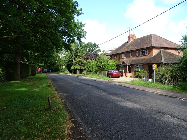
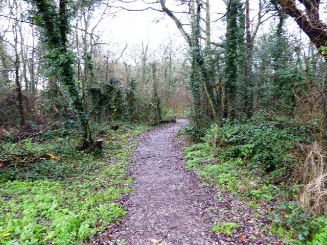
The wood is well-known for its scenic beauty, with its dense tree cover providing a haven for wildlife and a peaceful retreat for visitors. It offers a range of recreational activities, including hiking, nature walks, and birdwatching, attracting nature enthusiasts and families alike.

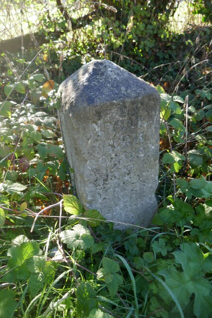
The trails within Big Wood are well-maintained, allowing visitors to explore the forest and discover its hidden treasures. Along these paths, one can encounter a variety of flora and fauna, including oak, beech, and pine trees, as well as deer, foxes, rabbits, and numerous bird species. The wood is also home to a number of rare and protected species, making it an important conservation area.

The tranquil atmosphere of Big Wood, coupled with its natural beauty, makes it an ideal location for relaxation and meditation. Visitors can escape the hustle and bustle of daily life and immerse themselves in the peacefulness of the forest. Additionally, the wood provides opportunities for educational activities, with guided tours and workshops being organized to promote environmental awareness and understanding.

Big Wood is a valuable natural resource and a cherished part of the local community in Berkshire. Its preservation and conservation efforts ensure that future generations can continue to enjoy its beauty and appreciate the wonders of nature.

If you have any feedback on the listing, please let us know in the comments section below.

Big Wood Images

Images are sourced within 2km of 51.421297/-0.72225549 or Grid Reference SU8869. Thanks to Geograph Open Source API. All images are credited.

Houses on Chavey Down Road, Winkfield Row
Chavey Down Road (B3017), Winkfield Row
Entering Hayley Green On the B3034.
Entering Hayley Green
On the B3034.
House on Forest Road, Hayley Green
Cottages on Forest Road
Forest Road (B3034), Hayley Green
Strawberry Hill, Warfield
House on the B3034
House on the B3034
B3034, Newell Green
B3034, Newell Green
House, Newell Green
House, Newell Green
Elizabeth II postbox on Warfield Street, Newell Green Postbox No. RG42 74.
Elizabeth II postbox on Warfield Street, Newell Green
Postbox No. RG42 74.
Brickwork on the Roundabout There's not much that can't be improved by a bit of decoration, even a humble mini roundabout.
This is more stylish than one of the usual white blobs.
Pity the drain covers spoil the pattern.
At the junction of Howell Close and Mareshall Avenue.
Brickwork on the Roundabout
There's not much that can't be improved by a bit of decoration, even a humble mini roundabout. This is more stylish than one of the usual white blobs. Pity the drain covers spoil the pattern. At the junction of Howell Close and Mareshall Avenue.
Bridge in Piggy Wood Piggy Wood nature reserve is a small area of remnant natural woodland in the middle of an area that has otherwise all been built over.
Bridge in Piggy Wood
Piggy Wood nature reserve is a small area of remnant natural woodland in the middle of an area that has otherwise all been built over.
Lakeside and Wick Hill Wood Lakeside is the name of this street, and there is a pond off to the left behind the houses, but you can't see it.
Wick Hill Wood is a small square of woodland that has been left standing for people to enjoy.
Lakeside and Wick Hill Wood
Lakeside is the name of this street, and there is a pond off to the left behind the houses, but you can't see it. Wick Hill Wood is a small square of woodland that has been left standing for people to enjoy.
Bracknell : Tesco A Tesco store on the outskirts of Bracknell.
Bracknell : Tesco
A Tesco store on the outskirts of Bracknell.
Overgrown footpath at Larks Hill A footpath overgrown with grass and weeds at Larks Hill.
Overgrown footpath at Larks Hill
A footpath overgrown with grass and weeds at Larks Hill.
Overgrown footpath at Larks Hill A footpath at Larks Hill bordered by dense weeds and grass.
Overgrown footpath at Larks Hill
A footpath at Larks Hill bordered by dense weeds and grass.
Old Milestone by the B3022, Bracknell Road, Hayley Green
Show me another place!

Big Wood is located at Grid Ref: SU8869 (Lat: 51.421297, Lng: -0.72225549)

Unitary Authority: Bracknell Forest

Police Authority: Thames Valley

What 3 Words

///loaded.bucks.rents. Near Bracknell, Berkshire

Related Wikis

Bullbrook

Bullbrook is a suburb of Bracknell , in the English county of Berkshire, formerly part of the parish of Winkfield. It is named after the Bull Brook which...

Whitegrove

Whitegrove or Warfield Green is a suburb of Bracknell in the English county of Berkshire. It stands within the bounds of the civil parish of Warfield....

Hayley Green Wood

Hayley Green Wood is a 2-hectare (4.9-acre) Local Nature Reserve on the northern outskirts of Bracknell in Berkshire. It is owned and managed by Bracknell...

Chavey Down

Chavey Down is a hamlet partly in Ascot, Berkshire, England, and part of the civil parish of Winkfield. The settlement lies near to the A329 road, and...

Whitegrove Copse

Whitegrove Copse is a 3.6-hectare (8.9-acre) Local Nature Reserve on the northern outskirts of Bracknell in Berkshire. It is owned and managed by Bracknell...

Heathfield School, Ascot

Heathfield School is a girls' independent boarding and day school in Ascot, Berkshire, England. In 2006, the school absorbed St Mary's School, Wantage...

Ascot Priory

Ascot Priory is a former priory in Berkshire, England, established in 1861. It was the mother house of the Society of the Most Holy Trinity, a community...

Wick Hill, Bracknell

Wick Hill is a suburb of Bracknell, in Berkshire, England. == Geography == The settlement lies north of the A329 road between Bullbrook and Priestwood...

Nearby Amenities

Located within 500m of 51.421297,-0.72225549
Crossing
Bicycle: yes
Crossing: uncontrolled
Crossing Island: yes
Kerb: lowered
Lat/Long: 51.419961/-0.7215946
Traffic Calming: table
Lat/Long: 51.4236548/-0.7243455
Crossing
Bicycle: yes
Crossing: unmarked
Kerb: lowered
Lat/Long: 51.4213197/-0.7290236
Crossing
Crossing: unmarked
Kerb: lowered
Sloped Curb: yes
Lat/Long: 51.4206804/-0.7243191
Barrier: bollard
Lat/Long: 51.4196894/-0.7245988
Traffic Calming: cushion
Lat/Long: 51.4241125/-0.7242012
Crossing
Crossing: uncontrolled
Crossing Island: yes
Kerb: lowered
Tactile Paving: yes
Lat/Long: 51.4247067/-0.7242419
Traffic Calming: cushion
Lat/Long: 51.4252276/-0.7245837
Barrier: bollard
Lat/Long: 51.420716/-0.724419
Crossing
Crossing: unmarked
Kerb: lowered
Lat/Long: 51.4207929/-0.7252669
Traffic Calming: table
Lat/Long: 51.4212967/-0.7251887
Traffic Calming: table
Lat/Long: 51.4221523/-0.725644
Crossing
Bicycle: yes
Crossing: unmarked
Kerb: lowered
Sloped Curb: yes
Lat/Long: 51.4186851/-0.7254855
Entrance: yes
Lat/Long: 51.4244902/-0.7243797
Entrance: yes
Lat/Long: 51.4250321/-0.7246158
Mini Roundabout
Direction: clockwise
Lat/Long: 51.4252388/-0.7238171
Mini Roundabout
Source: bing
Lat/Long: 51.4203868/-0.7241983
Mini Roundabout
Source: bing
Lat/Long: 51.4203771/-0.7232348
Barrier: bollard
Lat/Long: 51.419872/-0.7256417
Crossing
Bicycle: yes
Crossing: uncontrolled
Crossing Island: yes
Kerb: lowered
Lat/Long: 51.420623/-0.7226305
Crossing
Bicycle: yes
Crossing: uncontrolled
Crossing Island: yes
Kerb: lowered
Lat/Long: 51.4204727/-0.721954
Noexit: yes
Lat/Long: 51.4195797/-0.7247202
Barrier: bollard
Lat/Long: 51.4196056/-0.7213268
Barrier: bollard
Lat/Long: 51.4197449/-0.7245389
Barrier: bollard
Lat/Long: 51.4196351/-0.7238381
Barrier: bollard
Lat/Long: 51.419434/-0.7230609
Crossing
Bicycle: yes
Crossing: unmarked
Kerb: lowered
Sloped Curb: yes
Lat/Long: 51.4197264/-0.724581
Crossing
Bicycle: yes
Crossing: uncontrolled
Crossing Island: yes
Kerb: lowered
Lat/Long: 51.4227935/-0.725255
Barrier: bollard
Lat/Long: 51.4200951/-0.7255021
Barrier: bollard
Lat/Long: 51.4199475/-0.7255945
Barrier: bollard
Lat/Long: 51.421324/-0.7289202
Barrier: bollard
Lat/Long: 51.4213159/-0.7291157
Crossing
Crossing: uncontrolled
Crossing Island: yes
Kerb: lowered
Lat/Long: 51.4224359/-0.7256224
Crossing
Crossing: uncontrolled
Crossing Island: yes
Kerb: lowered
Lat/Long: 51.4224172/-0.7255061
Crossing
Bicycle: yes
Crossing Island: yes
Kerb: lowered
Lat/Long: 51.4226173/-0.7274125
Crossing
Bicycle: yes
Crossing: uncontrolled
Crossing Island: yes
Kerb: lowered
Lat/Long: 51.4227541/-0.7251727
Crossing
Bicycle: yes
Crossing: uncontrolled
Crossing Island: yes
Kerb: lowered
Lat/Long: 51.4226127/-0.725773
Crossing
Bicycle: yes
Crossing: uncontrolled
Crossing Island: yes
Kerb: lowered
Lat/Long: 51.4225314/-0.7250927
Crossing
Bicycle: yes
Crossing: uncontrolled
Crossing Island: yes
Kerb: lowered
Lat/Long: 51.4224799/-0.7251442
Crossing
Bicycle: yes
Crossing: uncontrolled
Crossing Island: yes
Kerb: lowered
Lat/Long: 51.4226833/-0.7257543
Crossing
Bicycle: yes
Crossing: unmarked
Kerb: lowered
Lat/Long: 51.4232322/-0.7248389
Crossing
Crossing: unmarked
Kerb: lowered
Lat/Long: 51.4240327/-0.7269966
Crossing
Crossing: unmarked
Kerb: lowered
Lat/Long: 51.4250926/-0.7243514
Crossing
Bicycle: yes
Crossing: unmarked
Kerb: lowered
Lat/Long: 51.4244691/-0.7242733
Crossing
Bicycle: yes
Crossing: unmarked
Kerb: lowered
Lat/Long: 51.4250526/-0.724505
Barrier: bollard
Lat/Long: 51.4182919/-0.726165
Crossing
Crossing: unmarked
Kerb: lowered
Sloped Curb: yes
Lat/Long: 51.4176061/-0.7260382
Crossing
Crossing: unmarked
Kerb: lowered
Sloped Curb: yes
Source: survey
Lat/Long: 51.4171497/-0.7247183
Crossing
Crossing: uncontrolled
Crossing Island: yes
Kerb: lowered
Source: Bing
Lat/Long: 51.4227221/-0.7284729
Post Box
Addr City: Bracknell
Addr Housenumber: 110
Addr Street: Bullbrook Drive
Collection Times: Mo-Fr 09:00; Sa 07:00
Drive Through: no
Operator: Royal Mail
Post Box Type: wall
Ref: RG12 116D
Royal Cypher: EIIR
Royal Cypher Wikidata: Q33102113
Lat/Long: 51.419041/-0.7269387
Leisure: playground
Lat/Long: 51.4190308/-0.725166
Barrier: bollard
Lat/Long: 51.4184767/-0.7260788
Noexit: yes
Lat/Long: 51.422759/-0.7232522
Crossing
Crossing: unmarked
Kerb: lowered
Source: Bing
Lat/Long: 51.4236431/-0.7242614
Noexit: yes
Lat/Long: 51.4239937/-0.7222711
Noexit: yes
Lat/Long: 51.4229217/-0.7239712
Noexit: yes
Lat/Long: 51.4240234/-0.7215476
Noexit: yes
Lat/Long: 51.4229167/-0.7241831
Noexit: yes
Lat/Long: 51.4229015/-0.7224287
Noexit: yes
Lat/Long: 51.4229666/-0.72173
Direction: 280
Generator Method: photovoltaic
Generator Output Electricity: yes
Generator Solar Modules: 12
Generator Source: solar
Generator Type: solar_photovoltaic_panel
Location: roof
Power: generator
Lat/Long: 51.4231194/-0.7238675
Direction: 180
Generator Method: photovoltaic
Generator Output Electricity: yes
Generator Solar Modules: 16
Generator Source: solar
Generator Type: solar_photovoltaic_panel
Location: roof
Power: generator
Lat/Long: 51.4238125/-0.724775
Direction: 215
Fixme: survey for panel count
Generator Method: photovoltaic
Generator Output Electricity: yes
Generator Solar Modules: 16
Generator Source: solar
Generator Type: solar_photovoltaic_panel
Location: roof
Power: generator
Lat/Long: 51.4233706/-0.7211263
Bus Stop
Bus: yes
Public Transport: platform
Lat/Long: 51.4242861/-0.7241268
Direction: 150
Generator Method: photovoltaic
Generator Output Electricity: yes
Generator Solar Modules: 18
Generator Source: solar
Generator Type: solar_photovoltaic_panel
Location: roof
Power: generator
Lat/Long: 51.4245722/-0.7227136
Bus Stop
Bus: yes
Naptan AtcoCode: 0380H752F362
Naptan NaptanCode: bkndajm
Public Transport: platform
Lat/Long: 51.4253484/-0.724799
Direction: 200
Generator Method: photovoltaic
Generator Output Electricity: yes
Generator Solar Modules: 6
Generator Source: solar
Generator Type: solar_photovoltaic_panel
Location: roof
Power: generator
Lat/Long: 51.4198742/-0.722868
Direction: 150
Generator Method: photovoltaic
Generator Output Electricity: yes
Generator Solar Modules: 16
Generator Source: solar
Generator Type: solar_photovoltaic_panel
Location: roof
Power: generator
Lat/Long: 51.4203146/-0.7226136
Direction: 200
Generator Method: photovoltaic
Generator Output Electricity: yes
Generator Solar Modules: 10
Generator Source: solar
Generator Type: solar_photovoltaic_panel
Location: roof
Power: generator
Lat/Long: 51.4200313/-0.7257321
Direction: 205
Generator Method: photovoltaic
Generator Output Electricity: yes
Generator Solar Modules: 14
Generator Source: solar
Generator Type: solar_photovoltaic_panel
Location: roof
Power: generator
Lat/Long: 51.4218037/-0.727587
Direction: 180
Fixme: survey for panel count
Generator Method: photovoltaic
Generator Output Electricity: yes
Generator Solar Modules: 7
Generator Source: solar
Generator Type: solar_photovoltaic_panel
Location: roof
Power: generator
Lat/Long: 51.4215941/-0.7278698
Direction: 180
Fixme: survey for panel count
Generator Method: photovoltaic
Generator Output Electricity: yes
Generator Solar Modules: 7
Generator Source: solar
Generator Type: solar_photovoltaic_panel
Location: roof
Power: generator
Lat/Long: 51.421593/-0.7277824
Direction: 90
Fixme: survey for panel count
Generator Method: photovoltaic
Generator Output Electricity: yes
Generator Solar Modules: 12
Generator Source: solar
Generator Type: solar_photovoltaic_panel
Location: roof
Power: generator
Lat/Long: 51.4215699/-0.7278088
Direction: 270
Fixme: survey for panel count
Generator Method: photovoltaic
Generator Output Electricity: yes
Generator Solar Modules: 12
Generator Source: solar
Generator Type: solar_photovoltaic_panel
Location: roof
Power: generator
Lat/Long: 51.4215687/-0.7278477
Direction: 200
Generator Method: photovoltaic
Generator Output Electricity: yes
Generator Solar Modules: 16
Generator Source: solar
Generator Type: solar_photovoltaic_panel
Location: roof
Power: generator
Lat/Long: 51.4173383/-0.7248366
Bus Stop
Bus: yes
Public Transport: platform
Lat/Long: 51.4182161/-0.7245512
Direction: 225
Generator Method: photovoltaic
Generator Output Electricity: yes
Generator Solar Modules: 16
Generator Source: solar
Generator Type: solar_photovoltaic_panel
Location: roof
Power: generator
Lat/Long: 51.4183714/-0.7246233
Direction: 210
Fixme: survey: the one odd panel - thermal?
Generator Method: photovoltaic
Generator Output Electricity: yes
Generator Solar Modules: 17
Generator Source: solar
Generator Type: solar_photovoltaic_panel
Location: roof
Power: generator
Lat/Long: 51.4179225/-0.7216496
Direction: 210
Generator Method: photovoltaic
Generator Output Electricity: yes
Generator Solar Modules: 14
Generator Source: solar
Generator Type: solar_photovoltaic_panel
Location: roof
Power: generator
Lat/Long: 51.4198693/-0.7161051
The data included in this document is from www.openstreetmap.org. The data is made available under ODbL.

Have you been to Big Wood?

Leave your review of Big Wood below (or comments, questions and feedback).