Wrangle

Civil Parish in Lincolnshire Boston

England

Wrangle

Sea Lane Heading Eastwards
Sea Lane Heading Eastwards Credit: Ian Paterson

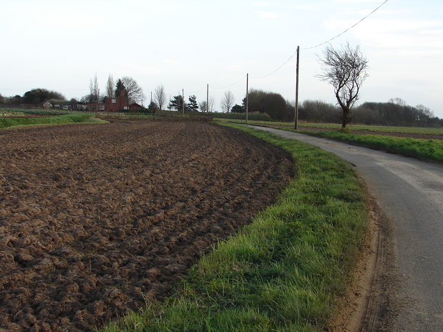
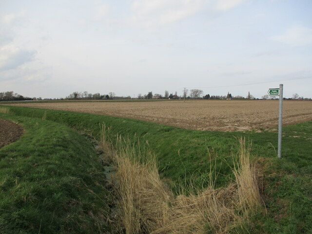
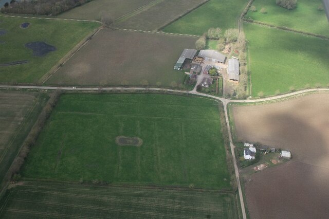
Wrangle is a civil parish located in the county of Lincolnshire, England. Situated approximately 10 miles east of the town of Boston, it covers an area of about 18.8 square miles and is home to a population of around 1,300 residents. The parish is predominantly rural, characterized by flat agricultural land and scattered farmsteads.

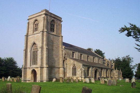
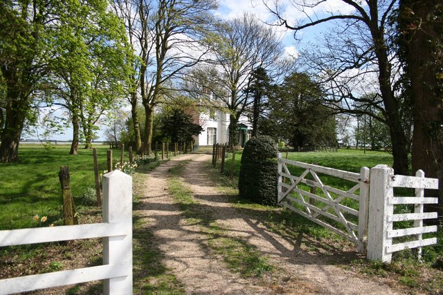
The village of Wrangle is the main settlement within the parish. It has a long history, with evidence of human activity dating back to Roman times. The village features a mix of architectural styles, reflecting its rich heritage, including several Grade II listed buildings. Notable landmarks include St. Mary and St. Nicholas Church, a beautiful 14th-century structure renowned for its ornate interior.

Agriculture plays a significant role in the local economy, with farming and horticulture being the main industries. The fertile soil and favorable climate of the area make it suitable for various crops, including vegetables, grains, and flowers. Livestock farming, particularly sheep and cattle rearing, is also common.

The community in Wrangle is close-knit, with a strong sense of camaraderie. The village has a primary school, a village hall, and a local pub, serving as social hubs for residents. The parish also organizes various events and activities throughout the year, fostering a sense of community spirit.

In terms of transport, Wrangle is well-connected by road, with the A52 passing through the parish, providing access to nearby towns and cities. Public transportation options are limited, with infrequent bus services being the main mode of travel for those without private vehicles.

Overall, Wrangle is a charming rural parish, offering a peaceful and picturesque living environment for its residents.

If you have any feedback on the listing, please let us know in the comments section below.

Wrangle Images

Images are sourced within 2km of 53.039836/0.15492 or Grid Reference TF4451. Thanks to Geograph Open Source API. All images are credited.

Sea Lane Heading Eastwards
New Sea Lane Freshly laid hard surface running alongside a drainage ditch. The Lane runs between the old sea bank to the new one. (Behind the photographer)
New Sea Lane
Freshly laid hard surface running alongside a drainage ditch. The Lane runs between the old sea bank to the new one. (Behind the photographer)
Towards Marsh Farm Looking over what appears to be a deliberately made lagoon towards the distinctive domes at Marsh Farm.
Towards Marsh Farm
Looking over what appears to be a deliberately made lagoon towards the distinctive domes at Marsh Farm.
A long shot Another view of Wrangle Mill from Sea Lane. Different month. Different point of view.  <a href="https://www.geograph.org.uk/photo/3784918">TF4351 : Wrangle Mill viewed from Sea Lane</a>
A long shot
Another view of Wrangle Mill from Sea Lane. Different month. Different point of view. TF4351 : Wrangle Mill viewed from Sea Lane
One way in Access point to the saltmarsh, presumably to allow cattle to graze there.  Also useful for geographing without tearing one's breeks.  That fence wire is barbed!
One way in
Access point to the saltmarsh, presumably to allow cattle to graze there. Also useful for geographing without tearing one's breeks. That fence wire is barbed!
Footpath to Hall End, Wrangle
Dylings or daila at junction of Gold Fen Dike Bank and Gateroom Lane, Wrangle Lowgate: aerial 2023 (1) A (medieval) daila was a community-managed pasture rather analogous to an arable open field. Shares were owned and could be passed on to the next generation. 

See <a href="https://www.geograph.org.uk/photo/5362573">TF4352 : Dylings or daila at junction of Gold Fen Dike Bank and Gateroom Lane, Wrangle Lowgate: aerial 2017 (1)</a> for details.
Dylings or daila at junction of Gold Fen Dike Bank and Gateroom Lane, Wrangle Lowgate: aerial 2023 (1)
A (medieval) daila was a community-managed pasture rather analogous to an arable open field. Shares were owned and could be passed on to the next generation. See TF4352 : Dylings or daila at junction of Gold Fen Dike Bank and Gateroom Lane, Wrangle Lowgate: aerial 2017 (1) for details.
Dylings or daila at junction of Gold Fen Dike Bank and Gateroom Lane, Wrangle Lowgate: aerial 2023 (2) Grass field to the right of the farm. A (medieval) daila was a community-managed pasture rather analogous to an arable open field. Shares were owned and could be passed on to the next generation. 

See <a href="https://www.geograph.org.uk/photo/5362573">TF4352 : Dylings or daila at junction of Gold Fen Dike Bank and Gateroom Lane, Wrangle Lowgate: aerial 2017 (1)</a> for details.
Dylings or daila at junction of Gold Fen Dike Bank and Gateroom Lane, Wrangle Lowgate: aerial 2023 (2)
Grass field to the right of the farm. A (medieval) daila was a community-managed pasture rather analogous to an arable open field. Shares were owned and could be passed on to the next generation. See TF4352 : Dylings or daila at junction of Gold Fen Dike Bank and Gateroom Lane, Wrangle Lowgate: aerial 2017 (1) for details.
Staples vegetable processing factory, Wrangle: aerial 2023
Flood mark of field, Gold Fen Dike Bank, Wrangle Lowgate: aerial 2023
Kink in the sea bank, Wrangle Tofts: aerial 2017 The old, inner sea wall is marked by the line of trees.

Along the road which crosses it and leads to the new sea wall are the old Sailor's Home, and the colourfully named "Sandalf's Garden".
Kink in the sea bank, Wrangle Tofts: aerial 2017
The old, inner sea wall is marked by the line of trees. Along the road which crosses it and leads to the new sea wall are the old Sailor's Home, and the colourfully named "Sandalf's Garden".
Kink in the sea bank, Wrangle Tofts: aerial 2017 The old, inner sea wall is marked by the line of trees.

Along the road which crosses it and leads to the new sea wall are the old Sailors' Home, and the colourfully named "Sandalf's Garden".
Kink in the sea bank, Wrangle Tofts: aerial 2017
The old, inner sea wall is marked by the line of trees. Along the road which crosses it and leads to the new sea wall are the old Sailors' Home, and the colourfully named "Sandalf's Garden".
Jubilee Bank and other sea walls; Wrangle Tofts and view to Wrangle Lowgate:aerial 2017 White farm is Staples vegetable processing plant.

The old, inner sea wall is marked by the line of trees.

Along the road which crosses it and leads to the new sea wall are the old Sailor's Home, and the colourfully named "Sandalf's Garden".
Jubilee Bank and other sea walls; Wrangle Tofts and view to Wrangle Lowgate:aerial 2017
White farm is Staples vegetable processing plant. The old, inner sea wall is marked by the line of trees. Along the road which crosses it and leads to the new sea wall are the old Sailor's Home, and the colourfully named "Sandalf's Garden".
Sea walls, Tofts and view to Wrangle: aerial 2017 The white farm is Staples vegetable processing plant.

The old, inner sea wall runs behind the new one and turns sharply upwards.
Sea walls, Tofts and view to Wrangle: aerial 2017
The white farm is Staples vegetable processing plant. The old, inner sea wall runs behind the new one and turns sharply upwards.
Old sluice gate on the edge of Toft Marsh
Wrangle - Toft Mill Changed from windpower to an engine driven mill in the 1920's and then stood derelict before being converted into the current dwelling complete with lovely new cap.
Wrangle - Toft Mill
Changed from windpower to an engine driven mill in the 1920's and then stood derelict before being converted into the current dwelling complete with lovely new cap.
Toft Mill Built before 1824, Toft Mill had 4 sails until c1922 <span class="nowrap"><a title="http://www.lincolnshire.gov.uk/windmills/section.asp?catId=3330" rel="nofollow ugc noopener" href="http://www.lincolnshire.gov.uk/windmills/section.asp?catId=3330">Link</a><img style="margin-left:2px;" alt="External link" title="External link - shift click to open in new window" src="https://s1.geograph.org.uk/img/external.png" width="10" height="10"/></span>. It is now converted for holiday accommodation <span class="nowrap"><a title="http://www.toftwindmill.co.uk/" rel="nofollow ugc noopener" href="http://www.toftwindmill.co.uk/">Link</a><img style="margin-left:2px;" alt="External link" title="External link - shift click to open in new window" src="https://s1.geograph.org.uk/img/external.png" width="10" height="10"/></span>
Toft Mill
Built before 1824, Toft Mill had 4 sails until c1922 LinkExternal link. It is now converted for holiday accommodation LinkExternal link
Hall Lane Hall Lane from the junction with Gipsy Lane and Mill Lane
Hall Lane
Hall Lane from the junction with Gipsy Lane and Mill Lane
Show me another place!

Wrangle is located at Grid Ref: TF4451 (Lat: 53.039836, Lng: 0.15492)

Administrative County: Lincolnshire

District: Boston

Police Authority: Lincolnshire

What 3 Words

///spillage.husky.noticing. Near Old Leake, Lincolnshire

Nearby Locations

Wrangle

Related Wikis

Wrangle, Lincolnshire

Wrangle is a village in the Boston Borough of Lincolnshire, England. It is situated approximately 9 miles (14 km) north-east from the town of Boston. The...

Old Leake

Old Leake is a village and civil parish in Lincolnshire, England. The population of the civil parish at the 2011 census was 2,022.Old Leake is situated...

Giles Academy

The Giles Academy (formerly the Giles School) is a mixed secondary school located in Old Leake in the English county of Lincolnshire. == History == Giles...

Friskney

Friskney is a village and civil parish within the East Lindsey district of Lincolnshire, England.The parish includes the settlement of Friskney Eaudyke...

RAF Wainfleet

RAF Wainfleet was a Royal Air Force weapons range on The Wash on the east coast of England near Wainfleet, in the civil parish of Friskney, although the...

Friskney Eaudyke

Friskney Eaudyke is a settlement in the civil parish of Friskney, and the East Lindsey district of Lincolnshire, England. It is 11 miles (20 km) north...

Leverton, Lincolnshire

Leverton is a village and civil parish in the Boston district of Lincolnshire, England, about 6 mi (10 km) east-north-east of Boston, on the A52 road....

Benington Sea End

Benington Sea End is a hamlet in the Benington civil parish of the Borough of Boston in Lincolnshire, England. It is 5 miles (8 km) east-northeast from...

Nearby Amenities

Located within 500m of 53.039836,0.15492
Auraceria House Farm
Place: farm
Source: Bing
Lat/Long: 53.0425361/0.1543792
America House
Place: isolated_dwelling
Lat/Long: 53.0415257/0.1491308
Mill Lodge
Place: isolated_dwelling
Lat/Long: 53.0419195/0.1490964
The Chequers
Place: isolated_dwelling
Lat/Long: 53.0419506/0.1513025
Toft House
Place: isolated_dwelling
Lat/Long: 53.0413185/0.1507854
Toft Mill
Place: isolated_dwelling
Lat/Long: 53.0423651/0.1509061
Power: pole
Lat/Long: 53.0360983/0.1553605
Power: pole
Lat/Long: 53.0367338/0.1543788
Power: pole
Lat/Long: 53.0373015/0.1534991
Power: pole
Lat/Long: 53.0379176/0.152394
Power: pole
Lat/Long: 53.0384482/0.1514498
Power: pole
Lat/Long: 53.0390046/0.1504413
Power: pole
Lat/Long: 53.0396754/0.1492987
Power: pole
Lat/Long: 53.0401786/0.1483197
The data included in this document is from www.openstreetmap.org. The data is made available under ODbL.

Have you been to Wrangle?

Leave your review of Wrangle below (or comments, questions and feedback).