Wormingford

Civil Parish in Essex Colchester

England

Wormingford

Smallbridge Hall, near Wormingford, Essex This Elizabethan moated house was built in 1550 and what we see today is believed to be one wing of a much larger mansion. Queen Elizabeth I is said to have stayed here on two occasions. In 1874 it was much rebuilt and further restoration took place in 1932. It stands between Wormingford and Bures.
Smallbridge Hall, near Wormingford, Essex Credit: Robert Edwards

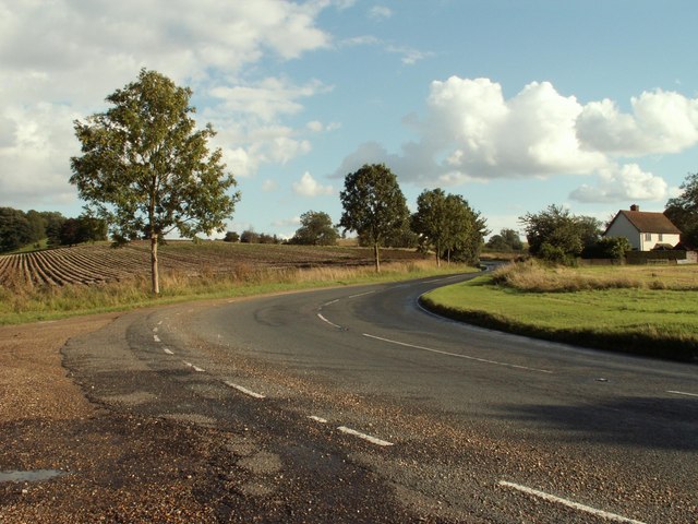
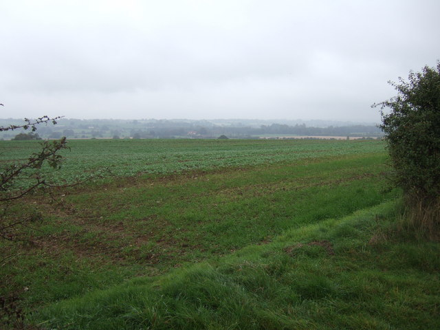
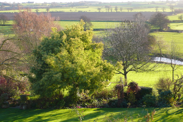
Wormingford is a civil parish located in the county of Essex, England. It is situated in the borough of Colchester, approximately 10 miles south of the town center. The parish covers an area of around 6 square miles and is surrounded by picturesque countryside, making it an attractive location for nature lovers and outdoor enthusiasts.

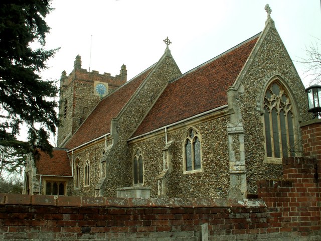
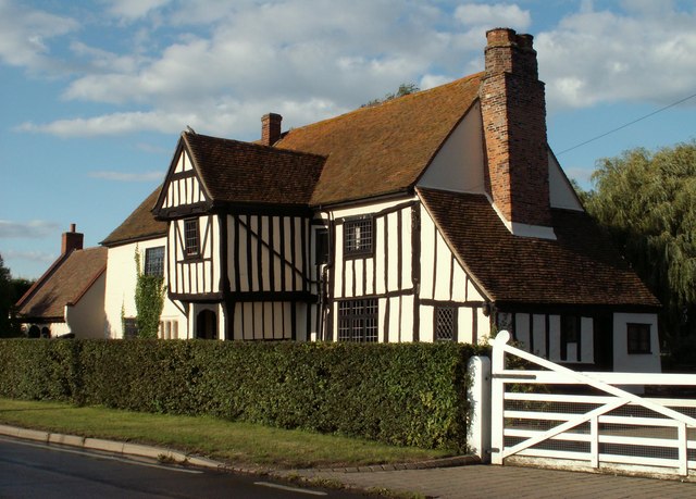
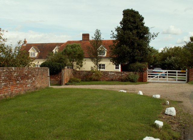
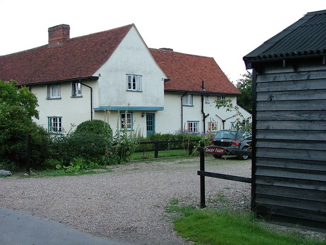
The village of Wormingford itself is small and charming, with a population of around 400 residents. It is characterized by traditional English architecture, including thatched cottages and historic buildings. The village is centered around the Holy Trinity Church, which dates back to the 13th century and serves as a focal point for the community.

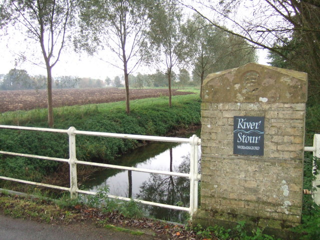
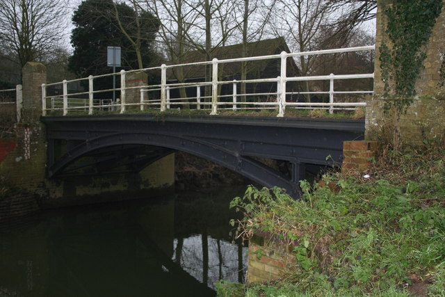
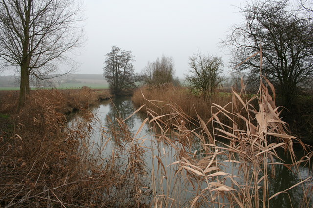
The River Stour, which flows through the parish, adds to the scenic beauty of the area. The river provides opportunities for fishing and boating, attracting visitors from near and far. Additionally, the Stour Valley Path, a long-distance footpath, passes through Wormingford, offering stunning views of the surrounding countryside.

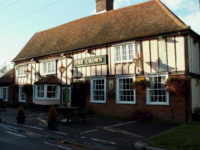
Wormingford has a strong sense of community, with various local organizations and clubs that bring residents together. These include a cricket club, a gardening society, and a historical society. The village also has a primary school, ensuring that families have access to education within the local area.

Overall, Wormingford is a charming and rural parish, offering a peaceful and idyllic lifestyle for its residents. With its scenic landscapes, historic buildings, and strong community spirit, it is a wonderful place to live or visit.

If you have any feedback on the listing, please let us know in the comments section below.
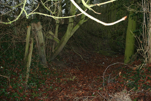
Wormingford Images

Images are sourced within 2km of 51.951444/0.814357 or Grid Reference TL9331. Thanks to Geograph Open Source API. All images are credited.

Smallbridge Hall, near Wormingford, Essex This Elizabethan moated house was built in 1550 and what we see today is believed to be one wing of a much larger mansion. Queen Elizabeth I is said to have stayed here on two occasions. In 1874 it was much rebuilt and further restoration took place in 1932. It stands between Wormingford and Bures.
Smallbridge Hall, near Wormingford, Essex
This Elizabethan moated house was built in 1550 and what we see today is believed to be one wing of a much larger mansion. Queen Elizabeth I is said to have stayed here on two occasions. In 1874 it was much rebuilt and further restoration took place in 1932. It stands between Wormingford and Bures.
St. Andrew's church, Wormingford, Essex The nave and tower of this church are Norman. Most of the rest of the church is 14th century.
St. Andrew's church, Wormingford, Essex
The nave and tower of this church are Norman. Most of the rest of the church is 14th century.
The B.1508 near Wormingford, Essex The white house on the right is known as The Lodge.
The B.1508 near Wormingford, Essex
The white house on the right is known as The Lodge.
'The Crown' inn, Wormingford, Essex
The farmhouse at Jenkin's Farm, near Wormingford, Essex This is a splendid timber-framed house and one that makes you slow down and stop for a close inspection. It was built around 1583 and stands about one mile south of Wormingford on Fordham Road.
The farmhouse at Jenkin's Farm, near Wormingford, Essex
This is a splendid timber-framed house and one that makes you slow down and stop for a close inspection. It was built around 1583 and stands about one mile south of Wormingford on Fordham Road.
The B.1508 at Wormingford, Essex This section of the road is called Sandy Hill.
The B.1508 at Wormingford, Essex
This section of the road is called Sandy Hill.
Cockrell's Farm, Wormingford, Essex
Road to Staunch Farm, just west of Wormingford
Wormingford Airfield This is the perimeter track of Wormingford Airfield. Military aviation in Wormingford began during WW1 however this aerodrome was operational from November 1943 until the end of the war, after the war it was used by transport command. The base was finally stood down in 1962.  It was used as a civilian airfield for a further nine years. During the 1970’s and 80’s the hard standings and other infrastructure were broken up as the land returned to agriculture as the Air ministry had promised when all land was requisitioned for airfield construction (it is worth noting this promise was also made to the owners of the land at RAF Heathrow). In 1990 the Essex and Suffolk Gliding Club moved to the airfield they have a history of the airfield and the units that operated from here on their website see club info section <span class="nowrap"><a title="http://www.esgc.co.uk/home.asp?start=esgchome.htm" rel="nofollow ugc noopener" href="http://www.esgc.co.uk/home.asp?start=esgchome.htm">Link</a><img style="margin-left:2px;" alt="External link" title="External link - shift click to open in new window" src="https://s1.geograph.org.uk/img/external.png" width="10" height="10"/></span>. To go to the next field in an alphabetical tour of Essex WW2 airfields click on <a href="https://www.geograph.org.uk/photo/221140">TL6824 : Andrews Field</a>. Much information was gleaned from Graham Smith’s book “Essex Airfields In The Second World War”. <span class="nowrap"><a title="https://books.google.co.uk/books/about/Essex_Airfields_in_the_Second_World_War.html?id=u3atAAAACAAJ&redir_esc=y" rel="nofollow ugc noopener" href="https://books.google.co.uk/books/about/Essex_Airfields_in_the_Second_World_War.html?id=u3atAAAACAAJ&redir_esc=y">Link</a><img style="margin-left:2px;" alt="External link" title="External link - shift click to open in new window" src="https://s1.geograph.org.uk/img/external.png" width="10" height="10"/></span>
Wormingford Airfield
This is the perimeter track of Wormingford Airfield. Military aviation in Wormingford began during WW1 however this aerodrome was operational from November 1943 until the end of the war, after the war it was used by transport command. The base was finally stood down in 1962. It was used as a civilian airfield for a further nine years. During the 1970’s and 80’s the hard standings and other infrastructure were broken up as the land returned to agriculture as the Air ministry had promised when all land was requisitioned for airfield construction (it is worth noting this promise was also made to the owners of the land at RAF Heathrow). In 1990 the Essex and Suffolk Gliding Club moved to the airfield they have a history of the airfield and the units that operated from here on their website see club info section LinkExternal link. To go to the next field in an alphabetical tour of Essex WW2 airfields click on TL6824 : Andrews Field. Much information was gleaned from Graham Smith’s book “Essex Airfields In The Second World War”. LinkExternal link
North East of Wormingford Farmland looking towards the River Stour North East of Worminford.
North East of Wormingford
Farmland looking towards the River Stour North East of Worminford.
River Stour North of Wormingford View of River Stour and Farmland North of Wormingford
River Stour North of Wormingford
View of River Stour and Farmland North of Wormingford
Old Farm Machinery near Bowdens Farm Old Farm machinery on the Bridleway near Bowdens Farm to Garnons
Old Farm Machinery near Bowdens Farm
Old Farm machinery on the Bridleway near Bowdens Farm to Garnons
Stream and pasture - Stour valley The remains of an old sluice beside the road controlled the flow on this tributary to the Stour
Stream and pasture - Stour valley
The remains of an old sluice beside the road controlled the flow on this tributary to the Stour
Stour Valley from Creems, Wissington, Suffolk Line of R. Stour is in top quarter of the photo.  Essex beyond.
Stour Valley from Creems, Wissington, Suffolk
Line of R. Stour is in top quarter of the photo. Essex beyond.
Upper Dairy Farm, Holts Road, Little Horkesley Circa early 17th Century timber framed farm house, Grade II listed.  Farmed in the 19th Century by Henry Turrall of the East Suffolk farming family.  Now known simply as "Dairy Farm", it has in the past been known by the names "Upper Dairy Farm" and "Upper Dairy Hall Farm".
Upper Dairy Farm, Holts Road, Little Horkesley
Circa early 17th Century timber framed farm house, Grade II listed. Farmed in the 19th Century by Henry Turrall of the East Suffolk farming family. Now known simply as "Dairy Farm", it has in the past been known by the names "Upper Dairy Farm" and "Upper Dairy Hall Farm".
Wormingford Bridge A modest cast iron bridge over the River Stour, dating from the 1870's. It is still in use today, albeit with a weight limit of 8 tonnes.
Wormingford Bridge
A modest cast iron bridge over the River Stour, dating from the 1870's. It is still in use today, albeit with a weight limit of 8 tonnes.
River Stour near Wormingford A pleasant and tranquil spot, even on a grey January day.
River Stour near Wormingford
A pleasant and tranquil spot, even on a grey January day.
Stour Navigation, near Wormingford In the mid 1700s the river Stour was navigable upstream as far as Sudbury. Near Wormingford a weir was bypassed by a short canal with a lock. These timbers and a shallow overgrown ditch are all that remains of Wormingford lock.
Stour Navigation, near Wormingford
In the mid 1700s the river Stour was navigable upstream as far as Sudbury. Near Wormingford a weir was bypassed by a short canal with a lock. These timbers and a shallow overgrown ditch are all that remains of Wormingford lock.
Show me another place!

Wormingford is located at Grid Ref: TL9331 (Lat: 51.951444, Lng: 0.814357)

Administrative County: Essex

District: Colchester

Police Authority: Essex

What 3 Words

///potato.essential.excuse. Near Bures St Mary, Suffolk

Related Wikis

Wormingford

Wormingford is a village and civil parish in the City of Colchester district of Essex, England. The ancient parish of Wormingford on the south bank of...
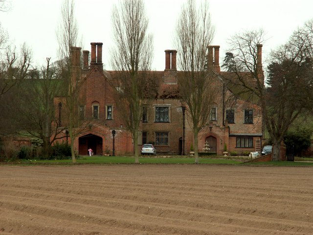
Smallbridge Hall

Smallbridge Hall is a Grade II* listed English country house in Bures St. Mary, Suffolk, near Colchester, England. The house is partially surrounded by...

RAF Wormingford

Royal Air Force Wormingford, or more simply RAF Wormingford, is a former Royal Air Force station located 6 miles (9.7 km) northwest of Colchester, Essex...

Little Horkesley Priory

Little Horkesley Priory was a priory of Cluniac monks in Essex, England. It was an alien priory, a daughter house of Thetford, Norfolk and dependent on...

Wissington, Suffolk

Wissington or Wiston is a small village and former civil parish, now in the parish of Nayland-with-Wissington, in the Babergh district, in south Suffolk...

Little Horkesley

Little Horkesley is a civil parish in the City of Colchester district of Essex, England. It is situated approximately 4 miles north of Colchester on the...

Sergeants Orchard

Sergeants Orchard is a 3.2-hectare (7.9-acre) nature reserve in Mount Bures and north of Chappel in Essex. It is owned and managed by the Essex Wildlife...

Mount Bures

Mount Bures is a small village in England on the Essex and Suffolk borders. It takes its name from the mount or motte believed to have been built shortly...

Nearby Amenities

Located within 500m of 51.951444,0.814357
Wormingford
Place: village
Lat/Long: 51.9506005/0.8108382
Bus Stop
Church Road
Naptan AtcoCode: 150027011007
Naptan Bearing: W
Naptan BusStopType: CUS
Naptan CommonName: Church Road
Naptan Crossing: Church Road
Naptan Indicator: Adj
Naptan Landmark: Church Road
Naptan NaptanCode: esxdjptd
Naptan Street: Main Road
Naptan Verified: no
Public Transport: platform
Shelter: yes
Source: naptan_import
Lat/Long: 51.9487788/0.8086063
Wormingford Store
Addr Housename: Shop
Addr Postcode: CO6 3AD
Addr Street: Church Road
Shop: convenience
Lat/Long: 51.9498044/0.8093847
Barrier: stile
Stile: steps
Lat/Long: 51.9550124/0.8119262
Barrier: kissing_gate
Lat/Long: 51.9547935/0.8110455
Waste Basket
Lat/Long: 51.9550223/0.8119187
Information: board
Tourism: information
Lat/Long: 51.9550065/0.8119223
Post Box
Collection Times: Mo-Fr 09:00; Sa 07:00
Post Box Mounting: wall
Post Box Type: wall
Ref: CO6 111D
Royal Cypher: VR
Royal Cypher Wikidata: Q33102356
Lat/Long: 51.955/0.8119179
Barrier: kissing_gate
Lat/Long: 51.9552297/0.8138478
Public Bookcase
The Wormery Book Exchange
Booth: K6
Disused Amenity: telephone
Man Made: telephone_box
Public Bookcase Type: phone_box
Lat/Long: 51.9487579/0.8086729
Information: guidepost
Tourism: information
Lat/Long: 51.9487394/0.8087388
Post Box
Post Box Type: lamp
Royal Cypher: EIIR
Lat/Long: 51.9489229/0.8087648
Defibrillator
Access: yes
Defibrillator Location: on post on car park side of building
Emergency: defibrillator
Indoor: no
Ref GB The Circuit: F06776CA-4AC6-40B7-94B3-AFB100C874E2
Lat/Long: 51.9494397/0.8107791
The data included in this document is from www.openstreetmap.org. The data is made available under ODbL.

Have you been to Wormingford?

Leave your review of Wormingford below (or comments, questions and feedback).