Woodborough

Civil Parish in Nottinghamshire Gedling

England

Woodborough

Bonner Hill The road out of Calverton towards Woodborough.
Bonner Hill Credit: Alan Murray-Rust

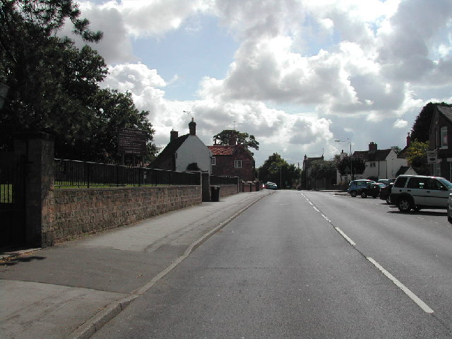
Woodborough is a civil parish located in the Gedling district of Nottinghamshire, England. Situated approximately seven miles northeast of Nottingham city center, it is a picturesque village surrounded by rural landscapes and farmland. The parish covers an area of about 1,300 acres and has a population of around 2,500 residents.

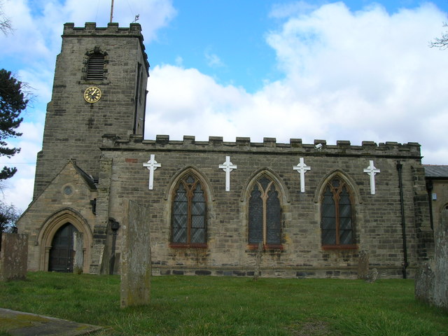
Woodborough is known for its rich history, with evidence of human settlement dating back to the Bronze Age. The village itself has a charming and traditional feel, characterized by its well-preserved historic buildings, including several timber-framed houses. St. Swithun's Church, a Grade I listed building, is a prominent feature in the village and dates back to the 11th century.

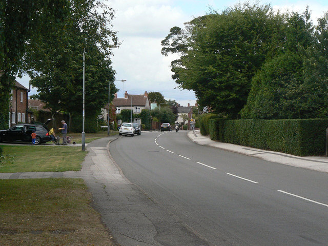
The village is home to a range of amenities and services, including a primary school, a village hall, a post office, and a convenience store. The local pub, The Four Bells, is a popular meeting place for residents and visitors alike.

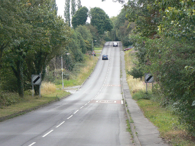
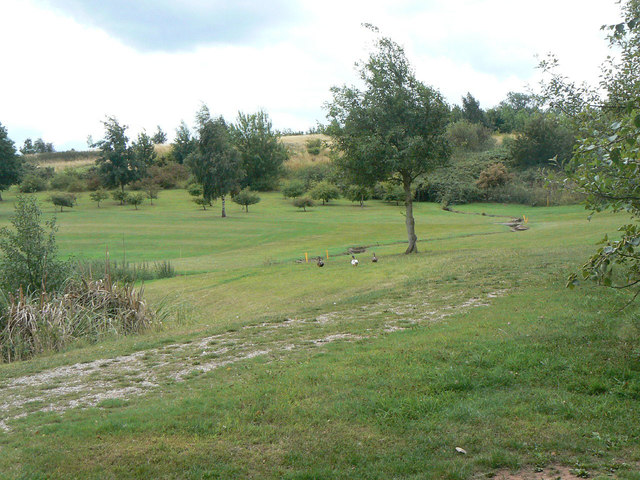
Woodborough is surrounded by beautiful countryside and offers ample opportunities for outdoor activities. The nearby Calverton and Woodborough Woods provide scenic walking trails, while Gedling Country Park, a short distance away, offers nature reserves and recreational facilities.

Transport links in Woodborough are well-established, with regular bus services connecting the village to Nottingham and other nearby towns. The village is also conveniently located close to major road networks, including the A60 and A614, providing easy access to the wider region.

Overall, Woodborough is a charming and historic village, offering a peaceful and idyllic setting for its residents while maintaining easy access to amenities and nearby urban areas.

If you have any feedback on the listing, please let us know in the comments section below.

Woodborough Images

Images are sourced within 2km of 53.024008/-1.069219 or Grid Reference SK6247. Thanks to Geograph Open Source API. All images are credited.

Bonner Hill The road out of Calverton towards Woodborough.
Bonner Hill
The road out of Calverton towards Woodborough.
Church Meadow Modern housing on the south side of Calverton, part of the expansion of the village as a dormitory for Nottingham.
Church Meadow
Modern housing on the south side of Calverton, part of the expansion of the village as a dormitory for Nottingham.
Main Street, Calverton Looking west from the junction with Bonner Hill.
Main Street, Calverton
Looking west from the junction with Bonner Hill.
Traditional fingerpost At the junction of Main Street and Bonner Hill.
Traditional fingerpost
At the junction of Main Street and Bonner Hill.
Main Street Calverton postbox (ref. NG14 23) E II R pillar box at the corner of Bonner Lane and Bonner Hill, where Main Street ends. The postbox on Main Street nearer the centre of the village is called Mews Lane <a title="https://www.geograph.org.uk/photo/2559143" href="https://www.geograph.org.uk/photo/2559143">Link</a>.
The cottages to the left are Windles Square <a title="https://www.geograph.org.uk/photo/2558512" href="https://www.geograph.org.uk/photo/2558512">Link</a>.
Main Street Calverton postbox (ref. NG14 23)
E II R pillar box at the corner of Bonner Lane and Bonner Hill, where Main Street ends. The postbox on Main Street nearer the centre of the village is called Mews Lane Link. The cottages to the left are Windles Square Link.
Windles Square A group of terraced cottages built for framework knitters, of which the western and part of the northern rows still survive. This is the rear face of the western row and shows to advantage the large windows to provide light for the knitters. Unusually these are on the ground floor rather than the more traditional attic location; this is a feature of a number of buildings in Calverton. The cottages were built in 1834 and renovated in 1974, commemorated by the plaque on the side of the building. Listed Grade II.
Windles Square
A group of terraced cottages built for framework knitters, of which the western and part of the northern rows still survive. This is the rear face of the western row and shows to advantage the large windows to provide light for the knitters. Unusually these are on the ground floor rather than the more traditional attic location; this is a feature of a number of buildings in Calverton. The cottages were built in 1834 and renovated in 1974, commemorated by the plaque on the side of the building. Listed Grade II.
The Gleaners Mock-half-timbered public house on Bonner Lane.
The Gleaners
Mock-half-timbered public house on Bonner Lane.
Park Road East This is the main distributor road for the development of Calverton as a mining village in the 1950s and 60s, making a roughly semicircular sweep round the then northern periphery. This is its eastern end where it meets Bonner Lane.
Park Road East
This is the main distributor road for the development of Calverton as a mining village in the 1950s and 60s, making a roughly semicircular sweep round the then northern periphery. This is its eastern end where it meets Bonner Lane.
Houses on Moor Road The carved stones above the doorways have a coat of arms and the date 1957. I believe that they were built as police houses.
Houses on Moor Road
The carved stones above the doorways have a coat of arms and the date 1957. I believe that they were built as police houses.
Fields off Bonner Lane The field pattern on the slope to the south east of the village still reflects the medieval strip farming. Enclosures in the parish of Calverton seem to have followed the old strip boundaries rather than creating larger open fields.
Fields off Bonner Lane
The field pattern on the slope to the south east of the village still reflects the medieval strip farming. Enclosures in the parish of Calverton seem to have followed the old strip boundaries rather than creating larger open fields.
Stubble field Alongside Bonner Lane, and waiting for the next stage of ploughing-in.
Stubble field
Alongside Bonner Lane, and waiting for the next stage of ploughing-in.
Hillside above Bonner Lane One of the narrow strip fields characteristic of the immediate vicinity, with a modern golf course development alongside.
Hillside above Bonner Lane
One of the narrow strip fields characteristic of the immediate vicinity, with a modern golf course development alongside.
Pond on the golf course This does not appear on older maps so has presumably been created as part of the golf course.
Pond on the golf course
This does not appear on older maps so has presumably been created as part of the golf course.
Springwater Golf Course On the ridge to the south east of Calverton village.
Springwater Golf Course
On the ridge to the south east of Calverton village.
Calverton Sewage Treatment works Circular filter beds seen from Bonner Lane.
Calverton Sewage Treatment works
Circular filter beds seen from Bonner Lane.
Calverton Sewage Treatment works The entrance to the works on Bonner Lane.
Calverton Sewage Treatment works
The entrance to the works on Bonner Lane.
Springwater Golf Club Clubhouse and car park, with the Grimesmoor Dyke stream to the left.
Springwater Golf Club
Clubhouse and car park, with the Grimesmoor Dyke stream to the left.
Dover Beck Valley Looking across from near Calverton sewage works to Epperstone Park.
Dover Beck Valley
Looking across from near Calverton sewage works to Epperstone Park.
Show me another place!

Woodborough is located at Grid Ref: SK6247 (Lat: 53.024008, Lng: -1.069219)

Administrative County: Nottinghamshire

District: Gedling

Police Authority: Nottinghamshire

What 3 Words

///converter.behave.special. Near Calverton, Nottinghamshire

Nearby Locations

Woodborough Stanley Wood

Related Wikis

St Swithun's Church, Woodborough

St Swithun's Church is a parish church in the Church of England in Woodborough, Nottinghamshire. == History == The church is medieval with the chancel...

Woodborough, Nottinghamshire

Woodborough is a village and civil parish in the Gedling district, in the county of Nottinghamshire, England. It is located 7 miles (11 km) north-east...

St Wilfrid's Church, Calverton

St Wilfrid's Church is a Grade II* listed parish church in the Church of England in Calverton, Nottinghamshire. == History == St Wilfrid’s church seems...

Calverton, Nottinghamshire

Calverton () is a village and civil parish in Nottinghamshire, England and of some 4,247 acres (6.636 sq mi; 1,719 ha; 17.19 km2) in size. It is in the...

Nearby Amenities

Located within 500m of 53.024008,-1.069219
Turning Circle
Lat/Long: 53.0223473/-1.0657111
Bus Stop
Westfields Lane
Bench: no
Bus: yes
Naptan AtcoCode: 3300GE0241
Naptan Bearing: SE
Naptan CommonName: Westfields Lane
Naptan Crossing: Westfields Lane
Naptan Indicator: opp
Naptan NaptanCode: ntsatwpa
Naptan Notes: none
Naptan Street: Foxwood Lane
Naptan Verified: no
Public Transport: platform
Shelter: no
Source: naptan_import
Lat/Long: 53.0245836/-1.0704699
Bus Stop
Westfields Lane
Bus: yes
Naptan AtcoCode: 3300GE0242
Naptan Bearing: NW
Naptan CommonName: Westfields Lane
Naptan Crossing: Westfields Lane
Naptan Indicator: adj
Naptan NaptanCode: ntsatwpd
Naptan Notes: none
Naptan Street: Foxwood Lane
Naptan Verified: no
Public Transport: platform
Shelter: no
Source: naptan_import
Lat/Long: 53.0246579/-1.0707814
Bus Stop
Main Street
Bench: no
Bin: no
Bus: yes
Check Date Shelter: 2021-06-06
Lit: no
Naptan AtcoCode: 3300GE0250
Naptan Bearing: SE
Naptan CommonName: Main Street
Naptan Indicator: o/s 29
Naptan NaptanCode: ntsatwtg
Naptan Notes: none
Naptan Street: Main Street
Naptan Verified: no
Public Transport: platform
Shelter: no
Source: naptan_import
Tactile Paving: no
Lat/Long: 53.0240869/-1.0678863
Bus Stop
Park Avenue
Bench: no
Bin: no
Bus: yes
Naptan AtcoCode: 3300GE0252
Naptan Bearing: W
Naptan CommonName: Park Avenue
Naptan Crossing: Park Avenue
Naptan Indicator: adj
Naptan NaptanCode: ntsdtmwp
Naptan Notes: none
Naptan Street: Main Street
Naptan Verified: no
Public Transport: platform
Shelter: no
Source: naptan_import
Tactile Paving: no
Lat/Long: 53.0236469/-1.0656593
Bus Stop
Main Street
Bench: no
Bin: no
Bus: yes
Lit: no
Naptan AtcoCode: 3300GE0276
Naptan Bearing: NW
Naptan CommonName: Main Street
Naptan Indicator: opp 25
Naptan NaptanCode: ntsatwtw
Naptan Notes: none
Naptan Street: Main Street
Naptan Verified: no
Public Transport: platform
Shelter: no
Source: naptan_import
Tactile Paving: no
Lat/Long: 53.0241909/-1.06854
Bus Stop
Park Avenue
Bench: no
Bin: no
Bus: yes
Lit: no
Naptan AtcoCode: 3300GE0289
Naptan Bearing: E
Naptan CommonName: Park Avenue
Naptan Crossing: Park Avenue
Naptan Indicator: opp
Naptan NaptanCode: ntsatwdw
Naptan Notes: none
Naptan Street: Main Street
Naptan Verified: no
Public Transport: platform
Shelter: no
Source: naptan_import
Tactile Paving: no
Lat/Long: 53.0237943/-1.0649703
Man Made: mast
Note: looks like mobile mast
Source: Bing
Tower Type: communication
Lat/Long: 53.0200885/-1.0694559
Generator Method: photovoltaic
Generator Output Electricity: yes
Generator Source: solar
Generator Type: solar_photovoltaic_panel
Location: roof
Power: generator
Lat/Long: 53.0241431/-1.0720099
Generator Method: photovoltaic
Generator Output Electricity: yes
Generator Source: solar
Generator Type: solar_photovoltaic_panel
Location: roof
Power: generator
Lat/Long: 53.0238246/-1.0719106
Generator Method: photovoltaic
Generator Output Electricity: yes
Generator Source: solar
Generator Type: solar_photovoltaic_panel
Location: roof
Power: generator
Lat/Long: 53.0239241/-1.071861
Generator Method: photovoltaic
Generator Output Electricity: yes
Generator Source: solar
Generator Type: solar_photovoltaic_panel
Location: roof
Power: generator
Lat/Long: 53.0229837/-1.0714721
Generator Method: photovoltaic
Generator Output Electricity: yes
Generator Source: solar
Generator Type: solar_photovoltaic_panel
Location: roof
Power: generator
Lat/Long: 53.0243172/-1.0724842
Generator Method: photovoltaic
Generator Output Electricity: yes
Generator Source: solar
Generator Type: solar_photovoltaic_panel
Location: roof
Power: generator
Lat/Long: 53.0252038/-1.0674157
Generator Method: photovoltaic
Generator Output Electricity: yes
Generator Source: solar
Generator Type: solar_photovoltaic_panel
Location: roof
Power: generator
Lat/Long: 53.0248072/-1.0648724
Generator Method: photovoltaic
Generator Output Electricity: yes
Generator Source: solar
Generator Type: solar_photovoltaic_panel
Location: roof
Power: generator
Lat/Long: 53.0249145/-1.069954
Telephone
Defibrillator
Addr Postcode: NG14 6EA
Booth: K6
Covered: booth
Defibrillator Location: inside red phone box, Main Street, Woodborough
Emergency: defibrillator
Listed Status: Grade II
Man Made: telephone_box
Source Addr Postcode: ons_uprn_lookup
Lat/Long: 53.0244103/-1.0691175
Information: board
Tourism: information
Lat/Long: 53.0244006/-1.069078
Bus Stop
Bank Hill Farm
Bench: no
Bin: no
Bus: yes
Naptan AtcoCode: 3300GE0849
Naptan Bearing: E
Naptan CommonName: Bank Hill Farm
Naptan NaptanCode: ntsgwgp
Naptan PlusbusZoneRef: NTNG
Naptan Street: Bank Hill
Naptan Verified: no
Public Transport: platform
Shelter: no
Source: naptan_import
Lat/Long: 53.022004/-1.0720467
Bus Stop
Bank Hill Farm
Bench: no
Bin: no
Bus: yes
Lit: no
Naptan AtcoCode: 3300GE0848
Naptan Bearing: W
Naptan CommonName: Bank Hill Farm
Naptan Indicator: adj
Naptan NaptanCode: ntsgwgp
Naptan PlusbusZoneRef: NTNG
Naptan Street: Bank Hill
Naptan Verified: no
Public Transport: platform
Shelter: no
Source: naptan_import
Tactile Paving: no
Lat/Long: 53.0218837/-1.071985
Bus Stop
Woodborough Hall
Bench: no
Bus: yes
Naptan AtcoCode: 3300GE0847
Naptan Bearing: N
Naptan CommonName: Woodborough Hall
Naptan Indicator: opp
Naptan NaptanCode: ntsgwgp
Naptan PlusbusZoneRef: NTNG
Naptan Street: Bank Hill
Naptan Verified: no
Public Transport: platform
Shelter: no
Source: naptan_import
Lat/Long: 53.0236501/-1.0706309
Bus Stop
Woodborough Hall
Bench: no
Bin: no
Bus: yes
Lit: no
Naptan AtcoCode: 3300GE0846
Naptan Bearing: S
Naptan CommonName: Woodborough Hall
Naptan Indicator: adj
Naptan NaptanCode: ntsgwgp
Naptan PlusbusZoneRef: NTNG
Naptan Street: Bank Hill
Naptan Verified: no
Public Transport: platform
Shelter: no
Source: naptan_import
Lat/Long: 53.0239262/-1.0703039
The data included in this document is from www.openstreetmap.org. The data is made available under ODbL.

Have you been to Woodborough?

Leave your review of Woodborough below (or comments, questions and feedback).