Bugle

Settlement in Cornwall

England

Bugle

Carbis from Roche Rock A partly industrial landscape with a modern china clay plant seen to the left and the chimneys to the right are at Carbis Wharf where there is a china clay dry converted to holiday lets and the remains of a brickworks.
Carbis from Roche Rock Credit: Chris Allen

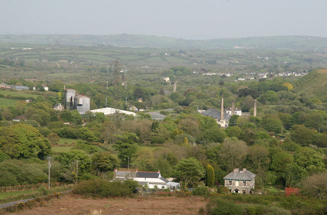
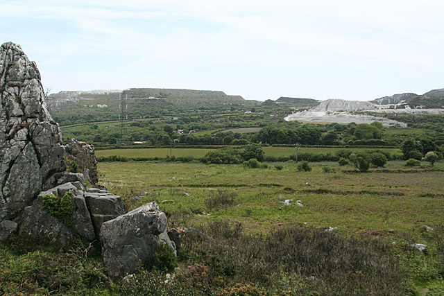
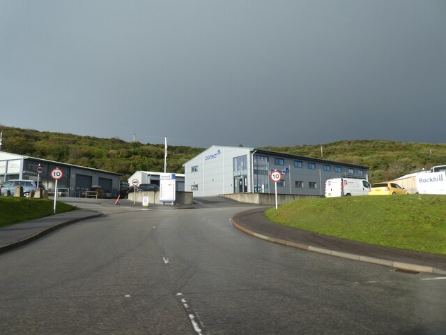
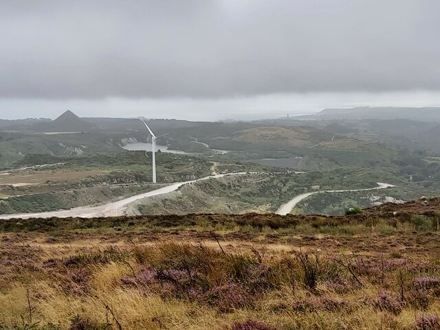
Bugle is a small village located in the county of Cornwall, in the southwestern part of England. Situated approximately 5 miles northeast of St Austell, it falls within the civil parish of Roche. The village is positioned on the edge of the China Clay Country Park, an area known for its rich mining history.

Bugle is a quiet and picturesque village, surrounded by beautiful countryside and rolling hills. The village itself has a population of around 1,500 residents, giving it a close-knit and friendly community atmosphere. It offers a range of amenities to cater to the needs of its residents, including a primary school, a post office, a local grocery store, and a few small shops and businesses.

One notable feature of Bugle is its brass band, which has a long-standing tradition in the village. The Bugle Silver Band, founded in 1868, is renowned for its musical performances and has won numerous awards over the years. The band holds regular concerts and plays at various events, adding to the cultural vibrancy of the village.

Bugle is also an ideal location for outdoor enthusiasts, with plenty of opportunities for walking, hiking, and exploring the surrounding countryside. The nearby China Clay Country Park provides visitors with a chance to learn about the area's industrial heritage and offers scenic trails and nature walks.

Overall, Bugle is a charming village that offers a peaceful and idyllic lifestyle, surrounded by natural beauty and steeped in local history.

If you have any feedback on the listing, please let us know in the comments section below.
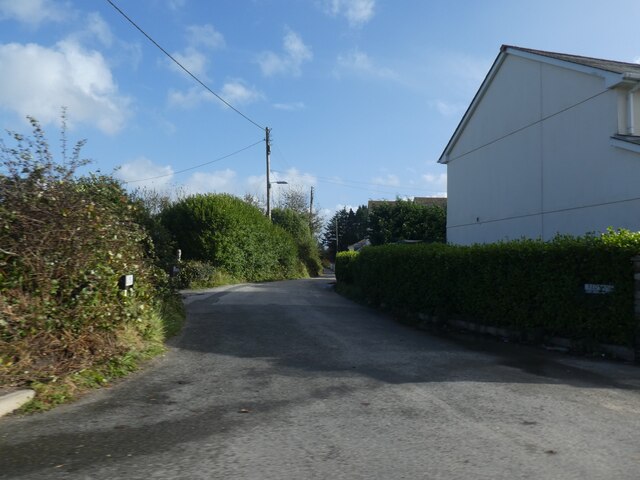
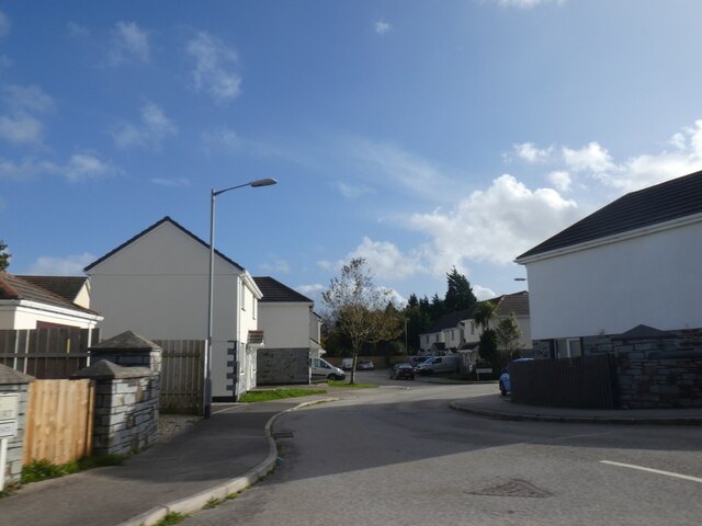
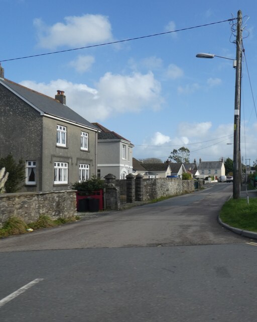
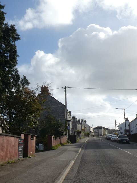
Bugle Images

Images are sourced within 2km of 50.394125/-4.795614 or Grid Reference SX0158. Thanks to Geograph Open Source API. All images are credited.

Carbis from Roche Rock A partly industrial landscape with a modern china clay plant seen to the left and the chimneys to the right are at Carbis Wharf where there is a china clay dry converted to holiday lets and the remains of a brickworks.
Carbis from Roche Rock
A partly industrial landscape with a modern china clay plant seen to the left and the chimneys to the right are at Carbis Wharf where there is a china clay dry converted to holiday lets and the remains of a brickworks.
Roche: towards Tresayes Downs Landscape beneath Hensbarrow Downs and china clay works. Seen from Roche Rock, Roche parish
Roche: towards Tresayes Downs
Landscape beneath Hensbarrow Downs and china clay works. Seen from Roche Rock, Roche parish
B3274 passing china clay spoil heaps The road passes through several spoil heaps; some of them are gradually being reclaimed.
B3274 passing china clay spoil heaps
The road passes through several spoil heaps; some of them are gradually being reclaimed.
Tresayes Pegmatite A pegmatite is a rock with abnormally large crystals. The Tresayes pegmatite has crystals up to 800 cm; these formed in the late upper vapour phase of the granite crystallisation.

Large potassium-rich feldspars grew first before smaller feldspars, quartz and tourmaline grew in the interstitial space. The K-feldspars were mined for glass which requires aluminium, sodium and potassium.
Tresayes Pegmatite
A pegmatite is a rock with abnormally large crystals. The Tresayes pegmatite has crystals up to 800 cm; these formed in the late upper vapour phase of the granite crystallisation. Large potassium-rich feldspars grew first before smaller feldspars, quartz and tourmaline grew in the interstitial space. The K-feldspars were mined for glass which requires aluminium, sodium and potassium.
Tresayes Pegmatite A pegmatite is a rock with abnormally large crystals. The Tresayes pegmatite has crystals up to 80 cm; these formed in the late upper vapour phase of the granite crystallisation.

Large potassium-rich feldspars grew first before smaller feldspars, quartz and tourmaline grew in the interstitial space. The K-feldspars were mined for glass which requires aluminium, sodium and potassium.
Tresayes Pegmatite
A pegmatite is a rock with abnormally large crystals. The Tresayes pegmatite has crystals up to 80 cm; these formed in the late upper vapour phase of the granite crystallisation. Large potassium-rich feldspars grew first before smaller feldspars, quartz and tourmaline grew in the interstitial space. The K-feldspars were mined for glass which requires aluminium, sodium and potassium.
Tresayes Pegmatite A pegmatite is a rock with abnormally large crystals. The Tresayes pegmatite has crystals up to 800 cm; these formed in the late upper vapour phase of the granite crystallisation.

Large potassium-rich feldspars grew first before smaller feldspars, quartz and tourmaline grew in the interstitial space. The K-feldspars were mined for glass which requires aluminium, sodium and potassium.
Tresayes Pegmatite
A pegmatite is a rock with abnormally large crystals. The Tresayes pegmatite has crystals up to 800 cm; these formed in the late upper vapour phase of the granite crystallisation. Large potassium-rich feldspars grew first before smaller feldspars, quartz and tourmaline grew in the interstitial space. The K-feldspars were mined for glass which requires aluminium, sodium and potassium.
Tresayes Pegmatite Quarry A Cornwall Wildlife Trust reserve, preserved for its geology. Bring wellies!
Tresayes Pegmatite Quarry
A Cornwall Wildlife Trust reserve, preserved for its geology. Bring wellies!
Tresayes Signage Cornwall Wildlife Trust sign at the entrance to Tresayes Quarry
Tresayes Signage
Cornwall Wildlife Trust sign at the entrance to Tresayes Quarry
Tips in the Downs Cornwall is more scarred by its clay tips than my home County of Lancashire is by coal tips.
Tips in the Downs
Cornwall is more scarred by its clay tips than my home County of Lancashire is by coal tips.
Hensbarrow Beacon The Beacon is centre middle distance in the picture.  
Once, presumably, the highest point of Hensborough Downs, the hill and trig point which surmounts it are now dwarfed by the Gunheath china clay pit waste tip.
Hensbarrow Beacon
The Beacon is centre middle distance in the picture. Once, presumably, the highest point of Hensborough Downs, the hill and trig point which surmounts it are now dwarfed by the Gunheath china clay pit waste tip.
Derelict building On slightly earlier OS map, a mast is shown here, the only remains is this building. There are several new radio masts at Littlejohn’s in the adjacent grid square.
Derelict building
On slightly earlier OS map, a mast is shown here, the only remains is this building. There are several new radio masts at Littlejohn’s in the adjacent grid square.
Red Lane, Molinnis
Red Lane, Molinnis
Houses in Springfields, Molinnis
Molinnis Road, Bugle
Stannary Road (A391) north of Stenalees
Industrial estate at Chynoweth
View West from Hensbarrow Downs
Show me another place!

Bugle is located at Grid Ref: SX0158 (Lat: 50.394125, Lng: -4.795614)

Unitary Authority: Cornwall

Police Authority: Devon and Cornwall

What 3 Words

///jeering.magnitude.complies. Near Bugle, Cornwall

Nearby Locations

Carnsmerry Bugle

Related Wikis

Carnsmerry

Carnsmerry is a hamlet in Cornwall, England. It is half a mile south-west of Bugle and lies at around 520 feet (160 m) above sea level. Carnsmerry is in...

Bugle, Cornwall

Bugle (Cornish: Karnrosveur) is a village in mid Cornwall, England, United Kingdom. It is in the parish of Treverbyn and is situated about five miles...

Gracca

Gracca is a hamlet in Cornwall, England. It is about half a mile west of Bugle. According to the Post Office the 2011 census population was included in...

Bugle railway station

Bugle railway station (Cornish: Karnrosveur) serves the village of Bugle in Cornwall, England. The station is situated on the Atlantic Coast Line, 288...

Nearby Amenities

Located within 500m of 50.394125,-4.795614
Traffic Signals
Traffic Signals Direction: both
Lat/Long: 50.3961793/-4.7936957
Bus Stop
Carnsmerry
Bus: yes
Long Name: Bugle Carnsmerry (N-bound)
Naptan AdministrativeAreaCode: 73
Naptan AtcoCode: 0800COC31331
Naptan Bearing: N
Naptan BusStopType: MKD
Naptan CommonName: Carnsmerry
Naptan Indicator: N-bound
Naptan LocalityName: Bugle
Naptan ModificationDate: 2021-07-07 13:30
Naptan NaptanCode: cordjdwd
Naptan NptgLocalityCode: E0004481
Naptan RegionCode: cordjdwd
Naptan Street: Higher Bugle
Naptan Verified: no
Public Transport: platform
Source: naptan;bing
Lat/Long: 50.392917/-4.7941713
Bus Stop
Carnsmerry
Bus: yes
Long Name: Bugle, opp Carnsmerry
Naptan AdministrativeAreaCode: 73
Naptan AtcoCode: 0800COC31332
Naptan Bearing: S
Naptan BusStopType: MKD
Naptan CommonName: Carnsmerry
Naptan Indicator: opp
Naptan LocalityName: Bugle
Naptan ModificationDate: 2015-04-25 12:21
Naptan NaptanCode: cordjdwt
Naptan NptgLocalityCode: E0004481
Naptan RegionCode: cordjdwt
Naptan Street: Fore Street
Naptan Verified: no
Public Transport: platform
Source: naptan;bing
Lat/Long: 50.3930408/-4.7940255
Post Office
Bugle Post Office
Addr Postcode: PL26 8QF
Brand: Post Office
Brand Wikidata: Q1783168
Check Date: 2023-09-27
Check Date Opening Hours: 2023-09-27
Opening Hours: Mo-Su 07:00-21:00
Operator: Spar
Ref Pol Id: 177665
Website: https://www.postoffice.co.uk/branch-finder/0205397/bugle
Lat/Long: 50.3977368/-4.7929332
PC Tonkin
Shop: car
Lat/Long: 50.3979642/-4.793357
Spar
Brand: Spar
Brand Wikidata: Q610492
Brand Wikipedia: en:Spar (retailer)
Shop: convenience
Lat/Long: 50.3977993/-4.7929439
Fast Food
Man Foon House
Cuisine: chinese
Takeaway: only
Lat/Long: 50.3951208/-4.7936828
Bugle
Name Kw: Karnrosveur
Place: village
Wikidata: Q4986208
Wikipedia: en:Bugle, Cornwall
Lat/Long: 50.3963082/-4.7933312
Generator Method: photovoltaic
Generator Output Electricity: yes
Generator Source: solar
Generator Type: solar_photovoltaic_panel
Location: roof
Power: generator
Lat/Long: 50.3979044/-4.7919488
Generator Method: photovoltaic
Generator Output Electricity: yes
Generator Source: solar
Generator Type: solar_photovoltaic_panel
Location: roof
Power: generator
Lat/Long: 50.3963083/-4.7917222
Generator Method: photovoltaic
Generator Output Electricity: yes
Generator Source: solar
Generator Type: solar_photovoltaic_panel
Location: roof
Power: generator
Lat/Long: 50.3962869/-4.7906157
Generator Method: photovoltaic
Generator Output Electricity: yes
Generator Source: solar
Generator Type: solar_photovoltaic_panel
Location: roof
Power: generator
Lat/Long: 50.3962869/-4.7905487
Generator Method: photovoltaic
Generator Output Electricity: yes
Generator Source: solar
Generator Type: solar_photovoltaic_panel
Location: roof
Power: generator
Lat/Long: 50.3950678/-4.790495
Generator Method: photovoltaic
Generator Output Electricity: yes
Generator Source: solar
Generator Type: solar_photovoltaic_panel
Location: roof
Power: generator
Lat/Long: 50.3948558/-4.7907123
Generator Method: photovoltaic
Generator Output Electricity: yes
Generator Source: solar
Generator Type: solar_photovoltaic_panel
Location: roof
Power: generator
Lat/Long: 50.3948284/-4.7906265
Generator Method: photovoltaic
Generator Output Electricity: yes
Generator Source: solar
Generator Type: solar_photovoltaic_panel
Location: roof
Power: generator
Lat/Long: 50.3963314/-4.7914231
Generator Method: photovoltaic
Generator Output Electricity: yes
Generator Source: solar
Generator Type: solar_photovoltaic_panel
Location: roof
Power: generator
Lat/Long: 50.3963964/-4.7927615
Generator Method: photovoltaic
Generator Output Electricity: yes
Generator Source: solar
Generator Type: solar_photovoltaic_panel
Location: roof
Power: generator
Lat/Long: 50.396092/-4.7943172
Generator Method: photovoltaic
Generator Output Electricity: yes
Generator Source: solar
Generator Type: solar_photovoltaic_panel
Location: roof
Power: generator
Lat/Long: 50.3960749/-4.7941482
Generator Method: photovoltaic
Generator Output Electricity: yes
Generator Source: solar
Generator Type: solar_photovoltaic_panel
Location: roof
Power: generator
Lat/Long: 50.3950781/-4.7921902
Generator Method: photovoltaic
Generator Output Electricity: yes
Generator Source: solar
Generator Type: solar_photovoltaic_panel
Location: roof
Power: generator
Lat/Long: 50.3952337/-4.7925898
Generator Method: photovoltaic
Generator Output Electricity: yes
Generator Source: solar
Generator Type: solar_photovoltaic_panel
Location: roof
Power: generator
Lat/Long: 50.3942624/-4.7937888
Generator Method: photovoltaic
Generator Output Electricity: yes
Generator Source: solar
Generator Type: solar_photovoltaic_panel
Location: roof
Power: generator
Lat/Long: 50.3942539/-4.7937137
Generator Method: photovoltaic
Generator Output Electricity: yes
Generator Source: solar
Generator Type: solar_photovoltaic_panel
Location: roof
Power: generator
Lat/Long: 50.3929389/-4.7939578
Bus Stop
Rosevear Road
Bus: yes
Long Name: Bugle Rosevear Road (SE-bound)
Naptan AdministrativeAreaCode: 73
Naptan AtcoCode: 0800COA16082
Naptan Bearing: SE
Naptan BusStopType: MKD
Naptan CommonName: Rosevear Road
Naptan Indicator: SE-bound
Naptan LocalityName: Bugle
Naptan ModificationDate: 2018-03-22 12:03
Naptan NptgLocalityCode: E0004481
Naptan RegionCode: corgmpwj
Naptan Verified: no
Public Transport: platform
Lat/Long: 50.3955997/-4.7909987
Bus Stop
Rosevear Road
Bus: yes
Long Name: Bugle Rosevear Road (NW-bound)
Naptan AdministrativeAreaCode: 73
Naptan AtcoCode: 0800COA16083
Naptan Bearing: NW
Naptan BusStopType: CUS
Naptan CommonName: Rosevear Road
Naptan Indicator: NW-bound
Naptan LocalityName: Bugle
Naptan ModificationDate: 2018-03-22 12:03
Naptan NptgLocalityCode: E0004481
Naptan RegionCode: corgmpwm
Naptan Verified: no
Public Transport: platform
Lat/Long: 50.39552/-4.79104
Bus Stop
The Square Bugle
Bus: yes
Long Name: Bugle The Square (N-bound)
Naptan AdministrativeAreaCode: 73
Naptan AtcoCode: 0800COC31334
Naptan Bearing: N
Naptan BusStopType: MKD
Naptan CommonName: The Square
Naptan Indicator: N-bound
Naptan LocalityName: Bugle
Naptan ModificationDate: 2021-07-07 13:30
Naptan NptgLocalityCode: E0004481
Naptan RegionCode: cordjgag
Naptan Street: Fore Street
Naptan Verified: no
Public Transport: platform
Lat/Long: 50.3949477/-4.7939557
Bus Stop
The Square Bugle
Bus: yes
Long Name: Bugle The Square (S-bound)
Naptan AdministrativeAreaCode: 73
Naptan AtcoCode: 0800COC31333
Naptan Bearing: S
Naptan BusStopType: MKD
Naptan CommonName: The Square
Naptan Indicator: S-bound
Naptan LocalityName: Bugle
Naptan ModificationDate: 2021-07-07 13:30
Naptan NptgLocalityCode: E0004481
Naptan RegionCode: cordjgaj
Naptan Street: Fore Street
Naptan Verified: no
Public Transport: platform
Lat/Long: 50.3950294/-4.7938202
The data included in this document is from www.openstreetmap.org. The data is made available under ODbL.

Have you been to Bugle?

Leave your review of Bugle below (or comments, questions and feedback).