Wivenhoe

Civil Parish in Essex Colchester

England

Wivenhoe

Wivenhoe House Set in the historic grounds of Wivenhoe Park, this 18th-century house is next to the University of Essex campus. It offers a unique brasserie restaurant, luxurious accommodation, free WiFi and free parking on site.
Note the ha-ha in the foreground.
Wivenhoe House Credit: Russel Wills

Wivenhoe is a civil parish located in the county of Essex, in the East of England. Situated on the banks of the River Colne, it is just four miles southeast of the larger town of Colchester. With a population of around 8,000 residents, Wivenhoe is a relatively small and close-knit community.

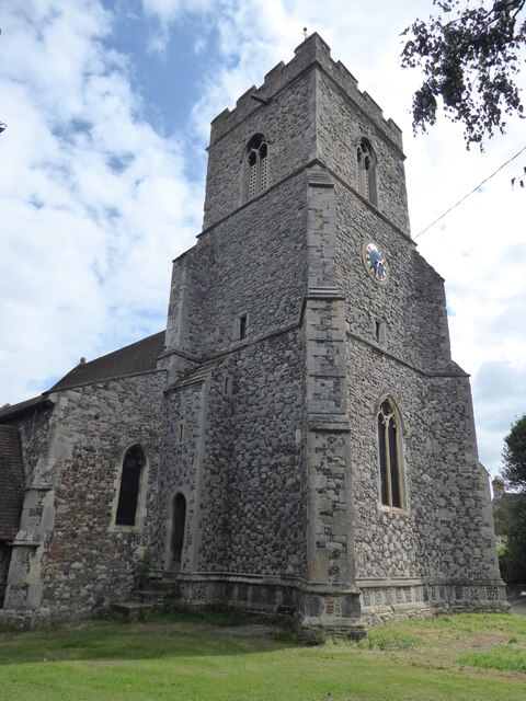
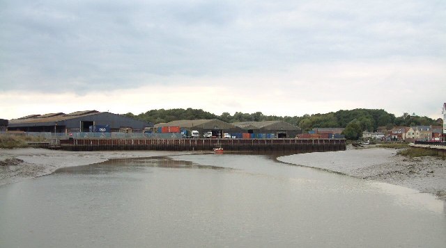
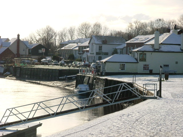
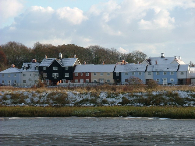
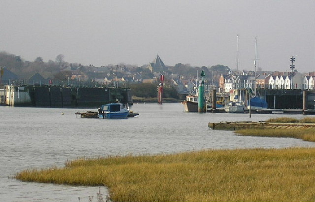
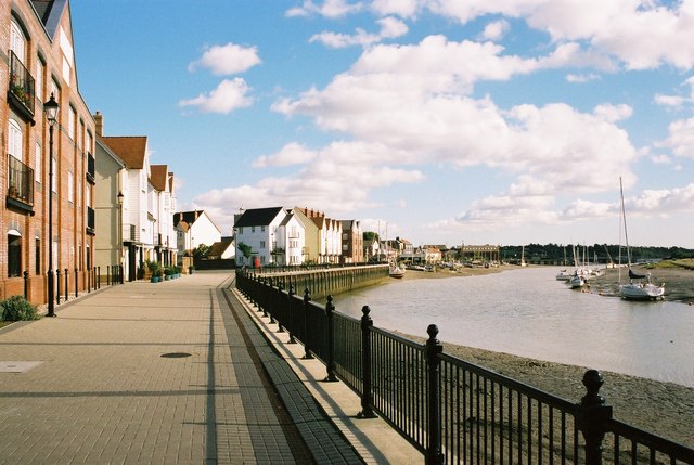
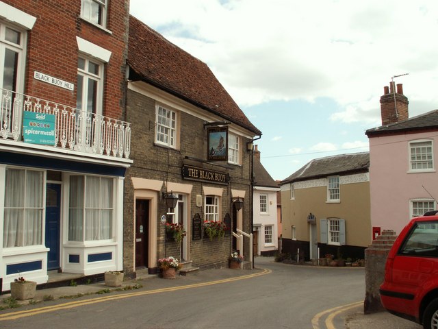
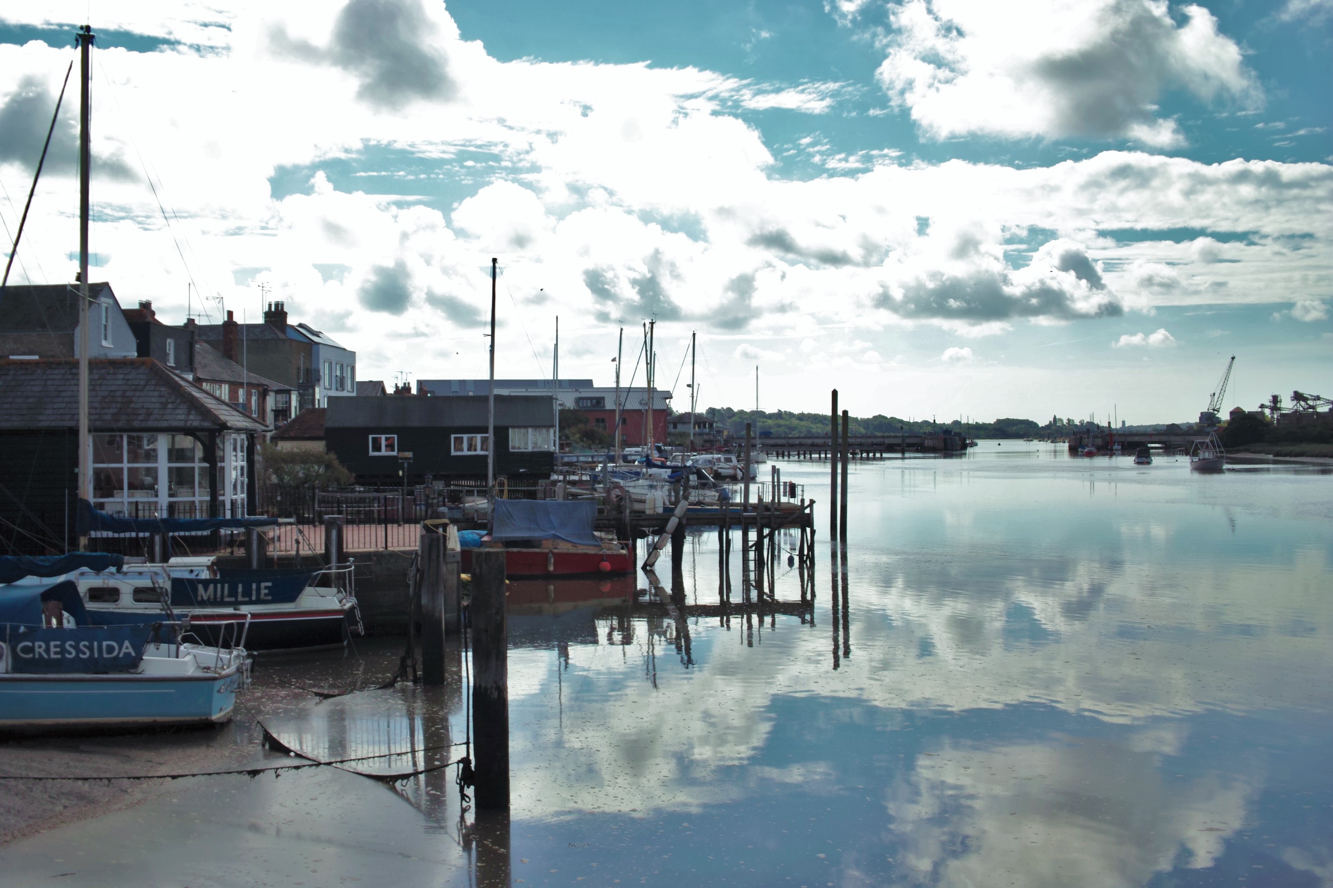
The town has a rich history, dating back to Roman times when it served as a port for trade and fishing. Today, Wivenhoe maintains its maritime charm, with a picturesque waterfront and several historic buildings. The town's architecture is a mix of traditional and modern styles, with quaint cottages, Victorian houses, and contemporary developments.

Wivenhoe is renowned for its vibrant arts scene and cultural events. The University of Essex's School of Art is based in the town, attracting many creative individuals and hosting regular exhibitions and performances. The annual Wivenhoe Regatta, held in August, is another highlight, featuring boat races, live music, and a bustling carnival atmosphere.

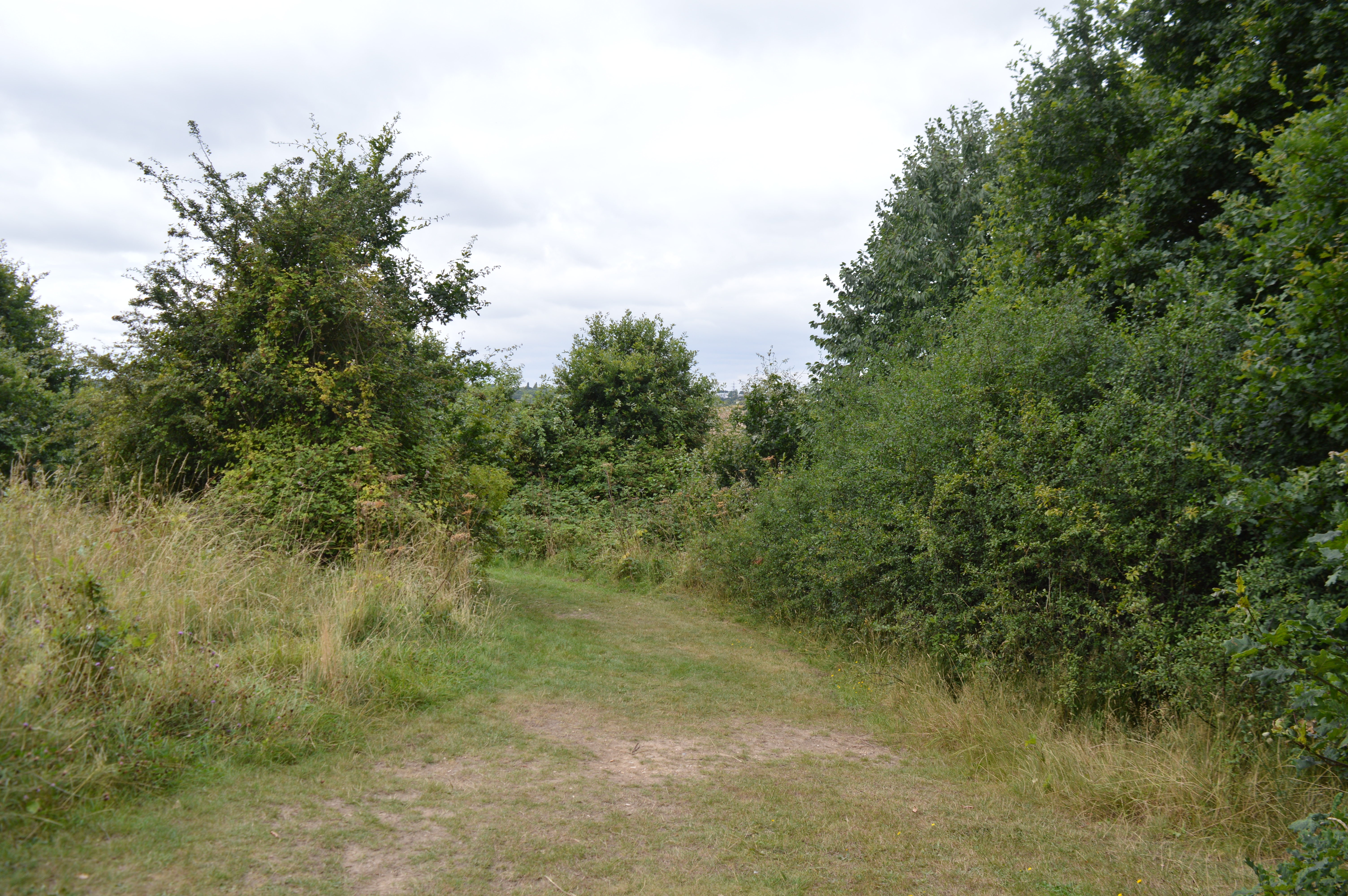
Nature lovers can enjoy the Wivenhoe Trail, a scenic path that follows the river and provides stunning views of the surrounding countryside. The nearby Wivenhoe Woods also offer opportunities for outdoor activities and exploration.

The town offers a range of amenities, including shops, restaurants, and pubs, serving both the local community and visitors. Wivenhoe has its own railway station, providing convenient access to Colchester and connecting services to London.

Overall, Wivenhoe is a charming and picturesque town, combining a rich history, thriving arts scene, and beautiful natural surroundings, making it an attractive place to live or visit in Essex.

If you have any feedback on the listing, please let us know in the comments section below.
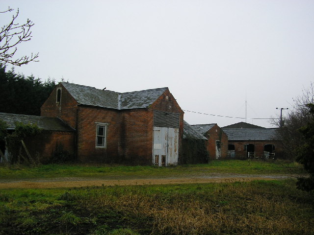
Wivenhoe Images

Images are sourced within 2km of 51.864862/0.962237 or Grid Reference TM0422. Thanks to Geograph Open Source API. All images are credited.

Wivenhoe House Set in the historic grounds of Wivenhoe Park, this 18th-century house is next to the University of Essex campus. It offers a unique brasserie restaurant, luxurious accommodation, free WiFi and free parking on site.
Note the ha-ha in the foreground.
Wivenhoe House
Set in the historic grounds of Wivenhoe Park, this 18th-century house is next to the University of Essex campus. It offers a unique brasserie restaurant, luxurious accommodation, free WiFi and free parking on site. Note the ha-ha in the foreground.
Essex University Built in grounds of Wivenhoe Park.
Essex University
Built in grounds of Wivenhoe Park.
Lake on University of Essex campus Part of the Wivenhoe Park estate.
Lake on University of Essex campus
Part of the Wivenhoe Park estate.
Modern extension to Wivenhoe House Wivenhoe House is a grade II-listed house located in Colchester, Essex.
This is the restaurant facility and further bedrooms.
<span class="nowrap"><a title="https://www.wivenhoehouse.co.uk/" rel="nofollow ugc noopener" href="https://www.wivenhoehouse.co.uk/">Link</a><img style="margin-left:2px;" alt="External link" title="External link - shift click to open in new window" src="https://s1.geograph.org.uk/img/external.png" width="10" height="10"/></span>
Modern extension to Wivenhoe House
Wivenhoe House is a grade II-listed house located in Colchester, Essex. This is the restaurant facility and further bedrooms. LinkExternal link
Wivenhoe, St Mary the Virgin
Rowhedge Quay The quay on the River Colne is no longer in use. The photo was taken from Wivenhoe, on the opposite bank.
Rowhedge Quay
The quay on the River Colne is no longer in use. The photo was taken from Wivenhoe, on the opposite bank.
Wivenhoe Park (University of Essex Buildings) The central block in the photo carries (I believe) the transmitting aerials for local station SGR Colchester. The block in the foreground carries transmitting aerials for a low power TV relay covering parts of Colchester (out of shot).
Wivenhoe Park (University of Essex Buildings)
The central block in the photo carries (I believe) the transmitting aerials for local station SGR Colchester. The block in the foreground carries transmitting aerials for a low power TV relay covering parts of Colchester (out of shot).
The Edge of Rowhedge This is the point on Rowhedge Rd where Old Heath becomes Rowhedge. The photo was taken looking towards the South-East.
The Edge of Rowhedge
This is the point on Rowhedge Rd where Old Heath becomes Rowhedge. The photo was taken looking towards the South-East.
Rowhedge Quay in Snow. Rowhedge Quay side with new pontoon, early 2006 Snow cover looking up river. "River Blackwater"
Rowhedge Quay in Snow.
Rowhedge Quay side with new pontoon, early 2006 Snow cover looking up river. "River Blackwater"
Wivenhoe Winter Wivenhoe new homes in early 2006 light snow cover, viewed from Rowhedge Quay.
Wivenhoe Winter
Wivenhoe new homes in early 2006 light snow cover, viewed from Rowhedge Quay.
Sand and gravel pit
Sand and gravel pit
Wivenhoe Fire Station in Colchester Road opposite Vine Drive
Wivenhoe Fire Station
in Colchester Road opposite Vine Drive
Colne Barrier The Colne Barrier spans the River Colne just downstream from Wivenhoe. It was opened in 1993 <span class="nowrap"><a title="http://www.wivenhoe.gov.uk/Walks/Heritage%20Trail_files/Heritage%20Trail.htm" rel="nofollow ugc noopener" href="http://www.wivenhoe.gov.uk/Walks/Heritage%20Trail_files/Heritage%20Trail.htm">Link</a><img style="margin-left:2px;" alt="External link" title="External link - shift click to open in new window" src="https://s1.geograph.org.uk/img/external.png" width="10" height="10"/></span> or 1994 <span class="nowrap"><a title="http://www.environment-agency.gov.uk/commondata/acrobat/ne_floodrisk_3_1153133.pdf" rel="nofollow ugc noopener" href="http://www.environment-agency.gov.uk/commondata/acrobat/ne_floodrisk_3_1153133.pdf">Link</a><img style="margin-left:2px;" alt="External link" title="External link - shift click to open in new window" src="https://s1.geograph.org.uk/img/external.png" width="10" height="10"/></span>. It protects a stretch of river about 4 km long and extending right up to Colchester from tidal surges. Aerial views: <span class="nowrap"><a title="http://www.wivenhoe.gov.uk/About_Wivenhoe/Picture_Gallery/aerial_pictures.htm" rel="nofollow ugc noopener" href="http://www.wivenhoe.gov.uk/About_Wivenhoe/Picture_Gallery/aerial_pictures.htm">Link</a><img style="margin-left:2px;" alt="External link" title="External link - shift click to open in new window" src="https://s1.geograph.org.uk/img/external.png" width="10" height="10"/></span> .

The spire of St Lawrence's Church, Rowhedge <a href="https://www.geograph.org.uk/gridref/TM030215">TM030215</a> can be seen in the centre of the picture.
Colne Barrier
The Colne Barrier spans the River Colne just downstream from Wivenhoe. It was opened in 1993 LinkExternal link or 1994 LinkExternal link. It protects a stretch of river about 4 km long and extending right up to Colchester from tidal surges. Aerial views: LinkExternal link . The spire of St Lawrence's Church, Rowhedge TM030215 can be seen in the centre of the picture.
Cottages In Clacton Road, Elmstead there are these faintly Dutch style cottages and two other identical buildings within 500 metres in either direction. They may well have been cottages for the workers on the Wivenhoe Park, <a href="https://www.geograph.org.uk/gridref/TM0224">TM0224</a> estate. (That is the stately home painted by John Constable not the ugly tower blocks of the university which now occupy the site.)
Cottages
In Clacton Road, Elmstead there are these faintly Dutch style cottages and two other identical buildings within 500 metres in either direction. They may well have been cottages for the workers on the Wivenhoe Park, TM0224 estate. (That is the stately home painted by John Constable not the ugly tower blocks of the university which now occupy the site.)
Keelars Tye
Keelars Tye
Wivenhoe Waterfront The Tidal Colne providing the setting for Wivenhoe.
Wivenhoe Waterfront
The Tidal Colne providing the setting for Wivenhoe.
'The Black Buoy' inn, Wivenhoe, Essex This is one of the pretty winding streets at Wivenhoe, full of interesting buildings. 'The Black Buoy' is Wivenhoe's oldest inn and has a smugglers' tunnel running from the quay - though we are reliably informed that it is no longer in use.
'The Black Buoy' inn, Wivenhoe, Essex
This is one of the pretty winding streets at Wivenhoe, full of interesting buildings. 'The Black Buoy' is Wivenhoe's oldest inn and has a smugglers' tunnel running from the quay - though we are reliably informed that it is no longer in use.
Wivenhoe House Conference Centre This is Wivenhoe House conference centre; part of Essex University. The house was built in 1758 and remodelled in 1816 it was used by the military including the SAS during WW2 and became part of Essex University in 1964. For more history and current info see <span class="nowrap"><a title="http://www.wivenhoehousehotel.co.uk/" rel="nofollow ugc noopener" href="http://www.wivenhoehousehotel.co.uk/">Link</a><img style="margin-left:2px;" alt="External link" title="External link - shift click to open in new window" src="https://s1.geograph.org.uk/img/external.png" width="10" height="10"/></span>
Wivenhoe House Conference Centre
This is Wivenhoe House conference centre; part of Essex University. The house was built in 1758 and remodelled in 1816 it was used by the military including the SAS during WW2 and became part of Essex University in 1964. For more history and current info see LinkExternal link
Show me another place!

Wivenhoe is located at Grid Ref: TM0422 (Lat: 51.864862, Lng: 0.962237)

Administrative County: Essex

District: Colchester

Police Authority: Essex

What 3 Words

///marzipan.since.glitz. Near Wivenhoe, Essex

Related Wikis

Wivenhoe

Wivenhoe ( WIV-ən-hoh) is a town and civil parish in the Colchester district, in north-eastern Essex, England, approximately 3 miles (5 km) south-east...

Colne Local Nature Reserve

Colne Local Nature Reserve is a 34.7 hectare Local Nature Reserve in Wivenhoe in Essex. It is owned and managed by Colchester Borough Council.Most of the...

Wivenhoe railway station

Wivenhoe railway station is on the Sunshine Coast Line, a branch of the Great Eastern Main Line, in the East of England, serving the small town of Wivenhoe...

Wivenhoe Town F.C.

Wivenhoe Town F.C. is an English football club based in Wivenhoe, Essex. The club are currently members of the Eastern Counties League Division One North...

Nearby Amenities

Located within 500m of 51.864862,0.962237
Mini Roundabout
Direction: clockwise
Lat/Long: 51.8668694/0.9625374
Post Office
Wivenhoe Cross Post Office
Addr Postcode: CO7 9QL
Branch: Wivenhoe Cross
Brand: Post Office
Brand Wikidata: Q1783168
Check Date: 2020-02-20
Contact Website: https://www.postoffice.co.uk/branch-finder/1221167/wivenhoe-cross
Ref Pol Id: 2007
Lat/Long: 51.8666827/0.9623862
Barrier: bollard
Foot: yes
Source: Bing; knowledge
Lat/Long: 51.8655444/0.9606528
Barrier: cycle_barrier
Source: knowledge
Lat/Long: 51.8682706/0.9631466
Barrier: cycle_barrier
Source: knowledge
Lat/Long: 51.8682575/0.9635816
Crossing
Lat/Long: 51.8677261/0.9629691
Bus Stop
Heath Road
Bench: no
Bus: yes
Naptan AtcoCode: 150032002012
Naptan Bearing: S
Naptan CommonName: Heath Road
Naptan Crossing: Heath Road
Naptan Indicator: Opp
Naptan Landmark: Heath Road
Naptan NaptanCode: esxgjgjm
Naptan PlusbusZoneRef: CLCHSTR
Naptan Street: Colchester Road
Naptan Verified: no
Public Transport: platform
Ref: esxgjgjm
Shelter: no
Source: naptan_import; survey
Lat/Long: 51.8671415/0.9627834
Bus Stop
Wivenhoe Cross
Bench: yes
Bus: yes
Naptan AtcoCode: 150032002013
Naptan Bearing: N
Naptan CommonName: Wivenhoe Cross
Naptan Crossing: Tower Road
Naptan Indicator: N-bound
Naptan Landmark: Wivenhoe Cross
Naptan NaptanCode: esxgjgjp
Naptan PlusbusZoneRef: CLCHSTR
Naptan Street: The Avenue
Naptan Verified: no
Public Transport: platform
Ref: esxgjgjp
Shelter: yes
Source: naptan_import; survey
Lat/Long: 51.8651603/0.9610987
Bus Stop
Wivenhoe Cross
Bench: no
Bus: yes
Naptan AtcoCode: 150032002014
Naptan Bearing: S
Naptan CommonName: Wivenhoe Cross
Naptan Crossing: Tower Road
Naptan Indicator: S-bound
Naptan Landmark: Wivenhoe Cross
Naptan NaptanCode: esxgjgjt
Naptan PlusbusZoneRef: CLCHSTR
Naptan Street: The Avenue
Naptan Verified: no
Public Transport: platform
Ref: esxgjgjt
Shelter: no
Source: naptan_import; survey
Lat/Long: 51.8649268/0.9610833
Bus Stop
Rosabelle Avenue
Bench: yes
Bus: yes
Naptan AtcoCode: 150032002015
Naptan NaptanCode: esxgjgjw
Naptan PlusbusZoneRef: CLCHSTR
Naptan Verified: no
Note: surveyed names do not match (stop & road)
Public Transport: platform
Ref: esxgjgjw
Shelter: yes
Source: naptan_import; survey
Lat/Long: 51.8625592/0.9600997
Bus Stop
Rosabelle Avenue
Bench: yes
Bus: yes
Naptan AtcoCode: 150032002016
Naptan BusStopType: CUS
Naptan NaptanCode: esxgjgma
Naptan PlusbusZoneRef: CLCHSTR
Naptan Verified: no
Public Transport: platform
Ref: esxgjgma
Shelter: yes
Source: naptan_import; survey
Toilets Wheelchair: no
Wheelchair: yes
Lat/Long: 51.8618649/0.9600469
Bus Stop
Cemetery
Bench: no
Bus: yes
Naptan AtcoCode: 150032002025
Naptan Bearing: N
Naptan CommonName: Cemetery
Naptan Crossing: Rectory Hill
Naptan Indicator: N-bound
Naptan Landmark: Cemetery
Naptan NaptanCode: esxgjgpg
Naptan PlusbusZoneRef: CLCHSTR
Naptan Street: Belle Vue Road
Naptan Verified: no
Public Transport: platform
Ref: esxgjgpg
Shelter: no
Source: naptan_import; survey
Lat/Long: 51.8619504/0.965696
Bus Stop
Cricket Ground
Bench: yes
Bus: yes
Naptan AtcoCode: 1500DGK186
Naptan Bearing: SE
Naptan CommonName: Cricket Ground
Naptan Indicator: o/s
Naptan Landmark: Cricket Ground
Naptan NaptanCode: esxgwdpm
Naptan PlusbusZoneRef: CLCHSTR
Naptan Street: Rectory Road
Naptan Verified: no
Public Transport: platform
Ref: esxgwdpm
Shelter: yes
Source: naptan_import; survey
Lat/Long: 51.8642932/0.9637437
Bus Stop
Cemetery
Bench: yes
Bus: yes
Naptan AtcoCode: 1500WIVCEM
Naptan Bearing: S
Naptan CommonName: Cemetery
Naptan Crossing: Rectory Hill
Naptan Indicator: S-bound
Naptan Landmark: Cemetery
Naptan NaptanCode: esxgjgpd
Naptan PlusbusZoneRef: CLCHSTR
Naptan Street: Belle Vue Road
Naptan Verified: no
Public Transport: platform
Ref: esxgjgpd
Shelter: yes
Source: naptan_import; survey
Lat/Long: 51.8618094/0.9657297
Crossing
Lat/Long: 51.8667122/0.9622183
Post Box
Collection Times: Mo-Fr 17:30; Sa 12:00
Operator: Royal Mail
Post Box Type: pillar
Ref: CO7 165
Royal Cypher: EIIR
Royal Cypher Wikidata: Q33102113
Lat/Long: 51.8666631/0.9624949
Post Box
Collection Times: Mo-Fr 17:00; Sa 10:30
Operator: Royal Mail
Post Box Type: lamp
Ref: CO7 273
Royal Cypher: EIIR
Royal Cypher Wikidata: Q33102113
Source: survey; Bing; GPS
Lat/Long: 51.8618899/0.9657726
Post Box
Collection Times: Mo-Fr 17:00; Sa 10:30
Operator: Royal Mail
Post Box Type: lamp
Ref: CO7 421
Royal Cypher: EIIR
Royal Cypher Wikidata: Q33102113
Source: survey
Lat/Long: 51.8624337/0.961392
Post Box
Collection Times: Mo-Fr 17:00; Sa 10:30
Operator: Royal Mail
Post Box Type: lamp
Ref: CO7 465
Royal Cypher: EIIR
Royal Cypher Wikidata: Q33102113
Lat/Long: 51.8663279/0.9561764
Barrier: bollard
Foot: yes
Source: Bing; knowledge
Lat/Long: 51.86555/0.9603218
Crossing
Crossing: unmarked
Note: Connection to Rosabelle in absence of sidewalk mapping
Source: Bing
Lat/Long: 51.8623577/0.9597593
Post Box
Collection Times: Mo-Fr 17:15; Sa 10:30
Operator: Royal Mail
Post Box Type: pillar
Ref: CO7 170
Royal Cypher: EIIR
Royal Cypher Wikidata: Q33102113
Source: survey
Lat/Long: 51.8618987/0.9600518
Barrier: bollard
Bicycle: yes
Foot: yes
Lat/Long: 51.8617734/0.9612729
Entrance: main
Lat/Long: 51.8606439/0.9602409
Entrance: main
Lat/Long: 51.8608529/0.9599823
Source: Bing; knowledge
Lat/Long: 51.8655563/0.9608915
Barrier: bollard
Foot: yes
Source: survey
Lat/Long: 51.864917/0.9577669
Note: Junction of Spring Lane / Broome Grove about here
Lat/Long: 51.8648966/0.958087
Bus Stop
Cricket Ground
Bench: no
Bus: yes
Naptan AtcoCode: 1500DGK186B
Naptan NaptanCode: esxjgwpw
Public Transport: platform
Shelter: no
Source: survey
Lat/Long: 51.8641329/0.9637174
Bus Stop
Croquet Gardens
Bench: no
Bus: yes
Naptan AtcoCode: 150032002120
Naptan NaptanCode: esxjgwpm
Public Transport: platform
Shelter: no
Source: survey
Lat/Long: 51.8628548/0.9656584
Bus Stop
Croquet Gardens
Bench: no
Bus: yes
Naptan AtcoCode: 1500320021Y0
Naptan NaptanCode: esxjgwpt
Public Transport: platform
Shelter: no
Source: survey
Lat/Long: 51.862874/0.9653658
Bus Stop
The Flag
Bench: yes
Bus: yes
Naptan AtcoCode: 1500IM2533
Naptan NaptanCode: esxgjgja
Public Transport: platform
Shelter: yes
Lat/Long: 51.8688777/0.9630387
Addr Housename: Springfield
Addr Housenumber: 78
Addr Street: The Avenue
Building: house
Lat/Long: 51.8631822/0.960534
Addr Housenumber: 35
Addr Street: Ernest Road
Building: house
Lat/Long: 51.8611738/0.9609718
Addr Housenumber: 24
Addr Street: The Avenue
Building: house
Lat/Long: 51.8607754/0.9600501
Wivenhoe Cross
Place: locality
Lat/Long: 51.8669191/0.9665769
Waste Basket
Note: position is approximate
Source: survey
Waste: dog_excrement
Lat/Long: 51.8618421/0.9606648
Waste Basket
Waste: dog_excrement
Lat/Long: 51.8652292/0.9551395
Generator Source: solar
Power: generator
Lat/Long: 51.8621769/0.9639517
Addr Housenumber: 4
Addr Street: Harvey Road
Lat/Long: 51.8633637/0.9626167
Generator Source: solar
Power: generator
Lat/Long: 51.8662925/0.9564268
Generator Method: photovoltaic
Generator Output Electricity: yes
Generator Solar Modules: 12
Generator Source: solar
Generator Type: solar_photovoltaic_panel
Location: roof
Power: generator
Lat/Long: 51.8612211/0.9609738
Generator Method: photovoltaic
Generator Output Electricity: yes
Generator Source: solar
Generator Type: solar_photovoltaic_panel
Location: roof
Power: generator
Lat/Long: 51.8615806/0.9602094
Generator Method: photovoltaic
Generator Output Electricity: yes
Generator Source: solar
Generator Type: solar_photovoltaic_panel
Location: roof
Power: generator
Lat/Long: 51.8615963/0.9603006
Generator Method: photovoltaic
Generator Output Electricity: yes
Generator Source: solar
Generator Type: solar_photovoltaic_panel
Location: roof
Power: generator
Lat/Long: 51.8617147/0.9602201
Generator Method: photovoltaic
Generator Output Electricity: yes
Generator Solar Modules: 10
Generator Source: solar
Generator Type: solar_photovoltaic_panel
Location: roof
Power: generator
Lat/Long: 51.86194/0.9631303
Generator Method: photovoltaic
Generator Output Electricity: yes
Generator Source: solar
Generator Type: solar_photovoltaic_panel
Location: roof
Power: generator
Lat/Long: 51.8628908/0.9619394
Generator Method: photovoltaic
Generator Output Electricity: yes
Generator Solar Modules: 16
Generator Source: solar
Generator Type: solar_photovoltaic_panel
Location: roof
Power: generator
Lat/Long: 51.8627782/0.9613305
Generator Method: photovoltaic
Generator Output Electricity: yes
Generator Solar Modules: 14
Generator Source: solar
Generator Type: solar_photovoltaic_panel
Location: roof
Power: generator
Lat/Long: 51.8645836/0.9591338
Generator Method: photovoltaic
Generator Output Electricity: yes
Generator Solar Modules: 7
Generator Source: solar
Generator Type: solar_photovoltaic_panel
Location: roof
Power: generator
Lat/Long: 51.8644378/0.9591874
Generator Method: photovoltaic
Generator Output Electricity: yes
Generator Solar Modules: 36
Generator Source: solar
Generator Type: solar_photovoltaic_panel
Location: roof
Power: generator
Lat/Long: 51.8638101/0.9588039
Generator Method: photovoltaic
Generator Output Electricity: yes
Generator Solar Modules: 12
Generator Source: solar
Generator Type: solar_photovoltaic_panel
Location: roof
Power: generator
Lat/Long: 51.8637736/0.9589595
Generator Method: photovoltaic
Generator Output Electricity: yes
Generator Solar Modules: 12
Generator Source: solar
Generator Type: solar_photovoltaic_panel
Location: roof
Power: generator
Lat/Long: 51.8637405/0.9615988
Generator Method: photovoltaic
Generator Output Electricity: yes
Generator Solar Modules: 14
Generator Source: solar
Generator Type: solar_photovoltaic_panel
Location: roof
Power: generator
Lat/Long: 51.863497/0.9634307
Generator Method: photovoltaic
Generator Output Electricity: yes
Generator Source: solar
Generator Type: solar_photovoltaic_panel
Location: roof
Power: generator
Lat/Long: 51.8649041/0.9614713
Generator Method: photovoltaic
Generator Output Electricity: yes
Generator Source: solar
Generator Type: solar_photovoltaic_panel
Location: roof
Power: generator
Lat/Long: 51.8648801/0.9615129
Generator Method: photovoltaic
Generator Output Electricity: yes
Generator Solar Modules: 8
Generator Source: solar
Generator Type: solar_photovoltaic_panel
Location: roof
Power: generator
Lat/Long: 51.864789/0.9613359
Generator Method: photovoltaic
Generator Output Electricity: yes
Generator Solar Modules: 5
Generator Source: solar
Generator Type: solar_photovoltaic_panel
Location: roof
Power: generator
Lat/Long: 51.8648006/0.9614405
Generator Method: photovoltaic
Generator Output Electricity: yes
Generator Solar Modules: 8
Generator Source: solar
Generator Type: solar_photovoltaic_panel
Location: roof
Power: generator
Lat/Long: 51.8644875/0.962036
Generator Method: photovoltaic
Generator Output Electricity: yes
Generator Solar Modules: 8
Generator Source: solar
Generator Type: solar_photovoltaic_panel
Location: roof
Power: generator
Lat/Long: 51.864519/0.9620923
Generator Method: photovoltaic
Generator Output Electricity: yes
Generator Source: solar
Generator Type: solar_photovoltaic_panel
Location: roof
Power: generator
Lat/Long: 51.8643314/0.9624872
Generator Method: photovoltaic
Generator Output Electricity: yes
Generator Source: solar
Generator Type: solar_photovoltaic_panel
Location: roof
Power: generator
Lat/Long: 51.8643289/0.96251
Generator Method: photovoltaic
Generator Output Electricity: yes
Generator Source: solar
Generator Type: solar_photovoltaic_panel
Location: roof
Power: generator
Lat/Long: 51.8644312/0.9625261
Generator Method: photovoltaic
Generator Output Electricity: yes
Generator Source: solar
Generator Type: solar_photovoltaic_panel
Location: roof
Power: generator
Lat/Long: 51.864425/0.9625563
Generator Method: photovoltaic
Generator Output Electricity: yes
Generator Source: solar
Generator Type: solar_photovoltaic_panel
Location: roof
Power: generator
Lat/Long: 51.8640999/0.9629989
Generator Method: photovoltaic
Generator Output Electricity: yes
Generator Solar Modules: 10
Generator Source: solar
Generator Type: solar_photovoltaic_panel
Location: roof
Power: generator
Lat/Long: 51.8639757/0.9641898
Generator Method: photovoltaic
Generator Output Electricity: yes
Generator Solar Modules: 9
Generator Source: solar
Generator Type: solar_photovoltaic_panel
Location: roof
Power: generator
Lat/Long: 51.8624303/0.9646913
Generator Method: photovoltaic
Generator Output Electricity: yes
Generator Solar Modules: 8
Generator Source: solar
Generator Type: solar_photovoltaic_panel
Location: roof
Power: generator
Lat/Long: 51.8625976/0.9647772
Generator Method: photovoltaic
Generator Output Electricity: yes
Generator Solar Modules: 13
Generator Source: solar
Generator Type: solar_photovoltaic_panel
Location: roof
Power: generator
Lat/Long: 51.8628229/0.9649301
Generator Method: photovoltaic
Generator Output Electricity: yes
Generator Solar Modules: 8
Generator Source: solar
Generator Type: solar_photovoltaic_panel
Location: roof
Power: generator
Lat/Long: 51.8621984/0.9672609
Generator Method: photovoltaic
Generator Output Electricity: yes
Generator Solar Modules: 16
Generator Source: solar
Generator Type: solar_photovoltaic_panel
Location: roof
Power: generator
Lat/Long: 51.8618588/0.9671053
Defibrillator
Access: yes
Defibrillator Location: on wall to right of office entrance (to left of building passage) when viewed from road
Emergency: defibrillator
Indoor: no
Ref GB The Circuit: 4143472A-2C00-4F6D-B17B-AE190127199A
Lat/Long: 51.8626361/0.9647644
Defibrillator
Access: yes
Defibrillator Location: on facing wall of garage to right as you come up the driveway
Emergency: defibrillator
Indoor: no
Ref GB The Circuit: CF9803B4-72F6-4164-8A91-AE190124E2D7
Lat/Long: 51.8628974/0.9571677
Defibrillator
Access: yes
Defibrillator Location: on front of building facing pitch
Emergency: defibrillator
Indoor: no
Ref GB The Circuit: BA837782-3294-40DA-A2F6-AFBF01416A89
Lat/Long: 51.8641191/0.9656162
The data included in this document is from www.openstreetmap.org. The data is made available under ODbL.

Have you been to Wivenhoe?

Leave your review of Wivenhoe below (or comments, questions and feedback).