Wigginton

Civil Parish in Oxfordshire Cherwell

England

Wigginton

The end of Wigginton Road The road meets the A361 in the village of South Newington. Grange Farm to the left has a good collection of wheelie bins.
The end of Wigginton Road Credit: Bill Boaden

Wigginton is a picturesque civil parish located in Oxfordshire, England. Situated approximately 4 miles southwest of Banbury, it is surrounded by beautiful countryside and offers a tranquil setting for residents and visitors alike.

The village itself is small, with a population of around 200 people. It is characterized by its charming thatched cottages, traditional stone houses, and well-manicured gardens. The local community takes great pride in maintaining the area's rural charm and preserving its historical heritage.

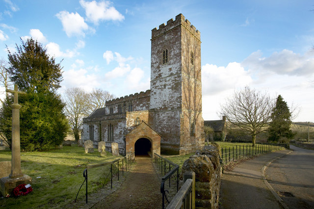
One of the notable landmarks in Wigginton is the St. Giles' Church, a Grade II listed building that dates back to the 13th century. Its distinctive architectural features and stained glass windows make it a popular attraction for history enthusiasts.

The village is also home to a vibrant community hall, which hosts various social events and activities throughout the year, fostering a strong sense of community among the residents. Additionally, Wigginton has a well-regarded primary school, providing education for local children.

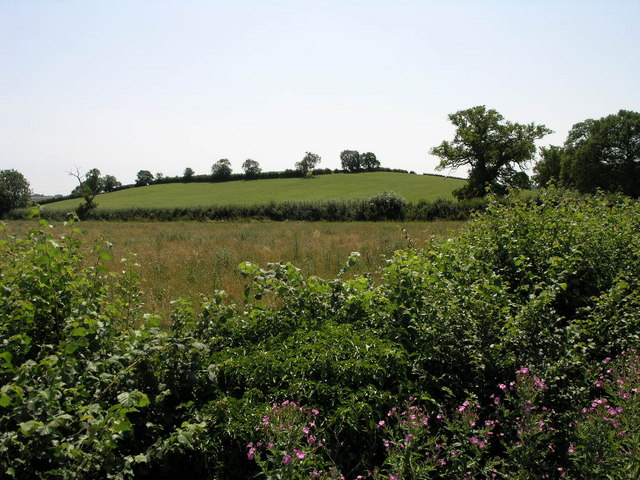
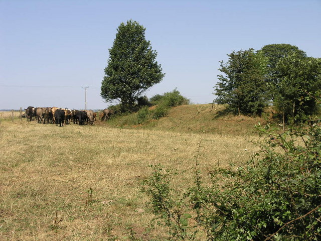
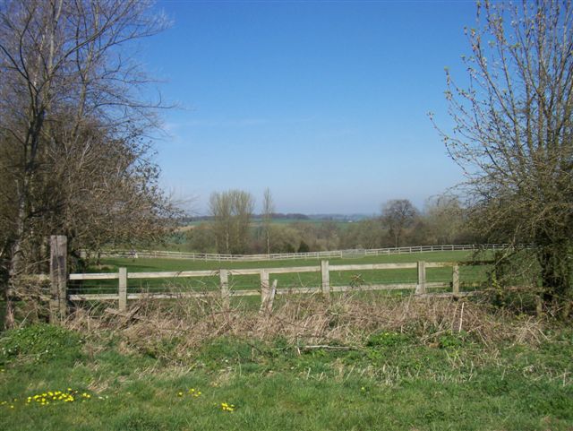
The surrounding countryside offers ample opportunities for outdoor pursuits, including walking, cycling, and horse riding. The nearby Horton Country Park and the Oxfordshire Way provide picturesque trails for nature enthusiasts to explore.

Despite its small size, Wigginton benefits from its close proximity to Banbury, where residents can access a wide range of amenities, including shops, supermarkets, restaurants, and leisure facilities.

Overall, Wigginton offers a tranquil and close-knit community, surrounded by stunning countryside, making it an ideal place for those seeking a peaceful and idyllic setting to call home.

If you have any feedback on the listing, please let us know in the comments section below.

Wigginton Images

Images are sourced within 2km of 52.001116/-1.440107 or Grid Reference SP3833. Thanks to Geograph Open Source API. All images are credited.

The end of Wigginton Road The road meets the A361 in the village of South Newington. Grange Farm to the left has a good collection of wheelie bins.
The end of Wigginton Road
The road meets the A361 in the village of South Newington. Grange Farm to the left has a good collection of wheelie bins.
A361 near South Newington
St. Giles, Wigginton
Wigginton Church, St. Giles
White Swan, Wigginton Little changed Hook Norton Brewery pub
White Swan, Wigginton
Little changed Hook Norton Brewery pub
Butter Hill Just to the other side of Butter Hill is Manor Farm.
Butter Hill
Just to the other side of Butter Hill is Manor Farm.
Brook and Trees The road here crosses a small brook on a bridge marked by these railings.  A railway once ran just behind the line of the hedge.
Brook and Trees
The road here crosses a small brook on a bridge marked by these railings. A railway once ran just behind the line of the hedge.
Path Over the Railway This footpath to Withycombe Farm crosses the line of the former GWR Banbury and Cheltenham railway.
Path Over the Railway
This footpath to Withycombe Farm crosses the line of the former GWR Banbury and Cheltenham railway.
Cattle and Fort The bump to the right of the cattle is the remains of an ancient fort.  A road passes over the top of the fort as it probably did when it was active.
Cattle and Fort
The bump to the right of the cattle is the remains of an ancient fort. A road passes over the top of the fort as it probably did when it was active.
Hailcombe Barns driveway
Entrance to Aspen Grove Dressage
Footpath from Swerford
View towards Highwood
Course of the Banbury and Cheltenham Railway The trackbed is now grassed over at this point and appears to be used as a ride.
Course of the Banbury and Cheltenham Railway
The trackbed is now grassed over at this point and appears to be used as a ride.
Farmland
Farmland
Lodge Farm
Lodge Farm
Cracking weather! It is surprising how quickly the ground has dried out after all the rain during the winter.
Farm track leading to a bridge over the disused railway line.
Cracking weather!
It is surprising how quickly the ground has dried out after all the rain during the winter. Farm track leading to a bridge over the disused railway line.
Disused railway line Looking East, from the bridge carrying a farm track (seen in <a href="https://www.geograph.org.uk/photo/407982">SP3733 : Cracking weather!</a>), in the direction of Banbury. The former railway line has now disappeared here under trees and vegetation.
Disused railway line
Looking East, from the bridge carrying a farm track (seen in SP3733 : Cracking weather!), in the direction of Banbury. The former railway line has now disappeared here under trees and vegetation.
Show me another place!

Wigginton is located at Grid Ref: SP3833 (Lat: 52.001116, Lng: -1.440107)

Administrative County: Oxfordshire

District: Cherwell

Police Authority: Thames Valley

What 3 Words

///abandons.glider.smiled. Near Hook Norton, Oxfordshire

Nearby Locations

Wigginton Wigginton

Related Wikis

Wigginton, Oxfordshire

Wigginton is a village and civil parish about 6 miles (10 km) southwest of Banbury in Oxfordshire. The village is beside the River Swere, which forms the...

Hook Norton ironstone quarries (Brymbo)

The Hook Norton ironstone quarries (Brymbo) were ironstone quarries near Hook Norton in Oxfordshire, England. The quarries were in operation from 1899...

Hook Norton railway station

Hook Norton railway station served the village of Hook Norton in northern Oxfordshire, England. == History == The station was built for the Banbury and...

South Newington

South Newington is a village and civil parish on the south bank of the River Swere in the Cotswold Hills in Oxfordshire, England, about 5 miles (8 km)...

Nearby Amenities

Located within 500m of 52.001116,-1.440107
Bus Stop
The White Swan PH
Bus: yes
Naptan AtcoCode: 340001759OPP
Naptan Bearing: N
Naptan BusStopType: CUS
Naptan CommonName: The White Swan PH
Naptan Indicator: Opposite
Naptan Landmark: White Swan PH
Naptan NaptanCode: oxfgdwgd
Naptan Street: Village Road
Naptan Verified: no
Public Transport: platform
Source: naptan_import
Lat/Long: 51.9981198/-1.4376085
Bus Stop
The White Swan PH
Bus: yes
Naptan AtcoCode: 340001759OUT
Naptan Bearing: S
Naptan BusStopType: CUS
Naptan CommonName: The White Swan PH
Naptan Indicator: Outside
Naptan Landmark: White Swan PH
Naptan NaptanCode: oxfgdgtp
Naptan Street: Village Road
Naptan Verified: no
Public Transport: platform
Source: naptan_import
Lat/Long: 51.9981285/-1.4375356
Natural: water
Source: OS_OpenData_StreetView
Lat/Long: 52.0043348/-1.4353711
The White Swan
Addr City: Wigginton
Addr Postcode: OX15 4LE
Addr Street: Pretty Bush Lane
Disused Amenity: pub
Source: OS_OpenData_StreetView
Source Name: NaPTAN
Lat/Long: 51.9982829/-1.4373806
Natural: water
Source: OS_OpenData_StreetView
Lat/Long: 52.0030903/-1.4366528
Wigginton Waterfowl Sanctuary
Source: OS_OpenData_StreetView
Tourism: attraction
Lat/Long: 52.0052712/-1.4416481
Power: pole
Lat/Long: 52.001889/-1.43388
Power: pole
Lat/Long: 52.0024486/-1.433628
Power: pole
Lat/Long: 52.0012001/-1.4341022
Power: pole
Lat/Long: 52.0001869/-1.4344402
Power: pole
Lat/Long: 51.9991639/-1.4347588
Power: pole
Lat/Long: 51.9984942/-1.4349729
Power: pole
Lat/Long: 51.9985133/-1.4356844
The data included in this document is from www.openstreetmap.org. The data is made available under ODbL.

Have you been to Wigginton?

Leave your review of Wigginton below (or comments, questions and feedback).