Allathasdal

Settlement in Inverness-shire

Scotland

Allathasdal

Gob Bhuirgh On the west coast of Barra.
Gob Bhuirgh Credit: John Lucas

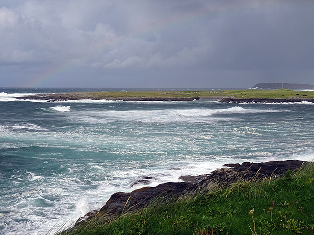
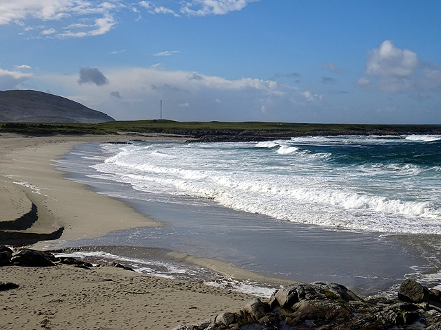
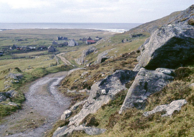
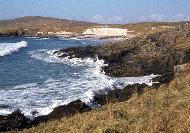
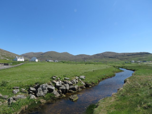
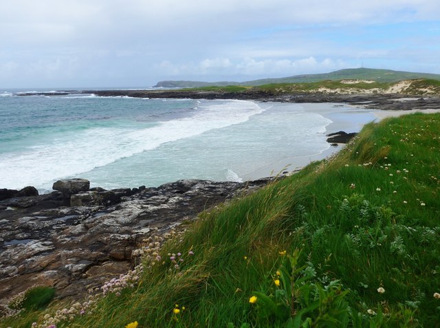
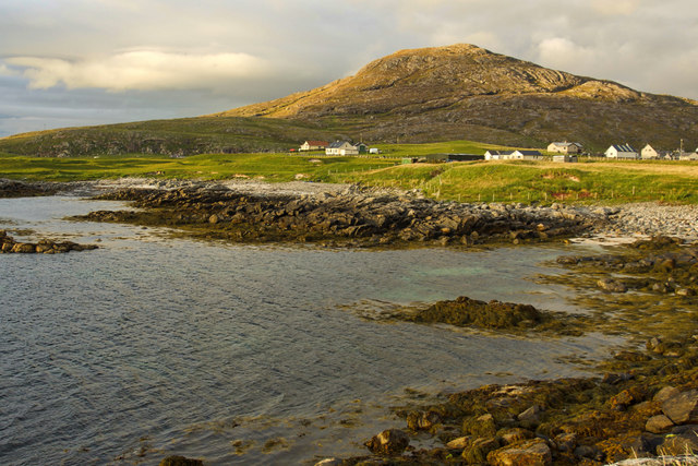
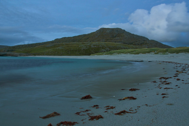
Allathasdal is a small village located in the county of Inverness-shire, Scotland. Situated in the picturesque Highlands region, the village is nestled in a valley surrounded by rolling hills and lush greenery, offering breathtaking views of the surrounding countryside.

The village is known for its tranquil and idyllic atmosphere, making it a popular destination for those seeking peace and serenity. It is a close-knit community with a small population, primarily consisting of locals who have lived in the area for generations. The residents are known for their warm hospitality and friendly nature, welcoming visitors with open arms.

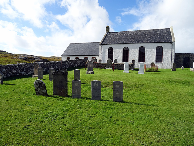
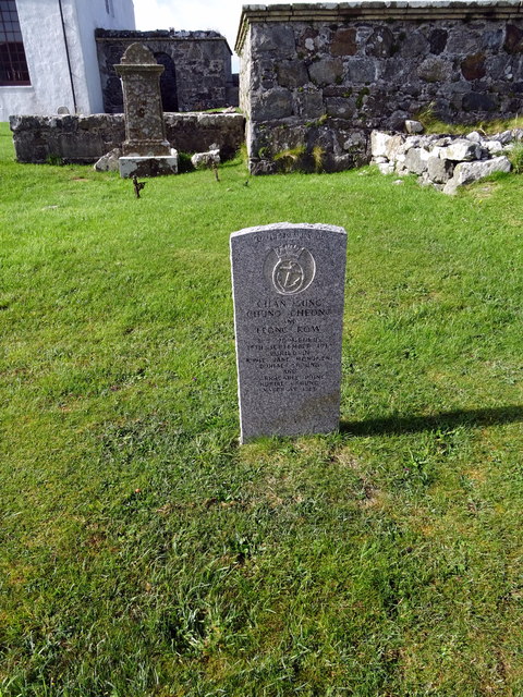
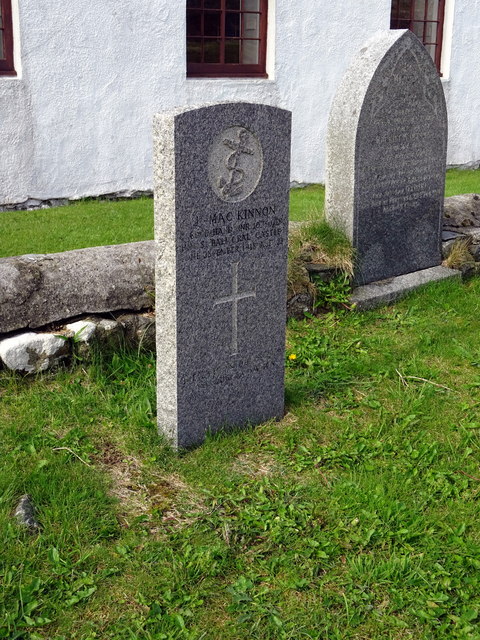
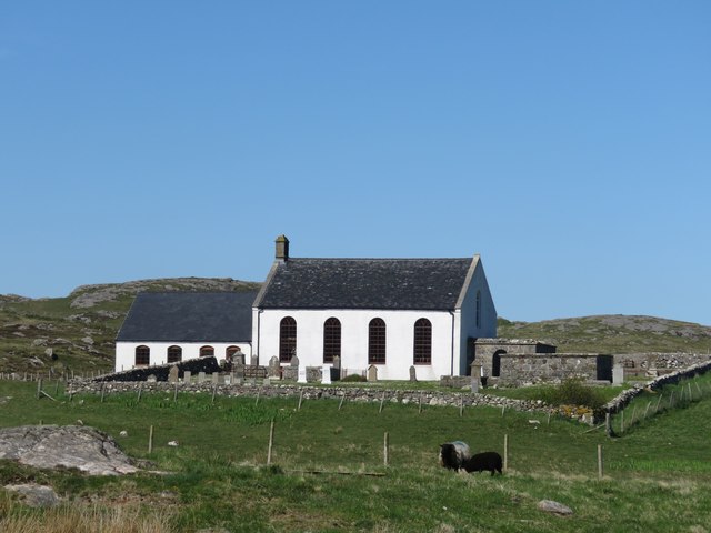
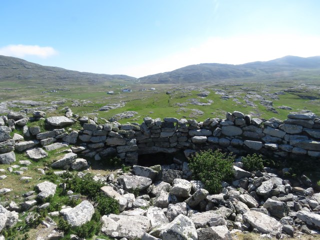
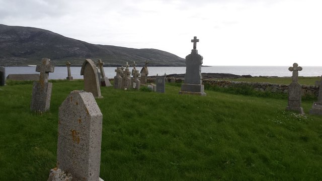
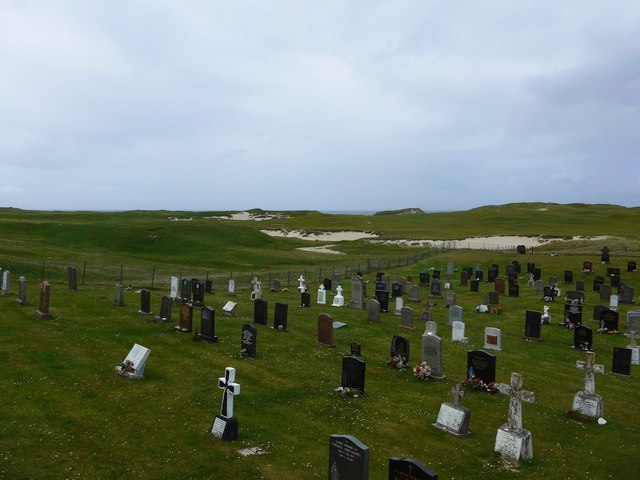
Allathasdal is rich in history, with traces of its past visible in the well-preserved traditional buildings and landmarks. The village is home to a charming church that dates back several centuries, adding to its historical significance. The surrounding area is also dotted with ancient ruins and archaeological sites, offering glimpses into the village's past.

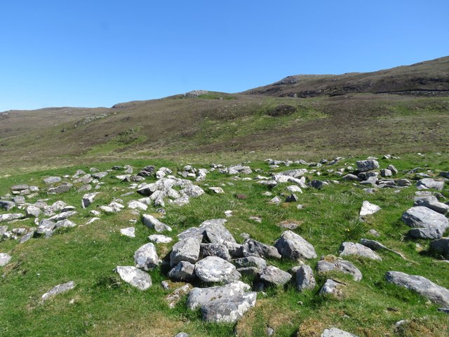
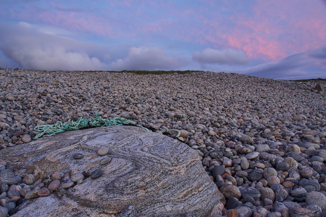
Nature enthusiasts will find plenty to explore in Allathasdal, as the village is surrounded by an abundance of natural beauty. There are numerous walking trails and hiking routes that showcase the stunning countryside, allowing visitors to experience the breathtaking landscapes up close.

While Allathasdal may be small in size, it offers a peaceful retreat for those seeking an escape from the hustle and bustle of city life. Its natural beauty, warm community spirit, and historical charm make it a hidden gem worth discovering in Inverness-shire.

If you have any feedback on the listing, please let us know in the comments section below.

Allathasdal Images

Images are sourced within 2km of 56.996524/-7.5038347 or Grid Reference NF6502. Thanks to Geograph Open Source API. All images are credited.

Gob Bhuirgh On the west coast of Barra.
Gob Bhuirgh
On the west coast of Barra.
Tràigh Tuath The mouth of the short Allt Ruadh is just seen on the left as it flows into the sea.
Tràigh Tuath
The mouth of the short Allt Ruadh is just seen on the left as it flows into the sea.
Cemetery at Cuidhir The cemetery contains several Commonwealth War Graves of naval origins. The stories of some of the casualties can be found in the descriptions of the following images:
<a href="https://www.geograph.org.uk/photo/4513717">NF6703 : Four war graves in Cuidhir Cemetery</a>
<a href="https://www.geograph.org.uk/photo/4514731">NF6703 : Three war graves in Cuidhir Cemetery</a>
<a href="https://www.geograph.org.uk/photo/4676860">NF6703 : Memorial to 3 crew members of SS Idomeneus</a>
<a href="https://www.geograph.org.uk/photo/4676877">NF6703 : Commonwealth war grave of John Mackinnon</a>
Cemetery at Cuidhir
The cemetery contains several Commonwealth War Graves of naval origins. The stories of some of the casualties can be found in the descriptions of the following images: NF6703 : Four war graves in Cuidhir Cemetery NF6703 : Three war graves in Cuidhir Cemetery NF6703 : Memorial to 3 crew members of SS Idomeneus NF6703 : Commonwealth war grave of John Mackinnon
Memorial to 3 crew members of SS Idomeneus Chan Sung, Chung Cheong and Leong Kow were members of the crew of SS Idomeneus which was torpedoed on 15th September 1917 en-route from New York to Liverpool. Although the ship was not sunk, the explosion caused the death of 4 crew members, 3 of whom are commemorated here. The ship was beached on Vatersay, eventually repaired and renamed, it continued sailing until 1933.
Memorial to 3 crew members of SS Idomeneus
Chan Sung, Chung Cheong and Leong Kow were members of the crew of SS Idomeneus which was torpedoed on 15th September 1917 en-route from New York to Liverpool. Although the ship was not sunk, the explosion caused the death of 4 crew members, 3 of whom are commemorated here. The ship was beached on Vatersay, eventually repaired and renamed, it continued sailing until 1933.
Commonwealth war grave of John Mackinnon John Mackinnon was a member of the Royal Naval Reserve and a 2nd hand on HMS Balmoral Castle which was a hired trawler during WWI. He was a native of Barra and hailed from nearby Allasdale.

John died of illness on Christmas Day 1918 at the age of 22.
Commonwealth war grave of John Mackinnon
John Mackinnon was a member of the Royal Naval Reserve and a 2nd hand on HMS Balmoral Castle which was a hired trawler during WWI. He was a native of Barra and hailed from nearby Allasdale. John died of illness on Christmas Day 1918 at the age of 22.
A track down to Borve from the hills
Tràigh Hamara, Barra
Home from school at Borve
Abhainn Mòr at Borgh, Barra
Cuidhir Church, Barra
Dun Chuidhir, Barra Situated on the west side of the island, this dun is quite well preserved.
Dun Chuidhir, Barra
Situated on the west side of the island, this dun is quite well preserved.
Taigh Talamhanta, Barra's aisled house Information from Canmore:
<span class="nowrap"><a title="https://canmore.org.uk/site/9721/barra-allasdale-tigh-talamhanta" rel="nofollow ugc noopener" href="https://canmore.org.uk/site/9721/barra-allasdale-tigh-talamhanta">Link</a><img style="margin-left:2px;" alt="External link" title="External link - shift click to open in new window" src="https://s1.geograph.org.uk/img/external.png" width="10" height="10"/></span>

Tigh Talamhanta (The House under the Ground), was excavated by Scott in 1950-1 and by Young in 1953.

The site comprises an aisled farmhouse, souterrain, kilnhouse and steading, in a partially walled enclosure of 1 1/2 acres. The wall ends in a marshy area near the barn, but intermittent mounds in the marsh are probably the remains of a continuous earthen bank completing the enclosure.

A long period of occupation is attested by the pottery commencing in the late 1st century, but it is not possible to give a terminal date. The steading was overlaid by an 18th century structure.
Taigh Talamhanta, Barra's aisled house
Information from Canmore: LinkExternal link Tigh Talamhanta (The House under the Ground), was excavated by Scott in 1950-1 and by Young in 1953. The site comprises an aisled farmhouse, souterrain, kilnhouse and steading, in a partially walled enclosure of 1 1/2 acres. The wall ends in a marshy area near the barn, but intermittent mounds in the marsh are probably the remains of a continuous earthen bank completing the enclosure. A long period of occupation is attested by the pottery commencing in the late 1st century, but it is not possible to give a terminal date. The steading was overlaid by an 18th century structure.
Burial site at Borve The cemetery sits on raised ground near to the seashore west of Borve settlement on the island of Barra.
Burial site at Borve
The cemetery sits on raised ground near to the seashore west of Borve settlement on the island of Barra.
Cemetery at Allasdale
Traigh Hamara
Traigh Hamara
Pebbly beach at Bruach Bearnasdale
Beinn Mhartainn overlooking the township of Borgh
Tràigh Tuath
Tràigh Tuath
Show me another place!

Allathasdal is located at Grid Ref: NF6502 (Lat: 56.996524, Lng: -7.5038347)

Unitary Authority: Na h-Eileanan an Iar

Police Authority: Highlands and Islands

Also known as: Allasdale

What 3 Words

///published.insert.derailed. Near CastleBay, Na h-Eileanan Siar

Related Wikis

Allasdale

Allasdale (Scottish Gaelic: Athalasdal, pronounced [ˈa.əl̪ˠəs̪t̪əl̪ˠ]) is a settlement on Barra in the Outer Hebrides, Scotland. The settlement is also...

Isle of Barra distillery

Isle of Barra distillery at Borve, Barra, Scotland is a planned future whisky distillery on Barra. The Barra Distillery company was founded in 2003 but...

Borve, Barra

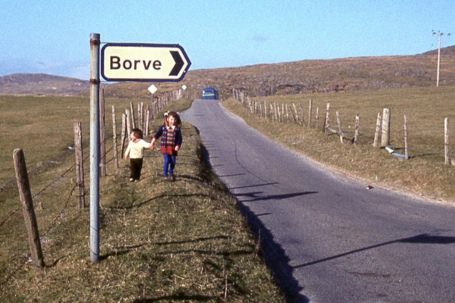
Borve (Scottish Gaelic: Borgh) is a village on the west coast of the island of Barra in the Outer Hebrides, Scotland. Borve is within the parish of Barra...

Barra

Barra (; Scottish Gaelic: Barraigh [ˈparˠaj] or Eilean Bharraigh [ˈelan ˈvarˠaj] ; Scots: Barra) is an island in the Outer Hebrides, Scotland, and the...

Heaval

Heaval is the highest hill on the Outer Hebridean island of Barra, Scotland. The highest point is 383 metres high above sea level and it is located 1.5...

Northbay

Northbay (Scottish Gaelic: Am Bàgh a Tuath) is a township and community in the north of Barra in the Outer Hebrides, off the west coast of Scotland. Northbay...

Castlebay Community School

Castlebay Community School is a bilingual Gaelic/English school for ages 3–18 on the Scottish island of Barra.In September 2007, it hosted a major tribute...

Barrathon

The Barrathon is an annual half marathon which takes place on the Isle of Barra, which is the southernmost inhabited isle of the Outer Hebrides in Scotland...

Nearby Amenities

Located within 500m of 56.996524,-7.5038347
Passing Place
Lat/Long: 56.9942099/-7.5073272
Allasdale
Bus: yes
Naptan AtcoCode: 6010731507
Naptan Bearing: NE
Naptan BusStopType: CUS
Naptan CommonName: Allasdale
Naptan Indicator: Turn
Naptan Landmark: junction with village
Naptan NaptanCode: 94723259
Naptan Street: Turn
Naptan Verified: no
Public Transport: stop_position
Source: naptan_import
Lat/Long: 57.0002044/-7.5036264
Turning Circle
Lat/Long: 56.9993381/-7.500544
Passing Place
Lat/Long: 56.9999874/-7.5021993
Turning Circle
Lat/Long: 56.9962704/-7.5024662
Passing Place
Lat/Long: 56.9947037/-7.5073695
Passing Place
Lat/Long: 56.9952537/-7.5071812
Passing Place
Lat/Long: 56.9996379/-7.5045091
Post Box
Note: RM list suggests different number
Operator: Royal Mail
Ref: HS9 2
Lat/Long: 57.0002286/-7.5036575
Allathasdal
Name En: Allasdale
Name Gd: Allathasdal
Place: hamlet
Wikidata: Q2544676
Wikipedia: en:Allasdale
Lat/Long: 56.9982935/-7.5032699
Material: wood
Power: pole
Lat/Long: 56.9933083/-7.5060777
Material: wood
Power: pole
Lat/Long: 56.9939234/-7.5057933
Material: wood
Power: pole
Lat/Long: 56.9944172/-7.5051013
Material: wood
Power: pole
Lat/Long: 56.9949315/-7.5043745
Material: wood
Power: pole
Lat/Long: 56.9953947/-7.5037173
Material: wood
Power: pole
Lat/Long: 56.9957877/-7.5031836
Material: wood
Power: pole
Lat/Long: 56.9967578/-7.5023092
Material: wood
Power: pole
Lat/Long: 56.9961412/-7.5026605
Material: wood
Power: pole
Lat/Long: 56.9974006/-7.5019149
Material: wood
Power: pole
Lat/Long: 56.9981851/-7.5014669
Material: wood
Power: pole
Lat/Long: 56.9988279/-7.5010592
Material: wood
Power: pole
Lat/Long: 56.9995992/-7.5006006
Material: wood
Power: pole
Lat/Long: 57.0001354/-7.5003082
Material: wood
Power: pole
Lat/Long: 56.9925573/-7.5064022
Passing Place
Lat/Long: 56.9987915/-7.5050503
Passing Place
Lat/Long: 56.9979032/-7.5056388
Passing Place
Lat/Long: 57.0007691/-7.5027864
Passing Place
Lat/Long: 56.9962293/-7.5066286
The data included in this document is from www.openstreetmap.org. The data is made available under ODbL.

Have you been to Allathasdal?

Leave your review of Allathasdal below (or comments, questions and feedback).