Whitnash

Civil Parish in Warwickshire Warwick

England

Whitnash

Othello Avenue  Sunrise following snow
Othello Avenue Credit: Timothy Santon

Whitnash is a civil parish located in Warwickshire, England. It is situated approximately two miles southeast of the town of Leamington Spa and is part of the District of Warwick. The parish covers an area of around 3.5 square miles and has a population of approximately 9,000 residents.

Whitnash is a predominantly residential area with a mix of housing types, including detached and semi-detached houses, as well as some apartment complexes. The community has a range of amenities, including several schools, a library, a community center, and a number of local shops and businesses.

The parish is well-connected in terms of transportation, with easy access to major road networks such as the A46 and M40 motorway. There are also regular bus services that connect Whitnash with nearby towns and cities.

Whitnash is surrounded by beautiful countryside, offering residents access to outdoor spaces and recreational activities. The nearby Leam Valley provides opportunities for hiking, cycling, and picnicking.

The community of Whitnash is known for its strong sense of community spirit and active local groups and organizations. The parish council works closely with residents to address local issues and organize community events.

Overall, Whitnash is a vibrant and welcoming place to live, offering residents a peaceful suburban lifestyle with convenient access to nearby amenities and attractions.

If you have any feedback on the listing, please let us know in the comments section below.
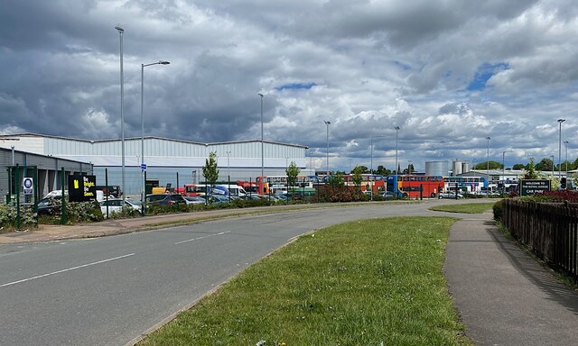
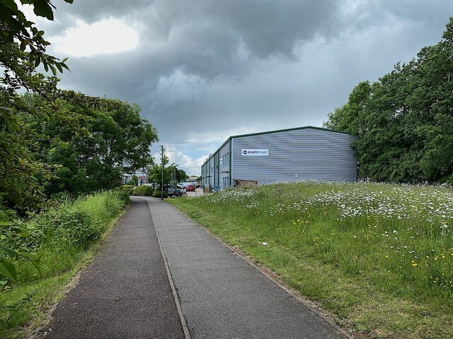
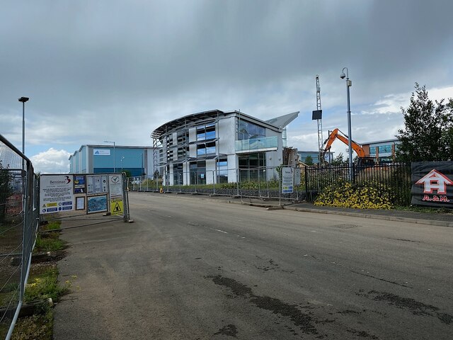
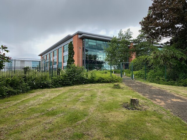
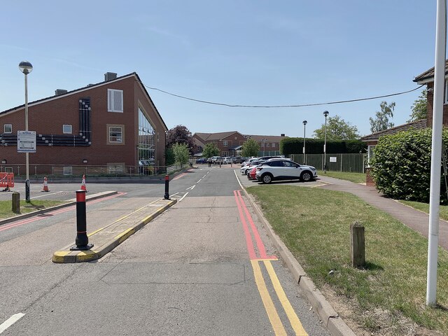
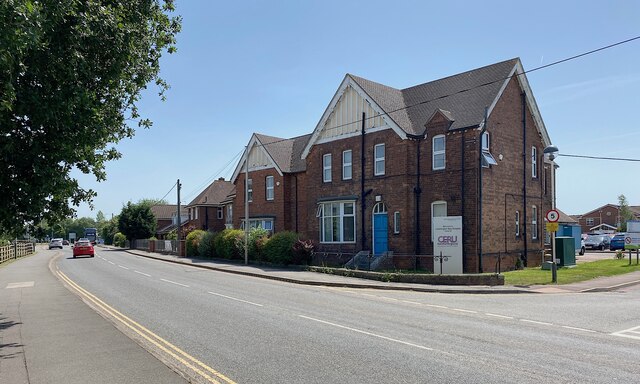
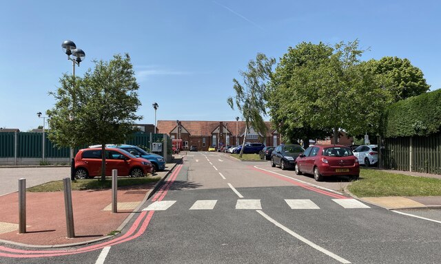
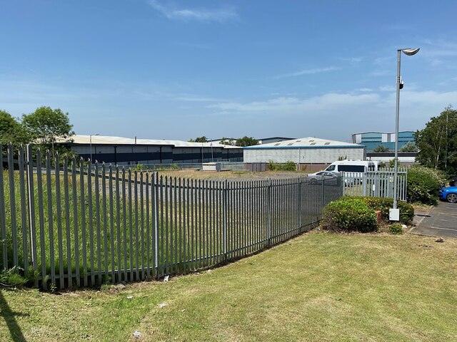
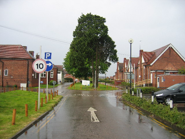
Whitnash Images

Images are sourced within 2km of 52.265342/-1.527401 or Grid Reference SP3263. Thanks to Geograph Open Source API. All images are credited.

Othello Avenue  Sunrise following snow
Othello Avenue
Sunrise following snow
NFA: No Fascists Allowed – Leamington street art, Eagle Recreation Ground The reference is to the gun lobby in the United States: the National Firearms Association. You can feel the anger. The mural below seems unrelated but who's to say? Something to do with Covid-19 perhaps. The location is the end wall of the derelict wing of the Rangemaster factory – the grey area on the right in <a href="https://www.geograph.org.uk/photo/1416117">SP3264 : Eagle Rec, Leamington Spa</a>.
NFA: No Fascists Allowed – Leamington street art, Eagle Recreation Ground
The reference is to the gun lobby in the United States: the National Firearms Association. You can feel the anger. The mural below seems unrelated but who's to say? Something to do with Covid-19 perhaps. The location is the end wall of the derelict wing of the Rangemaster factory – the grey area on the right in SP3264 : Eagle Rec, Leamington Spa.
Smoke from a fire in Hermes Close, south Leamington During 27 August 2021 it was reported that Warwickshire fire service was dealing with a blaze and explosions at Leeson Polymers. The address given, Juno Drive, was perhaps where the fire service was working from. The company's website  was "temporarily closed". Hermes Close is a winding drive serving a number of medium-sized units on an industrial estate off Tachbrook Park Drive. It was later confirmed that a male employee had died in the fire.
Smoke from a fire in Hermes Close, south Leamington
During 27 August 2021 it was reported that Warwickshire fire service was dealing with a blaze and explosions at Leeson Polymers. The address given, Juno Drive, was perhaps where the fire service was working from. The company's website was "temporarily closed". Hermes Close is a winding drive serving a number of medium-sized units on an industrial estate off Tachbrook Park Drive. It was later confirmed that a male employee had died in the fire.
Bus depot, Poseidon Way, Royal Leamington Spa With the development of the land north of Leamington Spa station – De Normanville Avenue flats and houses <a href="https://www.geograph.org.uk/photo/7011163">SP3165 : West on De Normanville Avenue, Royal Leamington Spa</a> – Stagecoach has moved its bus depot to an industrial estate in south Leamington.
Bus depot, Poseidon Way, Royal Leamington Spa
With the development of the land north of Leamington Spa station – De Normanville Avenue flats and houses SP3165 : West on De Normanville Avenue, Royal Leamington Spa – Stagecoach has moved its bus depot to an industrial estate in south Leamington.
Leafy start to a footpath and cycleway, Trident Park, south Leamington The nearest unit is for Presto Music, who have a shop in the town centre <span class="nowrap"><a title="https://www.prestomusic.com/shop" rel="nofollow ugc noopener" href="https://www.prestomusic.com/shop">Link</a><img style="margin-left:2px;" alt="External link" title="External link - shift click to open in new window" src="https://s1.geograph.org.uk/img/external.png" width="10" height="10"/></span>
Here's how the scene looked in 2015 <a href="https://www.geograph.org.uk/photo/5204482">SP3163 : Shared path between Tachbrook Road and the Trident Business Centre, Whitnash</a>.
Leafy start to a footpath and cycleway, Trident Park, south Leamington
The nearest unit is for Presto Music, who have a shop in the town centre LinkExternal link Here's how the scene looked in 2015 SP3163 : Shared path between Tachbrook Road and the Trident Business Centre, Whitnash.
Estate road into Spa Park, south Leamington Spa Park is a large industrial estate. At the time of the photo there were signs at entrances advertising units of 30,000-290,000 square feet to let for offices, R&D, production and distribution, and 4 new speculative units of 24,000-50,000 square feet to let from Q4 2022. Ahead in the photo is the demolition of the Sustainable Building Centre <a href="https://www.geograph.org.uk/photo/1422731">SP3163 : Sustainable Building Centre, Wolseley site, Spa Park, south Leamington</a>. It showcased products from Wolseley UK, the building and plumbing supplies behemoth that had opened warehouses and its HQ here. Outside the UK and Canada it is Ferguson plc. Wolseley UK was sold to a private equity firm in 2021 <span class="nowrap"><a title="https://en.wikipedia.org/wiki/Ferguson_plc" rel="nofollow ugc noopener" href="https://en.wikipedia.org/wiki/Ferguson_plc">Link</a><img style="margin-left:2px;" alt="External link" title="External link - shift click to open in new window" src="https://s1.geograph.org.uk/img/external.png" width="10" height="10"/></span>. The big shed in the background bears the logo of Iron Mountain, a data storage company.
Estate road into Spa Park, south Leamington
Spa Park is a large industrial estate. At the time of the photo there were signs at entrances advertising units of 30,000-290,000 square feet to let for offices, R&D, production and distribution, and 4 new speculative units of 24,000-50,000 square feet to let from Q4 2022. Ahead in the photo is the demolition of the Sustainable Building Centre SP3163 : Sustainable Building Centre, Wolseley site, Spa Park, south Leamington. It showcased products from Wolseley UK, the building and plumbing supplies behemoth that had opened warehouses and its HQ here. Outside the UK and Canada it is Ferguson plc. Wolseley UK was sold to a private equity firm in 2021 LinkExternal link. The big shed in the background bears the logo of Iron Mountain, a data storage company.
Aura building, Precision Park, south Leamington At the time of the photo the former high-quality HQ building for Wolseley UK (Ferguson plc elsewhere) had been refurbished as a suite of business premises by the property developers Canmoor and others. Access is from Harrison Way, the main entrance to the Spa Park industrial estate, of which Precision Park may be a corner renamed. The photo is a view from Tachbrook Road.
Aura building, Precision Park, south Leamington
At the time of the photo the former high-quality HQ building for Wolseley UK (Ferguson plc elsewhere) had been refurbished as a suite of business premises by the property developers Canmoor and others. Access is from Harrison Way, the main entrance to the Spa Park industrial estate, of which Precision Park may be a corner renamed. The photo is a view from Tachbrook Road.
Cat mural The striking 20-foot-high mural was painted in 2018 by street artist Muck Rock, who was born in Stoke-on-Trent but has relocated to Venice Beach, California.

It was completed in just under four hours with only the use of a ladder to reach the high sections. 

The portrait off Althorpe Street is part of a series of projects in Coventry and Warwickshire by Brink Contemporary Arts.
Cat mural
The striking 20-foot-high mural was painted in 2018 by street artist Muck Rock, who was born in Stoke-on-Trent but has relocated to Venice Beach, California. It was completed in just under four hours with only the use of a ladder to reach the high sections. The portrait off Althorpe Street is part of a series of projects in Coventry and Warwickshire by Brink Contemporary Arts.
View of a mural on the wall on the side of FitCookie on Clemens Street Looking south-southwest.
View of a mural on the wall on the side of FitCookie on Clemens Street
Looking south-southwest.
View of a mosaic tile windmill on the front of the old Banks's pub on Clemens Street Looking north-northeast.
View of a mosaic tile windmill on the front of the old Banks's pub on Clemens Street
Looking north-northeast.
View of a mosaic butterfly and tree and wooden moth on the front of the old Banks's pub on Clemens Street Looking east.
View of a mosaic butterfly and tree and wooden moth on the front of the old Banks's pub on Clemens Street
Looking east.
View of a mosaic tile tree on the front of the old Banks's pub on Clemens Street Looking east.
View of a mosaic tile tree on the front of the old Banks's pub on Clemens Street
Looking east.
View of a mosaic bird and flowers on the front of the old Banks's pub on Clemens Street Looking east.
View of a mosaic bird and flowers on the front of the old Banks's pub on Clemens Street
Looking east.
View of a mosaic swallow and bridge on the front of the old Banks's pub on Clemens Street Looking east.
View of a mosaic swallow and bridge on the front of the old Banks's pub on Clemens Street
Looking east.
Rehabilitation Hospital, Heathcote, Leamington One of the two vehicular entrances to the site. The hospital has expanded over the years, taking patients from beyond Warwickshire. There are units for treating brain injuries and strokes. <span class="nowrap"><a title="https://www.swft.nhs.uk/our-hospitals/leamington-spa-hospital" rel="nofollow ugc noopener" href="https://www.swft.nhs.uk/our-hospitals/leamington-spa-hospital">Link</a><img style="margin-left:2px;" alt="External link" title="External link - shift click to open in new window" src="https://s1.geograph.org.uk/img/external.png" width="10" height="10"/></span>
Rehabilitation Hospital, Heathcote, Leamington
One of the two vehicular entrances to the site. The hospital has expanded over the years, taking patients from beyond Warwickshire. There are units for treating brain injuries and strokes. LinkExternal link
Whitnash Lodge and Heathcote Lane, Leamington The extended Whitnash Lodge is believed to be the unit of the Rehabilitation Hospital that treats brain injuries. For a little history see <a title="https://www.geograph.org.uk/photo/6414082" href="https://www.geograph.org.uk/photo/6414082">Link</a> The Central England Brain Injury Charity raises funds to enhance the facilities at the Central England Rehabilitation Unit (CERU): <span class="nowrap"><a title="http://www.ceru.co.uk/?fbclid=IwAR111-mmr13zPvnIB-EobP1Or5cAJ-UHjMqGAann2suHG6FAatv-Dj72CQQ" rel="nofollow ugc noopener" href="http://www.ceru.co.uk/?fbclid=IwAR111-mmr13zPvnIB-EobP1Or5cAJ-UHjMqGAann2suHG6FAatv-Dj72CQQ">Link</a><img style="margin-left:2px;" alt="External link" title="External link - shift click to open in new window" src="https://s1.geograph.org.uk/img/external.png" width="10" height="10"/></span>
Whitnash Lodge and Heathcote Lane, Leamington
The extended Whitnash Lodge is believed to be the unit of the Rehabilitation Hospital that treats brain injuries. For a little history see Link The Central England Brain Injury Charity raises funds to enhance the facilities at the Central England Rehabilitation Unit (CERU): LinkExternal link
Circulation and parking, Leamington Rehab Hospital Also known as Heathcote Hospital; for a little history see <a title="https://www.geograph.org.uk/photo/6414082" href="https://www.geograph.org.uk/photo/6414082">Link</a>
Access to the fenced compound, left, is clearly restricted, arousing curiosity, but there are no clues.
Circulation and parking, Leamington Rehab Hospital
Also known as Heathcote Hospital; for a little history see Link Access to the fenced compound, left, is clearly restricted, arousing curiosity, but there are no clues.
Shed, industrial estate, Leamington The access is from Delphi Close. All the roads have a Greek flavour.
Shed, industrial estate, Leamington
The access is from Delphi Close. All the roads have a Greek flavour.
Show me another place!

Whitnash is located at Grid Ref: SP3263 (Lat: 52.265342, Lng: -1.527401)

Administrative County: Warwickshire

District: Warwick

Police Authority: Warwickshire

What 3 Words

///album.leans.penny. Near Royal Leamington Spa, Warwickshire

Nearby Locations

Whitnash Whitnash

Related Wikis

Whitnash

Whitnash is a town and civil parish located southeast of, and contiguous with Leamington Spa and Warwick in Warwickshire, England. In 2001, it had a population...

Leamington Spa Hospital

Leamington Spa Hospital is located on Heathcote Lane in Warwick, Warwickshire, in England. Originally an isolation hospital, it is now a hospital run by...

Oakley School, Bishop's Tachbrook

Oakley School is a coeducational all-through school located in Bishop's Tachbrook (near Leamington Spa and Warwick) The school formally opened in September...

Campion School, Leamington Spa

Campion School was formed in 1977 when it moved to the present site on Sydenham Drive in Leamington Spa, Warwickshire, England. In 2006, Campion was awarded...

Nearby Amenities

Located within 500m of 52.265342,-1.527401
Whitnash
Check Date: 2024-03-24
Place: suburb
Population: 10,000
Wikidata: Q2368471
Lat/Long: 52.2660705/-1.5257365
Plough & Harrow
Bus: yes
Check Date: 2024-03-24
Public Transport: stop_position
Traffic Sign: GB:970
Lat/Long: 52.2676559/-1.5248035
Crossing
Bicycle: no
Crossing: marked
Crossing Island: no
Crossing Markings: zebra;dots
Crossing Ref: zebra
Flashing Lights: always
Kerb: lowered
Tactile Paving: yes
Lat/Long: 52.2685623/-1.5278355
Whitnash News
Addr City: Leamington Spa
Addr Street: Coppice Road
Check Date: 2024-02-23
Fhrs Id: 242484
Opening Hours: Mo-Sa 07:00-21:00; Su 08:00-20:00
Payment Cash: yes
Payment Mastercard: yes
Payment Visa: yes
Shop: convenience
Wheelchair: no
Lat/Long: 52.2624317/-1.5255868
Fast Food
Happy Nest Chinese Takeaway
Addr City: Leamington Spa
Addr Postcode: CV31 2LT
Check Date: 2022-06-26
Check Date Opening Hours: 2023-12-13
Cuisine: chinese
Fhrs Id: 241346
Opening Hours: Mo,We,Th 17:00-23:00; Su 17:00-22:30; Fr,Sa 17:00-24:00
Opening Hours Signed: no
Phone: +441926330308
Website: https://happynestwhitnash.com/
Wheelchair: no
Lat/Long: 52.2625557/-1.5255144
Bus Stop
Hod Carrier
Bench: yes
Bin: yes
Bus: yes
Check Date: 2024-03-24
Covered: no
Lit: yes
Naptan AtcoCode: 4200F078100
Naptan Bearing: W
Naptan CommonName: Hod Carrier
Naptan Indicator: Opp
Naptan Landmark: South Farm
Naptan NaptanCode: wardapja
Naptan PlusbusZoneRef: LMNGTNS
Naptan Street: Coppice Road
Passenger Information Display: no
Physically Present: yes
Public Transport: platform
Route Ref: 1
Shelter: yes
Source: naptan_import
Tactile Paving: yes
Wheelchair: yes
Lat/Long: 52.2622049/-1.525603
Franklin Road
Bench: no
Bus: yes
Naptan AtcoCode: 4200F078200
Naptan Bearing: W
Naptan CommonName: Franklin Road
Naptan Indicator: Adj
Naptan NaptanCode: wardapjd
Naptan PlusbusZoneRef: LMNGTNS
Naptan Street: Heathcote Road
Physically Present: no
Route Ref: none
Shelter: no
Source: naptan_import
Tactile Paving: no
Lat/Long: 52.2686457/-1.5302082
Bus Stop
Plough & Harrow
Bench: yes
Bin: yes
Bus: yes
Check Date: 2024-03-24
Covered: no
Lit: yes
Naptan AtcoCode: 4200F078500
Naptan Bearing: E
Naptan CommonName: Plough & Harrow
Naptan Indicator: Opp
Naptan NaptanCode: wardapjm
Naptan PlusbusZoneRef: LMNGTNS
Naptan Street: Whitnash Road
Passenger Information Display: no
Physically Present: yes
Public Transport: platform
Route Ref: 1
Shelter: yes
Source: naptan_import
Tactile Paving: yes
Lat/Long: 52.2677085/-1.5247593
Bus Stop
Plough & Harrow
Bench: no
Bin: yes
Bus: yes
Check Date: 2024-03-24
Covered: no
Lit: yes
Naptan AtcoCode: 4200F078501
Naptan Bearing: W
Naptan CommonName: Plough & Harrow
Naptan Indicator: Adj
Naptan NaptanCode: wardapjp
Naptan PlusbusZoneRef: LMNGTNS
Naptan Street: Whitnash Road
Passenger Information Display: no
Physically Present: yes
Public Transport: platform
Route Ref: 1
Shelter: no
Source: naptan_import
Tactile Paving: yes
Lat/Long: 52.2675128/-1.5237439
Hod Carrier
Bench: no
Bus: yes
Check Date: 2024-03-24
Covered: no
Naptan AtcoCode: 4200F078700
Naptan Bearing: E
Naptan CommonName: Hod Carrier
Naptan Indicator: Adj
Naptan Landmark: South Farm
Naptan NaptanCode: waradtam
Naptan PlusbusZoneRef: LMNGTNS
Naptan Street: Coppice Road
Passenger Information Display: no
Physically Present: no
Route Ref: none
Shelter: no
Source: naptan_import
Tactile Paving: no
Wheelchair: limited
Lat/Long: 52.2623171/-1.5257351
Lammas Croft
Bench: no
Bus: yes
Naptan AtcoCode: 4200F142401
Naptan Bearing: NW
Naptan CommonName: Lammas Croft
Naptan Indicator: Adj
Naptan NaptanCode: waragpmj
Naptan PlusbusZoneRef: LMNGTNS
Naptan Street: Heathcote Road
Physically Present: no
Route Ref: none
Shelter: no
Source: naptan_import
Tactile Paving: no
Lat/Long: 52.2683969/-1.5274757
Bus Stop
Whitnash Club
Bench: no
Bin: yes
Bus: yes
Covered: no
Lit: yes
Naptan AtcoCode: 4200F142402
Naptan Bearing: SE
Naptan CommonName: Whitnash Club
Naptan Indicator: Adj
Naptan NaptanCode: waragpmp
Naptan PlusbusZoneRef: LMNGTNS
Naptan Street: Heathcote Road
Passenger Information Display: no
Physically Present: yes
Public Transport: platform
Route Ref: 1
Shelter: no
Source: naptan_import
Tactile Paving: yes
Lat/Long: 52.2684378/-1.5272328
Bus Stop
Avon Road
Bench: no
Bin: no
Bus: yes
Check Date: 2024-03-24
Covered: no
Lit: yes
Naptan AtcoCode: 4200F142502
Naptan Bearing: W
Naptan CommonName: Avon Road
Naptan Indicator: Adj
Naptan NaptanCode: waragpmt
Naptan PlusbusZoneRef: LMNGTNS
Naptan Street: Heathcote Road
Passenger Information Display: no
Physically Present: yes
Public Transport: platform
Route Ref: none
Shelter: no
Source: naptan_import
Tactile Paving: no
Lat/Long: 52.2676656/-1.5252444
Harrow Road
Bench: no
Bus: yes
Check Date: 2024-03-24
Naptan AtcoCode: 4200F143301
Naptan Bearing: N
Naptan CommonName: Harrow Road
Naptan Indicator: Opp
Naptan NaptanCode: waragpwa
Naptan PlusbusZoneRef: LMNGTNS
Naptan Street: Coppice Road
Physically Present: no
Route Ref: none
Shelter: no
Source: naptan_import
Tactile Paving: no
Lat/Long: 52.2663667/-1.5247464
Morris Drive
Bench: no
Bus: yes
Check Date: 2024-03-24
Departures Board: no
Naptan AtcoCode: 4200F143402
Naptan Bearing: N
Naptan CommonName: Morris Drive
Naptan Crossing: Morris Drive
Naptan Indicator: Opp
Naptan NaptanCode: waragpwd
Naptan PlusbusZoneRef: LMNGTNS
Naptan Street: Coppice Road
Physically Present: no
Route Ref: None
Shelter: no
Source: naptan_import
Tactile Paving: no
Lat/Long: 52.2637013/-1.5235787
Bus Stop
Anderson Drive
Bench: yes
Bin: yes
Bus: yes
Check Date: 2024-03-24
Covered: no
Lit: yes
Naptan AtcoCode: 4200F143501
Naptan Bearing: W
Naptan CommonName: Anderson Drive
Naptan Crossing: Anderson Drive
Naptan Indicator: Adj
Naptan NaptanCode: waradwmp
Naptan PlusbusZoneRef: LMNGTNS
Naptan Street: Coppice Road
Network: 1
Operator: Stagecoach
Passenger Information Display: no
Physically Present: yes
Public Transport: platform
Route Ref: 1
Shelter: yes
Source: naptan_import
Tactile Paving: yes
Wheelchair: yes
Lat/Long: 52.2617964/-1.5282825
Bus Stop
Ashford Road
Bench: no
Bin: no
Bus: yes
Covered: no
Lit: yes
Naptan AtcoCode: 4200F143601
Naptan Bearing: N
Naptan CommonName: Ashford Road
Naptan Crossing: Ashford Road
Naptan Indicator: Adj
Naptan NaptanCode: waradwmw
Naptan PlusbusZoneRef: LMNGTNS
Naptan Street: Coppice Road
Passenger Information Display: no
Physically Present: yes
Public Transport: platform
Route Ref: 1
Shelter: no
Source: naptan_import
Tactile Paving: yes
Lat/Long: 52.2632025/-1.5313522
Bus Stop
Washbourne Road
Bench: no
Bin: no
Bus: yes
Covered: no
Lit: yes
Naptan AtcoCode: 4200F143901
Naptan Bearing: E
Naptan CommonName: Washbourne Road
Naptan Crossing: Washbourne Road
Naptan Indicator: Opp
Naptan NaptanCode: waradwpg
Naptan PlusbusZoneRef: LMNGTNS
Naptan Street: Moorhill Road
Passenger Information Display: no
Physically Present: yes
Public Transport: platform
Route Ref: 1
Shelter: no
Source: naptan_import
Tactile Paving: yes
Lat/Long: 52.2647793/-1.5305457
Washbourne Road
Bench: no
Bus: yes
Naptan AtcoCode: 4200F143902
Naptan Bearing: W
Naptan CommonName: Washbourne Road
Naptan Crossing: Washbourne Road
Naptan Indicator: Adj
Naptan NaptanCode: waradwpj
Naptan PlusbusZoneRef: LMNGTNS
Naptan Street: Moorhill Road
Physically Present: no
Route Ref: none
Shelter: no
Source: naptan_import
Tactile Paving: no
Lat/Long: 52.2646934/-1.5306353
Gleave Road
Bench: no
Bus: yes
Naptan AtcoCode: 4200F144001
Naptan Bearing: S
Naptan CommonName: Gleave Road
Naptan Crossing: Gleave Road
Naptan Indicator: Opp
Naptan NaptanCode: waradwpm
Naptan PlusbusZoneRef: LMNGTNS
Naptan Street: Franklin Road
Physically Present: no
Route Ref: none
Shelter: no
Source: naptan_import
Tactile Paving: no
Lat/Long: 52.2667069/-1.5290547
Bus Stop
Murcott Road
Bench: no
Bin: yes
Bus: yes
Covered: no
Lit: yes
Naptan AtcoCode: 4200F144002
Naptan Bearing: N
Naptan CommonName: Murcott Road
Naptan Crossing: Murcott Road
Naptan Indicator: Opp
Naptan NaptanCode: waradwpt
Naptan PlusbusZoneRef: LMNGTNS
Naptan Street: Franklin Road
Passenger Information Display: no
Physically Present: yes
Public Transport: platform
Route Ref: 1
Shelter: no
Source: naptan_import
Tactile Paving: yes
Lat/Long: 52.2662204/-1.5289941
Library
Bench: no
Bus: yes
Naptan AtcoCode: 4200F144102
Naptan Bearing: S
Naptan CommonName: Library
Naptan Indicator: Adj
Naptan Landmark: Library
Naptan NaptanCode: waradwpw
Naptan PlusbusZoneRef: LMNGTNS
Naptan Street: Franklin Road
Physically Present: no
Route Ref: none
Shelter: no
Source: naptan_import
Tactile Paving: no
Lat/Long: 52.2681416/-1.5295556
Bus Stop
Harrow Road
Bench: no
Bin: no
Bus: yes
Check Date: 2024-03-24
Covered: no
Lit: yes
Naptan AtcoCode: 4200F203001
Naptan Bearing: S
Naptan CommonName: Harrow Road
Naptan Indicator: Adj
Naptan NaptanCode: waradpjp
Naptan PlusbusZoneRef: LMNGTNS
Naptan Street: Coppice Road
Passenger Information Display: no
Physically Present: yes
Public Transport: platform
Route Ref: 1
Shelter: no
Source: naptan_import
Tactile Paving: yes
Lat/Long: 52.2662566/-1.5246055
Bus Stop
Morris Drive
Bench: no
Bin: no
Bus: yes
Covered: no
Departures Board: timetable
Kerb: raised
Kerb Approach Aid: no
Lit: yes
Naptan AtcoCode: 4200F203101
Naptan Bearing: S
Naptan CommonName: Morris Drive
Naptan Crossing: Morris Drive
Naptan Indicator: Adj
Naptan NaptanCode: waradpjt
Naptan PlusbusZoneRef: LMNGTNS
Naptan Street: Coppice Road
Passenger Information Display: no
Physically Present: yes
Public Transport: platform
Route Ref: 1
Shelter: no
Source: naptan_import
Tactile Paving: yes
Lat/Long: 52.2638779/-1.5235206
Bus Stop
Landor Road
Bench: yes
Bin: no
Bus: yes
Covered: no
Lit: yes
Naptan AtcoCode: 4200F203701
Naptan Bearing: N
Naptan CommonName: Landor Road
Naptan Indicator: Adj
Naptan NaptanCode: waradpjw
Naptan PlusbusZoneRef: LMNGTNS
Naptan Street: Franklin Road
Passenger Information Display: no
Physically Present: yes
Public Transport: platform
Route Ref: 1
Shelter: yes
Source: naptan_import
Tactile Paving: yes
Lat/Long: 52.2681718/-1.5297125
Bus Stop
Halls Close
Bench: yes
Bin: no
Bus: yes
Check Date: 2024-03-24
Covered: no
Lit: yes
Naptan AtcoCode: 4200F205601
Naptan Bearing: N
Naptan CommonName: Halls Close
Naptan Indicator: Opp
Naptan NaptanCode: warajtdg
Naptan PlusbusZoneRef: LMNGTNS
Naptan Street: Whitnash Road
Passenger Information Display: no
Physically Present: yes
Public Transport: platform
Route Ref: 1
Shelter: yes
Source: naptan_import
Tactile Paving: yes
Wheelchair: designated
Lat/Long: 52.2686535/-1.5228228
Direction: both
Traffic Calming: table
Lat/Long: 52.2683111/-1.5231355
Turning Circle
Lat/Long: 52.2684817/-1.5247204
Barrier: kerb
Kerb: raised
Tactile Paving: no
Lat/Long: 52.2661678/-1.5229626
Barrier: kerb
Kerb: lowered
Tactile Paving: no
Lat/Long: 52.2668719/-1.5222823
Mini Roundabout
Direction: clockwise
Lat/Long: 52.2687122/-1.5298444
Barrier: kerb
Kerb: lowered
Tactile Paving: no
Lat/Long: 52.2630408/-1.5294329
Barrier: kerb
Kerb: lowered
Tactile Paving: no
Lat/Long: 52.2637845/-1.5255167
Direction: both
Traffic Calming: table
Lat/Long: 52.267748/-1.5255262
Give Way
Direction: backward
Lat/Long: 52.2642714/-1.5238475
Mini Roundabout
Direction: clockwise
Lat/Long: 52.2643257/-1.5238889
Barrier: kerb
Lat/Long: 52.2632158/-1.5251978
Barrier: kerb
Kerb: raised
Tactile Paving: no
Lat/Long: 52.2633629/-1.5243338
Noexit: yes
Lat/Long: 52.2625324/-1.5264089
Barrier: kerb
Kerb: lowered
Tactile Paving: no
Lat/Long: 52.2642561/-1.5211858
Barrier: kerb
Kerb: lowered
Tactile Paving: no
Lat/Long: 52.2619324/-1.523552
Noexit: yes
Lat/Long: 52.2620757/-1.5288214
Direction: backward
Road Marking: GB:1062
Lat/Long: 52.2685541/-1.5281767
Direction: both
Traffic Calming: table
Lat/Long: 52.2686396/-1.5281199
One Stop
Addr City: Leamington Spa
Addr Housenumber: 76-78
Addr Postcode: CV31 2NF
Addr Street: Heathcote Road
Brand: One Stop
Brand Wikidata: Q65954217
Check Date: 2022-11-09
Check Date Opening Hours: 2022-11-16
Contact Website: https://www.onestop.co.uk/store/?store=2ecf093e-0144-49c6-85e2-d198bc8113a1
Fhrs Id: 242345
Opening Hours: Mo-Su 06:00-22:00
Payment Mastercard: yes
Payment Visa: yes
Shop: convenience
Wheelchair: yes
Lat/Long: 52.268827/-1.5280533
Barrier: kerb
Kerb: lowered
Tactile Paving: no
Lat/Long: 52.2647021/-1.521585
Barrier: kerb
Kerb: lowered
Tactile Paving: no
Lat/Long: 52.2654432/-1.5218587
Barrier: kerb
Kerb: lowered
Tactile Paving: no
Lat/Long: 52.2662508/-1.5228416
Direction: backward
Traffic Sign: GB:951
Traffic Sign Backward: GB:951
Traffic Sign Direction: backward
Lat/Long: 52.2669977/-1.5327229
Plough & Harrow
Bus: yes
Check Date: 2024-03-24
Public Transport: stop_position
Traffic Sign: GB:970
Lat/Long: 52.2675679/-1.5237556
Direction: forward
Hazard: children
Traffic Sign: GB:545
Traffic Sign 2: GB:547.1
Traffic Sign 2 Direction: forward
Traffic Sign Direction: forward
Traffic Sign Forward: GB:545
Lat/Long: 52.2634836/-1.5324055
Direction: both
Traffic Calming: hump
Lat/Long: 52.2658032/-1.5244884
Direction: both
Traffic Calming: hump
Lat/Long: 52.2663324/-1.5246843
Direction: both
Traffic Calming: hump
Lat/Long: 52.2644497/-1.5239573
Direction: both
Traffic Calming: hump
Lat/Long: 52.2653123/-1.5243146
Crossing
Crossing: unmarked
Crossing Island: no
Crossing Markings: no
Kerb: raised
Tactile Paving: no
Lat/Long: 52.2630531/-1.5266303
Crossing
Crossing: unmarked
Crossing Island: no
Crossing Markings: no
Kerb: lowered
Tactile Paving: no
Lat/Long: 52.2621489/-1.5299486
Kerb: raised
Noexit: yes
Tactile Paving: no
Lat/Long: 52.2653136/-1.5220397
Barrier: kerb
Kerb: lowered
Tactile Paving: no
Lat/Long: 52.2671035/-1.5229436
Barrier: kerb
Kerb: lowered
Tactile Paving: no
Lat/Long: 52.2671702/-1.5231239
Door: hinged
Entrance: yes
Lat/Long: 52.2669096/-1.5248529
Give Way
Direction: 80
Road Marking: GB:1003A
Lat/Long: 52.2660302/-1.5209563
Give Way
Direction: 345
Road Marking: GB:1003A
Lat/Long: 52.2639187/-1.5208257
Give Way
Direction: 70
Road Marking: GB:1003A
Lat/Long: 52.2635261/-1.5233162
Barrier: kerb
Kerb: lowered
Tactile Paving: no
Lat/Long: 52.2635932/-1.5233044
Barrier: kerb
Kerb: lowered
Tactile Paving: no
Lat/Long: 52.263972/-1.5204912
Give Way
Direction: 255
Road Marking: GB:1003A
Lat/Long: 52.2649197/-1.520709
Barrier: kerb
Kerb: raised
Tactile Paving: no
Lat/Long: 52.2655069/-1.5209586
Give Way
Direction: 255
Road Marking: GB:1003A
Lat/Long: 52.2654719/-1.5208839
Barrier: kerb
Kerb: lowered
Tactile Paving: no
Lat/Long: 52.2662521/-1.5227876
Give Way
Direction: 260
Road Marking: GB:1003A
Lat/Long: 52.2662068/-1.5221455
Barrier: kerb
Kerb: lowered
Tactile Paving: no
Lat/Long: 52.2662486/-1.5229003
Barrier: kerb
Kerb: raised
Tactile Paving: no
Lat/Long: 52.2661379/-1.5221372
Barrier: kerb
Kerb: raised
Tactile Paving: no
Lat/Long: 52.2668888/-1.5213917
Give Way
Direction: 255
Road Marking: GB:1003A
Lat/Long: 52.2668611/-1.5213207
Barrier: kerb
Kerb: lowered
Tactile Paving: no
Lat/Long: 52.2667469/-1.5223009
Barrier: kerb
Kerb: raised
Tactile Paving: no
Lat/Long: 52.2658392/-1.5220122
Barrier: kerb
Kerb: lowered
Tactile Paving: no
Lat/Long: 52.2681035/-1.5224981
Give Way
Direction: 195
Road Marking: GB:1003A
Lat/Long: 52.2681352/-1.5224393
Barrier: kerb
Kerb: lowered
Tactile Paving: no
Lat/Long: 52.2680463/-1.5224358
Barrier: kerb
Kerb: lowered
Tactile Paving: no
Lat/Long: 52.2677923/-1.5214327
Give Way
Direction: 75
Road Marking: GB:1003A
Lat/Long: 52.2677204/-1.5214277
Barrier: kerb
Kerb: lowered
Tactile Paving: yes
Lat/Long: 52.268259/-1.5230602
Barrier: kerb
Kerb: lowered
Tactile Paving: no
Wheelchair: yes
Lat/Long: 52.2642323/-1.5203841
Give Way
Direction: 110
Road Marking: GB:1003A
Lat/Long: 52.2683005/-1.5230865
Barrier: kerb
Kerb: lowered
Tactile Paving: no
Wheelchair: yes
Lat/Long: 52.2646529/-1.5205213
Give Way
Direction: 70
Road Marking: GB:1003A
Lat/Long: 52.2659852/-1.5245182
Barrier: kerb
Kerb: lowered
Tactile Paving: no
Lat/Long: 52.2668761/-1.5232177
Barrier: kerb
Kerb: lowered
Tactile Paving: no
Lat/Long: 52.2669295/-1.5232533
Give Way
Direction: 305
Road Marking: GB:1003A
Lat/Long: 52.2626904/-1.5238385
Barrier: kerb
Kerb: lowered
Tactile Paving: no
Lat/Long: 52.2627532/-1.5238042
Barrier: kerb
Kerb: lowered
Tactile Paving: no
Lat/Long: 52.2626888/-1.5239422
Give Way
Direction: 75
Road Marking: GB:1003A
Lat/Long: 52.2636451/-1.527094
Barrier: kerb
Kerb: raised
Tactile Paving: no
Lat/Long: 52.2630285/-1.5265846
Give Way
Direction: 85
Road Marking: GB:1003A
Lat/Long: 52.2629796/-1.5271584
Barrier: kerb
Kerb: lowered
Tactile Paving: no
Lat/Long: 52.2621379/-1.5260221
Give Way
Direction: 165
Road Marking: GB:1003A
Lat/Long: 52.26218/-1.5260964
Give Way
Direction: 75
Road Marking: GB:1003A
Lat/Long: 52.2662255/-1.5302748
Give Way
Direction: 255
Road Marking: GB:1003A
Lat/Long: 52.2663954/-1.5290347
Barrier: kerb
Kerb: raised
Tactile Paving: no
Lat/Long: 52.2663492/-1.5291945
Barrier: kerb
Kerb: raised
Tactile Paving: no
Lat/Long: 52.2613875/-1.5251253
Give Way
Direction: 270
Road Marking: GB:1003A
Lat/Long: 52.2613352/-1.5251126
Give Way
Direction: 165
Road Marking: GB:1003A
Lat/Long: 52.2619685/-1.5271021
Just Ian
Addr Housenumber: 106
Addr Postcode: CV31 2LT
Addr Street: Coppice Road
Check Date: 2022-06-26
Female Signed: no
Male Signed: no
Opening Hours Signed: no
Phone: +44 1926 338420
Shop: hairdresser
Wheelchair: no
Lat/Long: 52.2624415/-1.5254989
Barrier: kerb
Kerb: lowered
Tactile Paving: no
Lat/Long: 52.2654276/-1.5253256
Give Way
Direction: 165
Road Marking: GB:1003A
Lat/Long: 52.2654526/-1.5254049
Barrier: kerb
Kerb: lowered
Tactile Paving: no
Lat/Long: 52.2654111/-1.5254748
Give Way
Direction: 70
Road Marking: GB:1003A
Lat/Long: 52.2641071/-1.5247801
Give Way
Direction: 245
Lat/Long: 52.2643122/-1.5239509
Barrier: kerb
Kerb: raised
Tactile Paving: no
Lat/Long: 52.2642646/-1.5239366
Give Way
Direction: 235
Road Marking: GB:1003A
Lat/Long: 52.2609801/-1.5276601
Barrier: kerb
Kerb: lowered
Tactile Paving: no
Lat/Long: 52.2609436/-1.5276679
Barrier: kerb
Kerb: lowered
Tactile Paving: no
Lat/Long: 52.2609983/-1.5277186
Barrier: kerb
Kerb: lowered
Tactile Paving: no
Lat/Long: 52.2609464/-1.5264009
Barrier: kerb
Kerb: raised
Tactile Paving: no
Lat/Long: 52.2618444/-1.5238437
Give Way
Direction: 95
Road Marking: GB:1003A
Lat/Long: 52.2619604/-1.5248337
Barrier: kerb
Kerb: raised
Tactile Paving: no
Lat/Long: 52.2619142/-1.5248006
Barrier: kerb
Kerb: raised
Tactile Paving: no
Lat/Long: 52.2620011/-1.5247872
Give Way
Direction: 265
Road Marking: GB:1003A
Lat/Long: 52.2614617/-1.5278737
Barrier: kerb
Kerb: lowered
Tactile Paving: no
Lat/Long: 52.261428/-1.5278927
Barrier: kerb
Kerb: lowered
Tactile Paving: no
Lat/Long: 52.2614968/-1.5279106
Barrier: kerb
Kerb: lowered
Tactile Paving: no
Lat/Long: 52.2614045/-1.5283636
Give Way
Direction: 170
Road Marking: GB:1003A
Lat/Long: 52.2618549/-1.5279243
Give Way
Direction: 165
Road Marking: GB:1003A
Lat/Long: 52.2623377/-1.5249912
Barrier: kerb
Kerb: lowered
Tactile Paving: no
Lat/Long: 52.2649103/-1.5291186
Barrier: kerb
Kerb: lowered
Tactile Paving: no
Lat/Long: 52.2649337/-1.5289531
Give Way
Direction: 165
Road Marking: GB:1003A
Lat/Long: 52.2649291/-1.5290448
Give Way
Direction: 75
Road Marking: GB:1003A
Lat/Long: 52.2671109/-1.5278294
Barrier: kerb
Kerb: lowered
Tactile Paving: no
Lat/Long: 52.2647221/-1.5304673
Barrier: kerb
Kerb: lowered
Tactile Paving: no
Lat/Long: 52.2647402/-1.530308
Give Way
Direction: 170
Road Marking: GB:1003A
Lat/Long: 52.2647408/-1.5303947
Give Way
Direction: 345
Road Marking: GB:1003A
Lat/Long: 52.2620958/-1.5268167
Barrier: kerb
Kerb: lowered
Tactile Paving: yes
Wheelchair: yes
Lat/Long: 52.262118/-1.5268976
Barrier: kerb
Kerb: lowered
Tactile Paving: no
Lat/Long: 52.2651232/-1.5276123
Barrier: kerb
Kerb: lowered
Tactile Paving: yes
Wheelchair: yes
Lat/Long: 52.262143/-1.5267614
Barrier: kerb
Kerb: lowered
Tactile Paving: no
Lat/Long: 52.2651026/-1.5277753
Barrier: kerb
Kerb: lowered
Tactile Paving: yes
Lat/Long: 52.264179/-1.5272876
Give Way
Direction: 165
Road Marking: GB:1003A
Lat/Long: 52.2651215/-1.5276961
Barrier: kerb
Kerb: lowered
Tactile Paving: no
Lat/Long: 52.2668434/-1.5260087
Give Way
Direction: 195
Road Marking: GB:1003A
Lat/Long: 52.2677194/-1.5255408
Barrier: kerb
Kerb: lowered
Tactile Paving: no
Lat/Long: 52.2669588/-1.5258879
Barrier: kerb
Kerb: raised
Tactile Paving: no
Lat/Long: 52.269569/-1.528144
Barrier: kerb
Kerb: lowered
Tactile Paving: yes
Lat/Long: 52.2688864/-1.5284446
Give Way
Direction: 25
Road Marking: GB:1003A
Lat/Long: 52.2686806/-1.5281607
Barrier: kerb
Kerb: lowered
Tactile Paving: yes
Lat/Long: 52.2689007/-1.528542
Barrier: kerb
Kerb: lowered
Tactile Paving: no
Lat/Long: 52.2688025/-1.5290079
Barrier: kerb
Kerb: lowered
Tactile Paving: yes
Lat/Long: 52.2687079/-1.5282183
Barrier: kerb
Kerb: lowered
Tactile Paving: no
Lat/Long: 52.2695584/-1.528085
Barrier: kerb
Kerb: lowered
Tactile Paving: no
Lat/Long: 52.2688/-1.528884
Barrier: kerb
Kerb: lowered
Tactile Paving: no
Lat/Long: 52.268614/-1.5282372
Give Way
Direction: 200
Road Marking: GB:1003A
Lat/Long: 52.2686113/-1.5281393
Street Lamp
Lamp Mount: straight_mast
Lamp Type: led
Man Made: utility_pole
Material: steel
Operator: Warwickshire County Council
Ref: 2
Lat/Long: 52.2691135/-1.5283093
Post Office
Whitnash Post Office
Addr City: Leamington Spa
Addr Country: GB
Addr Housenumber: 88
Addr Postcode: CV31 2LY
Addr Street: Heathcote Road
Addr Village: Whitnash
Brand: Post Office
Brand Wikidata: Q1783168
Contact Website: https://www.postoffice.co.uk/branch-finder/4702468/whitnash
Fhrs Id: 242174
Opening Hours: Mo-Fr 08:30-17:30; Sa 08:30-14:00
Ref Pol Id: 15383
Wheelchair: no
Lat/Long: 52.2689506/-1.5288335
Crossing
Bicycle: no
Crossing: marked
Crossing Island: no
Crossing Markings: zebra;dots
Crossing Ref: zebra
Flashing Lights: always
Kerb: lowered
Tactile Paving: yes
Lat/Long: 52.2687354/-1.5294963
Barrier: kerb
Kerb: lowered
Tactile Paving: no
Lat/Long: 52.2653391/-1.5220493
Barrier: kerb
Kerb: lowered
Tactile Paving: no
Lat/Long: 52.2652847/-1.5220288
Barrier: kerb
Kerb: lowered
Tactile Paving: no
Lat/Long: 52.263557/-1.5330122
Give Way
Direction: 360
Road Marking: GB:1003A
Lat/Long: 52.2635381/-1.5329214
Barrier: kerb
Kerb: lowered
Tactile Paving: no
Lat/Long: 52.2635091/-1.5318316
Give Way
Direction: 250
Road Marking: GB:1003A
Lat/Long: 52.2635289/-1.5315471
Give Way
Direction: backward
Road Marking: GB:1003A
Lat/Long: 52.2649403/-1.5332538
Barrier: kerb
Kerb: lowered
Tactile Paving: no
Lat/Long: 52.2670763/-1.5320969
Give Way
Direction: 255
Road Marking: GB:1003A
Lat/Long: 52.2670476/-1.5320548
Barrier: kerb
Kerb: lowered
Tactile Paving: no
Lat/Long: 52.2669774/-1.532717
Give Way
Direction: 70
Road Marking: GB:1003A
Lat/Long: 52.2656525/-1.5314571
Give Way
Direction: 165
Road Marking: GB:1003A
Lat/Long: 52.2677181/-1.5308659
Give Way
Direction: 350
Road Marking: GB:1003A
Lat/Long: 52.2661902/-1.5275368
Give Way
Direction: 80
Road Marking: GB:1003A
Lat/Long: 52.2676663/-1.5294096
Barrier: kerb
Kerb: lowered
Tactile Paving: no
Lat/Long: 52.2646621/-1.5314645
Give Way
Direction: 80
Road Marking: GB:1003A
Lat/Long: 52.2646216/-1.5315857
Barrier: kerb
Kerb: lowered
Tactile Paving: no
Lat/Long: 52.2655533/-1.5244774
Give Way
Direction: 350
Road Marking: GB:1003A
Lat/Long: 52.2650518/-1.5285033
Barrier: kerb
Kerb: lowered
Tactile Paving: no
Lat/Long: 52.2656688/-1.5245137
Give Way
Direction: 255
Road Marking: GB:1003A
Lat/Long: 52.2656195/-1.5244582
Barrier: kerb
Kerb: lowered
Tactile Paving: no
Lat/Long: 52.261879/-1.52611
Barrier: kerb
Kerb: lowered
Tactile Paving: no
Lat/Long: 52.2619204/-1.5258542
Give Way
Direction: 140
Road Marking: GB:1003A
Lat/Long: 52.2665993/-1.5248028
Barrier: kerb
Kerb: raised
Tactile Paving: no
Lat/Long: 52.2665476/-1.5248051
Barrier: kerb
Kerb: raised
Tactile Paving: no
Lat/Long: 52.2665848/-1.5247372
Barrier: kerb
Kerb: lowered
Tactile Paving: no
Wheelchair: yes
Lat/Long: 52.2641538/-1.5209509
Access: private
Door: overhead
Entrance: garage
Lat/Long: 52.2641411/-1.5210448
Barrier: kerb
Kerb: lowered
Tactile Paving: no
Wheelchair: yes
Lat/Long: 52.2642875/-1.5209216
Access: private
Door: overhead
Entrance: garage
Lat/Long: 52.2642761/-1.5208485
Barrier: kerb
Kerb: lowered
Tactile Paving: no
Wheelchair: yes
Lat/Long: 52.2641516/-1.5208695
Access: private
Door: overhead
Entrance: garage
Lat/Long: 52.2642993/-1.5208568
Barrier: kerb
Kerb: lowered
Tactile Paving: no
Wheelchair: yes
Lat/Long: 52.2642696/-1.5209151
Access: private
Door: overhead
Entrance: garage
Lat/Long: 52.2641648/-1.5207923
Barrier: kerb
Kerb: lowered
Tactile Paving: yes
Lat/Long: 52.2651533/-1.5241744
Crossing
Crossing: unmarked
Crossing Markings: no
Kerb: no
Tactile Paving: no
Lat/Long: 52.267549/-1.5235623
Barrier: kerb
Kerb: raised
Tactile Paving: no
Lat/Long: 52.2660573/-1.528801
Barrier: kerb
Kerb: lowered
Tactile Paving: no
Lat/Long: 52.2623891/-1.5253736
Barrier: kerb
Kerb: raised
Tactile Paving: no
Lat/Long: 52.262997/-1.5266107
Barrier: kerb
Kerb: raised
Tactile Paving: no
Lat/Long: 52.2625897/-1.5252364
Barrier: kerb
Kerb: no
Tactile Paving: no
Lat/Long: 52.2634698/-1.5252132
Barrier: cycle_barrier
Cycle Barrier: double
Cycle Barrier Installation: fixed
Material: metal
Lat/Long: 52.2637057/-1.5253645
Barrier: kerb
Kerb: lowered
Tactile Paving: yes
Lat/Long: 52.2663313/-1.5257033
Barrier: kerb
Kerb: lowered
Tactile Paving: yes
Lat/Long: 52.2663446/-1.5256075
Barrier: kerb
Kerb: lowered
Tactile Paving: yes
Lat/Long: 52.2684569/-1.5231061
Barrier: kerb
Kerb: lowered
Tactile Paving: no
Lat/Long: 52.261395/-1.5285035
Crossing
Crossing: unmarked
Crossing Markings: no
Kerb: no
Tactile Paving: no
Lat/Long: 52.2684123/-1.5271601
Crossing
Crossing: unmarked
Crossing Markings: no
Kerb: no
Tactile Paving: no
Lat/Long: 52.2681662/-1.5264131
Barrier: kerb
Kerb: raised
Tactile Paving: no
Lat/Long: 52.2650728/-1.5284134
Barrier: kerb
Kerb: lowered
Tactile Paving: no
Lat/Long: 52.2618066/-1.5291828
Noexit: yes
Lat/Long: 52.2657237/-1.5219212
Noexit: yes
Lat/Long: 52.267158/-1.5269734
Noexit: yes
Lat/Long: 52.2673046/-1.5270323
Noexit: yes
Lat/Long: 52.2682481/-1.5282413
Barrier: kerb
Kerb: raised
Tactile Paving: no
Lat/Long: 52.2635795/-1.5244729
Barrier: kerb
Kerb: raised
Tactile Paving: no
Lat/Long: 52.2630822/-1.5253525
Barrier: kerb
Kerb: lowered
Tactile Paving: no
Lat/Long: 52.2638792/-1.5256482
Barrier: kerb
Kerb: raised
Tactile Paving: no
Lat/Long: 52.2636151/-1.5246918
Barrier: kerb
Kerb: lowered
Tactile Paving: no
Wheelchair: yes
Lat/Long: 52.2642842/-1.5211968
Barrier: kerb
Kerb: lowered
Tactile Paving: no
Lat/Long: 52.2636303/-1.522455
Barrier: kerb
Kerb: lowered
Tactile Paving: no
Lat/Long: 52.2636897/-1.5224759
Barrier: kerb
Kerb: lowered
Tactile Paving: yes
Lat/Long: 52.2651059/-1.5241556
Library
Whitnash Library
Addr City: Leamington Spa
Addr Housename: Acre Close
Addr Postcode: CV31 2ND
Addr Street: Acre Close
Opening Hours: Mo,Tu 10:30-17:00; We 13:30-17:00; Fr 10:30-16:00; Sa 10:30-13:30
Operator: Warwickshire County Council
Operator Type: government
Source: User
Wheelchair: yes
Lat/Long: 52.2695789/-1.5270392
Townhall
Whitnash Town Council
Addr City: Leamington Spa
Addr Housename: Whitnash Civic Centre & Library
Addr Postcode: CV31 2ND
Addr Street: Acre Close
Check Date Opening Hours: 2022-11-16
Opening Hours Signed: no
Townhall Type: town
Wheelchair: yes
Lat/Long: 52.2696168/-1.5270127
Cafe
Blue Wolf Coffee House
Addr City: Leamington Spa
Addr Housenumber: 84
Addr Postcode: CV31 2LY
Addr Street: Heathcote Road
Cuisine: coffee_shop
Lat/Long: 52.2689258/-1.5286501
Whitnash Sports & Social Club
Addr Postcode: CV31 2NF
Building: yes
Check Date: 2022-06-01
Contact Instagram: https://www.instagram.com/whitnashssc
Contact Twitter: https://twitter.com/whitnashssc
Fhrs Id: 241706
Leisure: sports_centre
Phone: +44 1926 426577
Sport: bowls;petanque
Website: http://www.whitnashssc.co.uk/
Lat/Long: 52.2689642/-1.5269045
Barrier: kerb
Kerb: lowered
Tactile Paving: no
Lat/Long: 52.260916/-1.5277731
Crossing
Crossing: unmarked
Crossing Island: no
Crossing Markings: no
Kerb: raised
Tactile Paving: no
Lat/Long: 52.2609333/-1.5277928
Crossing
Crossing: unmarked
Crossing Island: no
Crossing Markings: no
Kerb: lowered
Tactile Paving: no
Lat/Long: 52.2613988/-1.5284443
Barrier: kerb
Kerb: lowered
Tactile Paving: no
Lat/Long: 52.2621185/-1.5261288
Crossing
Crossing: unmarked
Crossing Island: no
Crossing Markings: no
Kerb: lowered
Tactile Paving: no
Lat/Long: 52.2621278/-1.5260758
Crossing
Crossing: unmarked
Crossing Markings: no
Kerb: lowered
Tactile Paving: no
Lat/Long: 52.2623962/-1.5253203
Crossing
Crossing: unmarked
Crossing Markings: no
Kerb: lowered
Tactile Paving: yes
Lat/Long: 52.2641462/-1.5272674
Crossing
Crossing: unmarked
Crossing Island: no
Crossing Markings: no
Kerb: raised
Tactile Paving: no
Lat/Long: 52.2650622/-1.5285074
Crossing
Crossing: unmarked
Crossing Markings: no
Kerb: lowered
Tactile Paving: yes
Lat/Long: 52.2651302/-1.5241652
Crossing
Crossing: unmarked
Crossing Island: no
Crossing Markings: no
Kerb: raised
Tactile Paving: no
Lat/Long: 52.2660236/-1.5287956
Barrier: kerb
Kerb: lowered
Tactile Paving: yes
Lat/Long: 52.2686752/-1.5280854
Crossing
Crossing: unmarked
Crossing Markings: no
Kerb: lowered
Tactile Paving: yes
Lat/Long: 52.2686914/-1.5281533
Crossing
Crossing: unmarked
Crossing Markings: no
Kerb: lowered
Tactile Paving: no
Lat/Long: 52.268802/-1.5289378
Barrier: kerb
Kerb: lowered
Tactile Paving: no
Wheelchair: yes
Lat/Long: 52.2641148/-1.5203443
Barrier: kerb
Kerb: lowered
Tactile Paving: no
Wheelchair: yes
Lat/Long: 52.2645431/-1.5205878
Access: private
Door: overhead
Entrance: garage
Lat/Long: 52.2645052/-1.5208919
Barrier: kerb
Kerb: lowered
Tactile Paving: no
Wheelchair: yes
Lat/Long: 52.2645447/-1.520487
Barrier: kerb
Kerb: lowered
Tactile Paving: no
Wheelchair: yes
Lat/Long: 52.264433/-1.5204517
Access: private
Door: overhead
Entrance: garage
Lat/Long: 52.2646816/-1.520316
Access: private
Door: overhead
Entrance: garage
Lat/Long: 52.2648929/-1.5204185
Barrier: kerb
Kerb: flush
Tactile Paving: yes
Lat/Long: 52.2685356/-1.5278552
Barrier: kerb
Kerb: lowered
Tactile Paving: no
Lat/Long: 52.2678899/-1.526127
Barrier: kerb
Kerb: lowered
Tactile Paving: no
Lat/Long: 52.2684074/-1.5271638
Barrier: kerb
Kerb: flush
Tactile Paving: yes
Lat/Long: 52.268589/-1.5278167
Barrier: kerb
Kerb: flush
Tactile Paving: yes
Lat/Long: 52.2687072/-1.5294916
Barrier: kerb
Kerb: raised
Tactile Paving: no
Lat/Long: 52.2667026/-1.5247275
Barrier: kerb
Kerb: lowered
Tactile Paving: no
Lat/Long: 52.2674233/-1.5241452
Barrier: kerb
Kerb: flush
Tactile Paving: yes
Lat/Long: 52.2686671/-1.5299071
Barrier: kerb
Kerb: lowered
Tactile Paving: yes
Wheelchair: yes
Lat/Long: 52.2618929/-1.5281977
Barrier: kerb
Kerb: lowered
Tactile Paving: yes
Lat/Long: 52.2683655/-1.5232115
Barrier: kerb
Kerb: lowered
Tactile Paving: no
Lat/Long: 52.2618435/-1.5293226
Barrier: kerb
Kerb: lowered
Tactile Paving: yes
Wheelchair: yes
Lat/Long: 52.2623807/-1.5252017
Barrier: kerb
Kerb: lowered
Tactile Paving: no
Lat/Long: 52.2624029/-1.5252722
Barrier: kerb
Kerb: lowered
Tactile Paving: no
Lat/Long: 52.2621286/-1.5299875
Barrier: kerb
Kerb: raised
Tactile Paving: no
Lat/Long: 52.2659694/-1.5287868
Fast Food
Heathcote Fish Bar
Addr City: Leamington Spa
Addr Housenumber: 86
Addr Postcode: CV31 2LY
Addr Street: Heathcote Road
Check Date: 2022-06-01
Check Date Opening Hours: 2023-06-14
Cuisine: fish_and_chips
Fhrs Id: 241350
Indoor Seating: no
Opening Hours: Mo-Sa 16:30-21:00, Tu-Sa 12:00-14:00
Outdoor Seating: no
Payment Credit Cards: no
Payment Debit Cards: no
Phone: +44 1926 435300
Takeaway: only
Wheelchair: no
Lat/Long: 52.2689274/-1.5287715
Post Box
Brand: Royal Mail
Brand Wikidata: Q638098
Brand Wikipedia: en:Royal Mail
Collection Times: Mo-Fr 17:15; Sa 12:30
Drive Through: no
Operator: Royal Mail
Operator Wikidata: Q638098
Post Box Mounting: brick_pillar
Post Box Type: wall
Ref: CV31 83
Royal Cypher: EIIR
Royal Cypher Wikidata: Q33102113
Source: survey
Lat/Long: 52.2683669/-1.5232474
Barrier: kerb
Kerb: lowered
Tactile Paving: no
Lat/Long: 52.2675559/-1.5235767
Barrier: kerb
Kerb: lowered
Tactile Paving: no
Lat/Long: 52.267737/-1.523356
Crossing
Crossing: unmarked
Crossing Markings: no
Kerb: no
Tactile Paving: no
Lat/Long: 52.2691595/-1.5309643
Barrier: kerb
Kerb: lowered
Tactile Paving: yes
Lat/Long: 52.2675095/-1.5241488
Barrier: kerb
Kerb: lowered
Tactile Paving: yes
Lat/Long: 52.2684406/-1.5232897
Post Box
Brand: Royal Mail
Brand Wikidata: Q638098
Brand Wikipedia: en:Royal Mail
Collection Times: Mo-Fr 17:15, Sa 12:15
Operator: Royal Mail
Operator Wikidata: Q638098
Post Box Type: pillar
Ref: CV31 199
Royal Cypher: EIIR
Royal Cypher Wikidata: Q33102113
Source: survey
Lat/Long: 52.2689175/-1.5288439
Direction: forward
Traffic Sign: GB:816
Traffic Sign Direction: forward
Traffic Sign Forward: GB:816
Lat/Long: 52.2660401/-1.524296
Post Box
Brand: Royal Mail
Brand Wikidata: Q638098
Brand Wikipedia: en:Royal Mail
Collection Times: Mo-Fr 16:00, Sa 12:30
Operator: Royal Mail
Operator Wikidata: Q638098
Post Box Type: pillar
Ref: CV31 142
Royal Cypher: EIIR
Royal Cypher Wikidata: Q33102113
Source: survey
Lat/Long: 52.2623341/-1.5256698
Post Box
Brand: Royal Mail
Brand Wikidata: Q638098
Brand Wikipedia: en:Royal Mail
Collection Times: Mo-Fr 09:00; Sa 07:00
Drive Through: no
Operator: Royal Mail
Operator Wikidata: Q638098
Post Box Type: lamp
Ref: CV31 46D
Royal Cypher: EIIR
Royal Cypher Wikidata: Q33102113
Source: survey
Lat/Long: 52.2641997/-1.5204953
Post Box
Brand: Royal Mail
Brand Wikidata: Q638098
Brand Wikipedia: en:Royal Mail
Collection Times: Mo-Fr 09:00, Sa 07:00
Operator: Royal Mail
Operator Wikidata: Q638098
Post Box Type: lamp
Ref: CV31 238D
Royal Cypher: EIIR
Royal Cypher Wikidata: Q33102113
Source: survey
Lat/Long: 52.2650503/-1.5286774
Post Box
Brand: Royal Mail
Brand Wikidata: Q638098
Brand Wikipedia: en:Royal Mail
Check Date: 2020-12-28
Collection Times: Mo-Fr 09:00, Sa 07:00
Operator: Royal Mail
Operator Wikidata: Q638098
Post Box Type: lamp
Ref: CV31 10D
Royal Cypher: EIIR
Royal Cypher Wikidata: Q33102113
Source: survey
Lat/Long: 52.268917/-1.531042
Crossing
Crossing: unmarked
Crossing Island: no
Crossing Markings: no
Kerb: lowered
Tactile Paving: no
Lat/Long: 52.2618261/-1.5292587
Crossing
Crossing: unmarked
Crossing Island: no
Crossing Markings: no
Kerb: lowered
Tactile Paving: yes
Lat/Long: 52.268412/-1.5231579
Crossing
Crossing: unmarked
Crossing Island: no
Crossing Markings: no
Kerb: lowered
Tactile Paving: no
Lat/Long: 52.2649202/-1.5290417
Crossing
Crossing: unmarked
Crossing Island: no
Crossing Markings: no
Kerb: lowered
Tactile Paving: no
Lat/Long: 52.2651124/-1.5276925
Barrier: kerb
Kerb: raised
Tactile Paving: no
Lat/Long: 52.2650533/-1.5285705
Barrier: kerb
Kerb: lowered
Tactile Paving: yes
Lat/Long: 52.2658587/-1.5301279
Waste Basket
Colour: black
Material: metal
Operator: Warwick District Council
Waste: trash
Lat/Long: 52.2676435/-1.5215402
Pharmacy
Birk & Nagra
Addr City: Leamington Spa
Addr Housenumber: 90
Addr Postcode: CV31 2LY
Addr Street: Heathcote Road
Check Date Opening Hours: 2023-06-14
Dispensing: yes
Fhrs Id: 242152
Healthcare: pharmacy
Opening Hours: Mo-Sa 09:00-13:00, Mo-Fr 14:00-18:00
Source: survey
Wheelchair: no
Lat/Long: 52.2689383/-1.5289261
Dentist
Whitnash Dental Care
Addr City: Leamington Spa
Addr Housenumber: 80
Addr Postcode: CV31 2NF
Addr Street: Heathcote Road
Check Date: 2022-06-01
Healthcare: dentist
Opening Hours: Tu-Th 08:30-13:00; Tu-We 14:00-18:00; Mo 09:00-13:00; Fr 08:30-14:00; Mo,Th 14:00-18:30
Payment Mastercard: yes
Payment Visa: yes
Phone: +44 1926 886066
Wheelchair: no
Lat/Long: 52.2688652/-1.5281933
Noexit: yes
Lat/Long: 52.2615588/-1.5307924
Barrier: kerb
Kerb: lowered
Tactile Paving: no
Wheelchair: yes
Lat/Long: 52.2648738/-1.5205914
Barrier: kerb
Kerb: lowered
Tactile Paving: no
Wheelchair: yes
Lat/Long: 52.2649494/-1.5206154
Barrier: kerb
Kerb: lowered
Tactile Paving: no
Wheelchair: yes
Lat/Long: 52.265075/-1.5206551
Give Way
Direction: 190
Road Marking: GB:1003A
Lat/Long: 52.2675359/-1.5240574
Give Way
Direction: 300
Road Marking: GB:1003A
Lat/Long: 52.2684022/-1.523127
Give Way
Direction: 265
Road Marking: GB:1003A
Lat/Long: 52.2684176/-1.5232679
Give Way
Direction: forward
Lat/Long: 52.2687083/-1.529976
Give Way
Direction: backward
Lat/Long: 52.2687217/-1.5297175
Give Way
Direction: 355
Road Marking: GB:1003A
Lat/Long: 52.2686811/-1.5308982
Give Way
Direction: 255
Road Marking: GB:1003A
Lat/Long: 52.2679232/-1.5296114
Give Way
Direction: 75
Road Marking: GB:1003A
Lat/Long: 52.2660191/-1.5288237
Give Way
Direction: forward
Lat/Long: 52.2643771/-1.5239156
Noexit: yes
Lat/Long: 52.2627691/-1.5332386
Barrier: kerb
Kerb: lowered
Tactile Paving: no
Lat/Long: 52.2619223/-1.527153
Crossing
Crossing: unmarked
Crossing Island: no
Crossing Markings: no
Kerb: lowered
Tactile Paving: no
Lat/Long: 52.2619331/-1.5270873
Barrier: kerb
Kerb: lowered
Tactile Paving: no
Lat/Long: 52.261942/-1.5270333
Barrier: kerb
Kerb: lowered
Tactile Paving: no
Lat/Long: 52.2622848/-1.5250462
Barrier: kerb
Kerb: lowered
Tactile Paving: no
Lat/Long: 52.2623119/-1.5248954
Crossing
Crossing: unmarked
Crossing Island: no
Crossing Markings: no
Kerb: lowered
Tactile Paving: no
Lat/Long: 52.2622973/-1.5249749
Generator Method: photovoltaic
Generator Output Electricity: yes
Generator Source: solar
Generator Type: solar_photovoltaic_panel
Location: roof
Power: generator
Lat/Long: 52.2678565/-1.526392
Generator Method: photovoltaic
Generator Output Electricity: yes
Generator Source: solar
Generator Type: solar_photovoltaic_panel
Location: roof
Power: generator
Lat/Long: 52.2658296/-1.5242459
Generator Method: photovoltaic
Generator Output Electricity: yes
Generator Source: solar
Generator Type: solar_photovoltaic_panel
Location: roof
Power: generator
Lat/Long: 52.2659918/-1.5271874
Generator Method: photovoltaic
Generator Output Electricity: yes
Generator Source: solar
Generator Type: solar_photovoltaic_panel
Location: roof
Power: generator
Lat/Long: 52.2640444/-1.5319358
Generator Method: photovoltaic
Generator Output Electricity: yes
Generator Source: solar
Generator Type: solar_photovoltaic_panel
Location: roof
Power: generator
Lat/Long: 52.2653905/-1.5334268
Generator Method: photovoltaic
Generator Output Electricity: yes
Generator Source: solar
Generator Type: solar_photovoltaic_panel
Location: roof
Power: generator
Lat/Long: 52.264352/-1.5333503
Crossing
Crossing: unmarked
Crossing Island: no
Crossing Markings: no
Kerb: lowered
Tactile Paving: no
Lat/Long: 52.2635527/-1.5329213
Crossing
Crossing: unmarked
Crossing Island: no
Crossing Markings: no
Kerb: lowered
Tactile Paving: no
Lat/Long: 52.2634793/-1.5318205
Crossing
Crossing: unmarked
Crossing Island: no
Crossing Markings: no
Kerb: raised
Tactile Paving: no
Lat/Long: 52.2633921/-1.531418
Crossing
Crossing: unmarked
Crossing Island: no
Crossing Markings: no
Kerb: lowered
Tactile Paving: no
Lat/Long: 52.2636612/-1.5315505
Barrier: kerb
Kerb: lowered
Tactile Paving: no
Lat/Long: 52.2618041/-1.5279778
Crossing
Crossing: unmarked
Crossing Island: no
Crossing Markings: no
Kerb: lowered
Tactile Paving: no
Lat/Long: 52.261812/-1.5279124
Crossing
Crossing: unmarked
Crossing Island: no
Crossing Markings: no
Kerb: lowered
Tactile Paving: no
Lat/Long: 52.2614602/-1.527901
Crossing
Crossing: unmarked
Crossing Island: no
Crossing Markings: no
Kerb: lowered
Tactile Paving: no
Lat/Long: 52.2609682/-1.5276907
Crossing
Crossing: unmarked
Crossing Island: no
Crossing Markings: no
Kerb: raised
Tactile Paving: no
Lat/Long: 52.2613361/-1.5251356
Crossing
Crossing: unmarked
Crossing Island: no
Crossing Markings: no
Kerb: raised
Tactile Paving: no
Lat/Long: 52.2619573/-1.5247918
Crossing
Crossing: unmarked
Crossing Island: no
Crossing Markings: no
Kerb: lowered
Tactile Paving: yes
Lat/Long: 52.2621295/-1.5268338
Crossing
Crossing: unmarked
Crossing Island: no
Crossing Markings: no
Kerb: lowered
Tactile Paving: yes
Lat/Long: 52.2618582/-1.5281842
Crossing
Crossing: unmarked
Crossing Island: no
Crossing Markings: no
Kerb: lowered
Tactile Paving: no
Lat/Long: 52.2654201/-1.5253932
Crossing
Crossing: unmarked
Crossing Island: no
Crossing Markings: no
Kerb: lowered
Tactile Paving: no
Lat/Long: 52.2656137/-1.5244964
Crossing
Crossing: unmarked
Crossing Island: no
Crossing Markings: no
Kerb: raised
Tactile Paving: no
Lat/Long: 52.2641178/-1.5247363
Crossing
Crossing: unmarked
Crossing Island: no
Crossing Markings: no
Kerb: lowered
Tactile Paving: no
Lat/Long: 52.2659915/-1.5244891
Crossing
Crossing: unmarked
Crossing Island: no
Crossing Markings: no
Kerb: lowered
Tactile Paving: no
Lat/Long: 52.2665669/-1.5247699
Crossing
Crossing: unmarked
Crossing Island: no
Crossing Markings: no
Kerb: lowered
Tactile Paving: no
Lat/Long: 52.2651747/-1.5285478
Crossing
Crossing: unmarked
Crossing Island: no
Crossing Markings: no
Kerb: lowered
Tactile Paving: no
Lat/Long: 52.2661796/-1.5289173
Crossing
Crossing: unmarked
Crossing Island: no
Crossing Markings: no
Kerb: lowered
Tactile Paving: no
Lat/Long: 52.265875/-1.5288049
Crossing
Crossing: unmarked
Crossing Island: no
Crossing Markings: no
Kerb: raised
Tactile Paving: no
Lat/Long: 52.2663717/-1.5292012
Crossing
Crossing: unmarked
Crossing Island: no
Crossing Markings: no
Kerb: lowered
Tactile Paving: no
Lat/Long: 52.264632/-1.5314703
Crossing
Crossing: unmarked
Crossing Island: no
Crossing Markings: no
Kerb: lowered
Tactile Paving: no
Lat/Long: 52.2656583/-1.5314248
Crossing
Crossing: unmarked
Crossing Markings: no
Kerb: no
Tactile Paving: no
Lat/Long: 52.2666449/-1.5304146
Crossing
Crossing: unmarked
Crossing Island: no
Crossing Markings: no
Kerb: lowered
Tactile Paving: no
Lat/Long: 52.2676967/-1.530858
Crossing
Crossing: unmarked
Crossing Island: no
Crossing Markings: no
Kerb: lowered
Tactile Paving: no
Lat/Long: 52.2639334/-1.5208311
Crossing
Crossing: unmarked
Crossing Island: no
Crossing Markings: no
Kerb: lowered
Tactile Paving: no
Lat/Long: 52.2639348/-1.5204809
Street Lamp
Lamp Mount: straight_mast
Lamp Type: led
Light Colour: white
Light Count: 1
Light Method: LED
Man Made: utility_pole
Material: steel
Operator: Warwickshire County Council
Ref: 1
Support: pole
Lat/Long: 52.2647977/-1.5212761
Street Lamp
Lamp Mount: straight_mast
Lamp Type: led
Light Colour: white
Light Method: LED
Man Made: utility_pole
Material: steel
Operator: Warwickshire County Council
Ref: 1
Support: pole
Lat/Long: 52.2653419/-1.5214753
Street Lamp
Lamp Mount: straight_mast
Lamp Type: led
Light Colour: white
Light Count: 1
Light Method: LED
Man Made: utility_pole
Material: steel
Operator: Warwickshire County Council
Ref: 1
Support: pole
Lat/Long: 52.2660081/-1.5207801
Street Lamp
Lamp Mount: straight_mast
Lamp Type: led
Light Colour: white
Light Count: 1
Light Method: LED
Man Made: utility_pole
Material: steel
Operator: Warwickshire County Council
Ref: 2
Support: pole
Lat/Long: 52.2661412/-1.5204177
Street Lamp
Lamp Mount: straight_mast
Lamp Type: led
Operator: Warwickshire County Council
Ref: 1
Lat/Long: 52.268101/-1.5225164
Street Lamp
Lamp Mount: straight_mast
Lamp Type: led
Man Made: utility_pole
Material: steel
Operator: Warwickshire County Council
Ref: 2
Lat/Long: 52.2678281/-1.5225144
Street Lamp
Lamp Mount: straight_mast
Lamp Type: led
Man Made: utility_pole
Material: steel
Operator: Warwickshire County Council
Ref: 1
Lat/Long: 52.2667569/-1.5217803
Street Lamp
Lamp Mount: straight_mast
Lamp Type: led
Man Made: utility_pole
Material: steel
Operator: Warwickshire County Council
Ref: 2
Lat/Long: 52.2667566/-1.5223306
Street Lamp
Lamp Mount: straight_mast
Lamp Type: led
Man Made: utility_pole
Material: steel
Operator: Warwickshire County Council
Ref: 3
Lat/Long: 52.2664611/-1.5222646
Street Lamp
Lamp Mount: straight_mast
Lamp Type: led
Man Made: utility_pole
Material: steel
Operator: Warwickshire County Council
Ref: 4
Lat/Long: 52.2661818/-1.5220328
Street Lamp
Lamp Mount: straight_mast
Lamp Type: led
Man Made: utility_pole
Material: steel
Operator: Warwickshire County Council
Ref: 5
Lat/Long: 52.2657601/-1.5219932
Street Lamp
Lamp Mount: straight_mast
Lamp Type: led
Man Made: utility_pole
Material: steel
Operator: Warwickshire County Council
Ref: 1
Lat/Long: 52.2661339/-1.5226579
Street Lamp
Lamp Mount: straight_mast
Lamp Type: led
Man Made: utility_pole
Material: steel
Operator: Warwickshire County Council
Ref: 3
Lat/Long: 52.267703/-1.5227022
Street Lamp
Lamp Mount: straight_mast
Lamp Type: led
Man Made: utility_pole
Material: steel
Operator: Warwickshire County Council
Ref: 4
Lat/Long: 52.2676242/-1.5224245
Crossing
Crossing: unmarked
Crossing Island: no
Crossing Markings: no
Kerb: lowered
Tactile Paving: yes
Lat/Long: 52.2684171/-1.5232841
Street Lamp
Lamp Mount: straight_mast
Lamp Type: led
Man Made: utility_pole
Material: steel
Operator: Warwickshire County Council
Ref: 1
Support: pole
Lat/Long: 52.268465/-1.5234646
Street Lamp
Lamp Mount: straight_mast
Lamp Type: led
Man Made: utility_pole
Material: steel
Operator: Warwickshire County Council
Ref: 2
Support: pole
Lat/Long: 52.2684942/-1.5239065
Street Lamp
Lamp Mount: straight_mast
Lamp Type: led
Man Made: utility_pole
Material: steel
Operator: Warwickshire County Council
Ref: 3
Support: pole
Lat/Long: 52.2684047/-1.5243544
Man Made: utility_pole
Material: wood
Operator: Openreach
Utility: telecom
Lat/Long: 52.2685109/-1.5249111
Man Made: utility_pole
Material: wood
Operator: Openreach
Utility: telecom
Lat/Long: 52.268426/-1.524512
Man Made: utility_pole
Material: wood
Operator: Openreach
Utility: telecom
Lat/Long: 52.2683756/-1.523301
Man Made: utility_pole
Material: wood
Operator: Openreach
Utility: telecom
Lat/Long: 52.2687071/-1.5232742
Man Made: utility_pole
Material: wood
Operator: Openreach
Utility: telecom
Lat/Long: 52.269403/-1.5246908
Street Lamp
Lamp Mount: straight_mast
Lamp Type: led
Light Colour: white
Light Count: 1
Light Method: LED
Man Made: utility_pole
Material: steel
Operator: Warwickshire County Council
Ref: 1
Support: pole
Lat/Long: 52.2638711/-1.5206086
Street Lamp
Lamp Mount: straight_mast
Lamp Type: led
Light Colour: white
Light Count: 1
Man Made: utility_pole
Material: steel
Operator: Warwickshire County Council
Ref: 2
Support: pole
Lat/Long: 52.2638226/-1.5209452
Street Lamp
Lamp Mount: straight_mast
Lamp Type: led
Light Colour: white
Light Count: 1
Light Method: LED
Man Made: utility_pole
Material: steel
Operator: Warwickshire County Council
Ref: 3
Support: pole
Lat/Long: 52.2638296/-1.5215622
Street Lamp
Lamp Mount: straight_mast
Lamp Type: led
Light Colour: white
Light Count: 1
Light Method: LED
Man Made: utility_pole
Material: steel
Operator: Warwickshire County Council
Ref: 4
Support: pole
Lat/Long: 52.2636425/-1.52225
Street Lamp
Lamp Mount: straight_mast
Lamp Type: led
Light Method: LED
Man Made: utility_pole
Material: steel
Operator: Warwickshire County Council
Ref: 5
Support: pole
Lat/Long: 52.2636425/-1.5229333
Street Lamp
Lamp Mount: straight_mast
Lamp Type: led
Light Colour: white
Light Count: 1
Light Method: LED
Man Made: utility_pole
Material: steel
Operator: Warwickshire County Council
Ref: 1
Support: pole
Lat/Long: 52.2641686/-1.5209814
Street Lamp
Lamp Mount: bent_mast
Lamp Type: led
Man Made: utility_pole
Material: steel
Ref: 18
Support: pole
Lat/Long: 52.2682965/-1.5232852
Street Lamp
Lamp Mount: bent_mast
Lamp Type: led
Man Made: utility_pole
Material: steel
Ref: 17
Support: pole
Lat/Long: 52.2685156/-1.5230582
Street Lamp
Lamp Mount: bent_mast
Lamp Type: led
Man Made: utility_pole
Material: steel
Ref: 16
Support: pole
Lat/Long: 52.2686577/-1.5228591
Street Lamp
Lamp Mount: straight_mast
Lamp Type: led
Man Made: utility_pole
Material: steel
Operator: Warwickshire County Council
Ref: 1
Support: pole
Lat/Long: 52.2687814/-1.5232011
Street Lamp
Lamp Mount: straight_mast
Lamp Type: led
Man Made: utility_pole
Material: steel
Operator: Warwickshire County Council
Ref: 21
Support: pole
Lat/Long: 52.2640699/-1.5204522
Street Lamp
Lamp Mount: bent_mast
Lamp Type: led
Man Made: utility_pole
Material: steel
Operator: Warwickshire County Council
Ref: 20
Support: pole
Lat/Long: 52.264344/-1.5203957
Street Lamp
Lamp Mount: straight_mast
Lamp Type: led
Man Made: utility_pole
Material: steel
Operator: Warwickshire County Council
Ref: 19
Support: pole
Lat/Long: 52.2646608/-1.5206458
Street Lamp
Lamp Mount: straight_mast
Lamp Type: led
Man Made: utility_pole
Material: steel
Operator: Warwickshire County Council
Ref: 18
Support: pole
Lat/Long: 52.2649276/-1.5205848
Street Lamp
Lamp Mount: bent_mast
Lamp Type: led
Man Made: utility_pole
Material: steel
Operator: Warwickshire County Council
Ref: 17
Support: pole
Lat/Long: 52.2651867/-1.5208065
Street Lamp
Lamp Mount: bent_mast
Lamp Type: led
Man Made: utility_pole
Material: steel
Operator: Warwickshire County Council
Ref: 16
Support: pole
Lat/Long: 52.2654899/-1.5207609
Street Lamp
Lamp Mount: bent_mast
Lamp Type: led
Man Made: utility_pole
Material: steel
Operator: Warwickshire County Council
Ref: 15
Support: pole
Lat/Long: 52.2656734/-1.5209634
Street Lamp
Lamp Mount: straight_mast
Lamp Type: led
Man Made: utility_pole
Material: steel
Operator: Warwickshire County Council
Ref: 14
Support: pole
Lat/Long: 52.2658814/-1.5208836
Street Lamp
Lamp Mount: bent_mast
Lamp Type: led
Man Made: utility_pole
Material: steel
Operator: Warwickshire County Council
Ref: 13
Support: pole
Lat/Long: 52.2660636/-1.521111
Street Lamp
Lamp Mount: bent_mast
Lamp Type: led
Man Made: utility_pole
Material: steel
Operator: Warwickshire County Council
Ref: 12
Support: pole
Lat/Long: 52.2663833/-1.5211881
Street Lamp
Lamp Mount: straight_mast
Lamp Type: led
Man Made: utility_pole
Material: steel
Operator: Warwickshire County Council
Ref: 11
Support: pole
Lat/Long: 52.2667486/-1.5213068
Street Lamp
Lamp Mount: bent_mast
Lamp Type: led
Man Made: utility_pole
Material: steel
Operator: Warwickshire County Council
Ref: 10
Lat/Long: 52.2669976/-1.5212431
Street Lamp
Lamp Mount: straight_mast
Lamp Type: led
Man Made: utility_pole
Material: steel
Operator: Warwickshire County Council
Ref: 9
Lat/Long: 52.2672734/-1.5214623
Street Lamp
Lamp Mount: bent_mast
Lamp Type: led
Light Colour: white
Light Count: 1
Light Method: LED
Man Made: utility_pole
Material: steel
Operator: Warwickshire County Council
Ref: 8
Support: pole
Lat/Long: 52.2676033/-1.5213691
Street Lamp
Lamp Mount: straight_mast
Lamp Type: led
Light Colour: white
Light Count: 1
Light Method: LED
Man Made: utility_pole
Material: steel
Operator: Warwickshire County Council
Ref: 7
Support: pole
Lat/Long: 52.2677109/-1.5215643
Street Lamp
Lamp Mount: bent_mast
Lamp Type: led
Light Colour: white
Light Count: 1
Light Method: LED
Man Made: utility_pole
Material: steel
Operator: Warwickshire County Council
Ref: 6
Support: pole
Lat/Long: 52.267891/-1.5215535
Street Lamp
Lamp Mount: bent_mast
Lamp Type: led
Light Colour: white
Light Count: 1
Light Method: LED
Man Made: utility_pole
Material: steel
Operator: Warwickshire County Council
Ref: 5
Support: pole
Lat/Long: 52.2680309/-1.521815
Street Lamp
Lamp Mount: bent_mast
Lamp Type: led
Light Colour: white
Light Count: 1
Light Method: LED
Man Made: utility_pole
Material: steel
Operator: Warwickshire County Council
Ref: 4
Support: pole
Lat/Long: 52.2681257/-1.5221322
Street Lamp
Lamp Mount: bent_mast
Lamp Type: led
Light Colour: white
Light Count: 1
Light Method: LED
Man Made: utility_pole
Material: steel
Operator: Warwickshire County Council
Ref: 2
Support: pole
Lat/Long: 52.2681836/-1.5227404
Street Lamp
Lamp Mount: bent_mast
Lamp Type: led
Light Colour: white
Light Count: 1
Light Method: LED
Man Made: utility_pole
Material: steel
Operator: Warwickshire County Council
Ref: 3
Support: pole
Lat/Long: 52.2681975/-1.5224299
Street Lamp
Lamp Mount: bent_mast
Lamp Type: led
Light Colour: white
Light Count: 1
Light Method: LED
Man Made: utility_pole
Material: steel
Operator: Warwickshire County Council
Ref: 1
Support: pole
Lat/Long: 52.2682345/-1.5230187
Man Made: utility_pole
Material: wood
Operator: Openreach
Utility: telecom
Lat/Long: 52.2677047/-1.5216109
Board Type: notice
Information: board
Operator: Whitnash Town Council
Tourism: information
Lat/Long: 52.2676822/-1.5215612
Street Lamp
Lamp Mount: straight_mast
Lamp Type: led
Light Count: 1
Light Method: LED
Man Made: utility_pole
Material: steel
Operator: Warwickshire County Council
Ref: 1
Support: pole
Lat/Long: 52.2677015/-1.5212583
Barrier: kerb
Kerb: lowered
Tactile Paving: yes
Lat/Long: 52.2641729/-1.5272765
Barrier: kerb
Kerb: lowered
Tactile Paving: yes
Lat/Long: 52.2641226/-1.5272585
Give Way
Direction: forward
Lat/Long: 52.2686676/-1.5298285
Give Way
Direction: backward
Road Marking: GB:1003A
Lat/Long: 52.2688811/-1.5285076
Waste Basket
Operator: Warwick District Council
Waste: trash
Lat/Long: 52.2689162/-1.5288183
Street Lamp
Lamp Mount: straight_mast
Lamp Type: led
Man Made: utility_pole
Material: steel
Operator: Warwickshire County Council
Ref: 3
Support: pole
Lat/Long: 52.2694631/-1.5247894
Street Lamp
Lamp Mount: straight_mast
Lamp Type: high_pressure_sodium
Man Made: utility_pole
Material: steel
Operator: Warwickshire County Council
Ref: 2
Lat/Long: 52.2682162/-1.5283019
Street Lamp
Lamp Mount: straight_mast
Lamp Type: led
Man Made: utility_pole
Material: steel
Operator: Warwickshire County Council
Ref: 1
Lat/Long: 52.2683707/-1.528368
Street Lamp
Lamp Mount: bent_mast
Lamp Type: led
Man Made: utility_pole
Material: steel
Ref: 14
Lat/Long: 52.2686559/-1.527996
Street Lamp
Direction: 20;200
Lamp Mount: bent_mast
Lamp Type: led
Light Colour: white
Light Count: 2
Light Lit: dusk-dawn
Light Method: LED
Ref: 15
Support: pole
Lat/Long: 52.2687398/-1.5283872
Street Lamp
Direction: 10;190
Lamp Mount: bent_mast
Lamp Type: led
Light Colour: white
Light Count: 2
Light Lit: dusk-dawn
Light Method: LED
Ref: 16
Support: pole
Lat/Long: 52.2687844/-1.5287369
Street Lamp
Lamp Mount: straight_mast
Lamp Type: led
Man Made: utility_pole
Material: steel
Operator: Warwickshire County Council
Ref: 1
Lat/Long: 52.2690048/-1.5283863
Street Lamp
Lamp Mount: straight_mast
Lamp Type: led
Man Made: utility_pole
Material: steel
Operator: Warwickshire County Council
Ref: 3
Lat/Long: 52.2693205/-1.5281947
Street Lamp
Lamp Mount: straight_mast
Lamp Type: led
Man Made: utility_pole
Material: steel
Operator: Warwickshire County Council
Ref: 4
Lat/Long: 52.2695522/-1.5281865
Street Lamp
Lamp Mount: straight_mast
Lamp Type: led
Man Made: utility_pole
Material: steel
Ref: 1
Lat/Long: 52.2676324/-1.5255351
Street Lamp
Lamp Mount: straight_mast
Lamp Type: led
Man Made: utility_pole
Material: steel
Ref: 2
Lat/Long: 52.2673198/-1.5258059
Street Lamp
Lamp Mount: straight_mast
Lamp Type: led
Man Made: utility_pole
Material: steel
Ref: 3
Lat/Long: 52.2670255/-1.5258392
Street Lamp
Lamp Mount: bent_mast
Lamp Type: led
Man Made: utility_pole
Material: steel
Ref: 19
Support: pole
Lat/Long: 52.2680833/-1.5233426
Street Lamp
Lamp Mount: bent_mast
Lamp Type: led
Man Made: utility_pole
Material: steel
Ref: 20
Support: pole
Lat/Long: 52.2679523/-1.5231904
Street Lamp
Lamp Mount: bent_mast
Lamp Type: led
Light Colour: white
Light Count: 1
Light Method: LED
Man Made: utility_pole
Material: steel
Ref: 21
Support: pole
Lat/Long: 52.2677692/-1.5233019
Street Lamp
Lamp Mount: bent_mast
Lamp Type: led
Man Made: utility_pole
Material: steel
Ref: 22
Support: pole
Lat/Long: 52.2676036/-1.5234497
Street Lamp
Lamp Mount: bent_mast
Lamp Type: led
Man Made: utility_pole
Material: steel
Ref: 1
Lat/Long: 52.2674953/-1.523706
Waste Basket
Operator: Warwick District Council
Waste: cigarettes;trash;dog_excrement
Lat/Long: 52.2674983/-1.5237111
Waste Basket
Colour: black
Operator: Warwick District Council
Waste: trash
Lat/Long: 52.2675274/-1.5243129
Street Lamp
Lamp Mount: bent_mast
Lamp Type: led
Man Made: utility_pole
Material: steel
Ref: 3
Lat/Long: 52.2675476/-1.5242997
Waste Basket
Operator: Warwick District Council
Waste: trash;cigarettes
Lat/Long: 52.2676984/-1.5247251
Street Lamp
Lamp Mount: bent_mast
Lamp Type: led
Man Made: utility_pole
Material: steel
Ref: 4
Lat/Long: 52.2677199/-1.5247632
Street Lamp
Lamp Mount: bent_mast
Lamp Type: led
Man Made: utility_pole
Material: steel
Ref: 5
Lat/Long: 52.2676742/-1.5253542
Street Lamp
Lamp Mount: bent_mast
Lamp Type: led
Man Made: utility_pole
Material: steel
Ref: 6
Lat/Long: 52.2677193/-1.5256398
Street Lamp
Lamp Mount: bent_mast
Lamp Type: led
Man Made: utility_pole
Material: steel
Ref: 7
Lat/Long: 52.267774/-1.5259316
Street Lamp
Lamp Mount: bent_mast
Lamp Type: led
Man Made: utility_pole
Material: steel
Ref: 8
Lat/Long: 52.2679087/-1.5262166
Street Lamp
Lamp Mount: bent_mast
Lamp Type: led
Man Made: utility_pole
Material: steel
Ref: 9
Lat/Long: 52.2681257/-1.5262567
Street Lamp
Lamp Mount: bent_mast
Lamp Type: led
Man Made: utility_pole
Material: steel
Ref: 10
Lat/Long: 52.2682445/-1.526524
Street Lamp
Lamp Mount: bent_mast
Lamp Type: led
Man Made: utility_pole
Material: steel
Ref: 11
Lat/Long: 52.2683552/-1.5269031
Street Lamp
Lamp Mount: bent_mast
Lamp Type: led
Man Made: utility_pole
Material: steel
Ref: 12
Lat/Long: 52.2683347/-1.527239
Street Lamp
Lamp Mount: bent_mast
Lamp Type: led
Man Made: utility_pole
Material: steel
Ref: 13
Lat/Long: 52.2685434/-1.5275678
Street Lamp
Lamp Mount: straight_mast
Lamp Type: led
Man Made: utility_pole
Material: steel
Lat/Long: 52.2685222/-1.5278494
Street Lamp
Lamp Mount: straight_mast
Lamp Type: led
Man Made: utility_pole
Material: steel
Lat/Long: 52.2686006/-1.527854
Street Lamp
Lamp Mount: bent_mast
Lamp Type: led
Man Made: utility_pole
Material: steel
Ref: 17
Lat/Long: 52.2688093/-1.5291397
Street Lamp
Lamp Mount: bent_mast
Lamp Type: led
Man Made: utility_pole
Material: steel
Ref: 18
Lat/Long: 52.2688018/-1.5294994
Street Lamp
Lamp Mount: straight_mast
Lamp Type: led
Man Made: utility_pole
Material: steel
Lat/Long: 52.2687651/-1.5295406
Street Lamp
Lamp Mount: straight_mast
Lamp Type: led
Man Made: utility_pole
Material: steel
Lat/Long: 52.2687035/-1.5294598
Street Lamp
Lamp Mount: bent_mast
Lamp Type: led
Man Made: utility_pole
Material: steel
Ref: 19
Lat/Long: 52.2687769/-1.5298948
Street Lamp
Lamp Mount: bent_mast
Lamp Type: led
Man Made: utility_pole
Material: steel
Ref: 20
Lat/Long: 52.268642/-1.5301957
Street Lamp
Lamp Mount: bent_mast
Lamp Type: led
Man Made: utility_pole
Material: steel
Ref: 21
Lat/Long: 52.2687247/-1.5306871
Street Lamp
Lamp Mount: bent_mast
Lamp Type: led
Man Made: utility_pole
Material: steel
Ref: 22
Lat/Long: 52.2686046/-1.5308055
Street Lamp
Lamp Mount: bent_mast
Lamp Type: led
Man Made: utility_pole
Material: steel
Ref: 23
Lat/Long: 52.2686818/-1.5311775
Street Lamp
Lamp Mount: bent_mast
Lamp Type: led
Man Made: utility_pole
Material: steel
Ref: 24
Lat/Long: 52.2686653/-1.5315535
Street Lamp
Lamp Mount: bent_mast
Lamp Type: led
Man Made: utility_pole
Material: steel
Ref: 25
Lat/Long: 52.2686031/-1.5319962
Street Lamp
Lamp Mount: bent_mast
Lamp Type: led
Man Made: utility_pole
Material: steel
Ref: 26
Lat/Long: 52.2685369/-1.5325064
Crossing
Crossing: unmarked
Crossing Island: no
Crossing Markings: no
Kerb: lowered
Tactile Paving: no
Lat/Long: 52.2647306/-1.530391
Crossing
Crossing: unmarked
Crossing Markings: no
Kerb: lowered
Tactile Paving: yes
Lat/Long: 52.2663377/-1.5256569
Barrier: kerb
Kerb: lowered
Tactile Paving: no
Lat/Long: 52.2649619/-1.5334091
Barrier: kerb
Kerb: raised
Tactile Paving: no
Lat/Long: 52.2649839/-1.5332774
Crossing
Crossing: unmarked
Crossing Island: no
Crossing Markings: no
Kerb: raised
Tactile Paving: no
Lat/Long: 52.2649513/-1.5332279
Barrier: kerb
Kerb: raised
Tactile Paving: no
Lat/Long: 52.264918/-1.5331774
Street Lamp
Lamp Mount: straight_mast
Lamp Type: electric
Lat/Long: 52.2654415/-1.5206213
Generator Method: photovoltaic
Generator Output Electricity: yes
Generator Source: solar
Generator Type: solar_photovoltaic_panel
Location: roof
Power: generator
Lat/Long: 52.2636998/-1.5208394
Generator Method: photovoltaic
Generator Output Electricity: yes
Generator Source: solar
Generator Type: solar_photovoltaic_panel
Location: roof
Power: generator
Lat/Long: 52.263639/-1.5214241
Generator Method: photovoltaic
Generator Output Electricity: yes
Generator Source: solar
Generator Type: solar_photovoltaic_panel
Location: roof
Power: generator
Lat/Long: 52.2639132/-1.5215327
Generator Method: photovoltaic
Generator Output Electricity: yes
Generator Source: solar
Generator Type: solar_photovoltaic_panel
Location: roof
Power: generator
Lat/Long: 52.2638524/-1.5219981
Generator Method: photovoltaic
Generator Output Electricity: yes
Generator Source: solar
Generator Type: solar_photovoltaic_panel
Location: roof
Power: generator
Lat/Long: 52.2638886/-1.5217527
Generator Method: photovoltaic
Generator Output Electricity: yes
Generator Source: solar
Generator Type: solar_photovoltaic_panel
Location: roof
Power: generator
Lat/Long: 52.2639074/-1.5216682
Barrier: kerb
Kerb: raised
Tactile Paving: no
Lat/Long: 52.2647635/-1.5218462
Crossing
Crossing: unmarked
Crossing Island: no
Crossing Markings: no
Kerb: raised
Tactile Paving: no
Lat/Long: 52.2643098/-1.5239611
Man Made: utility_pole
Material: wood
Operator: Openreach
Utility: telecom
Lat/Long: 52.2682622/-1.5227464
Man Made: utility_pole
Material: wood
Operator: Openreach
Utility: telecom
Lat/Long: 52.2658993/-1.5208645
Man Made: utility_pole
Material: wood
Operator: Openreach
Utility: telecom
Lat/Long: 52.2665022/-1.5210748
Man Made: utility_pole
Material: wood
Operator: Openreach
Utility: telecom
Lat/Long: 52.2651023/-1.5206373
Man Made: utility_pole
Material: wood
Operator: Openreach
Utility: telecom
Lat/Long: 52.266104/-1.520839
Man Made: utility_pole
Material: wood
Operator: Openreach
Utility: telecom
Lat/Long: 52.2680784/-1.5219588
Generator Method: photovoltaic
Generator Output Electricity: yes
Generator Source: solar
Generator Type: solar_photovoltaic_panel
Location: roof
Power: generator
Lat/Long: 52.268458/-1.5311876
Generator Method: photovoltaic
Generator Output Electricity: yes
Generator Source: solar
Generator Type: solar_photovoltaic_panel
Location: roof
Power: generator
Lat/Long: 52.2691198/-1.5281012
Generator Method: photovoltaic
Generator Output Electricity: yes
Generator Source: solar
Generator Type: solar_photovoltaic_panel
Location: roof
Power: generator
Lat/Long: 52.2690834/-1.5280755
Colour: green
Man Made: street_cabinet
Operator: Virgin Media
Utility: telecom
Lat/Long: 52.2668873/-1.5214366
Colour: green
Hinge: vertical
Man Made: street_cabinet
Operator: Virgin Media
Operator Wikidata: Q1199764
Utility: telecom
Lat/Long: 52.2639866/-1.5204952
Colour: green
Hinge: vertical
Man Made: street_cabinet
Operator: Virgin Media
Utility: telecom
Lat/Long: 52.2649843/-1.5207906
Colour: green
Man Made: street_cabinet
Street Cabinet: postal_service
Lat/Long: 52.2661154/-1.5207323
Barrier: bollard
Bollard: fixed
Material: wood
Lat/Long: 52.2685851/-1.5229156
Barrier: bollard
Bollard: fixed
Material: wood
Lat/Long: 52.2685569/-1.5229551
Colour: green
Man Made: street_cabinet
Operator: Virgin Media
Operator Wikidata: Q1199764
Ref: LS021 D20
Utility: telecom
Lat/Long: 52.2682705/-1.522782
Generator Method: photovoltaic
Generator Output Electricity: yes
Generator Source: solar
Generator Type: solar_photovoltaic_panel
Location: roof
Power: generator
Lat/Long: 52.2634512/-1.5228389
Generator Method: photovoltaic
Generator Output Electricity: yes
Generator Source: solar
Generator Type: solar_photovoltaic_panel
Location: roof
Power: generator
Lat/Long: 52.2622963/-1.5237817
Man Made: manhole
Manhole: telecom
Operator: Openreach
Lat/Long: 52.2681643/-1.5225999
Man Made: manhole
Manhole: telecom
Operator: Virgin Media
Lat/Long: 52.2682624/-1.5227857
Man Made: manhole
Manhole: telecom
Operator: Virgin Media
Lat/Long: 52.2682085/-1.5228319
Bench
Backrest: yes
Colour: brown
Material: concrete
Seats: 3
Lat/Long: 52.2672818/-1.5240716
Barrier: bollard
Bollard: fixed
Material: wood
Lat/Long: 52.268394/-1.5230167
Barrier: bollard
Bollard: fixed
Material: wood
Lat/Long: 52.2683567/-1.5230274
Barrier: bollard
Bollard: fixed
Material: wood
Lat/Long: 52.2684866/-1.5229011
Barrier: bollard
Bollard: fixed
Material: wood
Lat/Long: 52.2684358/-1.5229678
Barrier: bollard
Bollard: fixed
Material: wood
Lat/Long: 52.2684109/-1.5229982
Barrier: bollard
Bollard: fixed
Material: wood
Lat/Long: 52.2684625/-1.5229321
Barrier: bollard
Bollard: fixed
Material: wood
Lat/Long: 52.268376/-1.5230258
Man Made: manhole
Manhole: telecom
Operator: Virgin Media
Lat/Long: 52.2683636/-1.523003
Man Made: manhole
Manhole: telecom
Operator: Openreach
Lat/Long: 52.2682482/-1.5230267
Man Made: manhole
Manhole: telecom
Operator: Openreach
Lat/Long: 52.2682483/-1.5230373
Man Made: flagpole
Lat/Long: 52.2674905/-1.5238636
Man Made: flagpole
Lat/Long: 52.267486/-1.5237859
Man Made: flagpole
Lat/Long: 52.2674868/-1.5238279
Man Made: manhole
Manhole: telecom
Operator: Openreach
Lat/Long: 52.2667978/-1.5213495
Man Made: manhole
Manhole: telecom
Operator: Openreach
Lat/Long: 52.2668026/-1.521361
Man Made: manhole
Manhole: telecom
Operator: Virgin Media
Lat/Long: 52.2668005/-1.5213924
Fire Hydrant
Emergency: fire_hydrant
Fire Hydrant Diameter Signed: no
Fire Hydrant Position: sidewalk
Fire Hydrant Type: underground
Operator: Severn Trent Water
Water Source: main
Lat/Long: 52.2652015/-1.5208323
Man Made: manhole
Manhole: telecom
Material: concrete
Operator: Openreach
Shape: rectangular
Lat/Long: 52.2641516/-1.5204712
Man Made: manhole
Manhole: telecom
Material: concrete
Operator: Openreach
Shape: square
Lat/Long: 52.2639987/-1.5204564
Man Made: manhole
Manhole: telecom
Material: concrete
Operator: Virgin Media
Shape: rectangular
Lat/Long: 52.2639849/-1.52048
Man Made: manhole
Manhole: telecom
Material: concrete
Operator: Openreach
Shape: square
Lat/Long: 52.2640055/-1.520452
Man Made: manhole
Manhole: telecom
Material: concrete
Operator: Virgin Media
Shape: rectangular
Lat/Long: 52.2648572/-1.5207741
Man Made: manhole
Manhole: telecom
Material: concrete
Operator: Openreach
Shape: square
Lat/Long: 52.2648544/-1.5207405
Man Made: manhole
Manhole: telecom
Material: concrete
Operator: Openreach
Shape: square
Lat/Long: 52.2648564/-1.5207479
Man Made: manhole
Manhole: telecom
Material: concrete
Operator: Openreach
Shape: square
Lat/Long: 52.2649653/-1.5207673
Man Made: manhole
Manhole: telecom
Material: concrete
Operator: Virgin Media
Shape: square
Lat/Long: 52.2649827/-1.5207847
Man Made: manhole
Manhole: telecom
Material: concrete
Operator: Openreach
Shape: square
Lat/Long: 52.264971/-1.5207612
Man Made: manhole
Manhole: telecom
Material: concrete
Operator: Virgin Media
Shape: square
Lat/Long: 52.2649869/-1.5207855
Barrier: kerb
Kerb: lowered
Tactile Paving: yes
Wheelchair: yes
Lat/Long: 52.2623107/-1.525183
Crossing
Crossing: unmarked
Crossing Island: no
Tactile Paving: yes
Lat/Long: 52.2623469/-1.5251923
Bench
Backrest: yes
Material: wood
Seats: 3
Lat/Long: 52.2685/-1.5231392
Man Made: manhole
Manhole: telecom
Operator: Virgin Media
Lat/Long: 52.2684941/-1.5230413
Colour: green
Hinge: vertical
Man Made: street_cabinet
Operator: Openreach
Ref: 51
Utility: telecom
Lat/Long: 52.2659257/-1.5208689
Colour: green
Hinge: vertical
Man Made: street_cabinet
Operator: Openreach
Utility: telecom
Lat/Long: 52.2659507/-1.5208678
Man Made: manhole
Manhole: telecom
Operator: Virgin Media
Lat/Long: 52.2626157/-1.5236524
Street Lamp
Lamp Mount: straight_mast
Lamp Type: led
Man Made: utility_pole
Material: steel
Ref: 15
Lat/Long: 52.2631281/-1.5232728
Man Made: manhole
Manhole: telecom
Operator: Virgin Media
Lat/Long: 52.2626229/-1.5236467
Street Lamp
Lamp Mount: bent_mast
Lamp Type: led
Man Made: utility_pole
Material: steel
Ref: 17
Lat/Long: 52.2626371/-1.5237263
Street Lamp
Lamp Mount: straight_mast
Lamp Type: led
Light Colour: white
Light Count: 1
Light Method: LED
Man Made: utility_pole
Material: steel
Ref: 14
Support: pole
Lat/Long: 52.2633607/-1.5231867
Colour: green
Man Made: street_cabinet
Utility: telecom
Lat/Long: 52.2626175/-1.5236381
Street Lamp
Lamp Mount: straight_mast
Lamp Type: electric
Lat/Long: 52.2623765/-1.5238433
Barrier: bollard
Bollard: fixed
Material: wood
Lat/Long: 52.2624021/-1.5245098
Man Made: manhole
Lat/Long: 52.2624955/-1.5239903
Barrier: bollard
Bollard: fixed
Material: wood
Lat/Long: 52.2624606/-1.5241307
Street Lamp
Lamp Mount: straight_mast
Lamp Type: led
Man Made: utility_pole
Material: steel
Ref: 19
Lat/Long: 52.2624192/-1.5243379
Street Lamp
Lamp Mount: bent_mast
Lamp Type: led
Man Made: utility_pole
Material: steel
Ref: 18
Lat/Long: 52.2625009/-1.5240073
Barrier: bollard
Bollard: fixed
Material: wood
Lat/Long: 52.2624598/-1.5241674
Barrier: bollard
Bollard: fixed
Material: wood
Lat/Long: 52.2624675/-1.5241411
Barrier: bollard
Bollard: fixed
Material: wood
Lat/Long: 52.2624226/-1.5243574
Barrier: bollard
Bollard: fixed
Material: wood
Lat/Long: 52.2624045/-1.5244859
Barrier: bollard
Bollard: fixed
Material: wood
Lat/Long: 52.2624293/-1.524321
Barrier: bollard
Bollard: fixed
Material: wood
Lat/Long: 52.2624538/-1.5241174
Barrier: bollard
Bollard: fixed
Material: wood
Lat/Long: 52.2624548/-1.5241924
Man Made: manhole
Lat/Long: 52.2624719/-1.5239717
Barrier: bollard
Bollard: fixed
Material: wood
Lat/Long: 52.2624458/-1.5241968
Man Made: pumping_station
Lat/Long: 52.2623555/-1.5235558
Street Lamp
Lamp Mount: bent_mast
Lamp Type: led
Man Made: utility_pole
Material: steel
Ref: 20
Lat/Long: 52.2623619/-1.5247033
Street Lamp
Lamp Mount: bent_mast
Lamp Type: led
Man Made: utility_pole
Material: steel
Ref: 22
Lat/Long: 52.2622915/-1.5252116
Waste Basket
Operator: Warwick District Council
Waste: trash
Lat/Long: 52.2622286/-1.5255367
Street Lamp
Lamp Mount: bent_mast
Lamp Type: led
Man Made: utility_pole
Material: steel
Ref: 24
Lat/Long: 52.2623215/-1.5257837
Street Lamp
Lamp Mount: straight_mast
Lamp Type: led
Man Made: utility_pole
Material: steel
Ref: 6
Lat/Long: 52.2626155/-1.5259303
Street Lamp
Lamp Mount: straight_mast
Lamp Type: led
Man Made: utility_pole
Material: steel
Ref: 4
Lat/Long: 52.2630824/-1.5263471
Street Lamp
Lamp Mount: straight_mast
Lamp Type: led
Man Made: utility_pole
Material: steel
Ref: 5
Lat/Long: 52.2629127/-1.5260421
Street Lamp
Lamp Mount: straight_mast
Lamp Type: metal-halide
Man Made: utility_pole
Material: steel
Ref: 10
Lat/Long: 52.2630312/-1.5257941
Street Lamp
Lamp Mount: straight_mast
Lamp Type: led
Man Made: utility_pole
Material: steel
Ref: 16
Lat/Long: 52.2629229/-1.5236113
Street Lamp
Lamp Mount: straight_mast
Lamp Type: led
Man Made: utility_pole
Material: steel
Ref: 23
Lat/Long: 52.2623548/-1.5255474
Waste Basket
Operator: Warwick District Council
Waste: trash
Lat/Long: 52.2623844/-1.5256226
Waste Basket
Operator: Warwick District Council
Waste: trash
Lat/Long: 52.2624398/-1.5249434
Telephone
Booth: KX100
Covered: booth
Fee: yes
Operator: BT
Operator Wikidata: Q593786
Payment Coins: yes
Lat/Long: 52.2623458/-1.5256186
Grit Bin
Seasonal: no
Lat/Long: 52.2623472/-1.5255967
Waste Basket
Operator: Warwick District Council
Waste: trash
Lat/Long: 52.2623992/-1.5253785
Bicycle Parking
Bicycle Parking: stands
Capacity: 3
Covered: no
Fee: no
Lit: yes
Operator: Warwick District Council
Surface: asphalt
Lat/Long: 52.2624124/-1.5250841
Street Lamp
Lamp Mount: bent_mast
Lamp Type: led
Man Made: utility_pole
Material: steel
Ref: 21
Lat/Long: 52.2624334/-1.5250064
Bicycle Parking
Bicycle Parking: stands
Capacity: 3
Covered: no
Fee: no
Lit: yes
Operator: Warwick District Council
Surface: asphalt
Lat/Long: 52.2623528/-1.5255143
Street Lamp
Lamp Mount: straight_mast
Lamp Type: led
Man Made: utility_pole
Material: steel
Ref: 25
Lat/Long: 52.2622774/-1.5261965
Street Lamp
Lamp Mount: straight_mast
Lamp Type: led
Light Colour: white
Light Count: 1
Light Method: LED
Man Made: utility_pole
Material: steel
Ref: 13
Support: pole
Lat/Long: 52.263522/-1.5234415
Street Lamp
Lamp Mount: bent_mast
Lamp Type: led
Man Made: utility_pole
Material: steel
Ref: 12
Support: pole
Lat/Long: 52.2638393/-1.5234946
Street Lamp
Lamp Mount: bent_mast
Lamp Type: led
Man Made: utility_pole
Material: steel
Ref: 11
Lat/Long: 52.2640657/-1.5237967
Street Lamp
Lamp Mount: straight_mast
Lamp Type: led
Man Made: utility_pole
Material: steel
Ref: 10
Lat/Long: 52.2643643/-1.5238335
Street Lamp
Lamp Mount: bent_mast
Lamp Type: led
Man Made: utility_pole
Material: steel
Ref: 9
Lat/Long: 52.2645346/-1.5240874
Street Lamp
Lamp Mount: bent_mast
Lamp Type: led
Man Made: utility_pole
Material: steel
Ref: 8
Lat/Long: 52.2647794/-1.5241834
Street Lamp
Lamp Mount: bent_mast
Lamp Type: led
Man Made: utility_pole
Material: steel
Ref: 7
Lat/Long: 52.2650236/-1.5241493
Street Lamp
Lamp Mount: bent_mast
Lamp Type: led
Man Made: utility_pole
Material: steel
Ref: 6
Lat/Long: 52.2653117/-1.5243727
Street Lamp
Lamp Mount: bent_mast
Lamp Type: led
Man Made: utility_pole
Material: steel
Ref: 5
Lat/Long: 52.2656117/-1.5243573
Street Lamp
Lamp Mount: bent_mast
Lamp Type: led
Man Made: utility_pole
Material: steel
Ref: 4
Lat/Long: 52.2657982/-1.5244307
Street Lamp
Lamp Mount: bent_mast
Lamp Type: led
Man Made: utility_pole
Material: steel
Ref: 3
Lat/Long: 52.2660452/-1.5246386
Street Lamp
Lamp Mount: bent_mast
Lamp Type: led
Man Made: utility_pole
Material: steel
Ref: 2
Lat/Long: 52.2663324/-1.5246231
Street Lamp
Lamp Mount: straight_mast
Lamp Type: led
Man Made: utility_pole
Material: steel
Ref: 1
Lat/Long: 52.2665244/-1.5248182
Street Lamp
Lamp Mount: straight_mast
Lamp Type: led
Man Made: utility_pole
Material: steel
Ref: 1
Lat/Long: 52.2660132/-1.5242493
Street Lamp
Lamp Mount: straight_mast
Lamp Type: led
Man Made: utility_pole
Material: steel
Ref: 2
Lat/Long: 52.2661846/-1.5238573
Street Lamp
Lamp Mount: straight_mast
Lamp Type: led
Man Made: utility_pole
Material: steel
Ref: 3
Lat/Long: 52.2663603/-1.5235601
Street Lamp
Lamp Mount: straight_mast
Lamp Type: led
Man Made: utility_pole
Material: steel
Ref: 4
Lat/Long: 52.2666879/-1.5233035
Street Lamp
Lamp Mount: straight_mast
Lamp Type: led
Man Made: utility_pole
Material: steel
Ref: 5
Lat/Long: 52.2669007/-1.5231752
Street Lamp
Lamp Mount: straight_mast
Lamp Type: led
Man Made: utility_pole
Material: steel
Ref: 6
Lat/Long: 52.2671311/-1.5231398
Street Lamp
Lamp Mount: straight_mast
Lamp Type: led
Man Made: utility_pole
Material: steel
Ref: 26
Lat/Long: 52.2621792/-1.5265631
Street Lamp
Lamp Mount: straight_mast
Lamp Type: led
Man Made: utility_pole
Material: steel
Ref: 27
Lat/Long: 52.2620026/-1.5267851
Street Lamp
Lamp Mount: straight_mast
Lamp Type: led
Man Made: utility_pole
Material: steel
Ref: 28
Lat/Long: 52.2620576/-1.5271676
Street Lamp
Lamp Mount: straight_mast
Lamp Type: led
Man Made: utility_pole
Material: steel
Ref: 29
Lat/Long: 52.261884/-1.5274879
Street Lamp
Lamp Mount: straight_mast
Lamp Type: led
Man Made: utility_pole
Material: steel
Ref: 30
Lat/Long: 52.2619433/-1.5280127
Street Lamp
Lamp Mount: straight_mast
Lamp Type: led
Man Made: utility_pole
Material: steel
Ref: 31
Lat/Long: 52.2618942/-1.5283624
Camera Mount: pole
Camera Type: panning
Man Made: surveillance
Operator: Warwick District Council
Surveillance: public
Surveillance Type: camera
Lat/Long: 52.261809/-1.5282054
Street Lamp
Lamp Mount: bent_mast
Lamp Type: led
Man Made: utility_pole
Material: steel
Ref: 32
Lat/Long: 52.2617164/-1.5286922
Street Lamp
Lamp Mount: bent_mast
Lamp Type: led
Man Made: utility_pole
Material: steel
Ref: 33
Lat/Long: 52.2616818/-1.5291125
Street Lamp
Lamp Mount: bent_mast
Lamp Type: led
Man Made: utility_pole
Material: steel
Ref: 32
Lat/Long: 52.2617697/-1.5294861
Street Lamp
Lamp Mount: bent_mast
Lamp Type: led
Man Made: utility_pole
Material: steel
Ref: 31
Lat/Long: 52.2619079/-1.5297243
Street Lamp
Lamp Mount: bent_mast
Lamp Type: led
Ref: 30
Lat/Long: 52.262108/-1.5300091
Street Lamp
Lamp Mount: bent_mast
Lamp Type: led
Man Made: utility_pole
Material: steel
Ref: 29
Lat/Long: 52.2624122/-1.5302198
Street Lamp
Lamp Mount: bent_mast
Lamp Type: led
Man Made: utility_pole
Material: steel
Ref: 28
Lat/Long: 52.2625545/-1.5306463
Street Lamp
Lamp Mount: bent_mast
Lamp Type: led
Man Made: utility_pole
Material: steel
Ref: 27
Lat/Long: 52.2627806/-1.5309583
Street Lamp
Lamp Mount: bent_mast
Lamp Type: led
Man Made: utility_pole
Material: steel
Ref: 26
Lat/Long: 52.263018/-1.5312129
Street Lamp
Lamp Mount: bent_mast
Lamp Type: led
Man Made: utility_pole
Material: steel
Ref: 25
Lat/Long: 52.2632627/-1.5314268
Street Lamp
Lamp Mount: bent_mast
Lamp Type: led
Man Made: utility_pole
Material: steel
Ref: 24
Lat/Long: 52.2635507/-1.5314289
Street Lamp
Lamp Mount: bent_mast
Lamp Type: led
Man Made: utility_pole
Material: steel
Ref: 23
Lat/Long: 52.2636297/-1.531623
Street Lamp
Lamp Mount: bent_mast
Lamp Type: led
Man Made: utility_pole
Material: steel
Ref: 22
Lat/Long: 52.2638356/-1.5317018
Street Lamp
Lamp Mount: bent_mast
Lamp Type: led
Man Made: utility_pole
Material: steel
Ref: 21
Lat/Long: 52.2641013/-1.5317689
Street Lamp
Lamp Mount: bent_mast
Lamp Type: led
Man Made: utility_pole
Material: steel
Ref: 20
Lat/Long: 52.2643488/-1.5317973
Street Lamp
Lamp Mount: bent_mast
Lamp Type: led
Man Made: utility_pole
Material: steel
Ref: 19
Lat/Long: 52.2645995/-1.5317429
Street Lamp
Lamp Mount: bent_mast
Lamp Type: led
Man Made: utility_pole
Material: steel
Ref: 18
Lat/Long: 52.2647062/-1.5314761
Street Lamp
Lamp Mount: bent_mast
Lamp Type: led
Man Made: utility_pole
Material: steel
Ref: 17
Lat/Long: 52.264946/-1.5313425
Street Lamp
Lamp Mount: bent_mast
Lamp Type: led
Man Made: utility_pole
Material: steel
Ref: 16
Lat/Long: 52.265178/-1.5313323
Street Lamp
Lamp Mount: bent_mast
Lamp Type: led
Man Made: utility_pole
Material: steel
Ref: 15
Lat/Long: 52.2654604/-1.5313811
Street Lamp
Lamp Mount: bent_mast
Lamp Type: led
Man Made: utility_pole
Material: steel
Ref: 14
Lat/Long: 52.2657555/-1.5314634
Street Lamp
Lamp Mount: bent_mast
Lamp Type: led
Man Made: utility_pole
Material: steel
Ref: 13
Lat/Long: 52.2659938/-1.5316942
Street Lamp
Lamp Mount: bent_mast
Lamp Type: led
Man Made: utility_pole
Material: steel
Ref: 12
Lat/Long: 52.2662556/-1.5317902
Street Lamp
Lamp Mount: bent_mast
Lamp Type: led
Man Made: utility_pole
Material: steel
Ref: 11
Lat/Long: 52.2665309/-1.5318969
Street Lamp
Lamp Mount: bent_mast
Lamp Type: led
Man Made: utility_pole
Material: steel
Ref: 10
Lat/Long: 52.2668254/-1.5320041
Street Lamp
Lamp Mount: bent_mast
Lamp Type: led
Man Made: utility_pole
Material: steel
Ref: 9
Lat/Long: 52.2671047/-1.5319564
Street Lamp
Lamp Mount: bent_mast
Lamp Type: led
Man Made: utility_pole
Material: steel
Ref: 8
Lat/Long: 52.267324/-1.5321828
Street Lamp
Lamp Mount: straight_mast
Lamp Type: led
Man Made: utility_pole
Material: steel
Ref: 7
Lat/Long: 52.2675107/-1.5320661
Street Lamp
Lamp Mount: bent_mast
Lamp Type: led
Man Made: utility_pole
Material: steel
Ref: 6
Lat/Long: 52.267573/-1.531816
Street Lamp
Lamp Mount: bent_mast
Lamp Type: led
Man Made: utility_pole
Material: steel
Ref: 5
Lat/Long: 52.2677272/-1.5313336
Street Lamp
Lamp Mount: bent_mast
Lamp Type: led
Man Made: utility_pole
Material: steel
Ref: 4
Lat/Long: 52.2677866/-1.5309168
Street Lamp
Lamp Mount: bent_mast
Lamp Type: led
Man Made: utility_pole
Material: steel
Ref: 2
Lat/Long: 52.2678933/-1.530118
Street Lamp
Lamp Mount: bent_mast
Lamp Type: led
Man Made: utility_pole
Material: steel
Ref: 3
Lat/Long: 52.267767/-1.5304458
Street Lamp
Lamp Mount: bent_mast
Lamp Type: led
Man Made: utility_pole
Material: steel
Ref: 1
Lat/Long: 52.2678519/-1.5298156
Barrier: kerb
Kerb: flush
Tactile Paving: yes
Lat/Long: 52.2686865/-1.5297194
Street Lamp
Lamp Mount: bent_mast
Lamp Type: led
Man Made: utility_pole
Material: steel
Ref: 1
Lat/Long: 52.2686455/-1.5297475
Street Lamp
Lamp Mount: bent_mast
Lamp Type: led
Man Made: utility_pole
Material: steel
Ref: 2
Lat/Long: 52.2683837/-1.5298156
Street Lamp
Lamp Mount: bent_mast
Lamp Type: led
Man Made: utility_pole
Material: steel
Ref: 3
Lat/Long: 52.2681376/-1.5297254
Street Lamp
Lamp Mount: bent_mast
Lamp Type: led
Man Made: utility_pole
Material: steel
Ref: 4
Lat/Long: 52.267918/-1.5294763
Street Lamp
Lamp Mount: bent_mast
Lamp Type: led
Man Made: utility_pole
Material: steel
Ref: 5
Lat/Long: 52.2676243/-1.5295254
Street Lamp
Lamp Mount: straight_mast
Lamp Type: led
Man Made: utility_pole
Material: steel
Ref: 6
Lat/Long: 52.2674599/-1.5293037
Street Lamp
Lamp Mount: straight_mast
Lamp Type: led
Man Made: utility_pole
Material: steel
Ref: 7
Lat/Long: 52.2671564/-1.5293639
Street Lamp
Lamp Mount: straight_mast
Lamp Type: led
Man Made: utility_pole
Material: steel
Ref: 8
Lat/Long: 52.2669212/-1.5291064
Street Lamp
Lamp Mount: straight_mast
Lamp Type: led
Man Made: utility_pole
Material: steel
Ref: 9
Lat/Long: 52.2666038/-1.5291635
Street Lamp
Lamp Mount: straight_mast
Lamp Type: led
Man Made: utility_pole
Material: steel
Ref: 10
Lat/Long: 52.2662944/-1.5290365
Street Lamp
Lamp Mount: straight_mast
Lamp Type: led
Man Made: utility_pole
Material: steel
Ref: 11
Lat/Long: 52.2660014/-1.5289268
Street Lamp
Lamp Mount: straight_mast
Lamp Type: led
Man Made: utility_pole
Material: steel
Ref: 12
Lat/Long: 52.2657453/-1.5288286
Street Lamp
Lamp Mount: straight_mast
Lamp Type: led
Man Made: utility_pole
Material: steel
Ref: 13
Lat/Long: 52.2654454/-1.5287159
Street Lamp
Lamp Mount: straight_mast
Lamp Type: led
Man Made: utility_pole
Material: steel
Ref: 14
Lat/Long: 52.2651717/-1.5286132
Street Lamp
Lamp Mount: straight_mast
Lamp Type: led
Man Made: utility_pole
Material: steel
Ref: 1
Lat/Long: 52.2646981/-1.531333
Street Lamp
Lamp Mount: straight_mast
Lamp Type: led
Man Made: utility_pole
Material: steel
Ref: 2
Lat/Long: 52.2646723/-1.5308279
Street Lamp
Lamp Mount: straight_mast
Lamp Type: led
Man Made: utility_pole
Material: steel
Ref: 3
Lat/Long: 52.2648038/-1.5304259
Street Lamp
Lamp Mount: straight_mast
Lamp Type: led
Man Made: utility_pole
Material: steel
Ref: 4
Lat/Long: 52.2647814/-1.5299401
Street Lamp
Lamp Mount: straight_mast
Lamp Type: led
Man Made: utility_pole
Material: steel
Ref: 5
Lat/Long: 52.2648486/-1.5294909
Street Lamp
Lamp Mount: straight_mast
Lamp Type: led
Man Made: utility_pole
Material: steel
Ref: 6
Lat/Long: 52.2649858/-1.5290777
Street Lamp
Lamp Mount: straight_mast
Lamp Type: led
Man Made: utility_pole
Material: steel
Ref: 7
Lat/Long: 52.2649786/-1.5285853
Street Lamp
Lamp Mount: straight_mast
Lamp Type: led
Man Made: utility_pole
Material: steel
Ref: 8
Lat/Long: 52.2651024/-1.5282687
Street Lamp
Lamp Mount: straight_mast
Lamp Type: led
Man Made: utility_pole
Material: steel
Ref: 9
Lat/Long: 52.265071/-1.5279409
Street Lamp
Lamp Mount: straight_mast
Lamp Type: led
Man Made: utility_pole
Material: steel
Ref: 10
Lat/Long: 52.2651861/-1.5276939
Street Lamp
Lamp Mount: straight_mast
Lamp Type: led
Man Made: utility_pole
Material: steel
Ref: 11
Lat/Long: 52.2651711/-1.5272487
Street Lamp
Lamp Mount: straight_mast
Lamp Type: led
Man Made: utility_pole
Material: steel
Ref: 12
Lat/Long: 52.2653151/-1.5268107
Street Lamp
Lamp Mount: straight_mast
Lamp Type: led
Man Made: utility_pole
Material: steel
Ref: 13
Lat/Long: 52.2652989/-1.5263559
Street Lamp
Lamp Mount: straight_mast
Lamp Type: led
Man Made: utility_pole
Material: steel
Ref: 14
Lat/Long: 52.265372/-1.5258512
Street Lamp
Lamp Mount: straight_mast
Lamp Type: led
Man Made: utility_pole
Material: steel
Ref: 15
Lat/Long: 52.2655139/-1.5254391
Street Lamp
Lamp Mount: straight_mast
Lamp Type: led
Man Made: utility_pole
Material: steel
Ref: 16
Lat/Long: 52.2655698/-1.5250397
Street Lamp
Lamp Mount: straight_mast
Lamp Type: led
Man Made: utility_pole
Material: steel
Ref: 17
Lat/Long: 52.2655555/-1.5246052
Street Lamp
Lamp Mount: straight_mast
Lamp Type: led
Man Made: utility_pole
Material: steel
Ref: 1
Lat/Long: 52.2621236/-1.5260192
Street Lamp
Lamp Mount: straight_mast
Lamp Type: led
Man Made: utility_pole
Material: steel
Ref: 2
Lat/Long: 52.2619028/-1.5259731
Street Lamp
Lamp Mount: straight_mast
Lamp Type: high_pressure_sodium
Man Made: utility_pole
Material: steel
Ref: 1
Lat/Long: 52.2641957/-1.5245957
Street Lamp
Lamp Mount: straight_mast
Lamp Type: led
Man Made: utility_pole
Material: steel
Ref: 2
Lat/Long: 52.2642214/-1.5241573
Street Lamp
Lamp Mount: bent_mast
Lamp Type: led
Man Made: utility_pole
Material: steel
Operator: Warwickshire County Council
Ref: 1
Lat/Long: 52.2663337/-1.5292166
Street Lamp
Lamp Mount: bent_mast
Lamp Type: led
Man Made: utility_pole
Material: steel
Operator: Warwickshire County Council
Ref: 2
Lat/Long: 52.2662708/-1.5296542
Street Lamp
Lamp Mount: bent_mast
Lamp Type: led
Man Made: utility_pole
Material: steel
Operator: Warwickshire County Council
Ref: 3
Lat/Long: 52.2662835/-1.5301687
Street Lamp
Lamp Mount: bent_mast
Lamp Type: metal-halide
Man Made: utility_pole
Material: steel
Ref: 1
Lat/Long: 52.2674834/-1.5241661
Street Lamp
Lamp Mount: bent_mast
Lamp Type: led
Man Made: utility_pole
Material: steel
Ref: 2
Lat/Long: 52.2671905/-1.5241483
Street Lamp
Lamp Mount: bent_mast
Lamp Type: high_pressure_sodium
Man Made: utility_pole
Material: steel
Ref: 1
Lat/Long: 52.2673681/-1.524437
Street Lamp
Lamp Mount: bent_mast
Lamp Type: high_pressure_sodium
Man Made: utility_pole
Material: steel
Ref: 2
Lat/Long: 52.26729/-1.5245625
Street Lamp
Lamp Mount: bent_mast
Lamp Type: metal-halide
Man Made: utility_pole
Material: steel
Ref: 3
Lat/Long: 52.267025/-1.524251
Street Lamp
Lamp Mount: bent_mast
Lamp Type: led
Man Made: utility_pole
Material: steel
Ref: 4
Lat/Long: 52.2668086/-1.5244548
Street Lamp
Lamp Mount: bent_mast
Lamp Type: led
Man Made: utility_pole
Material: steel
Ref: 5
Lat/Long: 52.2666848/-1.5247957
Street Lamp
Lamp Mount: straight_mast
Lamp Type: led
Man Made: utility_pole
Material: steel
Ref: 6
Lat/Long: 52.266533/-1.5248913
Street Lamp
Lamp Mount: straight_mast
Lamp Type: led
Man Made: utility_pole
Material: steel
Ref: 7
Lat/Long: 52.2664036/-1.5252247
Street Lamp
Lamp Mount: straight_mast
Lamp Type: led
Man Made: utility_pole
Material: steel
Ref: 8
Lat/Long: 52.2664024/-1.5257084
Street Lamp
Lamp Mount: straight_mast
Lamp Type: led
Man Made: utility_pole
Material: steel
Ref: 9
Lat/Long: 52.2662625/-1.5261548
Street Lamp
Lamp Mount: straight_mast
Lamp Type: led
Man Made: utility_pole
Material: steel
Ref: 10
Lat/Long: 52.2662734/-1.5266147
Street Lamp
Lamp Mount: straight_mast
Lamp Type: led
Man Made: utility_pole
Material: steel
Ref: 11
Lat/Long: 52.266214/-1.5270649
Street Lamp
Lamp Mount: straight_mast
Lamp Type: led
Man Made: utility_pole
Material: steel
Ref: 12
Lat/Long: 52.2661176/-1.5275243
Street Lamp
Lamp Mount: straight_mast
Lamp Type: led
Man Made: utility_pole
Material: steel
Ref: 13
Lat/Long: 52.266112/-1.5278943
Street Lamp
Lamp Mount: straight_mast
Lamp Type: led
Man Made: utility_pole
Material: steel
Ref: 14
Lat/Long: 52.2660576/-1.5282846
Street Lamp
Lamp Mount: straight_mast
Lamp Type: led
Man Made: utility_pole
Material: steel
Ref: 15
Lat/Long: 52.2660933/-1.5286108
Street Lamp
Lamp Mount: straight_mast
Lamp Type: led
Man Made: utility_pole
Material: steel
Ref: 1
Lat/Long: 52.2652264/-1.5252571
Street Lamp
Lamp Mount: straight_mast
Lamp Type: led
Man Made: utility_pole
Material: steel
Ref: 2
Lat/Long: 52.2648518/-1.5251262
Street Lamp
Lamp Mount: straight_mast
Lamp Type: led
Man Made: utility_pole
Material: steel
Ref: 3
Lat/Long: 52.2644808/-1.5251188
Street Lamp
Lamp Mount: straight_mast
Lamp Type: metal-halide
Man Made: utility_pole
Material: steel
Operator: Warwickshire County Council
Ref: 1
Lat/Long: 52.2627633/-1.5240185
Street Lamp
Lamp Mount: straight_mast
Lamp Type: led
Man Made: utility_pole
Material: steel
Operator: Warwickshire County Council
Ref: 2
Lat/Long: 52.2630551/-1.5240674
Street Lamp
Lamp Mount: straight_mast
Lamp Type: led
Man Made: utility_pole
Material: steel
Operator: Warwickshire County Council
Ref: 3
Lat/Long: 52.2633206/-1.524233
Street Lamp
Lamp Mount: straight_mast
Lamp Type: led
Man Made: utility_pole
Material: steel
Operator: Warwickshire County Council
Ref: 4
Lat/Long: 52.2634007/-1.5239481
Street Lamp
Lamp Mount: straight_mast
Lamp Type: led
Man Made: utility_pole
Material: steel
Operator: Warwickshire County Council
Ref: 5
Lat/Long: 52.2632271/-1.5246086
Street Lamp
Lamp Mount: straight_mast
Lamp Type: led
Man Made: utility_pole
Material: steel
Operator: Warwickshire County Council
Ref: 6
Lat/Long: 52.2630822/-1.5250323
Street Lamp
Lamp Mount: straight_mast
Lamp Type: led
Man Made: utility_pole
Material: steel
Operator: Warwickshire County Council
Ref: 9
Lat/Long: 52.263218/-1.5252851
Street Lamp
Lamp Mount: straight_mast
Lamp Type: led
Man Made: utility_pole
Material: steel
Ref: 4
Lat/Long: 52.2643491/-1.5249116
Street Lamp
Lamp Mount: straight_mast
Lamp Type: led
Man Made: utility_pole
Material: steel
Ref: 5
Lat/Long: 52.2640905/-1.5248734
Street Lamp
Lamp Mount: straight_mast
Lamp Type: led
Man Made: utility_pole
Material: steel
Ref: 6
Lat/Long: 52.2638369/-1.524577
Street Lamp
Lamp Mount: straight_mast
Lamp Type: led
Man Made: utility_pole
Material: steel
Ref: 7
Lat/Long: 52.2635981/-1.5247152
Street Lamp
Lamp Mount: straight_mast
Lamp Type: metal-halide
Man Made: utility_pole
Material: steel
Ref: 8
Lat/Long: 52.263578/-1.524402
Street Lamp
Lamp Mount: straight_mast
Lamp Type: led
Man Made: utility_pole
Material: steel
Ref: 1
Lat/Long: 52.2630566/-1.5267879
Street Lamp
Lamp Mount: straight_mast
Lamp Type: led
Man Made: utility_pole
Material: steel
Ref: 2
Lat/Long: 52.2628059/-1.526703
Street Lamp
Lamp Mount: straight_mast
Lamp Type: led
Man Made: utility_pole
Material: steel
Ref: 3
Lat/Long: 52.2625437/-1.5265785
Street Lamp
Lamp Mount: straight_mast
Lamp Type: led
Man Made: utility_pole
Material: steel
Operator: Warwickshire County Council
Ref: 1
Lat/Long: 52.2646097/-1.5302808
Street Lamp
Lamp Mount: straight_mast
Lamp Type: led
Man Made: utility_pole
Material: steel
Operator: Warwickshire County Council
Ref: 2
Lat/Long: 52.2643457/-1.5301796
Street Lamp
Lamp Mount: straight_mast
Lamp Type: led
Man Made: utility_pole
Material: steel
Operator: Warwickshire County Council
Ref: 3
Lat/Long: 52.264128/-1.5302244
Street Lamp
Lamp Mount: straight_mast
Lamp Type: led
Man Made: utility_pole
Material: steel
Operator: Warwickshire County Council
Ref: 4
Lat/Long: 52.2637874/-1.5300988
Street Lamp
Lamp Mount: straight_mast
Lamp Type: led
Man Made: utility_pole
Material: steel
Operator: Warwickshire County Council
Ref: 5
Lat/Long: 52.2634316/-1.5298453
Street Lamp
Lamp Mount: straight_mast
Lamp Type: metal-halide
Man Made: utility_pole
Material: steel
Operator: Warwickshire County Council
Ref: 6
Lat/Long: 52.2631314/-1.5294489
Street Lamp
Lamp Mount: straight_mast
Lamp Type: led
Man Made: utility_pole
Material: steel
Operator: Warwickshire County Council
Ref: 1
Lat/Long: 52.2648013/-1.5289422
Street Lamp
Lamp Mount: straight_mast
Lamp Type: led
Man Made: utility_pole
Material: steel
Operator: Warwickshire County Council
Ref: 2
Lat/Long: 52.2645077/-1.5289529
Street Lamp
Lamp Mount: straight_mast
Lamp Type: led
Man Made: utility_pole
Material: steel
Operator: Warwickshire County Council
Ref: 3
Lat/Long: 52.2643006/-1.5287394
Street Lamp
Lamp Mount: straight_mast
Lamp Type: led
Man Made: utility_pole
Material: steel
Operator: Warwickshire County Council
Ref: 4
Lat/Long: 52.2640141/-1.5287623
Street Lamp
Lamp Mount: straight_mast
Lamp Type: led
Man Made: utility_pole
Material: steel
Operator: Warwickshire County Council
Ref: 5
Lat/Long: 52.2638788/-1.5285758
Street Lamp
Lamp Mount: straight_mast
Lamp Type: led
Man Made: utility_pole
Material: steel
Operator: Warwickshire County Council
Ref: 6
Lat/Long: 52.2636686/-1.5286256
Camera Mount: pole
Camera Type: dome
Man Made: surveillance
Surveillance: public
Surveillance Type: camera
Lat/Long: 52.263152/-1.5283182
Street Lamp
Lamp Mount: straight_mast
Lamp Type: led
Man Made: utility_pole
Material: steel
Operator: Warwickshire County Council
Ref: 7
Lat/Long: 52.2635019/-1.5285458
Street Lamp
Lamp Mount: straight_mast
Lamp Type: led
Man Made: utility_pole
Material: steel
Operator: Warwickshire County Council
Ref: 8
Lat/Long: 52.2632789/-1.52828
Street Lamp
Lamp Mount: straight_mast
Lamp Type: led
Man Made: utility_pole
Material: steel
Ref: 1
Lat/Long: 52.263711/-1.5269291
Street Lamp
Lamp Mount: straight_mast
Lamp Type: led
Man Made: utility_pole
Material: steel
Ref: 2
Lat/Long: 52.2637013/-1.5264641
Street Lamp
Lamp Mount: straight_mast
Lamp Type: led
Man Made: utility_pole
Material: steel
Ref: 3
Lat/Long: 52.2637928/-1.5260347
Street Lamp
Lamp Mount: straight_mast
Lamp Type: led
Man Made: utility_pole
Material: steel
Ref: 4
Lat/Long: 52.2638027/-1.5255052
Street Lamp
Lamp Mount: straight_mast
Lamp Type: led
Man Made: utility_pole
Material: steel
Ref: 3
Lat/Long: 52.2657523/-1.5310728
Street Lamp
Lamp Mount: straight_mast
Lamp Type: led
Man Made: utility_pole
Material: steel
Ref: 2
Lat/Long: 52.2658145/-1.5306193
Street Lamp
Lamp Mount: straight_mast
Lamp Type: led
Man Made: utility_pole
Material: steel
Ref: 1
Lat/Long: 52.2657929/-1.5301614
Street Lamp
Lamp Mount: straight_mast
Lamp Type: led
Man Made: utility_pole
Material: steel
Ref: 7
Lat/Long: 52.2660271/-1.5303149
Street Lamp
Lamp Mount: bent_mast
Lamp Type: led
Man Made: utility_pole
Material: steel
Ref: 6
Lat/Long: 52.2662201/-1.5303884
Generator Method: photovoltaic
Generator Output Electricity: yes
Generator Source: solar
Generator Type: solar_photovoltaic_panel
Location: roof
Power: generator
Lat/Long: 52.2665886/-1.5301541
Generator Method: photovoltaic
Generator Output Electricity: yes
Generator Source: solar
Generator Type: solar_photovoltaic_panel
Location: roof
Power: generator
Lat/Long: 52.2665848/-1.530212
Street Lamp
Lamp Mount: straight_mast
Lamp Type: led
Man Made: utility_pole
Material: steel
Ref: 5
Lat/Long: 52.2664451/-1.530337
Street Lamp
Lamp Mount: straight_mast
Lamp Type: led
Man Made: utility_pole
Material: steel
Ref: 4
Lat/Long: 52.2667449/-1.5304448
Street Lamp
Lamp Mount: straight_mast
Lamp Type: led
Man Made: utility_pole
Material: steel
Ref: 3
Lat/Long: 52.2670124/-1.5306705
Street Lamp
Lamp Mount: straight_mast
Lamp Type: led
Man Made: utility_pole
Material: steel
Ref: 2
Lat/Long: 52.2672982/-1.5306443
Street Lamp
Lamp Mount: straight_mast
Lamp Type: led
Man Made: utility_pole
Material: steel
Ref: 1
Lat/Long: 52.2675762/-1.530754
Street Lamp
Lamp Mount: straight_mast
Lamp Type: led
Man Made: utility_pole
Material: steel
Operator: Warwickshire County Council
Ref: 1
Lat/Long: 52.2669877/-1.5322176
Street Lamp
Lamp Mount: straight_mast
Lamp Type: led
Man Made: utility_pole
Material: steel
Operator: Warwickshire County Council
Ref: 1
Lat/Long: 52.2671198/-1.5327858
Street Lamp
Lamp Mount: straight_mast
Lamp Type: led
Man Made: utility_pole
Material: steel
Operator: Warwickshire County Council
Ref: 2
Lat/Long: 52.2669797/-1.5327213
Street Lamp
Lamp Mount: straight_mast
Lamp Type: led
Man Made: utility_pole
Material: steel
Operator: Warwickshire County Council
Ref: 3
Lat/Long: 52.2668225/-1.5331625
Street Lamp
Lamp Mount: straight_mast
Lamp Type: led
Man Made: utility_pole
Material: steel
Operator: Warwickshire County Council
Ref: 4
Lat/Long: 52.2665981/-1.5331627
Street Lamp
Lamp Mount: straight_mast
Lamp Type: led
Man Made: utility_pole
Material: steel
Operator: Warwickshire County Council
Ref: 5
Lat/Long: 52.2663701/-1.5332381
Street Lamp
Lamp Mount: straight_mast
Lamp Type: led
Man Made: utility_pole
Material: steel
Operator: Warwickshire County Council
Ref: 6
Lat/Long: 52.2662168/-1.5331227
Street Lamp
Lamp Mount: straight_mast
Lamp Type: led
Man Made: utility_pole
Material: steel
Ref: 7
Lat/Long: 52.2634187/-1.5318698
Street Lamp
Lamp Mount: straight_mast
Lamp Type: led
Man Made: utility_pole
Material: steel
Ref: 6
Lat/Long: 52.2635373/-1.5323952
Street Lamp
Lamp Mount: straight_mast
Lamp Type: led
Man Made: utility_pole
Material: steel
Ref: 5
Lat/Long: 52.2634522/-1.5328744
Street Lamp
Lamp Mount: straight_mast
Lamp Type: led
Man Made: utility_pole
Material: steel
Ref: 4
Lat/Long: 52.2635762/-1.5333805
Street Lamp
Lamp Mount: straight_mast
Lamp Type: led
Man Made: utility_pole
Material: steel
Ref: 3
Lat/Long: 52.2634898/-1.5338113
Street Lamp
Lamp Mount: straight_mast
Lamp Type: led
Man Made: utility_pole
Material: steel
Ref: 9
Lat/Long: 52.2662804/-1.5276316
Street Lamp
Lamp Mount: straight_mast
Lamp Type: led
Man Made: utility_pole
Material: steel
Ref: 8
Lat/Long: 52.2665434/-1.527732
Street Lamp
Lamp Mount: straight_mast
Lamp Type: led
Man Made: utility_pole
Material: steel
Ref: 7
Lat/Long: 52.2668445/-1.5277116
Street Lamp
Man Made: utility_pole
Material: steel
Lat/Long: 52.267096/-1.5279282
Street Lamp
Lamp Mount: straight_mast
Lamp Type: led
Man Made: utility_pole
Material: steel
Ref: 5
Lat/Long: 52.267295/-1.5278902
Street Lamp
Lamp Mount: straight_mast
Lamp Type: led
Man Made: utility_pole
Material: steel
Ref: 4
Lat/Long: 52.2674801/-1.5280599
Street Lamp
Lamp Mount: straight_mast
Lamp Type: led
Man Made: utility_pole
Material: steel
Ref: 3
Lat/Long: 52.2676808/-1.5284541
Street Lamp
Lamp Mount: straight_mast
Lamp Type: led
Man Made: utility_pole
Material: steel
Ref: 2
Lat/Long: 52.2677435/-1.5287465
Street Lamp
Lamp Mount: straight_mast
Lamp Type: led
Man Made: utility_pole
Material: steel
Ref: 1
Lat/Long: 52.2677764/-1.5292561
Street Lamp
Lamp Mount: straight_mast
Lamp Type: led
Man Made: utility_pole
Material: steel
Operator: Warwickshire County Council
Ref: 1
Lat/Long: 52.2671879/-1.5275435
Street Lamp
Lamp Mount: straight_mast
Lamp Type: led
Man Made: utility_pole
Material: steel
Operator: Warwickshire County Council
Ref: 2
Lat/Long: 52.2671719/-1.5270681
Street Lamp
Lamp Mount: straight_mast
Lamp Type: led
Man Made: utility_pole
Material: steel
Ref: 1
Lat/Long: 52.2637948/-1.532864
Street Lamp
Lamp Mount: straight_mast
Lamp Type: led
Man Made: utility_pole
Material: steel
Ref: 2
Lat/Long: 52.2640564/-1.5328944
Street Lamp
Lamp Mount: straight_mast
Lamp Type: led
Man Made: utility_pole
Material: steel
Ref: 3
Lat/Long: 52.2643909/-1.5332293
Generator Method: photovoltaic
Generator Output Electricity: yes
Generator Source: solar
Generator Type: solar_photovoltaic_panel
Location: roof
Power: generator
Lat/Long: 52.2643477/-1.5334117
Street Lamp
Lamp Mount: straight_mast
Lamp Type: led
Man Made: utility_pole
Material: steel
Ref: 4
Lat/Long: 52.2647431/-1.5331356
Street Lamp
Lamp Mount: straight_mast
Lamp Type: led
Man Made: utility_pole
Material: steel
Ref: 5
Lat/Long: 52.2650055/-1.5332608
Street Lamp
Lamp Mount: straight_mast
Lamp Type: led
Man Made: utility_pole
Material: steel
Ref: 6
Lat/Long: 52.2648928/-1.5336846
Street Lamp
Lamp Mount: straight_mast
Lamp Type: led
Man Made: utility_pole
Material: steel
Ref: 7
Lat/Long: 52.2651533/-1.5339209
Street Lamp
Lamp Mount: straight_mast
Lamp Type: led
Man Made: utility_pole
Material: steel
Ref: 8
Lat/Long: 52.2655023/-1.5339076
Street Lamp
Lamp Mount: straight_mast
Lamp Type: led
Man Made: utility_pole
Material: steel
Ref: 9
Lat/Long: 52.265645/-1.5333931
Street Lamp
Lamp Mount: straight_mast
Lamp Type: led
Man Made: utility_pole
Material: steel
Ref: 10
Lat/Long: 52.2656628/-1.5328733
Street Lamp
Lamp Mount: straight_mast
Lamp Type: led
Man Made: utility_pole
Material: steel
Ref: 11
Lat/Long: 52.2653244/-1.5326813
Street Lamp
Lamp Mount: straight_mast
Lamp Type: led
Ref: 12
Lat/Long: 52.2650382/-1.532806
Hazard: bump
Traffic Sign: GB:557.1
Traffic Sign 2: GB:557.3
Traffic Sign 3: GB:557.3
Lat/Long: 52.2681747/-1.5227239
Street Lamp
Lamp Mount: straight_mast
Lamp Type: led
Man Made: utility_pole
Material: steel
Ref: 6
Lat/Long: 52.2619153/-1.527014
Street Lamp
Lamp Mount: straight_mast
Lamp Type: led
Man Made: utility_pole
Material: steel
Ref: 5
Lat/Long: 52.2617339/-1.5270755
Street Lamp
Lamp Mount: straight_mast
Lamp Type: led
Man Made: utility_pole
Material: steel
Ref: 4
Lat/Long: 52.2614357/-1.526922
Street Lamp
Lamp Mount: straight_mast
Lamp Type: led
Man Made: utility_pole
Material: steel
Ref: 3
Lat/Long: 52.2613296/-1.5264992
Street Lamp
Lamp Mount: straight_mast
Lamp Type: led
Man Made: utility_pole
Material: steel
Ref: 2
Lat/Long: 52.2613958/-1.525989
Street Lamp
Lamp Mount: straight_mast
Lamp Type: led
Man Made: utility_pole
Material: steel
Ref: 1
Lat/Long: 52.2613035/-1.525365
Street Lamp
Lamp Mount: straight_mast
Lamp Type: led
Man Made: utility_pole
Material: steel
Operator: Warwickshire County Council
Ref: 5
Lat/Long: 52.2609654/-1.5263658
Street Lamp
Lamp Mount: straight_mast
Lamp Type: led
Man Made: utility_pole
Material: steel
Operator: Warwickshire County Council
Ref: 2
Lat/Long: 52.2614892/-1.5241561
Street Lamp
Lamp Mount: straight_mast
Lamp Type: led
Man Made: utility_pole
Material: steel
Ref: 1
Lat/Long: 52.26228/-1.5248912
Street Lamp
Lamp Mount: straight_mast
Lamp Type: led
Man Made: utility_pole
Material: steel
Ref: 2
Lat/Long: 52.261962/-1.5249655
Street Lamp
Lamp Mount: straight_mast
Lamp Type: led
Man Made: utility_pole
Material: steel
Ref: 3
Lat/Long: 52.2616472/-1.5248995
Street Lamp
Lamp Mount: straight_mast
Lamp Type: led
Man Made: utility_pole
Material: steel
Ref: 4
Lat/Long: 52.2613424/-1.5249813
Street Lamp
Lamp Mount: straight_mast
Lamp Type: led
Man Made: utility_pole
Material: steel
Operator: Warwickshire County Council
Ref: 1
Lat/Long: 52.2619064/-1.5246818
Street Lamp
Lamp Mount: straight_mast
Lamp Type: led
Man Made: utility_pole
Material: steel
Operator: Warwickshire County Council
Ref: 2
Lat/Long: 52.2618696/-1.5243035
Street Lamp
Lamp Mount: straight_mast
Lamp Type: metal-halide
Man Made: utility_pole
Material: steel
Operator: Warwickshire County Council
Ref: 4
Lat/Long: 52.2619168/-1.5239266
Street Lamp
Lamp Mount: straight_mast
Lamp Type: led
Man Made: utility_pole
Material: steel
Operator: Warwickshire County Council
Ref: 5
Lat/Long: 52.2618519/-1.5235892
Street Lamp
Lamp Mount: straight_mast
Lamp Type: led
Man Made: utility_pole
Material: steel
Operator: Warwickshire County Council
Ref: 1
Lat/Long: 52.2617192/-1.5239701
Street Lamp
Lamp Mount: bent_mast
Lamp Type: led
Man Made: utility_pole
Material: steel
Ref: 1
Lat/Long: 52.2614158/-1.5280941
Street Lamp
Lamp Mount: bent_mast
Lamp Type: led
Man Made: utility_pole
Material: steel
Ref: 2
Lat/Long: 52.26147/-1.528493
Street Lamp
Lamp Mount: straight_mast
Lamp Type: led
Man Made: utility_pole
Material: steel
Ref: 1
Lat/Long: 52.2617357/-1.5277918
Street Lamp
Lamp Mount: straight_mast
Lamp Type: led
Man Made: utility_pole
Material: steel
Ref: 2
Lat/Long: 52.2614717/-1.5277329
Street Lamp
Lamp Mount: straight_mast
Lamp Type: led
Man Made: utility_pole
Material: steel
Ref: 3
Lat/Long: 52.2611549/-1.5278144
Street Lamp
Lamp Mount: straight_mast
Lamp Type: led
Man Made: utility_pole
Material: steel
Ref: 4
Lat/Long: 52.2608457/-1.5275489
Street Lamp
Lamp Mount: straight_mast
Lamp Type: led
Man Made: utility_pole
Material: steel
Ref: 1
Lat/Long: 52.2608881/-1.5278251
Man Made: manhole
Manhole: drain
Lat/Long: 52.2676645/-1.5233949
Man Made: manhole
Manhole: power
Operator: Western Power Distribution
Lat/Long: 52.2678287/-1.5232568
Man Made: manhole
Lat/Long: 52.2677862/-1.5233081
Street Lamp
Lamp Mount: straight_mast
Lamp Type: led
Man Made: utility_pole
Material: steel
Operator: Warwickshire County Council
Ref: 1
Lat/Long: 52.2670811/-1.5236992
Man Made: manhole
Lat/Long: 52.2676862/-1.5233802
Man Made: manhole
Manhole: telecom
Operator: Virgin Media
Lat/Long: 52.2656159/-1.5246374
Colour: green
Man Made: street_cabinet
Utility: telecom
Lat/Long: 52.2656264/-1.5246401
Man Made: manhole
Manhole: sewer
Operator: Severn Trent
Lat/Long: 52.2634342/-1.5234374
Man Made: manhole
Manhole: drain
Operator: Severn Trent
Lat/Long: 52.2633906/-1.5236087
Man Made: manhole
Manhole: sewer
Operator: Severn Trent
Lat/Long: 52.2633916/-1.5236197
Street Lamp
Lamp Mount: straight_mast
Lamp Type: high_pressure_sodium
Man Made: utility_pole
Material: steel
Lat/Long: 52.2628251/-1.5246575
Street Lamp
Lamp Mount: straight_mast
Lamp Type: high_pressure_sodium
Man Made: utility_pole
Material: steel
Lat/Long: 52.2627659/-1.5251078
Street Lamp
Lamp Mount: bent_mast
Lamp Type: led
Man Made: utility_pole
Material: steel
Ref: 8
Lat/Long: 52.2636704/-1.5253058
Man Made: manhole
Manhole: water
Operator: Severn Trent
Lat/Long: 52.2631234/-1.524823
Man Made: utility_pole
Material: wood
Operator: Openreach
Utility: telecom
Lat/Long: 52.2649188/-1.525166
Barrier: bollard
Bollard: fixed
Material: wood
Lat/Long: 52.2635655/-1.5246992
Barrier: bollard
Bollard: fixed
Material: wood
Lat/Long: 52.2635365/-1.5246781
Barrier: bollard
Bollard: fixed
Material: wood
Lat/Long: 52.2635507/-1.5246889
Man Made: utility_pole
Material: wood
Operator: Openreach
Utility: telecom
Lat/Long: 52.2645027/-1.525003
Man Made: street_cabinet
Lat/Long: 52.2632319/-1.5251283
Barrier: bollard
Bollard: fixed
Material: wood
Lat/Long: 52.2635833/-1.5247104
Man Made: street_cabinet
Utility: telecom
Lat/Long: 52.2641755/-1.524746
Barrier: bollard
Bollard: fixed
Material: wood
Lat/Long: 52.2635219/-1.5246674
Street Lamp
Lamp Mount: straight_mast
Lamp Type: led
Man Made: utility_pole
Material: steel
Lat/Long: 52.262696/-1.5255573
Barrier: bollard
Bollard: fixed
Material: wood
Lat/Long: 52.2636055/-1.5247275
Street Lamp
Lamp Mount: straight_mast
Lamp Type: led
Man Made: utility_pole
Material: steel
Ref: 7
Lat/Long: 52.2635038/-1.5252779
Barrier: bollard
Bollard: fixed
Material: wood
Lat/Long: 52.2634718/-1.5252666
Man Made: manhole
Manhole: telecom
Operator: Virgin Media
Lat/Long: 52.2632277/-1.5251452
Man Made: manhole
Lat/Long: 52.2635226/-1.5250424
Barrier: kerb
Kerb: lowered
Tactile Paving: yes
Wheelchair: yes
Lat/Long: 52.2618258/-1.528171
Noexit: yes
Lat/Long: 52.2693131/-1.529197
Barrier: bollard
Bollard: fixed
Material: concrete
Lat/Long: 52.2627018/-1.525741
Barrier: bollard
Bollard: fixed
Material: concrete
Lat/Long: 52.2626864/-1.5257352
Barrier: bollard
Bollard: fixed
Material: concrete
Lat/Long: 52.2627464/-1.5257564
Man Made: manhole
Manhole: telecom
Operator: Virgin Media
Lat/Long: 52.2662813/-1.5288794
Man Made: manhole
Manhole: telecom
Operator: Virgin Media
Lat/Long: 52.266295/-1.5288869
Man Made: manhole
Manhole: telecom
Operator: Virgin Media
Lat/Long: 52.2663012/-1.5290858
Waste Basket
Operator: Warwick District Council
Waste: trash
Lat/Long: 52.2662038/-1.528991
Colour: green
Man Made: street_cabinet
Lat/Long: 52.2662883/-1.5288651
Man Made: manhole
Manhole: telecom
Operator: Virgin Media
Lat/Long: 52.2663045/-1.5290971
Man Made: street_cabinet
Lat/Long: 52.2663219/-1.5290955
Man Made: manhole
Manhole: telecom
Operator: Virgin Media
Lat/Long: 52.2663094/-1.5291058
Man Made: street_cabinet
Lat/Long: 52.2663054/-1.5290679
Barrier: bollard
Lat/Long: 52.2638365/-1.5238016
Man Made: utility_pole
Material: wood
Operator: Openreach
Utility: telecom
Lat/Long: 52.2652877/-1.5236679
Grit Bin
Seasonal: no
Lat/Long: 52.2653081/-1.5236844
Barrier: bollard
Lat/Long: 52.2638674/-1.5238237
Man Made: utility_pole
Material: wood
Operator: Openreach
Utility: telecom
Lat/Long: 52.2650164/-1.524269
Barrier: bollard
Lat/Long: 52.2638525/-1.5238128
Access: private
Addr Flats: 1-9
Door: hinged
Entrance: yes
Lat/Long: 52.2662871/-1.5253925
Access: private
Addr Flats: 10-12
Door: hinged
Entrance: yes
Lat/Long: 52.2660266/-1.525365
Access: customers
Door: hinged
Entrance: yes
Lat/Long: 52.2665449/-1.5261867
Street Lamp
Lamp Mount: straight_mast
Lamp Type: led
Operator: Warwickshire County Council
Ref: 3
Lat/Long: 52.2622631/-1.5238636
Generator Method: photovoltaic
Generator Output Electricity: yes
Generator Source: solar
Generator Type: solar_photovoltaic_panel
Location: roof
Power: generator
Lat/Long: 52.2661571/-1.5292946
Generator Method: photovoltaic
Generator Output Electricity: yes
Generator Source: solar
Generator Type: solar_photovoltaic_panel
Location: roof
Power: generator
Lat/Long: 52.2661984/-1.5292218
Bench
Backrest: yes
Colour: brown
Seats: 3
Lat/Long: 52.2627282/-1.5280249
Waste Basket
Waste: trash
Lat/Long: 52.2631116/-1.5296811
Waste Basket
Waste: trash
Lat/Long: 52.2627003/-1.5280571
Covered: no
Leisure: picnic_table
Lat/Long: 52.2627946/-1.5288596
Waste Basket
Waste: trash
Lat/Long: 52.2627872/-1.5288962
Generator Method: photovoltaic
Generator Output Electricity: yes
Generator Source: solar
Generator Type: solar_photovoltaic_panel
Location: roof
Power: generator
Lat/Long: 52.2638569/-1.5298072
Covered: no
Leisure: picnic_table
Lat/Long: 52.2627946/-1.5286986
Waste Basket
Waste: trash
Lat/Long: 52.262799/-1.5290777
Bench
Backrest: yes
Colour: green
Material: metal
Seats: 2
Lat/Long: 52.2631811/-1.5292177
Bench
Backrest: yes
Colour: green
Material: metal
Seats: 2
Lat/Long: 52.2628375/-1.5290834
Backrest: no
Covered: no
Leisure: picnic_table
Material: wood
Lat/Long: 52.2624996/-1.5248431
Backrest: no
Covered: no
Leisure: picnic_table
Material: wood
Lat/Long: 52.2624517/-1.5251325
Backrest: no
Covered: no
Leisure: picnic_table
Material: wood
Lat/Long: 52.2624765/-1.5249405
Backrest: no
Covered: no
Leisure: picnic_table
Material: wood
Lat/Long: 52.2624824/-1.5249015
Generator Method: photovoltaic
Generator Output Electricity: yes
Generator Source: solar
Generator Type: solar_photovoltaic_panel
Location: roof
Power: generator
Lat/Long: 52.2618726/-1.5256497
Generator Method: photovoltaic
Generator Output Electricity: yes
Generator Source: solar
Generator Type: solar_photovoltaic_panel
Location: roof
Power: generator
Lat/Long: 52.2618565/-1.5255732
Access: private
Addr City: Leamington Spa
Addr Housenumber: 23
Addr Street: Whitnash Road
Addr Suburb: Whitnash
Door: hinged
Entrance: home
Level: 0
Lat/Long: 52.2688161/-1.5233985
Access: private
Addr City: Leamington Spa
Addr Housenumber: 21
Addr Street: Whitnash Road
Addr Suburb: Whitnash
Door: hinged
Entrance: home
Level: 0
Lat/Long: 52.2687744/-1.5234411
Access: private
Addr City: Leamington Spa
Addr Housenumber: 25
Addr Street: Whitnash Road
Addr Suburb: Whitnash
Door: hinged
Entrance: home
Level: 0
Lat/Long: 52.268894/-1.5232351
Access: private
Addr City: Leamington Spa
Addr Housenumber: 27
Addr Street: Whitnash Road
Addr Suburb: Whitnash
Door: hinged
Entrance: home
Level: 0
Lat/Long: 52.2689403/-1.5231919
Access: private
Addr City: Leamington Spa
Addr Housenumber: 29A
Addr Street: Whitnash Road
Addr Suburb: Whitnash
Door: hinged
Entrance: home
Level: 0
Lat/Long: 52.2690119/-1.5231474
Access: private
Addr City: Leamington Spa
Addr Housenumber: 27A
Addr Street: Whitnash Road
Addr Suburb: Whitnash
Door: hinged
Entrance: home
Level: 0
Lat/Long: 52.2689781/-1.5231895
Access: private
Addr City: Leamington Spa
Addr Housenumber: 25A
Addr Street: Whitnash Road
Addr Suburb: Whitnash
Door: hinged
Entrance: home
Level: 0
Lat/Long: 52.2688731/-1.5232914
Access: private
Addr City: Leamington Spa
Addr Housenumber: 23A
Addr Street: Whitnash Road
Addr Suburb: Whitnash
Door: hinged
Entrance: home
Level: 0
Lat/Long: 52.2688622/-1.5234048
Access: private
Addr City: Leamington Spa
Addr Housenumber: 21A
Addr Street: Whitnash Road
Addr Suburb: Whitnash
Door: hinged
Entrance: home
Level: 0
Lat/Long: 52.2687553/-1.5235088
Generator Method: photovoltaic
Generator Output Electricity: yes
Generator Source: solar
Generator Type: solar_photovoltaic_panel
Location: roof
Power: generator
Lat/Long: 52.2616602/-1.5251661
Generator Method: photovoltaic
Generator Output Electricity: yes
Generator Source: solar
Generator Type: solar_photovoltaic_panel
Location: roof
Power: generator
Lat/Long: 52.2616682/-1.525237
Man Made: manhole
Manhole: telecom
Operator: Virgin Media
Lat/Long: 52.2626496/-1.5239535
Man Made: manhole
Manhole: telecom
Operator: Virgin Media
Lat/Long: 52.2627662/-1.5237639
Fire Hydrant
Emergency: fire_hydrant
Fire Hydrant Diameter: 100
Fire Hydrant Position: sidewalk
Fire Hydrant Type: underground
Operator: Severn Trent Water
Water Source: main
Lat/Long: 52.2624759/-1.5247819
Man Made: street_cabinet
Lat/Long: 52.2621885/-1.526525
Mike Morris
Historic: memorial
Material: stone
Memorial: stone
Lat/Long: 52.2619367/-1.5284609
Waste Basket
Operator: Warwick District Council
Waste: trash
Lat/Long: 52.261905/-1.5284764
Generator Method: photovoltaic
Generator Output Electricity: yes
Generator Source: solar
Generator Type: solar_photovoltaic_panel
Location: roof
Power: generator
Lat/Long: 52.2645945/-1.5341714
Man Made: utility_pole
Material: wood
Operator: Openreach
Utility: telecom
Lat/Long: 52.2685361/-1.5231691
Man Made: utility_pole
Material: wood
Operator: Openreach
Utility: telecom
Lat/Long: 52.2677478/-1.523572
Man Made: utility_pole
Material: wood
Operator: Openreach
Utility: telecom
Lat/Long: 52.2675443/-1.5243459
Man Made: utility_pole
Material: wood
Operator: Openreach
Utility: telecom
Lat/Long: 52.2676891/-1.5244156
Man Made: utility_pole
Material: wood
Operator: Openreach
Utility: telecom
Lat/Long: 52.2676125/-1.5248123
Man Made: utility_pole
Material: wood
Operator: Openreach
Utility: telecom
Lat/Long: 52.2677092/-1.5255991
Man Made: utility_pole
Material: wood
Operator: Openreach
Utility: telecom
Lat/Long: 52.2673567/-1.5257862
Man Made: utility_pole
Material: wood
Operator: Openreach
Utility: telecom
Lat/Long: 52.2669985/-1.5259626
Man Made: utility_pole
Material: wood
Operator: Openreach
Utility: telecom
Lat/Long: 52.2681676/-1.5263202
Man Made: utility_pole
Material: wood
Operator: Openreach
Utility: telecom
Lat/Long: 52.268303/-1.5267319
Man Made: utility_pole
Material: wood
Operator: Openreach
Utility: telecom
Lat/Long: 52.2683215/-1.5272382
Man Made: utility_pole
Material: wood
Operator: Openreach
Utility: telecom
Lat/Long: 52.2684787/-1.5273468
Man Made: utility_pole
Material: wood
Operator: Openreach
Utility: telecom
Lat/Long: 52.2683482/-1.5284036
Man Made: utility_pole
Material: wood
Operator: Openreach
Utility: telecom
Lat/Long: 52.2692838/-1.5283399
Man Made: utility_pole
Material: wood
Operator: Openreach
Utility: telecom
Lat/Long: 52.2696811/-1.5280788
Man Made: utility_pole
Material: wood
Operator: Openreach
Ref: DP 1569
Utility: telecom
Lat/Long: 52.2688193/-1.5292285
Man Made: utility_pole
Material: wood
Operator: Openreach
Utility: telecom
Lat/Long: 52.2686547/-1.5302403
Man Made: utility_pole
Material: wood
Operator: Openreach
Utility: telecom
Lat/Long: 52.2686826/-1.5311932
Man Made: utility_pole
Material: wood
Operator: Openreach
Utility: telecom
Lat/Long: 52.2686318/-1.5318114
Access: private
Door: overhead
Entrance: garage
Lat/Long: 52.2645325/-1.5209014
Barrier: kerb
Kerb: lowered
Tactile Paving: no
Wheelchair: yes
Lat/Long: 52.2645667/-1.5205963
Access: private
Door: overhead
Entrance: garage
Lat/Long: 52.2649407/-1.5203809
Access: private
Door: overhead
Entrance: garage
Lat/Long: 52.2643605/-1.5216189
Access: private
Door: overhead
Entrance: garage
Lat/Long: 52.2643825/-1.5216271
Access: private
Door: overhead
Entrance: garage
Lat/Long: 52.2644046/-1.5216354
Access: private
Door: overhead
Entrance: garage
Lat/Long: 52.2644267/-1.5216436
Access: private
Door: overhead
Entrance: garage
Lat/Long: 52.2644446/-1.5215152
Access: private
Door: overhead
Entrance: garage
Lat/Long: 52.2644228/-1.5215069
Man Made: manhole
Manhole: telecom
Material: concrete
Operator: Openreach
Shape: rectangular
Lat/Long: 52.2639407/-1.5207144
Man Made: manhole
Manhole: telecom
Material: concrete
Operator: Openreach
Shape: rectangular
Lat/Long: 52.2639089/-1.5209478
Man Made: manhole
Manhole: telecom
Material: concrete
Operator: Virgin Media
Shape: rectangular
Lat/Long: 52.2639268/-1.5209129
Man Made: manhole
Manhole: telecom
Material: metal
Operator: Openreach
Shape: rectangular
Lat/Long: 52.2642003/-1.5211734
Man Made: manhole
Manhole: telecom
Material: concrete
Operator: Virgin Media
Shape: rectangular
Lat/Long: 52.264195/-1.5211663
Man Made: manhole
Manhole: telecom
Material: concrete
Operator: Virgin Media
Shape: rectangular
Lat/Long: 52.2643062/-1.5212127
Man Made: manhole
Manhole: telecom
Material: concrete
Operator: Virgin Media
Shape: rectangular
Lat/Long: 52.264195/-1.5209897
Man Made: manhole
Manhole: telecom
Material: concrete
Operator: Openreach
Shape: rectangular
Lat/Long: 52.264468/-1.520454
Man Made: manhole
Manhole: telecom
Material: concrete
Operator: Virgin Media
Shape: rectangular
Lat/Long: 52.2654439/-1.5207467
Man Made: manhole
Manhole: telecom
Material: concrete
Operator: Virgin Media
Shape: rectangular
Lat/Long: 52.2650086/-1.5206266
Man Made: manhole
Manhole: telecom
Material: concrete
Operator: Openreach
Shape: rectangular
Lat/Long: 52.2650938/-1.5206377
Man Made: manhole
Manhole: telecom
Material: concrete
Operator: Openreach
Shape: rectangular
Lat/Long: 52.2659298/-1.5209024
Man Made: manhole
Manhole: telecom
Material: concrete
Operator: Virgin Media
Shape: rectangular
Lat/Long: 52.2659955/-1.5208281
Man Made: manhole
Manhole: telecom
Material: concrete
Operator: Openreach
Shape: rectangular
Lat/Long: 52.2659243/-1.5209024
Man Made: manhole
Manhole: telecom
Material: concrete
Operator: Openreach
Shape: rectangular
Lat/Long: 52.2645697/-1.5204872
Man Made: manhole
Manhole: telecom
Material: concrete
Operator: Openreach
Shape: rectangular
Lat/Long: 52.2659194/-1.5209022
Man Made: manhole
Manhole: power
Operator: Western Power Distribution
Lat/Long: 52.2661422/-1.5208424
Man Made: manhole
Manhole: telecom
Operator: Openreach
Lat/Long: 52.2661688/-1.520645
Man Made: manhole
Lat/Long: 52.2660122/-1.5204697
Man Made: manhole
Manhole: telecom
Operator: Openreach
Lat/Long: 52.2660369/-1.5206182
Man Made: manhole
Manhole: telecom
Operator: Virgin Media
Lat/Long: 52.2664689/-1.5210749
Fire Hydrant
Emergency: fire_hydrant
Fire Hydrant Diameter Signed: no
Fire Hydrant Position: sidewalk
Fire Hydrant Type: underground
Operator: Severn Trent Water
Water Source: main
Lat/Long: 52.2661304/-1.5209876
Man Made: manhole
Manhole: telecom
Operator: Virgin Media
Lat/Long: 52.266851/-1.521194
Man Made: manhole
Lat/Long: 52.2670161/-1.5212427
Access: private
Door: overhead
Entrance: garage
Lat/Long: 52.2644009/-1.5214986
Access: private
Door: overhead
Entrance: garage
Lat/Long: 52.2643384/-1.5216107
Access: private
Door: overhead
Entrance: garage
Lat/Long: 52.2643163/-1.5216024
Access: private
Door: hinged
Entrance: garage
Level: 0
Lat/Long: 52.2644513/-1.520247
Access: private
Door: hinged
Entrance: home
Lat/Long: 52.2658523/-1.5217363
Access: private
Door: hinged
Entrance: home
Lat/Long: 52.2657373/-1.5216807
Access: private
Door: hinged
Entrance: home
Lat/Long: 52.2658681/-1.5216326
Access: private
Door: hinged
Entrance: home
Lat/Long: 52.2657524/-1.5215782
Direction: backward
Hazard: children
Traffic Sign: GB:545
Traffic Sign 2: GB:546
Traffic Sign 2 Direction: backward
Traffic Sign Backward: GB:545
Traffic Sign Direction: backward
Lat/Long: 52.2651944/-1.5207389
Direction: forward
Hazard: children
Traffic Sign: GB:545
Traffic Sign 2: GB:546
Traffic Sign 2 Direction: forward
Traffic Sign Direction: forward
Traffic Sign Forward: GB:545
Lat/Long: 52.2658742/-1.5209545
Hazard: bump
Traffic Sign: GB:557.1
Traffic Sign 2: GB:557.3
Traffic Sign 2 Arrow: left
Traffic Sign 2 Direction: forward
Traffic Sign 2 Distance: 620 yards
Traffic Sign 3: GB:557.3
Traffic Sign 3 Arrow: right
Traffic Sign 3 Direction: forward
Traffic Sign 3 Distance: 560 yards
Traffic Sign Arrow: left|right
Traffic Sign Direction: forward
Traffic Sign Distance: 620 yards|560 yards
Traffic Sign Forward: GB:557.1
Lat/Long: 52.2682174/-1.5227017
Crossing
Crossing: unmarked
Crossing Island: no
Crossing Markings: no
Kerb: lowered
Tactile Paving: yes
Traffic Sign: GB:816
Traffic Sign Direction: forward
Lat/Long: 52.2677095/-1.5255452
Direction: backward
Hazard: children
Traffic Sign: GB:545
Traffic Sign 2: GB:546
Traffic Sign 2 Direction: backward
Traffic Sign Backward: GB:545
Traffic Sign Direction: backward
Lat/Long: 52.2685242/-1.5276962
Direction: backward
Traffic Sign: GB:616
Traffic Sign Backward: GB:616
Traffic Sign Direction: backward
Lat/Long: 52.2686858/-1.528157
Direction: forward
Traffic Sign: GB:652
Traffic Sign Direction: forward
Traffic Sign Forward: GB:652
Lat/Long: 52.2687928/-1.5289404
Direction: backward
Traffic Sign: GB:611.1
Traffic Sign Backward: GB:611.1
Traffic Sign Direction: backward
Traffic Sign Text: GIVE WAY TO TRAFFIC FROM RIGHT
Lat/Long: 52.2687236/-1.5296864
Direction: forward
Traffic Sign: GB:611.1
Traffic Sign Direction: forward
Traffic Sign Forward: GB:611.1
Traffic Sign Text: GIVE WAY TO TRAFFIC FROM RIGHT
Lat/Long: 52.2687062/-1.5300321
Waste Basket
Colour: black
Operator: Warwick District Council
Waste: trash
Lat/Long: 52.2686325/-1.5299035
Direction: forward
Traffic Sign: GB:611.1
Traffic Sign Direction: forward
Traffic Sign Forward: GB:611.1
Traffic Sign Text: GIVE WAY TO TRAFFIC FROM RIGHT
Lat/Long: 52.2686332/-1.5298159
Direction: forward
Hazard: bump
Traffic Sign: GB:557.1
Traffic Sign 2: GB:557.3
Traffic Sign 2 Arrow: left
Traffic Sign 2 Direction: forward
Traffic Sign 2 Distance: 20 yards
Traffic Sign 3: GB:557.3
Traffic Sign 3 Arrow: right
Traffic Sign 3 Direction: forward
Traffic Sign 3 Distance: 0.75 miles
Traffic Sign Direction: forward
Traffic Sign Forward: GB:557.1
Lat/Long: 52.2684646/-1.529754
Direction: forward
Hazard: bump
Traffic Sign: GB:557.1
Traffic Sign 2: GB:557.2
Traffic Sign 2 Direction: forward
Traffic Sign 2 Distance: 0.75 miles
Traffic Sign Direction: forward
Traffic Sign Forward: GB:557.1
Lat/Long: 52.2686657/-1.5306775
Direction: forward
Traffic Sign: GB:816
Traffic Sign Direction: forward
Traffic Sign Forward: GB:816
Lat/Long: 52.2687479/-1.5309081
Direction: backward
Traffic Sign: GB:816.1
Traffic Sign Backward: GB:816.1
Traffic Sign Direction: backward
Lat/Long: 52.2681051/-1.5224522
Direction: forward
Traffic Sign: GB:816.1
Traffic Sign Direction: forward
Traffic Sign Forward: GB:816.1
Lat/Long: 52.26546/-1.5209706
Man Made: street_cabinet
Lat/Long: 52.2611747/-1.5251777
Man Made: street_cabinet
Lat/Long: 52.2612133/-1.5251721
Access: private
Door: hinged
Entrance: home
Lat/Long: 52.2643976/-1.5209779
Waste Basket
Operator: Warwick District Council
Waste: trash
Lat/Long: 52.2618066/-1.528243
Operator: Cadent
Operator Wikidata: Q30688985
Pipeline: substation
Substance: gas
Lat/Long: 52.2619474/-1.5268429
Coppice Road
Brand: National Grid
Brand Wikidata: Q1465461
Frequency: 50
Location: outdoor
Operator: National Grid Electricity Distribution
Operator Old: Western Power Distribution
Operator Wikidata: Q7988183
Owner: National Grid Electricity Distribution (East Midlands) Plc
Owner Wikidata: Q114348127
Power: substation
Ref: 42D 1435/932120
Substation: minor_distribution
Voltage: 11000
Lat/Long: 52.262135/-1.5271768
Barrier: bollard
Bollard: fixed
Material: concrete
Lat/Long: 52.2623733/-1.5253892
Barrier: bollard
Bollard: fixed
Material: concrete
Lat/Long: 52.2623542/-1.5254634
Access: private
Door: hinged
Entrance: home
Lat/Long: 52.264381/-1.5210923
Access: private
Door: hinged
Entrance: home
Lat/Long: 52.2643721/-1.5211598
Barrier: bollard
Bollard: fixed
Material: wood
Lat/Long: 52.2629011/-1.5235945
Barrier: bollard
Bollard: fixed
Material: wood
Lat/Long: 52.2631334/-1.5234406
Barrier: bollard
Bollard: fixed
Material: wood
Lat/Long: 52.2631593/-1.5234245
Fire Hydrant
Emergency: fire_hydrant
Fire Hydrant Diameter Signed: no
Fire Hydrant Position: sidewalk
Fire Hydrant Type: underground
Operator: Severn Trent Water
Water Source: main
Lat/Long: 52.2636819/-1.5220502
Street Lamp
Lamp Mount: bent_mast
Lamp Type: led
Man Made: utility_pole
Material: steel
Ref: 1
Lat/Long: 52.2687483/-1.5309829
Street Lamp
Lamp Mount: bent_mast
Lamp Type: led
Man Made: utility_pole
Material: steel
Ref: 2
Lat/Long: 52.2690039/-1.5310174
Street Lamp
Lamp Mount: bent_mast
Lamp Type: led
Man Made: utility_pole
Material: steel
Ref: 3
Lat/Long: 52.2692483/-1.5309466
Direction: forward
Hazard: bump
Traffic Sign: GB:557.1
Traffic Sign 2: GB:557.3
Traffic Sign 2 Arrow: through
Traffic Sign 2 Direction: forward
Traffic Sign 2 Distance: 210 yards
Traffic Sign Direction: forward
Traffic Sign Forward: GB:557.1
Lat/Long: 52.2610826/-1.525116
Direction: forward
Traffic Sign: GB:816.1
Traffic Sign Direction: forward
Traffic Sign Forward: GB:816.1
Lat/Long: 52.2614588/-1.5279318
Barrier: kerb
Kerb: raised
Tactile Paving: no
Lat/Long: 52.2609523/-1.527814
Direction: forward
Traffic Sign: GB:816.1
Traffic Sign Direction: forward
Traffic Sign Forward: GB:816.1
Lat/Long: 52.2609622/-1.5277082
Direction: backward
Traffic Sign: GB:958.1
Traffic Sign Backward: GB:958.1
Traffic Sign Direction: backward
Lat/Long: 52.2635069/-1.5316681
Direction: forward
Traffic Sign: GB:816
Traffic Sign 2: GB:816.1
Traffic Sign 2 Direction: forward
Traffic Sign Direction: forward
Traffic Sign Forward: GB:816
Lat/Long: 52.2670396/-1.5321121
Direction: forward
Traffic Sign: GB:661A
Traffic Sign Direction: 170
Traffic Sign Forward: GB:661A
Lat/Long: 52.2677781/-1.5292253
Direction: forward
Hazard: bump
Traffic Sign: GB:557.1
Traffic Sign 2: GB:557.2
Traffic Sign 2 Direction: forward
Traffic Sign 2 Distance: 250 yards
Traffic Sign Direction: forward
Traffic Sign Forward: GB:557.1
Lat/Long: 52.2664496/-1.5247264
Direction: forward
Hazard: children
Traffic Sign: GB:545
Traffic Sign 2: GB:547.1
Traffic Sign 2 Direction: forward
Traffic Sign Direction: forward
Traffic Sign Forward: GB:545
Lat/Long: 52.2657884/-1.524483
Direction: backward
Hazard: children
Traffic Sign: GB:545
Traffic Sign Backward: GB:545
Traffic Sign Direction: backward
Lat/Long: 52.2638396/-1.5272011
Direction: forward
Hazard: children
Traffic Sign: GB:545
Traffic Sign 2: GB:546
Traffic Sign 2 Direction: forward
Traffic Sign Direction: forward
Traffic Sign Forward: GB:545
Lat/Long: 52.2649975/-1.5276446
Direction: forward
Hazard: bump
Traffic Sign: GB:557.1
Traffic Sign 2: GB:557.3
Traffic Sign 2 Arrow: left
Traffic Sign 2 Direction: forward
Traffic Sign 2 Distance: 100 yards
Traffic Sign 3: GB:557.3
Traffic Sign 3 Arrow: right
Traffic Sign 3 Direction: forward
Traffic Sign 3 Distance: 150 yards
Traffic Sign Direction: forward
Traffic Sign Forward: GB:557.1
Lat/Long: 52.2656237/-1.5244317
Direction: backward
Hazard: bump
Traffic Sign: GB:557.1
Traffic Sign 2: GB:557.2
Traffic Sign 2 Direction: backward
Traffic Sign 2 Distance: 250 yards
Traffic Sign Backward: GB:557.1
Traffic Sign Direction: backward
Lat/Long: 52.2639567/-1.5236406
Direction: forward
Traffic Sign: GB:611.1
Traffic Sign Direction: forward
Traffic Sign Forward: GB:611.1
Lat/Long: 52.2642933/-1.5240284
Direction: backward
Traffic Sign: GB:611.1
Traffic Sign 2: GB:602
Traffic Sign 2 Direction: backward
Traffic Sign Backward: GB:611.1
Traffic Sign Direction: backward
Lat/Long: 52.2642231/-1.5238147
Direction: backward
Hazard: children
Traffic Sign: GB:545
Traffic Sign 2: GB:547.1
Traffic Sign 2 Direction: backward
Traffic Sign Backward: GB:545
Traffic Sign Direction: backward
Lat/Long: 52.2635522/-1.523373
Direction: forward
Traffic Sign: GB:816.1
Traffic Sign Direction: forward
Traffic Sign Forward: GB:816.1
Lat/Long: 52.2629878/-1.5270482
Direction: backward
Hazard: bump
Traffic Sign: GB:557.1
Traffic Sign 2: GB:557.3
Traffic Sign 2 Arrow: left
Traffic Sign 2 Direction: backward
Traffic Sign 2 Distance: 500 yards
Traffic Sign 3: GB:557.3
Traffic Sign 3 Arrow: right
Traffic Sign 3 Direction: backward
Traffic Sign 3 Distance: 680 yards
Traffic Sign Backward: GB:557.1
Traffic Sign Direction: backward
Lat/Long: 52.2672734/-1.5241771
Direction: forward
Traffic Sign: GB:611.1
Traffic Sign 2: GB:602
Traffic Sign 2 Direction: forward
Traffic Sign Direction: forward
Traffic Sign Forward: GB:611.1
Lat/Long: 52.2644339/-1.5239482
Street Lamp
Lamp Mount: straight_mast
Lamp Type: led
Ref: 1
Lat/Long: 52.2650058/-1.527589
Street Lamp
Lamp Mount: straight_mast
Lamp Type: led
Man Made: utility_pole
Material: steel
Ref: 2
Lat/Long: 52.2647028/-1.5276002
Street Lamp
Lamp Mount: straight_mast
Lamp Type: led
Man Made: utility_pole
Material: steel
Ref: 3
Lat/Long: 52.2644674/-1.5275169
Street Lamp
Lamp Mount: straight_mast
Lamp Type: led
Man Made: utility_pole
Material: steel
Ref: 4
Lat/Long: 52.2641794/-1.5272704
Street Lamp
Lamp Mount: straight_mast
Lamp Type: led
Man Made: utility_pole
Material: steel
Ref: 5
Lat/Long: 52.2638311/-1.5272712
Street Lamp
Lamp Mount: straight_mast
Lamp Type: led
Man Made: utility_pole
Material: steel
Ref: 6
Lat/Long: 52.2635481/-1.5270399
Street Lamp
Lamp Mount: straight_mast
Lamp Type: led
Man Made: utility_pole
Material: steel
Ref: 7
Lat/Long: 52.2632343/-1.5270704
Street Lamp
Lamp Mount: straight_mast
Lamp Type: led
Man Made: utility_pole
Material: steel
Ref: 8
Lat/Long: 52.2629985/-1.5272619
Street Lamp
Lamp Mount: straight_mast
Lamp Type: led
Man Made: utility_pole
Material: steel
Ref: 9
Lat/Long: 52.2627488/-1.5272602
Street Lamp
Lamp Mount: straight_mast
Lamp Type: led
Man Made: utility_pole
Material: steel
Ref: 10
Lat/Long: 52.2624957/-1.5269585
Street Lamp
Lamp Mount: straight_mast
Lamp Type: led
Man Made: utility_pole
Material: steel
Ref: 11
Lat/Long: 52.2622309/-1.526935
Direction: backward
Hazard: children
Traffic Sign: GB:545
Traffic Sign 2: GB:546
Traffic Sign 2 Direction: backward
Traffic Sign Backward: GB:545
Traffic Sign Direction: backward
Lat/Long: 52.2652075/-1.5272606
Hazard: children
Traffic Sign: GB:545
Traffic Sign 2: GB:546
Traffic Sign 2 Direction: forward
Traffic Sign Direction: forward
Traffic Sign Forward: GB:545
Lat/Long: 52.2650634/-1.5282583
Man Made: utility_pole
Material: wood
Operator: Openreach
Utility: telecom
Lat/Long: 52.2686994/-1.5228
Man Made: utility_pole
Material: wood
Operator: Openreach
Utility: telecom
Lat/Long: 52.2645811/-1.5315825
Man Made: utility_pole
Material: wood
Operator: Openreach
Utility: telecom
Lat/Long: 52.2642287/-1.5316369
Man Made: utility_pole
Material: wood
Operator: Openreach
Utility: telecom
Lat/Long: 52.263838/-1.5315671
Man Made: utility_pole
Material: wood
Operator: Openreach
Utility: telecom
Lat/Long: 52.2633391/-1.5314651
Man Made: utility_pole
Material: wood
Operator: Openreach
Utility: telecom
Lat/Long: 52.2630225/-1.5310453
Man Made: utility_pole
Material: wood
Operator: Openreach
Utility: telecom
Lat/Long: 52.2625591/-1.5304574
Man Made: utility_pole
Material: wood
Operator: Openreach
Utility: telecom
Lat/Long: 52.2621841/-1.5299211
Man Made: utility_pole
Material: wood
Operator: Openreach
Utility: telecom
Lat/Long: 52.2618442/-1.5293609
Man Made: utility_pole
Material: wood
Operator: Openreach
Utility: telecom
Lat/Long: 52.2634265/-1.5319236
Man Made: utility_pole
Material: wood
Operator: Openreach
Utility: telecom
Lat/Long: 52.2635355/-1.5324731
Man Made: utility_pole
Material: wood
Operator: Openreach
Utility: telecom
Lat/Long: 52.2634549/-1.5326509
Man Made: utility_pole
Material: wood
Operator: Openreach
Utility: telecom
Lat/Long: 52.2654562/-1.5252467
Man Made: utility_pole
Material: wood
Operator: Openreach
Utility: telecom
Lat/Long: 52.2654291/-1.5259085
Man Made: utility_pole
Material: wood
Operator: Openreach
Utility: telecom
Lat/Long: 52.2652816/-1.5269384
Man Made: utility_pole
Material: wood
Operator: Openreach
Utility: telecom
Lat/Long: 52.2650718/-1.5277605
Man Made: utility_pole
Material: wood
Operator: Openreach
Utility: telecom
Lat/Long: 52.2644721/-1.5275205
Man Made: utility_pole
Material: wood
Operator: Openreach
Utility: telecom
Lat/Long: 52.2638534/-1.5272771
Man Made: utility_pole
Material: wood
Operator: Openreach
Utility: telecom
Lat/Long: 52.2648939/-1.5290958
Man Made: utility_pole
Material: wood
Operator: Openreach
Utility: telecom
Lat/Long: 52.2643056/-1.5287405
Man Made: utility_pole
Material: wood
Operator: Openreach
Utility: telecom
Lat/Long: 52.2641291/-1.5288038
Man Made: utility_pole
Material: wood
Operator: Openreach
Utility: telecom
Lat/Long: 52.2636134/-1.5284715
Man Made: utility_pole
Material: wood
Operator: Openreach
Utility: telecom
Lat/Long: 52.2647155/-1.5303144
Man Made: utility_pole
Material: wood
Operator: Openreach
Utility: telecom
Lat/Long: 52.2641546/-1.5301089
Man Made: utility_pole
Material: wood
Operator: Openreach
Utility: telecom
Lat/Long: 52.2634876/-1.5297522
Man Made: utility_pole
Material: wood
Operator: Openreach
Ref: DP 1778
Utility: telecom
Lat/Long: 52.2672916/-1.5240174
Man Made: utility_pole
Material: wood
Operator: Openreach
Utility: telecom
Lat/Long: 52.2669256/-1.5245358
Man Made: utility_pole
Material: wood
Operator: Openreach
Utility: telecom
Lat/Long: 52.2666281/-1.5249019
Man Made: utility_pole
Material: wood
Operator: Openreach
Utility: telecom
Lat/Long: 52.2657817/-1.5245489
Man Made: utility_pole
Material: wood
Operator: Openreach
Utility: telecom
Lat/Long: 52.2662424/-1.5237397
Man Made: utility_pole
Material: wood
Operator: Openreach
Utility: telecom
Lat/Long: 52.2667935/-1.523255
Man Made: utility_pole
Material: wood
Operator: Openreach
Utility: telecom
Lat/Long: 52.2655572/-1.5245575
Man Made: utility_pole
Material: wood
Operator: Openreach
Utility: telecom
Lat/Long: 52.2635755/-1.5333681
Man Made: utility_pole
Material: wood
Operator: Openreach
Utility: telecom
Lat/Long: 52.2634934/-1.5335584
Man Made: utility_pole
Material: wood
Operator: Openreach
Utility: telecom
Lat/Long: 52.263591/-1.5337297
Barrier: kerb
Lat/Long: 52.2631863/-1.5265182
Natural: tree_stump
Lat/Long: 52.2672043/-1.5214594
Direction: backward
Traffic Sign: GB:602
Traffic Sign Backward: GB:602
Traffic Sign Direction: backward
Lat/Long: 52.2665515/-1.5247626
Direction: backward
Traffic Sign: GB:602
Traffic Sign Backward: GB:602
Traffic Sign Direction: backward
Lat/Long: 52.2674735/-1.5240815
Direction: forward
Traffic Sign: GB:602
Traffic Sign Direction: forward
Traffic Sign Forward: GB:602
Lat/Long: 52.2682817/-1.5229988
Man Made: manhole
Manhole: telecom
Material: concrete
Operator: Openreach
Shape: rectangular
Lat/Long: 52.2648301/-1.5211276
Man Made: manhole
Manhole: telecom
Material: concrete
Operator: Virgin Media
Shape: rectangular
Lat/Long: 52.2654081/-1.5209573
Man Made: manhole
Manhole: telecom
Material: concrete
Operator: Openreach
Shape: square
Lat/Long: 52.265911/-1.5210296
Man Made: manhole
Manhole: yes
Material: metal
Shape: triangular
Lat/Long: 52.2656179/-1.5209163
Man Made: manhole
Manhole: yes
Material: metal
Shape: triangular
Lat/Long: 52.2659235/-1.5210532
Man Made: manhole
Manhole: telecom
Material: concrete
Operator: Openreach
Shape: square
Lat/Long: 52.2654011/-1.5209173
Man Made: manhole
Manhole: yes
Material: metal
Shape: triangular
Lat/Long: 52.2654397/-1.5212473
Man Made: manhole
Manhole: telecom
Material: concrete
Operator: Virgin Media
Shape: square
Lat/Long: 52.2659422/-1.521071
Man Made: manhole
Manhole: yes
Material: metal
Shape: triangular
Lat/Long: 52.2660283/-1.521024
Man Made: manhole
Manhole: telecom
Material: concrete
Operator: Virgin Media
Shape: rectangular
Lat/Long: 52.2655046/-1.5209914
Man Made: manhole
Manhole: telecom
Material: concrete
Operator: Openreach
Shape: rectangular
Lat/Long: 52.2648578/-1.5213645
Man Made: manhole
Manhole: yes
Material: concrete
Shape: rectangular
Lat/Long: 52.2654271/-1.5214396
Man Made: manhole
Manhole: telecom
Material: concrete
Operator: Openreach
Shape: rectangular
Lat/Long: 52.2654411/-1.521336
Man Made: manhole
Manhole: yes
Material: metal
Shape: triangular
Lat/Long: 52.2657378/-1.5210138
Man Made: manhole
Manhole: telecom
Material: concrete
Operator: Openreach
Shape: square
Lat/Long: 52.2655218/-1.5209542
Man Made: manhole
Manhole: telecom
Material: concrete
Operator: Virgin Media
Shape: square
Lat/Long: 52.2659487/-1.5210727
Man Made: manhole
Manhole: yes
Material: metal
Shape: triangular
Lat/Long: 52.2654839/-1.5208711
Man Made: manhole
Manhole: telecom
Material: concrete
Operator: Openreach
Shape: square
Lat/Long: 52.2659055/-1.5210282
Man Made: manhole
Manhole: telecom
Material: concrete
Operator: Openreach
Shape: square
Lat/Long: 52.2655169/-1.5209577
Man Made: manhole
Manhole: telecom
Material: concrete
Operator: Virgin Media
Shape: rectangular
Lat/Long: 52.2652793/-1.521952
Man Made: manhole
Manhole: telecom
Material: concrete
Operator: Virgin Media
Shape: rectangular
Lat/Long: 52.2654585/-1.521788
Man Made: manhole
Manhole: telecom
Material: concrete
Operator: Virgin Media
Shape: rectangular
Lat/Long: 52.2646882/-1.5216413
Man Made: manhole
Manhole: telecom
Material: concrete
Operator: Openreach
Shape: square
Lat/Long: 52.265403/-1.5209252
Man Made: manhole
Manhole: telecom
Material: concrete
Operator: Openreach
Shape: rectangular
Lat/Long: 52.2654758/-1.5210917
Man Made: manhole
Manhole: telecom
Material: concrete
Operator: Virgin Media
Shape: rectangular
Lat/Long: 52.2647051/-1.5215195
Access: private
Door: hinged
Entrance: home
Lat/Long: 52.2643555/-1.5212836
Barrier: kerb
Kerb: raised
Tactile Paving: no
Lat/Long: 52.2612692/-1.5251538
Barrier: kerb
Kerb: lowered
Tactile Paving: no
Lat/Long: 52.2685698/-1.528058
Crossing
Crossing: unmarked
Crossing Island: no
Crossing Markings: no
Kerb: lowered
Tactile Paving: no
Lat/Long: 52.2685925/-1.5281518
Barrier: kerb
Kerb: flush
Tactile Paving: yes
Lat/Long: 52.268761/-1.5295006
Crossing
Crossing: unmarked
Crossing Island: no
Crossing Markings: no
Kerb: flush
Tactile Paving: yes
Lat/Long: 52.268673/-1.5298307
Crossing
Crossing: unmarked
Crossing Island: no
Crossing Markings: no
Kerb: lowered
Tactile Paving: yes
Lat/Long: 52.2688943/-1.5285012
Barrier: kerb
Kerb: lowered
Tactile Paving: no
Lat/Long: 52.2678755/-1.5296321
Crossing
Crossing: unmarked
Crossing Island: no
Crossing Markings: no
Kerb: lowered
Tactile Paving: no
Lat/Long: 52.2679182/-1.5296469
Barrier: kerb
Kerb: lowered
Tactile Paving: no
Lat/Long: 52.2679527/-1.529661
Barrier: kerb
Kerb: lowered
Tactile Paving: yes
Lat/Long: 52.2677098/-1.5294085
Crossing
Crossing: unmarked
Crossing Island: no
Crossing Markings: no
Kerb: lowered
Tactile Paving: yes
Lat/Long: 52.2676689/-1.5293925
Barrier: kerb
Kerb: lowered
Tactile Paving: yes
Lat/Long: 52.2676151/-1.5293736
Barrier: kerb
Kerb: lowered
Tactile Paving: no
Lat/Long: 52.2621694/-1.5299088
Barrier: kerb
Kerb: lowered
Tactile Paving: no
Lat/Long: 52.2634466/-1.5318073
Barrier: kerb
Kerb: lowered
Tactile Paving: no
Lat/Long: 52.2635487/-1.532837
Barrier: kerb
Kerb: raised
Tactile Paving: no
Lat/Long: 52.2633818/-1.5314639
Barrier: kerb
Kerb: lowered
Tactile Paving: no
Lat/Long: 52.263402/-1.531368
Barrier: kerb
Kerb: lowered
Tactile Paving: yes
Lat/Long: 52.2660577/-1.5245119
Barrier: kerb
Kerb: lowered
Tactile Paving: yes
Lat/Long: 52.2659069/-1.5244601
Barrier: kerb
Kerb: raised
Tactile Paving: no
Lat/Long: 52.2643616/-1.5239881
Barrier: kerb
Kerb: lowered
Tactile Paving: no
Lat/Long: 52.2618206/-1.5278387
Barrier: kerb
Kerb: lowered
Tactile Paving: yes
Lat/Long: 52.2658189/-1.530116
Barrier: kerb
Kerb: lowered
Tactile Paving: no
Lat/Long: 52.2656933/-1.5314339
Barrier: kerb
Kerb: lowered
Tactile Paving: no
Lat/Long: 52.2656225/-1.5314144
Barrier: kerb
Kerb: lowered
Tactile Paving: no
Lat/Long: 52.2646088/-1.531473
Noexit: yes
Lat/Long: 52.2630609/-1.5213772
Noexit: yes
Lat/Long: 52.2629452/-1.5212673
Barrier: bollard
Lat/Long: 52.2631174/-1.5214777
Barrier: bollard
Lat/Long: 52.2631277/-1.5214507
Barrier: bollard
Lat/Long: 52.2631373/-1.5214256
Barrier: bollard
Lat/Long: 52.2631443/-1.521407
Barrier: bollard
Lat/Long: 52.2631526/-1.5213853
Barrier: bollard
Lat/Long: 52.2631639/-1.5213558
Barrier: bollard
Lat/Long: 52.2631771/-1.5213211
Barrier: bollard
Lat/Long: 52.2631882/-1.5212919
Barrier: bollard
Lat/Long: 52.2632019/-1.5212561
Barrier: bollard
Lat/Long: 52.2632145/-1.5212229
Barrier: bollard
Lat/Long: 52.2632263/-1.5211922
Barrier: bollard
Lat/Long: 52.2632389/-1.5211592
Barrier: bollard
Lat/Long: 52.2632515/-1.521126
Barrier: bollard
Lat/Long: 52.2632631/-1.5210955
Barrier: bollard
Lat/Long: 52.2632753/-1.5210637
Barrier: bollard
Lat/Long: 52.2632876/-1.5210314
Barrier: bollard
Lat/Long: 52.2632996/-1.5209997
Barrier: bollard
Lat/Long: 52.2633124/-1.5209662
Barrier: bollard
Lat/Long: 52.263324/-1.520936
Barrier: bollard
Lat/Long: 52.2633368/-1.5209023
Barrier: bollard
Lat/Long: 52.263349/-1.5208704
Barrier: bollard
Lat/Long: 52.2629785/-1.5221906
Barrier: bollard
Lat/Long: 52.2629986/-1.5221993
Barrier: bollard
Lat/Long: 52.2630191/-1.5221899
Barrier: bollard
Lat/Long: 52.2629645/-1.5221617
Barrier: bollard
Lat/Long: 52.2629617/-1.5221208
Barrier: bollard
Lat/Long: 52.2633577/-1.5216243
Barrier: bollard
Lat/Long: 52.2633199/-1.5215874
Barrier: bollard
Lat/Long: 52.2632907/-1.5215589
Barrier: bollard
Lat/Long: 52.2632683/-1.5215368
Barrier: bollard
Lat/Long: 52.263242/-1.5215111
Barrier: bollard
Lat/Long: 52.263329/-1.5217829
Barrier: bollard
Lat/Long: 52.2633064/-1.521764
Barrier: bollard
Lat/Long: 52.2632945/-1.5217965
Barrier: bollard
Lat/Long: 52.2632763/-1.5218461
Barrier: bollard
Lat/Long: 52.2632573/-1.5218979
Barrier: bollard
Lat/Long: 52.263239/-1.5219476
Barrier: bollard
Lat/Long: 52.2632222/-1.5219933
Barrier: bollard
Lat/Long: 52.263202/-1.5220485
Barrier: bollard
Lat/Long: 52.263183/-1.5221003
Barrier: bollard
Lat/Long: 52.263137/-1.5222255
Barrier: bollard
Lat/Long: 52.263155/-1.5221765
Barrier: bollard
Lat/Long: 52.263168/-1.5221412
Barrier: bollard
Lat/Long: 52.2631199/-1.5222721
Barrier: bollard
Lat/Long: 52.2630807/-1.5222375
Barrier: bollard
Lat/Long: 52.2630524/-1.522267
Barrier: bollard
Lat/Long: 52.2632235/-1.5216412
Barrier: bollard
Lat/Long: 52.2631954/-1.5215682
Barrier: bollard
Lat/Long: 52.2632129/-1.5215846
Barrier: bollard
Lat/Long: 52.2632279/-1.5215986
Barrier: bollard
Lat/Long: 52.2631804/-1.5215542
Barrier: bollard
Lat/Long: 52.2631563/-1.5215805
Barrier: bollard
Lat/Long: 52.2631649/-1.5215606
Barrier: bollard
Lat/Long: 52.2632317/-1.5216219
Barrier: bollard
Lat/Long: 52.2632327/-1.5216073
Barrier: bollard
Lat/Long: 52.263172/-1.5215501
Barrier: kerb
Kerb: lowered
Tactile Paving: no
Lat/Long: 52.2663737/-1.5210638
Noexit: yes
Lat/Long: 52.2661675/-1.5208365
Barrier: kerb
Kerb: raised
Tactile Paving: no
Lat/Long: 52.266808/-1.5213652
Crossing
Crossing: unmarked
Crossing Island: no
Crossing Markings: no
Kerb: raised
Tactile Paving: no
Lat/Long: 52.2668527/-1.5213798
Barrier: kerb
Kerb: lowered
Tactile Paving: no
Lat/Long: 52.2676578/-1.5213791
Crossing
Crossing: unmarked
Crossing Island: no
Crossing Markings: no
Kerb: lowered
Tactile Paving: no
Lat/Long: 52.2677232/-1.5214051
Barrier: kerb
Kerb: raised
Tactile Paving: no
Lat/Long: 52.265413/-1.5209253
Crossing
Crossing: unmarked
Crossing Island: no
Crossing Markings: no
Kerb: raised
Tactile Paving: no
Lat/Long: 52.2654637/-1.5209433
Barrier: kerb
Kerb: raised
Tactile Paving: no
Lat/Long: 52.2659522/-1.5209053
Barrier: kerb
Kerb: raised
Tactile Paving: no
Lat/Long: 52.2661119/-1.5209668
Crossing
Crossing: unmarked
Crossing Island: no
Crossing Markings: no
Kerb: raised
Tactile Paving: no
Lat/Long: 52.2660328/-1.5209359
Barrier: kerb
Kerb: raised
Tactile Paving: no
Lat/Long: 52.2662851/-1.5221864
Crossing
Crossing: unmarked
Crossing Island: no
Crossing Markings: no
Kerb: raised
Tactile Paving: no
Lat/Long: 52.2662054/-1.5221596
Barrier: kerb
Kerb: lowered
Tactile Paving: no
Lat/Long: 52.2639426/-1.5207688
Barrier: kerb
Kerb: lowered
Tactile Paving: no
Lat/Long: 52.2639244/-1.5208945
Barrier: kerb
Kerb: lowered
Tactile Paving: yes
Lat/Long: 52.2683147/-1.5230067
Crossing
Crossing: unmarked
Crossing Island: no
Crossing Markings: no
Kerb: lowered
Tactile Paving: yes
Lat/Long: 52.2682886/-1.5230321
Barrier: kerb
Kerb: lowered
Tactile Paving: yes
Lat/Long: 52.2683957/-1.52328
Crossing
Crossing: unmarked
Crossing Markings: no
Kerb: no
Tactile Paving: no
Lat/Long: 52.2678814/-1.5261385
Barrier: kerb
Kerb: lowered
Tactile Paving: yes
Lat/Long: 52.2677049/-1.5255065
Barrier: kerb
Kerb: lowered
Tactile Paving: yes
Lat/Long: 52.2677135/-1.5255797
Barrier: kerb
Kerb: lowered
Tactile Paving: no
Lat/Long: 52.266293/-1.5264512
Crossing
Crossing: unmarked
Crossing Island: no
Crossing Markings: no
Kerb: no
Tactile Paving: no
Lat/Long: 52.2674258/-1.5241615
Crossing
Crossing: unmarked
Crossing Markings: no
Kerb: no
Tactile Paving: no
Lat/Long: 52.2667889/-1.5246194
Barrier: kerb
Kerb: lowered
Tactile Paving: no
Lat/Long: 52.2662734/-1.5265818
Crossing
Crossing: unmarked
Crossing Markings: no
Kerb: lowered
Tactile Paving: no
Lat/Long: 52.2662824/-1.5265218
Barrier: kerb
Kerb: lowered
Tactile Paving: no
Lat/Long: 52.267112/-1.5276653
Barrier: kerb
Kerb: lowered
Tactile Paving: no
Lat/Long: 52.2671521/-1.527682
Crossing
Crossing: unmarked
Crossing Island: no
Crossing Markings: no
Kerb: lowered
Tactile Paving: no
Lat/Long: 52.2671329/-1.527674
Barrier: kerb
Kerb: raised
Tactile Paving: no
Lat/Long: 52.267068/-1.5277878
Barrier: kerb
Kerb: raised
Tactile Paving: no
Lat/Long: 52.2671576/-1.5278177
Crossing
Crossing: unmarked
Crossing Island: no
Crossing Markings: no
Kerb: raised
Tactile Paving: no
Lat/Long: 52.2671146/-1.5278033
Barrier: kerb
Kerb: lowered
Tactile Paving: no
Lat/Long: 52.2663412/-1.5276252
Barrier: kerb
Kerb: lowered
Tactile Paving: no
Lat/Long: 52.2663506/-1.5275536
Crossing
Crossing: unmarked
Crossing Island: no
Crossing Markings: no
Kerb: lowered
Tactile Paving: no
Lat/Long: 52.2663459/-1.5275891
Street Lamp
Lamp Mount: straight_mast
Lamp Type: led
Man Made: utility_pole
Material: steel
Operator: Warwickshire County Council
Ref: 6
Lat/Long: 52.2680047/-1.5331485
Street Lamp
Lamp Mount: straight_mast
Lamp Type: led
Man Made: utility_pole
Material: steel
Operator: Warwickshire County Council
Ref: 4
Lat/Long: 52.2676805/-1.533022
Street Lamp
Lamp Mount: straight_mast
Lamp Type: led
Man Made: utility_pole
Material: steel
Operator: Warwickshire County Council
Ref: 2
Lat/Long: 52.2673549/-1.5328787
Barrier: kerb
Kerb: lowered
Tactile Paving: no
Lat/Long: 52.2670085/-1.5320714
Crossing
Crossing: unmarked
Crossing Island: no
Crossing Markings: no
Kerb: lowered
Tactile Paving: no
Lat/Long: 52.2670434/-1.5320845
Generator Method: photovoltaic
Generator Output Electricity: yes
Generator Source: solar
Generator Type: solar_photovoltaic_panel
Location: roof
Power: generator
Lat/Long: 52.2651841/-1.5316362
Barrier: kerb
Kerb: lowered
Tactile Paving: no
Lat/Long: 52.2686954/-1.5307642
Barrier: kerb
Kerb: lowered
Tactile Paving: no
Lat/Long: 52.2686869/-1.5310116
Crossing
Crossing: unmarked
Crossing Island: no
Crossing Markings: no
Kerb: lowered
Tactile Paving: no
Lat/Long: 52.2686907/-1.5308996
Crossing
Crossing: unmarked
Crossing Markings: no
Kerb: no
Tactile Paving: no
Lat/Long: 52.2686687/-1.5312201
Generator Method: photovoltaic
Generator Output Electricity: yes
Generator Source: solar
Generator Type: solar_photovoltaic_panel
Location: roof
Power: generator
Lat/Long: 52.2673201/-1.5246311
Barrier: kerb
Kerb: lowered
Tactile Paving: no
Lat/Long: 52.2651714/-1.5285837
Barrier: kerb
Kerb: raised
Tactile Paving: no
Lat/Long: 52.2641623/-1.5247672
Barrier: kerb
Kerb: lowered
Tactile Paving: no
Lat/Long: 52.2651783/-1.5285119
Barrier: kerb
Kerb: raised
Tactile Paving: no
Lat/Long: 52.2640781/-1.5247089
Barrier: kerb
Kerb: lowered
Tactile Paving: no
Lat/Long: 52.2636581/-1.5315994
Barrier: kerb
Kerb: lowered
Tactile Paving: no
Lat/Long: 52.2636648/-1.5315014
Barrier: kerb
Kerb: raised
Tactile Paving: no
Lat/Long: 52.2663936/-1.5292083
Barrier: kerb
Kerb: lowered
Tactile Paving: no
Lat/Long: 52.2676857/-1.530924
Barrier: kerb
Kerb: lowered
Tactile Paving: no
Lat/Long: 52.2677052/-1.5307997
Revival Hair Design
Check Date: 2023-01-18
Contact Facebook: https://www.facebook.com/revivalsalons
Female: yes
Opening Hours: Mo-We 09:00-20:00; Th,Fr 09:00-18:00; Sa 09:00-15:00
Phone: +44 1926 427352
Shop: hairdresser
Wheelchair: yes
Lat/Long: 52.269047/-1.5283203
Linleigh Electrical
Check Date: 2022-06-01
Craft: electrician
Email: enquiries@linleigh.co.uk
Opening Hours: Mo-Fr 09:00-17:00
Phone: +44 1926 335909
Website: https://www.linleigh.co.uk/
Lat/Long: 52.2690839/-1.528503
Barrier: height_restrictor
Maxheight: 2
Lat/Long: 52.2696818/-1.5280462
Street Lamp
Lamp Mount: straight_mast
Lamp Type: led
Lat/Long: 52.2696752/-1.5280006
Road Marking: GB:1001.5
Lat/Long: 52.2685524/-1.5277981
Road Marking: GB:1001.5
Lat/Long: 52.2685714/-1.5278674
Road Marking: GB:1001.5
Lat/Long: 52.2687376/-1.5294584
Road Marking: GB:1001.5
Lat/Long: 52.2687333/-1.5295301
Direction: backward
Traffic Sign: GB:880
Traffic Sign Backward: GB:880
Traffic Sign Direction: backward
Lat/Long: 52.2630103/-1.5311046
Direction: forward
Hazard: children
Traffic Sign: GB:545
Traffic Sign 2: GB:547.1
Traffic Sign 2 Direction: forward
Traffic Sign Direction: forward
Traffic Sign Forward: GB:545
Lat/Long: 52.262586/-1.5305772
Ashford Road
Bus: yes
Public Transport: stop_position
Traffic Sign: GB:970
Lat/Long: 52.2632212/-1.5312944
Anderson Drive
Bus: yes
Check Date: 2024-03-24
Public Transport: stop_position
Traffic Sign: GB:970
Lat/Long: 52.2618378/-1.5283129
Whitnash Club
Bus: yes
Public Transport: stop_position
Traffic Sign: GB:970
Lat/Long: 52.2684031/-1.5272596
Washbourne Road
Bus: yes
Public Transport: stop_position
Traffic Sign: GB:970
Lat/Long: 52.2647456/-1.5305429
Hod Carrier
Bus: yes
Check Date: 2024-03-24
Public Transport: stop_position
Traffic Sign: GB:970
Lat/Long: 52.262283/-1.5256395
Landor Road
Bus: yes
Public Transport: stop_position
Traffic Sign: GB:970
Lat/Long: 52.2681765/-1.5296482
Murcott Road
Bus: yes
Public Transport: stop_position
Traffic Sign: GB:970
Lat/Long: 52.2662317/-1.5289338
Harrow Road
Bus: yes
Public Transport: stop_position
Traffic Sign: GB:970
Lat/Long: 52.2662457/-1.5246502
Halls Close
Bus: yes
Check Date: 2024-03-24
Public Transport: stop_position
Traffic Sign: GB:970
Lat/Long: 52.268635/-1.5227863
Access: private
Addr Housenumber: 11
Addr Street: Lammas Croft
Door: hinged
Entrance: home
Level: 0
Lat/Long: 52.2681804/-1.5282426
Access: private
Addr Housenumber: 10
Addr Street: Lammas Croft
Door: hinged
Entrance: home
Level: 0
Lat/Long: 52.2681785/-1.5282745
Access: private
Door: overhead
Entrance: garage
Lat/Long: 52.2683184/-1.5286325
Access: private
Door: overhead
Entrance: garage
Lat/Long: 52.2683406/-1.5285526
Access: private
Door: overhead
Entrance: garage
Lat/Long: 52.2682198/-1.5286068
Access: private
Door: overhead
Entrance: garage
Lat/Long: 52.2683402/-1.5285242
Access: private
Door: overhead
Entrance: garage
Lat/Long: 52.2682651/-1.5286317
Access: private
Door: overhead
Entrance: garage
Lat/Long: 52.2682474/-1.5286315
Access: private
Door: overhead
Entrance: garage
Lat/Long: 52.2683006/-1.5286322
Access: private
Door: overhead
Entrance: garage
Lat/Long: 52.2682829/-1.528632
Access: private
Door: hinged
Entrance: home
Lat/Long: 52.2682042/-1.5283784
Access: private
Door: overhead
Entrance: garage
Lat/Long: 52.268341/-1.5285809
Access: private
Door: overhead
Entrance: garage
Lat/Long: 52.2682133/-1.5285837
Access: private
Door: overhead
Entrance: garage
Lat/Long: 52.2683398/-1.5284959
Access: private
Door: hinged
Entrance: home
Lat/Long: 52.2685611/-1.5286046
Access: private
Door: overhead
Entrance: garage
Lat/Long: 52.2686006/-1.5285429
Access: private
Door: hinged
Entrance: home
Lat/Long: 52.2684899/-1.5283414
Access: private
Door: hinged
Entrance: home
Lat/Long: 52.2685337/-1.5285111
Access: private
Door: overhead
Entrance: garage
Lat/Long: 52.268557/-1.5283697
Access: private
Door: overhead
Entrance: garage
Lat/Long: 52.2685908/-1.5285036
Access: private
Door: hinged
Entrance: home
Lat/Long: 52.268513/-1.5284308
Access: private
Door: overhead
Entrance: garage
Lat/Long: 52.2685476/-1.5283334
Anderson Drive
Bench: no
Bin: no
Bus: yes
Check Date: 2024-03-24
Covered: no
Naptan AtcoCode: 4200F143502
Naptan Bearing: E
Naptan CommonName: Anderson Drive
Naptan Crossing: Anderson Drive
Naptan Indicator: Opp
Naptan NaptanCode: waradwmt
Naptan PlusbusZoneRef: LMNGTNS
Naptan Street: Coppice Road
Passenger Information Display: no
Physically Present: no
Route Ref: none
Share Taxi: no
Shelter: no
Tactile Paving: no
Lat/Long: 52.26187/-1.52855
Street Lamp
Lamp Mount: bent_mast
Lamp Type: led
Man Made: utility_pole
Material: steel
Ref: 2
Lat/Long: 52.2675031/-1.5239044
Street Lamp
Lamp Mount: straight_mast
Lamp Type: led
Lat/Long: 52.2618761/-1.5314855
Street Lamp
Lamp Mount: straight_mast
Lamp Type: led
Lat/Long: 52.2620889/-1.5311633
Street Lamp
Lamp Mount: straight_mast
Lamp Type: led
Lat/Long: 52.2628393/-1.5333783
Man Made: manhole
Manhole: telecom
Operator: Openreach
Lat/Long: 52.2623055/-1.5257639
Defibrillator
Access: yes
Defibrillator Location: On front wall of medical centre, to left of front door
Emergency: defibrillator
Indoor: no
Note: no ref visible
Opening Hours: 24/7
Source: survey
Lat/Long: 52.2623939/-1.5257801
Street Lamp
Lamp Mount: straight_mast
Lamp Type: led
Lat/Long: 52.2617153/-1.5317404
Defibrillator
Defibrillator Location: On front wall of Chemist
Emergency: defibrillator
Indoor: no
Note: no ref visible
Opening Hours: 24/7
Source: survey
Lat/Long: 52.268938/-1.5289088
Atm
NoteMachine
Brand: NoteMachine
Brand Wikidata: Q104368525
Operator: NoteMachine
Operator Short: NMATM
Operator Wikidata: Q104368525
Short Name: NMATM
Source: survey
Lat/Long: 52.2689376/-1.5288429
Revival Men
Check Date: 2023-06-14
Contact Facebook: https://www.facebook.com/revivalsalons
Contact Twitter: https://twitter.com/revivalsalons
Male: yes
Opening Hours: Tu 09:00-19:00; We 10:00-18:00; Th 10:00-19:00; Fr 09:00-18:00; Sa 09:00-15:00
Shop: hairdresser
Source: survey
Wheelchair: yes
Lat/Long: 52.2688864/-1.5283472
Generator Method: photovoltaic
Generator Output Electricity: yes
Generator Source: solar
Generator Type: solar_photovoltaic_panel
Location: roof
Power: generator
Lat/Long: 52.2660177/-1.5269884
Moorhill Road
Brand: National Grid
Brand Wikidata: Q1465461
Frequency: 50
Operator: National Grid Electricity Distribution
Operator Old: Western Power Distribution
Operator Wikidata: Q7988183
Owner: National Grid Electricity Distribution (East Midlands) Plc
Owner Wikidata: Q114348127
Power: substation
Ref: 42D 3056
Substation: minor_distribution
Voltage: 11000
Lat/Long: 52.2645249/-1.5309434
Street Lamp
Lamp Mount: straight_mast
Lamp Type: led
Man Made: utility_pole
Material: steel
Operator: Warwickshire County Council
Ref: 5
Lat/Long: 52.2678222/-1.5330462
Street Lamp
Lamp Mount: straight_mast
Lamp Type: led
Man Made: utility_pole
Material: steel
Operator: Warwickshire County Council
Ref: 3
Lat/Long: 52.2675284/-1.532922
Whitnash
Brand: National Grid
Brand Wikidata: Q1465461
Frequency: 50
Location: outdoor
Operator: National Grid Electricity Distribution
Operator Old: Western Power Distribution
Operator Wikidata: Q7988183
Owner: National Grid Electricity Distribution (East Midlands) Plc
Owner Wikidata: Q114348127
Power: substation
Ref: 42D 3162
Substation: minor_distribution
Voltage: 11000
Lat/Long: 52.2677625/-1.532967
Street Lamp
Barrier: bollard
Bollard: fixed
Lamp Type: led
Material: metal
Lat/Long: 52.2677607/-1.533442
Barrier: bollard
Bollard: fixed
Material: concrete
Lat/Long: 52.2673433/-1.5328499
Barrier: kerb
Kerb: lowered
Tactile Paving: no
Lat/Long: 52.2661833/-1.528883
Barrier: kerb
Kerb: lowered
Tactile Paving: no
Lat/Long: 52.2661756/-1.5289541
Barrier: kerb
Kerb: lowered
Tactile Paving: no
Lat/Long: 52.2658703/-1.5288418
Barrier: kerb
Kerb: lowered
Tactile Paving: no
Lat/Long: 52.2658797/-1.5287701
Man Made: manhole
Manhole: drain
Operator: Warwickshire County Council
Lat/Long: 52.2681461/-1.5222735
Man Made: manhole
Lat/Long: 52.2674646/-1.521338
Man Made: manhole
Lat/Long: 52.2682409/-1.5229876
Man Made: manhole
Lat/Long: 52.268212/-1.5226066
Man Made: manhole
Lat/Long: 52.2678209/-1.5214758
Man Made: manhole
Manhole: drain
Operator: Warwickshire County Council
Lat/Long: 52.2674623/-1.5213744
Man Made: manhole
Manhole: telecom
Operator: Openreach
Lat/Long: 52.2680342/-1.5219836
Man Made: manhole
Manhole: drain
Operator: Warwickshire County Council
Lat/Long: 52.2680707/-1.5224343
Man Made: manhole
Manhole: drain
Operator: Warwickshire County Council
Lat/Long: 52.2675843/-1.5214859
Man Made: manhole
Manhole: drain
Operator: Warwickshire County Council
Lat/Long: 52.2681099/-1.5223097
Man Made: manhole
Manhole: drain
Operator: Warwickshire County Council
Lat/Long: 52.2680852/-1.5224988
Man Made: manhole
Manhole: telecom
Operator: Openreach
Lat/Long: 52.268039/-1.5219975
Man Made: manhole
Lat/Long: 52.2671066/-1.52138
Man Made: manhole
Manhole: drain
Operator: Warwickshire County Council
Lat/Long: 52.2662561/-1.521034
Man Made: manhole
Manhole: drain
Operator: Warwickshire County Council
Lat/Long: 52.2668732/-1.5212298
Man Made: manhole
Lat/Long: 52.2665747/-1.5211378
Man Made: manhole
Manhole: drain
Operator: Warwickshire County Council
Lat/Long: 52.2660239/-1.5207766
Man Made: manhole
Manhole: telecom
Operator: Openreach
Lat/Long: 52.2672244/-1.5213366
Man Made: manhole
Manhole: drain
Operator: Warwickshire County Council
Lat/Long: 52.2670546/-1.5213768
Man Made: manhole
Manhole: drain
Operator: Warwickshire County Council
Lat/Long: 52.2660833/-1.5207753
Man Made: manhole
Lat/Long: 52.2665594/-1.5211358
Man Made: manhole
Manhole: telecom
Operator: Openreach
Lat/Long: 52.2669011/-1.5213877
Man Made: manhole
Manhole: drain
Operator: Warwickshire County Council
Lat/Long: 52.2662556/-1.521127
Man Made: manhole
Manhole: drain
Operator: Warwickshire County Council
Lat/Long: 52.2669624/-1.5212588
Man Made: manhole
Manhole: telecom
Operator: Virgin Media
Lat/Long: 52.2668854/-1.5214383
Man Made: manhole
Manhole: drain
Operator: Warwickshire County Council
Lat/Long: 52.2668669/-1.5213175
Man Made: manhole
Manhole: telecom
Operator: Openreach
Lat/Long: 52.2668206/-1.5212132
Man Made: manhole
Manhole: drain
Operator: Warwickshire County Council
Lat/Long: 52.2670633/-1.5212866
Man Made: manhole
Manhole: telecom
Operator: Openreach
Lat/Long: 52.2672407/-1.5213424
Man Made: manhole
Manhole: drain
Operator: Warwickshire County Council
Lat/Long: 52.2668593/-1.5214891
Man Made: manhole
Manhole: drain
Operator: Warwickshire County Council
Lat/Long: 52.2666651/-1.5212554
Man Made: manhole
Manhole: drain
Operator: Warwickshire County Council
Lat/Long: 52.2664616/-1.5211003
Man Made: manhole
Manhole: drain
Operator: Warwickshire County Council
Lat/Long: 52.267197/-1.5213173
Man Made: manhole
Manhole: drain
Operator: Warwickshire County Council
Lat/Long: 52.2668171/-1.5214738
Man Made: manhole
Manhole: drain
Operator: Warwickshire County Council
Lat/Long: 52.2664526/-1.5211878
Man Made: manhole
Manhole: drain
Operator: Warwickshire County Council
Lat/Long: 52.2674025/-1.5214515
Man Made: manhole
Manhole: drain
Operator: Warwickshire County Council
Lat/Long: 52.267221/-1.5214143
Man Made: manhole
Manhole: telecom
Operator: Openreach
Lat/Long: 52.2668047/-1.5212091
Man Made: manhole
Manhole: telecom
Operator: Openreach
Lat/Long: 52.2672326/-1.5213396
Man Made: manhole
Manhole: drain
Operator: Warwickshire County Council
Lat/Long: 52.2666724/-1.5211649
Man Made: manhole
Manhole: drain
Operator: Warwickshire County Council
Lat/Long: 52.2661448/-1.5202552
Man Made: manhole
Manhole: drain
Operator: Warwickshire County Council
Lat/Long: 52.2660923/-1.5202347
Access: private
Door: overhead
Entrance: garage
Lat/Long: 52.2658493/-1.5220769
Access: private
Door: overhead
Entrance: garage
Lat/Long: 52.2658292/-1.5222257
Access: private
Door: overhead
Entrance: garage
Lat/Long: 52.265756/-1.5220441
Access: private
Door: overhead
Entrance: garage
Lat/Long: 52.2657359/-1.5221914
Access: private
Door: overhead
Entrance: garage
Lat/Long: 52.2658393/-1.5221513
Access: private
Door: overhead
Entrance: garage
Lat/Long: 52.2659081/-1.5221196
Access: private
Door: overhead
Entrance: garage
Lat/Long: 52.2658443/-1.5221141
Access: private
Door: overhead
Entrance: garage
Lat/Long: 52.2658342/-1.5221885
Access: private
Door: overhead
Entrance: garage
Lat/Long: 52.2657406/-1.5221574
Man Made: manhole
Manhole: drain
Material: steel
Operator: Warwickshire County Council
Lat/Long: 52.2639656/-1.520881
Man Made: manhole
Manhole: drain
Material: steel
Operator: Warwickshire County Council
Lat/Long: 52.263972/-1.5208115
Man Made: manhole
Manhole: drain
Operator: Warwickshire County Council
Lat/Long: 52.2638549/-1.5208562
Man Made: manhole
Manhole: drain
Material: steel
Operator: Warwickshire County Council
Lat/Long: 52.2638954/-1.5209698
Man Made: manhole
Manhole: drain
Operator: Warwickshire County Council
Lat/Long: 52.2641912/-1.5209639
Man Made: manhole
Manhole: drain
Operator: Warwickshire County Council
Lat/Long: 52.2661525/-1.5226804
Man Made: manhole
Manhole: drain
Operator: Warwickshire County Council
Lat/Long: 52.2661603/-1.5221842
Man Made: manhole
Manhole: drain
Operator: Warwickshire County Council
Lat/Long: 52.2662435/-1.5222223
Man Made: manhole
Manhole: drain
Operator: Warwickshire County Council
Lat/Long: 52.2668739/-1.5222202
Man Made: manhole
Manhole: drain
Operator: Warwickshire County Council
Lat/Long: 52.2667622/-1.5218597
Man Made: manhole
Manhole: drain
Operator: Warwickshire County Council
Lat/Long: 52.2659293/-1.5220365
Man Made: manhole
Manhole: drain
Operator: Warwickshire County Council
Lat/Long: 52.2668033/-1.521883
Man Made: manhole
Manhole: drain
Operator: Warwickshire County Council
Lat/Long: 52.2659426/-1.5219687
Man Made: manhole
Manhole: drain
Operator: Warwickshire County Council
Lat/Long: 52.2664836/-1.5221732
Man Made: manhole
Manhole: drain
Operator: Warwickshire County Council
Lat/Long: 52.2664778/-1.5222363
Man Made: manhole
Manhole: drain
Operator: Warwickshire County Council
Lat/Long: 52.2654099/-1.5215006
Man Made: manhole
Manhole: drain
Operator: Warwickshire County Council
Lat/Long: 52.2655022/-1.5209623
Man Made: manhole
Manhole: drain
Operator: Warwickshire County Council
Lat/Long: 52.2654224/-1.5209455
Man Made: manhole
Manhole: drain
Operator: Warwickshire County Council
Lat/Long: 52.2653615/-1.5214835
Man Made: manhole
Manhole: drain
Operator: Warwickshire County Council
Lat/Long: 52.2648636/-1.5212753
Man Made: manhole
Manhole: drain
Operator: Warwickshire County Council
Lat/Long: 52.2648187/-1.5212578
Man Made: manhole
Manhole: drain
Operator: Warwickshire County Council
Lat/Long: 52.264869/-1.520764
Man Made: manhole
Manhole: drain
Operator: Warwickshire County Council
Lat/Long: 52.2649502/-1.5207769
Man Made: manhole
Lat/Long: 52.263889/-1.52084
Man Made: manhole
Manhole: drain
Operator: Warwickshire County Council
Lat/Long: 52.2634812/-1.5232158
Man Made: manhole
Manhole: drain
Operator: Warwickshire County Council
Lat/Long: 52.2636566/-1.5226875
Man Made: manhole
Manhole: drain
Operator: Warwickshire County Council
Lat/Long: 52.2636045/-1.5226587
Man Made: manhole
Manhole: drain
Material: steel
Operator: Warwickshire County Council
Lat/Long: 52.2638306/-1.5214163
Man Made: manhole
Lat/Long: 52.2636324/-1.5228458
Man Made: manhole
Manhole: drain
Material: steel
Operator: Warwickshire County Council
Lat/Long: 52.2637806/-1.5213983
Man Made: manhole
Manhole: drain
Operator: Warwickshire County Council
Lat/Long: 52.2636863/-1.5220749
Man Made: manhole
Manhole: drain
Operator: Warwickshire County Council
Lat/Long: 52.2639778/-1.520471
Man Made: manhole
Lat/Long: 52.2636807/-1.5224168
Man Made: manhole
Manhole: drain
Material: steel
Operator: Warwickshire County Council
Lat/Long: 52.2637388/-1.5220903
Man Made: manhole
Manhole: drain
Operator: Warwickshire County Council
Lat/Long: 52.2639024/-1.5204568
Man Made: manhole
Manhole: drain
Operator: Warwickshire County Council
Lat/Long: 52.2635863/-1.5232243
Street Lamp
Lamp Mount: bent_mast
Lamp Type: low_pressure_sodium
Lat/Long: 52.2654383/-1.5303336
Generator Method: photovoltaic
Generator Output Electricity: yes
Generator Source: solar
Generator Type: solar_photovoltaic_panel
Location: roof
Power: generator
Lat/Long: 52.2655743/-1.5307263
Fire Hydrant
Emergency: fire_hydrant
Fire Hydrant Diameter Signed: no
Fire Hydrant Position: sidewalk
Fire Hydrant Type: underground
Operator: Severn Trent Water
Water Source: main
Lat/Long: 52.2656482/-1.5333157
Fire Hydrant
Emergency: fire_hydrant
Fire Hydrant Diameter: 100
Fire Hydrant Position: sidewalk
Fire Hydrant Type: underground
Operator: Severn Trent Water
Water Source: main
Lat/Long: 52.2634564/-1.5316652
Fire Hydrant
Emergency: fire_hydrant
Fire Hydrant Diameter Signed: no
Fire Hydrant Position: sidewalk
Fire Hydrant Type: underground
Operator: Severn Trent Water
Water Source: main
Lat/Long: 52.2648376/-1.533151
Generator Method: photovoltaic
Generator Output Electricity: yes
Generator Source: solar
Generator Type: solar_photovoltaic_panel
Location: roof
Power: generator
Lat/Long: 52.267308/-1.5274219
Fire Hydrant
Emergency: fire_hydrant
Fire Hydrant Diameter Signed: no
Fire Hydrant Position: sidewalk
Fire Hydrant Type: underground
Operator: Severn Trent Water
Water Source: main
Lat/Long: 52.2678689/-1.5296364
Generator Method: photovoltaic
Generator Output Electricity: yes
Generator Source: solar
Generator Type: solar_photovoltaic_panel
Location: roof
Power: generator
Lat/Long: 52.267291/-1.5273748
Fire Hydrant
Emergency: fire_hydrant
Fire Hydrant Diameter Signed: no
Fire Hydrant Position: sidewalk
Fire Hydrant Type: underground
Operator: Severn Trent Water
Water Source: main
Lat/Long: 52.2634057/-1.5232188
Fire Hydrant
Emergency: fire_hydrant
Fire Hydrant Diameter Signed: no
Fire Hydrant Position: sidewalk
Fire Hydrant Type: underground
Operator: Severn Trent Water
Water Source: main
Lat/Long: 52.2618086/-1.5280236
Fire Hydrant
Emergency: fire_hydrant
Fire Hydrant Diameter Signed: no
Fire Hydrant Position: sidewalk
Fire Hydrant Type: underground
Operator: Severn Trent Water
Water Source: main
Lat/Long: 52.261689/-1.5292381
Barrier: bollard
Bollard: fixed
Material: wood
Lat/Long: 52.268531/-1.522992
Barrier: bollard
Bollard: fixed
Material: wood
Lat/Long: 52.2684809/-1.5230608
Barrier: bollard
Bollard: fixed
Material: wood
Lat/Long: 52.2685045/-1.523028
Barrier: bollard
Bollard: fixed
Material: wood
Lat/Long: 52.268748/-1.5227113
Barrier: bollard
Bollard: fixed
Material: wood
Lat/Long: 52.2687734/-1.5226787
Barrier: bollard
Bollard: fixed
Material: wood
Lat/Long: 52.2687165/-1.5227488
Barrier: bollard
Bollard: fixed
Material: wood
Lat/Long: 52.2686646/-1.5228111
Man Made: manhole
Manhole: telecom
Operator: Virgin Media
Lat/Long: 52.2681272/-1.5225274
Man Made: manhole
Manhole: telecom
Operator: Virgin Media
Lat/Long: 52.2680895/-1.5223899
Man Made: manhole
Manhole: telecom
Operator: Openreach
Lat/Long: 52.2681002/-1.5223081
Man Made: manhole
Manhole: telecom
Operator: Virgin Media
Lat/Long: 52.2679226/-1.5225982
Man Made: manhole
Manhole: telecom
Operator: Openreach
Lat/Long: 52.2679278/-1.5225855
Man Made: manhole
Manhole: telecom
Operator: Openreach
Lat/Long: 52.2679099/-1.5224785
Man Made: manhole
Manhole: telecom
Operator: Openreach
Lat/Long: 52.2676275/-1.5226341
Man Made: manhole
Manhole: telecom
Operator: Openreach
Lat/Long: 52.267731/-1.5225647
Man Made: manhole
Manhole: telecom
Operator: Openreach
Lat/Long: 52.267747/-1.522671
Man Made: manhole
Manhole: yes
Lat/Long: 52.2677626/-1.5227323
Man Made: manhole
Manhole: yes
Lat/Long: 52.2677548/-1.5227327
Man Made: manhole
Manhole: drain
Operator: Warwickshire County Council
Lat/Long: 52.2675783/-1.5224565
Man Made: manhole
Manhole: drain
Operator: Warwickshire County Council
Lat/Long: 52.2676158/-1.5224302
Man Made: manhole
Manhole: drain
Operator: Warwickshire County Council
Lat/Long: 52.2676263/-1.5227584
Waste Basket
Colour: black
Operator: Warwick District Council
Waste: dog_excrement;cigarettes;trash
Lat/Long: 52.2687746/-1.5280779
Barrier: bollard
Bollard: fixed
Material: wood
Lat/Long: 52.2689746/-1.5284249
Barrier: bollard
Bollard: fixed
Material: wood
Lat/Long: 52.2689544/-1.5284359
Barrier: bollard
Bollard: fixed
Material: wood
Lat/Long: 52.268933/-1.5284491
Golf: pin
Lat/Long: 52.2627802/-1.5226689
Shelter
Shelter Type: public_transport
Lat/Long: 52.2677069/-1.5247553
Shelter
Shelter Type: public_transport
Lat/Long: 52.2617845/-1.5282642
Shelter
Shelter Type: public_transport
Lat/Long: 52.2681908/-1.529749
Shelter
Shelter Type: public_transport
Lat/Long: 52.2622125/-1.5256193
Access: private
Door: overhead
Entrance: garage
Lat/Long: 52.2638025/-1.524121
Access: private
Door: overhead
Entrance: garage
Lat/Long: 52.2638109/-1.5240868
Access: private
Door: overhead
Entrance: garage
Lat/Long: 52.2637188/-1.5239827
Access: private
Door: overhead
Entrance: garage
Lat/Long: 52.2636978/-1.523969
Access: private
Door: overhead
Entrance: garage
Lat/Long: 52.2636769/-1.5239554
Access: private
Door: overhead
Entrance: garage
Lat/Long: 52.263656/-1.5239417
Access: private
Door: overhead
Entrance: garage
Lat/Long: 52.2636351/-1.523928
Access: private
Door: overhead
Entrance: garage
Lat/Long: 52.2636141/-1.5239143
Access: private
Door: overhead
Entrance: garage
Lat/Long: 52.2635932/-1.5239007
Access: private
Door: overhead
Entrance: garage
Lat/Long: 52.2635723/-1.523887
Access: private
Door: overhead
Entrance: garage
Lat/Long: 52.2635514/-1.5238733
Access: private
Door: overhead
Entrance: garage
Lat/Long: 52.2635304/-1.5238596
Access: private
Door: overhead
Entrance: garage
Lat/Long: 52.2635095/-1.5238459
Traffic Calming: bump
Lat/Long: 52.2652648/-1.523183
Traffic Calming: bump
Lat/Long: 52.2651969/-1.5237787
Traffic Calming: bump
Lat/Long: 52.2651428/-1.5240823
Street Lamp
Lamp Mount: straight_mast
Lamp Type: led
Lat/Long: 52.2698185/-1.5275166
Street Lamp
Lamp Mount: straight_mast
Lamp Type: led
Lat/Long: 52.2696953/-1.5278014
Street Lamp
Lamp Mount: straight_mast
Lamp Type: led
Lat/Long: 52.2695997/-1.5274653
Street Lamp
Lamp Mount: straight_mast
Lamp Type: led
Lat/Long: 52.2695681/-1.5273003
Street Lamp
Lamp Mount: straight_mast
Lamp Type: led
Lat/Long: 52.2696375/-1.5276475
Street Lamp
Lamp Mount: straight_mast
Lamp Type: led
Lat/Long: 52.2697202/-1.5272244
Bus Stop
Bench: no
Bin: no
Bus: yes
Covered: no
Lit: yes
Passenger Information Display: no
Physically Present: yes
Public Transport: platform
Shelter: no
Tactile Paving: no
Lat/Long: 52.2672673/-1.521462
Bus Stop
Bench: no
Bin: no
Bus: yes
Covered: no
Lit: yes
Passenger Information Display: no
Physically Present: yes
Public Transport: platform
Shelter: no
Tactile Paving: no
Lat/Long: 52.2654949/-1.5207645
Bus: yes
Public Transport: stop_position
Lat/Long: 52.2654917/-1.5208274
Bus: yes
Public Transport: stop_position
Lat/Long: 52.2672759/-1.5213839
Bench
Ted Kevin Ellard
Backrest: yes
Historic: memorial
Inscription: 31/05/2017 - 16/06/2018 Our Beautiful Angel If love could have saved you, you would have lived forever.
Material: wood
Memorial: plaque
Seats: 3
Lat/Long: 52.2624311/-1.5252397
Backrest: no
Covered: no
Leisure: picnic_table
Material: wood
Lat/Long: 52.2624477/-1.525158
Backrest: no
Covered: no
Leisure: picnic_table
Material: wood
Lat/Long: 52.2624841/-1.5248782
Backrest: no
Covered: no
Leisure: picnic_table
Material: wood
Lat/Long: 52.2624457/-1.5252654
Board Type: notice
Information: board
Tourism: information
Lat/Long: 52.2623495/-1.5255743
Man Made: manhole
Manhole: drain
Operator: Warwickshire County Council
Lat/Long: 52.2624208/-1.5252953
Backrest: no
Covered: no
Leisure: picnic_table
Material: wood
Lat/Long: 52.2624496/-1.5252194
Barrier: cycle_barrier
Cycle Barrier: double
Cycle Barrier Installation: fixed
Material: metal
Lat/Long: 52.262726/-1.527269
Barrier: kerb
Kerb: raised
Tactile Paving: no
Lat/Long: 52.263077/-1.526679
Man Made: utility_pole
Material: steel
Operator: Openreach
Utility: telecom
Lat/Long: 52.2642217/-1.5272683
Recycling
Check Date Recycling: 2024-03-24
Opening Hours: 24/7
Operator: Green World Recycling
Recycling Clothes: yes
Recycling Shoes: yes
Recycling Type: container
Lat/Long: 52.2677362/-1.5232554
Man Made: manhole
Manhole: telecom
Material: concrete
Operator: Virgin Media
Lat/Long: 52.2638101/-1.5216819
Man Made: manhole
Manhole: telecom
Operator: Openreach
Lat/Long: 52.2638527/-1.5213375
Man Made: manhole
Manhole: drain
Operator: Warwickshire County Council
Lat/Long: 52.2636202/-1.5233708
Man Made: manhole
Manhole: telecom
Material: concrete
Operator: Openreach
Lat/Long: 52.2637834/-1.5218422
Morris Drive
Bus: yes
Check Date: 2024-03-24
Public Transport: stop_position
Traffic Sign: GB:970
Lat/Long: 52.263863/-1.5235799
Man Made: manhole
Manhole: telecom
Operator: Openreach
Lat/Long: 52.263599/-1.5232347
Man Made: manhole
Manhole: telecom
Operator: Virgin Media
Lat/Long: 52.263605/-1.5233007
Man Made: manhole
Manhole: telecom
Operator: Openreach
Lat/Long: 52.2635989/-1.5232498
Man Made: manhole
Manhole: telecom
Material: concrete
Operator: Openreach
Lat/Long: 52.2637214/-1.5222834
Man Made: manhole
Manhole: drain
Material: steel
Operator: Warwickshire County Council
Lat/Long: 52.263718/-1.5234444
Barrier: kerb
Kerb: lowered
Tactile Paving: no
Lat/Long: 52.2639011/-1.5204715
Man Made: manhole
Manhole: drain
Operator: Warwickshire County Council
Lat/Long: 52.2651938/-1.5206987
Man Made: manhole
Manhole: drain
Operator: Warwickshire County Council
Lat/Long: 52.2659436/-1.5209164
Man Made: manhole
Manhole: drain
Operator: Warwickshire County Council
Lat/Long: 52.2648531/-1.5205906
Man Made: manhole
Manhole: drain
Operator: Warwickshire County Council
Lat/Long: 52.2657178/-1.5209577
Man Made: manhole
Manhole: drain
Operator: Warwickshire County Council
Lat/Long: 52.2655483/-1.5208117
Man Made: manhole
Manhole: drain
Operator: Warwickshire County Council
Lat/Long: 52.2650351/-1.520651
Man Made: manhole
Manhole: drain
Operator: Warwickshire County Council
Lat/Long: 52.2651857/-1.520786
Man Made: manhole
Manhole: drain
Operator: Warwickshire County Council
Lat/Long: 52.2653746/-1.5207556
Man Made: manhole
Manhole: drain
Operator: Warwickshire County Council
Lat/Long: 52.2657286/-1.5208677
Man Made: manhole
Manhole: drain
Operator: Warwickshire County Council
Lat/Long: 52.2648424/-1.520681
Man Made: manhole
Manhole: drain
Operator: Warwickshire County Council
Lat/Long: 52.2653646/-1.5208439
Man Made: manhole
Manhole: drain
Operator: Warwickshire County Council
Lat/Long: 52.2655368/-1.5209008
Man Made: manhole
Manhole: drain
Operator: Warwickshire County Council
Lat/Long: 52.2650251/-1.5207401
Board Type: notice
Information: board
Tourism: information
Lat/Long: 52.2674865/-1.5237428
Man Made: manhole
Manhole: drain
Operator: Warwickshire County Council
Lat/Long: 52.2678459/-1.5260298
Crossing
Crossing: unmarked
Crossing Island: no
Crossing Markings: no
Kerb: lowered
Tactile Paving: yes
Lat/Long: 52.2675017/-1.5240711
Atm
Operator: YourCash
Lat/Long: 52.2688855/-1.5280553
Fire Hydrant
Emergency: fire_hydrant
Fire Hydrant Diameter Signed: no
Fire Hydrant Position: lane
Fire Hydrant Type: underground
Operator: Severn Trent Water
Water Source: main
Lat/Long: 52.2682685/-1.5229716
Barrier: kerb
Kerb: lowered
Tactile Paving: yes
Lat/Long: 52.2674945/-1.5239988
Man Made: manhole
Manhole: drain
Operator: Warwickshire County Council
Lat/Long: 52.2676316/-1.5248118
Man Made: manhole
Manhole: drain
Operator: Warwickshire County Council
Lat/Long: 52.2677875/-1.5233194
Man Made: manhole
Manhole: drain
Operator: Warwickshire County Council
Lat/Long: 52.2676693/-1.5255329
Board Type: notice
Information: board
Tourism: information
Lat/Long: 52.2672177/-1.5212858
Man Made: manhole
Manhole: drain
Operator: Warwickshire County Council
Lat/Long: 52.2677942/-1.521576
Man Made: manhole
Manhole: drain
Operator: Warwickshire County Council
Lat/Long: 52.2675758/-1.5239018
Man Made: manhole
Manhole: drain
Operator: Warwickshire County Council
Lat/Long: 52.2676975/-1.5255184
Man Made: manhole
Manhole: drain
Lat/Long: 52.2676683/-1.5233615
Man Made: manhole
Manhole: drain
Operator: Warwickshire County Council
Lat/Long: 52.2675014/-1.5241368
Man Made: manhole
Manhole: drain
Operator: Warwickshire County Council
Lat/Long: 52.2676873/-1.5235215
Man Made: manhole
Manhole: drain
Operator: Warwickshire County Council
Lat/Long: 52.267502/-1.5239888
Man Made: manhole
Manhole: drain
Operator: Warwickshire County Council
Lat/Long: 52.2676792/-1.5255875
Man Made: manhole
Manhole: drain
Operator: Warwickshire County Council
Lat/Long: 52.2676824/-1.5247983
Man Made: manhole
Manhole: drain
Operator: Warwickshire County Council
Lat/Long: 52.2677644/-1.5254402
Man Made: manhole
Manhole: drain
Operator: Warwickshire County Council
Lat/Long: 52.2678648/-1.5259244
Board Type: notice
Information: board
Tourism: information
Lat/Long: 52.268442/-1.5270874
Man Made: manhole
Manhole: drain
Operator: Warwickshire County Council
Lat/Long: 52.2678206/-1.5233673
Man Made: manhole
Manhole: drain
Operator: Warwickshire County Council
Lat/Long: 52.267736/-1.5256421
Man Made: manhole
Manhole: drain
Operator: Warwickshire County Council
Lat/Long: 52.2677124/-1.5254562
Fire Hydrant
Emergency: fire_hydrant
Fire Hydrant Diameter Signed: no
Fire Hydrant Position: sidewalk
Fire Hydrant Type: underground
Operator: Severn Trent Water
Water Source: main
Lat/Long: 52.2668861/-1.5214118
Board Type: notice
Information: board
Tourism: information
Lat/Long: 52.2671631/-1.5214915
Man Made: manhole
Manhole: drain
Operator: Warwickshire County Council
Lat/Long: 52.2677072/-1.5255762
Man Made: manhole
Manhole: drain
Operator: Warwickshire County Council
Lat/Long: 52.2677903/-1.5256171
Man Made: utility_pole
Material: wood
Operator: Openreach
Utility: telecom
Lat/Long: 52.2683152/-1.5262787
Man Made: utility_pole
Material: wood
Operator: Openreach
Utility: telecom
Lat/Long: 52.2686547/-1.5269043
Fire Hydrant
Emergency: fire_hydrant
Fire Hydrant Diameter Signed: no
Fire Hydrant Position: lane
Fire Hydrant Type: underground
Operator: Severn Trent Water
Water Source: main
Lat/Long: 52.2682793/-1.5229772
Board Type: notice
Information: board
Tourism: information
Lat/Long: 52.2684188/-1.5270863
Man Made: manhole
Manhole: drain
Operator: Warwickshire County Council
Lat/Long: 52.2678128/-1.5259535
Barrier: kerb
Kerb: lowered
Tactile Paving: yes
Lat/Long: 52.2697525/-1.5279938
Barrier: kerb
Kerb: lowered
Tactile Paving: yes
Lat/Long: 52.2697015/-1.5280108
Man Made: utility_pole
Material: wood
Operator: Openreach
Utility: telecom
Lat/Long: 52.2676801/-1.5310959
Board Type: notice
Information: board
Tourism: information
Lat/Long: 52.2687721/-1.5285877
Camera Type: dome
Man Made: surveillance
Operator: Warwick District Council
Surveillance: public
Surveillance Type: camera
Lat/Long: 52.2687743/-1.5285971
Man Made: utility_pole
Material: wood
Operator: Openreach
Utility: telecom
Lat/Long: 52.2672553/-1.5270928
Man Made: utility_pole
Material: wood
Operator: Openreach
Utility: telecom
Lat/Long: 52.2662178/-1.5269371
Man Made: utility_pole
Material: wood
Operator: Openreach
Utility: telecom
Lat/Long: 52.2677818/-1.5303547
Man Made: utility_pole
Material: wood
Operator: Openreach
Utility: telecom
Lat/Long: 52.2677362/-1.5295505
Board Type: notice
Information: board
Tourism: information
Lat/Long: 52.2678803/-1.5294357
Man Made: utility_pole
Material: wood
Operator: Openreach
Utility: telecom
Lat/Long: 52.2675958/-1.5282947
Bench
Backrest: yes
Material: wood
Seats: 3
Lat/Long: 52.2686356/-1.5296216
Waste Basket
Operator: Warwick District Council
Lat/Long: 52.2686272/-1.5296327
Man Made: utility_pole
Material: wood
Operator: Openreach
Utility: telecom
Lat/Long: 52.2677426/-1.5306578
Man Made: utility_pole
Material: wood
Operator: Openreach
Utility: telecom
Lat/Long: 52.2666174/-1.5276443
Street Lamp
Lamp Mount: straight_mast
Lamp Type: floodlight
Material: wood
Lat/Long: 52.2695015/-1.5271228
Man Made: utility_pole
Material: wood
Operator: Openreach
Utility: telecom
Lat/Long: 52.2677921/-1.5292226
Man Made: utility_pole
Material: wood
Operator: Openreach
Utility: telecom
Lat/Long: 52.267739/-1.5287532
Man Made: utility_pole
Material: wood
Operator: Openreach
Utility: telecom
Lat/Long: 52.2661191/-1.5283155
Barrier: kerb
Kerb: lowered
Tactile Paving: yes
Lat/Long: 52.2698009/-1.5279925
Man Made: utility_pole
Material: wood
Operator: Openreach
Utility: telecom
Lat/Long: 52.2671812/-1.5278283
Man Made: utility_pole
Material: wood
Operator: Openreach
Utility: telecom
Lat/Long: 52.2670155/-1.5293096
Man Made: utility_pole
Material: wood
Operator: Openreach
Utility: telecom
Lat/Long: 52.2681638/-1.5297106
Waste Basket
Lat/Long: 52.2644421/-1.5233675
Waste Basket
Lat/Long: 52.2646052/-1.5236807
Man Made: manhole
Manhole: drain
Operator: Warwickshire County Council
Lat/Long: 52.267606/-1.5242113
Man Made: manhole
Manhole: drain
Operator: Warwickshire County Council
Lat/Long: 52.2672468/-1.5258112
Man Made: manhole
Manhole: drain
Operator: Warwickshire County Council
Lat/Long: 52.2672346/-1.5257622
Man Made: manhole
Manhole: drain
Operator: Warwickshire County Council
Lat/Long: 52.2684371/-1.5272746
Man Made: manhole
Manhole: drain
Operator: Warwickshire County Council
Lat/Long: 52.2683891/-1.527317
Man Made: manhole
Manhole: drain
Operator: Warwickshire County Council
Lat/Long: 52.268501/-1.5277273
Man Made: manhole
Manhole: drain
Operator: Warwickshire County Council
Lat/Long: 52.2685529/-1.5276957
Man Made: manhole
Manhole: drain
Operator: Warwickshire County Council
Lat/Long: 52.2685722/-1.5277627
Man Made: manhole
Manhole: drain
Operator: Warwickshire County Council
Lat/Long: 52.2685229/-1.5278026
Man Made: manhole
Manhole: drain
Operator: Warwickshire County Council
Lat/Long: 52.2686512/-1.5282816
Man Made: manhole
Manhole: drain
Operator: Warwickshire County Council
Lat/Long: 52.2687037/-1.5282486
Man Made: manhole
Manhole: drain
Operator: Warwickshire County Council
Lat/Long: 52.2687224/-1.5283484
Man Made: manhole
Manhole: drain
Operator: Warwickshire County Council
Lat/Long: 52.2686749/-1.5283758
Man Made: manhole
Manhole: drain
Operator: Warwickshire County Council
Lat/Long: 52.2687333/-1.5289725
Man Made: manhole
Manhole: drain
Operator: Warwickshire County Council
Lat/Long: 52.2689019/-1.5288757
Man Made: manhole
Manhole: drain
Operator: Warwickshire County Council
Lat/Long: 52.2688586/-1.5283827
Barrier: kerb
Kerb: lowered
Tactile Paving: no
Lat/Long: 52.2691133/-1.5284122
Barrier: kerb
Kerb: lowered
Tactile Paving: no
Lat/Long: 52.269102/-1.5283588
Man Made: manhole
Manhole: drain
Operator: Warwickshire County Council
Lat/Long: 52.2696023/-1.5281626
Man Made: manhole
Manhole: drain
Operator: Warwickshire County Council
Lat/Long: 52.269448/-1.5282088
Man Made: manhole
Manhole: drain
Operator: Warwickshire County Council
Lat/Long: 52.2690817/-1.5284268
Man Made: manhole
Manhole: drain
Operator: Warwickshire County Council
Lat/Long: 52.2685128/-1.5281671
Man Made: manhole
Manhole: drain
Operator: Warwickshire County Council
Lat/Long: 52.2685576/-1.528195
Man Made: manhole
Manhole: drain
Operator: Warwickshire County Council
Lat/Long: 52.2686111/-1.5282318
Man Made: manhole
Manhole: drain
Operator: Warwickshire County Council
Lat/Long: 52.2683215/-1.5282844
Man Made: manhole
Manhole: drain
Operator: Warwickshire County Council
Lat/Long: 52.2683412/-1.5283737
Man Made: manhole
Manhole: drain
Operator: Warwickshire County Council
Lat/Long: 52.267161/-1.5242694
Man Made: manhole
Manhole: drain
Operator: Warwickshire County Council
Lat/Long: 52.2671607/-1.5242009
Man Made: manhole
Manhole: drain
Operator: Warwickshire County Council
Lat/Long: 52.2667471/-1.5246497
Man Made: manhole
Manhole: drain
Operator: Warwickshire County Council
Lat/Long: 52.2667243/-1.5245977
Man Made: manhole
Manhole: drain
Operator: Warwickshire County Council
Lat/Long: 52.2665568/-1.52484
Man Made: manhole
Manhole: drain
Operator: Warwickshire County Council
Lat/Long: 52.2664223/-1.52544
Man Made: manhole
Manhole: drain
Operator: Warwickshire County Council
Lat/Long: 52.2663865/-1.5254144
Man Made: manhole
Manhole: drain
Operator: Warwickshire County Council
Lat/Long: 52.2662417/-1.5264327
Man Made: manhole
Manhole: drain
Operator: Warwickshire County Council
Lat/Long: 52.2662806/-1.5264488
Man Made: manhole
Manhole: drain
Operator: Warwickshire County Council
Lat/Long: 52.2661373/-1.52752
Man Made: manhole
Manhole: drain
Operator: Warwickshire County Council
Lat/Long: 52.2661858/-1.5274749
Man Made: manhole
Manhole: drain
Operator: Warwickshire County Council
Lat/Long: 52.266055/-1.5287973
Man Made: manhole
Manhole: drain
Operator: Warwickshire County Council
Lat/Long: 52.2659878/-1.5287765
Man Made: manhole
Manhole: drain
Operator: Warwickshire County Council
Lat/Long: 52.2670898/-1.5292175
Man Made: manhole
Manhole: drain
Operator: Warwickshire County Council
Lat/Long: 52.2673094/-1.5293629
Barrier: kerb
Kerb: lowered
Tactile Paving: no
Lat/Long: 52.2638952/-1.5236454
Barrier: kerb
Lat/Long: 52.2631383/-1.5247679
Verdun Close
Brand: National Grid
Brand Wikidata: Q1465461
Frequency: 50
Location: outdoor
Operator: National Grid Electricity Distribution
Operator Old: Western Power Distribution
Operator Wikidata: Q7988183
Owner: National Grid Electricity Distribution (East Midlands) Plc
Owner Wikidata: Q114348127
Power: substation
Ref: 42D 3395
Substation: minor_distribution
Voltage: 11000
Lat/Long: 52.2630876/-1.5239543
Whitnash C of E School
Brand: National Grid
Brand Wikidata: Q1465461
Frequency: 50
Operator: National Grid Electricity Distribution
Operator Old: Western Power Distribution
Operator Wikidata: Q7988183
Owner: National Grid Electricity Distribution (East Midlands) Plc
Owner Wikidata: Q114348127
Power: substation
Substation: minor_distribution
Voltage: 11000
Lat/Long: 52.2653/-1.5238633
Franklin Road
Brand: National Grid
Brand Wikidata: Q1465461
Frequency: 50
Location: indoor
Operator: National Grid Electricity Distribution
Operator Old: Western Power Distribution
Operator Wikidata: Q7988183
Owner: National Grid Electricity Distribution (East Midlands) Plc
Owner Wikidata: Q114348127
Power: substation
Ref: 42D 2022
Substation: minor_distribution
Voltage: 11000
Lat/Long: 52.2665547/-1.5293282
Markham Drive
Brand: National Grid
Brand Wikidata: Q1465461
Frequency: 50
Location: outdoor
Operator: National Grid Electricity Distribution
Operator Old: Western Power Distribution
Operator Wikidata: Q7988183
Owner: National Grid Electricity Distribution (East Midlands) Plc
Owner Wikidata: Q114348127
Power: substation
Ref: 42D 4072
Substation: minor_distribution
Voltage: 11000
Lat/Long: 52.2657222/-1.5220803
Ashford Gardens
Brand: National Grid
Brand Wikidata: Q1465461
Frequency: 50
Location: outdoor
Operator: National Grid Electricity Distribution
Operator Old: Western Power Distribution
Operator Wikidata: Q7988183
Owner: National Grid Electricity Distribution (East Midlands) Plc
Owner Wikidata: Q114348127
Power: substation
Substation: minor_distribution
Voltage: 11000
Lat/Long: 52.2639848/-1.5333591
Rowley Road
Brand: National Grid
Brand Wikidata: Q1465461
Frequency: 50
Location: indoor
Operator: National Grid Electricity Distribution
Operator Old: Western Power Distribution
Operator Wikidata: Q7988183
Owner: National Grid Electricity Distribution (East Midlands) Plc
Owner Wikidata: Q114348127
Power: substation
Substation: minor_distribution
Voltage: 11000
Lat/Long: 52.2643289/-1.5270947
Lammas Croft
Brand: National Grid
Brand Wikidata: Q1465461
Frequency: 50
Location: outdoor
Operator: National Grid Electricity Distribution
Operator Old: Western Power Distribution
Operator Wikidata: Q7988183
Owner: National Grid Electricity Distribution (East Midlands) Plc
Owner Wikidata: Q114348127
Power: substation
Ref: 42D 4031/932656
Substation: minor_distribution
Voltage: 11000
Lat/Long: 52.2683708/-1.5284378
Barrier: bollard
Bollard: fixed
Material: wood
Lat/Long: 52.2684524/-1.5275794
Barrier: bollard
Bollard: fixed
Material: wood
Lat/Long: 52.2683929/-1.5273669
Barrier: bollard
Bollard: fixed
Material: wood
Lat/Long: 52.2684119/-1.5274358
Barrier: bollard
Bollard: fixed
Material: wood
Lat/Long: 52.2684266/-1.527492
Barrier: bollard
Bollard: fixed
Material: wood
Lat/Long: 52.268442/-1.5275451
Barrier: bollard
Bollard: fixed
Material: wood
Lat/Long: 52.2683697/-1.5272857
Waste Basket
Colour: black
Operator: Warwick District Council
Waste: cigarettes;dog_excrement;trash
Lat/Long: 52.268447/-1.5272271
Barrier: bollard
Bollard: fixed
Material: wood
Lat/Long: 52.2683831/-1.5273305
Man Made: manhole
Manhole: drain
Operator: Warwickshire County Council
Lat/Long: 52.2687758/-1.5308719
Man Made: manhole
Manhole: drain
Operator: Warwickshire County Council
Lat/Long: 52.268976/-1.5308976
Fire Hydrant
Emergency: fire_hydrant
Fire Hydrant Diameter Signed: no
Fire Hydrant Position: sidewalk
Fire Hydrant Type: underground
Operator: Severn Trent Water
Water Source: main
Lat/Long: 52.2687425/-1.5299426
Man Made: manhole
Manhole: drain
Operator: Warwickshire County Council
Lat/Long: 52.268569/-1.5282175
Crossing
Crossing: unmarked
Crossing Island: no
Crossing Markings: no
Kerb: lowered
Tactile Paving: no
Lat/Long: 52.2649101/-1.5207773
Crossing
Crossing: unmarked
Crossing Island: no
Crossing Markings: no
Kerb: flush
Tactile Paving: yes
Lat/Long: 52.2697755/-1.5279935
Barrier: kerb
Kerb: lowered
Tactile Paving: no
Lat/Long: 52.2675731/-1.5236093
Fire Hydrant
Emergency: fire_hydrant
Fire Hydrant Diameter Signed: no
Fire Hydrant Position: green
Fire Hydrant Type: underground
Operator: Severn Trent Water
Water Source: main
Lat/Long: 52.2667677/-1.5213242
Man Made: manhole
Manhole: drain
Operator: Warwickshire County Council
Lat/Long: 52.264622/-1.520517
Man Made: manhole
Manhole: drain
Operator: Warwickshire County Council
Lat/Long: 52.264617/-1.5206107
Fire Hydrant
Emergency: fire_hydrant
Fire Hydrant Diameter Signed: no
Fire Hydrant Position: sidewalk
Fire Hydrant Type: underground
Operator: Severn Trent Water
Water Source: main
Lat/Long: 52.2651886/-1.5208278
Man Made: manhole
Manhole: telecom
Operator: Openreach
Lat/Long: 52.2681012/-1.5223157
Man Made: manhole
Manhole: drain
Operator: Warwickshire County Council
Lat/Long: 52.2648594/-1.5241177
Fire Hydrant
Emergency: fire_hydrant
Fire Hydrant Diameter: 150
Fire Hydrant Position: lane
Fire Hydrant Type: underground
Operator: Severn Trent Water
Water Source: main
Lat/Long: 52.2649084/-1.5241055
Man Made: manhole
Manhole: telecom
Operator: Openreach
Lat/Long: 52.2636253/-1.5229739
Man Made: manhole
Manhole: telecom
Operator: Openreach
Lat/Long: 52.2638789/-1.5211474
Man Made: manhole
Manhole: telecom
Operator: Openreach
Lat/Long: 52.2636709/-1.5226511
Man Made: manhole
Manhole: telecom
Operator: Openreach
Lat/Long: 52.2636539/-1.5227847
Man Made: manhole
Manhole: telecom
Operator: Openreach
Lat/Long: 52.2636397/-1.5228725
Man Made: manhole
Manhole: telecom
Operator: Openreach
Lat/Long: 52.2636635/-1.5227252
Fire Hydrant
Emergency: fire_hydrant
Fire Hydrant Diameter: 100
Fire Hydrant Position: sidewalk
Fire Hydrant Type: underground
Operator: Severn Trent Water
Water Source: main
Lat/Long: 52.265654/-1.5243916
Fire Hydrant
Emergency: fire_hydrant
Fire Hydrant Diameter Signed: no
Fire Hydrant Position: sidewalk
Fire Hydrant Type: underground
Operator: Severn Trent Water
Water Source: main
Lat/Long: 52.2665249/-1.5247009
Board Type: notice
Information: board
Tourism: information
Lat/Long: 52.2667559/-1.5247339
Board Type: notice
Information: board
Tourism: information
Lat/Long: 52.2643874/-1.5237471
Man Made: utility_pole
Material: wood
Operator: Openreach
Utility: telecom
Lat/Long: 52.2675689/-1.5319436
Bicycle Parking
Bicycle Parking: stands
Capacity: 5
Covered: yes
Fee: no
Lit: yes
Operator: Whitnash Town Council
Surface: asphalt
Lat/Long: 52.2696075/-1.5272828
Fire Hydrant
Emergency: fire_hydrant
Fire Hydrant Diameter: 100
Fire Hydrant Position: sidewalk
Fire Hydrant Type: underground
Operator: Severn Trent Water
Water Source: main
Lat/Long: 52.2684514/-1.5232884
Fire Hydrant
Emergency: fire_hydrant
Fire Hydrant Diameter: 100
Fire Hydrant Position: sidewalk
Fire Hydrant Type: underground
Operator: Severn Trent Water
Water Source: main
Lat/Long: 52.2651698/-1.5277902
Board Type: notice
Information: board
Tourism: information
Lat/Long: 52.2641083/-1.5272311
Fire Hydrant
Emergency: fire_hydrant
Fire Hydrant Diameter Signed: no
Fire Hydrant Position: green
Fire Hydrant Type: underground
Operator: Severn Trent Water
Water Source: main
Lat/Long: 52.2623426/-1.5257999
Fire Hydrant
Emergency: fire_hydrant
Fire Hydrant Diameter Signed: no
Fire Hydrant Position: sidewalk
Fire Hydrant Type: underground
Operator: Severn Trent Water
Water Source: main
Lat/Long: 52.261915/-1.5271513
Fire Hydrant
Emergency: fire_hydrant
Fire Hydrant Diameter: 100
Fire Hydrant Position: sidewalk
Fire Hydrant Type: underground
Operator: Severn Trent Water
Water Source: main
Lat/Long: 52.265145/-1.5286018
Barrier: kerb
Kerb: lowered
Tactile Paving: yes
Lat/Long: 52.2651097/-1.5281042
Barrier: kerb
Kerb: lowered
Tactile Paving: yes
Lat/Long: 52.2650656/-1.5280877
Generator Method: photovoltaic
Generator Output Electricity: yes
Generator Source: solar
Generator Type: solar_photovoltaic_panel
Location: roof
Power: generator
Lat/Long: 52.2640788/-1.5318841
Fire Hydrant
Emergency: fire_hydrant
Fire Hydrant Diameter Signed: no
Fire Hydrant Position: sidewalk
Fire Hydrant Type: underground
Operator: Severn Trent Water
Water Source: main
Lat/Long: 52.2646459/-1.53169
Crossing
Crossing: unmarked
Crossing Island: no
Crossing Markings: no
Kerb: lowered
Tactile Paving: yes
Lat/Long: 52.2650872/-1.5280953
Hazard: children
Lat/Long: 52.2641075/-1.5316942
Fire Hydrant
Emergency: fire_hydrant
Fire Hydrant Diameter Signed: no
Fire Hydrant Position: green
Fire Hydrant Type: underground
Operator: Severn Trent Water
Water Source: main
Lat/Long: 52.2684756/-1.5249319
Fire Hydrant
Emergency: fire_hydrant
Fire Hydrant Diameter Signed: no
Fire Hydrant Position: sidewalk
Fire Hydrant Type: underground
Operator: Severn Trent Water
Water Source: main
Lat/Long: 52.2676904/-1.5227187
Fire Hydrant
Emergency: fire_hydrant
Fire Hydrant Diameter: 100
Fire Hydrant Position: lane
Fire Hydrant Type: underground
Operator: Severn Trent Water
Water Source: main
Lat/Long: 52.2672459/-1.5244302
Fire Hydrant
Emergency: fire_hydrant
Fire Hydrant Diameter: 100
Fire Hydrant Position: sidewalk
Fire Hydrant Type: underground
Operator: Severn Trent Water
Water Source: main
Lat/Long: 52.2661391/-1.5229512
Fire Hydrant
Emergency: fire_hydrant
Fire Hydrant Diameter Signed: no
Fire Hydrant Position: sidewalk
Fire Hydrant Type: underground
Operator: Severn Trent Water
Water Source: main
Lat/Long: 52.2670752/-1.5230364
Fire Hydrant
Emergency: fire_hydrant
Fire Hydrant Diameter Signed: no
Fire Hydrant Position: sidewalk
Fire Hydrant Type: underground
Operator: Severn Trent Water
Water Source: main
Lat/Long: 52.2670588/-1.5230456
Fire Hydrant
Emergency: fire_hydrant
Fire Hydrant Diameter Signed: no
Fire Hydrant Position: lane
Fire Hydrant Type: underground
Operator: Severn Trent Water
Water Source: main
Lat/Long: 52.2669279/-1.5259741
Fire Hydrant
Emergency: fire_hydrant
Fire Hydrant Diameter: 100
Fire Hydrant Position: sidewalk
Fire Hydrant Type: underground
Water Source: main
Lat/Long: 52.2622975/-1.524898
Cafe
Blenz
Check Date Opening Hours: 2022-11-16
Contact Facebook: https://www.facebook.com/blenzcafe
Cuisine: coffee_shop;cake;tea
Opening Hours Signed: no
Outdoor Seating: no
Wheelchair: yes
Lat/Long: 52.2695675/-1.5268285
Barrier: kerb
Kerb: lowered
Tactile Paving: yes
Lat/Long: 52.2648715/-1.5208071
Barrier: kerb
Kerb: lowered
Tactile Paving: yes
Lat/Long: 52.2649305/-1.5208267
Crossing
Crossing: unmarked
Crossing Island: no
Crossing Markings: no
Kerb: lowered
Tactile Paving: no
Lat/Long: 52.2649034/-1.5208179
Barrier: kerb
Kerb: lowered
Tactile Paving: no
Lat/Long: 52.2647374/-1.5218316
Barrier: kerb
Kerb: lowered
Tactile Paving: no
Lat/Long: 52.2647883/-1.5218498
Crossing
Crossing: unmarked
Crossing Island: no
Crossing Markings: no
Kerb: lowered
Tactile Paving: no
Lat/Long: 52.2647641/-1.5218411
Access: private
Door: overhead
Entrance: garage
Lat/Long: 52.2636779/-1.5240769
Access: private
Door: overhead
Entrance: garage
Lat/Long: 52.2636554/-1.5240623
Access: private
Door: overhead
Entrance: garage
Lat/Long: 52.2636103/-1.5240332
Access: private
Door: overhead
Entrance: garage
Lat/Long: 52.2635878/-1.5240186
Access: private
Door: overhead
Entrance: garage
Lat/Long: 52.2634973/-1.5239524
Access: private
Door: overhead
Entrance: garage
Lat/Long: 52.2634752/-1.523939
Entrance: yes
Lat/Long: 52.2636871/-1.5253827
Access: private
Entrance: garage
Lat/Long: 52.2633141/-1.526573
Access: private
Entrance: garage
Lat/Long: 52.2633193/-1.5265369
Access: private
Entrance: garage
Lat/Long: 52.2632883/-1.5266075
Access: private
Entrance: garage
Lat/Long: 52.2632665/-1.5265986
Access: private
Entrance: garage
Lat/Long: 52.2632447/-1.5265896
Access: private
Entrance: garage
Lat/Long: 52.2632229/-1.5265807
Access: private
Entrance: garage
Lat/Long: 52.2632011/-1.5265717
Access: private
Entrance: garage
Lat/Long: 52.2633013/-1.5265157
Access: private
Entrance: garage
Lat/Long: 52.263279/-1.5265061
Access: private
Entrance: garage
Lat/Long: 52.2632566/-1.5264965
Access: private
Entrance: garage
Lat/Long: 52.2632342/-1.5264869
Access: private
Entrance: garage
Lat/Long: 52.2632119/-1.5264773
Access: private
Entrance: garage
Lat/Long: 52.262746/-1.5264274
Access: private
Entrance: garage
Lat/Long: 52.2629605/-1.5265871
Access: private
Entrance: garage
Lat/Long: 52.2629379/-1.5265782
Access: private
Entrance: garage
Lat/Long: 52.2628097/-1.5264767
Access: private
Entrance: garage
Lat/Long: 52.2628986/-1.5265382
Access: private
Entrance: garage
Lat/Long: 52.2628752/-1.5265316
Access: private
Entrance: garage
Lat/Long: 52.2627865/-1.5264679
Access: private
Entrance: garage
Lat/Long: 52.2626823/-1.526392
Access: private
Entrance: garage
Lat/Long: 52.2626597/-1.5263841
Access: private
Entrance: garage
Lat/Long: 52.2625421/-1.5263424
Access: private
Entrance: garage
Lat/Long: 52.2625984/-1.5263624
Access: private
Entrance: garage
Lat/Long: 52.2625756/-1.5263534
Access: private
Entrance: garage
Lat/Long: 52.262502/-1.5265236
Access: private
Entrance: garage
Lat/Long: 52.2625079/-1.5264862
Access: private
Entrance: garage
Lat/Long: 52.2625138/-1.5264487
Access: private
Entrance: garage
Lat/Long: 52.2625198/-1.5264113
Access: private
Entrance: garage
Lat/Long: 52.2625257/-1.5263738
Access: private
Entrance: garage
Lat/Long: 52.2627615/-1.525497
Access: private
Entrance: garage
Lat/Long: 52.2626724/-1.5256705
Access: private
Entrance: garage
Lat/Long: 52.2627891/-1.5253157
Access: private
Entrance: garage
Lat/Long: 52.2628038/-1.525214
Access: private
Entrance: garage
Lat/Long: 52.2628658/-1.5247961
Access: private
Entrance: garage
Lat/Long: 52.2628558/-1.5248646
Access: private
Entrance: garage
Lat/Long: 52.2627409/-1.5246235
Access: private
Entrance: garage
Lat/Long: 52.2628203/-1.5245552
Access: private
Entrance: garage
Lat/Long: 52.2627979/-1.5245461
Access: private
Entrance: garage
Lat/Long: 52.2627756/-1.5245369
Access: private
Entrance: garage
Lat/Long: 52.2627532/-1.5245278
Access: private
Entrance: garage
Lat/Long: 52.2627308/-1.5245188
Access: private
Entrance: garage
Lat/Long: 52.2627631/-1.5246319
Access: private
Entrance: garage
Lat/Long: 52.2627853/-1.5246404
Access: private
Entrance: garage
Lat/Long: 52.2628074/-1.5246488
Access: private
Door: overhead
Entrance: garage
Lat/Long: 52.2658528/-1.5254625
Access: private
Door: overhead
Entrance: garage
Lat/Long: 52.2658579/-1.5254272
Access: private
Door: overhead
Entrance: garage
Lat/Long: 52.265863/-1.525392
Access: private
Door: overhead
Entrance: garage
Lat/Long: 52.2658681/-1.5253568
Access: private
Door: overhead
Entrance: garage
Lat/Long: 52.2658732/-1.5253215
Access: private
Door: overhead
Entrance: garage
Lat/Long: 52.2658783/-1.5252863
Access: private
Door: overhead
Entrance: garage
Lat/Long: 52.2659089/-1.5250748
Access: private
Door: overhead
Entrance: garage
Lat/Long: 52.2658986/-1.5251453
Access: private
Door: overhead
Entrance: garage
Lat/Long: 52.2659038/-1.5251101
Access: private
Door: overhead
Entrance: garage
Lat/Long: 52.2658834/-1.525251
Access: private
Door: overhead
Entrance: garage
Lat/Long: 52.2658885/-1.5252158
Access: private
Door: overhead
Entrance: garage
Lat/Long: 52.2658936/-1.5251806
Entrance: staircase
Lat/Long: 52.2661943/-1.5253818
Colour: green
Man Made: street_cabinet
Utility: telecom
Lat/Long: 52.2675253/-1.5242665
Man Made: street_cabinet
Operator: Virgin Media
Operator Wikidata: Q1199764
Utility: telecom
Lat/Long: 52.2677828/-1.5259261
Man Made: street_cabinet
Operator: Virgin Media
Operator Wikidata: Q1199764
Utility: telecom
Lat/Long: 52.2686735/-1.52804
Man Made: street_cabinet
Utility: telecom
Lat/Long: 52.2688252/-1.5308497
Man Made: manhole
Manhole: drain
Operator: Warwickshire County Council
Lat/Long: 52.2687716/-1.5309512
Fire Hydrant
Emergency: fire_hydrant
Fire Hydrant Diameter Signed: no
Fire Hydrant Position: lane
Fire Hydrant Type: underground
Operator: Severn Trent Water
Water Source: main
Lat/Long: 52.2687412/-1.5308616
Man Made: manhole
Manhole: drain
Operator: Warwickshire County Council
Lat/Long: 52.2688552/-1.5309635
Man Made: manhole
Manhole: drain
Operator: Warwickshire County Council
Lat/Long: 52.2688584/-1.530883
Man Made: street_cabinet
Lat/Long: 52.2690729/-1.5310114
Man Made: street_cabinet
Lat/Long: 52.2690292/-1.5310083
Man Made: street_cabinet
Lat/Long: 52.2690088/-1.5310272
Man Made: manhole
Manhole: drain
Operator: Warwickshire County Council
Lat/Long: 52.2691497/-1.530873
Man Made: manhole
Manhole: drain
Operator: Warwickshire County Council
Lat/Long: 52.2693256/-1.5308189
Fire Hydrant
Emergency: fire_hydrant
Fire Hydrant Diameter Signed: no
Fire Hydrant Position: lane
Fire Hydrant Type: underground
Operator: Severn Trent Water
Water Source: main
Lat/Long: 52.2678048/-1.5257175
Waste Basket
Waste: trash
Lat/Long: 52.2630069/-1.529422
Fire Hydrant
Emergency: fire_hydrant
Fire Hydrant Diameter Signed: no
Fire Hydrant Position: green
Fire Hydrant Type: underground
Operator: Severn Trent Water
Water Source: main
Lat/Long: 52.2631753/-1.5296008
Entrance: staircase
Lat/Long: 52.2662012/-1.5253327
Fire Hydrant
Emergency: fire_hydrant
Fire Hydrant Diameter: 100
Fire Hydrant Position: parking_lot
Fire Hydrant Type: underground
Operator: Severn Trent Water
Water Source: main
Lat/Long: 52.2663545/-1.5260672
Fire Hydrant
Emergency: fire_hydrant
Fire Hydrant Diameter Signed: no
Fire Hydrant Position: sidewalk
Fire Hydrant Type: underground
Operator: Severn Trent Water
Water Source: main
Lat/Long: 52.2656968/-1.5314229
Fire Hydrant
Emergency: fire_hydrant
Fire Hydrant Diameter Signed: no
Fire Hydrant Position: sidewalk
Fire Hydrant Type: underground
Operator: Severn Trent Water
Water Source: main
Lat/Long: 52.2669991/-1.5321213
Fire Hydrant
Emergency: fire_hydrant
Fire Hydrant Diameter Signed: no
Fire Hydrant Position: green
Fire Hydrant Type: underground
Operator: Severn Trent Water
Water Source: main
Lat/Long: 52.2662368/-1.5276216
Fire Hydrant
Emergency: fire_hydrant
Fire Hydrant Diameter: 100
Fire Hydrant Position: sidewalk
Fire Hydrant Type: underground
Operator: Severn Trent Water
Water Source: main
Lat/Long: 52.263368/-1.5283359
Fire Hydrant
Emergency: fire_hydrant
Fire Hydrant Diameter Signed: no
Fire Hydrant Position: lane
Fire Hydrant Type: underground
Operator: Severn Trent Water
Water Source: main
Lat/Long: 52.2688077/-1.5289924
Fire Hydrant
Emergency: fire_hydrant
Fire Hydrant Diameter Signed: no
Fire Hydrant Position: lane
Fire Hydrant Type: underground
Operator: Severn Trent Water
Water Source: main
Lat/Long: 52.2696083/-1.5280205
Man Made: manhole
Manhole: drain
Operator: Warwickshire County Council
Lat/Long: 52.2628586/-1.523605
Man Made: manhole
Manhole: power
Operator: Western Power Distribution
Lat/Long: 52.2623876/-1.5254055
Man Made: manhole
Manhole: drain
Operator: Warwickshire County Council
Lat/Long: 52.2624658/-1.5245775
Man Made: manhole
Manhole: drain
Operator: Warwickshire County Council
Lat/Long: 52.2631645/-1.5232987
Man Made: manhole
Manhole: drain
Operator: Warwickshire County Council
Lat/Long: 52.262828/-1.5235184
Man Made: manhole
Manhole: drain
Operator: Warwickshire County Council
Lat/Long: 52.2626019/-1.5238315
Man Made: manhole
Manhole: telecom
Operator: Virgin Media
Lat/Long: 52.2623611/-1.5254463
Man Made: manhole
Manhole: telecom
Operator: Openreach
Lat/Long: 52.2623544/-1.5254569
Man Made: manhole
Manhole: drain
Operator: Warwickshire County Council
Lat/Long: 52.2624/-1.5245593
Man Made: manhole
Manhole: telecom
Operator: Openreach
Lat/Long: 52.2624203/-1.5249545
Man Made: manhole
Manhole: drain
Operator: Warwickshire County Council
Lat/Long: 52.2627826/-1.524
Man Made: manhole
Manhole: drain
Operator: Warwickshire County Council
Lat/Long: 52.2632851/-1.523345
Man Made: manhole
Manhole: telecom
Operator: Openreach
Lat/Long: 52.262421/-1.5249475
Man Made: manhole
Manhole: drain
Operator: Warwickshire County Council
Lat/Long: 52.2625202/-1.5244176
Man Made: manhole
Manhole: telecom
Operator: Virgin Media
Lat/Long: 52.2634949/-1.523193
Man Made: manhole
Manhole: telecom
Operator: Openreach
Lat/Long: 52.2630447/-1.5235392
Man Made: manhole
Manhole: telecom
Operator: Openreach
Lat/Long: 52.2637756/-1.5234574
Colour: green
Man Made: street_cabinet
Operator: Virgin Media
Utility: telecom
Lat/Long: 52.2639376/-1.5235541
Barrier: kerb
Kerb: flush
Tactile Paving: no
Lat/Long: 52.2697754/-1.5280077
Man Made: utility_pole
Material: wood
Operator: Openreach
Utility: telecom
Lat/Long: 52.2686943/-1.5258176
Crossing
Crossing: unmarked
Crossing Island: no
Crossing Markings: no
Kerb: lowered
Tactile Paving: no
Lat/Long: 52.2635371/-1.5232678
Crossing
Crossing: unmarked
Crossing Island: no
Crossing Markings: no
Kerb: lowered
Tactile Paving: no
Lat/Long: 52.262715/-1.5238861
Barrier: kerb
Kerb: lowered
Tactile Paving: no
Lat/Long: 52.2634688/-1.5232213
Fire Hydrant
Emergency: fire_hydrant
Fire Hydrant Diameter Signed: no
Fire Hydrant Position: sidewalk
Fire Hydrant Type: underground
Operator: Severn Trent Water
Water Source: main
Lat/Long: 52.2619493/-1.5280668
Morris Drive
Board Type: public_transport
Information: board
Man Made: utility_pole
Material: steel
Tourism: information
Lat/Long: 52.2638517/-1.5235174
Noexit: yes
Lat/Long: 52.2683105/-1.5284861
Community Centre
Whitnash Civic Centre & Library
Addr City: Leamington Spa
Addr Housename: Whitnash Community Hub
Addr Postcode: CV31 2ND
Addr Street: Acre Close
Addr Suburb: Whitnash
Check Date Opening Hours: 2022-11-16
Community Centre: village_hall
Opening Hours Signed: no
Operator: Whitnash Town Council
Website: https://www.whitnashciviccentre.uk
Wheelchair: yes
Lat/Long: 52.2695114/-1.526834
Man Made: street_cabinet
Lat/Long: 52.2678172/-1.5294348
Barrier: kerb
Kerb: lowered
Lat/Long: 52.2651552/-1.5237912
Generator Method: photovoltaic
Generator Output Electricity: yes
Generator Source: solar
Generator Type: solar_photovoltaic_panel
Location: roof
Power: generator
Lat/Long: 52.2659481/-1.5271337
Man Made: street_cabinet
Lat/Long: 52.2698338/-1.5275989
Bench
Backrest: yes
Material: wood
Seats: 3
Lat/Long: 52.2675136/-1.5243007
Man Made: manhole
Manhole: telecom
Operator: Virgin Media
Lat/Long: 52.2675291/-1.5242617
Generator Method: photovoltaic
Generator Output Electricity: yes
Generator Source: solar
Generator Type: solar_photovoltaic_panel
Location: roof
Power: generator
Lat/Long: 52.2639373/-1.5212956
Generator Method: photovoltaic
Generator Output Electricity: yes
Generator Source: solar
Generator Type: solar_photovoltaic_panel
Location: roof
Power: generator
Lat/Long: 52.2679607/-1.52548
Generator Method: photovoltaic
Generator Output Electricity: yes
Generator Source: solar
Generator Type: solar_photovoltaic_panel
Location: roof
Power: generator
Lat/Long: 52.2626706/-1.5273823
Generator Method: photovoltaic
Generator Output Electricity: yes
Generator Source: solar
Generator Type: solar_photovoltaic_panel
Location: roof
Power: generator
Lat/Long: 52.2626521/-1.5274254
Fire Hydrant
Emergency: fire_hydrant
Fire Hydrant Diameter Signed: no
Fire Hydrant Position: sidewalk
Fire Hydrant Type: underground
Water Source: main
Lat/Long: 52.262115/-1.5269283
Fire Hydrant
Emergency: fire_hydrant
Fire Hydrant Diameter Signed: no
Fire Hydrant Position: sidewalk
Fire Hydrant Type: underground
Water Source: main
Lat/Long: 52.2617723/-1.5316009
Generator Method: photovoltaic
Generator Output Electricity: yes
Generator Source: solar
Generator Type: solar_photovoltaic_panel
Location: roof
Power: generator
Lat/Long: 52.2626145/-1.5329552
Fire Hydrant
Emergency: fire_hydrant
Fire Hydrant Diameter Signed: no
Fire Hydrant Position: sidewalk
Fire Hydrant Type: underground
Water Source: main
Lat/Long: 52.2652804/-1.522022
Revival Beauty
Check Date: 2023-06-14
Check Date Opening Hours: 2023-06-14
Opening Hours Signed: no
Shop: beauty
Wheelchair: yes
Lat/Long: 52.269054/-1.528508
Barrier: bollard
Bollard: fixed
Material: wood
Lat/Long: 52.2685113/-1.5277878
Barrier: bollard
Bollard: fixed
Material: wood
Lat/Long: 52.2685195/-1.5278213
Barrier: bollard
Bollard: fixed
Material: wood
Lat/Long: 52.2685036/-1.5277579
Barrier: kerb
Kerb: lowered
Tactile Paving: no
Lat/Long: 52.2681587/-1.5264217
Man Made: manhole
Manhole: telecom
Lat/Long: 52.2677726/-1.5252727
Street Lamp
Lamp Mount: straight_mast
Lamp Type: led
Ref: 4
Lat/Long: 52.2641781/-1.5272682
Man Made: utility_pole
Material: wood
Operator: Openreach
Utility: telecom
Lat/Long: 52.264692/-1.5274471
Barrier: bollard
Lat/Long: 52.2644281/-1.5273841
Barrier: bollard
Lat/Long: 52.264341/-1.5273492
Colour: green
Man Made: street_cabinet
Operator: Virgin Media
Utility: telecom
Lat/Long: 52.263956/-1.523561
Colour: green
Man Made: street_cabinet
Utility: telecom
Lat/Long: 52.2661165/-1.5207593
Colour: green
Man Made: street_cabinet
Operator: Virgin Media
Ref: WARW-X-DV02AB
Utility: telecom
Lat/Long: 52.2639989/-1.5204792
The data included in this document is from www.openstreetmap.org. The data is made available under ODbL.

Have you been to Whitnash?

Leave your review of Whitnash below (or comments, questions and feedback).