Whitnash

Settlement in Warwickshire Warwick

England

Whitnash

Top of Court Street car park and the rear of Clemens Street, Old Town, Leamington Getting dark around five o'clock on a late October afternoon. A Covid-19 test centre, left, remains open on its half of the car park.
Top of Court Street car park and the rear of Clemens Street, Old Town, Leamington Credit: Robin Stott

Whitnash is a small town located in the county of Warwickshire, England. Situated just south of the River Leam, it is approximately two miles southeast of the popular tourist destination of Leamington Spa. Whitnash has a population of around 7,000 people.

The town has a rich history, with evidence of human habitation dating back to the Neolithic period. Throughout its history, it has been primarily an agricultural community, known for its fertile soil and farming activities.

In recent years, Whitnash has experienced significant growth and development. The town now boasts a range of amenities, including several schools, churches, shops, and recreational facilities. There is also a community center that hosts various events and activities throughout the year, fostering a sense of community spirit.

Whitnash benefits from its proximity to Leamington Spa, which offers additional amenities and employment opportunities. The town is well-connected, with good transport links to surrounding areas. The M40 motorway is easily accessible, providing convenient access to Birmingham, Oxford, and London.

The town is surrounded by picturesque countryside, making it an attractive location for nature enthusiasts. There are several walking and cycling routes in the area, allowing residents and visitors to explore the beautiful Warwickshire countryside.

Overall, Whitnash offers a peaceful and friendly environment, combining the charm of a rural community with the convenience of nearby urban amenities.

If you have any feedback on the listing, please let us know in the comments section below.
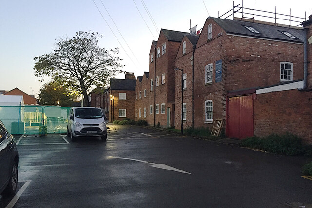
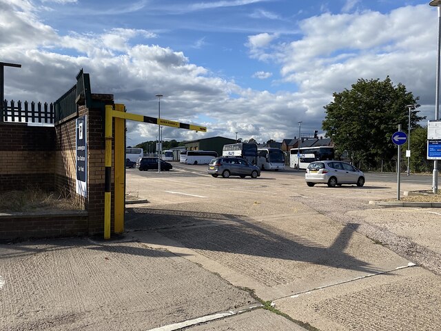
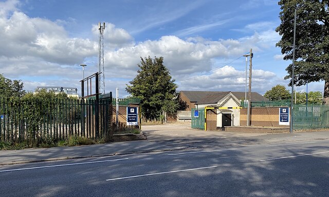
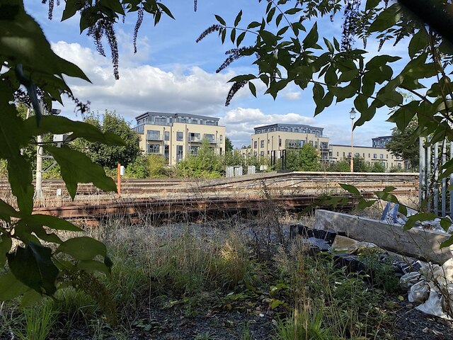
Whitnash Images

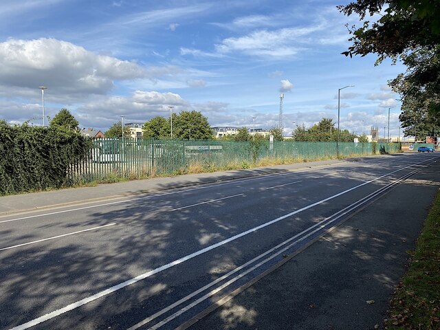
Images are sourced within 2km of 52.268842/-1.5285332 or Grid Reference SP3263. Thanks to Geograph Open Source API. All images are credited.

Top of Court Street car park and the rear of Clemens Street, Old Town, Leamington Getting dark around five o'clock on a late October afternoon. A Covid-19 test centre, left, remains open on its half of the car park.
Top of Court Street car park and the rear of Clemens Street, Old Town, Leamington
Getting dark around five o'clock on a late October afternoon. A Covid-19 test centre, left, remains open on its half of the car park.
Rail Replacement bus at Leamington Spa There were rail replacement buses coming and going at Leamington Spa station on this Sunday. Staff on duty did not know why. This bus was for Oxford. A southbound CrossCountry trainset from the north or west returned thither from platform 3 later, having terminated at Leamington.
Rail Replacement bus at Leamington Spa
There were rail replacement buses coming and going at Leamington Spa station on this Sunday. Staff on duty did not know why. This bus was for Oxford. A southbound CrossCountry trainset from the north or west returned thither from platform 3 later, having terminated at Leamington.
A corner of Leamington Spa station car park, Old Warwick Road The car park, operated by Chiltern Railways, has extended west as land became available, in particular the site of a builders' merchant. The far end looks like a quiet corner for off-duty rail replacement buses.
A corner of Leamington Spa station car park, Old Warwick Road
The car park, operated by Chiltern Railways, has extended west as land became available, in particular the site of a builders' merchant. The far end looks like a quiet corner for off-duty rail replacement buses.
Western entrance, Leamington Spa station car park, Old Warwick Road
Flats in De Normanville Avenue seen from Leamington Spa station car park Framed by Buddleia, the residential development on the north side of the station has changed the character of the area after decades of temporary and other uses on former railway land.
Flats in De Normanville Avenue seen from Leamington Spa station car park
Framed by Buddleia, the residential development on the north side of the station has changed the character of the area after decades of temporary and other uses on former railway land.
Maximum headroom, Leamington Spa station car park, Old Warwick Road Looking from the western extension towards the earlier parking just west of the station forecourt. Note the tortuous route that pedestrians are expected to take.
Maximum headroom, Leamington Spa station car park, Old Warwick Road
Looking from the western extension towards the earlier parking just west of the station forecourt. Note the tortuous route that pedestrians are expected to take.
Turn for Morrisons and Costa, Old Warwick Road, Royal Leamington Spa In the distance, on the other side of the railway, are new houses on De Normanville Avenue.
Turn for Morrisons and Costa, Old Warwick Road, Royal Leamington Spa
In the distance, on the other side of the railway, are new houses on De Normanville Avenue.
Ramp between canal towpath and Old Warwick Road, Royal Leamington Spa Along the road on the left is the superstore: Morrisons.
Ramp between canal towpath and Old Warwick Road, Royal Leamington Spa
Along the road on the left is the superstore: Morrisons.
Jewson and end of cycle lane, Old Warwick Road, Royal Leamington Spa
Old Warwick Road passing Leamington Spa station car park extension In the car park, what look like off-duty all-white rail replacement buses. In the background, across the tracks, new flats on De Normanville Avenue.
Old Warwick Road passing Leamington Spa station car park extension
In the car park, what look like off-duty all-white rail replacement buses. In the background, across the tracks, new flats on De Normanville Avenue.
Rusting estate fencing, Old Warwick Road, Royal Leamington Spa Over the fence a bank drops down to the canal towpath.
Rusting estate fencing, Old Warwick Road, Royal Leamington Spa
Over the fence a bank drops down to the canal towpath.
Flats, De Normanville Avenue, seen from Leamington Spa station car park
Old Warwick Road by Leamington Spa station Ahead of the turn in to the original station car park (operated by Chiltern Railways) is an access to West Midlands Railways train crew facilities <a href="https://www.geograph.org.uk/photo/5303309">SP3165 : Single-storey building by Old Warwick Road west of Leamington Spa station</a>.
Old Warwick Road by Leamington Spa station
Ahead of the turn in to the original station car park (operated by Chiltern Railways) is an access to West Midlands Railways train crew facilities SP3165 : Single-storey building by Old Warwick Road west of Leamington Spa station.
Subway, Leamington Spa station
Murals, Leamington Spa station subway Some fourteen murals depict aspects of Leamington. The nearest is headed 'Naval Camouflage', with a caption 'The Civil Defence Camouflage Unit was based in Leamington' [in World War II]. The other mural shows a bowls match in Victoria Park, on one of its five greens.
Murals, Leamington Spa station subway
Some fourteen murals depict aspects of Leamington. The nearest is headed 'Naval Camouflage', with a caption 'The Civil Defence Camouflage Unit was based in Leamington' [in World War II]. The other mural shows a bowls match in Victoria Park, on one of its five greens.
Exit from subway to Sayer Close, Leamington Spa station
Footpath to Lower Avenue from Sayer Close, Royal Leamington Spa Before Sayer Close was developed this area north of the station was landlocked.
Footpath to Lower Avenue from Sayer Close, Royal Leamington Spa
Before Sayer Close was developed this area north of the station was landlocked.
West on Sayer Close, Royal Leamington Spa The view to the south (right) from these flats is of Leamington Spa station. Before Sayer Close was developed this was the route of a footpath through open space to the station subway: <a href="https://www.geograph.org.uk/photo/5148168">SP3165 : Footpaths, landlocked land and Severn Trent plant north of Leamington Spa station</a>.
West on Sayer Close, Royal Leamington Spa
The view to the south (right) from these flats is of Leamington Spa station. Before Sayer Close was developed this was the route of a footpath through open space to the station subway: SP3165 : Footpaths, landlocked land and Severn Trent plant north of Leamington Spa station.
Show me another place!

Whitnash is located at Grid Ref: SP3263 (Lat: 52.268842, Lng: -1.5285332)

Administrative County: Warwickshire

District: Warwick

Police Authority: Warwickshire

What 3 Words

///barks.lovely.wasp. Near Royal Leamington Spa, Warwickshire

Nearby Locations

Whitnash Whitnash

Related Wikis

Whitnash

Whitnash is a town and civil parish located southeast of, and contiguous with Leamington Spa and Warwick in Warwickshire, England. In 2001, it had a population...

Leamington Spa Hospital

Leamington Spa Hospital is located on Heathcote Lane in Warwick, Warwickshire, in England. Originally an isolation hospital, it is now a hospital run by...

St John the Baptist's Church, Leamington Spa

St John the Baptist's Church is an Anglo-Catholic parish church in Leamington Spa, England. The historic structure is Grade II* listed. == History == The...

Campion School, Leamington Spa

Campion School was formed in 1977 when it moved to the present site on Sydenham Drive in Leamington Spa, Warwickshire, England. In 2006, Campion was awarded...

Nearby Amenities

Located within 500m of 52.268842,-1.5285332
Bus: yes
Public Transport: stop_position
Lat/Long: 52.2672332/-1.5345768
Whitnash
Check Date: 2024-03-24
Place: suburb
Population: 10,000
Wikidata: Q2368471
Lat/Long: 52.2660705/-1.5257365
Crossing
Bicycle: no
Crossing: marked
Crossing Island: no
Crossing Markings: zebra;dots
Crossing Ref: zebra
Flashing Lights: always
Kerb: lowered
Tactile Paving: yes
Lat/Long: 52.2701861/-1.5217628
Direction: both
Traffic Calming: table
Lat/Long: 52.2692079/-1.5222132
Plough & Harrow
Bus: yes
Check Date: 2024-03-24
Public Transport: stop_position
Traffic Sign: GB:970
Lat/Long: 52.2676559/-1.5248035
Crossing
Bicycle: no
Crossing: marked
Crossing Island: no
Crossing Markings: zebra;dots
Crossing Ref: zebra
Flashing Lights: always
Kerb: lowered
Tactile Paving: yes
Lat/Long: 52.2685623/-1.5278355
Franklin Road
Bench: no
Bus: yes
Naptan AtcoCode: 4200F078200
Naptan Bearing: W
Naptan CommonName: Franklin Road
Naptan Indicator: Adj
Naptan NaptanCode: wardapjd
Naptan PlusbusZoneRef: LMNGTNS
Naptan Street: Heathcote Road
Physically Present: no
Route Ref: none
Shelter: no
Source: naptan_import
Tactile Paving: no
Lat/Long: 52.2686457/-1.5302082
Bus Stop
Plough & Harrow
Bench: yes
Bin: yes
Bus: yes
Check Date: 2024-03-24
Covered: no
Lit: yes
Naptan AtcoCode: 4200F078500
Naptan Bearing: E
Naptan CommonName: Plough & Harrow
Naptan Indicator: Opp
Naptan NaptanCode: wardapjm
Naptan PlusbusZoneRef: LMNGTNS
Naptan Street: Whitnash Road
Passenger Information Display: no
Physically Present: yes
Public Transport: platform
Route Ref: 1
Shelter: yes
Source: naptan_import
Tactile Paving: yes
Lat/Long: 52.2677085/-1.5247593
Bus Stop
Plough & Harrow
Bench: no
Bin: yes
Bus: yes
Check Date: 2024-03-24
Covered: no
Lit: yes
Naptan AtcoCode: 4200F078501
Naptan Bearing: W
Naptan CommonName: Plough & Harrow
Naptan Indicator: Adj
Naptan NaptanCode: wardapjp
Naptan PlusbusZoneRef: LMNGTNS
Naptan Street: Whitnash Road
Passenger Information Display: no
Physically Present: yes
Public Transport: platform
Route Ref: 1
Shelter: no
Source: naptan_import
Tactile Paving: yes
Lat/Long: 52.2675128/-1.5237439
Allibone Close
Bus: yes
Naptan AtcoCode: 4200F125850
Naptan Bearing: S
Naptan BusStopType: CUS
Naptan CommonName: Allibone Close
Naptan Indicator: Adj
Naptan NaptanCode: warajwdp
Naptan PlusbusZoneRef: LMNGTNS
Naptan Street: Dobson Lane
Physically Present: no
Route Ref: none
Shelter: no
Source: naptan_import
Lat/Long: 52.2709748/-1.5299363
Bus Stop
Heathcote Crossroads
Bench: no
Bin: no
Bus: yes
Covered: no
Lit: yes
Naptan AtcoCode: 4200F142202
Naptan Bearing: W
Naptan CommonName: Heathcote Crossroads
Naptan Indicator: Adj
Naptan Landmark: Heathcote Crossroads
Naptan NaptanCode: waragpmg
Naptan PlusbusZoneRef: LMNGTNS
Naptan Street: Tachbrook Road
Passenger Information Display: no
Physically Present: yes
Public Transport: platform
Route Ref: none
Shelter: no
Source: naptan_import
Tactile Paving: no
Lat/Long: 52.2683395/-1.5329535
Lammas Croft
Bench: no
Bus: yes
Naptan AtcoCode: 4200F142401
Naptan Bearing: NW
Naptan CommonName: Lammas Croft
Naptan Indicator: Adj
Naptan NaptanCode: waragpmj
Naptan PlusbusZoneRef: LMNGTNS
Naptan Street: Heathcote Road
Physically Present: no
Route Ref: none
Shelter: no
Source: naptan_import
Tactile Paving: no
Lat/Long: 52.2683969/-1.5274757
Bus Stop
Whitnash Club
Bench: no
Bin: yes
Bus: yes
Covered: no
Lit: yes
Naptan AtcoCode: 4200F142402
Naptan Bearing: SE
Naptan CommonName: Whitnash Club
Naptan Indicator: Adj
Naptan NaptanCode: waragpmp
Naptan PlusbusZoneRef: LMNGTNS
Naptan Street: Heathcote Road
Passenger Information Display: no
Physically Present: yes
Public Transport: platform
Route Ref: 1
Shelter: no
Source: naptan_import
Tactile Paving: yes
Lat/Long: 52.2684378/-1.5272328
Bus Stop
Avon Road
Bench: no
Bin: no
Bus: yes
Check Date: 2024-03-24
Covered: no
Lit: yes
Naptan AtcoCode: 4200F142502
Naptan Bearing: W
Naptan CommonName: Avon Road
Naptan Indicator: Adj
Naptan NaptanCode: waragpmt
Naptan PlusbusZoneRef: LMNGTNS
Naptan Street: Heathcote Road
Passenger Information Display: no
Physically Present: yes
Public Transport: platform
Route Ref: none
Shelter: no
Source: naptan_import
Tactile Paving: no
Lat/Long: 52.2676656/-1.5252444
Bus Stop
Medley Grove
Bench: no
Bin: no
Bus: yes
Covered: no
Lit: yes
Naptan AtcoCode: 4200F143201
Naptan Bearing: N
Naptan CommonName: Medley Grove
Naptan Crossing: Medley Grove
Naptan Indicator: Adj
Naptan NaptanCode: waragptp
Naptan PlusbusZoneRef: LMNGTNS
Naptan Street: Tachbrook Road
Passenger Information Display: no
Physically Present: yes
Public Transport: platform
Shelter: yes
Source: naptan_import
Tactile Paving: no
Lat/Long: 52.2672391/-1.534659
Bus Stop
Heathcote Road
Bench: no
Bin: no
Bus: yes
Covered: no
Lit: yes
Naptan AtcoCode: 4200F143202
Naptan Bearing: S
Naptan CommonName: Heathcote Road
Naptan Indicator: Adj
Naptan NaptanCode: waragptw
Naptan PlusbusZoneRef: LMNGTNS
Naptan Street: Tachbrook Road
Naptan Verified: no
Passenger Information Display: no
Public Transport: platform
Shelter: no
Source: naptan_import
Tactile Paving: no
Lat/Long: 52.2673463/-1.5344387
Harrow Road
Bench: no
Bus: yes
Check Date: 2024-03-24
Naptan AtcoCode: 4200F143301
Naptan Bearing: N
Naptan CommonName: Harrow Road
Naptan Indicator: Opp
Naptan NaptanCode: waragpwa
Naptan PlusbusZoneRef: LMNGTNS
Naptan Street: Coppice Road
Physically Present: no
Route Ref: none
Shelter: no
Source: naptan_import
Tactile Paving: no
Lat/Long: 52.2663667/-1.5247464
Bus Stop
Washbourne Road
Bench: no
Bin: no
Bus: yes
Covered: no
Lit: yes
Naptan AtcoCode: 4200F143901
Naptan Bearing: E
Naptan CommonName: Washbourne Road
Naptan Crossing: Washbourne Road
Naptan Indicator: Opp
Naptan NaptanCode: waradwpg
Naptan PlusbusZoneRef: LMNGTNS
Naptan Street: Moorhill Road
Passenger Information Display: no
Physically Present: yes
Public Transport: platform
Route Ref: 1
Shelter: no
Source: naptan_import
Tactile Paving: yes
Lat/Long: 52.2647793/-1.5305457
Washbourne Road
Bench: no
Bus: yes
Naptan AtcoCode: 4200F143902
Naptan Bearing: W
Naptan CommonName: Washbourne Road
Naptan Crossing: Washbourne Road
Naptan Indicator: Adj
Naptan NaptanCode: waradwpj
Naptan PlusbusZoneRef: LMNGTNS
Naptan Street: Moorhill Road
Physically Present: no
Route Ref: none
Shelter: no
Source: naptan_import
Tactile Paving: no
Lat/Long: 52.2646934/-1.5306353
Gleave Road
Bench: no
Bus: yes
Naptan AtcoCode: 4200F144001
Naptan Bearing: S
Naptan CommonName: Gleave Road
Naptan Crossing: Gleave Road
Naptan Indicator: Opp
Naptan NaptanCode: waradwpm
Naptan PlusbusZoneRef: LMNGTNS
Naptan Street: Franklin Road
Physically Present: no
Route Ref: none
Shelter: no
Source: naptan_import
Tactile Paving: no
Lat/Long: 52.2667069/-1.5290547
Bus Stop
Murcott Road
Bench: no
Bin: yes
Bus: yes
Covered: no
Lit: yes
Naptan AtcoCode: 4200F144002
Naptan Bearing: N
Naptan CommonName: Murcott Road
Naptan Crossing: Murcott Road
Naptan Indicator: Opp
Naptan NaptanCode: waradwpt
Naptan PlusbusZoneRef: LMNGTNS
Naptan Street: Franklin Road
Passenger Information Display: no
Physically Present: yes
Public Transport: platform
Route Ref: 1
Shelter: no
Source: naptan_import
Tactile Paving: yes
Lat/Long: 52.2662204/-1.5289941
Library
Bench: no
Bus: yes
Naptan AtcoCode: 4200F144102
Naptan Bearing: S
Naptan CommonName: Library
Naptan Indicator: Adj
Naptan Landmark: Library
Naptan NaptanCode: waradwpw
Naptan PlusbusZoneRef: LMNGTNS
Naptan Street: Franklin Road
Physically Present: no
Route Ref: none
Shelter: no
Source: naptan_import
Tactile Paving: no
Lat/Long: 52.2681416/-1.5295556
Bus Stop
Heathcote Crossroads
Bench: no
Bin: yes
Bus: yes
Covered: no
Lit: yes
Naptan AtcoCode: 4200F202501
Naptan Bearing: E
Naptan CommonName: Heathcote Crossroads
Naptan Indicator: Adj
Naptan Landmark: Heathcote Crossroads
Naptan NaptanCode: waradpjm
Naptan PlusbusZoneRef: LMNGTNS
Naptan Street: Heathcote Road
Passenger Information Display: no
Physically Present: yes
Public Transport: platform
Route Ref: none
Shelter: no
Source: naptan_import
Tactile Paving: no
Lat/Long: 52.2684313/-1.5335985
Bus Stop
Harrow Road
Bench: no
Bin: no
Bus: yes
Check Date: 2024-03-24
Covered: no
Lit: yes
Naptan AtcoCode: 4200F203001
Naptan Bearing: S
Naptan CommonName: Harrow Road
Naptan Indicator: Adj
Naptan NaptanCode: waradpjp
Naptan PlusbusZoneRef: LMNGTNS
Naptan Street: Coppice Road
Passenger Information Display: no
Physically Present: yes
Public Transport: platform
Route Ref: 1
Shelter: no
Source: naptan_import
Tactile Paving: yes
Lat/Long: 52.2662566/-1.5246055
Bus Stop
Landor Road
Bench: yes
Bin: no
Bus: yes
Covered: no
Lit: yes
Naptan AtcoCode: 4200F203701
Naptan Bearing: N
Naptan CommonName: Landor Road
Naptan Indicator: Adj
Naptan NaptanCode: waradpjw
Naptan PlusbusZoneRef: LMNGTNS
Naptan Street: Franklin Road
Passenger Information Display: no
Physically Present: yes
Public Transport: platform
Route Ref: 1
Shelter: yes
Source: naptan_import
Tactile Paving: yes
Lat/Long: 52.2681718/-1.5297125
Bus Stop
Montgomery Road
Bench: no
Bin: no
Bus: yes
Covered: no
Lit: yes
Naptan AtcoCode: 4200F204101
Naptan Bearing: S
Naptan CommonName: Montgomery Road
Naptan Crossing: Montgomery Road
Naptan Indicator: Opp
Naptan NaptanCode: waradpmg
Naptan PlusbusZoneRef: LMNGTNS
Naptan Street: Tachbrook Road
Passenger Information Display: no
Physically Present: no
Public Transport: platform
Shelter: no
Source: naptan_import
Tactile Paving: no
Lat/Long: 52.269429/-1.5339021
Bus Stop
Halls Close
Bench: yes
Bin: no
Bus: yes
Check Date: 2024-03-24
Covered: no
Lit: yes
Naptan AtcoCode: 4200F205601
Naptan Bearing: N
Naptan CommonName: Halls Close
Naptan Indicator: Opp
Naptan NaptanCode: warajtdg
Naptan PlusbusZoneRef: LMNGTNS
Naptan Street: Whitnash Road
Passenger Information Display: no
Physically Present: yes
Public Transport: platform
Route Ref: 1
Shelter: yes
Source: naptan_import
Tactile Paving: yes
Wheelchair: designated
Lat/Long: 52.2686535/-1.5228228
Bus Stop
Montgomery Road
Bench: no
Bin: no
Bus: yes
Covered: no
Lit: yes
Naptan AtcoCode: 4200F227902
Naptan Bearing: N
Naptan CommonName: Montgomery Road
Naptan Crossing: Montgomery Road
Naptan Indicator: Opp
Naptan NaptanCode: waraptam
Naptan PlusbusZoneRef: LMNGTNS
Naptan Street: Tachbrook Road
Passenger Information Display: no
Physically Present: yes
Public Transport: platform
Shelter: no
Source: naptan_import
Tactile Paving: no
Lat/Long: 52.2696293/-1.5340775
Direction: both
Traffic Calming: table
Lat/Long: 52.2683111/-1.5231355
Noexit: yes
Lat/Long: 52.270537/-1.5287433
Noexit: yes
Lat/Long: 52.27061/-1.529381
Turning Circle
Lat/Long: 52.2684817/-1.5247204
Barrier: kerb
Kerb: raised
Tactile Paving: no
Lat/Long: 52.2661678/-1.5229626
Barrier: kerb
Kerb: lowered
Tactile Paving: no
Lat/Long: 52.2668719/-1.5222823
Mini Roundabout
Direction: clockwise
Lat/Long: 52.2687122/-1.5298444
Direction: both
Traffic Calming: table
Lat/Long: 52.267748/-1.5255262
Kerb: no
Lat/Long: 52.2704792/-1.5329184
Crossing
Crossing: unmarked
Crossing Island: no
Crossing Markings: no
Kerb: lowered
Tactile Paving: yes
Lat/Long: 52.2725387/-1.5320604
Direction: forward
Traffic Sign: GB:816.1
Traffic Sign Direction: forward
Traffic Sign Forward: GB:816.1
Lat/Long: 52.2721212/-1.530476
Crossing
Crossing: unmarked
Crossing Island: no
Crossing Markings: no
Kerb: lowered
Tactile Paving: yes
Lat/Long: 52.2695402/-1.5327709
Crossing
Crossing: unmarked
Crossing Island: no
Crossing Markings: no
Direction: both
Tactile Paving: yes
Traffic Calming: table
Lat/Long: 52.2704126/-1.5312552
Direction: backward
Road Marking: GB:1062
Lat/Long: 52.2685541/-1.5281767
Direction: both
Traffic Calming: table
Lat/Long: 52.2686396/-1.5281199
One Stop
Addr City: Leamington Spa
Addr Housenumber: 76-78
Addr Postcode: CV31 2NF
Addr Street: Heathcote Road
Brand: One Stop
Brand Wikidata: Q65954217
Check Date: 2022-11-09
Check Date Opening Hours: 2022-11-16
Contact Website: https://www.onestop.co.uk/store/?store=2ecf093e-0144-49c6-85e2-d198bc8113a1
Fhrs Id: 242345
Opening Hours: Mo-Su 06:00-22:00
Payment Mastercard: yes
Payment Visa: yes
Shop: convenience
Wheelchair: yes
Lat/Long: 52.268827/-1.5280533
Barrier: cycle_barrier
Cycle Barrier: double
Cycle Barrier Installation: fixed
Material: metal
Lat/Long: 52.2715015/-1.5308594
Barrier: kerb
Kerb: lowered
Tactile Paving: no
Lat/Long: 52.2662508/-1.5228416
Direction: backward
Traffic Sign: GB:951
Traffic Sign Backward: GB:951
Traffic Sign Direction: backward
Lat/Long: 52.2669977/-1.5327229
Plough & Harrow
Bus: yes
Check Date: 2024-03-24
Public Transport: stop_position
Traffic Sign: GB:970
Lat/Long: 52.2675679/-1.5237556
Direction: forward
Traffic Sign: GB:816.1
Traffic Sign Direction: forward
Traffic Sign Forward: GB:816.1
Lat/Long: 52.2698571/-1.5308798
Direction: forward
Traffic Sign: GB:816.1
Traffic Sign Direction: forward
Traffic Sign Forward: GB:816.1
Lat/Long: 52.2702493/-1.5289172
Give Way
Direction: backward
Road Marking: GB:1003A
Lat/Long: 52.2698356/-1.5307326
Give Way
Direction: backward
Road Marking: GB:1003A
Lat/Long: 52.270461/-1.5302832
Traffic Signals
Crossing Markings: no
Road Marking: GB:1001
Source: Warwicks CC Aerial Imagery 2013
Traffic Signals: signal
Traffic Signals Direction: backward
Lat/Long: 52.2683859/-1.5338467
Noexit: yes
Lat/Long: 52.2703338/-1.5321696
Crossing
Crossing: unmarked
Crossing Island: no
Crossing Markings: no
Kerb: lowered
Tactile Paving: no
Lat/Long: 52.2715021/-1.5306507
Direction: forward
Traffic Sign: GB:610
Traffic Sign Direction: forward
Traffic Sign Forward: GB:610
Lat/Long: 52.2714198/-1.5331197
Barrier: cycle_barrier
Cycle Barrier: double
Cycle Barrier Installation: fixed
Material: metal
Lat/Long: 52.2720846/-1.5331255
Crossing
Crossing: unmarked
Crossing Island: no
Crossing Markings: no
Kerb: lowered
Tactile Paving: yes
Lat/Long: 52.2721549/-1.5331759
Crossing
Crossing: unmarked
Crossing Markings: no
Kerb: no
Tactile Paving: no
Lat/Long: 52.2722288/-1.5322518
Crossing
Crossing: unmarked
Crossing Island: no
Crossing Markings: no
Kerb: flush
Tactile Paving: no
Lat/Long: 52.2703014/-1.533953
Crossing
Crossing: unmarked
Crossing Island: no
Crossing Markings: no
Kerb: lowered
Tactile Paving: yes
Lat/Long: 52.2711285/-1.5341242
Barrier: kerb
Kerb: lowered
Tactile Paving: no
Lat/Long: 52.2702317/-1.5339404
Barrier: kerb
Kerb: lowered
Tactile Paving: no
Lat/Long: 52.27038/-1.5339747
Noexit: yes
Lat/Long: 52.2718275/-1.5335426
Direction: both
Traffic Calming: hump
Lat/Long: 52.2658032/-1.5244884
Direction: both
Traffic Calming: hump
Lat/Long: 52.2663324/-1.5246843
Direction: both
Traffic Calming: hump
Lat/Long: 52.2653123/-1.5243146
Direction: forward
Maxspeed: 40 mph
Traffic Sign: maxspeed
Traffic Sign Direction: forward
Lat/Long: 52.2685758/-1.5357603
Traffic Calming: bump
Lat/Long: 52.2700837/-1.5355233
Traffic Calming: bump
Lat/Long: 52.2700836/-1.5354905
Give Way
Direction: forward
Lat/Long: 52.269819/-1.5351442
Noexit: yes
Lat/Long: 52.2692046/-1.5331521
Direction: both
Traffic Calming: hump
Lat/Long: 52.2730283/-1.5267023
Direction: both
Traffic Calming: hump
Lat/Long: 52.2720239/-1.5241689
Direction: forward
Traffic Sign: GB:957
Traffic Sign Direction: forward
Traffic Sign Forward: GB:957
Lat/Long: 52.2708947/-1.5344138
Crossing
Button Operated: yes
Crossing: traffic_signals
Crossing Island: yes
Crossing Markings: dots
Crossing Signals: yes
Crossing Ref: toucan
Kerb: lowered
Tactile Paving: yes
Traffic Signals Sound: yes
Traffic Signals Vibration: yes
Lat/Long: 52.270551/-1.5342094
Crossing
Bicycle: yes
Button Operated: yes
Crossing: traffic_signals
Crossing Island: no
Crossing Markings: dots
Crossing Signals: yes
Crossing Ref: toucan
Kerb: lowered
Tactile Paving: yes
Traffic Signals Sound: yes
Traffic Signals Vibration: yes
Lat/Long: 52.2685005/-1.53537
Direction: forward
Traffic Sign: GB:957
Traffic Sign 2: GB:956
Traffic Sign 2 Direction: backward
Traffic Sign Backward: GB:956
Traffic Sign Direction: forward
Traffic Sign Forward: GB:957
Lat/Long: 52.269848/-1.5341418
Barrier: kerb
Kerb: lowered
Tactile Paving: yes
Lat/Long: 52.2684657/-1.5353871
Barrier: kerb
Kerb: flush
Tactile Paving: yes
Lat/Long: 52.2670658/-1.5347553
Crossing
Crossing: unmarked
Crossing Island: no
Crossing Markings: no
Kerb: lowered
Tactile Paving: yes
Lat/Long: 52.2670035/-1.5347831
Barrier: kerb
Kerb: lowered
Tactile Paving: no
Lat/Long: 52.2671035/-1.5229436
Barrier: kerb
Kerb: lowered
Tactile Paving: no
Lat/Long: 52.2671702/-1.5231239
Barrier: kerb
Kerb: lowered
Tactile Paving: no
Lat/Long: 52.268824/-1.5212601
Door: hinged
Entrance: yes
Lat/Long: 52.2669096/-1.5248529
Barrier: kerb
Kerb: lowered
Tactile Paving: no
Lat/Long: 52.2662521/-1.5227876
Barrier: kerb
Kerb: lowered
Tactile Paving: no
Lat/Long: 52.2662486/-1.5229003
Barrier: kerb
Kerb: lowered
Tactile Paving: no
Lat/Long: 52.2667469/-1.5223009
Barrier: kerb
Kerb: lowered
Tactile Paving: no
Lat/Long: 52.2681035/-1.5224981
Give Way
Direction: 195
Road Marking: GB:1003A
Lat/Long: 52.2681352/-1.5224393
Barrier: kerb
Kerb: lowered
Tactile Paving: no
Lat/Long: 52.2680463/-1.5224358
Barrier: kerb
Kerb: raised
Tactile Paving: no
Lat/Long: 52.2690261/-1.5212384
Barrier: kerb
Kerb: raised
Tactile Paving: no
Lat/Long: 52.2690111/-1.5213386
Give Way
Direction: 115
Road Marking: GB:1003A
Lat/Long: 52.2692013/-1.5221621
Barrier: kerb
Kerb: lowered
Tactile Paving: no
Lat/Long: 52.2677923/-1.5214327
Give Way
Direction: 75
Road Marking: GB:1003A
Lat/Long: 52.2677204/-1.5214277
Barrier: kerb
Kerb: lowered
Tactile Paving: yes
Lat/Long: 52.268259/-1.5230602
Give Way
Direction: 110
Road Marking: GB:1003A
Lat/Long: 52.2683005/-1.5230865
Give Way
Direction: 70
Road Marking: GB:1003A
Lat/Long: 52.2659852/-1.5245182
Barrier: kerb
Kerb: lowered
Tactile Paving: no
Lat/Long: 52.2668761/-1.5232177
Barrier: kerb
Kerb: lowered
Tactile Paving: no
Lat/Long: 52.2669295/-1.5232533
Give Way
Direction: 75
Road Marking: GB:1003A
Lat/Long: 52.2662255/-1.5302748
Give Way
Direction: 255
Road Marking: GB:1003A
Lat/Long: 52.2663954/-1.5290347
Barrier: kerb
Kerb: raised
Tactile Paving: no
Lat/Long: 52.2663492/-1.5291945
Barrier: kerb
Kerb: lowered
Tactile Paving: no
Lat/Long: 52.2654276/-1.5253256
Give Way
Direction: 165
Road Marking: GB:1003A
Lat/Long: 52.2654526/-1.5254049
Barrier: kerb
Kerb: lowered
Tactile Paving: no
Lat/Long: 52.2654111/-1.5254748
Barrier: kerb
Kerb: lowered
Tactile Paving: no
Lat/Long: 52.2649103/-1.5291186
Barrier: kerb
Kerb: lowered
Tactile Paving: no
Lat/Long: 52.2649337/-1.5289531
Give Way
Direction: 165
Road Marking: GB:1003A
Lat/Long: 52.2649291/-1.5290448
Give Way
Direction: 75
Road Marking: GB:1003A
Lat/Long: 52.2671109/-1.5278294
Barrier: kerb
Kerb: lowered
Tactile Paving: no
Lat/Long: 52.2647221/-1.5304673
Barrier: kerb
Kerb: lowered
Tactile Paving: no
Lat/Long: 52.2647402/-1.530308
Give Way
Direction: 170
Road Marking: GB:1003A
Lat/Long: 52.2647408/-1.5303947
Barrier: kerb
Kerb: lowered
Tactile Paving: no
Lat/Long: 52.2651232/-1.5276123
Barrier: kerb
Kerb: lowered
Tactile Paving: no
Lat/Long: 52.2651026/-1.5277753
Give Way
Direction: 165
Road Marking: GB:1003A
Lat/Long: 52.2651215/-1.5276961
Barrier: kerb
Kerb: lowered
Tactile Paving: no
Lat/Long: 52.2668434/-1.5260087
Give Way
Direction: 195
Road Marking: GB:1003A
Lat/Long: 52.2677194/-1.5255408
Barrier: kerb
Kerb: lowered
Tactile Paving: no
Lat/Long: 52.2669588/-1.5258879
Barrier: kerb
Kerb: raised
Tactile Paving: no
Lat/Long: 52.269569/-1.528144
Barrier: kerb
Kerb: lowered
Tactile Paving: yes
Lat/Long: 52.2688864/-1.5284446
Give Way
Direction: 25
Road Marking: GB:1003A
Lat/Long: 52.2686806/-1.5281607
Barrier: kerb
Kerb: lowered
Tactile Paving: yes
Lat/Long: 52.2689007/-1.528542
Barrier: kerb
Kerb: lowered
Tactile Paving: no
Lat/Long: 52.2688025/-1.5290079
Barrier: kerb
Kerb: lowered
Tactile Paving: yes
Lat/Long: 52.2687079/-1.5282183
Barrier: kerb
Kerb: lowered
Tactile Paving: no
Lat/Long: 52.2695584/-1.528085
Barrier: kerb
Kerb: lowered
Tactile Paving: no
Lat/Long: 52.2688/-1.528884
Barrier: kerb
Kerb: lowered
Tactile Paving: no
Lat/Long: 52.268614/-1.5282372
Give Way
Direction: 200
Road Marking: GB:1003A
Lat/Long: 52.2686113/-1.5281393
Street Lamp
Lamp Mount: straight_mast
Lamp Type: led
Man Made: utility_pole
Material: steel
Operator: Warwickshire County Council
Ref: 2
Lat/Long: 52.2691135/-1.5283093
Post Office
Whitnash Post Office
Addr City: Leamington Spa
Addr Country: GB
Addr Housenumber: 88
Addr Postcode: CV31 2LY
Addr Street: Heathcote Road
Addr Village: Whitnash
Brand: Post Office
Brand Wikidata: Q1783168
Contact Website: https://www.postoffice.co.uk/branch-finder/4702468/whitnash
Fhrs Id: 242174
Opening Hours: Mo-Fr 08:30-17:30; Sa 08:30-14:00
Ref Pol Id: 15383
Wheelchair: no
Lat/Long: 52.2689506/-1.5288335
Crossing
Bicycle: no
Crossing: marked
Crossing Island: no
Crossing Markings: zebra;dots
Crossing Ref: zebra
Flashing Lights: always
Kerb: lowered
Tactile Paving: yes
Lat/Long: 52.2687354/-1.5294963
Barrier: kerb
Kerb: lowered
Tactile Paving: no
Lat/Long: 52.2670763/-1.5320969
Give Way
Direction: 255
Road Marking: GB:1003A
Lat/Long: 52.2670476/-1.5320548
Barrier: kerb
Kerb: lowered
Tactile Paving: no
Lat/Long: 52.2669774/-1.532717
Give Way
Direction: 70
Road Marking: GB:1003A
Lat/Long: 52.2656525/-1.5314571
Give Way
Direction: 165
Road Marking: GB:1003A
Lat/Long: 52.2677181/-1.5308659
Give Way
Direction: 350
Road Marking: GB:1003A
Lat/Long: 52.2661902/-1.5275368
Give Way
Direction: 80
Road Marking: GB:1003A
Lat/Long: 52.2676663/-1.5294096
Barrier: kerb
Kerb: lowered
Tactile Paving: no
Lat/Long: 52.2655533/-1.5244774
Give Way
Direction: 350
Road Marking: GB:1003A
Lat/Long: 52.2650518/-1.5285033
Barrier: kerb
Kerb: lowered
Tactile Paving: no
Lat/Long: 52.2656688/-1.5245137
Give Way
Direction: 255
Road Marking: GB:1003A
Lat/Long: 52.2656195/-1.5244582
Give Way
Direction: 140
Road Marking: GB:1003A
Lat/Long: 52.2665993/-1.5248028
Barrier: kerb
Kerb: raised
Tactile Paving: no
Lat/Long: 52.2665476/-1.5248051
Barrier: kerb
Kerb: raised
Tactile Paving: no
Lat/Long: 52.2665848/-1.5247372
Crossing
Crossing: unmarked
Crossing Markings: no
Kerb: no
Tactile Paving: no
Lat/Long: 52.267549/-1.5235623
Barrier: kerb
Kerb: raised
Tactile Paving: no
Lat/Long: 52.2660573/-1.528801
Barrier: kerb
Kerb: lowered
Tactile Paving: yes
Lat/Long: 52.2663313/-1.5257033
Barrier: kerb
Kerb: lowered
Tactile Paving: yes
Lat/Long: 52.2663446/-1.5256075
Barrier: kerb
Kerb: lowered
Tactile Paving: yes
Lat/Long: 52.2684569/-1.5231061
Barrier: kerb
Kerb: lowered
Tactile Paving: yes
Lat/Long: 52.2704969/-1.5329602
Crossing
Crossing: unmarked
Crossing Markings: no
Kerb: no
Tactile Paving: no
Lat/Long: 52.2684123/-1.5271601
Crossing
Crossing: unmarked
Crossing Markings: no
Kerb: no
Tactile Paving: no
Lat/Long: 52.2681662/-1.5264131
Direction: both
Traffic Calming: hump
Lat/Long: 52.2723873/-1.5249415
Direction: both
Traffic Calming: hump
Lat/Long: 52.2726994/-1.5258303
Barrier: kerb
Kerb: raised
Tactile Paving: no
Lat/Long: 52.2650728/-1.5284134
Noexit: yes
Lat/Long: 52.267158/-1.5269734
Noexit: yes
Lat/Long: 52.2673046/-1.5270323
Noexit: yes
Lat/Long: 52.2682481/-1.5282413
Crossing
Crossing: unmarked
Crossing Markings: no
Kerb: no
Tactile Paving: no
Lat/Long: 52.2684784/-1.53482
Entrance: main
Lat/Long: 52.269116/-1.5352209
Library
Whitnash Library
Addr City: Leamington Spa
Addr Housename: Acre Close
Addr Postcode: CV31 2ND
Addr Street: Acre Close
Opening Hours: Mo,Tu 10:30-17:00; We 13:30-17:00; Fr 10:30-16:00; Sa 10:30-13:30
Operator: Warwickshire County Council
Operator Type: government
Source: User
Wheelchair: yes
Lat/Long: 52.2695789/-1.5270392
Townhall
Whitnash Town Council
Addr City: Leamington Spa
Addr Housename: Whitnash Civic Centre & Library
Addr Postcode: CV31 2ND
Addr Street: Acre Close
Check Date Opening Hours: 2022-11-16
Opening Hours Signed: no
Townhall Type: town
Wheelchair: yes
Lat/Long: 52.2696168/-1.5270127
Cafe
Blue Wolf Coffee House
Addr City: Leamington Spa
Addr Housenumber: 84
Addr Postcode: CV31 2LY
Addr Street: Heathcote Road
Cuisine: coffee_shop
Lat/Long: 52.2689258/-1.5286501
Whitnash Sports & Social Club
Addr Postcode: CV31 2NF
Building: yes
Check Date: 2022-06-01
Contact Instagram: https://www.instagram.com/whitnashssc
Contact Twitter: https://twitter.com/whitnashssc
Fhrs Id: 241706
Leisure: sports_centre
Phone: +44 1926 426577
Sport: bowls;petanque
Website: http://www.whitnashssc.co.uk/
Lat/Long: 52.2689642/-1.5269045
Crossing
Crossing: unmarked
Crossing Island: no
Crossing Markings: no
Kerb: raised
Tactile Paving: no
Lat/Long: 52.2650622/-1.5285074
Crossing
Crossing: unmarked
Crossing Island: no
Crossing Markings: no
Kerb: raised
Tactile Paving: no
Lat/Long: 52.2660236/-1.5287956
Barrier: kerb
Kerb: lowered
Tactile Paving: yes
Lat/Long: 52.2686752/-1.5280854
Crossing
Crossing: unmarked
Crossing Markings: no
Kerb: lowered
Tactile Paving: yes
Lat/Long: 52.2686914/-1.5281533
Crossing
Crossing: unmarked
Crossing Markings: no
Kerb: lowered
Tactile Paving: no
Lat/Long: 52.268802/-1.5289378
Crossing
Crossing: unmarked
Crossing Markings: no
Kerb: yes
Tactile Paving: no
Lat/Long: 52.2690193/-1.521275
Crossing
Crossing: unmarked
Crossing Island: no
Crossing Markings: no
Kerb: lowered
Tactile Paving: yes
Lat/Long: 52.269219/-1.5222863
Barrier: kerb
Kerb: lowered
Tactile Paving: yes
Lat/Long: 52.2691774/-1.5223124
Barrier: kerb
Kerb: flush
Tactile Paving: yes
Lat/Long: 52.2685356/-1.5278552
Barrier: kerb
Kerb: lowered
Tactile Paving: no
Lat/Long: 52.2678899/-1.526127
Barrier: kerb
Kerb: lowered
Tactile Paving: no
Lat/Long: 52.2684074/-1.5271638
Barrier: kerb
Kerb: flush
Tactile Paving: yes
Lat/Long: 52.268589/-1.5278167
Barrier: kerb
Kerb: flush
Tactile Paving: yes
Lat/Long: 52.2687072/-1.5294916
Barrier: kerb
Kerb: raised
Tactile Paving: no
Lat/Long: 52.2667026/-1.5247275
Barrier: kerb
Kerb: lowered
Tactile Paving: no
Lat/Long: 52.2674233/-1.5241452
Barrier: kerb
Kerb: flush
Tactile Paving: yes
Lat/Long: 52.2686671/-1.5299071
Barrier: kerb
Kerb: lowered
Tactile Paving: yes
Lat/Long: 52.2683655/-1.5232115
Barrier: kerb
Kerb: raised
Tactile Paving: no
Lat/Long: 52.2691467/-1.5228995
Barrier: kerb
Kerb: raised
Tactile Paving: no
Lat/Long: 52.2659694/-1.5287868
Barrier: kerb
Kerb: lowered
Tactile Paving: yes
Lat/Long: 52.27019/-1.5218068
Fast Food
Heathcote Fish Bar
Addr City: Leamington Spa
Addr Housenumber: 86
Addr Postcode: CV31 2LY
Addr Street: Heathcote Road
Check Date: 2022-06-01
Check Date Opening Hours: 2023-06-14
Cuisine: fish_and_chips
Fhrs Id: 241350
Indoor Seating: no
Opening Hours: Mo-Sa 16:30-21:00, Tu-Sa 12:00-14:00
Outdoor Seating: no
Payment Credit Cards: no
Payment Debit Cards: no
Phone: +44 1926 435300
Takeaway: only
Wheelchair: no
Lat/Long: 52.2689274/-1.5287715
Veterinary
Avonvale Veterinary Centre
Addr Housenumber: 123
Addr Postcode: CV31 2LX
Addr Street: Heathcote Road
Check Date: 2023-01-18
Opening Hours: Mo-Fr 08:30-18:30; Sa 08:30-12:30
Phone: +44 1926 337790
Website: http://www.heathcotevets.co.uk/
Wheelchair: yes
Lat/Long: 52.2682618/-1.5333312
Post Box
Brand: Royal Mail
Brand Wikidata: Q638098
Brand Wikipedia: en:Royal Mail
Collection Times: Mo-Fr 17:15; Sa 12:30
Drive Through: no
Operator: Royal Mail
Operator Wikidata: Q638098
Post Box Mounting: brick_pillar
Post Box Type: wall
Ref: CV31 83
Royal Cypher: EIIR
Royal Cypher Wikidata: Q33102113
Source: survey
Lat/Long: 52.2683669/-1.5232474
Barrier: kerb
Kerb: lowered
Tactile Paving: no
Lat/Long: 52.2675559/-1.5235767
Barrier: kerb
Kerb: lowered
Tactile Paving: no
Lat/Long: 52.267737/-1.523356
Barrier: kerb
Kerb: lowered
Tactile Paving: yes
Lat/Long: 52.2694787/-1.5338574
Barrier: kerb
Kerb: lowered
Tactile Paving: no
Lat/Long: 52.26948/-1.5337909
Crossing
Crossing: unmarked
Crossing Markings: no
Kerb: no
Tactile Paving: no
Lat/Long: 52.2691595/-1.5309643
Barrier: kerb
Kerb: lowered
Tactile Paving: yes
Lat/Long: 52.2675095/-1.5241488
Barrier: kerb
Kerb: lowered
Tactile Paving: yes
Lat/Long: 52.2684406/-1.5232897
Post Box
Brand: Royal Mail
Brand Wikidata: Q638098
Brand Wikipedia: en:Royal Mail
Collection Times: Mo-Fr 17:15, Sa 12:15
Operator: Royal Mail
Operator Wikidata: Q638098
Post Box Type: pillar
Ref: CV31 199
Royal Cypher: EIIR
Royal Cypher Wikidata: Q33102113
Source: survey
Lat/Long: 52.2689175/-1.5288439
Barrier: kerb
Kerb: lowered
Tactile Paving: yes
Lat/Long: 52.2684335/-1.533953
Barrier: kerb
Kerb: lowered
Tactile Paving: yes
Lat/Long: 52.2705462/-1.5342763
Barrier: kerb
Kerb: lowered
Tactile Paving: yes
Lat/Long: 52.2705557/-1.5341416
Barrier: kerb
Kerb: lowered
Tactile Paving: yes
Lat/Long: 52.2685366/-1.5353529
Direction: forward
Traffic Sign: GB:816
Traffic Sign Direction: forward
Traffic Sign Forward: GB:816
Lat/Long: 52.2660401/-1.524296
Post Box
Brand: Royal Mail
Brand Wikidata: Q638098
Brand Wikipedia: en:Royal Mail
Collection Times: Mo-Fr 09:00, Sa 07:00
Operator: Royal Mail
Operator Wikidata: Q638098
Post Box Type: lamp
Ref: CV31 238D
Royal Cypher: EIIR
Royal Cypher Wikidata: Q33102113
Source: survey
Lat/Long: 52.2650503/-1.5286774
Post Box
Brand: Royal Mail
Brand Wikidata: Q638098
Brand Wikipedia: en:Royal Mail
Check Date: 2020-12-28
Collection Times: Mo-Fr 09:00, Sa 07:00
Operator: Royal Mail
Operator Wikidata: Q638098
Post Box Type: lamp
Ref: CV31 10D
Royal Cypher: EIIR
Royal Cypher Wikidata: Q33102113
Source: survey
Lat/Long: 52.268917/-1.531042
Crossing
Crossing: unmarked
Crossing Island: no
Crossing Markings: no
Kerb: lowered
Tactile Paving: yes
Lat/Long: 52.268412/-1.5231579
Ecozi
Addr Housename: Trident Park
Addr Street: Poseidon Way
Addr Unit: Unit 7
Building: industrial
Lat/Long: 52.2704418/-1.5353755
Emerald Group
Addr Housename: Trident Park
Addr Street: Poseidon Way
Addr Unit: Unit 8
Building: industrial
Lat/Long: 52.270372/-1.5353652
JCS Cochrane
Addr Housename: Trident Park
Addr Street: Poseidon Way
Addr Unit: Unit 9
Building: industrial
Lat/Long: 52.2703015/-1.5353494
Addr Housename: Trident Park
Addr Street: Poseidon Way
Addr Unit: Unit 10
Building: industrial
Lat/Long: 52.2702264/-1.5353386
Crossing
Crossing: unmarked
Crossing Island: no
Crossing Markings: no
Kerb: lowered
Tactile Paving: no
Lat/Long: 52.2649202/-1.5290417
Crossing
Crossing: unmarked
Crossing Island: no
Crossing Markings: no
Kerb: lowered
Tactile Paving: no
Lat/Long: 52.2651124/-1.5276925
Barrier: kerb
Kerb: raised
Tactile Paving: no
Lat/Long: 52.2650533/-1.5285705
Barrier: kerb
Kerb: lowered
Tactile Paving: yes
Lat/Long: 52.2658587/-1.5301279
Waste Basket
Colour: black
Material: metal
Operator: Warwick District Council
Waste: trash
Lat/Long: 52.2676435/-1.5215402
Barrier: kerb
Kerb: lowered
Tactile Paving: yes
Lat/Long: 52.2692245/-1.5220941
Give Way
Direction: 280
Road Marking: GB:1003A
Lat/Long: 52.2692152/-1.5222577
Pharmacy
Birk & Nagra
Addr City: Leamington Spa
Addr Housenumber: 90
Addr Postcode: CV31 2LY
Addr Street: Heathcote Road
Check Date Opening Hours: 2023-06-14
Dispensing: yes
Fhrs Id: 242152
Healthcare: pharmacy
Opening Hours: Mo-Sa 09:00-13:00, Mo-Fr 14:00-18:00
Source: survey
Wheelchair: no
Lat/Long: 52.2689383/-1.5289261
Dentist
Whitnash Dental Care
Addr City: Leamington Spa
Addr Housenumber: 80
Addr Postcode: CV31 2NF
Addr Street: Heathcote Road
Check Date: 2022-06-01
Healthcare: dentist
Opening Hours: Tu-Th 08:30-13:00; Tu-We 14:00-18:00; Mo 09:00-13:00; Fr 08:30-14:00; Mo,Th 14:00-18:30
Payment Mastercard: yes
Payment Visa: yes
Phone: +44 1926 886066
Wheelchair: no
Lat/Long: 52.2688652/-1.5281933
Give Way
Direction: 190
Road Marking: GB:1003A
Lat/Long: 52.2675359/-1.5240574
Give Way
Direction: 300
Road Marking: GB:1003A
Lat/Long: 52.2684022/-1.523127
Give Way
Direction: 265
Road Marking: GB:1003A
Lat/Long: 52.2684176/-1.5232679
Give Way
Direction: forward
Lat/Long: 52.2687083/-1.529976
Give Way
Direction: backward
Lat/Long: 52.2687217/-1.5297175
Give Way
Direction: 355
Road Marking: GB:1003A
Lat/Long: 52.2686811/-1.5308982
Give Way
Direction: 255
Road Marking: GB:1003A
Lat/Long: 52.2679232/-1.5296114
Give Way
Direction: 75
Road Marking: GB:1003A
Lat/Long: 52.2660191/-1.5288237
Give Way
Direction: 80
Road Marking: GB:1003A
Source: Warwicks CC Aerial Imagery 2013
Lat/Long: 52.2702927/-1.5340808
Give Way
Barrier: kerb
Direction: backward
Kerb: flush
Source: Warwicks CC Aerial Imagery 2013
Tactile Paving: no
Lat/Long: 52.270273/-1.5339473
Give Way
Barrier: kerb
Direction: forward
Kerb: flush
Source: Warwicks CC Aerial Imagery 2013
Tactile Paving: no
Lat/Long: 52.2703279/-1.5339588
Crossing
Button Operated: yes
Crossing: traffic_signals
Crossing Island: no
Crossing Markings: dots
Crossing Signals: yes
Crossing Ref: puffin
Kerb: lowered
Source: Warwicks CC Aerial Imagery 2013
Tactile Paving: yes
Traffic Signals Sound: yes
Traffic Signals Vibration: yes
Lat/Long: 52.2685501/-1.5341454
Crossing
Button Operated: yes
Crossing: traffic_signals
Crossing Island: no
Crossing Markings: dots
Crossing Signals: yes
Crossing Ref: puffin
Kerb: lowered
Source: Warwicks CC Aerial Imagery 2013
Tactile Paving: yes
Traffic Signals Sound: yes
Traffic Signals Vibration: yes
Lat/Long: 52.2683864/-1.5339603
Crossing
Button Operated: yes
Crossing: traffic_signals
Crossing Island: no
Crossing Markings: dots
Crossing Signals: yes
Crossing Ref: puffin
Kerb: lowered
Source: Warwicks CC Aerial Imagery 2013
Tactile Paving: yes
Traffic Signals Sound: yes
Traffic Signals Vibration: yes
Lat/Long: 52.2683859/-1.534436
Cycleway: asl
Direction: backward
Source: Warwicks CC Aerial Imagery 2013
Lat/Long: 52.2683866/-1.5339203
Cycleway: asl
Direction: backward
Source: Warwicks CC Aerial Imagery 2013
Lat/Long: 52.2685809/-1.5341396
Cycleway: asl
Direction: backward
Source: Warwicks CC Aerial Imagery 2013
Lat/Long: 52.2683855/-1.5345026
Cycleway: asl
Direction: forward
Source: Warwicks CC Aerial Imagery 2013
Lat/Long: 52.2681751/-1.5342439
Traffic Signals
Crossing Markings: no
Road Marking: GB:1001
Source: Warwicks CC Aerial Imagery 2013
Traffic Signals: signal
Traffic Signals Direction: backward
Lat/Long: 52.2686258/-1.5341321
Traffic Signals
Crossing Markings: no
Road Marking: GB:1001
Source: Warwicks CC Aerial Imagery 2013
Traffic Signals: signal
Traffic Signals Direction: forward
Lat/Long: 52.2681286/-1.5342576
Crossing
Button Operated: yes
Crossing: traffic_signals
Crossing Island: yes
Crossing Markings: dots
Crossing Signals: yes
Crossing Ref: puffin
Kerb: lowered
Source: Warwicks CC Aerial Imagery 2013
Tactile Paving: yes
Traffic Signals Sound: yes
Traffic Signals Vibration: yes
Lat/Long: 52.2681969/-1.5342369
Traffic Signals
Crossing Markings: no
Road Marking: GB:1001
Source: Warwicks CC Aerial Imagery 2013
Traffic Signals: signal
Traffic Signals Direction: backward
Lat/Long: 52.2683869/-1.534571
Give Way
Direction: forward
Road Marking: GB:1003A
Lat/Long: 52.2725188/-1.5253927
Give Way
Direction: backward
Road Marking: GB:1003A
Lat/Long: 52.2725594/-1.5253585
Generator Method: photovoltaic
Generator Output Electricity: yes
Generator Source: solar
Generator Type: solar_photovoltaic_panel
Location: roof
Power: generator
Lat/Long: 52.2690937/-1.5327056
Generator Method: photovoltaic
Generator Output Electricity: yes
Generator Source: solar
Generator Type: solar_photovoltaic_panel
Location: roof
Power: generator
Lat/Long: 52.2678565/-1.526392
Generator Method: photovoltaic
Generator Output Electricity: yes
Generator Source: solar
Generator Type: solar_photovoltaic_panel
Location: roof
Power: generator
Lat/Long: 52.2658296/-1.5242459
Generator Method: photovoltaic
Generator Output Electricity: yes
Generator Source: solar
Generator Type: solar_photovoltaic_panel
Location: roof
Power: generator
Lat/Long: 52.2659918/-1.5271874
Crossing
Crossing: unmarked
Crossing Island: no
Crossing Markings: no
Kerb: lowered
Tactile Paving: no
Lat/Long: 52.2654201/-1.5253932
Crossing
Crossing: unmarked
Crossing Island: no
Crossing Markings: no
Kerb: lowered
Tactile Paving: no
Lat/Long: 52.2656137/-1.5244964
Crossing
Crossing: unmarked
Crossing Island: no
Crossing Markings: no
Kerb: lowered
Tactile Paving: no
Lat/Long: 52.2659915/-1.5244891
Crossing
Crossing: unmarked
Crossing Island: no
Crossing Markings: no
Kerb: lowered
Tactile Paving: no
Lat/Long: 52.2665669/-1.5247699
Crossing
Crossing: unmarked
Crossing Island: no
Crossing Markings: no
Kerb: lowered
Tactile Paving: no
Lat/Long: 52.2651747/-1.5285478
Crossing
Crossing: unmarked
Crossing Island: no
Crossing Markings: no
Kerb: lowered
Tactile Paving: no
Lat/Long: 52.2661796/-1.5289173
Crossing
Crossing: unmarked
Crossing Island: no
Crossing Markings: no
Kerb: lowered
Tactile Paving: no
Lat/Long: 52.265875/-1.5288049
Crossing
Crossing: unmarked
Crossing Island: no
Crossing Markings: no
Kerb: raised
Tactile Paving: no
Lat/Long: 52.2663717/-1.5292012
Crossing
Crossing: unmarked
Crossing Island: no
Crossing Markings: no
Kerb: lowered
Tactile Paving: no
Lat/Long: 52.2656583/-1.5314248
Crossing
Crossing: unmarked
Crossing Markings: no
Kerb: no
Tactile Paving: no
Lat/Long: 52.2666449/-1.5304146
Crossing
Crossing: unmarked
Crossing Markings: no
Kerb: lowered
Tactile Paving: yes
Lat/Long: 52.2677949/-1.5342906
Crossing
Crossing: unmarked
Crossing Island: no
Crossing Markings: no
Kerb: lowered
Tactile Paving: no
Lat/Long: 52.2676967/-1.530858
Direction: backward
Hazard: bump
Traffic Sign: GB:557.1
Traffic Sign 2: GB:557.3
Traffic Sign 2 Arrow: left
Traffic Sign 2 Direction: backward
Traffic Sign 2 Distance: 750 yards
Traffic Sign 3: GB:557.3
Traffic Sign 3 Arrow: right
Traffic Sign 3 Direction: backward
Traffic Sign 3 Distance: 430 yards
Traffic Sign Backward: GB:557.1
Traffic Sign Direction: backward
Lat/Long: 52.2690833/-1.5216595
Street Lamp
Lamp Mount: straight_mast
Lamp Type: led
Operator: Warwickshire County Council
Ref: 1
Lat/Long: 52.268101/-1.5225164
Street Lamp
Lamp Mount: straight_mast
Lamp Type: led
Man Made: utility_pole
Material: steel
Operator: Warwickshire County Council
Ref: 2
Lat/Long: 52.2678281/-1.5225144
Street Lamp
Lamp Mount: straight_mast
Lamp Type: led
Man Made: utility_pole
Material: steel
Operator: Warwickshire County Council
Ref: 2
Lat/Long: 52.2667566/-1.5223306
Street Lamp
Lamp Mount: straight_mast
Lamp Type: led
Man Made: utility_pole
Material: steel
Operator: Warwickshire County Council
Ref: 3
Lat/Long: 52.267703/-1.5227022
Street Lamp
Lamp Mount: straight_mast
Lamp Type: led
Man Made: utility_pole
Material: steel
Operator: Warwickshire County Council
Ref: 4
Lat/Long: 52.2676242/-1.5224245
Crossing
Crossing: unmarked
Crossing Island: no
Crossing Markings: no
Kerb: lowered
Tactile Paving: yes
Lat/Long: 52.2684171/-1.5232841
Street Lamp
Lamp Mount: straight_mast
Lamp Type: led
Man Made: utility_pole
Material: steel
Operator: Warwickshire County Council
Ref: 1
Support: pole
Lat/Long: 52.268465/-1.5234646
Street Lamp
Lamp Mount: straight_mast
Lamp Type: led
Man Made: utility_pole
Material: steel
Operator: Warwickshire County Council
Ref: 2
Support: pole
Lat/Long: 52.2684942/-1.5239065
Street Lamp
Lamp Mount: straight_mast
Lamp Type: led
Man Made: utility_pole
Material: steel
Operator: Warwickshire County Council
Ref: 3
Support: pole
Lat/Long: 52.2684047/-1.5243544
Man Made: utility_pole
Material: wood
Operator: Openreach
Utility: telecom
Lat/Long: 52.2685109/-1.5249111
Man Made: utility_pole
Material: wood
Operator: Openreach
Utility: telecom
Lat/Long: 52.268426/-1.524512
Man Made: utility_pole
Material: wood
Operator: Openreach
Utility: telecom
Lat/Long: 52.2683756/-1.523301
Man Made: utility_pole
Material: wood
Operator: Openreach
Utility: telecom
Lat/Long: 52.2687071/-1.5232742
Man Made: utility_pole
Material: wood
Operator: Openreach
Utility: telecom
Lat/Long: 52.2693378/-1.523242
Man Made: utility_pole
Material: wood
Operator: Openreach
Utility: telecom
Lat/Long: 52.2694496/-1.5239829
Man Made: utility_pole
Material: wood
Operator: Openreach
Utility: telecom
Lat/Long: 52.269403/-1.5246908
Man Made: utility_pole
Material: wood
Operator: Openreach
Utility: telecom
Lat/Long: 52.2698635/-1.5247447
Man Made: utility_pole
Material: wood
Operator: Openreach
Utility: telecom
Lat/Long: 52.2706177/-1.5242779
Man Made: utility_pole
Material: wood
Operator: Openreach
Utility: telecom
Lat/Long: 52.2704437/-1.523342
Man Made: utility_pole
Material: wood
Operator: Openreach
Utility: telecom
Lat/Long: 52.2703179/-1.5230925
Man Made: utility_pole
Material: wood
Operator: Openreach
Utility: telecom
Lat/Long: 52.2700473/-1.5232658
Street Lamp
Lamp Mount: bent_mast
Lamp Type: led
Man Made: utility_pole
Material: steel
Ref: 18
Support: pole
Lat/Long: 52.2682965/-1.5232852
Street Lamp
Lamp Mount: bent_mast
Lamp Type: led
Man Made: utility_pole
Material: steel
Ref: 17
Support: pole
Lat/Long: 52.2685156/-1.5230582
Street Lamp
Lamp Mount: bent_mast
Lamp Type: led
Man Made: utility_pole
Material: steel
Ref: 16
Support: pole
Lat/Long: 52.2686577/-1.5228591
Street Lamp
Lamp Mount: bent_mast
Lamp Type: led
Man Made: utility_pole
Material: steel
Ref: 15
Support: pole
Lat/Long: 52.2688315/-1.5224672
Street Lamp
Lamp Mount: bent_mast
Lamp Type: led
Man Made: utility_pole
Material: steel
Ref: 14
Support: pole
Lat/Long: 52.2690552/-1.5222401
Street Lamp
Lamp Mount: straight_mast
Lamp Type: led
Man Made: utility_pole
Material: steel
Operator: Warwickshire County Council
Ref: 1
Support: pole
Lat/Long: 52.2687814/-1.5232011
Street Lamp
Lamp Mount: straight_mast
Lamp Type: led
Light Colour: white
Light Count: 1
Light Method: LED
Man Made: utility_pole
Material: steel
Operator: Warwickshire County Council
Ref: 7
Support: pole
Lat/Long: 52.2677109/-1.5215643
Street Lamp
Lamp Mount: bent_mast
Lamp Type: led
Light Colour: white
Light Count: 1
Light Method: LED
Man Made: utility_pole
Material: steel
Operator: Warwickshire County Council
Ref: 6
Support: pole
Lat/Long: 52.267891/-1.5215535
Street Lamp
Lamp Mount: bent_mast
Lamp Type: led
Light Colour: white
Light Count: 1
Light Method: LED
Man Made: utility_pole
Material: steel
Operator: Warwickshire County Council
Ref: 5
Support: pole
Lat/Long: 52.2680309/-1.521815
Street Lamp
Lamp Mount: bent_mast
Lamp Type: led
Light Colour: white
Light Count: 1
Light Method: LED
Man Made: utility_pole
Material: steel
Operator: Warwickshire County Council
Ref: 4
Support: pole
Lat/Long: 52.2681257/-1.5221322
Street Lamp
Lamp Mount: bent_mast
Lamp Type: led
Light Colour: white
Light Count: 1
Light Method: LED
Man Made: utility_pole
Material: steel
Operator: Warwickshire County Council
Ref: 2
Support: pole
Lat/Long: 52.2681836/-1.5227404
Street Lamp
Lamp Mount: bent_mast
Lamp Type: led
Light Colour: white
Light Count: 1
Light Method: LED
Man Made: utility_pole
Material: steel
Operator: Warwickshire County Council
Ref: 3
Support: pole
Lat/Long: 52.2681975/-1.5224299
Street Lamp
Lamp Mount: bent_mast
Lamp Type: led
Light Colour: white
Light Count: 1
Light Method: LED
Man Made: utility_pole
Material: steel
Operator: Warwickshire County Council
Ref: 1
Support: pole
Lat/Long: 52.2682345/-1.5230187
Man Made: utility_pole
Material: wood
Operator: Openreach
Utility: telecom
Lat/Long: 52.2677047/-1.5216109
Board Type: notice
Information: board
Operator: Whitnash Town Council
Tourism: information
Lat/Long: 52.2676822/-1.5215612
Street Lamp
Lamp Mount: straight_mast
Lamp Type: metal-halide
Man Made: utility_pole
Material: steel
Operator: Warwickshire County Council
Ref: 24
Lat/Long: 52.2690351/-1.5212003
Street Lamp
Lamp Mount: straight_mast
Lamp Type: led
Man Made: utility_pole
Material: steel
Operator: Warwickshire County Council
Ref: 26
Lat/Long: 52.2690451/-1.5216555
Street Lamp
Lamp Mount: straight_mast
Lamp Type: led
Man Made: utility_pole
Material: steel
Operator: Warwickshire County Council
Ref: 27
Lat/Long: 52.2691347/-1.5220572
Give Way
Direction: forward
Lat/Long: 52.2686676/-1.5298285
Give Way
Direction: backward
Road Marking: GB:1003A
Lat/Long: 52.2688811/-1.5285076
Give Way
Direction: backward
Road Marking: GB:1003A
Lat/Long: 52.2711273/-1.5299062
Give Way
Direction: backward
Road Marking: GB:1003A
Lat/Long: 52.2700093/-1.5314141
Give Way
Direction: backward
Road Marking: GB:1003A
Lat/Long: 52.2698046/-1.5327661
Waste Basket
Operator: Warwick District Council
Waste: trash
Lat/Long: 52.2689162/-1.5288183
Street Lamp
Lamp Mount: straight_mast
Lamp Type: led
Man Made: utility_pole
Material: steel
Operator: Warwickshire County Council
Ref: 2
Support: pole
Lat/Long: 52.2691631/-1.5229413
Street Lamp
Lamp Mount: straight_mast
Lamp Type: led
Man Made: utility_pole
Material: steel
Operator: Warwickshire County Council
Ref: 1
Support: pole
Lat/Long: 52.2694401/-1.5234329
Street Lamp
Lamp Mount: straight_mast
Lamp Type: led
Man Made: utility_pole
Material: steel
Operator: Warwickshire County Council
Ref: 2
Support: pole
Lat/Long: 52.2694992/-1.5240866
Street Lamp
Lamp Mount: straight_mast
Lamp Type: led
Man Made: utility_pole
Material: steel
Operator: Warwickshire County Council
Ref: 3
Support: pole
Lat/Long: 52.2694631/-1.5247894
Street Lamp
Lamp Mount: straight_mast
Lamp Type: led
Man Made: utility_pole
Material: steel
Operator: Warwickshire County Council
Ref: 5
Support: pole
Lat/Long: 52.2701533/-1.5246714
Street Lamp
Lamp Mount: straight_mast
Lamp Type: led
Man Made: utility_pole
Material: steel
Operator: Warwickshire County Council
Ref: 6
Support: pole
Lat/Long: 52.2705858/-1.5244937
Street Lamp
Lamp Mount: straight_mast
Lamp Type: led
Man Made: utility_pole
Material: steel
Operator: Warwickshire County Council
Ref: 7
Support: pole
Lat/Long: 52.2709251/-1.5243166
Street Lamp
Lamp Mount: straight_mast
Lamp Type: led
Man Made: utility_pole
Material: steel
Operator: Warwickshire County Council
Ref: 8
Support: pole
Lat/Long: 52.2704572/-1.5238481
Street Lamp
Lamp Mount: straight_mast
Lamp Type: led
Man Made: utility_pole
Material: steel
Operator: Warwickshire County Council
Ref: 9
Support: pole
Lat/Long: 52.2704247/-1.5231907
Street Lamp
Lamp Mount: straight_mast
Lamp Type: led
Man Made: utility_pole
Material: steel
Operator: Warwickshire County Council
Ref: 10
Support: pole
Lat/Long: 52.2699493/-1.5231951
Street Lamp
Lamp Mount: bent_mast
Lamp Type: led
Man Made: utility_pole
Material: steel
Ref: 13
Support: pole
Lat/Long: 52.2693252/-1.5220445
Street Lamp
Lamp Mount: bent_mast
Lamp Type: led
Man Made: utility_pole
Material: steel
Ref: 12
Support: pole
Lat/Long: 52.2696322/-1.5220445
Street Lamp
Lamp Mount: straight_mast
Lamp Type: led
Man Made: utility_pole
Material: steel
Support: pole
Lat/Long: 52.2701697/-1.5218252
Street Lamp
Lamp Mount: straight_mast
Lamp Type: led
Man Made: utility_pole
Material: steel
Support: pole
Lat/Long: 52.2702091/-1.5217005
Street Lamp
Lamp Mount: bent_mast
Lamp Type: led
Man Made: utility_pole
Material: steel
Ref: 10
Support: pole
Lat/Long: 52.2701615/-1.5216964
Street Lamp
Lamp Mount: bent_mast
Lamp Type: led
Man Made: utility_pole
Material: steel
Ref: 9
Lat/Long: 52.2703347/-1.5216287
Street Lamp
Lamp Mount: bent_mast
Lamp Type: led
Man Made: utility_pole
Material: steel
Ref: 8
Support: pole
Lat/Long: 52.2705005/-1.5218104
Street Lamp
Lamp Mount: straight_mast
Lamp Type: high_pressure_sodium
Man Made: utility_pole
Material: steel
Operator: Warwickshire County Council
Ref: 2
Lat/Long: 52.2682162/-1.5283019
Street Lamp
Lamp Mount: straight_mast
Lamp Type: led
Man Made: utility_pole
Material: steel
Operator: Warwickshire County Council
Ref: 1
Lat/Long: 52.2683707/-1.528368
Street Lamp
Lamp Mount: bent_mast
Lamp Type: led
Man Made: utility_pole
Material: steel
Ref: 14
Lat/Long: 52.2686559/-1.527996
Street Lamp
Direction: 20;200
Lamp Mount: bent_mast
Lamp Type: led
Light Colour: white
Light Count: 2
Light Lit: dusk-dawn
Light Method: LED
Ref: 15
Support: pole
Lat/Long: 52.2687398/-1.5283872
Street Lamp
Direction: 10;190
Lamp Mount: bent_mast
Lamp Type: led
Light Colour: white
Light Count: 2
Light Lit: dusk-dawn
Light Method: LED
Ref: 16
Support: pole
Lat/Long: 52.2687844/-1.5287369
Street Lamp
Lamp Mount: straight_mast
Lamp Type: led
Man Made: utility_pole
Material: steel
Operator: Warwickshire County Council
Ref: 1
Lat/Long: 52.2690048/-1.5283863
Street Lamp
Lamp Mount: straight_mast
Lamp Type: led
Man Made: utility_pole
Material: steel
Operator: Warwickshire County Council
Ref: 3
Lat/Long: 52.2693205/-1.5281947
Street Lamp
Lamp Mount: straight_mast
Lamp Type: led
Man Made: utility_pole
Material: steel
Operator: Warwickshire County Council
Ref: 4
Lat/Long: 52.2695522/-1.5281865
Street Lamp
Lamp Mount: straight_mast
Lamp Type: led
Man Made: utility_pole
Material: steel
Ref: 1
Lat/Long: 52.2676324/-1.5255351
Street Lamp
Lamp Mount: straight_mast
Lamp Type: led
Man Made: utility_pole
Material: steel
Ref: 2
Lat/Long: 52.2673198/-1.5258059
Street Lamp
Lamp Mount: straight_mast
Lamp Type: led
Man Made: utility_pole
Material: steel
Ref: 3
Lat/Long: 52.2670255/-1.5258392
Street Lamp
Lamp Mount: straight_mast
Lamp Type: high_pressure_sodium
Lat/Long: 52.2699154/-1.5279884
Street Lamp
Lamp Mount: bent_mast
Lamp Type: high_pressure_sodium
Lat/Long: 52.2701066/-1.5279706
Street Lamp
Lamp Mount: straight_mast
Lamp Type: high_pressure_sodium
Lat/Long: 52.270287/-1.5279238
Street Lamp
Lamp Mount: bent_mast
Lat/Long: 52.2704714/-1.5278786
Street Lamp
Lamp Mount: straight_mast
Lamp Type: electric
Lat/Long: 52.2706493/-1.5278384
Street Lamp
Lamp Mount: bent_mast
Lamp Type: led
Man Made: utility_pole
Material: steel
Ref: 19
Support: pole
Lat/Long: 52.2680833/-1.5233426
Street Lamp
Lamp Mount: bent_mast
Lamp Type: led
Man Made: utility_pole
Material: steel
Ref: 20
Support: pole
Lat/Long: 52.2679523/-1.5231904
Street Lamp
Lamp Mount: bent_mast
Lamp Type: led
Light Colour: white
Light Count: 1
Light Method: LED
Man Made: utility_pole
Material: steel
Ref: 21
Support: pole
Lat/Long: 52.2677692/-1.5233019
Street Lamp
Lamp Mount: bent_mast
Lamp Type: led
Man Made: utility_pole
Material: steel
Ref: 22
Support: pole
Lat/Long: 52.2676036/-1.5234497
Street Lamp
Lamp Mount: bent_mast
Lamp Type: led
Man Made: utility_pole
Material: steel
Ref: 1
Lat/Long: 52.2674953/-1.523706
Waste Basket
Operator: Warwick District Council
Waste: cigarettes;trash;dog_excrement
Lat/Long: 52.2674983/-1.5237111
Waste Basket
Colour: black
Operator: Warwick District Council
Waste: trash
Lat/Long: 52.2675274/-1.5243129
Street Lamp
Lamp Mount: bent_mast
Lamp Type: led
Man Made: utility_pole
Material: steel
Ref: 3
Lat/Long: 52.2675476/-1.5242997
Waste Basket
Operator: Warwick District Council
Waste: trash;cigarettes
Lat/Long: 52.2676984/-1.5247251
Street Lamp
Lamp Mount: bent_mast
Lamp Type: led
Man Made: utility_pole
Material: steel
Ref: 4
Lat/Long: 52.2677199/-1.5247632
Street Lamp
Lamp Mount: bent_mast
Lamp Type: led
Man Made: utility_pole
Material: steel
Ref: 5
Lat/Long: 52.2676742/-1.5253542
Street Lamp
Lamp Mount: bent_mast
Lamp Type: led
Man Made: utility_pole
Material: steel
Ref: 6
Lat/Long: 52.2677193/-1.5256398
Street Lamp
Lamp Mount: bent_mast
Lamp Type: led
Man Made: utility_pole
Material: steel
Ref: 7
Lat/Long: 52.267774/-1.5259316
Street Lamp
Lamp Mount: bent_mast
Lamp Type: led
Man Made: utility_pole
Material: steel
Ref: 8
Lat/Long: 52.2679087/-1.5262166
Street Lamp
Lamp Mount: bent_mast
Lamp Type: led
Man Made: utility_pole
Material: steel
Ref: 9
Lat/Long: 52.2681257/-1.5262567
Street Lamp
Lamp Mount: bent_mast
Lamp Type: led
Man Made: utility_pole
Material: steel
Ref: 10
Lat/Long: 52.2682445/-1.526524
Street Lamp
Lamp Mount: bent_mast
Lamp Type: led
Man Made: utility_pole
Material: steel
Ref: 11
Lat/Long: 52.2683552/-1.5269031
Street Lamp
Lamp Mount: bent_mast
Lamp Type: led
Man Made: utility_pole
Material: steel
Ref: 12
Lat/Long: 52.2683347/-1.527239
Street Lamp
Lamp Mount: bent_mast
Lamp Type: led
Man Made: utility_pole
Material: steel
Ref: 13
Lat/Long: 52.2685434/-1.5275678
Street Lamp
Lamp Mount: straight_mast
Lamp Type: led
Man Made: utility_pole
Material: steel
Lat/Long: 52.2685222/-1.5278494
Street Lamp
Lamp Mount: straight_mast
Lamp Type: led
Man Made: utility_pole
Material: steel
Lat/Long: 52.2686006/-1.527854
Street Lamp
Lamp Mount: bent_mast
Lamp Type: led
Man Made: utility_pole
Material: steel
Ref: 17
Lat/Long: 52.2688093/-1.5291397
Street Lamp
Lamp Mount: bent_mast
Lamp Type: led
Man Made: utility_pole
Material: steel
Ref: 18
Lat/Long: 52.2688018/-1.5294994
Street Lamp
Lamp Mount: straight_mast
Lamp Type: led
Man Made: utility_pole
Material: steel
Lat/Long: 52.2687651/-1.5295406
Street Lamp
Lamp Mount: straight_mast
Lamp Type: led
Man Made: utility_pole
Material: steel
Lat/Long: 52.2687035/-1.5294598
Street Lamp
Lamp Mount: bent_mast
Lamp Type: led
Man Made: utility_pole
Material: steel
Ref: 19
Lat/Long: 52.2687769/-1.5298948
Street Lamp
Lamp Mount: bent_mast
Lamp Type: led
Man Made: utility_pole
Material: steel
Ref: 20
Lat/Long: 52.268642/-1.5301957
Street Lamp
Lamp Mount: bent_mast
Lamp Type: led
Man Made: utility_pole
Material: steel
Ref: 21
Lat/Long: 52.2687247/-1.5306871
Street Lamp
Lamp Mount: bent_mast
Lamp Type: led
Man Made: utility_pole
Material: steel
Ref: 22
Lat/Long: 52.2686046/-1.5308055
Street Lamp
Lamp Mount: bent_mast
Lamp Type: led
Man Made: utility_pole
Material: steel
Ref: 23
Lat/Long: 52.2686818/-1.5311775
Street Lamp
Lamp Mount: bent_mast
Lamp Type: led
Man Made: utility_pole
Material: steel
Ref: 24
Lat/Long: 52.2686653/-1.5315535
Street Lamp
Lamp Mount: bent_mast
Lamp Type: led
Man Made: utility_pole
Material: steel
Ref: 25
Lat/Long: 52.2686031/-1.5319962
Street Lamp
Lamp Mount: bent_mast
Lamp Type: led
Man Made: utility_pole
Material: steel
Ref: 26
Lat/Long: 52.2685369/-1.5325064
Street Lamp
Lamp Mount: bent_mast
Lamp Type: led
Man Made: utility_pole
Material: steel
Ref: 27
Lat/Long: 52.268345/-1.5329602
Street Lamp
Lamp Mount: bent_mast
Lamp Type: led
Man Made: utility_pole
Material: steel
Ref: 28
Lat/Long: 52.2683101/-1.5333764
Street Lamp
Lamp Mount: bent_mast
Lamp Type: led
Man Made: utility_pole
Material: wood
Ref: 29
Lat/Long: 52.2683086/-1.5337067
Street Lamp
Lamp Mount: bent_mast
Lamp Type: led
Man Made: utility_pole
Material: steel
Operator: Warwickshire County Council
Ref: 30
Lat/Long: 52.2684445/-1.5339156
Crossing
Crossing: unmarked
Crossing Island: no
Crossing Markings: no
Kerb: lowered
Tactile Paving: no
Lat/Long: 52.2647306/-1.530391
Crossing
Crossing: unmarked
Crossing Markings: no
Kerb: lowered
Tactile Paving: yes
Lat/Long: 52.2663377/-1.5256569
Barrier: kerb
Kerb: raised
Tactile Paving: no
Lat/Long: 52.2695425/-1.5234808
Crossing
Crossing: unmarked
Crossing Island: no
Crossing Markings: no
Kerb: raised
Tactile Paving: no
Lat/Long: 52.2695111/-1.5233826
Barrier: kerb
Kerb: raised
Tactile Paving: no
Lat/Long: 52.2694912/-1.5233203
Man Made: utility_pole
Material: wood
Operator: Openreach
Utility: telecom
Lat/Long: 52.2682622/-1.5227464
Man Made: utility_pole
Material: wood
Operator: Openreach
Utility: telecom
Lat/Long: 52.2680784/-1.5219588
Generator Method: photovoltaic
Generator Output Electricity: yes
Generator Source: solar
Generator Type: solar_photovoltaic_panel
Location: roof
Power: generator
Lat/Long: 52.268458/-1.5311876
Generator Method: photovoltaic
Generator Output Electricity: yes
Generator Source: solar
Generator Type: solar_photovoltaic_panel
Location: roof
Power: generator
Lat/Long: 52.2691198/-1.5281012
Generator Method: photovoltaic
Generator Output Electricity: yes
Generator Source: solar
Generator Type: solar_photovoltaic_panel
Location: roof
Power: generator
Lat/Long: 52.2690834/-1.5280755
Barrier: bollard
Bollard: fixed
Material: wood
Lat/Long: 52.2685851/-1.5229156
Barrier: bollard
Bollard: fixed
Material: wood
Lat/Long: 52.2685569/-1.5229551
Colour: green
Man Made: street_cabinet
Operator: Virgin Media
Operator Wikidata: Q1199764
Ref: LS021 D20
Utility: telecom
Lat/Long: 52.2682705/-1.522782
Man Made: manhole
Manhole: telecom
Operator: Openreach
Lat/Long: 52.2681643/-1.5225999
Man Made: manhole
Manhole: telecom
Operator: Virgin Media
Lat/Long: 52.2682624/-1.5227857
Man Made: manhole
Manhole: telecom
Operator: Virgin Media
Lat/Long: 52.2682085/-1.5228319
Bench
Backrest: yes
Colour: brown
Material: concrete
Seats: 3
Lat/Long: 52.2672818/-1.5240716
Barrier: bollard
Bollard: fixed
Material: wood
Lat/Long: 52.268394/-1.5230167
Barrier: bollard
Bollard: fixed
Material: wood
Lat/Long: 52.2683567/-1.5230274
Barrier: bollard
Bollard: fixed
Material: wood
Lat/Long: 52.2684866/-1.5229011
Barrier: bollard
Bollard: fixed
Material: wood
Lat/Long: 52.2684358/-1.5229678
Barrier: bollard
Bollard: fixed
Material: wood
Lat/Long: 52.2684109/-1.5229982
Barrier: bollard
Bollard: fixed
Material: wood
Lat/Long: 52.2684625/-1.5229321
Barrier: bollard
Bollard: fixed
Material: wood
Lat/Long: 52.268376/-1.5230258
Man Made: manhole
Manhole: telecom
Operator: Virgin Media
Lat/Long: 52.2683636/-1.523003
Man Made: manhole
Manhole: telecom
Operator: Openreach
Lat/Long: 52.2682482/-1.5230267
Man Made: manhole
Manhole: telecom
Operator: Openreach
Lat/Long: 52.2682483/-1.5230373
Man Made: flagpole
Lat/Long: 52.2674905/-1.5238636
Man Made: flagpole
Lat/Long: 52.267486/-1.5237859
Man Made: flagpole
Lat/Long: 52.2674868/-1.5238279
Bench
Backrest: no
Lat/Long: 52.2694977/-1.5348011
Bench
Backrest: no
Lat/Long: 52.2693434/-1.5348408
Bench
Lat/Long: 52.2694648/-1.5350848
Bench
Lat/Long: 52.2693855/-1.535072
Bench
Backrest: no
Lat/Long: 52.2691869/-1.534891
Bench
Backrest: no
Lat/Long: 52.2690886/-1.5349477
Bench
Backrest: yes
Material: wood
Seats: 3
Lat/Long: 52.2685/-1.5231392
Man Made: manhole
Manhole: telecom
Operator: Virgin Media
Lat/Long: 52.2684941/-1.5230413
Man Made: manhole
Manhole: telecom
Operator: Openreach
Lat/Long: 52.2693154/-1.5222174
Man Made: manhole
Manhole: telecom
Operator: Openreach
Lat/Long: 52.2692295/-1.522095
Man Made: manhole
Manhole: telecom
Operator: Openreach
Lat/Long: 52.2692382/-1.5220985
Man Made: manhole
Manhole: telecom
Operator: Virgin Media
Lat/Long: 52.2692452/-1.5220598
Man Made: manhole
Manhole: telecom
Operator: Virgin Media
Lat/Long: 52.2692895/-1.5222722
Man Made: manhole
Manhole: telecom
Operator: Openreach
Lat/Long: 52.2693078/-1.5222241
Colour: green
Man Made: street_cabinet
Operator: Openreach
Operator Wikidata: Q7096543
Utility: telecom
Lat/Long: 52.2692905/-1.5220528
Man Made: manhole
Manhole: telecom
Operator: Openreach
Lat/Long: 52.269234/-1.5220969
Bench
Backrest: yes
Colour: green
Material: wood
Seats: 3
Lat/Long: 52.2692919/-1.5225137
Man Made: manhole
Manhole: telecom
Operator: Openreach
Lat/Long: 52.2693238/-1.5222115
Colour: green
Man Made: street_cabinet
Operator: Openreach
Operator Wikidata: Q7096543
Ref: 29
Utility: telecom
Lat/Long: 52.2692698/-1.522067
Man Made: manhole
Manhole: telecom
Operator: Virgin Media
Lat/Long: 52.2692967/-1.522265
Street Lamp
Lamp Mount: bent_mast
Lamp Type: led
Man Made: utility_pole
Material: steel
Ref: 6
Lat/Long: 52.2653117/-1.5243727
Street Lamp
Lamp Mount: bent_mast
Lamp Type: led
Man Made: utility_pole
Material: steel
Ref: 5
Lat/Long: 52.2656117/-1.5243573
Street Lamp
Lamp Mount: bent_mast
Lamp Type: led
Man Made: utility_pole
Material: steel
Ref: 4
Lat/Long: 52.2657982/-1.5244307
Street Lamp
Lamp Mount: bent_mast
Lamp Type: led
Man Made: utility_pole
Material: steel
Ref: 3
Lat/Long: 52.2660452/-1.5246386
Street Lamp
Lamp Mount: bent_mast
Lamp Type: led
Man Made: utility_pole
Material: steel
Ref: 2
Lat/Long: 52.2663324/-1.5246231
Street Lamp
Lamp Mount: straight_mast
Lamp Type: led
Man Made: utility_pole
Material: steel
Ref: 1
Lat/Long: 52.2665244/-1.5248182
Street Lamp
Lamp Mount: straight_mast
Lamp Type: led
Man Made: utility_pole
Material: steel
Ref: 1
Lat/Long: 52.2660132/-1.5242493
Street Lamp
Lamp Mount: straight_mast
Lamp Type: led
Man Made: utility_pole
Material: steel
Ref: 2
Lat/Long: 52.2661846/-1.5238573
Street Lamp
Lamp Mount: straight_mast
Lamp Type: led
Man Made: utility_pole
Material: steel
Ref: 3
Lat/Long: 52.2663603/-1.5235601
Street Lamp
Lamp Mount: straight_mast
Lamp Type: led
Man Made: utility_pole
Material: steel
Ref: 4
Lat/Long: 52.2666879/-1.5233035
Street Lamp
Lamp Mount: straight_mast
Lamp Type: led
Man Made: utility_pole
Material: steel
Ref: 5
Lat/Long: 52.2669007/-1.5231752
Street Lamp
Lamp Mount: straight_mast
Lamp Type: led
Man Made: utility_pole
Material: steel
Ref: 6
Lat/Long: 52.2671311/-1.5231398
Street Lamp
Lamp Mount: bent_mast
Lamp Type: led
Man Made: utility_pole
Material: steel
Ref: 17
Lat/Long: 52.264946/-1.5313425
Street Lamp
Lamp Mount: bent_mast
Lamp Type: led
Man Made: utility_pole
Material: steel
Ref: 16
Lat/Long: 52.265178/-1.5313323
Street Lamp
Lamp Mount: bent_mast
Lamp Type: led
Man Made: utility_pole
Material: steel
Ref: 15
Lat/Long: 52.2654604/-1.5313811
Street Lamp
Lamp Mount: bent_mast
Lamp Type: led
Man Made: utility_pole
Material: steel
Ref: 14
Lat/Long: 52.2657555/-1.5314634
Street Lamp
Lamp Mount: bent_mast
Lamp Type: led
Man Made: utility_pole
Material: steel
Ref: 13
Lat/Long: 52.2659938/-1.5316942
Street Lamp
Lamp Mount: bent_mast
Lamp Type: led
Man Made: utility_pole
Material: steel
Ref: 12
Lat/Long: 52.2662556/-1.5317902
Street Lamp
Lamp Mount: bent_mast
Lamp Type: led
Man Made: utility_pole
Material: steel
Ref: 11
Lat/Long: 52.2665309/-1.5318969
Street Lamp
Lamp Mount: bent_mast
Lamp Type: led
Man Made: utility_pole
Material: steel
Ref: 10
Lat/Long: 52.2668254/-1.5320041
Street Lamp
Lamp Mount: bent_mast
Lamp Type: led
Man Made: utility_pole
Material: steel
Ref: 9
Lat/Long: 52.2671047/-1.5319564
Street Lamp
Lamp Mount: bent_mast
Lamp Type: led
Man Made: utility_pole
Material: steel
Ref: 8
Lat/Long: 52.267324/-1.5321828
Street Lamp
Lamp Mount: straight_mast
Lamp Type: led
Man Made: utility_pole
Material: steel
Ref: 7
Lat/Long: 52.2675107/-1.5320661
Street Lamp
Lamp Mount: bent_mast
Lamp Type: led
Man Made: utility_pole
Material: steel
Ref: 6
Lat/Long: 52.267573/-1.531816
Street Lamp
Lamp Mount: bent_mast
Lamp Type: led
Man Made: utility_pole
Material: steel
Ref: 5
Lat/Long: 52.2677272/-1.5313336
Street Lamp
Lamp Mount: bent_mast
Lamp Type: led
Man Made: utility_pole
Material: steel
Ref: 4
Lat/Long: 52.2677866/-1.5309168
Street Lamp
Lamp Mount: bent_mast
Lamp Type: led
Man Made: utility_pole
Material: steel
Ref: 2
Lat/Long: 52.2678933/-1.530118
Street Lamp
Lamp Mount: bent_mast
Lamp Type: led
Man Made: utility_pole
Material: steel
Ref: 3
Lat/Long: 52.267767/-1.5304458
Street Lamp
Lamp Mount: bent_mast
Lamp Type: led
Man Made: utility_pole
Material: steel
Ref: 1
Lat/Long: 52.2678519/-1.5298156
Barrier: kerb
Kerb: flush
Tactile Paving: yes
Lat/Long: 52.2686865/-1.5297194
Street Lamp
Lamp Mount: bent_mast
Lamp Type: led
Man Made: utility_pole
Material: steel
Ref: 1
Lat/Long: 52.2686455/-1.5297475
Street Lamp
Lamp Mount: bent_mast
Lamp Type: led
Man Made: utility_pole
Material: steel
Ref: 2
Lat/Long: 52.2683837/-1.5298156
Street Lamp
Lamp Mount: bent_mast
Lamp Type: led
Man Made: utility_pole
Material: steel
Ref: 3
Lat/Long: 52.2681376/-1.5297254
Street Lamp
Lamp Mount: bent_mast
Lamp Type: led
Man Made: utility_pole
Material: steel
Ref: 4
Lat/Long: 52.267918/-1.5294763
Street Lamp
Lamp Mount: bent_mast
Lamp Type: led
Man Made: utility_pole
Material: steel
Ref: 5
Lat/Long: 52.2676243/-1.5295254
Street Lamp
Lamp Mount: straight_mast
Lamp Type: led
Man Made: utility_pole
Material: steel
Ref: 6
Lat/Long: 52.2674599/-1.5293037
Street Lamp
Lamp Mount: straight_mast
Lamp Type: led
Man Made: utility_pole
Material: steel
Ref: 7
Lat/Long: 52.2671564/-1.5293639
Street Lamp
Lamp Mount: straight_mast
Lamp Type: led
Man Made: utility_pole
Material: steel
Ref: 8
Lat/Long: 52.2669212/-1.5291064
Street Lamp
Lamp Mount: straight_mast
Lamp Type: led
Man Made: utility_pole
Material: steel
Ref: 9
Lat/Long: 52.2666038/-1.5291635
Street Lamp
Lamp Mount: straight_mast
Lamp Type: led
Man Made: utility_pole
Material: steel
Ref: 10
Lat/Long: 52.2662944/-1.5290365
Street Lamp
Lamp Mount: straight_mast
Lamp Type: led
Man Made: utility_pole
Material: steel
Ref: 11
Lat/Long: 52.2660014/-1.5289268
Street Lamp
Lamp Mount: straight_mast
Lamp Type: led
Man Made: utility_pole
Material: steel
Ref: 12
Lat/Long: 52.2657453/-1.5288286
Street Lamp
Lamp Mount: straight_mast
Lamp Type: led
Man Made: utility_pole
Material: steel
Ref: 13
Lat/Long: 52.2654454/-1.5287159
Street Lamp
Lamp Mount: straight_mast
Lamp Type: led
Man Made: utility_pole
Material: steel
Ref: 14
Lat/Long: 52.2651717/-1.5286132
Street Lamp
Lamp Mount: straight_mast
Lamp Type: led
Man Made: utility_pole
Material: steel
Ref: 1
Lat/Long: 52.2646981/-1.531333
Street Lamp
Lamp Mount: straight_mast
Lamp Type: led
Man Made: utility_pole
Material: steel
Ref: 2
Lat/Long: 52.2646723/-1.5308279
Street Lamp
Lamp Mount: straight_mast
Lamp Type: led
Man Made: utility_pole
Material: steel
Ref: 3
Lat/Long: 52.2648038/-1.5304259
Street Lamp
Lamp Mount: straight_mast
Lamp Type: led
Man Made: utility_pole
Material: steel
Ref: 4
Lat/Long: 52.2647814/-1.5299401
Street Lamp
Lamp Mount: straight_mast
Lamp Type: led
Man Made: utility_pole
Material: steel
Ref: 5
Lat/Long: 52.2648486/-1.5294909
Street Lamp
Lamp Mount: straight_mast
Lamp Type: led
Man Made: utility_pole
Material: steel
Ref: 6
Lat/Long: 52.2649858/-1.5290777
Street Lamp
Lamp Mount: straight_mast
Lamp Type: led
Man Made: utility_pole
Material: steel
Ref: 7
Lat/Long: 52.2649786/-1.5285853
Street Lamp
Lamp Mount: straight_mast
Lamp Type: led
Man Made: utility_pole
Material: steel
Ref: 8
Lat/Long: 52.2651024/-1.5282687
Street Lamp
Lamp Mount: straight_mast
Lamp Type: led
Man Made: utility_pole
Material: steel
Ref: 9
Lat/Long: 52.265071/-1.5279409
Street Lamp
Lamp Mount: straight_mast
Lamp Type: led
Man Made: utility_pole
Material: steel
Ref: 10
Lat/Long: 52.2651861/-1.5276939
Street Lamp
Lamp Mount: straight_mast
Lamp Type: led
Man Made: utility_pole
Material: steel
Ref: 11
Lat/Long: 52.2651711/-1.5272487
Street Lamp
Lamp Mount: straight_mast
Lamp Type: led
Man Made: utility_pole
Material: steel
Ref: 12
Lat/Long: 52.2653151/-1.5268107
Street Lamp
Lamp Mount: straight_mast
Lamp Type: led
Man Made: utility_pole
Material: steel
Ref: 13
Lat/Long: 52.2652989/-1.5263559
Street Lamp
Lamp Mount: straight_mast
Lamp Type: led
Man Made: utility_pole
Material: steel
Ref: 14
Lat/Long: 52.265372/-1.5258512
Street Lamp
Lamp Mount: straight_mast
Lamp Type: led
Man Made: utility_pole
Material: steel
Ref: 15
Lat/Long: 52.2655139/-1.5254391
Street Lamp
Lamp Mount: straight_mast
Lamp Type: led
Man Made: utility_pole
Material: steel
Ref: 16
Lat/Long: 52.2655698/-1.5250397
Street Lamp
Lamp Mount: straight_mast
Lamp Type: led
Man Made: utility_pole
Material: steel
Ref: 17
Lat/Long: 52.2655555/-1.5246052
Street Lamp
Lamp Mount: bent_mast
Lamp Type: led
Man Made: utility_pole
Material: steel
Operator: Warwickshire County Council
Ref: 1
Lat/Long: 52.2663337/-1.5292166
Street Lamp
Lamp Mount: bent_mast
Lamp Type: led
Man Made: utility_pole
Material: steel
Operator: Warwickshire County Council
Ref: 2
Lat/Long: 52.2662708/-1.5296542
Street Lamp
Lamp Mount: bent_mast
Lamp Type: led
Man Made: utility_pole
Material: steel
Operator: Warwickshire County Council
Ref: 3
Lat/Long: 52.2662835/-1.5301687
Street Lamp
Lamp Mount: bent_mast
Lamp Type: metal-halide
Man Made: utility_pole
Material: steel
Ref: 1
Lat/Long: 52.2674834/-1.5241661
Street Lamp
Lamp Mount: bent_mast
Lamp Type: led
Man Made: utility_pole
Material: steel
Ref: 2
Lat/Long: 52.2671905/-1.5241483
Street Lamp
Lamp Mount: bent_mast
Lamp Type: high_pressure_sodium
Man Made: utility_pole
Material: steel
Ref: 1
Lat/Long: 52.2673681/-1.524437
Street Lamp
Lamp Mount: bent_mast
Lamp Type: high_pressure_sodium
Man Made: utility_pole
Material: steel
Ref: 2
Lat/Long: 52.26729/-1.5245625
Street Lamp
Lamp Mount: bent_mast
Lamp Type: metal-halide
Man Made: utility_pole
Material: steel
Ref: 3
Lat/Long: 52.267025/-1.524251
Street Lamp
Lamp Mount: bent_mast
Lamp Type: led
Man Made: utility_pole
Material: steel
Ref: 4
Lat/Long: 52.2668086/-1.5244548
Street Lamp
Lamp Mount: bent_mast
Lamp Type: led
Man Made: utility_pole
Material: steel
Ref: 5
Lat/Long: 52.2666848/-1.5247957
Street Lamp
Lamp Mount: straight_mast
Lamp Type: led
Man Made: utility_pole
Material: steel
Ref: 6
Lat/Long: 52.266533/-1.5248913
Street Lamp
Lamp Mount: straight_mast
Lamp Type: led
Man Made: utility_pole
Material: steel
Ref: 7
Lat/Long: 52.2664036/-1.5252247
Street Lamp
Lamp Mount: straight_mast
Lamp Type: led
Man Made: utility_pole
Material: steel
Ref: 8
Lat/Long: 52.2664024/-1.5257084
Street Lamp
Lamp Mount: straight_mast
Lamp Type: led
Man Made: utility_pole
Material: steel
Ref: 9
Lat/Long: 52.2662625/-1.5261548
Street Lamp
Lamp Mount: straight_mast
Lamp Type: led
Man Made: utility_pole
Material: steel
Ref: 10
Lat/Long: 52.2662734/-1.5266147
Street Lamp
Lamp Mount: straight_mast
Lamp Type: led
Man Made: utility_pole
Material: steel
Ref: 11
Lat/Long: 52.266214/-1.5270649
Street Lamp
Lamp Mount: straight_mast
Lamp Type: led
Man Made: utility_pole
Material: steel
Ref: 12
Lat/Long: 52.2661176/-1.5275243
Street Lamp
Lamp Mount: straight_mast
Lamp Type: led
Man Made: utility_pole
Material: steel
Ref: 13
Lat/Long: 52.266112/-1.5278943
Street Lamp
Lamp Mount: straight_mast
Lamp Type: led
Man Made: utility_pole
Material: steel
Ref: 14
Lat/Long: 52.2660576/-1.5282846
Street Lamp
Lamp Mount: straight_mast
Lamp Type: led
Man Made: utility_pole
Material: steel
Ref: 15
Lat/Long: 52.2660933/-1.5286108
Street Lamp
Lamp Mount: straight_mast
Lamp Type: led
Man Made: utility_pole
Material: steel
Ref: 1
Lat/Long: 52.2652264/-1.5252571
Street Lamp
Lamp Mount: straight_mast
Lamp Type: led
Man Made: utility_pole
Material: steel
Operator: Warwickshire County Council
Ref: 1
Lat/Long: 52.2646097/-1.5302808
Street Lamp
Lamp Mount: straight_mast
Lamp Type: led
Man Made: utility_pole
Material: steel
Operator: Warwickshire County Council
Ref: 1
Lat/Long: 52.2648013/-1.5289422
Street Lamp
Lamp Mount: straight_mast
Lamp Type: led
Man Made: utility_pole
Material: steel
Operator: Warwickshire County Council
Ref: 2
Lat/Long: 52.2645077/-1.5289529
Street Lamp
Lamp Mount: straight_mast
Lamp Type: led
Man Made: utility_pole
Material: steel
Ref: 3
Lat/Long: 52.2657523/-1.5310728
Street Lamp
Lamp Mount: straight_mast
Lamp Type: led
Man Made: utility_pole
Material: steel
Ref: 2
Lat/Long: 52.2658145/-1.5306193
Street Lamp
Lamp Mount: straight_mast
Lamp Type: led
Man Made: utility_pole
Material: steel
Ref: 1
Lat/Long: 52.2657929/-1.5301614
Street Lamp
Lamp Mount: straight_mast
Lamp Type: led
Man Made: utility_pole
Material: steel
Ref: 7
Lat/Long: 52.2660271/-1.5303149
Street Lamp
Lamp Mount: bent_mast
Lamp Type: led
Man Made: utility_pole
Material: steel
Ref: 6
Lat/Long: 52.2662201/-1.5303884
Generator Method: photovoltaic
Generator Output Electricity: yes
Generator Source: solar
Generator Type: solar_photovoltaic_panel
Location: roof
Power: generator
Lat/Long: 52.2665886/-1.5301541
Generator Method: photovoltaic
Generator Output Electricity: yes
Generator Source: solar
Generator Type: solar_photovoltaic_panel
Location: roof
Power: generator
Lat/Long: 52.2665848/-1.530212
Street Lamp
Lamp Mount: straight_mast
Lamp Type: led
Man Made: utility_pole
Material: steel
Ref: 5
Lat/Long: 52.2664451/-1.530337
Street Lamp
Lamp Mount: straight_mast
Lamp Type: led
Man Made: utility_pole
Material: steel
Ref: 4
Lat/Long: 52.2667449/-1.5304448
Street Lamp
Lamp Mount: straight_mast
Lamp Type: led
Man Made: utility_pole
Material: steel
Ref: 3
Lat/Long: 52.2670124/-1.5306705
Street Lamp
Lamp Mount: straight_mast
Lamp Type: led
Man Made: utility_pole
Material: steel
Ref: 2
Lat/Long: 52.2672982/-1.5306443
Street Lamp
Lamp Mount: straight_mast
Lamp Type: led
Man Made: utility_pole
Material: steel
Ref: 1
Lat/Long: 52.2675762/-1.530754
Street Lamp
Lamp Mount: straight_mast
Lamp Type: led
Man Made: utility_pole
Material: steel
Operator: Warwickshire County Council
Ref: 1
Lat/Long: 52.2669877/-1.5322176
Street Lamp
Lamp Mount: straight_mast
Lamp Type: led
Man Made: utility_pole
Material: steel
Operator: Warwickshire County Council
Ref: 1
Lat/Long: 52.2671198/-1.5327858
Street Lamp
Lamp Mount: straight_mast
Lamp Type: led
Man Made: utility_pole
Material: steel
Operator: Warwickshire County Council
Ref: 2
Lat/Long: 52.2669797/-1.5327213
Street Lamp
Lamp Mount: straight_mast
Lamp Type: led
Man Made: utility_pole
Material: steel
Operator: Warwickshire County Council
Ref: 3
Lat/Long: 52.2668225/-1.5331625
Street Lamp
Lamp Mount: straight_mast
Lamp Type: led
Man Made: utility_pole
Material: steel
Operator: Warwickshire County Council
Ref: 4
Lat/Long: 52.2665981/-1.5331627
Street Lamp
Lamp Mount: straight_mast
Lamp Type: led
Man Made: utility_pole
Material: steel
Operator: Warwickshire County Council
Ref: 5
Lat/Long: 52.2663701/-1.5332381
Street Lamp
Lamp Mount: straight_mast
Lamp Type: led
Man Made: utility_pole
Material: steel
Operator: Warwickshire County Council
Ref: 6
Lat/Long: 52.2662168/-1.5331227
Street Lamp
Lamp Mount: straight_mast
Lamp Type: led
Man Made: utility_pole
Material: steel
Ref: 9
Lat/Long: 52.2662804/-1.5276316
Street Lamp
Lamp Mount: straight_mast
Lamp Type: led
Man Made: utility_pole
Material: steel
Ref: 8
Lat/Long: 52.2665434/-1.527732
Street Lamp
Lamp Mount: straight_mast
Lamp Type: led
Man Made: utility_pole
Material: steel
Ref: 7
Lat/Long: 52.2668445/-1.5277116
Street Lamp
Man Made: utility_pole
Material: steel
Lat/Long: 52.267096/-1.5279282
Street Lamp
Lamp Mount: straight_mast
Lamp Type: led
Man Made: utility_pole
Material: steel
Ref: 5
Lat/Long: 52.267295/-1.5278902
Street Lamp
Lamp Mount: straight_mast
Lamp Type: led
Man Made: utility_pole
Material: steel
Ref: 4
Lat/Long: 52.2674801/-1.5280599
Street Lamp
Lamp Mount: straight_mast
Lamp Type: led
Man Made: utility_pole
Material: steel
Ref: 3
Lat/Long: 52.2676808/-1.5284541
Street Lamp
Lamp Mount: straight_mast
Lamp Type: led
Man Made: utility_pole
Material: steel
Ref: 2
Lat/Long: 52.2677435/-1.5287465
Street Lamp
Lamp Mount: straight_mast
Lamp Type: led
Man Made: utility_pole
Material: steel
Ref: 1
Lat/Long: 52.2677764/-1.5292561
Street Lamp
Lamp Mount: straight_mast
Lamp Type: led
Man Made: utility_pole
Material: steel
Operator: Warwickshire County Council
Ref: 1
Lat/Long: 52.2671879/-1.5275435
Street Lamp
Lamp Mount: straight_mast
Lamp Type: led
Man Made: utility_pole
Material: steel
Operator: Warwickshire County Council
Ref: 2
Lat/Long: 52.2671719/-1.5270681
Street Lamp
Lamp Mount: straight_mast
Lamp Type: led
Man Made: utility_pole
Material: steel
Ref: 9
Lat/Long: 52.265645/-1.5333931
Street Lamp
Lamp Mount: straight_mast
Lamp Type: led
Man Made: utility_pole
Material: steel
Ref: 10
Lat/Long: 52.2656628/-1.5328733
Street Lamp
Lamp Mount: straight_mast
Lamp Type: led
Man Made: utility_pole
Material: steel
Ref: 11
Lat/Long: 52.2653244/-1.5326813
Hazard: bump
Traffic Sign: GB:557.1
Traffic Sign 2: GB:557.3
Traffic Sign 3: GB:557.3
Lat/Long: 52.2681747/-1.5227239
Street Lamp
Lamp Mount: straight_mast
Lamp Type: electric
Lat/Long: 52.2708576/-1.5280785
Camera Type: dome
Man Made: surveillance
Operator: Warwick District Council
Surveillance: public
Surveillance Type: camera
Lat/Long: 52.2706813/-1.5277247
Street Lamp
Lamp Mount: bent_mast
Lamp Type: led
Man Made: utility_pole
Material: steel
Ref: 5
Lat/Long: 52.2730941/-1.5268896
Street Lamp
Lamp Mount: bent_mast
Lamp Type: led
Man Made: utility_pole
Material: steel
Ref: 6
Lat/Long: 52.2729226/-1.52657
Street Lamp
Lamp Mount: bent_mast
Lamp Type: led
Man Made: utility_pole
Material: steel
Ref: 7
Lat/Long: 52.2728242/-1.5260597
Street Lamp
Lamp Mount: bent_mast
Lamp Type: led
Man Made: utility_pole
Material: steel
Ref: 8
Lat/Long: 52.2726027/-1.5256761
Street Lamp
Lamp Mount: bent_mast
Lamp Type: led
Man Made: utility_pole
Material: steel
Ref: 9
Lat/Long: 52.2725095/-1.5251764
Street Lamp
Lamp Mount: bent_mast
Lamp Type: led
Man Made: utility_pole
Material: steel
Ref: 10
Lat/Long: 52.2723823/-1.5248075
Street Lamp
Lamp Mount: bent_mast
Lamp Type: led
Man Made: utility_pole
Material: steel
Ref: 11
Lat/Long: 52.2722534/-1.5244473
Street Lamp
Lamp Mount: bent_mast
Lamp Type: led
Man Made: utility_pole
Material: steel
Ref: 12
Lat/Long: 52.2720844/-1.5241485
Street Lamp
Lamp Mount: bent_mast
Lamp Type: led
Man Made: utility_pole
Material: steel
Ref: 13
Lat/Long: 52.2718262/-1.5240802
Street Lamp
Lamp Mount: straight_mast
Lamp Type: led
Man Made: utility_pole
Material: steel
Ref: 14
Lat/Long: 52.2715172/-1.524163
Street Lamp
Lamp Mount: bent_mast
Lamp Type: led
Man Made: utility_pole
Material: steel
Ref: 3
Lat/Long: 52.2727567/-1.5252447
Street Lamp
Lamp Mount: bent_mast
Lamp Type: led
Man Made: utility_pole
Material: steel
Ref: 2
Lat/Long: 52.2724216/-1.5254199
Street Lamp
Lamp Mount: bent_mast
Lamp Type: led
Man Made: utility_pole
Material: steel
Ref: 1
Lat/Long: 52.2721766/-1.5256475
Man Made: manhole
Manhole: telecom
Operator: Virgin Media
Lat/Long: 52.2689137/-1.5214079
Man Made: manhole
Manhole: telecom
Operator: Virgin Media
Lat/Long: 52.2689079/-1.5214095
Colour: green
Man Made: street_cabinet
Operator: Virgin Media
Utility: telecom
Lat/Long: 52.2689103/-1.5214201
Man Made: manhole
Manhole: drain
Lat/Long: 52.2676645/-1.5233949
Man Made: manhole
Manhole: power
Operator: Western Power Distribution
Lat/Long: 52.2678287/-1.5232568
Man Made: manhole
Lat/Long: 52.2677862/-1.5233081
Street Lamp
Lamp Mount: straight_mast
Lamp Type: led
Man Made: utility_pole
Material: steel
Operator: Warwickshire County Council
Ref: 1
Lat/Long: 52.2670811/-1.5236992
Man Made: manhole
Lat/Long: 52.2676862/-1.5233802
Man Made: manhole
Manhole: telecom
Operator: Virgin Media
Lat/Long: 52.2656159/-1.5246374
Colour: green
Man Made: street_cabinet
Utility: telecom
Lat/Long: 52.2656264/-1.5246401
Man Made: utility_pole
Material: wood
Operator: Openreach
Utility: telecom
Lat/Long: 52.2649188/-1.525166
Give Way
Direction: backward
Road Marking: GB:1003A
Lat/Long: 52.2703074/-1.5294722
Give Way
Direction: backward
Road Marking: GB:1003A
Lat/Long: 52.2697451/-1.5316724
Noexit: yes
Lat/Long: 52.2693131/-1.529197
Barrier: kerb
Kerb: lowered
Tactile Paving: no
Lat/Long: 52.2705022/-1.5301865
Barrier: kerb
Kerb: lowered
Tactile Paving: no
Lat/Long: 52.2710506/-1.5299108
Barrier: kerb
Kerb: lowered
Tactile Paving: yes
Lat/Long: 52.2697958/-1.5307898
Barrier: kerb
Kerb: flush
Tactile Paving: yes
Lat/Long: 52.2704061/-1.5312283
Street Lamp
Lamp Mount: straight_mast
Lamp Type: led
Man Made: utility_pole
Material: steel
Ref: 16
Lat/Long: 52.2703188/-1.5308136
Street Lamp
Lamp Mount: straight_mast
Lamp Type: led
Man Made: utility_pole
Material: steel
Ref: 15
Lat/Long: 52.2703623/-1.5310016
Street Lamp
Lamp Mount: straight_mast
Lamp Type: led
Man Made: utility_pole
Material: steel
Ref: 6
Lat/Long: 52.2714109/-1.529785
Street Lamp
Lamp Mount: straight_mast
Lamp Type: led
Man Made: utility_pole
Material: steel
Ref: 7
Lat/Long: 52.2713475/-1.5293307
Street Lamp
Lamp Mount: straight_mast
Lamp Type: led
Man Made: utility_pole
Material: steel
Ref: 8
Lat/Long: 52.2712884/-1.5288774
Street Lamp
Lamp Mount: straight_mast
Lamp Type: led
Man Made: utility_pole
Material: steel
Ref: 9
Lat/Long: 52.2712312/-1.5284444
Street Lamp
Lamp Mount: straight_mast
Lamp Type: led
Man Made: utility_pole
Material: steel
Ref: 10
Lat/Long: 52.2711733/-1.5280125
Street Lamp
Lamp Mount: straight_mast
Lamp Type: led
Man Made: utility_pole
Material: steel
Ref: 5
Lat/Long: 52.2714507/-1.5301347
Street Lamp
Lamp Mount: straight_mast
Lamp Type: led
Ref: 4
Lat/Long: 52.2714824/-1.5304203
Street Lamp
Lamp Mount: straight_mast
Lamp Type: led
Man Made: utility_pole
Material: steel
Ref: 3
Lat/Long: 52.2715228/-1.5310677
Street Lamp
Lamp Mount: straight_mast
Lamp Type: led
Man Made: utility_pole
Material: steel
Ref: 2
Lat/Long: 52.2714718/-1.5314224
Street Lamp
Lamp Mount: straight_mast
Lamp Type: led
Man Made: utility_pole
Material: steel
Ref: 1
Lat/Long: 52.2713754/-1.5317791
Street Lamp
Lamp Mount: straight_mast
Lamp Type: led
Man Made: utility_pole
Material: steel
Ref: 14
Lat/Long: 52.2704196/-1.5313648
Street Lamp
Lamp Mount: straight_mast
Lamp Type: led
Man Made: utility_pole
Material: steel
Ref: 13
Lat/Long: 52.2705375/-1.5317646
Street Lamp
Lamp Mount: straight_mast
Lamp Type: led
Ref: 2
Lat/Long: 52.2704201/-1.5328697
Street Lamp
Lamp Mount: straight_mast
Lamp Type: led
Man Made: utility_pole
Material: steel
Ref: 1
Lat/Long: 52.2704979/-1.5326888
Street Lamp
Lamp Mount: straight_mast
Lamp Type: led
Man Made: utility_pole
Material: steel
Ref: 2
Lat/Long: 52.2705713/-1.5323524
Street Lamp
Lamp Mount: straight_mast
Lamp Type: led
Man Made: utility_pole
Material: steel
Ref: 3
Lat/Long: 52.2705744/-1.5319916
Street Lamp
Lamp Mount: straight_mast
Lamp Type: led
Man Made: utility_pole
Material: steel
Ref: 1
Lat/Long: 52.2703119/-1.5328789
Street Lamp
Lamp Mount: straight_mast
Lamp Type: led
Man Made: utility_pole
Material: steel
Ref: 12
Lat/Long: 52.2707311/-1.5318686
Street Lamp
Lamp Mount: straight_mast
Lamp Type: led
Man Made: utility_pole
Material: steel
Ref: 11
Lat/Long: 52.2709911/-1.5318239
Street Lamp
Lamp Mount: straight_mast
Lamp Type: led
Man Made: utility_pole
Material: steel
Ref: 10
Lat/Long: 52.2712063/-1.531834
Street Lamp
Lamp Mount: straight_mast
Lamp Type: led
Man Made: utility_pole
Material: steel
Ref: 7
Lat/Long: 52.2716659/-1.5325241
Street Lamp
Lamp Mount: straight_mast
Lamp Type: led
Man Made: utility_pole
Material: steel
Ref: 9
Lat/Long: 52.2713985/-1.5319916
Street Lamp
Lamp Mount: straight_mast
Lamp Type: led
Man Made: utility_pole
Material: steel
Ref: 8
Lat/Long: 52.2715403/-1.5322243
Street Lamp
Lamp Mount: straight_mast
Lamp Type: led
Man Made: utility_pole
Material: steel
Ref: 6
Lat/Long: 52.2717921/-1.5328921
Give Way
Direction: 305
Road Marking: GB:1003A
Lat/Long: 52.2691807/-1.5228129
Man Made: manhole
Manhole: telecom
Operator: Virgin Media
Lat/Long: 52.2662813/-1.5288794
Man Made: manhole
Manhole: telecom
Operator: Virgin Media
Lat/Long: 52.266295/-1.5288869
Man Made: manhole
Manhole: telecom
Operator: Virgin Media
Lat/Long: 52.2663012/-1.5290858
Waste Basket
Operator: Warwick District Council
Waste: trash
Lat/Long: 52.2662038/-1.528991
Colour: green
Man Made: street_cabinet
Lat/Long: 52.2662883/-1.5288651
Man Made: manhole
Manhole: telecom
Operator: Virgin Media
Lat/Long: 52.2663045/-1.5290971
Man Made: street_cabinet
Lat/Long: 52.2663219/-1.5290955
Man Made: manhole
Manhole: telecom
Operator: Virgin Media
Lat/Long: 52.2663094/-1.5291058
Man Made: street_cabinet
Lat/Long: 52.2663054/-1.5290679
Access: private
Addr Flats: 1-9
Door: hinged
Entrance: yes
Lat/Long: 52.2662871/-1.5253925
Access: private
Addr Flats: 10-12
Door: hinged
Entrance: yes
Lat/Long: 52.2660266/-1.525365
Access: customers
Door: hinged
Entrance: yes
Lat/Long: 52.2665449/-1.5261867
Generator Method: photovoltaic
Generator Output Electricity: yes
Generator Source: solar
Generator Type: solar_photovoltaic_panel
Location: roof
Power: generator
Lat/Long: 52.2661571/-1.5292946
Generator Method: photovoltaic
Generator Output Electricity: yes
Generator Source: solar
Generator Type: solar_photovoltaic_panel
Location: roof
Power: generator
Lat/Long: 52.2661984/-1.5292218
Access: private
Addr City: Leamington Spa
Addr Housenumber: 23
Addr Street: Whitnash Road
Addr Suburb: Whitnash
Door: hinged
Entrance: home
Level: 0
Lat/Long: 52.2688161/-1.5233985
Access: private
Addr City: Leamington Spa
Addr Housenumber: 21
Addr Street: Whitnash Road
Addr Suburb: Whitnash
Door: hinged
Entrance: home
Level: 0
Lat/Long: 52.2687744/-1.5234411
Access: private
Addr City: Leamington Spa
Addr Housenumber: 25
Addr Street: Whitnash Road
Addr Suburb: Whitnash
Door: hinged
Entrance: home
Level: 0
Lat/Long: 52.268894/-1.5232351
Access: private
Addr City: Leamington Spa
Addr Housenumber: 27
Addr Street: Whitnash Road
Addr Suburb: Whitnash
Door: hinged
Entrance: home
Level: 0
Lat/Long: 52.2689403/-1.5231919
Access: private
Addr City: Leamington Spa
Addr Housenumber: 31
Addr Street: Whitnash Road
Addr Suburb: Whitnash
Door: hinged
Entrance: home
Level: 0
Lat/Long: 52.2690826/-1.5230511
Access: private
Addr City: Leamington Spa
Addr Housenumber: 29
Addr Street: Whitnash Road
Addr Suburb: Whitnash
Door: hinged
Entrance: home
Level: 0
Lat/Long: 52.269037/-1.5230949
Access: private
Addr City: Leamington Spa
Addr Housenumber: 31A
Addr Street: Whitnash Road
Addr Suburb: Whitnash
Door: hinged
Entrance: home
Level: 0
Lat/Long: 52.2691223/-1.5230446
Access: private
Addr City: Leamington Spa
Addr Housenumber: 29A
Addr Street: Whitnash Road
Addr Suburb: Whitnash
Door: hinged
Entrance: home
Level: 0
Lat/Long: 52.2690119/-1.5231474
Access: private
Addr City: Leamington Spa
Addr Housenumber: 27A
Addr Street: Whitnash Road
Addr Suburb: Whitnash
Door: hinged
Entrance: home
Level: 0
Lat/Long: 52.2689781/-1.5231895
Access: private
Addr City: Leamington Spa
Addr Housenumber: 25A
Addr Street: Whitnash Road
Addr Suburb: Whitnash
Door: hinged
Entrance: home
Level: 0
Lat/Long: 52.2688731/-1.5232914
Access: private
Addr City: Leamington Spa
Addr Housenumber: 23A
Addr Street: Whitnash Road
Addr Suburb: Whitnash
Door: hinged
Entrance: home
Level: 0
Lat/Long: 52.2688622/-1.5234048
Access: private
Addr City: Leamington Spa
Addr Housenumber: 21A
Addr Street: Whitnash Road
Addr Suburb: Whitnash
Door: hinged
Entrance: home
Level: 0
Lat/Long: 52.2687553/-1.5235088
Man Made: utility_pole
Material: wood
Operator: Openreach
Utility: telecom
Lat/Long: 52.2685361/-1.5231691
Man Made: utility_pole
Material: wood
Operator: Openreach
Utility: telecom
Lat/Long: 52.2677478/-1.523572
Man Made: utility_pole
Material: wood
Operator: Openreach
Utility: telecom
Lat/Long: 52.2675443/-1.5243459
Man Made: utility_pole
Material: wood
Operator: Openreach
Utility: telecom
Lat/Long: 52.2676891/-1.5244156
Man Made: utility_pole
Material: wood
Operator: Openreach
Utility: telecom
Lat/Long: 52.2676125/-1.5248123
Man Made: utility_pole
Material: wood
Operator: Openreach
Utility: telecom
Lat/Long: 52.2677092/-1.5255991
Man Made: utility_pole
Material: wood
Operator: Openreach
Utility: telecom
Lat/Long: 52.2673567/-1.5257862
Man Made: utility_pole
Material: wood
Operator: Openreach
Utility: telecom
Lat/Long: 52.2669985/-1.5259626
Man Made: utility_pole
Material: wood
Operator: Openreach
Utility: telecom
Lat/Long: 52.2681676/-1.5263202
Man Made: utility_pole
Material: wood
Operator: Openreach
Utility: telecom
Lat/Long: 52.268303/-1.5267319
Man Made: utility_pole
Material: wood
Operator: Openreach
Utility: telecom
Lat/Long: 52.2683215/-1.5272382
Man Made: utility_pole
Material: wood
Operator: Openreach
Utility: telecom
Lat/Long: 52.2684787/-1.5273468
Man Made: utility_pole
Material: wood
Operator: Openreach
Utility: telecom
Lat/Long: 52.2683482/-1.5284036
Man Made: utility_pole
Material: wood
Operator: Openreach
Utility: telecom
Lat/Long: 52.2692838/-1.5283399
Man Made: utility_pole
Material: wood
Operator: Openreach
Utility: telecom
Lat/Long: 52.2696811/-1.5280788
Man Made: utility_pole
Material: wood
Operator: Openreach
Ref: DP 1569
Utility: telecom
Lat/Long: 52.2688193/-1.5292285
Man Made: utility_pole
Material: wood
Operator: Openreach
Utility: telecom
Lat/Long: 52.2686547/-1.5302403
Man Made: utility_pole
Material: wood
Operator: Openreach
Utility: telecom
Lat/Long: 52.2686826/-1.5311932
Man Made: utility_pole
Material: wood
Operator: Openreach
Utility: telecom
Lat/Long: 52.2686318/-1.5318114
Man Made: utility_pole
Material: wood
Operator: Openreach
Utility: telecom
Lat/Long: 52.2684336/-1.5332927
Man Made: utility_pole
Material: wood
Operator: Openreach
Utility: telecom
Lat/Long: 52.2683248/-1.5330801
Hazard: bump
Traffic Sign: GB:557.1
Traffic Sign 2: GB:557.3
Traffic Sign 2 Arrow: left
Traffic Sign 2 Direction: forward
Traffic Sign 2 Distance: 620 yards
Traffic Sign 3: GB:557.3
Traffic Sign 3 Arrow: right
Traffic Sign 3 Direction: forward
Traffic Sign 3 Distance: 560 yards
Traffic Sign Arrow: left|right
Traffic Sign Direction: forward
Traffic Sign Distance: 620 yards|560 yards
Traffic Sign Forward: GB:557.1
Lat/Long: 52.2682174/-1.5227017
Crossing
Crossing: unmarked
Crossing Island: no
Crossing Markings: no
Kerb: lowered
Tactile Paving: yes
Traffic Sign: GB:816
Traffic Sign Direction: forward
Lat/Long: 52.2677095/-1.5255452
Direction: backward
Hazard: children
Traffic Sign: GB:545
Traffic Sign 2: GB:546
Traffic Sign 2 Direction: backward
Traffic Sign Backward: GB:545
Traffic Sign Direction: backward
Lat/Long: 52.2685242/-1.5276962
Direction: backward
Traffic Sign: GB:616
Traffic Sign Backward: GB:616
Traffic Sign Direction: backward
Lat/Long: 52.2686858/-1.528157
Direction: forward
Traffic Sign: GB:652
Traffic Sign Direction: forward
Traffic Sign Forward: GB:652
Lat/Long: 52.2687928/-1.5289404
Direction: backward
Traffic Sign: GB:611.1
Traffic Sign Backward: GB:611.1
Traffic Sign Direction: backward
Traffic Sign Text: GIVE WAY TO TRAFFIC FROM RIGHT
Lat/Long: 52.2687236/-1.5296864
Direction: forward
Traffic Sign: GB:611.1
Traffic Sign Direction: forward
Traffic Sign Forward: GB:611.1
Traffic Sign Text: GIVE WAY TO TRAFFIC FROM RIGHT
Lat/Long: 52.2687062/-1.5300321
Waste Basket
Colour: black
Operator: Warwick District Council
Waste: trash
Lat/Long: 52.2686325/-1.5299035
Direction: forward
Traffic Sign: GB:611.1
Traffic Sign Direction: forward
Traffic Sign Forward: GB:611.1
Traffic Sign Text: GIVE WAY TO TRAFFIC FROM RIGHT
Lat/Long: 52.2686332/-1.5298159
Direction: forward
Hazard: bump
Traffic Sign: GB:557.1
Traffic Sign 2: GB:557.3
Traffic Sign 2 Arrow: left
Traffic Sign 2 Direction: forward
Traffic Sign 2 Distance: 20 yards
Traffic Sign 3: GB:557.3
Traffic Sign 3 Arrow: right
Traffic Sign 3 Direction: forward
Traffic Sign 3 Distance: 0.75 miles
Traffic Sign Direction: forward
Traffic Sign Forward: GB:557.1
Lat/Long: 52.2684646/-1.529754
Direction: forward
Hazard: bump
Traffic Sign: GB:557.1
Traffic Sign 2: GB:557.2
Traffic Sign 2 Direction: forward
Traffic Sign 2 Distance: 0.75 miles
Traffic Sign Direction: forward
Traffic Sign Forward: GB:557.1
Lat/Long: 52.2686657/-1.5306775
Direction: forward
Traffic Sign: GB:816
Traffic Sign Direction: forward
Traffic Sign Forward: GB:816
Lat/Long: 52.2687479/-1.5309081
Direction: backward
Traffic Sign: GB:816.1
Traffic Sign Backward: GB:816.1
Traffic Sign Direction: backward
Lat/Long: 52.2681051/-1.5224522
Give Way
Direction: backward
Lat/Long: 52.2697529/-1.5350186
Street Lamp
Lamp Mount: straight_mast
Lamp Type: led
Man Made: utility_pole
Material: steel
Ref: 1
Lat/Long: 52.2702338/-1.5314704
Street Lamp
Lamp Mount: straight_mast
Lamp Type: led
Man Made: utility_pole
Material: steel
Ref: 2
Lat/Long: 52.2704246/-1.5311666
Street Lamp
Lamp Mount: straight_mast
Lamp Type: led
Man Made: utility_pole
Material: steel
Ref: 3
Lat/Long: 52.2706445/-1.5311311
Street Lamp
Lamp Mount: straight_mast
Lamp Type: led
Man Made: utility_pole
Material: steel
Ref: 4
Lat/Long: 52.2708232/-1.5308957
Street Lamp
Lamp Mount: straight_mast
Lamp Type: led
Man Made: utility_pole
Material: steel
Ref: 6
Lat/Long: 52.2709586/-1.5307971
Street Lamp
Lamp Mount: straight_mast
Lamp Type: led
Man Made: utility_pole
Material: steel
Ref: 5
Lat/Long: 52.2709857/-1.5310352
Street Lamp
Lamp Mount: straight_mast
Lamp Type: led
Man Made: utility_pole
Material: steel
Ref: 1
Lat/Long: 52.2704439/-1.5301267
Street Lamp
Lamp Mount: straight_mast
Lamp Type: led
Man Made: utility_pole
Material: steel
Ref: 2
Lat/Long: 52.2703618/-1.5298315
Street Lamp
Lamp Mount: straight_mast
Lamp Type: led
Man Made: utility_pole
Material: steel
Ref: 3
Lat/Long: 52.2702446/-1.5295184
Street Lamp
Lamp Mount: straight_mast
Lamp Type: led
Man Made: utility_pole
Material: steel
Ref: 4
Lat/Long: 52.2701917/-1.5290626
Street Lamp
Lamp Mount: straight_mast
Lamp Type: led
Man Made: utility_pole
Material: steel
Ref: 4
Lat/Long: 52.2704028/-1.5287267
Street Lamp
Lamp Mount: straight_mast
Lamp Type: led
Man Made: utility_pole
Material: steel
Ref: 3
Lat/Long: 52.2705652/-1.5288685
Street Lamp
Lamp Mount: straight_mast
Lamp Type: led
Man Made: utility_pole
Material: steel
Ref: 2
Lat/Long: 52.270609/-1.5292511
Street Lamp
Lamp Mount: straight_mast
Lamp Type: led
Man Made: utility_pole
Material: steel
Ref: 1
Lat/Long: 52.2704815/-1.5294854
Street Lamp
Lamp Mount: bent_mast
Lamp Type: led
Man Made: utility_pole
Material: steel
Ref: 1
Lat/Long: 52.2687483/-1.5309829
Street Lamp
Lamp Mount: bent_mast
Lamp Type: led
Man Made: utility_pole
Material: steel
Ref: 2
Lat/Long: 52.2690039/-1.5310174
Street Lamp
Lamp Mount: bent_mast
Lamp Type: led
Man Made: utility_pole
Material: steel
Ref: 3
Lat/Long: 52.2692483/-1.5309466
Street Lamp
Lamp Mount: bent_mast
Lamp Type: led
Man Made: utility_pole
Material: steel
Ref: 4
Lat/Long: 52.2695361/-1.5308679
Street Lamp
Lamp Mount: straight_mast
Lamp Type: led
Man Made: utility_pole
Material: steel
Ref: 5
Lat/Long: 52.2697987/-1.5306343
Street Lamp
Lamp Mount: bent_mast
Lamp Type: led
Man Made: utility_pole
Material: steel
Ref: 6
Lat/Long: 52.2700429/-1.5306967
Street Lamp
Lamp Mount: bent_mast
Lamp Type: led
Man Made: utility_pole
Material: steel
Ref: 7
Lat/Long: 52.2703106/-1.5305905
Street Lamp
Lamp Mount: bent_mast
Lamp Type: led
Man Made: utility_pole
Material: steel
Ref: 8
Lat/Long: 52.2705681/-1.5302698
Street Lamp
Lamp Mount: straight_mast
Lamp Type: led
Man Made: utility_pole
Material: steel
Ref: 9
Lat/Long: 52.2708486/-1.5299734
Street Lamp
Lamp Mount: straight_mast
Lamp Type: led
Man Made: utility_pole
Material: steel
Ref: 10
Lat/Long: 52.2711344/-1.5300119
Street Lamp
Lamp Mount: straight_mast
Lamp Type: led
Man Made: utility_pole
Material: steel
Ref: 11
Lat/Long: 52.2713432/-1.529823
Street Lamp
Lamp Mount: straight_mast
Lamp Type: led
Man Made: utility_pole
Material: steel
Operator: Warwickshire County Council
Ref: 1
Lat/Long: 52.2711426/-1.5297019
Street Lamp
Lamp Mount: straight_mast
Lamp Type: led
Man Made: utility_pole
Material: steel
Operator: Warwickshire County Council
Ref: 2
Lat/Long: 52.271022/-1.5293233
Street Lamp
Lamp Mount: straight_mast
Lamp Type: led
Man Made: utility_pole
Material: steel
Operator: Warwickshire County Council
Ref: 3
Lat/Long: 52.2710441/-1.5288166
Street Lamp
Lamp Mount: straight_mast
Lamp Type: led
Man Made: utility_pole
Material: steel
Operator: Warwickshire County Council
Ref: 4
Lat/Long: 52.2708861/-1.528497
Street Lamp
Lamp Mount: straight_mast
Lamp Type: led
Man Made: utility_pole
Material: steel
Ref: 1
Lat/Long: 52.269813/-1.5308811
Street Lamp
Lamp Mount: straight_mast
Lamp Type: led
Man Made: utility_pole
Material: steel
Ref: 2
Lat/Long: 52.2699719/-1.5311168
Street Lamp
Lamp Mount: straight_mast
Lamp Type: led
Man Made: utility_pole
Material: steel
Ref: 3
Lat/Long: 52.2699408/-1.5313953
Street Lamp
Lamp Mount: straight_mast
Lamp Type: led
Man Made: utility_pole
Material: steel
Ref: 4
Lat/Long: 52.2700115/-1.531505
Street Lamp
Lamp Mount: straight_mast
Lamp Type: led
Man Made: utility_pole
Material: steel
Ref: 5
Lat/Long: 52.2697878/-1.5315324
Street Lamp
Lamp Mount: straight_mast
Lamp Type: led
Man Made: utility_pole
Material: steel
Ref: 6
Lat/Long: 52.269735/-1.5318054
Street Lamp
Lamp Mount: straight_mast
Lamp Type: led
Man Made: utility_pole
Material: steel
Ref: 7
Lat/Long: 52.2698583/-1.5320585
Street Lamp
Lamp Mount: straight_mast
Lamp Type: led
Man Made: utility_pole
Material: steel
Ref: 8
Lat/Long: 52.2698753/-1.5324247
Street Lamp
Lamp Mount: straight_mast
Lamp Type: led
Man Made: utility_pole
Material: steel
Ref: 9
Lat/Long: 52.2697615/-1.5326799
Street Lamp
Lamp Mount: straight_mast
Lamp Type: led
Man Made: utility_pole
Material: steel
Ref: 10
Lat/Long: 52.2698051/-1.5328635
Street Lamp
Lamp Mount: straight_mast
Lamp Type: led
Man Made: utility_pole
Material: steel
Ref: 15
Lat/Long: 52.2700657/-1.5327916
Street Lamp
Lamp Mount: straight_mast
Lamp Type: led
Man Made: utility_pole
Material: steel
Ref: 16
Lat/Long: 52.2701531/-1.5329861
Street Lamp
Lamp Mount: straight_mast
Lamp Type: led
Man Made: utility_pole
Material: steel
Ref: 11
Lat/Long: 52.2695506/-1.5327109
Street Lamp
Lamp Mount: straight_mast
Lamp Type: led
Man Made: utility_pole
Material: steel
Ref: 12
Lat/Long: 52.2693413/-1.532812
Street Lamp
Lamp Mount: straight_mast
Lamp Type: led
Man Made: utility_pole
Material: steel
Ref: 13
Lat/Long: 52.2692449/-1.5329029
Street Lamp
Lamp Mount: straight_mast
Lamp Type: led
Man Made: utility_pole
Material: steel
Ref: 14
Lat/Long: 52.2692127/-1.5325764
Street Lamp
Lamp Mount: straight_mast
Lamp Type: led
Man Made: utility_pole
Material: steel
Operator: Warwickshire County Council
Ref: 1
Lat/Long: 52.2695771/-1.5317133
Street Lamp
Lamp Mount: straight_mast
Lamp Type: led
Man Made: utility_pole
Material: steel
Operator: Warwickshire County Council
Ref: 2
Lat/Long: 52.2693379/-1.5316985
Street Lamp
Lamp Mount: straight_mast
Lamp Type: led
Man Made: utility_pole
Material: steel
Operator: Warwickshire County Council
Ref: 3
Lat/Long: 52.2691861/-1.5318923
Crossing
Crossing: unmarked
Crossing Markings: no
Kerb: no
Tactile Paving: no
Lat/Long: 52.270897/-1.5276933
Crossing
Crossing: unmarked
Crossing Markings: no
Kerb: no
Tactile Paving: no
Lat/Long: 52.2709473/-1.5279035
Access: private
Addr City: Leamington Spa
Addr Housenumber: 7
Addr Street: Palmer Road
Addr Suburb: Whitnash
Door: hinged
Entrance: yes
Lat/Long: 52.2693312/-1.5234974
Access: private
Addr City: Leamington Spa
Addr Housenumber: 3
Addr Street: Palmer Road
Addr Suburb: Whitnash
Door: hinged
Entrance: yes
Lat/Long: 52.2693051/-1.5234297
Addr City: Leamington Spa
Addr Housenumber: 5
Addr Street: Palmer Road
Addr Suburb: Whitnash
Door: hinged
Entrance: yes
Lat/Long: 52.2692627/-1.5233958
Addr City: Leamington Spa
Addr Housenumber: 9
Addr Street: Palmer Road
Addr Suburb: Whitnash
Door: hinged
Entrance: yes
Lat/Long: 52.2693263/-1.5235721
Give Way
Direction: backward
Road Marking: GB:1003A
Lat/Long: 52.2696401/-1.5339373
Give Way
Direction: backward
Road Marking: GB:1003A
Lat/Long: 52.2709158/-1.5342201
Give Way
Direction: backward
Lat/Long: 52.2669968/-1.5347409
Direction: forward
Traffic Sign: GB:816
Traffic Sign 2: GB:816.1
Traffic Sign 2 Direction: forward
Traffic Sign Direction: forward
Traffic Sign Forward: GB:816
Lat/Long: 52.2670396/-1.5321121
Direction: forward
Traffic Sign: GB:661A
Traffic Sign Direction: 170
Traffic Sign Forward: GB:661A
Lat/Long: 52.2677781/-1.5292253
Direction: forward
Hazard: bump
Traffic Sign: GB:557.1
Traffic Sign 2: GB:557.2
Traffic Sign 2 Direction: forward
Traffic Sign 2 Distance: 250 yards
Traffic Sign Direction: forward
Traffic Sign Forward: GB:557.1
Lat/Long: 52.2664496/-1.5247264
Direction: forward
Hazard: children
Traffic Sign: GB:545
Traffic Sign 2: GB:547.1
Traffic Sign 2 Direction: forward
Traffic Sign Direction: forward
Traffic Sign Forward: GB:545
Lat/Long: 52.2657884/-1.524483
Direction: forward
Hazard: children
Traffic Sign: GB:545
Traffic Sign 2: GB:546
Traffic Sign 2 Direction: forward
Traffic Sign Direction: forward
Traffic Sign Forward: GB:545
Lat/Long: 52.2649975/-1.5276446
Direction: forward
Hazard: bump
Traffic Sign: GB:557.1
Traffic Sign 2: GB:557.3
Traffic Sign 2 Arrow: left
Traffic Sign 2 Direction: forward
Traffic Sign 2 Distance: 100 yards
Traffic Sign 3: GB:557.3
Traffic Sign 3 Arrow: right
Traffic Sign 3 Direction: forward
Traffic Sign 3 Distance: 150 yards
Traffic Sign Direction: forward
Traffic Sign Forward: GB:557.1
Lat/Long: 52.2656237/-1.5244317
Direction: backward
Hazard: bump
Traffic Sign: GB:557.1
Traffic Sign 2: GB:557.3
Traffic Sign 2 Arrow: left
Traffic Sign 2 Direction: backward
Traffic Sign 2 Distance: 500 yards
Traffic Sign 3: GB:557.3
Traffic Sign 3 Arrow: right
Traffic Sign 3 Direction: backward
Traffic Sign 3 Distance: 680 yards
Traffic Sign Backward: GB:557.1
Traffic Sign Direction: backward
Lat/Long: 52.2672734/-1.5241771
Direction: forward
Hazard: children
Traffic Sign: GB:545
Traffic Sign 2: GB:546
Traffic Sign 2 Direction: forward
Traffic Sign Direction: forward
Traffic Sign Forward: GB:545
Lat/Long: 52.2727918/-1.5260894
Street Lamp
Lamp Mount: straight_mast
Lamp Type: led
Ref: 1
Lat/Long: 52.2650058/-1.527589
Street Lamp
Lamp Mount: straight_mast
Lamp Type: led
Man Made: utility_pole
Material: steel
Ref: 2
Lat/Long: 52.2647028/-1.5276002
Street Lamp
Lamp Mount: straight_mast
Lamp Type: led
Man Made: utility_pole
Material: steel
Ref: 3
Lat/Long: 52.2644674/-1.5275169
Direction: backward
Hazard: children
Traffic Sign: GB:545
Traffic Sign 2: GB:546
Traffic Sign 2 Direction: backward
Traffic Sign Backward: GB:545
Traffic Sign Direction: backward
Lat/Long: 52.2652075/-1.5272606
Hazard: children
Traffic Sign: GB:545
Traffic Sign 2: GB:546
Traffic Sign 2 Direction: forward
Traffic Sign Direction: forward
Traffic Sign Forward: GB:545
Lat/Long: 52.2650634/-1.5282583
Street Lamp
Lamp Mount: straight_mast
Lamp Type: led
Light Colour: white
Light Count: 1
Light Method: LED
Man Made: utility_pole
Material: steel
Operator: Warwickshire County Council
Ref: 7
Support: pole
Lat/Long: 52.2682115/-1.5331842
Direction: forward
Traffic Sign: GB:951
Traffic Sign Direction: forward
Lat/Long: 52.2682107/-1.5332104
Direction: forward
Traffic Sign: GB:816.1
Traffic Sign Direction: forward
Traffic Sign Forward: GB:816.1
Lat/Long: 52.2711168/-1.529816
Direction: forward
Traffic Sign: GB:816.1
Traffic Sign Direction: forward
Traffic Sign Forward: GB:816.1
Lat/Long: 52.2703807/-1.5294489
Street Lamp
Lamp Mount: straight_mast
Lamp Type: led
Man Made: utility_pole
Material: steel
Operator: Warwickshire County Council
Ref: 1
Lat/Long: 52.2720342/-1.5314742
Street Lamp
Lamp Mount: straight_mast
Lamp Type: led
Man Made: utility_pole
Material: steel
Operator: Warwickshire County Council
Ref: 2
Lat/Long: 52.2718062/-1.5316069
Street Lamp
Lamp Mount: straight_mast
Lamp Type: led
Man Made: utility_pole
Material: steel
Operator: Warwickshire County Council
Ref: 3
Lat/Long: 52.2716403/-1.5316137
Street Lamp
Lamp Mount: straight_mast
Lamp Type: led
Man Made: utility_pole
Material: steel
Operator: Warwickshire County Council
Ref: 1
Lat/Long: 52.2727455/-1.5321005
Street Lamp
Lamp Mount: straight_mast
Lamp Type: led
Man Made: utility_pole
Material: steel
Operator: Warwickshire County Council
Ref: 1
Lat/Long: 52.2721273/-1.5303815
Street Lamp
Lamp Mount: straight_mast
Lamp Type: led
Man Made: utility_pole
Material: steel
Operator: Warwickshire County Council
Ref: 2
Lat/Long: 52.2724321/-1.5304461
Street Lamp
Lamp Mount: straight_mast
Lamp Type: led
Man Made: utility_pole
Material: steel
Operator: Warwickshire County Council
Ref: 3
Lat/Long: 52.2726514/-1.5303187
Street Lamp
Lamp Mount: straight_mast
Lamp Type: led
Man Made: utility_pole
Material: steel
Lat/Long: 52.2703685/-1.5338026
Street Lamp
Lamp Mount: straight_mast
Lamp Type: led
Man Made: utility_pole
Material: steel
Ref: 3
Lat/Long: 52.2704486/-1.5331809
Street Lamp
Lamp Mount: straight_mast
Lamp Type: led
Man Made: utility_pole
Material: steel
Ref: 4
Lat/Long: 52.2705761/-1.532854
Street Lamp
Lamp Mount: straight_mast
Lamp Type: led
Man Made: utility_pole
Material: steel
Ref: 5
Lat/Long: 52.2707772/-1.5328978
Street Lamp
Lamp Mount: straight_mast
Lamp Type: led
Man Made: utility_pole
Material: steel
Ref: 6
Lat/Long: 52.2709969/-1.5329568
Street Lamp
Lamp Mount: straight_mast
Lamp Type: led
Man Made: utility_pole
Material: steel
Ref: 7
Lat/Long: 52.2711651/-1.533101
Street Lamp
Lamp Mount: straight_mast
Lamp Type: led
Man Made: utility_pole
Material: steel
Ref: 8
Lat/Long: 52.271422/-1.532993
Street Lamp
Lamp Mount: straight_mast
Lamp Type: led
Man Made: utility_pole
Material: steel
Ref: 9
Lat/Long: 52.271652/-1.5331885
Street Lamp
Lamp Mount: straight_mast
Lamp Type: led
Man Made: utility_pole
Material: steel
Ref: 10
Lat/Long: 52.2717242/-1.5330514
Street Lamp
Lamp Mount: straight_mast
Lamp Type: led
Man Made: utility_pole
Material: steel
Ref: 11
Lat/Long: 52.2719478/-1.5331378
Street Lamp
Lamp Mount: straight_mast
Lamp Type: led
Man Made: utility_pole
Material: steel
Ref: 12
Lat/Long: 52.2721436/-1.5332979
Street Lamp
Lamp Mount: straight_mast
Lamp Type: led
Man Made: utility_pole
Material: steel
Ref: 13
Lat/Long: 52.2722657/-1.5329194
Street Lamp
Lamp Mount: straight_mast
Lamp Type: led
Man Made: utility_pole
Material: steel
Ref: 14
Lat/Long: 52.2722125/-1.5327583
Street Lamp
Lamp Mount: straight_mast
Lamp Type: led
Man Made: utility_pole
Material: steel
Ref: 15
Lat/Long: 52.2723114/-1.5324869
Street Lamp
Lamp Mount: straight_mast
Lamp Type: led
Man Made: utility_pole
Material: steel
Ref: 16
Lat/Long: 52.2722471/-1.5321763
Street Lamp
Lamp Mount: straight_mast
Lamp Type: led
Man Made: utility_pole
Material: steel
Ref: 17
Lat/Long: 52.2724814/-1.5321384
Street Lamp
Lamp Mount: straight_mast
Lamp Type: led
Man Made: utility_pole
Material: steel
Ref: 18
Lat/Long: 52.2725243/-1.5317187
Street Lamp
Lamp Mount: straight_mast
Lamp Type: led
Man Made: utility_pole
Material: steel
Ref: 19
Lat/Long: 52.2724664/-1.5313655
Street Lamp
Lamp Mount: straight_mast
Lamp Type: led
Man Made: utility_pole
Material: steel
Ref: 20
Lat/Long: 52.2722367/-1.5313795
Street Lamp
Lamp Mount: straight_mast
Lamp Type: led
Man Made: utility_pole
Material: steel
Ref: 21
Lat/Long: 52.2720816/-1.5310811
Street Lamp
Lamp Mount: straight_mast
Lamp Type: led
Man Made: utility_pole
Material: steel
Ref: 22
Lat/Long: 52.2721431/-1.5307136
Street Lamp
Lamp Mount: straight_mast
Lamp Type: led
Man Made: utility_pole
Material: steel
Ref: 23
Lat/Long: 52.2719383/-1.5304328
Street Lamp
Lamp Mount: straight_mast
Lamp Type: led
Man Made: utility_pole
Material: steel
Ref: 24
Lat/Long: 52.2716925/-1.5306841
Street Lamp
Lamp Mount: straight_mast
Lamp Type: led
Man Made: utility_pole
Material: steel
Ref: 25
Lat/Long: 52.2714121/-1.530639
Give Way
Direction: forward
Road Marking: GB:1003A
Lat/Long: 52.2706959/-1.5329441
Give Way
Direction: backward
Road Marking: GB:1003A
Lat/Long: 52.2722692/-1.5327968
Give Way
Direction: backward
Road Marking: GB:1003A
Lat/Long: 52.2725046/-1.532032
Give Way
Direction: forward
Road Marking: GB:1003A
Lat/Long: 52.2721304/-1.5312876
Give Way
Direction: backward
Road Marking: GB:1003A
Lat/Long: 52.2720947/-1.530507
Street Lamp
Lamp Mount: straight_mast
Lamp Type: led
Man Made: utility_pole
Material: steel
Operator: Warwickshire County Council
Ref: 1
Lat/Long: 52.2724072/-1.5328018
Street Lamp
Lamp Mount: straight_mast
Lamp Type: led
Man Made: utility_pole
Material: steel
Operator: Warwickshire County Council
Ref: 1
Lat/Long: 52.2716737/-1.5327985
Street Lamp
Lamp Mount: straight_mast
Lamp Type: led
Man Made: utility_pole
Material: steel
Operator: Warwickshire County Council
Ref: 2
Lat/Long: 52.271547/-1.5324056
Street Lamp
Lamp Mount: straight_mast
Lamp Type: led
Man Made: utility_pole
Material: steel
Operator: Warwickshire County Council
Ref: 3
Lat/Long: 52.2713147/-1.5321818
Street Lamp
Lamp Mount: straight_mast
Lamp Type: led
Man Made: utility_pole
Material: steel
Operator: Warwickshire County Council
Ref: 4
Lat/Long: 52.27107/-1.5321225
Street Lamp
Lamp Mount: straight_mast
Lamp Type: led
Man Made: utility_pole
Material: steel
Operator: Warwickshire County Council
Ref: 5
Lat/Long: 52.270835/-1.5321066
Street Lamp
Lamp Mount: straight_mast
Lamp Type: led
Man Made: utility_pole
Material: steel
Operator: Warwickshire County Council
Ref: 6
Lat/Long: 52.2706834/-1.5324277
Street Lamp
Lamp Mount: straight_mast
Lamp Type: led
Man Made: utility_pole
Material: steel
Operator: Warwickshire County Council
Ref: 7
Lat/Long: 52.2706704/-1.5327772
Direction: forward
Traffic Sign: GB:610
Traffic Sign Direction: forward
Traffic Sign Forward: GB:610
Lat/Long: 52.271468/-1.533044
Direction: forward
Traffic Sign: GB:816.1
Traffic Sign Direction: forward
Traffic Sign Forward: GB:816.1
Lat/Long: 52.2670091/-1.5348223
Crossing
Crossing: unmarked
Crossing Island: yes
Crossing Markings: no
Kerb: lowered
Tactile Paving: yes
Lat/Long: 52.2713562/-1.534344
Traffic Signals
Crossing Markings: no
Road Marking: GB:1001
Traffic Signals: signal
Traffic Signals Direction: forward
Lat/Long: 52.2705108/-1.5342013
Traffic Signals
Crossing Markings: no
Road Marking: GB:1001
Traffic Signals: signal
Traffic Signals Direction: backward
Lat/Long: 52.2705821/-1.5342157
Crossing
Crossing: unmarked
Crossing Island: yes
Crossing Markings: no
Kerb: lowered
Tactile Paving: yes
Lat/Long: 52.2692579/-1.5339944
Crossing
Crossing: unmarked
Crossing Island: yes
Crossing Markings: no
Kerb: lowered
Tactile Paving: yes
Lat/Long: 52.2697588/-1.5340282
Traffic Signals
Crossing Markings: no
Road Marking: GB:1001
Traffic Signals: signal
Traffic Signals Direction: forward
Lat/Long: 52.2684889/-1.535315
Traffic Signals
Crossing Markings: no
Road Marking: GB:1001
Traffic Signals: signal
Traffic Signals Direction: backward
Lat/Long: 52.2685129/-1.5354332
Crossing
Crossing: unmarked
Crossing Island: yes
Crossing Markings: no
Kerb: lowered
Tactile Paving: yes
Lat/Long: 52.2667643/-1.5347831
Man Made: utility_pole
Material: wood
Operator: Openreach
Utility: telecom
Lat/Long: 52.2695278/-1.5219556
Man Made: utility_pole
Material: wood
Operator: Openreach
Utility: telecom
Lat/Long: 52.2700056/-1.52191
Street Lamp
Lamp Mount: bent_mast
Lamp Type: led
Man Made: utility_pole
Material: steel
Ref: 11
Support: pole
Lat/Long: 52.2699234/-1.5217649
Man Made: utility_pole
Material: wood
Operator: Openreach
Utility: telecom
Lat/Long: 52.269905/-1.5217926
Man Made: utility_pole
Material: wood
Operator: Openreach
Utility: telecom
Lat/Long: 52.2686994/-1.5228
Man Made: utility_pole
Material: wood
Operator: Openreach
Utility: telecom
Lat/Long: 52.2689952/-1.5213668
Man Made: utility_pole
Material: wood
Operator: Openreach
Utility: telecom
Lat/Long: 52.2654562/-1.5252467
Man Made: utility_pole
Material: wood
Operator: Openreach
Utility: telecom
Lat/Long: 52.2654291/-1.5259085
Man Made: utility_pole
Material: wood
Operator: Openreach
Utility: telecom
Lat/Long: 52.2652816/-1.5269384
Man Made: utility_pole
Material: wood
Operator: Openreach
Utility: telecom
Lat/Long: 52.2650718/-1.5277605
Man Made: utility_pole
Material: wood
Operator: Openreach
Utility: telecom
Lat/Long: 52.2644721/-1.5275205
Man Made: utility_pole
Material: wood
Operator: Openreach
Utility: telecom
Lat/Long: 52.2648939/-1.5290958
Man Made: utility_pole
Material: wood
Operator: Openreach
Utility: telecom
Lat/Long: 52.2647155/-1.5303144
Man Made: utility_pole
Material: wood
Operator: Openreach
Ref: DP 1778
Utility: telecom
Lat/Long: 52.2672916/-1.5240174
Man Made: utility_pole
Material: wood
Operator: Openreach
Utility: telecom
Lat/Long: 52.2669256/-1.5245358
Man Made: utility_pole
Material: wood
Operator: Openreach
Utility: telecom
Lat/Long: 52.2666281/-1.5249019
Man Made: utility_pole
Material: wood
Operator: Openreach
Utility: telecom
Lat/Long: 52.2657817/-1.5245489
Man Made: utility_pole
Material: wood
Operator: Openreach
Utility: telecom
Lat/Long: 52.2662424/-1.5237397
Man Made: utility_pole
Material: wood
Operator: Openreach
Utility: telecom
Lat/Long: 52.2667935/-1.523255
Man Made: utility_pole
Material: wood
Operator: Openreach
Utility: telecom
Lat/Long: 52.2655572/-1.5245575
Direction: backward
Traffic Sign: GB:616
Traffic Sign Backward: GB:616
Traffic Sign Direction: backward
Lat/Long: 52.2706981/-1.5328735
Direction: forward
Traffic Sign: GB:652
Traffic Sign Direction: forward
Traffic Sign Forward: GB:652
Lat/Long: 52.2716468/-1.533015
Direction: forward
Traffic Sign: GB:816.1
Traffic Sign Direction: forward
Traffic Sign Forward: GB:816.1
Lat/Long: 52.272303/-1.5328142
Direction: forward
Traffic Sign: GB:816.1
Traffic Sign Direction: forward
Traffic Sign Forward: GB:816.1
Lat/Long: 52.2725474/-1.5320665
Crossing
Crossing: unmarked
Crossing Island: no
Crossing Markings: no
Kerb: lowered
Tactile Paving: yes
Lat/Long: 52.2721035/-1.5313206
Barrier: kerb
Kerb: lowered
Tactile Paving: no
Lat/Long: 52.2695958/-1.5220192
Barrier: kerb
Kerb: lowered
Tactile Paving: no
Lat/Long: 52.26971/-1.5219631
Barrier: kerb
Kerb: lowered
Tactile Paving: no
Lat/Long: 52.2697835/-1.5219326
Barrier: kerb
Kerb: lowered
Tactile Paving: no
Lat/Long: 52.2699359/-1.5218804
Generator Method: photovoltaic
Generator Output Electricity: yes
Generator Source: solar
Generator Type: solar_photovoltaic_panel
Location: roof
Power: generator
Lat/Long: 52.2678428/-1.5349411
Generator Method: photovoltaic
Generator Output Electricity: yes
Generator Source: solar
Generator Type: solar_photovoltaic_panel
Location: roof
Power: generator
Lat/Long: 52.2678471/-1.5350172
Direction: backward
Traffic Sign: GB:602
Traffic Sign Backward: GB:602
Traffic Sign Direction: backward
Lat/Long: 52.26917/-1.5220373
Direction: forward
Traffic Sign: GB:602
Traffic Sign Direction: forward
Traffic Sign Forward: GB:602
Lat/Long: 52.2692235/-1.522338
Direction: backward
Traffic Sign: GB:602
Traffic Sign Backward: GB:602
Traffic Sign Direction: backward
Lat/Long: 52.2665515/-1.5247626
Direction: backward
Traffic Sign: GB:602
Traffic Sign Backward: GB:602
Traffic Sign Direction: backward
Lat/Long: 52.2674735/-1.5240815
Direction: forward
Traffic Sign: GB:602
Traffic Sign Direction: forward
Traffic Sign Forward: GB:602
Lat/Long: 52.2682817/-1.5229988
Direction: backward
Traffic Sign: GB:610
Traffic Sign Backward: GB:610
Traffic Sign Direction: backward
Lat/Long: 52.2667788/-1.5347763
Direction: forward
Traffic Sign: GB:610
Traffic Sign Direction: forward
Traffic Sign Forward: GB:610
Lat/Long: 52.2667459/-1.5347917
Street Lamp
Lamp Mount: bent_mast
Lamp Type: led
Man Made: utility_pole
Material: steel
Operator: Warwickshire County Council
Ref: 75
Lat/Long: 52.2672285/-1.5346631
Street Lamp
Lamp Mount: bent_mast
Lamp Type: led
Man Made: utility_pole
Material: steel
Operator: Warwickshire County Council
Ref: 76
Lat/Long: 52.2668268/-1.53467
Street Lamp
Lamp Mount: bent_mast
Lamp Type: led
Man Made: utility_pole
Material: steel
Operator: Warwickshire County Council
Ref: 74
Lat/Long: 52.2676263/-1.5343203
Street Lamp
Lamp Mount: bent_mast
Lamp Type: led
Man Made: utility_pole
Material: steel
Operator: Warwickshire County Council
Ref: 73
Lat/Long: 52.2679921/-1.534459
Street Lamp
Lamp Mount: bent_mast
Lamp Type: led
Man Made: utility_pole
Material: steel
Operator: Warwickshire County Council
Ref: 72
Lat/Long: 52.2682419/-1.5341031
Street Lamp
Lamp Mount: bent_mast
Lamp Type: led
Man Made: utility_pole
Material: steel
Operator: Warwickshire County Council
Ref: 85
Lat/Long: 52.2683099/-1.5344447
Street Lamp
Lamp Mount: bent_mast
Lamp Type: led
Ref: 84
Lat/Long: 52.268348/-1.5347794
Street Lamp
Lamp Mount: bent_mast
Lamp Type: led
Ref: 83
Lat/Long: 52.2684988/-1.5350529
Street Lamp
Lamp Mount: bent_mast
Lamp Type: led
Man Made: utility_pole
Material: steel
Operator: Warwickshire County Council
Ref: 71
Lat/Long: 52.2685361/-1.5342502
Direction: forward
Traffic Sign: GB:610
Traffic Sign Direction: forward
Traffic Sign Forward: GB:610
Lat/Long: 52.2681245/-1.5342589
Direction: backward
Traffic Sign: GB:610
Traffic Sign Backward: GB:610
Traffic Sign Direction: backward
Lat/Long: 52.2681825/-1.5342415
Street Lamp
Lamp Mount: straight_mast
Lamp Type: metal-halide
Ref: 1
Lat/Long: 52.2670693/-1.5348152
Street Lamp
Lamp Mount: straight_mast
Lamp Type: led
Ref: 2
Lat/Long: 52.2670237/-1.5352208
Street Lamp
Lamp Mount: straight_mast
Lamp Type: led
Ref: 68
Lat/Long: 52.268572/-1.5344443
Street Lamp
Lamp Mount: bent_mast
Lamp Type: led
Man Made: utility_pole
Material: steel
Operator: Warwickshire County Council
Ref: 70
Lat/Long: 52.2687772/-1.5339528
Street Lamp
Lamp Mount: straight_mast
Lamp Type: led
Ref: 67
Lat/Long: 52.2687214/-1.5343002
Direction: forward
Traffic Sign: GB:610
Traffic Sign Direction: forward
Traffic Sign Forward: GB:610
Lat/Long: 52.2692306/-1.5339969
Direction: backward
Traffic Sign: GB:610
Traffic Sign Backward: GB:610
Traffic Sign Direction: backward
Lat/Long: 52.2692733/-1.533993
Direction: forward
Traffic Sign: GB:610
Traffic Sign Direction: forward
Traffic Sign Forward: GB:610
Lat/Long: 52.2697287/-1.5340223
Direction: backward
Traffic Sign: GB:610
Traffic Sign Backward: GB:610
Traffic Sign Direction: backward
Lat/Long: 52.2697745/-1.5340313
Street Lamp
Lamp Mount: bent_mast
Lamp Type: led
Man Made: utility_pole
Material: steel
Operator: Warwickshire County Council
Ref: 69
Lat/Long: 52.269128/-1.5338911
Street Lamp
Lamp Mount: bent_mast
Lamp Type: led
Man Made: utility_pole
Material: steel
Operator: Warwickshire County Council
Ref: 63
Lat/Long: 52.2694276/-1.5338777
Street Lamp
Lamp Mount: bent_mast
Lamp Type: led
Man Made: utility_pole
Material: steel
Operator: Warwickshire County Council
Ref: 64
Lat/Long: 52.2693258/-1.534101
Street Lamp
Lamp Mount: bent_mast
Lamp Type: led
Man Made: utility_pole
Material: steel
Operator: Warwickshire County Council
Ref: 62
Lat/Long: 52.2696287/-1.5341245
Street Lamp
Lamp Mount: bent_mast
Lamp Type: led
Man Made: utility_pole
Material: steel
Operator: Warwickshire County Council
Ref: 61
Lat/Long: 52.2698096/-1.5339501
Street Lamp
Lamp Mount: bent_mast
Lamp Type: led
Man Made: utility_pole
Material: steel
Operator: Warwickshire County Council
Ref: 60
Lat/Long: 52.2699738/-1.5341922
Street Lamp
Lamp Mount: bent_mast
Lamp Type: led
Man Made: utility_pole
Material: steel
Operator: Warwickshire County Council
Ref: 59
Lat/Long: 52.2701699/-1.5340306
Street Lamp
Lamp Mount: bent_mast
Lamp Type: led
Man Made: utility_pole
Material: steel
Operator: Warwickshire County Council
Ref: 58
Lat/Long: 52.2702593/-1.5342472
Street Lamp
Lamp Mount: bent_mast
Lamp Type: led
Man Made: utility_pole
Material: steel
Operator: Warwickshire County Council
Ref: 57
Lat/Long: 52.2704641/-1.5341097
Street Lamp
Lamp Mount: bent_mast
Lamp Type: high_pressure_sodium
Light Method: high_pressure_sodium
Ref: 38
Support: pole
Lat/Long: 52.270554/-1.5340997
Street Lamp
Lamp Mount: bent_mast
Lamp Type: high_pressure_sodium
Ref: 31
Lat/Long: 52.2705412/-1.5343706
Street Lamp
Lamp Mount: bent_mast
Lamp Type: led
Man Made: utility_pole
Material: steel
Operator: Warwickshire County Council
Ref: 55
Lat/Long: 52.2707758/-1.534162
Street Lamp
Lamp Mount: bent_mast
Lamp Type: led
Ref: 54
Lat/Long: 52.2708921/-1.5343886
Street Lamp
Lamp Mount: bent_mast
Lamp Type: led
Man Made: utility_pole
Material: steel
Operator: Warwickshire County Council
Ref: 56
Lat/Long: 52.2705951/-1.5343229
Street Lamp
Lamp Mount: bent_mast
Lamp Type: led
Man Made: utility_pole
Material: steel
Operator: Warwickshire County Council
Ref: 53
Lat/Long: 52.2711059/-1.5342203
Street Lamp
Lamp Mount: bent_mast
Lamp Type: led
Man Made: utility_pole
Material: steel
Operator: Warwickshire County Council
Ref: 52
Lat/Long: 52.2713382/-1.5342565
Street Lamp
Lamp Mount: straight_mast
Lamp Type: fluorescent
Lat/Long: 52.2713283/-1.5343477
Direction: forward
Traffic Sign: GB:610
Traffic Sign Direction: forward
Traffic Sign Forward: GB:610
Lat/Long: 52.271334/-1.5343409
Direction: backward
Traffic Sign: GB:610
Traffic Sign Backward: GB:610
Traffic Sign Direction: backward
Lat/Long: 52.2713734/-1.5343464
Direction: backward
Traffic Sign: GB:610
Traffic Sign Backward: GB:610
Traffic Sign Direction: backward
Lat/Long: 52.2705779/-1.5342148
Direction: forward
Traffic Sign: GB:610
Traffic Sign Direction: forward
Traffic Sign Forward: GB:610
Lat/Long: 52.2705155/-1.5342023
Street Lamp
Lamp Mount: straight_mast
Lamp Type: led
Ref: 65
Lat/Long: 52.2692267/-1.5342084
Street Lamp
Lamp Mount: straight_mast
Lamp Type: led
Ref: 66
Lat/Long: 52.2690066/-1.5342586
Barrier: kerb
Kerb: lowered
Tactile Paving: no
Lat/Long: 52.2685698/-1.528058
Crossing
Crossing: unmarked
Crossing Island: no
Crossing Markings: no
Kerb: lowered
Tactile Paving: no
Lat/Long: 52.2685925/-1.5281518
Barrier: kerb
Kerb: flush
Tactile Paving: yes
Lat/Long: 52.268761/-1.5295006
Crossing
Crossing: unmarked
Crossing Island: no
Crossing Markings: no
Kerb: flush
Tactile Paving: yes
Lat/Long: 52.268673/-1.5298307
Crossing
Crossing: unmarked
Crossing Island: no
Crossing Markings: no
Kerb: lowered
Tactile Paving: yes
Lat/Long: 52.2688943/-1.5285012
Direction: forward
Traffic Sign: GB:957R
Traffic Sign 2: GB:957
Traffic Sign 2 Direction: backward
Traffic Sign Backward: GB:957
Traffic Sign Direction: forward
Traffic Sign Forward: GB:957R
Lat/Long: 52.2711815/-1.5280051
Barrier: cycle_barrier
Cycle Barrier: double
Cycle Barrier Installation: fixed
Material: metal
Lat/Long: 52.2711762/-1.5279706
Barrier: kerb
Kerb: lowered
Tactile Paving: no
Lat/Long: 52.2678755/-1.5296321
Crossing
Crossing: unmarked
Crossing Island: no
Crossing Markings: no
Kerb: lowered
Tactile Paving: no
Lat/Long: 52.2679182/-1.5296469
Barrier: kerb
Kerb: lowered
Tactile Paving: no
Lat/Long: 52.2679527/-1.529661
Barrier: kerb
Kerb: lowered
Tactile Paving: yes
Lat/Long: 52.2677098/-1.5294085
Crossing
Crossing: unmarked
Crossing Island: no
Crossing Markings: no
Kerb: lowered
Tactile Paving: yes
Lat/Long: 52.2676689/-1.5293925
Barrier: kerb
Kerb: lowered
Tactile Paving: yes
Lat/Long: 52.2676151/-1.5293736
Barrier: kerb
Kerb: lowered
Tactile Paving: yes
Lat/Long: 52.2683236/-1.5339725
Barrier: kerb
Kerb: lowered
Tactile Paving: yes
Lat/Long: 52.2660577/-1.5245119
Barrier: kerb
Kerb: lowered
Tactile Paving: yes
Lat/Long: 52.2659069/-1.5244601
Barrier: kerb
Kerb: lowered
Tactile Paving: yes
Lat/Long: 52.2692591/-1.5222588
Barrier: kerb
Kerb: lowered
Tactile Paving: yes
Lat/Long: 52.2658189/-1.530116
Barrier: kerb
Kerb: lowered
Tactile Paving: no
Lat/Long: 52.2656933/-1.5314339
Barrier: kerb
Kerb: lowered
Tactile Paving: no
Lat/Long: 52.2656225/-1.5314144
Barrier: kerb
Kerb: lowered
Tactile Paving: yes
Lat/Long: 52.2701816/-1.5217124
Barrier: kerb
Kerb: lowered
Tactile Paving: yes
Lat/Long: 52.2684487/-1.5344318
Barrier: kerb
Kerb: lowered
Tactile Paving: yes
Lat/Long: 52.2683378/-1.5344414
Barrier: kerb
Kerb: lowered
Tactile Paving: yes
Lat/Long: 52.2682095/-1.5343449
Barrier: kerb
Kerb: lowered
Tactile Paving: yes
Lat/Long: 52.2681897/-1.5341626
Barrier: kerb
Kerb: lowered
Tactile Paving: yes
Lat/Long: 52.2685562/-1.5342162
Barrier: kerb
Kerb: lowered
Tactile Paving: yes
Lat/Long: 52.2685416/-1.5340456
Barrier: kerb
Kerb: lowered
Tactile Paving: yes
Lat/Long: 52.269152/-1.5221473
Crossing
Crossing: unmarked
Crossing Island: no
Crossing Markings: no
Kerb: lowered
Tactile Paving: yes
Lat/Long: 52.2691905/-1.522119
Barrier: kerb
Kerb: lowered
Tactile Paving: yes
Lat/Long: 52.2683147/-1.5230067
Crossing
Crossing: unmarked
Crossing Island: no
Crossing Markings: no
Kerb: lowered
Tactile Paving: yes
Lat/Long: 52.2682886/-1.5230321
Barrier: kerb
Kerb: lowered
Tactile Paving: yes
Lat/Long: 52.2683957/-1.52328
Barrier: kerb
Kerb: raised
Tactile Paving: no
Lat/Long: 52.269226/-1.5227831
Crossing
Crossing: unmarked
Crossing Island: no
Crossing Markings: no
Kerb: raised
Tactile Paving: no
Lat/Long: 52.2691912/-1.5228351
Crossing
Crossing: unmarked
Crossing Markings: no
Kerb: no
Tactile Paving: no
Lat/Long: 52.2678814/-1.5261385
Barrier: kerb
Kerb: lowered
Tactile Paving: yes
Lat/Long: 52.2677049/-1.5255065
Barrier: kerb
Kerb: lowered
Tactile Paving: yes
Lat/Long: 52.2677135/-1.5255797
Barrier: kerb
Kerb: lowered
Tactile Paving: no
Lat/Long: 52.266293/-1.5264512
Crossing
Crossing: unmarked
Crossing Island: no
Crossing Markings: no
Kerb: no
Tactile Paving: no
Lat/Long: 52.2674258/-1.5241615
Crossing
Crossing: unmarked
Crossing Markings: no
Kerb: no
Tactile Paving: no
Lat/Long: 52.2667889/-1.5246194
Barrier: kerb
Kerb: lowered
Tactile Paving: no
Lat/Long: 52.2662734/-1.5265818
Crossing
Crossing: unmarked
Crossing Markings: no
Kerb: lowered
Tactile Paving: no
Lat/Long: 52.2662824/-1.5265218
Barrier: kerb
Kerb: lowered
Tactile Paving: no
Lat/Long: 52.267112/-1.5276653
Barrier: kerb
Kerb: lowered
Tactile Paving: no
Lat/Long: 52.2671521/-1.527682
Crossing
Crossing: unmarked
Crossing Island: no
Crossing Markings: no
Kerb: lowered
Tactile Paving: no
Lat/Long: 52.2671329/-1.527674
Barrier: kerb
Kerb: raised
Tactile Paving: no
Lat/Long: 52.267068/-1.5277878
Barrier: kerb
Kerb: raised
Tactile Paving: no
Lat/Long: 52.2671576/-1.5278177
Crossing
Crossing: unmarked
Crossing Island: no
Crossing Markings: no
Kerb: raised
Tactile Paving: no
Lat/Long: 52.2671146/-1.5278033
Barrier: kerb
Kerb: lowered
Tactile Paving: no
Lat/Long: 52.2663412/-1.5276252
Barrier: kerb
Kerb: lowered
Tactile Paving: no
Lat/Long: 52.2663506/-1.5275536
Crossing
Crossing: unmarked
Crossing Island: no
Crossing Markings: no
Kerb: lowered
Tactile Paving: no
Lat/Long: 52.2663459/-1.5275891
Street Lamp
Lamp Mount: straight_mast
Lamp Type: led
Man Made: utility_pole
Material: steel
Operator: Warwickshire County Council
Ref: 6
Lat/Long: 52.2680047/-1.5331485
Street Lamp
Lamp Mount: straight_mast
Lamp Type: led
Man Made: utility_pole
Material: steel
Operator: Warwickshire County Council
Ref: 4
Lat/Long: 52.2676805/-1.533022
Street Lamp
Lamp Mount: straight_mast
Lamp Type: led
Man Made: utility_pole
Material: steel
Operator: Warwickshire County Council
Ref: 2
Lat/Long: 52.2673549/-1.5328787
Barrier: kerb
Kerb: lowered
Tactile Paving: no
Lat/Long: 52.2670085/-1.5320714
Crossing
Crossing: unmarked
Crossing Island: no
Crossing Markings: no
Kerb: lowered
Tactile Paving: no
Lat/Long: 52.2670434/-1.5320845
Generator Method: photovoltaic
Generator Output Electricity: yes
Generator Source: solar
Generator Type: solar_photovoltaic_panel
Location: roof
Power: generator
Lat/Long: 52.2651841/-1.5316362
Barrier: kerb
Kerb: lowered
Tactile Paving: no
Lat/Long: 52.2686954/-1.5307642
Barrier: kerb
Kerb: lowered
Tactile Paving: no
Lat/Long: 52.2686869/-1.5310116
Crossing
Crossing: unmarked
Crossing Island: no
Crossing Markings: no
Kerb: lowered
Tactile Paving: no
Lat/Long: 52.2686907/-1.5308996
Crossing
Crossing: unmarked
Crossing Markings: no
Kerb: no
Tactile Paving: no
Lat/Long: 52.2686687/-1.5312201
Barrier: kerb
Kerb: lowered
Tactile Paving: yes
Lat/Long: 52.2686245/-1.5339457
Barrier: kerb
Kerb: lowered
Tactile Paving: no
Lat/Long: 52.2686351/-1.5338933
Crossing
Crossing: unmarked
Crossing Island: no
Crossing Markings: no
Kerb: lowered
Tactile Paving: no
Lat/Long: 52.2686302/-1.5339174
Barrier: kerb
Kerb: lowered
Tactile Paving: yes
Lat/Long: 52.2678429/-1.5342713
Barrier: kerb
Kerb: lowered
Tactile Paving: yes
Lat/Long: 52.2677414/-1.5343092
Barrier: kerb
Kerb: lowered
Tactile Paving: yes
Lat/Long: 52.269895/-1.5307564
Crossing
Crossing: unmarked
Crossing Island: no
Crossing Markings: no
Kerb: lowered
Tactile Paving: yes
Lat/Long: 52.2698417/-1.5307744
Barrier: kerb
Kerb: lowered
Tactile Paving: no
Lat/Long: 52.2704062/-1.5303418
Crossing
Crossing: unmarked
Crossing Island: no
Crossing Markings: no
Kerb: lowered
Tactile Paving: no
Lat/Long: 52.2704524/-1.5302671
Barrier: kerb
Kerb: lowered
Tactile Paving: no
Lat/Long: 52.2703282/-1.5295497
Barrier: kerb
Kerb: lowered
Tactile Paving: no
Lat/Long: 52.270312/-1.5294032
Crossing
Crossing: unmarked
Crossing Island: no
Crossing Markings: no
Kerb: lowered
Tactile Paving: no
Lat/Long: 52.2703192/-1.5294684
Barrier: kerb
Kerb: lowered
Tactile Paving: no
Lat/Long: 52.2711977/-1.5298647
Crossing
Crossing: unmarked
Crossing Island: no
Crossing Markings: no
Kerb: lowered
Tactile Paving: no
Lat/Long: 52.2711252/-1.5298881
Generator Method: photovoltaic
Generator Output Electricity: yes
Generator Source: solar
Generator Type: solar_photovoltaic_panel
Location: roof
Power: generator
Lat/Long: 52.2673201/-1.5246311
Barrier: kerb
Kerb: lowered
Tactile Paving: yes
Lat/Long: 52.2700473/-1.5313888
Barrier: kerb
Kerb: lowered
Tactile Paving: yes
Lat/Long: 52.2700404/-1.531469
Crossing
Crossing: unmarked
Crossing Island: no
Crossing Markings: no
Kerb: lowered
Tactile Paving: yes
Lat/Long: 52.270044/-1.5314274
Barrier: kerb
Kerb: lowered
Tactile Paving: yes
Lat/Long: 52.2696967/-1.5316207
Barrier: kerb
Kerb: lowered
Tactile Paving: yes
Lat/Long: 52.2696866/-1.5316885
Crossing
Crossing: unmarked
Crossing Island: no
Crossing Markings: no
Kerb: lowered
Tactile Paving: yes
Lat/Long: 52.2696917/-1.531654
Crossing
Crossing: unmarked
Crossing Markings: no
Kerb: no
Tactile Paving: no
Lat/Long: 52.269227/-1.5328873
Barrier: kerb
Kerb: lowered
Tactile Paving: yes
Lat/Long: 52.269845/-1.5328406
Barrier: kerb
Kerb: lowered
Tactile Paving: yes
Lat/Long: 52.2698641/-1.5327812
Crossing
Crossing: unmarked
Crossing Island: no
Crossing Markings: no
Kerb: lowered
Tactile Paving: yes
Lat/Long: 52.2698545/-1.5328103
Barrier: kerb
Kerb: lowered
Tactile Paving: yes
Lat/Long: 52.2695352/-1.5328116
Barrier: kerb
Kerb: lowered
Tactile Paving: yes
Lat/Long: 52.2695436/-1.5327343
Crossing
Crossing: unmarked
Crossing Markings: no
Kerb: no
Tactile Paving: no
Lat/Long: 52.2702829/-1.5314232
Barrier: kerb
Kerb: lowered
Tactile Paving: yes
Lat/Long: 52.2706721/-1.532883
Crossing
Crossing: unmarked
Crossing Markings: no
Kerb: no
Tactile Paving: no
Lat/Long: 52.2703076/-1.5333672
Barrier: kerb
Kerb: lowered
Tactile Paving: yes
Lat/Long: 52.2707125/-1.5328911
Crossing
Crossing: unmarked
Crossing Markings: no
Kerb: lowered
Tactile Paving: yes
Lat/Long: 52.2706976/-1.5328881
Barrier: kerb
Kerb: lowered
Tactile Paving: yes
Lat/Long: 52.2713532/-1.5344048
Barrier: kerb
Kerb: lowered
Tactile Paving: yes
Lat/Long: 52.2713584/-1.5342772
Barrier: kerb
Kerb: raised
Tactile Paving: no
Lat/Long: 52.2711233/-1.5342453
Barrier: kerb
Kerb: lowered
Tactile Paving: yes
Lat/Long: 52.2711268/-1.5341648
Barrier: kerb
Kerb: lowered
Tactile Paving: yes
Lat/Long: 52.2711301/-1.5340912
Man Made: utility_pole
Material: wood
Operator: Openreach
Utility: telecom
Lat/Long: 52.2714123/-1.5342137
Crossing
Crossing: unmarked
Crossing Island: no
Crossing Markings: no
Kerb: lowered
Tactile Paving: no
Lat/Long: 52.2694795/-1.5338177
Barrier: kerb
Kerb: raised
Tactile Paving: no
Lat/Long: 52.2694395/-1.5339143
Crossing
Crossing: unmarked
Crossing Markings: no
Kerb: no
Tactile Paving: no
Lat/Long: 52.2715185/-1.5331649
Crossing
Crossing: unmarked
Crossing Markings: no
Kerb: no
Tactile Paving: no
Lat/Long: 52.2718333/-1.5332079
Barrier: kerb
Kerb: lowered
Tactile Paving: yes
Lat/Long: 52.2716334/-1.5330028
Barrier: kerb
Kerb: lowered
Tactile Paving: yes
Lat/Long: 52.2716646/-1.5330048
Crossing
Crossing: unmarked
Crossing Markings: no
Kerb: lowered
Tactile Paving: yes
Lat/Long: 52.2716468/-1.5330031
Crossing
Crossing: unmarked
Crossing Markings: no
Kerb: no
Tactile Paving: no
Lat/Long: 52.2721482/-1.5330458
Barrier: kerb
Kerb: lowered
Tactile Paving: yes
Lat/Long: 52.2722783/-1.5328615
Barrier: kerb
Kerb: lowered
Tactile Paving: yes
Lat/Long: 52.2723035/-1.5327619
Crossing
Crossing: unmarked
Crossing Island: no
Crossing Markings: no
Kerb: lowered
Tactile Paving: yes
Lat/Long: 52.2722917/-1.5328084
Barrier: kerb
Kerb: lowered
Tactile Paving: yes
Lat/Long: 52.2721181/-1.5313528
Barrier: kerb
Kerb: lowered
Tactile Paving: yes
Lat/Long: 52.2720895/-1.5312898
Barrier: kerb
Kerb: lowered
Tactile Paving: yes
Lat/Long: 52.2725297/-1.5320998
Barrier: kerb
Kerb: lowered
Tactile Paving: yes
Lat/Long: 52.2725479/-1.5320205
Crossing
Crossing: unmarked
Crossing Markings: no
Kerb: no
Tactile Paving: no
Lat/Long: 52.2724406/-1.5313116
Barrier: kerb
Kerb: lowered
Tactile Paving: yes
Lat/Long: 52.2721313/-1.5305246
Barrier: kerb
Kerb: lowered
Tactile Paving: yes
Lat/Long: 52.272098/-1.5304575
Crossing
Crossing: unmarked
Crossing Island: no
Crossing Markings: no
Kerb: lowered
Tactile Paving: yes
Lat/Long: 52.2721123/-1.5304864
Crossing
Crossing: unmarked
Crossing Markings: no
Kerb: no
Tactile Paving: no
Lat/Long: 52.2719007/-1.5304663
Crossing
Crossing: unmarked
Crossing Markings: no
Kerb: no
Tactile Paving: no
Lat/Long: 52.2725905/-1.5301667
Crossing
Crossing: unmarked
Crossing Markings: no
Kerb: no
Tactile Paving: no
Lat/Long: 52.2726272/-1.5305029
Crossing
Crossing: unmarked
Crossing Markings: no
Kerb: no
Tactile Paving: no
Lat/Long: 52.2716394/-1.531427
Crossing
Crossing: unmarked
Crossing Markings: no
Kerb: no
Tactile Paving: no
Lat/Long: 52.2720079/-1.5314833
Crossing
Crossing: unmarked
Crossing Markings: no
Kerb: no
Tactile Paving: no
Lat/Long: 52.2716835/-1.5317593
Crossing
Crossing: unmarked
Crossing Markings: no
Kerb: no
Tactile Paving: no
Lat/Long: 52.2728404/-1.5317977
Crossing
Crossing: unmarked
Crossing Markings: no
Kerb: no
Tactile Paving: no
Lat/Long: 52.2726562/-1.5321223
Crossing
Crossing: unmarked
Crossing Markings: no
Kerb: no
Tactile Paving: no
Lat/Long: 52.2683587/-1.5348465
Barrier: kerb
Kerb: flush
Tactile Paving: yes
Lat/Long: 52.2704191/-1.5312813
Barrier: kerb
Kerb: lowered
Tactile Paving: yes
Lat/Long: 52.2705611/-1.5340491
Barrier: kerb
Kerb: lowered
Tactile Paving: no
Lat/Long: 52.2651714/-1.5285837
Barrier: kerb
Kerb: lowered
Tactile Paving: no
Lat/Long: 52.2651783/-1.5285119
Barrier: kerb
Kerb: raised
Tactile Paving: no
Lat/Long: 52.2663936/-1.5292083
Barrier: kerb
Kerb: lowered
Tactile Paving: no
Lat/Long: 52.2676857/-1.530924
Barrier: kerb
Kerb: lowered
Tactile Paving: no
Lat/Long: 52.2677052/-1.5307997
Street Lamp
Lamp Mount: straight_mast
Lamp Type: led
Man Made: utility_pole
Material: steel
Operator: Warwickshire County Council
Ref: 25
Lat/Long: 52.2688121/-1.5212615
Street Lamp
Lamp Mount: straight_mast
Lamp Type: led
Man Made: utility_pole
Material: steel
Operator: Warwickshire County Council
Ref: 1
Lat/Long: 52.2720158/-1.5251517
Camera Mount: pole
Camera Type: panning
Man Made: surveillance
Surveillance: outdoor
Surveillance Type: camera
Lat/Long: 52.2712889/-1.524989
Street Lamp
Lamp Mount: straight_mast
Lamp Type: led
Man Made: utility_pole
Material: steel
Operator: Warwickshire County Council
Ref: 2
Lat/Long: 52.2716183/-1.5249175
Street Lamp
Lamp Mount: straight_mast
Lamp Type: led
Man Made: utility_pole
Material: steel
Operator: Warwickshire County Council
Ref: 3
Lat/Long: 52.2712707/-1.5249933
Street Lamp
Lamp Mount: straight_mast
Lamp Type: led
Man Made: utility_pole
Material: steel
Operator: Warwickshire County Council
Ref: 5
Lat/Long: 52.2704778/-1.525238
Street Lamp
Lamp Mount: straight_mast
Lamp Type: led
Man Made: utility_pole
Material: steel
Operator: Warwickshire County Council
Ref: 4
Lat/Long: 52.270846/-1.5251211
Noexit: yes
Lat/Long: 52.2708125/-1.5270791
Street Lamp
Lamp Mount: straight_mast
Lat/Long: 52.2706303/-1.5274218
Street Lamp
Lamp Mount: straight_mast
Lat/Long: 52.2706864/-1.5276369
Street Lamp
Lamp Mount: straight_mast
Lat/Long: 52.2707709/-1.5273362
Street Lamp
Lamp Mount: straight_mast
Lat/Long: 52.2708223/-1.527547
Barrier: cycle_barrier
Cycle Barrier: double
Cycle Barrier Installation: fixed
Material: metal
Lat/Long: 52.2714205/-1.5297889
Barrier: cycle_barrier
Cycle Barrier: double
Cycle Barrier Installation: fixed
Material: metal
Lat/Long: 52.2714389/-1.52993
Barrier: cycle_barrier
Cycle Barrier: double
Cycle Barrier Installation: fixed
Material: metal
Lat/Long: 52.2714728/-1.5304479
Revival Hair Design
Check Date: 2023-01-18
Contact Facebook: https://www.facebook.com/revivalsalons
Female: yes
Opening Hours: Mo-We 09:00-20:00; Th,Fr 09:00-18:00; Sa 09:00-15:00
Phone: +44 1926 427352
Shop: hairdresser
Wheelchair: yes
Lat/Long: 52.269047/-1.5283203
Linleigh Electrical
Check Date: 2022-06-01
Craft: electrician
Email: enquiries@linleigh.co.uk
Opening Hours: Mo-Fr 09:00-17:00
Phone: +44 1926 335909
Website: https://www.linleigh.co.uk/
Lat/Long: 52.2690839/-1.528503
Traffic Calming: cushion
Lat/Long: 52.2706472/-1.527874
Waste Basket
Waste: trash
Lat/Long: 52.2703709/-1.5279932
Barrier: height_restrictor
Maxheight: 2
Lat/Long: 52.2696818/-1.5280462
Street Lamp
Lamp Mount: straight_mast
Lamp Type: led
Lat/Long: 52.2696752/-1.5280006
Barrier: kerb
Kerb: lowered
Tactile Paving: yes
Lat/Long: 52.2669462/-1.5348097
Road Marking: GB:1001.5
Lat/Long: 52.2685524/-1.5277981
Road Marking: GB:1001.5
Lat/Long: 52.2685714/-1.5278674
Road Marking: GB:1001.5
Lat/Long: 52.2702094/-1.521757
Road Marking: GB:1001.5
Lat/Long: 52.2687376/-1.5294584
Road Marking: GB:1001.5
Lat/Long: 52.2701648/-1.5217691
Road Marking: GB:1001.5
Lat/Long: 52.2687333/-1.5295301
Direction: backward
Traffic Sign: GB:816.1
Traffic Sign Backward: GB:816.1
Traffic Sign Direction: backward
Lat/Long: 52.2721098/-1.5313128
Direction: backward
Traffic Sign: GB:957
Traffic Sign Backward: GB:957
Traffic Sign Direction: backward
Lat/Long: 52.2693253/-1.5340756
Whitnash Club
Bus: yes
Public Transport: stop_position
Traffic Sign: GB:970
Lat/Long: 52.2684031/-1.5272596
Washbourne Road
Bus: yes
Public Transport: stop_position
Traffic Sign: GB:970
Lat/Long: 52.2647456/-1.5305429
Church Lane
Bus: yes
Check Date: 2024-03-24
Public Transport: stop_position
Traffic Sign: GB:970
Lat/Long: 52.2704366/-1.5217125
Landor Road
Bus: yes
Public Transport: stop_position
Traffic Sign: GB:970
Lat/Long: 52.2681765/-1.5296482
Murcott Road
Bus: yes
Public Transport: stop_position
Traffic Sign: GB:970
Lat/Long: 52.2662317/-1.5289338
Harrow Road
Bus: yes
Public Transport: stop_position
Traffic Sign: GB:970
Lat/Long: 52.2662457/-1.5246502
Halls Close
Bus: yes
Check Date: 2024-03-24
Public Transport: stop_position
Traffic Sign: GB:970
Lat/Long: 52.268635/-1.5227863
Access: private
Addr Housenumber: 11
Addr Street: Lammas Croft
Door: hinged
Entrance: home
Level: 0
Lat/Long: 52.2681804/-1.5282426
Access: private
Addr Housenumber: 10
Addr Street: Lammas Croft
Door: hinged
Entrance: home
Level: 0
Lat/Long: 52.2681785/-1.5282745
Access: private
Door: overhead
Entrance: garage
Lat/Long: 52.2683184/-1.5286325
Access: private
Door: overhead
Entrance: garage
Lat/Long: 52.2683406/-1.5285526
Access: private
Door: overhead
Entrance: garage
Lat/Long: 52.2682198/-1.5286068
Access: private
Door: overhead
Entrance: garage
Lat/Long: 52.2683402/-1.5285242
Access: private
Door: overhead
Entrance: garage
Lat/Long: 52.2682651/-1.5286317
Access: private
Door: overhead
Entrance: garage
Lat/Long: 52.2682474/-1.5286315
Access: private
Door: overhead
Entrance: garage
Lat/Long: 52.2683006/-1.5286322
Access: private
Door: overhead
Entrance: garage
Lat/Long: 52.2682829/-1.528632
Access: private
Door: hinged
Entrance: home
Lat/Long: 52.2682042/-1.5283784
Access: private
Door: overhead
Entrance: garage
Lat/Long: 52.268341/-1.5285809
Access: private
Door: overhead
Entrance: garage
Lat/Long: 52.2682133/-1.5285837
Access: private
Door: overhead
Entrance: garage
Lat/Long: 52.2683398/-1.5284959
Access: private
Door: hinged
Entrance: home
Lat/Long: 52.2685611/-1.5286046
Access: private
Door: overhead
Entrance: garage
Lat/Long: 52.2686006/-1.5285429
Access: private
Door: hinged
Entrance: home
Lat/Long: 52.2684899/-1.5283414
Access: private
Door: hinged
Entrance: home
Lat/Long: 52.2685337/-1.5285111
Access: private
Door: overhead
Entrance: garage
Lat/Long: 52.268557/-1.5283697
Access: private
Door: overhead
Entrance: garage
Lat/Long: 52.2685908/-1.5285036
Access: private
Door: hinged
Entrance: home
Lat/Long: 52.268513/-1.5284308
Access: private
Door: overhead
Entrance: garage
Lat/Long: 52.2685476/-1.5283334
Street Lamp
Lamp Mount: straight_mast
Lamp Type: led
Man Made: utility_pole
Material: steel
Operator: Warwickshire County Council
Ref: 4
Support: pole
Lat/Long: 52.2699372/-1.5246273
Street Lamp
Lamp Mount: bent_mast
Lamp Type: led
Man Made: utility_pole
Material: steel
Ref: 2
Lat/Long: 52.2675031/-1.5239044
Barrier: kerb
Kerb: lowered
Tactile Paving: no
Lat/Long: 52.2726083/-1.5254345
Barrier: kerb
Kerb: lowered
Tactile Paving: no
Lat/Long: 52.2725558/-1.5252677
Crossing
Crossing: unmarked
Crossing Island: no
Crossing Markings: no
Kerb: lowered
Tactile Paving: no
Lat/Long: 52.2725787/-1.5253404
Defibrillator
Defibrillator Location: On front wall of Chemist
Emergency: defibrillator
Indoor: no
Note: no ref visible
Opening Hours: 24/7
Source: survey
Lat/Long: 52.268938/-1.5289088
Atm
NoteMachine
Brand: NoteMachine
Brand Wikidata: Q104368525
Operator: NoteMachine
Operator Short: NMATM
Operator Wikidata: Q104368525
Short Name: NMATM
Source: survey
Lat/Long: 52.2689376/-1.5288429
Revival Men
Check Date: 2023-06-14
Contact Facebook: https://www.facebook.com/revivalsalons
Contact Twitter: https://twitter.com/revivalsalons
Male: yes
Opening Hours: Tu 09:00-19:00; We 10:00-18:00; Th 10:00-19:00; Fr 09:00-18:00; Sa 09:00-15:00
Shop: hairdresser
Source: survey
Wheelchair: yes
Lat/Long: 52.2688864/-1.5283472
Generator Method: photovoltaic
Generator Output Electricity: yes
Generator Source: solar
Generator Type: solar_photovoltaic_panel
Location: roof
Power: generator
Lat/Long: 52.2660177/-1.5269884
Street Lamp
Lamp Mount: straight_mast
Lamp Type: led
Man Made: utility_pole
Material: steel
Operator: Warwickshire County Council
Ref: 5
Lat/Long: 52.2678222/-1.5330462
Street Lamp
Lamp Mount: straight_mast
Lamp Type: led
Man Made: utility_pole
Material: steel
Operator: Warwickshire County Council
Ref: 3
Lat/Long: 52.2675284/-1.532922
Whitnash
Brand: National Grid
Brand Wikidata: Q1465461
Frequency: 50
Location: outdoor
Operator: National Grid Electricity Distribution
Operator Old: Western Power Distribution
Operator Wikidata: Q7988183
Owner: National Grid Electricity Distribution (East Midlands) Plc
Owner Wikidata: Q114348127
Power: substation
Ref: 42D 3162
Substation: minor_distribution
Voltage: 11000
Lat/Long: 52.2677625/-1.532967
Street Lamp
Barrier: bollard
Bollard: fixed
Lamp Type: led
Material: metal
Lat/Long: 52.2677607/-1.533442
Street Lamp
Barrier: bollard
Bollard: fixed
Lamp Type: led
Material: metal
Lat/Long: 52.2678212/-1.5337851
Barrier: bollard
Bollard: fixed
Material: concrete
Lat/Long: 52.2673433/-1.5328499
Street Lamp
Barrier: bollard
Bollard: fixed
Lamp Type: led
Material: metal
Lat/Long: 52.2678204/-1.533652
Street Lamp
Lamp Mount: straight_mast
Lamp Type: electric
Lat/Long: 52.2678867/-1.5341785
Street Lamp
Barrier: bollard
Bollard: fixed
Lamp Type: led
Material: metal
Lat/Long: 52.2678215/-1.5340603
Street Lamp
Lamp Mount: straight_mast
Lamp Type: electric
Lat/Long: 52.2680858/-1.5341164
Street Lamp
Lamp Mount: straight_mast
Lamp Type: electric
Lat/Long: 52.2680728/-1.5340641
Street Lamp
Barrier: bollard
Bollard: fixed
Lamp Type: led
Material: metal
Lat/Long: 52.2678189/-1.5339923
Street Lamp
Lamp Mount: straight_mast
Lamp Type: led
Ref: 3
Lat/Long: 52.268152/-1.5355281
Street Lamp
Lamp Mount: straight_mast
Lamp Type: led
Ref: 1
Lat/Long: 52.268402/-1.5353537
Street Lamp
Lamp Mount: bent_mast
Lamp Type: led
Ref: 82
Lat/Long: 52.2684573/-1.5354463
Street Lamp
Lamp Mount: straight_mast
Lamp Type: led
Ref: 17
Lat/Long: 52.2679165/-1.5355567
Street Lamp
Lamp Mount: straight_mast
Lamp Type: led
Ref: 2
Lat/Long: 52.2682156/-1.5354042
Barrier: kerb
Kerb: lowered
Tactile Paving: no
Lat/Long: 52.2661833/-1.528883
Barrier: kerb
Kerb: lowered
Tactile Paving: no
Lat/Long: 52.2661756/-1.5289541
Barrier: kerb
Kerb: lowered
Tactile Paving: no
Lat/Long: 52.2658703/-1.5288418
Barrier: kerb
Kerb: lowered
Tactile Paving: no
Lat/Long: 52.2658797/-1.5287701
Street Lamp
Lamp Mount: bent_mast
Lamp Type: led
Ref: 81
Lat/Long: 52.2686396/-1.5357325
Street Lamp
Lat/Long: 52.2697425/-1.5351803
Street Lamp
Lat/Long: 52.2699807/-1.5350818
Street Lamp
Lamp Mount: straight_mast
Lat/Long: 52.2701102/-1.535269
Street Lamp
Lat/Long: 52.2698109/-1.5349767
Street Lamp
Lat/Long: 52.2696421/-1.534963
Street Lamp
Lat/Long: 52.2695805/-1.534583
Street Lamp
Lat/Long: 52.2697504/-1.5346673
Street Lamp
Lat/Long: 52.2694064/-1.5346071
Street Lamp
Lat/Long: 52.2692318/-1.534663
Street Lamp
Lat/Long: 52.2690629/-1.5347283
Street Lamp
Lat/Long: 52.2687562/-1.5349054
Street Lamp
Lat/Long: 52.2689003/-1.5348117
Street Lamp
Lat/Long: 52.2697803/-1.5355264
Man Made: manhole
Manhole: drain
Operator: Warwickshire County Council
Lat/Long: 52.2681461/-1.5222735
Man Made: manhole
Lat/Long: 52.2682409/-1.5229876
Man Made: manhole
Lat/Long: 52.268212/-1.5226066
Man Made: manhole
Lat/Long: 52.2678209/-1.5214758
Man Made: manhole
Manhole: telecom
Operator: Openreach
Lat/Long: 52.2680342/-1.5219836
Man Made: manhole
Manhole: drain
Operator: Warwickshire County Council
Lat/Long: 52.2680707/-1.5224343
Man Made: manhole
Manhole: drain
Operator: Warwickshire County Council
Lat/Long: 52.2675843/-1.5214859
Man Made: manhole
Manhole: drain
Operator: Warwickshire County Council
Lat/Long: 52.2681099/-1.5223097
Man Made: manhole
Manhole: drain
Operator: Warwickshire County Council
Lat/Long: 52.2680852/-1.5224988
Man Made: manhole
Manhole: telecom
Operator: Openreach
Lat/Long: 52.268039/-1.5219975
Man Made: manhole
Manhole: drain
Operator: Warwickshire County Council
Lat/Long: 52.2687894/-1.5226291
Man Made: manhole
Manhole: drain
Operator: Warwickshire County Council
Lat/Long: 52.2692961/-1.5221034
Man Made: manhole
Manhole: telecom
Operator: Virgin Media
Lat/Long: 52.2691505/-1.522324
Man Made: manhole
Lat/Long: 52.2689471/-1.52236
Man Made: manhole
Manhole: drain
Operator: Warwickshire County Council
Lat/Long: 52.2694065/-1.5220434
Man Made: manhole
Manhole: drain
Operator: Warwickshire County Council
Lat/Long: 52.2691053/-1.5223369
Man Made: manhole
Manhole: drain
Operator: Warwickshire County Council
Lat/Long: 52.2689714/-1.5224528
Man Made: manhole
Manhole: drain
Operator: Warwickshire County Council
Lat/Long: 52.2689522/-1.5223733
Man Made: manhole
Manhole: drain
Operator: Warwickshire County Council
Lat/Long: 52.2693194/-1.5221843
Man Made: manhole
Manhole: drain
Operator: Warwickshire County Council
Lat/Long: 52.2691311/-1.5222156
Man Made: manhole
Manhole: drain
Operator: Warwickshire County Council
Lat/Long: 52.2694259/-1.5221147
Man Made: manhole
Manhole: drain
Operator: Warwickshire County Council
Lat/Long: 52.2691427/-1.5223088
Man Made: manhole
Manhole: drain
Operator: Warwickshire County Council
Lat/Long: 52.2693596/-1.5221576
Man Made: manhole
Lat/Long: 52.2690625/-1.5222245
Man Made: manhole
Lat/Long: 52.2687603/-1.5225633
Man Made: manhole
Manhole: telecom
Operator: Virgin Media
Lat/Long: 52.2687833/-1.5225124
Man Made: manhole
Manhole: drain
Operator: Warwickshire County Council
Lat/Long: 52.2687617/-1.5225736
Man Made: manhole
Manhole: drain
Operator: Warwickshire County Council
Lat/Long: 52.2690859/-1.5222592
Man Made: manhole
Manhole: drain
Operator: Warwickshire County Council
Lat/Long: 52.2691573/-1.5221001
Man Made: manhole
Manhole: drain
Operator: Warwickshire County Council
Lat/Long: 52.269206/-1.5220689
Man Made: manhole
Manhole: drain
Operator: Warwickshire County Council
Lat/Long: 52.2690496/-1.5212062
Man Made: manhole
Manhole: telecom
Operator: Warwickshire County Council
Lat/Long: 52.2690821/-1.5212482
Man Made: manhole
Manhole: telecom
Operator: Openreach
Lat/Long: 52.269085/-1.5212743
Man Made: manhole
Manhole: drain
Operator: Warwickshire County Council
Lat/Long: 52.2690391/-1.5214855
Man Made: manhole
Manhole: drain
Operator: Warwickshire County Council
Lat/Long: 52.269067/-1.5213544
Man Made: manhole
Manhole: drain
Operator: Warwickshire County Council
Lat/Long: 52.2688557/-1.5214125
Man Made: manhole
Manhole: telecom
Operator: Virgin Media
Lat/Long: 52.2688317/-1.5213703
Man Made: manhole
Lat/Long: 52.2690294/-1.5214719
Man Made: manhole
Manhole: telecom
Operator: Virgin Media
Lat/Long: 52.2690786/-1.5213318
Man Made: manhole
Lat/Long: 52.2688458/-1.5213184
Man Made: manhole
Manhole: drain
Operator: Warwickshire County Council
Lat/Long: 52.2661525/-1.5226804
Man Made: manhole
Manhole: drain
Operator: Warwickshire County Council
Lat/Long: 52.2668739/-1.5222202
Street Lamp
Lamp Mount: straight_mast
Lamp Type: led
Ref: 11
Lat/Long: 52.2707546/-1.5349843
Man Made: surveillance
Surveillance Type: camera
Lat/Long: 52.2701446/-1.5353135
Street Lamp
Lamp Mount: straight_mast
Lamp Type: led
Ref: 12
Lat/Long: 52.2708139/-1.5345167
Street Lamp
Lamp Mount: straight_mast
Lamp Type: led
Ref: 10
Lat/Long: 52.2703726/-1.5350795
Barrier: kerb
Kerb: lowered
Tactile Paving: no
Lat/Long: 52.2725254/-1.5254806
Barrier: kerb
Kerb: lowered
Tactile Paving: no
Lat/Long: 52.2724744/-1.525337
Crossing
Crossing: unmarked
Crossing Island: no
Crossing Markings: no
Kerb: lowered
Tactile Paving: no
Lat/Long: 52.2725003/-1.5254098
Barrier: kerb
Kerb: lowered
Tactile Paving: no
Lat/Long: 52.2721782/-1.5257408
Street Lamp
Lamp Mount: bent_mast
Lamp Type: low_pressure_sodium
Lat/Long: 52.2654383/-1.5303336
Generator Method: photovoltaic
Generator Output Electricity: yes
Generator Source: solar
Generator Type: solar_photovoltaic_panel
Location: roof
Power: generator
Lat/Long: 52.2655743/-1.5307263
Fire Hydrant
Emergency: fire_hydrant
Fire Hydrant Diameter Signed: no
Fire Hydrant Position: sidewalk
Fire Hydrant Type: underground
Operator: Severn Trent Water
Water Source: main
Lat/Long: 52.2656482/-1.5333157
Generator Method: photovoltaic
Generator Output Electricity: yes
Generator Source: solar
Generator Type: solar_photovoltaic_panel
Location: roof
Power: generator
Lat/Long: 52.267308/-1.5274219
Fire Hydrant
Emergency: fire_hydrant
Fire Hydrant Diameter Signed: no
Fire Hydrant Position: sidewalk
Fire Hydrant Type: underground
Operator: Severn Trent Water
Water Source: main
Lat/Long: 52.2678689/-1.5296364
Generator Method: photovoltaic
Generator Output Electricity: yes
Generator Source: solar
Generator Type: solar_photovoltaic_panel
Location: roof
Power: generator
Lat/Long: 52.267291/-1.5273748
Generator Method: photovoltaic
Generator Output Electricity: yes
Generator Source: solar
Generator Type: solar_photovoltaic_panel
Location: roof
Power: generator
Lat/Long: 52.2712212/-1.530089
Generator Method: photovoltaic
Generator Output Electricity: yes
Generator Source: solar
Generator Type: solar_photovoltaic_panel
Location: roof
Power: generator
Lat/Long: 52.2728542/-1.5313471
Barrier: kerb
Kerb: lowered
Tactile Paving: yes
Lat/Long: 52.2721323/-1.5331579
Barrier: kerb
Kerb: lowered
Tactile Paving: yes
Lat/Long: 52.2721769/-1.5331939
Barrier: bollard
Bollard: fixed
Material: wood
Lat/Long: 52.268531/-1.522992
Barrier: bollard
Bollard: fixed
Material: wood
Lat/Long: 52.2684809/-1.5230608
Barrier: bollard
Bollard: fixed
Material: wood
Lat/Long: 52.2685045/-1.523028
Barrier: bollard
Bollard: fixed
Material: wood
Lat/Long: 52.269145/-1.5223246
Barrier: bollard
Bollard: fixed
Material: wood
Lat/Long: 52.2688869/-1.5225487
Barrier: bollard
Bollard: fixed
Material: wood
Lat/Long: 52.2690192/-1.5224204
Barrier: bollard
Bollard: fixed
Material: wood
Lat/Long: 52.2688556/-1.5225811
Barrier: bollard
Bollard: fixed
Material: wood
Lat/Long: 52.2689185/-1.522518
Barrier: bollard
Bollard: fixed
Material: wood
Lat/Long: 52.268748/-1.5227113
Barrier: bollard
Bollard: fixed
Material: wood
Lat/Long: 52.2689866/-1.5224512
Barrier: bollard
Bollard: fixed
Material: wood
Lat/Long: 52.2687734/-1.5226787
Barrier: bollard
Bollard: fixed
Material: wood
Lat/Long: 52.2688268/-1.5226194
Barrier: bollard
Bollard: fixed
Material: wood
Lat/Long: 52.2687165/-1.5227488
Barrier: bollard
Bollard: fixed
Material: wood
Lat/Long: 52.2690878/-1.5223664
Barrier: bollard
Bollard: fixed
Material: wood
Lat/Long: 52.2689542/-1.5224823
Barrier: bollard
Bollard: fixed
Material: wood
Lat/Long: 52.2687978/-1.522651
Barrier: bollard
Bollard: fixed
Material: wood
Lat/Long: 52.2686646/-1.5228111
Barrier: bollard
Bollard: fixed
Material: wood
Lat/Long: 52.2690542/-1.5223949
Barrier: bollard
Bollard: fixed
Material: wood
Lat/Long: 52.2691172/-1.5223441
Waste Basket
Waste: trash;cigarettes;dog_excrement
Lat/Long: 52.2701411/-1.5353813
Man Made: manhole
Manhole: telecom
Operator: Virgin Media
Lat/Long: 52.2681272/-1.5225274
Man Made: manhole
Manhole: telecom
Operator: Virgin Media
Lat/Long: 52.2680895/-1.5223899
Man Made: manhole
Manhole: telecom
Operator: Openreach
Lat/Long: 52.2681002/-1.5223081
Man Made: manhole
Manhole: telecom
Operator: Virgin Media
Lat/Long: 52.2679226/-1.5225982
Man Made: manhole
Manhole: telecom
Operator: Openreach
Lat/Long: 52.2679278/-1.5225855
Man Made: manhole
Manhole: telecom
Operator: Openreach
Lat/Long: 52.2679099/-1.5224785
Man Made: manhole
Manhole: telecom
Operator: Openreach
Lat/Long: 52.2676275/-1.5226341
Man Made: manhole
Manhole: telecom
Operator: Openreach
Lat/Long: 52.267731/-1.5225647
Man Made: manhole
Manhole: telecom
Operator: Openreach
Lat/Long: 52.267747/-1.522671
Man Made: manhole
Manhole: yes
Lat/Long: 52.2677626/-1.5227323
Man Made: manhole
Manhole: yes
Lat/Long: 52.2677548/-1.5227327
Man Made: manhole
Manhole: drain
Operator: Warwickshire County Council
Lat/Long: 52.2675783/-1.5224565
Man Made: manhole
Manhole: drain
Operator: Warwickshire County Council
Lat/Long: 52.2676158/-1.5224302
Man Made: manhole
Manhole: drain
Operator: Warwickshire County Council
Lat/Long: 52.2676263/-1.5227584
Waste Basket
Colour: black
Operator: Warwick District Council
Waste: dog_excrement;cigarettes;trash
Lat/Long: 52.2687746/-1.5280779
Barrier: bollard
Bollard: fixed
Material: wood
Lat/Long: 52.2689746/-1.5284249
Barrier: bollard
Bollard: fixed
Material: wood
Lat/Long: 52.2689544/-1.5284359
Barrier: bollard
Bollard: fixed
Material: wood
Lat/Long: 52.268933/-1.5284491
Heathcote Crossroads
Bus: yes
Public Transport: stop_position
Traffic Sign: GB:970
Lat/Long: 52.2683955/-1.5329748
Heathcote Crossroads
Bus: yes
Public Transport: stop_position
Traffic Sign: GB:970
Lat/Long: 52.2683802/-1.5336007
Shelter
Shelter Type: public_transport
Lat/Long: 52.2677069/-1.5247553
Shelter
Shelter Type: public_transport
Lat/Long: 52.2681908/-1.529749
Partridge Electrical
Check Date: 2023-01-18
Craft: electrician
Phone: +44 1926 420002
Website: https://www.partridge-electrical.co.uk
Lat/Long: 52.2682375/-1.5338034
Street Lamp
Lamp Mount: straight_mast
Lamp Type: led
Lat/Long: 52.2698185/-1.5275166
Street Lamp
Lamp Mount: straight_mast
Lamp Type: led
Lat/Long: 52.2696953/-1.5278014
Street Lamp
Lamp Mount: straight_mast
Lamp Type: led
Lat/Long: 52.2695997/-1.5274653
Street Lamp
Lamp Mount: straight_mast
Lamp Type: led
Lat/Long: 52.2695681/-1.5273003
Street Lamp
Lamp Mount: straight_mast
Lamp Type: led
Lat/Long: 52.2696375/-1.5276475
Street Lamp
Lamp Mount: straight_mast
Lamp Type: led
Lat/Long: 52.2697202/-1.5272244
Street Lamp
Lamp Mount: straight_mast
Lamp Type: led
Lat/Long: 52.2698599/-1.5277843
Man Made: utility_pole
Material: wood
Operator: Openreach
Utility: telecom
Lat/Long: 52.2728509/-1.5263941
Recycling
Check Date Recycling: 2024-03-24
Opening Hours: 24/7
Operator: Green World Recycling
Recycling Clothes: yes
Recycling Shoes: yes
Recycling Type: container
Lat/Long: 52.2677362/-1.5232554
Board Type: notice
Information: board
Tourism: information
Lat/Long: 52.2674865/-1.5237428
Man Made: manhole
Manhole: drain
Operator: Warwickshire County Council
Lat/Long: 52.2678459/-1.5260298
Crossing
Crossing: unmarked
Crossing Island: no
Crossing Markings: no
Kerb: lowered
Tactile Paving: yes
Lat/Long: 52.2675017/-1.5240711
Atm
Operator: YourCash
Lat/Long: 52.2688855/-1.5280553
Fire Hydrant
Emergency: fire_hydrant
Fire Hydrant Diameter Signed: no
Fire Hydrant Position: lane
Fire Hydrant Type: underground
Operator: Severn Trent Water
Water Source: main
Lat/Long: 52.2682685/-1.5229716
Barrier: kerb
Kerb: lowered
Tactile Paving: yes
Lat/Long: 52.2674945/-1.5239988
Man Made: manhole
Manhole: drain
Operator: Warwickshire County Council
Lat/Long: 52.2676316/-1.5248118
Man Made: manhole
Manhole: drain
Operator: Warwickshire County Council
Lat/Long: 52.2677875/-1.5233194
Man Made: manhole
Manhole: drain
Operator: Warwickshire County Council
Lat/Long: 52.2676693/-1.5255329
Man Made: manhole
Manhole: drain
Operator: Warwickshire County Council
Lat/Long: 52.2677942/-1.521576
Man Made: manhole
Manhole: drain
Operator: Warwickshire County Council
Lat/Long: 52.2675758/-1.5239018
Man Made: manhole
Manhole: drain
Operator: Warwickshire County Council
Lat/Long: 52.2676975/-1.5255184
Man Made: manhole
Manhole: drain
Lat/Long: 52.2676683/-1.5233615
Man Made: manhole
Manhole: drain
Operator: Warwickshire County Council
Lat/Long: 52.2675014/-1.5241368
Man Made: manhole
Manhole: drain
Operator: Warwickshire County Council
Lat/Long: 52.2676873/-1.5235215
Man Made: manhole
Manhole: drain
Operator: Warwickshire County Council
Lat/Long: 52.267502/-1.5239888
Man Made: manhole
Manhole: drain
Operator: Warwickshire County Council
Lat/Long: 52.2676792/-1.5255875
Man Made: manhole
Manhole: drain
Operator: Warwickshire County Council
Lat/Long: 52.2676824/-1.5247983
Man Made: manhole
Manhole: drain
Operator: Warwickshire County Council
Lat/Long: 52.2677644/-1.5254402
Man Made: manhole
Manhole: drain
Operator: Warwickshire County Council
Lat/Long: 52.2678648/-1.5259244
Board Type: notice
Information: board
Tourism: information
Lat/Long: 52.268442/-1.5270874
Man Made: manhole
Manhole: drain
Operator: Warwickshire County Council
Lat/Long: 52.2678206/-1.5233673
Man Made: manhole
Manhole: drain
Operator: Warwickshire County Council
Lat/Long: 52.267736/-1.5256421
Man Made: manhole
Manhole: drain
Operator: Warwickshire County Council
Lat/Long: 52.2677124/-1.5254562
Man Made: manhole
Manhole: drain
Operator: Warwickshire County Council
Lat/Long: 52.2677072/-1.5255762
Man Made: manhole
Manhole: drain
Operator: Warwickshire County Council
Lat/Long: 52.2677903/-1.5256171
Man Made: utility_pole
Material: wood
Operator: Openreach
Utility: telecom
Lat/Long: 52.2683152/-1.5262787
Man Made: utility_pole
Material: wood
Operator: Openreach
Utility: telecom
Lat/Long: 52.2686547/-1.5269043
Fire Hydrant
Emergency: fire_hydrant
Fire Hydrant Diameter Signed: no
Fire Hydrant Position: lane
Fire Hydrant Type: underground
Operator: Severn Trent Water
Water Source: main
Lat/Long: 52.2682793/-1.5229772
Board Type: notice
Information: board
Tourism: information
Lat/Long: 52.2684188/-1.5270863
Man Made: manhole
Manhole: drain
Operator: Warwickshire County Council
Lat/Long: 52.2678128/-1.5259535
Barrier: kerb
Kerb: lowered
Tactile Paving: yes
Lat/Long: 52.2697525/-1.5279938
Barrier: kerb
Kerb: lowered
Tactile Paving: yes
Lat/Long: 52.2697015/-1.5280108
Man Made: utility_pole
Material: wood
Operator: Openreach
Utility: telecom
Lat/Long: 52.2676801/-1.5310959
Board Type: notice
Information: board
Tourism: information
Lat/Long: 52.2687721/-1.5285877
Camera Type: dome
Man Made: surveillance
Operator: Warwick District Council
Surveillance: public
Surveillance Type: camera
Lat/Long: 52.2687743/-1.5285971
Man Made: utility_pole
Material: wood
Operator: Openreach
Utility: telecom
Lat/Long: 52.2672553/-1.5270928
Man Made: utility_pole
Material: wood
Operator: Openreach
Utility: telecom
Lat/Long: 52.2662178/-1.5269371
Man Made: utility_pole
Material: wood
Operator: Openreach
Utility: telecom
Lat/Long: 52.2677818/-1.5303547
Man Made: utility_pole
Material: wood
Operator: Openreach
Utility: telecom
Lat/Long: 52.2677362/-1.5295505
Board Type: notice
Information: board
Tourism: information
Lat/Long: 52.2678803/-1.5294357
Man Made: utility_pole
Material: wood
Operator: Openreach
Utility: telecom
Lat/Long: 52.2675958/-1.5282947
Bench
Backrest: yes
Material: wood
Seats: 3
Lat/Long: 52.2686356/-1.5296216
Waste Basket
Operator: Warwick District Council
Lat/Long: 52.2686272/-1.5296327
Man Made: utility_pole
Material: wood
Operator: Openreach
Utility: telecom
Lat/Long: 52.2677426/-1.5306578
Man Made: utility_pole
Material: wood
Operator: Openreach
Utility: telecom
Lat/Long: 52.2666174/-1.5276443
Street Lamp
Lamp Mount: straight_mast
Lamp Type: floodlight
Material: wood
Lat/Long: 52.2695015/-1.5271228
Man Made: utility_pole
Material: wood
Operator: Openreach
Utility: telecom
Lat/Long: 52.2677921/-1.5292226
Man Made: utility_pole
Material: wood
Operator: Openreach
Utility: telecom
Lat/Long: 52.267739/-1.5287532
Man Made: utility_pole
Material: wood
Operator: Openreach
Utility: telecom
Lat/Long: 52.2661191/-1.5283155
Barrier: kerb
Kerb: lowered
Tactile Paving: yes
Lat/Long: 52.2698009/-1.5279925
Man Made: utility_pole
Material: wood
Operator: Openreach
Utility: telecom
Lat/Long: 52.2671812/-1.5278283
Man Made: utility_pole
Material: wood
Operator: Openreach
Utility: telecom
Lat/Long: 52.2670155/-1.5293096
Man Made: utility_pole
Material: wood
Operator: Openreach
Utility: telecom
Lat/Long: 52.2681638/-1.5297106
Man Made: manhole
Manhole: drain
Operator: Warwickshire County Council
Lat/Long: 52.267606/-1.5242113
Man Made: manhole
Manhole: drain
Operator: Warwickshire County Council
Lat/Long: 52.2672468/-1.5258112
Man Made: manhole
Manhole: drain
Operator: Warwickshire County Council
Lat/Long: 52.2672346/-1.5257622
Man Made: manhole
Manhole: drain
Operator: Warwickshire County Council
Lat/Long: 52.2684371/-1.5272746
Man Made: manhole
Manhole: drain
Operator: Warwickshire County Council
Lat/Long: 52.2683891/-1.527317
Man Made: manhole
Manhole: drain
Operator: Warwickshire County Council
Lat/Long: 52.268501/-1.5277273
Man Made: manhole
Manhole: drain
Operator: Warwickshire County Council
Lat/Long: 52.2685529/-1.5276957
Man Made: manhole
Manhole: drain
Operator: Warwickshire County Council
Lat/Long: 52.2685722/-1.5277627
Man Made: manhole
Manhole: drain
Operator: Warwickshire County Council
Lat/Long: 52.2685229/-1.5278026
Man Made: manhole
Manhole: drain
Operator: Warwickshire County Council
Lat/Long: 52.2686512/-1.5282816
Man Made: manhole
Manhole: drain
Operator: Warwickshire County Council
Lat/Long: 52.2687037/-1.5282486
Man Made: manhole
Manhole: drain
Operator: Warwickshire County Council
Lat/Long: 52.2687224/-1.5283484
Man Made: manhole
Manhole: drain
Operator: Warwickshire County Council
Lat/Long: 52.2686749/-1.5283758
Man Made: manhole
Manhole: drain
Operator: Warwickshire County Council
Lat/Long: 52.2687333/-1.5289725
Man Made: manhole
Manhole: drain
Operator: Warwickshire County Council
Lat/Long: 52.2689019/-1.5288757
Man Made: manhole
Manhole: drain
Operator: Warwickshire County Council
Lat/Long: 52.2688586/-1.5283827
Barrier: kerb
Kerb: lowered
Tactile Paving: no
Lat/Long: 52.2691133/-1.5284122
Barrier: kerb
Kerb: lowered
Tactile Paving: no
Lat/Long: 52.269102/-1.5283588
Man Made: manhole
Manhole: drain
Operator: Warwickshire County Council
Lat/Long: 52.2696023/-1.5281626
Man Made: manhole
Manhole: drain
Operator: Warwickshire County Council
Lat/Long: 52.269448/-1.5282088
Man Made: manhole
Manhole: drain
Operator: Warwickshire County Council
Lat/Long: 52.2690817/-1.5284268
Man Made: manhole
Manhole: drain
Operator: Warwickshire County Council
Lat/Long: 52.2685128/-1.5281671
Man Made: manhole
Manhole: drain
Operator: Warwickshire County Council
Lat/Long: 52.2685576/-1.528195
Man Made: manhole
Manhole: drain
Operator: Warwickshire County Council
Lat/Long: 52.2686111/-1.5282318
Man Made: manhole
Manhole: drain
Operator: Warwickshire County Council
Lat/Long: 52.2683215/-1.5282844
Man Made: manhole
Manhole: drain
Operator: Warwickshire County Council
Lat/Long: 52.2683412/-1.5283737
Man Made: manhole
Manhole: drain
Operator: Warwickshire County Council
Lat/Long: 52.267161/-1.5242694
Man Made: manhole
Manhole: drain
Operator: Warwickshire County Council
Lat/Long: 52.2671607/-1.5242009
Man Made: manhole
Manhole: drain
Operator: Warwickshire County Council
Lat/Long: 52.2667471/-1.5246497
Man Made: manhole
Manhole: drain
Operator: Warwickshire County Council
Lat/Long: 52.2667243/-1.5245977
Man Made: manhole
Manhole: drain
Operator: Warwickshire County Council
Lat/Long: 52.2665568/-1.52484
Man Made: manhole
Manhole: drain
Operator: Warwickshire County Council
Lat/Long: 52.2664223/-1.52544
Man Made: manhole
Manhole: drain
Operator: Warwickshire County Council
Lat/Long: 52.2663865/-1.5254144
Man Made: manhole
Manhole: drain
Operator: Warwickshire County Council
Lat/Long: 52.2662417/-1.5264327
Man Made: manhole
Manhole: drain
Operator: Warwickshire County Council
Lat/Long: 52.2662806/-1.5264488
Man Made: manhole
Manhole: drain
Operator: Warwickshire County Council
Lat/Long: 52.2661373/-1.52752
Man Made: manhole
Manhole: drain
Operator: Warwickshire County Council
Lat/Long: 52.2661858/-1.5274749
Man Made: manhole
Manhole: drain
Operator: Warwickshire County Council
Lat/Long: 52.266055/-1.5287973
Man Made: manhole
Manhole: drain
Operator: Warwickshire County Council
Lat/Long: 52.2659878/-1.5287765
Man Made: manhole
Manhole: drain
Operator: Warwickshire County Council
Lat/Long: 52.2670898/-1.5292175
Man Made: manhole
Manhole: drain
Operator: Warwickshire County Council
Lat/Long: 52.2673094/-1.5293629
Waste Basket
Operator: Warwick District Council
Waste: cigarettes;dog_excrement;trash
Lat/Long: 52.2714524/-1.5301491
Shelter
Shelter Type: weather_shelter
Lat/Long: 52.2706115/-1.5277897
South Farm
Brand: National Grid
Brand Wikidata: Q1465461
Frequency: 50
Location: outdoor
Operator: National Grid Electricity Distribution
Operator Old: Western Power Distribution
Operator Wikidata: Q7988183
Owner: National Grid Electricity Distribution (East Midlands) Plc
Owner Wikidata: Q114348127
Power: substation
Ref: 42D 0575
Substation: minor_distribution
Voltage: 11000
Lat/Long: 52.2721477/-1.5334316
Franklin Road
Brand: National Grid
Brand Wikidata: Q1465461
Frequency: 50
Location: indoor
Operator: National Grid Electricity Distribution
Operator Old: Western Power Distribution
Operator Wikidata: Q7988183
Owner: National Grid Electricity Distribution (East Midlands) Plc
Owner Wikidata: Q114348127
Power: substation
Ref: 42D 2022
Substation: minor_distribution
Voltage: 11000
Lat/Long: 52.2665547/-1.5293282
Dobson Lane
Brand: National Grid
Brand Wikidata: Q1465461
Frequency: 50
Location: indoor
Operator: National Grid Electricity Distribution
Operator Old: Western Power Distribution
Operator Wikidata: Q7988183
Owner: National Grid Electricity Distribution (East Midlands) Plc
Owner Wikidata: Q114348127
Power: substation
Ref: 42D 1758
Substation: minor_distribution
Voltage: 11000
Lat/Long: 52.270517/-1.5305038
Shire Foods Tachbrook Road
Brand: National Grid
Brand Wikidata: Q1465461
Frequency: 50
Operator: National Grid Electricity Distribution
Operator Old: Western Power Distribution
Operator Wikidata: Q7988183
Owner: National Grid Electricity Distribution (East Midlands) Plc
Owner Wikidata: Q114348127
Power: substation
Substation: minor_distribution
Voltage: 11000
Lat/Long: 52.2710453/-1.5345373
Lammas Croft
Brand: National Grid
Brand Wikidata: Q1465461
Frequency: 50
Location: outdoor
Operator: National Grid Electricity Distribution
Operator Old: Western Power Distribution
Operator Wikidata: Q7988183
Owner: National Grid Electricity Distribution (East Midlands) Plc
Owner Wikidata: Q114348127
Power: substation
Ref: 42D 4031/932656
Substation: minor_distribution
Voltage: 11000
Lat/Long: 52.2683708/-1.5284378
Man Made: manhole
Manhole: drain
Operator: Warwickshire County Council
Lat/Long: 52.2724362/-1.531512
Man Made: manhole
Manhole: drain
Operator: Warwickshire County Council
Lat/Long: 52.2720705/-1.5313285
Man Made: manhole
Manhole: drain
Operator: Warwickshire County Council
Lat/Long: 52.2721468/-1.5311091
Man Made: manhole
Manhole: drain
Operator: Warwickshire County Council
Lat/Long: 52.272101/-1.5311319
Man Made: manhole
Manhole: drain
Operator: Warwickshire County Council
Lat/Long: 52.2725201/-1.5319166
Man Made: manhole
Manhole: drain
Operator: Warwickshire County Council
Lat/Long: 52.2722965/-1.5313328
Man Made: manhole
Manhole: drain
Operator: Warwickshire County Council
Lat/Long: 52.2720945/-1.5313735
Fire Hydrant
Emergency: fire_hydrant
Fire Hydrant Diameter: 125
Fire Hydrant Position: sidewalk
Fire Hydrant Type: underground
Operator: Severn Trent Water
Water Source: main
Lat/Long: 52.2723014/-1.5326487
Man Made: manhole
Manhole: drain
Operator: Warwickshire County Council
Lat/Long: 52.2724755/-1.5314707
Man Made: manhole
Manhole: drain
Operator: Warwickshire County Council
Lat/Long: 52.2722965/-1.5312615
Man Made: manhole
Manhole: drain
Operator: Warwickshire County Council
Lat/Long: 52.2724728/-1.5319084
Man Made: manhole
Manhole: drain
Operator: Warwickshire County Council
Lat/Long: 52.2725102/-1.5303938
Man Made: manhole
Manhole: drain
Operator: Warwickshire County Council
Lat/Long: 52.2720784/-1.5307095
Man Made: manhole
Manhole: drain
Operator: Warwickshire County Council
Lat/Long: 52.2714899/-1.5308055
Man Made: manhole
Manhole: drain
Operator: Warwickshire County Council
Lat/Long: 52.2727054/-1.5307373
Man Made: manhole
Manhole: drain
Operator: Warwickshire County Council
Lat/Long: 52.2716471/-1.5313907
Man Made: manhole
Manhole: drain
Operator: Warwickshire County Council
Lat/Long: 52.272643/-1.5304779
Man Made: manhole
Manhole: drain
Operator: Warwickshire County Council
Lat/Long: 52.2727924/-1.5307062
Man Made: manhole
Manhole: drain
Operator: Warwickshire County Council
Lat/Long: 52.2717413/-1.5321597
Man Made: manhole
Manhole: drain
Operator: Warwickshire County Council
Lat/Long: 52.2719076/-1.5304151
Man Made: manhole
Manhole: drain
Operator: Warwickshire County Council
Lat/Long: 52.2717103/-1.5317299
Man Made: manhole
Manhole: drain
Operator: Warwickshire County Council
Lat/Long: 52.2716716/-1.5314336
Man Made: manhole
Manhole: drain
Operator: Warwickshire County Council
Lat/Long: 52.2722521/-1.5304361
Man Made: manhole
Manhole: drain
Operator: Warwickshire County Council
Lat/Long: 52.2719342/-1.5305433
Fire Hydrant
Emergency: fire_hydrant
Fire Hydrant Diameter: 90
Fire Hydrant Position: sidewalk
Fire Hydrant Type: underground
Operator: Severn Trent Water
Water Source: main
Lat/Long: 52.2721338/-1.5307271
Man Made: manhole
Manhole: drain
Operator: Warwickshire County Council
Lat/Long: 52.2726497/-1.5304765
Man Made: manhole
Manhole: drain
Operator: Warwickshire County Council
Lat/Long: 52.2721227/-1.5306994
Man Made: manhole
Manhole: drain
Operator: Warwickshire County Council
Lat/Long: 52.2723863/-1.5304202
Man Made: manhole
Manhole: drain
Operator: Warwickshire County Council
Lat/Long: 52.2719223/-1.530471
Man Made: manhole
Manhole: drain
Operator: Warwickshire County Council
Lat/Long: 52.2727872/-1.5307083
Man Made: manhole
Manhole: drain
Operator: Warwickshire County Council
Lat/Long: 52.2727418/-1.5310476
Man Made: manhole
Manhole: drain
Operator: Warwickshire County Council
Lat/Long: 52.2716782/-1.5305807
Man Made: manhole
Manhole: drain
Operator: Warwickshire County Council
Lat/Long: 52.2720525/-1.5316504
Man Made: manhole
Manhole: drain
Operator: Warwickshire County Council
Lat/Long: 52.271891/-1.5302866
Man Made: manhole
Manhole: drain
Operator: Warwickshire County Council
Lat/Long: 52.2727422/-1.531052
Man Made: manhole
Manhole: drain
Operator: Warwickshire County Council
Lat/Long: 52.2718649/-1.5315503
Man Made: manhole
Manhole: drain
Operator: Warwickshire County Council
Lat/Long: 52.271841/-1.5314953
Man Made: manhole
Manhole: drain
Operator: Warwickshire County Council
Lat/Long: 52.2716867/-1.5306489
Man Made: manhole
Manhole: drain
Operator: Warwickshire County Council
Lat/Long: 52.2717205/-1.531966
Man Made: manhole
Manhole: drain
Operator: Warwickshire County Council
Lat/Long: 52.2714655/-1.5305011
Leisure: fitness_station
Noname: yes
Opening Hours: 24/7
Operator: Whitnash Town Council
Sport: fitness
Lat/Long: 52.2706307/-1.5281136
Leisure: fitness_station
Noname: yes
Opening Hours: 24/7
Operator: Whitnash Town Council
Sport: fitness
Lat/Long: 52.2705112/-1.5280969
Leisure: fitness_station
Noname: yes
Opening Hours: 24/7
Operator: Whitnash Town Council
Sport: fitness
Lat/Long: 52.2705255/-1.5282047
Leisure: fitness_station
Noname: yes
Opening Hours: 24/7
Operator: Whitnash Town Council
Sport: fitness
Lat/Long: 52.2705885/-1.5280375
Sport: skateboard
Lat/Long: 52.2703785/-1.5277889
Man Made: manhole
Manhole: drain
Operator: Warwickshire County Council
Lat/Long: 52.2713824/-1.5298355
Leisure: fitness_station
Noname: yes
Opening Hours: 24/7
Operator: Whitnash Town Council
Sport: fitness
Lat/Long: 52.2705838/-1.5281959
Direction: forward
Traffic Sign: GB:957R
Traffic Sign 2: GB:957
Traffic Sign 2 Direction: backward
Traffic Sign Backward: GB:957
Traffic Sign Direction: forward
Traffic Sign Forward: GB:957R
Lat/Long: 52.2714196/-1.5297819
Direction: forward
Traffic Sign: GB:957R
Traffic Sign 2: GB:957
Traffic Sign 2 Direction: backward
Traffic Sign Backward: GB:957
Traffic Sign Direction: forward
Traffic Sign Forward: GB:957R
Lat/Long: 52.2712979/-1.5288741
Man Made: manhole
Manhole: drain
Operator: Warwickshire County Council
Lat/Long: 52.2713902/-1.529907
Barrier: bollard
Bollard: fixed
Material: wood
Lat/Long: 52.2684524/-1.5275794
Barrier: bollard
Bollard: fixed
Material: wood
Lat/Long: 52.2683929/-1.5273669
Barrier: bollard
Bollard: fixed
Material: wood
Lat/Long: 52.2684119/-1.5274358
Barrier: bollard
Bollard: fixed
Material: wood
Lat/Long: 52.2684266/-1.527492
Barrier: bollard
Bollard: fixed
Material: wood
Lat/Long: 52.268442/-1.5275451
Barrier: bollard
Bollard: fixed
Material: wood
Lat/Long: 52.2683697/-1.5272857
Waste Basket
Colour: black
Operator: Warwick District Council
Waste: cigarettes;dog_excrement;trash
Lat/Long: 52.268447/-1.5272271
Barrier: bollard
Bollard: fixed
Material: wood
Lat/Long: 52.2683831/-1.5273305
Man Made: manhole
Manhole: drain
Operator: Warwickshire County Council
Lat/Long: 52.2719473/-1.5332394
Man Made: manhole
Manhole: drain
Operator: Warwickshire County Council
Lat/Long: 52.2698608/-1.5315991
Man Made: manhole
Manhole: drain
Operator: Warwickshire County Council
Lat/Long: 52.272225/-1.5329805
Man Made: manhole
Manhole: drain
Operator: Warwickshire County Council
Lat/Long: 52.2687758/-1.5308719
Man Made: manhole
Manhole: drain
Operator: Warwickshire County Council
Lat/Long: 52.268976/-1.5308976
Man Made: manhole
Manhole: drain
Operator: Warwickshire County Council
Lat/Long: 52.2719613/-1.5331672
Man Made: manhole
Manhole: drain
Operator: Warwickshire County Council
Lat/Long: 52.2707185/-1.5326397
Man Made: manhole
Manhole: drain
Operator: Warwickshire County Council
Lat/Long: 52.2713432/-1.5330135
Man Made: manhole
Manhole: drain
Operator: Warwickshire County Council
Lat/Long: 52.2715431/-1.5331498
Man Made: manhole
Manhole: drain
Operator: Warwickshire County Council
Lat/Long: 52.2698451/-1.5315229
Man Made: manhole
Manhole: drain
Operator: Warwickshire County Council
Lat/Long: 52.2699484/-1.5312494
Man Made: manhole
Manhole: drain
Operator: Warwickshire County Council
Lat/Long: 52.2705806/-1.5329757
Man Made: manhole
Manhole: drain
Operator: Warwickshire County Council
Lat/Long: 52.2699798/-1.5312159
Man Made: manhole
Manhole: drain
Operator: Warwickshire County Council
Lat/Long: 52.2697717/-1.5328306
Man Made: manhole
Manhole: drain
Operator: Warwickshire County Council
Lat/Long: 52.2707142/-1.5329118
Man Made: manhole
Manhole: drain
Operator: Warwickshire County Council
Lat/Long: 52.2711305/-1.5330715
Man Made: manhole
Manhole: drain
Operator: Warwickshire County Council
Lat/Long: 52.2713402/-1.5330874
Man Made: manhole
Manhole: drain
Operator: Warwickshire County Council
Lat/Long: 52.2700666/-1.5328212
Man Made: manhole
Manhole: drain
Operator: Warwickshire County Council
Lat/Long: 52.2698606/-1.5323466
Man Made: manhole
Manhole: drain
Operator: Warwickshire County Council
Lat/Long: 52.2698213/-1.5323225
Man Made: manhole
Manhole: drain
Operator: Warwickshire County Council
Lat/Long: 52.2698362/-1.5308888
Man Made: manhole
Manhole: drain
Operator: Warwickshire County Council
Lat/Long: 52.2698791/-1.5308676
Fire Hydrant
Emergency: fire_hydrant
Fire Hydrant Diameter Signed: no
Fire Hydrant Position: sidewalk
Fire Hydrant Type: underground
Operator: Severn Trent Water
Water Source: main
Lat/Long: 52.2687425/-1.5299426
Barrier: kerb
Kerb: lowered
Tactile Paving: yes
Lat/Long: 52.2714246/-1.5298206
Barrier: kerb
Kerb: lowered
Tactile Paving: yes
Lat/Long: 52.2714352/-1.5298993
Barrier: kerb
Kerb: lowered
Tactile Paving: yes
Lat/Long: 52.2704635/-1.5328832
Man Made: manhole
Manhole: drain
Operator: Warwickshire County Council
Lat/Long: 52.268569/-1.5282175
Crossing
Crossing: unmarked
Crossing Island: no
Crossing Markings: no
Kerb: flush
Tactile Paving: yes
Lat/Long: 52.2697755/-1.5279935
Barrier: kerb
Kerb: lowered
Tactile Paving: no
Lat/Long: 52.2675731/-1.5236093
Man Made: manhole
Manhole: telecom
Operator: Virgin Media
Lat/Long: 52.2691227/-1.5221522
Man Made: manhole
Manhole: telecom
Operator: Openreach
Lat/Long: 52.2681012/-1.5223157
Man Made: manhole
Manhole: drain
Operator: Warwickshire County Council
Lat/Long: 52.2721111/-1.5331989
Man Made: manhole
Manhole: drain
Operator: Warwickshire County Council
Lat/Long: 52.2714756/-1.5330255
Fire Hydrant
Emergency: fire_hydrant
Fire Hydrant Diameter: 180
Fire Hydrant Position: sidewalk
Fire Hydrant Type: underground
Operator: Severn Trent Water
Water Source: main
Lat/Long: 52.271609/-1.5331649
Man Made: manhole
Manhole: drain
Operator: Warwickshire County Council
Lat/Long: 52.2716318/-1.5330238
Man Made: manhole
Manhole: drain
Operator: Warwickshire County Council
Lat/Long: 52.271134/-1.5329919
Man Made: manhole
Manhole: drain
Operator: Warwickshire County Council
Lat/Long: 52.2716928/-1.5331579
Man Made: manhole
Manhole: drain
Operator: Warwickshire County Council
Lat/Long: 52.2714667/-1.5330244
Man Made: manhole
Manhole: drain
Operator: Warwickshire County Council
Lat/Long: 52.272141/-1.5332566
Man Made: manhole
Manhole: drain
Operator: Warwickshire County Council
Lat/Long: 52.2717087/-1.5330887
Barrier: bollard
Bollard: fixed
Material: concrete
Lat/Long: 52.2703733/-1.533999
Barrier: bollard
Bollard: fixed
Material: concrete
Lat/Long: 52.2702249/-1.5339693
Barrier: cycle_barrier
Cycle Barrier: double
Cycle Barrier Installation: fixed
Material: metal
Lat/Long: 52.2704644/-1.5328136
Barrier: bollard
Bollard: fixed
Material: concrete
Lat/Long: 52.2703751/-1.5339775
Barrier: bollard
Bollard: fixed
Material: concrete
Lat/Long: 52.2702267/-1.5339474
Man Made: manhole
Manhole: drain
Operator: Warwickshire County Council
Lat/Long: 52.2704323/-1.5330812
Man Made: manhole
Manhole: drain
Operator: Warwickshire County Council
Lat/Long: 52.2705936/-1.5342789
Man Made: manhole
Manhole: drain
Operator: Warwickshire County Council
Lat/Long: 52.270846/-1.5329704
Man Made: manhole
Manhole: drain
Operator: Warwickshire County Council
Lat/Long: 52.2705867/-1.5329014
Man Made: manhole
Manhole: drain
Operator: Warwickshire County Council
Lat/Long: 52.2703684/-1.5333576
Man Made: manhole
Manhole: drain
Operator: Warwickshire County Council
Lat/Long: 52.2704754/-1.5341336
Fire Hydrant
Emergency: fire_hydrant
Fire Hydrant Diameter: 180
Fire Hydrant Position: green
Fire Hydrant Type: underground
Operator: Severn Trent Water
Water Source: main
Lat/Long: 52.2704584/-1.5330422
Barrier: bollard
Bollard: fixed
Material: concrete
Lat/Long: 52.2703768/-1.5339568
Man Made: manhole
Manhole: drain
Operator: Warwickshire County Council
Lat/Long: 52.2703235/-1.5333435
Man Made: manhole
Manhole: drain
Operator: Warwickshire County Council
Lat/Long: 52.2706132/-1.5341622
Barrier: bollard
Bollard: fixed
Material: concrete
Lat/Long: 52.2702278/-1.5339239
Man Made: manhole
Manhole: drain
Operator: Warwickshire County Council
Lat/Long: 52.2705043/-1.5342588
Man Made: manhole
Manhole: drain
Operator: Warwickshire County Council
Lat/Long: 52.2703875/-1.5330596
Man Made: manhole
Manhole: drain
Operator: Warwickshire County Council
Lat/Long: 52.2708458/-1.5330442
Man Made: utility_pole
Material: wood
Operator: Openreach
Utility: telecom
Lat/Long: 52.2706359/-1.5341437
Barrier: bollard
Bollard: removable
Material: metal
Lat/Long: 52.2704449/-1.532855
Man Made: utility_pole
Material: wood
Operator: Openreach
Utility: telecom
Lat/Long: 52.2685358/-1.5347055
Fire Hydrant
Emergency: fire_hydrant
Fire Hydrant Diameter: 100
Fire Hydrant Position: sidewalk
Fire Hydrant Type: underground
Operator: Severn Trent Water
Water Source: main
Lat/Long: 52.265654/-1.5243916
Fire Hydrant
Emergency: fire_hydrant
Fire Hydrant Diameter Signed: no
Fire Hydrant Position: sidewalk
Fire Hydrant Type: underground
Operator: Severn Trent Water
Water Source: main
Lat/Long: 52.2665249/-1.5247009
Board Type: notice
Information: board
Tourism: information
Lat/Long: 52.2667559/-1.5247339
Man Made: utility_pole
Material: wood
Operator: Openreach
Utility: telecom
Lat/Long: 52.2678905/-1.5342374
Waste Basket
Colour: black
Operator: Warwick District Council
Waste: cigarettes;dog_excrement;trash
Lat/Long: 52.2684428/-1.5337331
Man Made: utility_pole
Material: wood
Operator: Openreach
Utility: telecom
Lat/Long: 52.2706242/-1.5343515
Man Made: utility_pole
Material: wood
Operator: Openreach
Utility: telecom
Lat/Long: 52.2689112/-1.5339293
Man Made: utility_pole
Material: wood
Operator: Openreach
Utility: telecom
Lat/Long: 52.269505/-1.5338781
Man Made: utility_pole
Material: wood
Operator: Openreach
Utility: telecom
Lat/Long: 52.2688703/-1.5341706
Man Made: utility_pole
Material: wood
Operator: Openreach
Utility: telecom
Lat/Long: 52.270065/-1.5342243
Man Made: utility_pole
Material: wood
Operator: Openreach
Utility: telecom
Lat/Long: 52.2675689/-1.5319436
Bicycle Parking
Bicycle Parking: stands
Capacity: 5
Covered: yes
Fee: no
Lit: yes
Operator: Whitnash Town Council
Surface: asphalt
Lat/Long: 52.2696075/-1.5272828
Fire Hydrant
Emergency: fire_hydrant
Fire Hydrant Diameter: 100
Fire Hydrant Position: sidewalk
Fire Hydrant Type: underground
Operator: Severn Trent Water
Water Source: main
Lat/Long: 52.2684514/-1.5232884
Fire Hydrant
Emergency: fire_hydrant
Fire Hydrant Diameter: 100
Fire Hydrant Position: sidewalk
Fire Hydrant Type: underground
Operator: Severn Trent Water
Water Source: main
Lat/Long: 52.2651698/-1.5277902
Fire Hydrant
Emergency: fire_hydrant
Fire Hydrant Diameter Signed: no
Fire Hydrant Position: sidewalk
Fire Hydrant Type: underground
Operator: Severn Trent Water
Water Source: main
Lat/Long: 52.2704923/-1.5303801
Fire Hydrant
Emergency: fire_hydrant
Fire Hydrant Diameter Signed: no
Fire Hydrant Position: sidewalk
Fire Hydrant Type: underground
Operator: Severn Trent Water
Water Source: main
Lat/Long: 52.2713953/-1.5299217
Fire Hydrant
Emergency: fire_hydrant
Fire Hydrant Diameter: 100
Fire Hydrant Position: sidewalk
Fire Hydrant Type: underground
Operator: Severn Trent Water
Water Source: main
Lat/Long: 52.265145/-1.5286018
Barrier: kerb
Kerb: lowered
Tactile Paving: yes
Lat/Long: 52.2651097/-1.5281042
Barrier: kerb
Kerb: lowered
Tactile Paving: yes
Lat/Long: 52.2650656/-1.5280877
Crossing
Crossing: unmarked
Crossing Island: no
Crossing Markings: no
Kerb: lowered
Tactile Paving: yes
Lat/Long: 52.2650872/-1.5280953
Man Made: utility_pole
Material: wood
Operator: Openreach
Utility: telecom
Lat/Long: 52.2703689/-1.5218279
Board Type: notice
Information: board
Tourism: information
Lat/Long: 52.2703213/-1.5215985
Waste Basket
Colour: black
Operator: Warwick District Council
Waste: cigarettes;dog_excrement;trash
Lat/Long: 52.2703071/-1.5216534
Man Made: utility_pole
Material: wood
Operator: Openreach
Utility: telecom
Lat/Long: 52.2703472/-1.5216068
Fire Hydrant
Emergency: fire_hydrant
Fire Hydrant Diameter Signed: no
Fire Hydrant Position: lane
Fire Hydrant Type: underground
Operator: Severn Trent Water
Water Source: main
Lat/Long: 52.2692497/-1.5222891
Fire Hydrant
Emergency: fire_hydrant
Fire Hydrant Diameter Signed: no
Fire Hydrant Position: sidewalk
Fire Hydrant Type: underground
Operator: Severn Trent Water
Water Source: main
Lat/Long: 52.2694141/-1.5233785
Fire Hydrant
Emergency: fire_hydrant
Fire Hydrant Diameter Signed: no
Fire Hydrant Position: green
Fire Hydrant Type: underground
Operator: Severn Trent Water
Water Source: main
Lat/Long: 52.2684756/-1.5249319
Fire Hydrant
Emergency: fire_hydrant
Fire Hydrant Diameter Signed: no
Fire Hydrant Position: sidewalk
Fire Hydrant Type: underground
Operator: Severn Trent Water
Water Source: main
Lat/Long: 52.2676904/-1.5227187
Fire Hydrant
Emergency: fire_hydrant
Fire Hydrant Diameter: 100
Fire Hydrant Position: lane
Fire Hydrant Type: underground
Operator: Severn Trent Water
Water Source: main
Lat/Long: 52.2672459/-1.5244302
Fire Hydrant
Emergency: fire_hydrant
Fire Hydrant Diameter: 100
Fire Hydrant Position: sidewalk
Fire Hydrant Type: underground
Operator: Severn Trent Water
Water Source: main
Lat/Long: 52.2661391/-1.5229512
Fire Hydrant
Emergency: fire_hydrant
Fire Hydrant Diameter Signed: no
Fire Hydrant Position: sidewalk
Fire Hydrant Type: underground
Operator: Severn Trent Water
Water Source: main
Lat/Long: 52.2670752/-1.5230364
Fire Hydrant
Emergency: fire_hydrant
Fire Hydrant Diameter Signed: no
Fire Hydrant Position: sidewalk
Fire Hydrant Type: underground
Operator: Severn Trent Water
Water Source: main
Lat/Long: 52.2670588/-1.5230456
Fire Hydrant
Emergency: fire_hydrant
Fire Hydrant Diameter Signed: no
Fire Hydrant Position: lane
Fire Hydrant Type: underground
Operator: Severn Trent Water
Water Source: main
Lat/Long: 52.2669279/-1.5259741
Man Made: utility_pole
Material: wood
Operator: Openreach
Utility: telecom
Lat/Long: 52.2676433/-1.5343175
Cafe
Blenz
Check Date Opening Hours: 2022-11-16
Contact Facebook: https://www.facebook.com/blenzcafe
Cuisine: coffee_shop;cake;tea
Opening Hours Signed: no
Outdoor Seating: no
Wheelchair: yes
Lat/Long: 52.2695675/-1.5268285
Man Made: utility_pole
Material: wood
Operator: Openreach
Utility: telecom
Lat/Long: 52.2725244/-1.525516
Man Made: utility_pole
Material: wood
Operator: Openreach
Utility: telecom
Lat/Long: 52.272039/-1.5241205
Man Made: utility_pole
Material: wood
Operator: Openreach
Utility: telecom
Lat/Long: 52.2722092/-1.5258692
Man Made: utility_pole
Material: wood
Operator: Openreach
Utility: telecom
Lat/Long: 52.2723522/-1.5247212
Man Made: utility_pole
Material: wood
Operator: Openreach
Utility: telecom
Lat/Long: 52.2716416/-1.5240933
Access: private
Door: overhead
Entrance: garage
Lat/Long: 52.2658528/-1.5254625
Access: private
Door: overhead
Entrance: garage
Lat/Long: 52.2658579/-1.5254272
Access: private
Door: overhead
Entrance: garage
Lat/Long: 52.265863/-1.525392
Access: private
Door: overhead
Entrance: garage
Lat/Long: 52.2658681/-1.5253568
Access: private
Door: overhead
Entrance: garage
Lat/Long: 52.2658732/-1.5253215
Access: private
Door: overhead
Entrance: garage
Lat/Long: 52.2658783/-1.5252863
Access: private
Door: overhead
Entrance: garage
Lat/Long: 52.2659089/-1.5250748
Access: private
Door: overhead
Entrance: garage
Lat/Long: 52.2658986/-1.5251453
Access: private
Door: overhead
Entrance: garage
Lat/Long: 52.2659038/-1.5251101
Access: private
Door: overhead
Entrance: garage
Lat/Long: 52.2658834/-1.525251
Access: private
Door: overhead
Entrance: garage
Lat/Long: 52.2658885/-1.5252158
Access: private
Door: overhead
Entrance: garage
Lat/Long: 52.2658936/-1.5251806
Entrance: staircase
Lat/Long: 52.2661943/-1.5253818
Colour: green
Man Made: street_cabinet
Utility: telecom
Lat/Long: 52.2675253/-1.5242665
Man Made: street_cabinet
Operator: Virgin Media
Operator Wikidata: Q1199764
Utility: telecom
Lat/Long: 52.2677828/-1.5259261
Man Made: street_cabinet
Operator: Virgin Media
Operator Wikidata: Q1199764
Utility: telecom
Lat/Long: 52.2686735/-1.52804
Colour: green
Man Made: street_cabinet
Utility: telecom
Lat/Long: 52.2685307/-1.5337636
Man Made: street_cabinet
Street Cabinet: traffic_control
Lat/Long: 52.2682725/-1.5343942
Man Made: street_cabinet
Street Cabinet: traffic_control
Lat/Long: 52.2682663/-1.5343845
Man Made: street_cabinet
Street Cabinet: traffic_control
Lat/Long: 52.2682774/-1.5343992
Man Made: street_cabinet
Lat/Long: 52.2682926/-1.5344722
Waste Basket
Lat/Long: 52.2684548/-1.5354172
Man Made: street_cabinet
Lat/Long: 52.2684272/-1.5353473
Man Made: street_cabinet
Lat/Long: 52.2684201/-1.5353519
Man Made: street_cabinet
Utility: telecom
Lat/Long: 52.2685622/-1.534293
Colour: green
Man Made: street_cabinet
Operator: Virgin Media
Utility: telecom
Lat/Long: 52.2702352/-1.5340426
Man Made: street_cabinet
Street Cabinet: traffic_control
Lat/Long: 52.2705005/-1.5341004
Man Made: street_cabinet
Street Cabinet: traffic_control
Lat/Long: 52.2704944/-1.5341004
Man Made: street_cabinet
Operator: Warwickshire County Council
Street Cabinet: traffic_control
Lat/Long: 52.2705073/-1.5341015
Man Made: street_cabinet
Utility: telecom
Lat/Long: 52.2688252/-1.5308497
Man Made: manhole
Manhole: drain
Operator: Warwickshire County Council
Lat/Long: 52.2687716/-1.5309512
Fire Hydrant
Emergency: fire_hydrant
Fire Hydrant Diameter Signed: no
Fire Hydrant Position: lane
Fire Hydrant Type: underground
Operator: Severn Trent Water
Water Source: main
Lat/Long: 52.2687412/-1.5308616
Man Made: manhole
Manhole: drain
Operator: Warwickshire County Council
Lat/Long: 52.2688552/-1.5309635
Man Made: manhole
Manhole: drain
Operator: Warwickshire County Council
Lat/Long: 52.2688584/-1.530883
Man Made: street_cabinet
Lat/Long: 52.2690729/-1.5310114
Man Made: street_cabinet
Lat/Long: 52.2690292/-1.5310083
Man Made: street_cabinet
Lat/Long: 52.2690088/-1.5310272
Man Made: manhole
Manhole: drain
Operator: Warwickshire County Council
Lat/Long: 52.2691497/-1.530873
Man Made: manhole
Manhole: drain
Operator: Warwickshire County Council
Lat/Long: 52.2693247/-1.5308925
Man Made: manhole
Manhole: drain
Operator: Warwickshire County Council
Lat/Long: 52.2693256/-1.5308189
Man Made: manhole
Manhole: drain
Operator: Warwickshire County Council
Lat/Long: 52.2694149/-1.530862
Man Made: manhole
Manhole: drain
Operator: Warwickshire County Council
Lat/Long: 52.2694142/-1.5307925
Man Made: manhole
Manhole: drain
Operator: Warwickshire County Council
Lat/Long: 52.2697215/-1.5307608
Man Made: manhole
Manhole: drain
Operator: Warwickshire County Council
Lat/Long: 52.2697305/-1.5306866
Man Made: manhole
Manhole: drain
Operator: Warwickshire County Council
Lat/Long: 52.2699293/-1.5307024
Man Made: manhole
Manhole: drain
Operator: Warwickshire County Council
Lat/Long: 52.2699308/-1.5306184
Man Made: manhole
Manhole: drain
Operator: Warwickshire County Council
Lat/Long: 52.2701689/-1.5306177
Man Made: manhole
Manhole: drain
Operator: Warwickshire County Council
Lat/Long: 52.2701907/-1.5305312
Man Made: manhole
Manhole: drain
Operator: Warwickshire County Council
Lat/Long: 52.2703033/-1.5304832
Man Made: manhole
Manhole: drain
Operator: Warwickshire County Council
Lat/Long: 52.2704098/-1.5303383
Man Made: manhole
Manhole: drain
Operator: Warwickshire County Council
Lat/Long: 52.2705379/-1.5302794
Man Made: manhole
Manhole: drain
Operator: Warwickshire County Council
Lat/Long: 52.270647/-1.5301499
Man Made: manhole
Manhole: drain
Operator: Warwickshire County Council
Lat/Long: 52.2708771/-1.5299908
Man Made: manhole
Manhole: drain
Operator: Warwickshire County Council
Lat/Long: 52.270897/-1.5300612
Man Made: manhole
Manhole: drain
Operator: Warwickshire County Council
Lat/Long: 52.2710898/-1.5299979
Man Made: manhole
Manhole: drain
Operator: Warwickshire County Council
Lat/Long: 52.2710716/-1.5298843
Man Made: manhole
Manhole: drain
Operator: Warwickshire County Council
Lat/Long: 52.2711733/-1.5298494
Man Made: manhole
Manhole: drain
Operator: Warwickshire County Council
Lat/Long: 52.2710666/-1.5291784
Man Made: manhole
Manhole: drain
Operator: Warwickshire County Council
Lat/Long: 52.2710087/-1.5286639
Man Made: manhole
Manhole: drain
Operator: Warwickshire County Council
Lat/Long: 52.2710003/-1.5289832
Man Made: manhole
Manhole: drain
Operator: Warwickshire County Council
Lat/Long: 52.2710617/-1.5295157
Man Made: manhole
Manhole: drain
Operator: Warwickshire County Council
Lat/Long: 52.2708526/-1.5285312
Man Made: manhole
Manhole: drain
Operator: Warwickshire County Council
Lat/Long: 52.2708616/-1.5286094
Man Made: manhole
Manhole: drain
Operator: Warwickshire County Council
Lat/Long: 52.2704557/-1.5301738
Man Made: street_cabinet
Lat/Long: 52.2704778/-1.5301574
Man Made: manhole
Manhole: drain
Operator: Warwickshire County Council
Lat/Long: 52.2703418/-1.5298075
Man Made: manhole
Manhole: drain
Operator: Warwickshire County Council
Lat/Long: 52.2702964/-1.5298171
Man Made: manhole
Manhole: drain
Operator: Warwickshire County Council
Lat/Long: 52.2703286/-1.5295307
Man Made: manhole
Manhole: drain
Operator: Warwickshire County Council
Lat/Long: 52.2702884/-1.529341
Man Made: manhole
Manhole: drain
Operator: Warwickshire County Council
Lat/Long: 52.2702431/-1.5293567
Man Made: manhole
Manhole: drain
Operator: Warwickshire County Council
Lat/Long: 52.2704651/-1.5294608
Man Made: manhole
Manhole: drain
Operator: Warwickshire County Council
Lat/Long: 52.27044/-1.5293919
Man Made: manhole
Manhole: drain
Operator: Warwickshire County Council
Lat/Long: 52.2703911/-1.5294081
Man Made: manhole
Manhole: drain
Operator: Warwickshire County Council
Lat/Long: 52.2703987/-1.5294841
Man Made: manhole
Manhole: drain
Operator: Warwickshire County Council
Lat/Long: 52.27049/-1.5293486
Man Made: manhole
Manhole: drain
Operator: Warwickshire County Council
Lat/Long: 52.2704864/-1.5292271
Man Made: manhole
Manhole: drain
Operator: Warwickshire County Council
Lat/Long: 52.2702201/-1.5291546
Man Made: manhole
Manhole: drain
Operator: Warwickshire County Council
Lat/Long: 52.2702637/-1.5291397
Man Made: manhole
Manhole: drain
Operator: Warwickshire County Council
Lat/Long: 52.270251/-1.5290283
Man Made: manhole
Manhole: drain
Operator: Warwickshire County Council
Lat/Long: 52.27028/-1.5289058
Man Made: manhole
Manhole: drain
Operator: Warwickshire County Council
Lat/Long: 52.2702112/-1.5289973
Man Made: manhole
Manhole: drain
Operator: Warwickshire County Council
Lat/Long: 52.270254/-1.5288511
Man Made: manhole
Manhole: drain
Operator: Warwickshire County Council
Lat/Long: 52.2704128/-1.5288307
Man Made: manhole
Manhole: drain
Operator: Warwickshire County Council
Lat/Long: 52.2703945/-1.5287582
Fire Hydrant
Emergency: fire_hydrant
Fire Hydrant Diameter Signed: no
Fire Hydrant Position: sidewalk
Fire Hydrant Type: underground
Operator: Severn Trent Water
Water Source: main
Lat/Long: 52.270533/-1.5286976
Man Made: manhole
Manhole: drain
Operator: Warwickshire County Council
Lat/Long: 52.2704574/-1.528968
Man Made: manhole
Manhole: drain
Lat/Long: 52.2704662/-1.529043
Man Made: manhole
Manhole: drain
Operator: Warwickshire County Council
Lat/Long: 52.270478/-1.5291544
Fire Hydrant
Emergency: fire_hydrant
Fire Hydrant Diameter Signed: no
Fire Hydrant Position: lane
Fire Hydrant Type: underground
Operator: Severn Trent Water
Water Source: main
Lat/Long: 52.2678048/-1.5257175
Fire Hydrant
Emergency: fire_hydrant
Fire Hydrant Diameter Signed: no
Fire Hydrant Position: lane
Fire Hydrant Type: underground
Operator: Severn Trent Water
Water Source: main
Lat/Long: 52.2684258/-1.533943
Entrance: staircase
Lat/Long: 52.2662012/-1.5253327
Fire Hydrant
Emergency: fire_hydrant
Fire Hydrant Diameter: 100
Fire Hydrant Position: parking_lot
Fire Hydrant Type: underground
Operator: Severn Trent Water
Water Source: main
Lat/Long: 52.2663545/-1.5260672
Fire Hydrant
Emergency: fire_hydrant
Fire Hydrant Diameter Signed: no
Fire Hydrant Position: sidewalk
Fire Hydrant Type: underground
Operator: Severn Trent Water
Water Source: main
Lat/Long: 52.2656968/-1.5314229
Fire Hydrant
Emergency: fire_hydrant
Fire Hydrant Diameter Signed: no
Fire Hydrant Position: sidewalk
Fire Hydrant Type: underground
Operator: Severn Trent Water
Water Source: main
Lat/Long: 52.2669991/-1.5321213
Fire Hydrant
Emergency: fire_hydrant
Fire Hydrant Diameter Signed: no
Fire Hydrant Position: green
Fire Hydrant Type: underground
Operator: Severn Trent Water
Water Source: main
Lat/Long: 52.2662368/-1.5276216
Fire Hydrant
Emergency: fire_hydrant
Fire Hydrant Diameter Signed: no
Fire Hydrant Position: lane
Fire Hydrant Type: underground
Operator: Severn Trent Water
Water Source: main
Lat/Long: 52.2688077/-1.5289924
Fire Hydrant
Emergency: fire_hydrant
Fire Hydrant Diameter Signed: no
Fire Hydrant Position: lane
Fire Hydrant Type: underground
Operator: Severn Trent Water
Water Source: main
Lat/Long: 52.2696083/-1.5280205
Man Made: utility_pole
Material: wood
Operator: Openreach
Utility: telecom
Lat/Long: 52.2711882/-1.5231701
Fire Hydrant
Emergency: fire_hydrant
Fire Hydrant Diameter Signed: no
Fire Hydrant Position: sidewalk
Fire Hydrant Type: underground
Operator: Severn Trent Water
Water Source: main
Lat/Long: 52.2710867/-1.5340742
Man Made: manhole
Manhole: power
Operator: Western Power Distribution
Lat/Long: 52.2714468/-1.5341316
Man Made: manhole
Manhole: drain
Operator: Warwickshire County Council
Lat/Long: 52.2715111/-1.534229
Man Made: manhole
Manhole: drain
Operator: Warwickshire County Council
Lat/Long: 52.2697753/-1.5319199
Man Made: manhole
Manhole: drain
Operator: Warwickshire County Council
Lat/Long: 52.2695716/-1.5316108
Fire Hydrant
Emergency: fire_hydrant
Fire Hydrant Diameter: 90
Fire Hydrant Position: sidewalk
Fire Hydrant Type: underground
Operator: Severn Trent Water
Water Source: main
Lat/Long: 52.2692256/-1.5319965
Man Made: manhole
Manhole: drain
Operator: Warwickshire County Council
Lat/Long: 52.2705794/-1.5340501
Man Made: manhole
Manhole: telecom
Operator: Openreach
Lat/Long: 52.2707499/-1.5339993
Man Made: manhole
Manhole: drain
Operator: Warwickshire County Council
Lat/Long: 52.2696628/-1.5327876
Man Made: manhole
Manhole: drain
Operator: Warwickshire County Council
Lat/Long: 52.2701833/-1.5328888
Man Made: manhole
Manhole: drain
Operator: Warwickshire County Council
Lat/Long: 52.2692326/-1.5320018
Man Made: manhole
Manhole: drain
Operator: Warwickshire County Council
Lat/Long: 52.2702962/-1.5337073
Fire Hydrant
Emergency: fire_hydrant
Fire Hydrant Diameter Signed: no
Fire Hydrant Position: sidewalk
Fire Hydrant Type: underground
Operator: Severn Trent Water
Water Source: main
Lat/Long: 52.2692919/-1.5325594
Man Made: manhole
Manhole: drain
Operator: Warwickshire County Council
Lat/Long: 52.269709/-1.5316219
Man Made: manhole
Manhole: drain
Operator: Warwickshire County Council
Lat/Long: 52.2698686/-1.5328576
Man Made: utility_pole
Material: wood
Operator: Openreach
Utility: telecom
Lat/Long: 52.271083/-1.5344665
Man Made: manhole
Manhole: drain
Operator: Warwickshire County Council
Lat/Long: 52.2694471/-1.532722
Man Made: manhole
Manhole: drain
Operator: Warwickshire County Council
Lat/Long: 52.2692148/-1.5327398
Man Made: manhole
Manhole: drain
Operator: Warwickshire County Council
Lat/Long: 52.2696989/-1.5316904
Man Made: manhole
Manhole: drain
Operator: Warwickshire County Council
Lat/Long: 52.2700443/-1.5328771
Man Made: manhole
Manhole: drain
Operator: Warwickshire County Council
Lat/Long: 52.2697813/-1.5326597
Man Made: manhole
Manhole: drain
Operator: Warwickshire County Council
Lat/Long: 52.2698246/-1.5326662
Man Made: manhole
Manhole: drain
Operator: Warwickshire County Council
Lat/Long: 52.2693025/-1.5326946
Man Made: manhole
Manhole: drain
Operator: Warwickshire County Council
Lat/Long: 52.270176/-1.5328269
Man Made: manhole
Manhole: drain
Operator: Warwickshire County Council
Lat/Long: 52.2698778/-1.5327965
Man Made: manhole
Manhole: drain
Operator: Warwickshire County Council
Lat/Long: 52.2703433/-1.5337118
Man Made: manhole
Manhole: drain
Operator: Warwickshire County Council
Lat/Long: 52.2691559/-1.5317975
Man Made: manhole
Manhole: drain
Operator: Warwickshire County Council
Lat/Long: 52.2707363/-1.5341862
Man Made: manhole
Manhole: drain
Operator: Warwickshire County Council
Lat/Long: 52.269291/-1.5317496
Man Made: manhole
Manhole: drain
Operator: Warwickshire County Council
Lat/Long: 52.269316/-1.5318017
Man Made: manhole
Manhole: drain
Operator: Warwickshire County Council
Lat/Long: 52.2694418/-1.5327956
Man Made: manhole
Manhole: drain
Operator: Warwickshire County Council
Lat/Long: 52.2691621/-1.5318599
Man Made: manhole
Manhole: drain
Operator: Warwickshire County Council
Lat/Long: 52.270869/-1.5341103
Man Made: manhole
Manhole: drain
Operator: Warwickshire County Council
Lat/Long: 52.2695788/-1.531678
Man Made: manhole
Manhole: drain
Operator: Warwickshire County Council
Lat/Long: 52.2696513/-1.5328488
Barrier: cycle_barrier
Cycle Barrier: double
Cycle Barrier Installation: fixed
Material: metal
Lat/Long: 52.2722263/-1.5332279
Generator Method: photovoltaic
Generator Output Electricity: yes
Generator Source: solar
Generator Type: solar_photovoltaic_panel
Location: roof
Power: generator
Lat/Long: 52.2723391/-1.5323617
Fire Hydrant
Emergency: fire_hydrant
Fire Hydrant Diameter Signed: no
Fire Hydrant Position: sidewalk
Fire Hydrant Type: underground
Operator: Severn Trent Water
Water Source: main
Lat/Long: 52.2716217/-1.5314387
Barrier: cycle_barrier
Cycle Barrier: double
Cycle Barrier Installation: fixed
Material: metal
Lat/Long: 52.2702742/-1.5306722
Fire Hydrant
Emergency: fire_hydrant
Fire Hydrant Diameter Signed: no
Fire Hydrant Position: sidewalk
Fire Hydrant Type: underground
Operator: Severn Trent Water
Water Source: main
Lat/Long: 52.2708569/-1.5286348
Barrier: kerb
Kerb: flush
Tactile Paving: no
Lat/Long: 52.2697754/-1.5280077
Man Made: utility_pole
Material: wood
Operator: Openreach
Utility: telecom
Lat/Long: 52.2686943/-1.5258176
Man Made: manhole
Manhole: telecom
Operator: Virgin Media
Lat/Long: 52.2689037/-1.5338337
Man Made: manhole
Manhole: drain
Operator: Warwickshire County Council
Lat/Long: 52.2702728/-1.5340112
Man Made: manhole
Manhole: telecom
Operator: Virgin Media
Lat/Long: 52.2702703/-1.5339117
Man Made: manhole
Manhole: drain
Operator: Warwickshire County Council
Lat/Long: 52.2703218/-1.5340136
Man Made: manhole
Manhole: drain
Operator: Warwickshire County Council
Lat/Long: 52.2703216/-1.5340233
Man Made: manhole
Manhole: drain
Operator: Warwickshire County Council
Lat/Long: 52.2695007/-1.5338563
Man Made: manhole
Manhole: drain
Operator: Warwickshire County Council
Lat/Long: 52.2699106/-1.5339201
Man Made: manhole
Manhole: telecom
Operator: Virgin Media
Lat/Long: 52.2697855/-1.5338139
Man Made: manhole
Manhole: telecom
Operator: Virgin Media
Lat/Long: 52.268527/-1.5337713
Man Made: utility_pole
Material: wood
Operator: Openreach
Utility: telecom
Lat/Long: 52.2693674/-1.5341025
Man Made: manhole
Manhole: telecom
Operator: Virgin Media
Lat/Long: 52.2702526/-1.5339091
Man Made: manhole
Manhole: drain
Operator: Warwickshire County Council
Lat/Long: 52.2712036/-1.5341715
Man Made: manhole
Manhole: drain
Operator: Warwickshire County Council
Lat/Long: 52.2702733/-1.5340061
Fire Hydrant
Emergency: fire_hydrant
Fire Hydrant Diameter Signed: no
Fire Hydrant Position: sidewalk
Fire Hydrant Type: underground
Operator: Severn Trent Water
Water Source: main
Lat/Long: 52.2679059/-1.535531
Noexit: yes
Lat/Long: 52.2683105/-1.5284861
Noexit: yes
Lat/Long: 52.269254/-1.5319987
Noexit: yes
Lat/Long: 52.2691538/-1.531832
Noexit: yes
Lat/Long: 52.2692597/-1.5325605
Noexit: yes
Lat/Long: 52.2701131/-1.533064
Noexit: yes
Lat/Long: 52.2709522/-1.5310807
Noexit: yes
Lat/Long: 52.2709126/-1.5307726
Noexit: yes
Lat/Long: 52.270854/-1.5285727
Noexit: yes
Lat/Long: 52.2709534/-1.5284035
Noexit: yes
Lat/Long: 52.2708957/-1.5245353
Noexit: yes
Lat/Long: 52.2708715/-1.5241514
Noexit: yes
Lat/Long: 52.2705083/-1.5230507
Noexit: yes
Lat/Long: 52.2704377/-1.5229841
Generator Method: photovoltaic
Generator Output Electricity: yes
Generator Source: solar
Generator Type: solar_photovoltaic_panel
Location: roof
Power: generator
Lat/Long: 52.2712586/-1.5301667
Noexit: yes
Lat/Long: 52.2684393/-1.5333153
Community Centre
Whitnash Civic Centre & Library
Addr City: Leamington Spa
Addr Housename: Whitnash Community Hub
Addr Postcode: CV31 2ND
Addr Street: Acre Close
Addr Suburb: Whitnash
Check Date Opening Hours: 2022-11-16
Community Centre: village_hall
Opening Hours Signed: no
Operator: Whitnash Town Council
Website: https://www.whitnashciviccentre.uk
Wheelchair: yes
Lat/Long: 52.2695114/-1.526834
Man Made: street_cabinet
Lat/Long: 52.2678172/-1.5294348
Generator Method: photovoltaic
Generator Output Electricity: yes
Generator Source: solar
Generator Type: solar_photovoltaic_panel
Location: roof
Power: generator
Lat/Long: 52.2659481/-1.5271337
Man Made: street_cabinet
Lat/Long: 52.2698338/-1.5275989
Waste Basket
Waste: cigarettes;dog_excrement;trash
Lat/Long: 52.2698595/-1.5279974
Street Lamp
Lamp Mount: straight_mast
Lamp Type: electric
Lat/Long: 52.2708844/-1.5280801
Bench
Backrest: yes
Material: wood
Seats: 3
Lat/Long: 52.2675136/-1.5243007
Man Made: manhole
Manhole: telecom
Operator: Virgin Media
Lat/Long: 52.2675291/-1.5242617
Generator Method: photovoltaic
Generator Output Electricity: yes
Generator Source: solar
Generator Type: solar_photovoltaic_panel
Location: roof
Power: generator
Lat/Long: 52.2679607/-1.52548
Fire Hydrant
Emergency: fire_hydrant
Fire Hydrant Diameter: 100
Fire Hydrant Position: sidewalk
Fire Hydrant Type: underground
Water Source: main
Lat/Long: 52.2715278/-1.5240913
Fire Hydrant
Emergency: fire_hydrant
Fire Hydrant Diameter Signed: no
Fire Hydrant Position: sidewalk
Fire Hydrant Type: underground
Water Source: main
Lat/Long: 52.2730027/-1.5267404
Fire Hydrant
Emergency: fire_hydrant
Fire Hydrant Diameter: 100
Fire Hydrant Position: sidewalk
Fire Hydrant Type: underground
Water Source: main
Lat/Long: 52.2724931/-1.5255061
Barrier: bollard
Bollard: fixed
Material: wood
Lat/Long: 52.2692925/-1.5220902
Barrier: bollard
Bollard: fixed
Material: wood
Lat/Long: 52.2693222/-1.522072
Barrier: bollard
Bollard: fixed
Material: wood
Lat/Long: 52.2693083/-1.5220796
Generator Method: photovoltaic
Generator Output Electricity: yes
Generator Source: solar
Generator Type: solar_photovoltaic_panel
Location: roof
Power: generator
Lat/Long: 52.2687751/-1.5337345
Revival Beauty
Check Date: 2023-06-14
Check Date Opening Hours: 2023-06-14
Opening Hours Signed: no
Shop: beauty
Wheelchair: yes
Lat/Long: 52.269054/-1.528508
Barrier: bollard
Bollard: fixed
Material: wood
Lat/Long: 52.2685113/-1.5277878
Barrier: bollard
Bollard: fixed
Material: wood
Lat/Long: 52.2685195/-1.5278213
Barrier: bollard
Bollard: fixed
Material: wood
Lat/Long: 52.2685036/-1.5277579
Barrier: kerb
Kerb: lowered
Tactile Paving: no
Lat/Long: 52.2681587/-1.5264217
Man Made: manhole
Manhole: telecom
Lat/Long: 52.2677726/-1.5252727
Man Made: utility_pole
Material: wood
Operator: Openreach
Utility: telecom
Lat/Long: 52.264692/-1.5274471
Montgomery Road
Bus: yes
Public Transport: stop_position
Lat/Long: 52.2694307/-1.5339867
Montgomery Road
Bus: yes
Public Transport: stop_position
Lat/Long: 52.2696315/-1.5340036
Barrier: cycle_barrier
Lat/Long: 52.2704385/-1.5313612
Barrier: cycle_barrier
Lat/Long: 52.2703865/-1.5311516
Barrier: bollard
Lat/Long: 52.2644281/-1.5273841
Colour: green
Man Made: street_cabinet
Operator: Virgin Media
Operator Wikidata: Q1199764
Utility: telecom
Lat/Long: 52.2702622/-1.5216632
The data included in this document is from www.openstreetmap.org. The data is made available under ODbL.

Have you been to Whitnash?

Leave your review of Whitnash below (or comments, questions and feedback).