Whiteshill and Ruscombe

Civil Parish in Gloucestershire Stroud

England

Whiteshill and Ruscombe

Pitchcombe (Glos) St John the Baptist's Church
Pitchcombe (Glos) St John the Baptist's Church Credit: ChurchCrawler

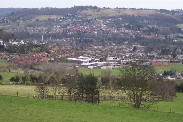
Whiteshill and Ruscombe is a civil parish located in the Stroud district of Gloucestershire, England. It is situated about 2 miles east of Stroud town center and covers an area of approximately 8 square miles.

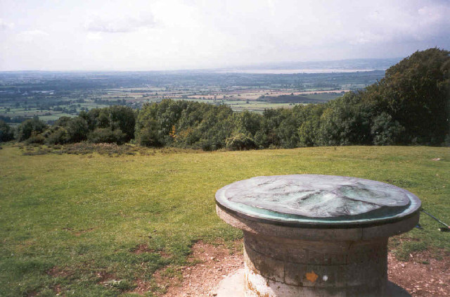
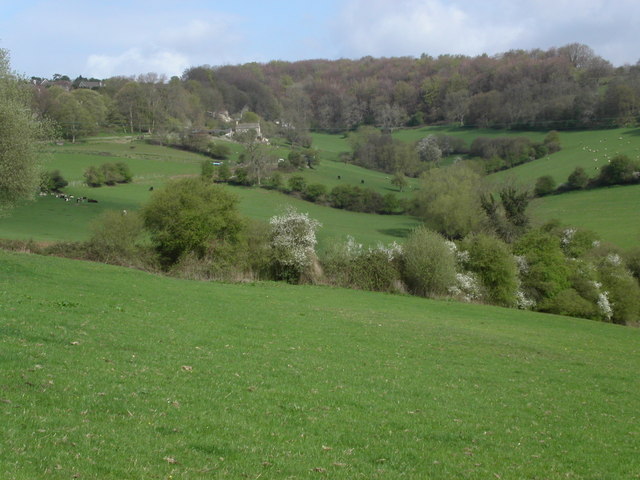
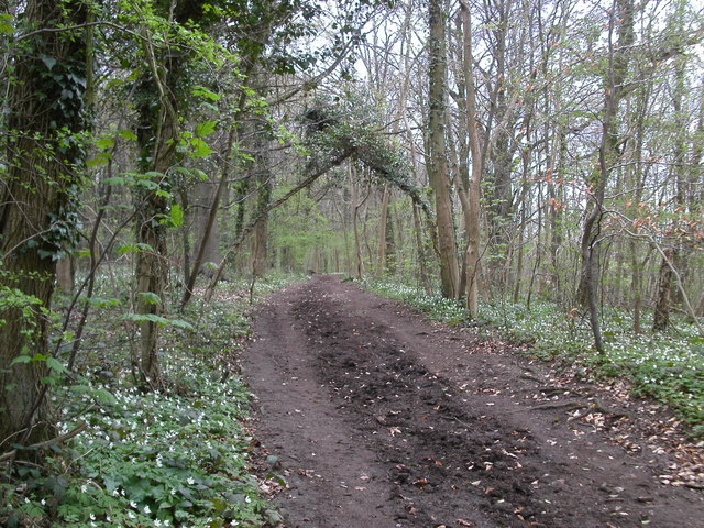
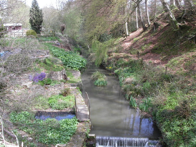
The parish is made up of two distinct villages, Whiteshill and Ruscombe, which are nestled within the beautiful Cotswold countryside. Whiteshill, the larger of the two villages, is situated on a hillside and offers stunning views of the surrounding landscape. It is a close-knit community with a population of around 1,500 residents. The village boasts a range of amenities including a primary school, village hall, and a local pub.

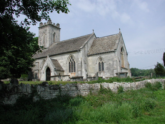
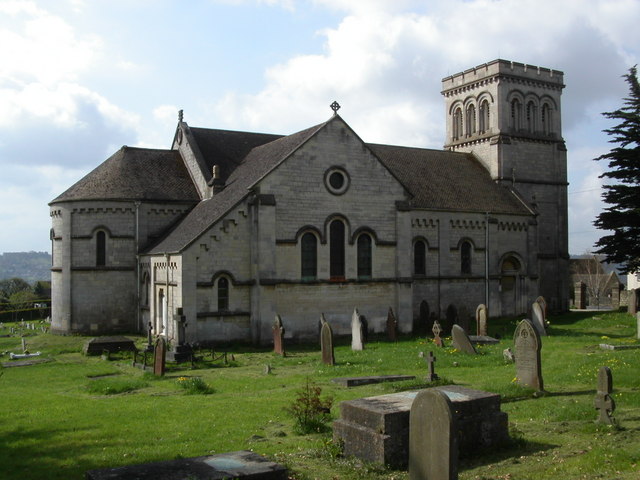
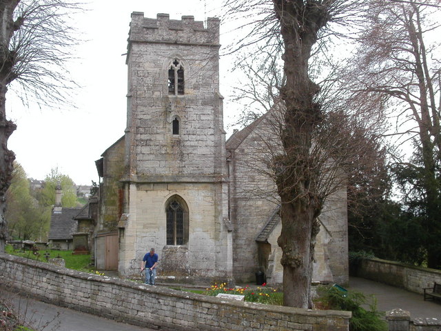
Ruscombe, on the other hand, is a smaller village with a population of approximately 400 residents. It is known for its picturesque setting and tranquil atmosphere. The village is home to a historic church, which dates back to the 12th century, and a handful of traditional cottages.

Both villages are well-connected to the nearby town of Stroud, which offers a wider range of amenities including shops, restaurants, and leisure facilities. The area is also known for its thriving arts and crafts community, with many local artists and artisans showcasing their work in galleries and studios.

Whiteshill and Ruscombe provide an ideal setting for those seeking a peaceful and rural lifestyle, while still being within easy reach of urban conveniences. The stunning natural beauty of the Cotswolds, combined with the sense of community and rich history, make it a desirable place to live.

If you have any feedback on the listing, please let us know in the comments section below.

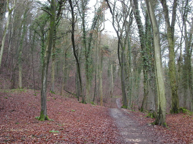
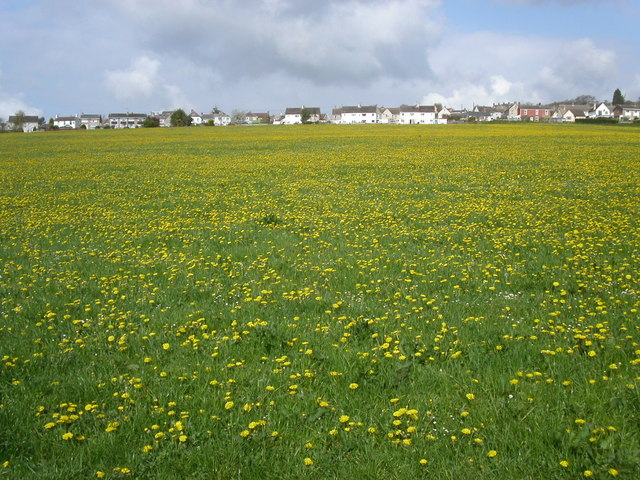
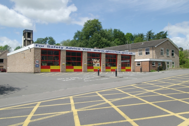
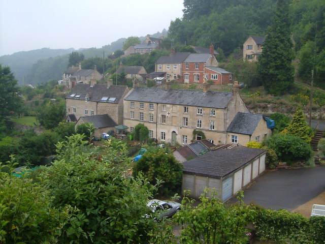
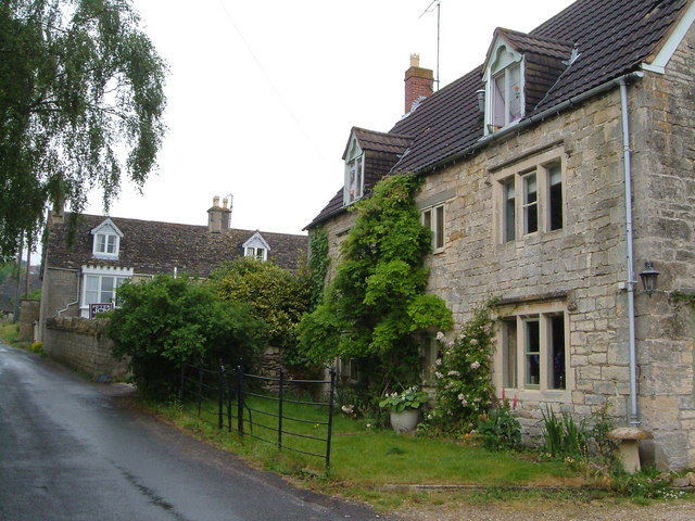
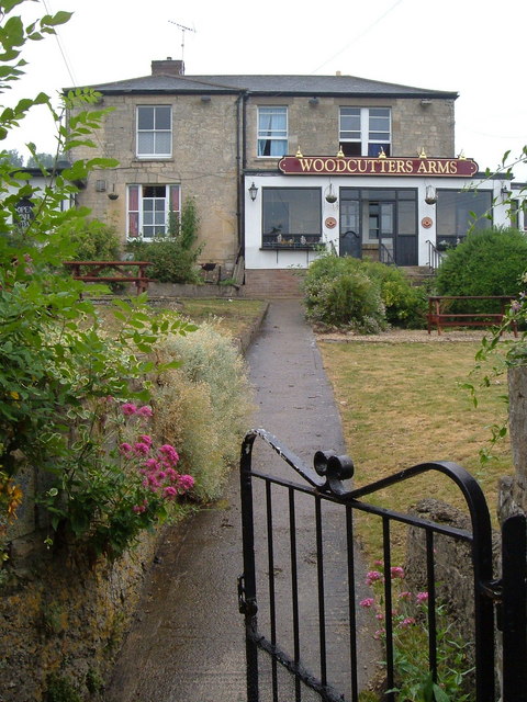
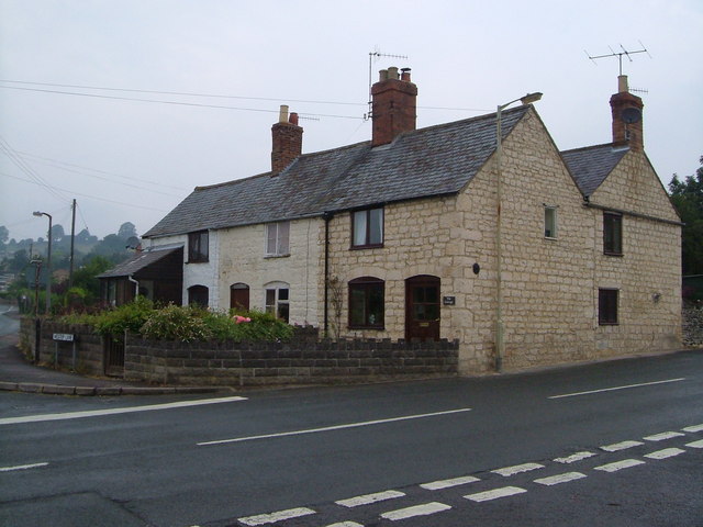
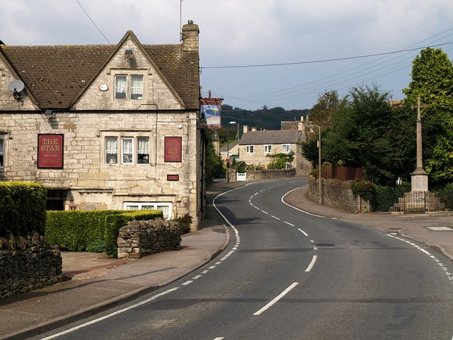
Whiteshill and Ruscombe Images

Images are sourced within 2km of 51.762403/-2.234544 or Grid Reference SO8307. Thanks to Geograph Open Source API. All images are credited.

Pitchcombe (Glos) St John the Baptist's Church
Stratford Park Lido View through turnstiles of 1930's open air lido with cast concrete diving boards and the modern leisure centre next door in Stratford Park, Stroud, Gloucestershire.
Stratford Park Lido
View through turnstiles of 1930's open air lido with cast concrete diving boards and the modern leisure centre next door in Stratford Park, Stroud, Gloucestershire.
Topograph on Haresfield Beacon The Severn Estuary can be seen in the distance.
Topograph on Haresfield Beacon
The Severn Estuary can be seen in the distance.
Stroud view General view of Stroud. The clump of buildings in the centre of the picture belong to Archway School. The pair of white lines looking like a giant rugby goal are chimney stacks belonging to the Millikan factory, a wool cloth mill. The hill in the background is Rodborough Hill.
Stroud view
General view of Stroud. The clump of buildings in the centre of the picture belong to Archway School. The pair of white lines looking like a giant rugby goal are chimney stacks belonging to the Millikan factory, a wool cloth mill. The hill in the background is Rodborough Hill.
Cotswold Way path woodland The Cotswold Way path as it runs between Maitlands Wood and Hallidays Wood not far from Edge village.
Cotswold Way path woodland
The Cotswold Way path as it runs between Maitlands Wood and Hallidays Wood not far from Edge village.
Road to Haresfield Beacon The road forks left to Haresfield Beacon. A popular walking area with views of the river Severn. The Cotswold Way path lies close to the road.
Road to Haresfield Beacon
The road forks left to Haresfield Beacon. A popular walking area with views of the river Severn. The Cotswold Way path lies close to the road.
Whiteshill Church Whiteshill church is situated at the southern end of Whiteshill and just north of Stroud. The church was opened in 1840.
Whiteshill Church
Whiteshill church is situated at the southern end of Whiteshill and just north of Stroud. The church was opened in 1840.
Farmland below Whiteshill Cotswold farmland to the east and below Whiteshill village. 2Km north of Stroud.
Farmland below Whiteshill
Cotswold farmland to the east and below Whiteshill village. 2Km north of Stroud.
Whiteshill village Whiteshill village is 2Km north of Stroud. The Cotswold Way path is 1Km to the west in Standish woods.
Whiteshill village
Whiteshill village is 2Km north of Stroud. The Cotswold Way path is 1Km to the west in Standish woods.
Randwick church Randwick parish church lies just below Standish wood and is 1Km north of Stroud.
Randwick church
Randwick parish church lies just below Standish wood and is 1Km north of Stroud.
Cotswold Way path in Standish woods The Cotswold Way path as it runs south-west through Standish woods. Taken in late April with a late spring the floor of the wood was covered in Wild Garlic and Bluebells.
Cotswold Way path in Standish woods
The Cotswold Way path as it runs south-west through Standish woods. Taken in late April with a late spring the floor of the wood was covered in Wild Garlic and Bluebells.
Painswick Stream Painswick Stream flowing South-west close to Wades Mill not far from Pitchcombe.
Painswick Stream
Painswick Stream flowing South-west close to Wades Mill not far from Pitchcombe.
Ocker Hill phone box An original red phonebox stands by the footpath marker at Ocker Hill, Randwick.
Ocker Hill phone box
An original red phonebox stands by the footpath marker at Ocker Hill, Randwick.
Stroud Fire Station Stroud Fire Station, Paganhill Lane, Stroud, Gloucestershire is station number W07 of the Gloucestershire Fire & Rescue Service.
Stroud Fire Station
Stroud Fire Station, Paganhill Lane, Stroud, Gloucestershire is station number W07 of the Gloucestershire Fire & Rescue Service.
Ruscombe Tucked into a narrow valley in the Cotswolds just north of Stroud. A view from the Congregational church.
Ruscombe
Tucked into a narrow valley in the Cotswolds just north of Stroud. A view from the Congregational church.
Redhouse Lane, Westrip Westrip, on the edge of the built-up area of Stroud, retains a village feel. This photo, looking up the lane, shows Westrip Farm House and Westrip Lodge.
Redhouse Lane, Westrip
Westrip, on the edge of the built-up area of Stroud, retains a village feel. This photo, looking up the lane, shows Westrip Farm House and Westrip Lodge.
Woodcutters Arms, Whiteshill The pub occupies the fork of land between Upper Kitesnest Road and the Main Road in this ridge village.
Woodcutters Arms, Whiteshill
The pub occupies the fork of land between Upper Kitesnest Road and the Main Road in this ridge village.
Cottages in Cashes Green Cottages at the corner of Westrip Lane and Cashes Green Road, in an area where the majority of houses are modern.
Cottages in Cashes Green
Cottages at the corner of Westrip Lane and Cashes Green Road, in an area where the majority of houses are modern.
Show me another place!

Whiteshill and Ruscombe is located at Grid Ref: SO8307 (Lat: 51.762403, Lng: -2.234544)

Administrative County: Gloucestershire

District: Stroud

Police Authority: Gloucestershire

What 3 Words

///trustees.rests.degrading. Near Stroud, Gloucestershire

Related Wikis

Whiteshill, Stroud

Whiteshill is a village in the Cotswolds, situated between Stroud and Gloucester, in Gloucestershire, England and forms part of the Stroud urban area....

Randwick, Gloucestershire

Randwick is a village bordering the market town of Stroud in Gloucestershire, England, the United Kingdom. It is known locally for its folk traditions...

Pitchcombe

Pitchcombe is a village and civil parish 6 miles (9.7 km) south of Gloucester, in the Stroud district, in the county of Gloucestershire, England. In 2011...

Archway School

Archway School is a comprehensive co-educational school for pupils aged 11 to 18 in Stroud, Gloucestershire, England. The headteacher is Kieron Smith....

Stratford Park

Stratford Park is a green flag awarded area of Stroud in Gloucestershire, south west England. With a large park and lake, and a leisure centre complex...

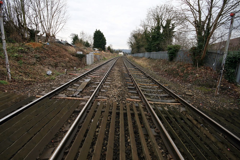
Downfield Crossing Halt railway station

Downfield Crossing Halt was on what is now the Golden Valley Line between Stroud and Stonehouse. == History == The line was opened in 1845 as the Cheltenham...

Stroud High School

Stroud High School (SHS) is a grammar school with academy status for girls aged 11 to 18 located in Stroud, Gloucestershire, England == History == Stroud...

Hawkwood College

Hawkwood Centre for Future Thinking is a registered charity and independent centre for education in a 19th-century Grade II listed building, on 42 acres...

Nearby Amenities

Located within 500m of 51.762403,-2.234544
Whiteshill
Is In: Gloucestershire, England, UK
Place: village
Wikidata: Q7996248
Lat/Long: 51.7646817/-2.2340008
Pub
Star Inn
Addr City: Stroud
Addr Place: Whiteshill
Addr Postcode: GL6 6AE
Addr Street: Main Road
Fhrs Id: 154066
Phone: +44 1453765321
Url: http://www.stroud-starinn.co.uk
Wikidata: Q26450751
Lat/Long: 51.760808/-2.2326092
Bus Stop
The Throat
Bus: yes
Naptan AtcoCode: 1600GL4060
Naptan Bearing: S
Naptan CommonName: The Throat
Naptan NaptanCode: glodajgj
Naptan PlusbusZoneRef: STRUD
Naptan Street: Ruscombe Rd
Naptan Verified: no
Public Transport: platform
Source: naptan_import
Lat/Long: 51.7659489/-2.2368565
Bus Stop
Woodcutters Arms
Bus: yes
Naptan AtcoCode: 1600GL5167
Naptan Bearing: N
Naptan CommonName: Woodcutters Arms
Naptan Indicator: Opp
Naptan NaptanCode: glodamgp
Naptan PlusbusZoneRef: STRUD
Naptan Street: Main Road
Naptan Verified: no
Public Transport: platform
Source: naptan_import
Lat/Long: 51.7640388/-2.2343686
Bus Stop
Woodcutters Arms
Bus: yes
Naptan AtcoCode: 1600GL5168
Naptan Bearing: S
Naptan CommonName: Woodcutters Arms
Naptan NaptanCode: glodamgt
Naptan PlusbusZoneRef: STRUD
Naptan Street: Main Road
Naptan Verified: no
Public Transport: platform
Source: naptan_import
Lat/Long: 51.7636169/-2.2340187
Bus Stop
Ruscombe Rd
Bus: yes
Naptan AtcoCode: 1600GLA57021
Naptan Bearing: NW
Naptan CommonName: Ruscombe Rd
Naptan NaptanCode: glogmtpt
Naptan PlusbusZoneRef: STRUD
Naptan Street: Ruscombe Rd
Naptan Verified: no
Public Transport: platform
Source: naptan_import
Lat/Long: 51.7641097/-2.2348762
Bus Stop
Ludlow Green Inn
Bus: yes
Naptan AtcoCode: 1600GLS253
Naptan Bearing: N
Naptan CommonName: Ludlow Green Inn
Naptan NaptanCode: glodagpd
Naptan PlusbusZoneRef: STRUD
Naptan Street: Ruscombe Rd
Naptan Verified: no
Public Transport: platform
Source: naptan_import
Lat/Long: 51.7631374/-2.2399427
Bus Stop
Ludlow Green Inn
Bus: yes
Naptan AtcoCode: 1600GLS254
Naptan Bearing: S
Naptan CommonName: Ludlow Green Inn
Naptan Indicator: Opp
Naptan NaptanCode: glodagpg
Naptan PlusbusZoneRef: STRUD
Naptan Street: Ruscombe Rd
Naptan Verified: no
Public Transport: platform
Source: naptan_import
Lat/Long: 51.7631286/-2.2398267
Bus Stop
The Close
Bus: yes
Naptan AtcoCode: 1600GLS255
Naptan Bearing: S
Naptan CommonName: The Close
Naptan NaptanCode: glodagtp
Naptan PlusbusZoneRef: STRUD
Naptan Street: Ruscombe Rd
Naptan Verified: no
Public Transport: platform
Source: naptan_import
Lat/Long: 51.764658/-2.2393856
Bus Stop
The Close
Bus: yes
Naptan AtcoCode: 1600GLS256
Naptan Bearing: SW
Naptan CommonName: The Close
Naptan Indicator: Opp
Naptan NaptanCode: glodagtm
Naptan PlusbusZoneRef: STRUD
Naptan Street: Ruscombe Rd
Naptan Verified: no
Public Transport: platform
Source: naptan_import
Lat/Long: 51.764595/-2.2394287
Bus Stop
Whiteshill Primary School
Bus: yes
Naptan AtcoCode: 1600GLS385
Naptan Bearing: S
Naptan CommonName: Whiteshill Primary School
Naptan Indicator: Opp
Naptan NaptanCode: glodamtj
Naptan PlusbusZoneRef: STRUD
Naptan Street: Main Road
Naptan Verified: no
Public Transport: platform
Source: naptan_import
Lat/Long: 51.7622788/-2.2331713
Bus Stop
Whiteshill Primary School
Bus: yes
Naptan AtcoCode: 1600GLS386
Naptan Bearing: N
Naptan CommonName: Whiteshill Primary School
Naptan NaptanCode: glodampt
Naptan PlusbusZoneRef: STRUD
Naptan Street: Main Road
Naptan Verified: no
Public Transport: platform
Source: naptan_import
Lat/Long: 51.7623504/-2.2333456
Bus Stop
St Paul's Church
Bus: yes
Naptan AtcoCode: 1600GLS387
Naptan Bearing: S
Naptan CommonName: St Paul's Church
Naptan NaptanCode: glodapdt
Naptan PlusbusZoneRef: STRUD
Naptan Street: Main Road
Naptan Verified: no
Public Transport: platform
Source: naptan_import
Lat/Long: 51.7602759/-2.2320888
Bus Stop
The Star Inn
Bus: yes
Naptan AtcoCode: 1600GLS388
Naptan Bearing: N
Naptan CommonName: The Star Inn
Naptan NaptanCode: glodamwm
Naptan PlusbusZoneRef: STRUD
Naptan Street: Main Road
Naptan Verified: no
Public Transport: platform
Source: naptan_import
Lat/Long: 51.7609851/-2.232672
Ruscombe
Place: hamlet
Lat/Long: 51.7642703/-2.2391911
Natural: spring
Source: OS OpenData StreetView
Lat/Long: 51.7640844/-2.2393199
Ruscombe and Whiteshill Village Shop
Description: community run village shop and coffee bar
Note: community run village shop and coffee bar
Shop: convenience
Lat/Long: 51.7616737/-2.234428
Created By: Peanutz
Historic: memorial
Lat/Long: 51.760998/-2.232486
Noexit: yes
Lat/Long: 51.7640343/-2.232023
Barrier: stile
Material: stone
Stile: squeezer
Lat/Long: 51.7600762/-2.2395592
Barrier: stile
Material: wood
Stile: squeezer
Lat/Long: 51.7597554/-2.2399944
Barrier: stile
Material: stone
Stile: squeezer
Lat/Long: 51.7602095/-2.2319203
Power: pole
Lat/Long: 51.7598095/-2.2286971
Power: pole
Lat/Long: 51.7623528/-2.2273787
Power: pole
Lat/Long: 51.7614961/-2.2370856
Power: pole
Lat/Long: 51.76173/-2.239198
Power: transformer
Lat/Long: 51.7623718/-2.240083
Power: pole
Lat/Long: 51.7613251/-2.2386413
Power: pole
Lat/Long: 51.7601996/-2.2388129
Power: pole
Lat/Long: 51.762562/-2.2356654
Power: pole
Lat/Long: 51.7608205/-2.2379774
Barrier: stile
Foot: designated
Material: wood
Stile: squeezer
Lat/Long: 51.7609854/-2.23581
Power: pole
Transformer: distribution
Lat/Long: 51.7627861/-2.2353396
Power: pole
Lat/Long: 51.7596401/-2.2395707
Power: pole
Lat/Long: 51.7619533/-2.2364676
Power: pole
Lat/Long: 51.7620175/-2.2349694
Power: pole
Lat/Long: 51.7616854/-2.2342492
Noexit: yes
Lat/Long: 51.7643183/-2.2317334
Power: pole
Lat/Long: 51.7645329/-2.2313425
Power: transformer
Lat/Long: 51.7643598/-2.238062
Power: pole
Lat/Long: 51.7639039/-2.2374327
Power: pole
Lat/Long: 51.7631696/-2.236462
Post Box
Field Road Whiteshill
Collection Times: Mo-Fr 09:00; Sa 07:00
Operator: Royal Mail
Post Box Type: lamp
Ref: GL6 226
Royal Cypher: EIIR
Royal Cypher Wikidata: Q33102113
Source: survey
Lat/Long: 51.7637039/-2.2307295
Post Box
Woodcutters Arms
Collection Times: Mo-Fr 09:00; Sa 07:00
Operator: Royal Mail
Post Box Type: lamp
Ref: GL6 94
Royal Cypher: EIIR
Royal Cypher Wikidata: Q33102113
Source: survey
Lat/Long: 51.7641557/-2.2342968
Post Box
Whiteshill PO
Collection Times: Mo-Fr 16:15; Sa 09:00
Operator: Royal Mail
Post Box Type: wall
Ref: GL6 119
Royal Cypher: GR
Royal Cypher Wikidata: Q33102273
Source: survey
Lat/Long: 51.7630532/-2.2350227
Defibrillator
Booth: K6
Covered: booth
Defibrillator Location: Inside disused red phone box
Disused Amenity: telephone
Emergency: defibrillator
Indoor: no
Man Made: telephone_box
Note: Phone box also used as a gallery.
Operator: Community Heartbeat
Ref: CH-RT-1 4 2 1
Source: survey
Lat/Long: 51.762323/-2.2404245
Post Box
Collection Times: Mo-Fr 09:00; Sa 07:00; Su off
Drive Through: no
Operator: Royal Mail
Post Box Type: wall
Ref: GL6 139D
Royal Cypher: GR
Royal Cypher Wikidata: Q33102273
Source: survey
Lat/Long: 51.7638275/-2.2398973
Defibrillator
Defibrillator Location: On outside wall of Ruscombe and Whiteshill Village Shop, to left of the entrance.
Emergency: defibrillator
Indoor: no
Not Ref GB The Circuit: 1933CB00-C970-49F5-993C-B04200BC7B71
Lat/Long: 51.7616636/-2.2343849
Entrance: yes
Lat/Long: 51.7616821/-2.234406
Social Facility
Booth: KX100
Covered: booth
Disused Amenity: telephone
Man Made: telephone_box
Operator: Whiteshill and Ruscombe Parish Council
Social Facility: food_bank
Lat/Long: 51.7628949/-2.2337678
Public Bookcase
Location: in bus shelter
Public Bookcase Type: shelter
Lat/Long: 51.7636183/-2.2339632
Bench
Lat/Long: 51.7653813/-2.2364644
Bench
Lat/Long: 51.7597332/-2.2321401
Bench
Lat/Long: 51.7598321/-2.231726
Bench
Lat/Long: 51.7593695/-2.2317696
Barrier: stile
Material: stone
Stile: squeezer
Lat/Long: 51.7597286/-2.23132
Bench
Lat/Long: 51.7654578/-2.2364115
The data included in this document is from www.openstreetmap.org. The data is made available under ODbL.

Have you been to Whiteshill and Ruscombe?

Leave your review of Whiteshill and Ruscombe below (or comments, questions and feedback).